An acre-foot is a common way in the U.S. to measure water volume
and use. It is the amount of water it takes to cover an acre of
land one foot deep. An acre is about the size of a football
field.
An acre-foot of water equals 325,851 gallons, and historically
that was enough to serve the needs of two families for a
year in California.
As the single largest water-consuming industry, agriculture has
become a focal point for efforts to promote water conservation.
In turn, discussions about agricultural water use often become
polarized.
With this in mind, the drive for water use
efficiency has become institutionalized in agriculture
through numerous federal, state and local programs.
California’s rich agricultural productivity comes with a price.
The dry climate that provides the almost year-round growing
season also can require heavily irrigated soils. But such
irrigation can degrade the local water quality.
Two of the state’s most productive farming areas in particular,
the west side of the San
Joaquin Valley and parts of the Imperial Valley in Southern
California, have poorly drained and naturally saline soils.
Few regions are as important to California water as the Sacramento-San
Joaquin Delta, where the Sacramento and San Joaquin rivers
converge to discharge into San Francisco Bay.
Agriculture drainage issues date back to the earliest farming. In
ancient times, farmers let fields stay fallow hoping rain would
flush out salt.
Today, salt and other contaminants continue to cause agricultural
drainage problems, particularly in California. Whether a field is
adequately drained, or saturated with water, the water still has
to be removed.
The disposal of this often-contaminated water continues to be a
challenge in California, with the environmental effects of
selenium and other drainage-related elements changing the course
of drainage planning.
Algal blooms are sudden
outbreaks of algae. Their occurrence is increasing in
California’s rivers, creeks and lakes and along the coast,
threatening the lives of people, pets and fisheries.
Only a few types of algae can produce poisons, but even nontoxic
blooms hurt the environment and local economies. When masses
of algae die and decay, they can deplete oxygen in the water to
the point of causing devastating fish kills.
The All-American Canal delivers
Colorado River water to
the Imperial Valley,
sustaining a desert valley that is one of the most productive
agricultural regions in the world. The canal, about 80 miles
long, joins the Imperial
Dam (and its desilting works) and the 123-mile-long
Coachella Canal to complete the All-American Canal System.
Alluvium generally refers to the clay, silt, sand and gravel that
are deposited by a stream, creek or other water body.
Alluvium is found around deltas and rivers, frequently
making soils very fertile. Alternatively, “colluvium” refers to
the accumulation at the base of hills, brought there from runoff
(as opposed to a water body).
The Oxnard Plain in Ventura County is a visible alluvial plain,
where floodplains have drifted over time due to gradual deposits
of alluvium, a feature also present in Red Rock Canyon State Park
in Kern County.
The American River originates high
in the Sierra Nevada just west of Lake Tahoe, in the Tahoe and
Eldorado national forests.
The birthplace of the California Gold Rush, the river today is a
prime recreational destination and a major water supply source
for the federal Central Valley Project.
Anadromous fish are freshwater fish
that migrate to sea and then return to spawn in fresh water.
In California, anadromous fish include coho salmon, chinook
salmon and steelhead. Those inhabiting rivers across the Central
Valley have experienced significant declines from historical
populations. This is due to drought, habitat destruction, water
diversions, migratory obstacles such as dams, unfavorable ocean
conditions, pollution and introduced predator species.
Applied water refers to water delivered by an application to a
user, either indoors or outdoors. Applied water use typically
occurs in an agricultural or urban setting.
In agriculture, applied water is typically supplied through
irrigation, which uses such devices as pipes and sprinklers.
There are also different types of systems including gravity flow
and pressurized systems.
With soil absorbing applied water and being porous (some water
can move down below a plant’s root zone), it is necessary to
apply more water than a crop might need.
California law allows rivers, streams, lakes and other surface
water to be diverted at one point and appropriated (used)
beneficially at a separate point.
This “appropriative right” contrasts with a “riparian right,” which is based
on ownership of property adjacent to surface water.
The legal term “area-of-origin” dates back to 1931 in California.
At that time, concerns over water transfers prompted enactment of
four “area-of-origin” statutes. With water transfers from
Yosemite’s Hetch Hetchy Valley to supply water for San Francisco
and from Owens Valley to Los Angeles fresh in mind, the
California statutes were intended to protect local areas against
export of water.
In particular, counties in Northern California had concerns about
the state tapping their water to develop California’s supply.
ARkStorm stands for an atmospheric
river (“AR”) that carries precipitation levels expected to occur
once every 1,000 years (“k”). The concept was presented in a 2011
report by the U.S. Geological Survey (USGS) intended to elevate
the visibility of the very real threats to human life, property
and ecosystems posed by extreme storms on the West Coast.
Both the drought and high nitrate levels in shallow groundwater have necessitated deeper
drilling of new wells in the San Joaquin Valley, only to expose
water with heightened
arsenic levels. Arsenic usually exists in water as arsenate
or arsenite, the latter of which is more frequent in deep lake
sediments or groundwater with little oxygen and is both
more harmful and difficult to remove.
Atmospheric rivers are relatively
narrow bands of moisture that ferry precipitation across the
Pacific Ocean to the West Coast and are key to California’s
water
supply.
They are commonly referred to as the “Pineapple Express” because
of their origins in tropical regions. While atmospheric rivers
are necessary to keep California’s water reservoirs full, some of
them are dangerous because the extreme rainfall and wind can
cause catastrophic flooding and damage.
Their presence has been likened to the West Coast version of the
hurricane hazard posed to the southeastern United States.
Auburn Dam, also known as the Auburn-Folsom South Unit, is an
unfinished federal Central Valley Project facility on the north
fork of the American River above Folsom Dam.
Work on the dam was halted in 1977 following a magnitude 5.7
earthquake in 1975 near Oroville Dam, some 50 miles away, raising
questions about the Auburn Dam’s safety. The dam remains unbuilt.
Jean Auer (1937-2005) was the first woman to serve on the State
Water Resources Control Board in California and a pioneer
for women aspiring to be leaders in the water world.
Operated by the U.S. Army Corps of Engineers, the
Bay Model is a giant hydraulic replica of San Francisco
Bay and the Sacramento-San Joaquin
Delta. It is housed in a converted World II-era
warehouse in Sausalito near San Francisco.
Hundreds of gallons of water are pumped through the
three-dimensional, 1.5-acre model to simulate a tidal ebb
and flow lasting 14 minutes.
Battle Creek, a tributary of the
Sacramento River in Shasta and Tehama counties, is considered one
of the most important anadromous fish spawning streams in the
Sacramento Valley.
At present, barriers make it difficult for anadromous fish,
including chinook salmon and Central Valley steelhead trout, to
migrate. Battle Creek has several hydroelectric dams, diversions
and a complex canal system between its north and south forks that
impede migration.
The biochemical oxygen demand (BOD) of water determines the
impact of decaying matter on species in a specific ecosystem.
Sampling for BOD tests how much oxygen is needed by bacteria to
break down the organic matter.
Carl Boronkay (1929-2017) was
general manager of the Metropolitan Water District of Southern
California (MWD) between 1984 and 1993. Boronkay is credited
with developing a long-term vision for the district’s sustainable
water supplies as well as large projects such as Diamond Valley
Lake, the large reservoir near the Riverside County town of
Hemet, and the Inland Feeder that connects the State Water Project to the
Colorado
River Aqueduct and Diamond Valley Lake.
Ralph M. Brody (1912-1981) is credited with playing an
instrumental role in securing legislative and then voter approval
of California’s State
Water Project, the nation’s largest state-financed water
project ever built. He later went on to serve as chief counsel
and manager for Westlands Water District, the nation’s largest
farm water district.
Edmund G. “Pat” Brown (1905-1996) was California’s governor from
1959-1967, exemplified the best in public service and left a
wide-ranging legacy that featured first and foremost the State Water Project (SWP)
and California
Aqueduct but also included the Fair Housing Act, the Fair
Employment Act, the Master Plan for Higher Education and highway
expansion.
Butte Creek, a tributary of the
Sacramento River, begins less than 50 miles northeast of Chico,
California and is named after nearby volcanic plateaus or
“buttes.” The cold, clear waters of the 93-mile creek sustain the
largest naturally spawning wild population of spring-run chinook salmon in the Central Valley.
Several other native fish species are found in Butte Creek,
including Pacific lamprey and Sacramento pikeminnow.
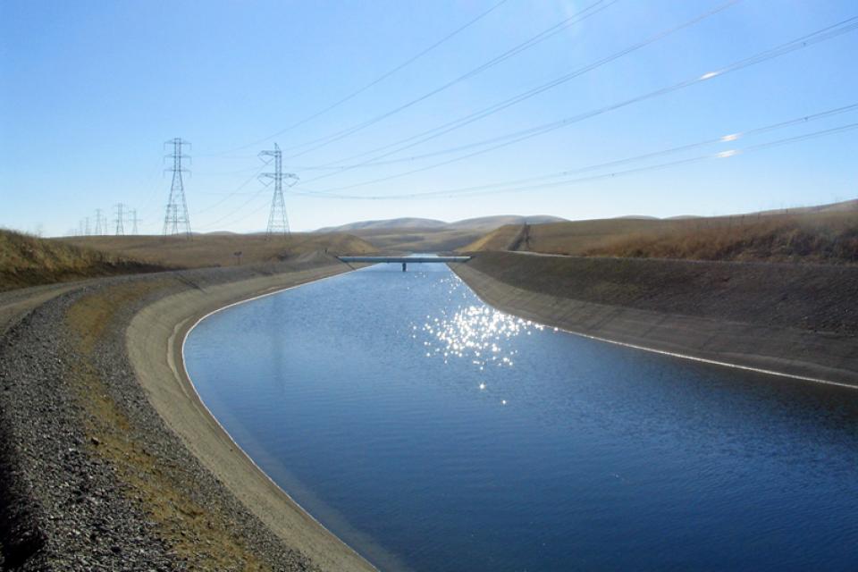
The California Aqueduct, a critical part of the State Water
Project, carries water from the Sacramento-San Joaquin
Delta to the San Joaquin Valley and Southern California.
Established as part of a $1.75 billion bond passed by voters in
1960, the 444-mile-long California Aqueduct (formally known as
the Edmund G. Brown California Aqueduct) begins at the Harvey O.
Banks Pumping Plant in the Delta.
It parallels Interstate 5 south to the Tehachapi Mountains.
The California Environmental Quality
Act, commonly known as CEQA, is foundational to the state’s
environmental protection efforts. The law requires proposed
developments with the potential for “significant” impacts on the
physical environment to undergo an environmental review.
Since its passage in 1970, CEQA (based on the National
Environmental Policy Act) has served as a model for
similar legislation in other states.
California will always be
inextricably linked to its water resources. Water continues
to shape the state’s development and no resource is as vital to
California’s urban centers, farms, industry, recreation, scenic
beauty and environmental preservation.
But California’s relationship to water is also one that continues
to generate controversy.
Every five years the California Department of Water Resources
updates its strategic plan for managing the state’s water
resources, as required by state law.
The California Water Plan, or Bulletin 160, projects the
status and trends of the state’s water supplies and demands
under a range of future scenarios.
California’s Legislature passed the
Wild and Scenic Rivers Act in 1972, following the passage of the
federal Wild and Scenic Rivers Act by Congress in 1968. Under
California law, “[c]ertain rivers which possess extraordinary
scenic, recreational, fishery, or wildlife values shall be
preserved in their free-flowing state, together with their
immediate environments, for the benefit and enjoyment of the
people of the state.”
In the Northern California community of Redding, he was a justice
of peace, a renowned water rights attorney in the law firm of
Carr and Kennedy and helped form the Anderson-Cottonwood
Irrigation District. He was often in the nation’s Capitol in
Washington, D.C., advocating for funds from Congress to get this
visionary project built for the benefit of all of California. In
his honor, the Judge Francis Carr Powerplant was named after him.
The East Fork begins in the mountains of California’s Sonora Pass
and after flowing through California and Nevada, it meets the
West Fork just south of Carson City. The West Fork forms at
California’s Carson Pass, running through California and into
Nevada to its junction with the East Fork.
Rachel Carson (1907-1964) authored Silent Spring, a book
published in 1962 about the impacts of pesticides on
the ecosystem and credited with beginning the modern
environmental movement.
Before becoming a full-time writer, she worked at the U.S. Bureau
of Fisheries, renamed the Fish and Wildlife Service, from
1935-1952 as a biologist and then editor-in-chief of
publications.
Birthed in the midst of the Great
Depression, the Central Valley Project today is one of the
largest water storage and transport systems in the world. In
years of normal precipitation, it stores and distributes about 20
percent of the state’s developed water through its massive system
of reservoirs and canals.
In the Central Valley, wetlands—partly or seasonally saturated
land that supports aquatic life and distinct ecosystems— provide
critical habitat for a variety of wildlife.
Ira J. “Jack” Chrisman (1910-1988) became a well-known force in
California’s water history beginning back in 1955 after his
family home was flooded in the San Joaquin Valley town of
Visalia.
Climate change involves natural and man-made changes to weather
patterns that occur over millions of years or over multiple
decades.
In the past 150 years, human industrial activity has accelerated
the rate of change in the climate due to the increase in
greenhouse gases (carbon dioxide, methane and nitrous oxide,
among others). Scientific studies describing this climate change
continue to be produced and its expected impacts continue to be
assessed.
The Coachella Valley in Southern California’s Inland Empire is
one of several valleys throughout the state with a water district
established to support agriculture.
Like the others, the Coachella Valley Water District in Riverside
County delivers water to arid agricultural lands and constructs,
operates and maintains a regional agricultural drainage system.
These systems collect drainage water from individual farm drain
outlets and convey the water to a point of reuse, disposal or
dilution.
Directly detecting harmful
pathogens in water can be expensive, unreliable and incredibly
complicated. Fortunately, certain organisms are known to
consistently coexist with these harmful microbes which are
substantially easier to detect and culture: coliform bacteria.
These generally non-toxic organisms are frequently used as
“indicator
species,” or organisms whose presence demonstrates a
particular feature of its surrounding environment.
Gordon Cologne (1924-2019) served for 10 years in the California
Legislature during the 1960s and early 1970s while the California
State Water Project was being built.
His interest in water issues began from his early life in the
Coachella Valley desert. An attorney, he worked in both the
public sector in Washington, D.C, and then in private practice in
California. He also served his local community as a member of the
city of Indio City Council, including as mayor, before his
decision to run for election to fill an open seat in the
Assembly.
Often referred to as the lifeline of
the Southwest, the Colorado River and its tributaries provide
water to nearly 40 million people and irrigate 5 million acres of
farmland in California, Arizona, Nevada, Colorado, New Mexico,
Utah and Wyoming. It also serves about 2.3 million people and
500,000 farmland acres in northern Mexico. The river’s water is
critical for 30 federally recognized Native American tribes,
Grand Canyon National Park and several other units of the
National Park system, and a number of wildlife refuges.
The Colorado River Aqueduct, a
242-mile-long channel completed in 1941 by the Metropolitan Water
District of Southern California, carries water from the Colorado River to urban Southern
California. The aqueduct is one of three conveyance systems of
imported water to Southern California, the other two being the
California Aqueduct
and the Los Angeles
Aqueduct.
The Colorado River Compact of 1922
marked the first time in U.S. history that more than three states
negotiated an agreement among themselves to apportion the waters
of a stream or river.
The compact is the cornerstone of the “Law of the River” – a
complex set of interstate compacts, federal laws, court decisions
and decrees, contracts and federal actions that regulate use of
the Colorado River.
The Colorado River Delta is located
at the natural terminus of the Colorado River at the Gulf of
California, just south of the U.S.-Mexico border. The desert
ecosystem was formed by silt flushed downstream from the Colorado
and fresh and brackish water mixing at the Gulf.
The Colorado River Delta once covered 9,650 square miles but has
shrunk to less than 1 percent of its original size due to
human-made water diversions.
In 2005, after six years of severe
drought in the Colorado River Basin, federal officials and
representatives of the seven basin states — California, Arizona,
Nevada, New Mexico, Colorado, Utah and Wyoming — began building a
framework to better respond to drought conditions and coordinate
the operations of the basin’s two key reservoirs, Lake Powell and
Lake Mead.
The resulting Interim Guidelines for Lower Basin Shortages and
the Coordinated Operations for Lake Powell and Lake Mead (Interim
Guidelines) identified the conditions for shortage determinations
and details of coordinated reservoir operations. The 2007 Interim
Guidelines remain in effect through Dec. 31, 2026.
In 2005, the Interior Department launched a program to recover 27
species in the lower Colorado
River, including seven the federal government has deemed
threatened or endangered or threatened with extinction. The
species include fish, birds, bats, mammals, insects, amphibians,
reptiles, rodents and plants
The Lower Colorado River Multispecies Conservation Program has a
50-year plan to create at least 8,132 acres of new habitat
and restore habitat that has become degraded.
The Mexican Water Treaty of 1944 committed the U.S. to deliver
1.5 million acre-feet of water to Mexico on an annual basis, plus
an additional 200,000 acre-feet under surplus conditions. The
treaty is overseen by the International Boundary and Water
Commission.
Colorado River water is delivered to Mexico at Morelos Dam,
located 1.1 miles downstream from where the California-Baja
California land boundary intersects the river between the town of
Los Algodones in northwestern Mexico and Yuma County, Ariz.
California’s Colorado River Water Use Plan (known colloquially as
the 4.4 Plan) intends to wean the state from its reliance on the
surplus flows from the river and return California to its annual
4.4 million acre-feet basic apportionment of the river.
In the past, California has also used more than its basic
apportionment. Consequently, the U.S. Department of
Interior urged California to devise a plan to reduce its water
consumption to its basic entitlement.
Consumptive water use is what happens when water is withdrawn for
use and is not returned to the local environment. Examples of
this include water that is evaporated, transpired by plants or
incorporated in products or crops.
Contaminants exist in water supplies from both natural and
manmade sources. Even those chemicals present without human
intervention can be mobilized from introduction of certain
pollutants from both
point and nonpoint sources.
Construction began in 1937 to build the Contra Costa Canal, the
first part of the federal Central Valley
Project. The Contra Costa Canal runs from the Sacramento-San
Joaquin Delta, where it draws its water near Knightsen, to
the eastern and central parts of Contra Costa County. It is about
30 miles from San Francisco.
Conveyance is infrastructure
providing for the movement of water. Conveyances are typically
thought of as human-made structures, such as a canal or aqueduct,
but can also be natural watercourses such as a river or stream.
Pauline Davis (1917-1995), who
represented all or portions of 12 rural Northern California
counties in the California Assembly, guided some of the state’s
most significant water development proposals through the
Legislature.
During her legislative career from 1952 to 1976, Davis
concentrated on water issues important to her constituents by
championing area-of-origin protections for water targeted for
export as part of the fledgling State Water Project.
The endangered Delta smelt is a 3-inch fish found only in the
Sacramento-San
Joaquin Delta. It is considered especially sensitive because
it lives just one year, has a limited diet and exists primarily
in brackish waters (a mix of river-fed fresh and salty ocean
water that is typically found in coastal estuaries).
Recurrent droughts and uncertainties about future water supplies
have led several California communities to look to treat salty
water for supplemental supplies through a process known as
desalination.
Desalination removes salt and other dissolved minerals from water
and is one method to reclaim water for other uses. This can occur
with ocean water along the coast and in the interior at spots
that draw from ancient salt water deep under the surface or where
groundwater has been tainted
by too much salt.
Developed water is water that is controlled and managed for a
variety of uses. These uses include water stored in dams and reservoirs, or pumped, diverted or
channeled in aqueducts.
With a holding capacity of more
than 260 billion gallons, Diamond Valley Lake is Southern
California’s largest reservoir. It sits about 90 miles southeast
of Los Angeles and just west of Hemet in Riverside County where
it was built in 2000. The offstream reservoir was created by
three large dams that connect
the surrounding hills, costing around $1.9 billion and doubling
the region’s water storage capacity.
Joan Didion (1934-2021) was a native California author and
playwright whose famous writings have featured California water
issues.
Born and reared in Sacramento, she
wrote extensively and personally about her feelings on the
subject of water. In her memoir, Where I Was From, she told not
only the story about her pioneering family’s roots in the
Sacramento area but also of the seasonal flooding, the water
politics and controversies, and the California State Water
Project (SWP) and federal Central Valley Project (CVP).
Disadvantaged communities are those carrying the greatest
economic, health and environmental burdens. They include
poverty, high unemployment, higher risk of asthma and heart
disease, and often limited access to clean, affordable drinking
water.
Drought—an extended period of
limited or no precipitation—is a fact of life in California and
the West, with water resources following boom-and-bust patterns.
During California’s 2012–2016 drought, much of the state
experienced severe drought conditions: significantly less
precipitation and snowpack, reduced streamflow and higher
temperatures. Those same conditions reappeared early in 2021
prompting Gov. Gavin Newsom in May to declare drought emergencies
in watersheds across 41 counties in California.
Arthur D. Edmonston directed the early planning
of the Central Valley Project, State Water Project and State
Water Plan.
He served as California state engineer and chief of the Division
of Water Resources (predecessor to the Department of Water
Resources) from 1950-1955, a time of rapid population,
agricultural and industry growth California. Water shortages were
common, and groundwater supplies were being overdrafted.
The world’s largest water lift, the Edmonston Pumping Plant is a
State Water Project
facility. The pumping plant plays a vital role in Southern
California’s economy by supplying the semi-arid region with badly
needed water.
The Eel River supports one of California’s largest wild salmon
and steelhead runs in a watershed that hosts the world’s largest
surviving stands of ancient redwoods.
The Eel flows generally northward from Northern California’s
Mendocino National Forest to the Pacific, a few miles south of
Eureka. The river and its tributaries drain
more than 3,500 square miles, the state’s
third-largest watershed.
California’s seasonal weather is influenced by El Niño and La
Niña – temporary climatic conditions that, depending on their
severity, make the weather wetter or drier than normal.
El Niño and La Niña episodes typically last 9 to 12 months,
but some may last for years. While their frequency can be quite
irregular, El Niño and La Niña events occur on average every two
to seven years. Typically, El Niño occurs more frequently than La
Niña, according to the National Oceanic and Atmospheric
Administration (NOAA).
The federal government passed the Endangered Species Act in 1973,
following earlier legislation. The first, the Endangered
Species Preservation Act of 1966, authorized land acquisition to
conserve select species. The Endangered Species Conservation Act
of 1969 then expanded on the 1966 act, and authorized “the
compilation of a list of animals “threatened with worldwide
extinction” and prohibits their importation without a permit.”
Entrainment is the process by which one thing is drawn along or
transported by another thing. In the water world, it is commonly
used to describe when fish or fish larvae are sucked into pumps
or water diversions.
Environmental concerns have closely followed California’s
development of water resources since its earliest days as a
state.
Early miners harnessed water to dislodge gold through hydraulic
mining. Debris resulting from these mining practices washed down
in rivers and streams, choking them and harming aquatic life and
causing flooding.
Estuaries are places where fresh and
salt water mix, usually at the point where a river enters the
ocean. They form highly productive natural habitats due to a
combination of tides, waves, salinity, fresh water flow and
sediment.
Evaporation ponds contain agricultural drainage water and are
used when agricultural growers do not have access to rivers for
drainage disposal.
Drainage water is the only source of water in many of these
ponds, resulting in extremely high concentrations of salts.
Concentrations of other trace elements such as selenium are also
elevated in evaporation basins, with a wide degree of variability
among basins.
Such ponds resemble wetland areas that birds use for nesting and
feeding grounds and may pose risks to waterfowl and shorebirds.
Federal reserved rights were created when the United States
reserved land from the public domain for uses such as Indian
reservations, military bases and national parks, forests and
monuments. [See also Pueblo Rights].
One of the major characteristics of federal reserved water rights
is that they often are senior in priority to water rights
established under state law. The date of priority of a federal
reserved right is the date the reservation was established, and
many were established prior to state water claims.
Flood forecasting allows flood control managers to predict,
with a high degree of accuracy, when local flooding is
likely to take place.
Forecasts typically use storm runoff data, reservoir levels and
releases to predict the rise in river levels.
In Northern California the National Weather Service, in
cooperation with the state’s California-Nevada River Forecast
Center in Sacramento, forecasts flooding.
When people think of natural
disasters in California, they typically think about earthquakes.
Yet the natural disaster that residents are most likely to face
involves flooding, not fault lines. In fact, all 58 counties in
the state have declared a state of emergency from flooding at
least three times since 1950. And the state’s capital,
Sacramento, is considered one of the nation’s most flood-prone
cities. Floods also affect every Californian because flood
management projects and damages are paid with public funds.
Liability for levee failure in California took a new turn after a
court ruling found the state liable for hundreds of millions of
dollars from the 1986 Linda Levee collapse in Yuba County. The
levee failure killed two people and destroyed or damaged about
3,000 homes.
The collapse also had long-term legal ramifications.
The Paterno Decision
California’s Supreme Court found that, “when a public entity
operates a flood management system built by someone else, it
accepts liability as if it had planned and built the system
itself.”
With the dual threats of aging levees and anticipated rising sea levels,
floodplains — low
areas along waterways that flood during wet years — are
increasingly at the forefront of many public policy and water
issues in California.
Adding to the challenges, many floodplains have been heavily
developed and are home to major cities such as Sacramento. Large
parts of California’s valleys are historic floodplains as well.
Folsom Dam is a multi-purpose dam
on the American
River about 23 miles east of Sacramento. Originally
authorized in 1944 solely as a flood control facility, Folsom Dam
was reauthorized in 1949, a year after construction began, as a
multi-purpose facility for flood
control, water storage and hydroelectric generation.
Hydraulic fracturing, commonly known as fracking, injects high
pressure volumes of water, sand and chemicals into existing wells
to unlock natural gas and oil. The technique essentially
fractures the rock to get to the otherwise unreachable deposits.
The United States
Geological Survey (USGS) defines freshwater as containing
less than 1,000 milligrams per liter dissolved solids. However,
500 milligrams per liter is usually the cutoff for municipal and
commercial use. Most of the Earth’s water is saline, 97.5
percent with only 2.5 percent fresh.
Friant Dam, located just north of
Fresno, is a part of the federal Central Valley
Project and captures the upper
San Joaquin River’s flow in Millerton Lake. The 319-foot-high
concrete gravity dam diverts water into the 152-mile
Friant-Kern Canal,
which delivers water south to Bakersfield, and the Madera Canal,
which runs 36 miles to the north.
A part of the federal Central Valley
Project (CVP), the 152-mile Friant-Kern Canal in
California’s San Joaquin
Valley plays a critical role in delivering water to 1 million
acres of farmland and 250,000 people from the Fresno area south
to Bakersfield.
The Friant-Kern Canal was designed as a gravity-fed facility and
does not rely on pumps to move water. It is part of the CVP’s
Friant Division Project that stores water from the
San Joaquin River in Millerton Lake behind Friant Dam, 10 miles northeast of
Fresno. The Madera Canal takes some of that water north to
Chowchilla.
David A. Gaines (1947-1988) is known for founding the Mono Lake
Committee in 1978 with the goal of preserving its ecosystem and
leading a grassroots effort to “Save Mono Lake.” The result would
be an environmental cause célèbre. As a synopsis of the Mono Lake
litigation, in 1979 a lawsuit was filed against the Los Angeles
Department of Water and Power (DWP) to stop diversions to
Southern California — citing the public trust values at Mono
Lake.
William R. “Bill” Gianelli
(1919-2020) was a civil engineer who served not only as
director of the California Department of Water Resources (DWR)
from 1967-1973 during Gov. Ronald Reagan’s administration, but
worked as a civil servant under Govs. Earl Warren, Goodwin Knight
and Edmund G. “Pat”
Brown during all phases of the California State Water Project (SWP):
its design, planning and construction.
Thomas J. “Tom” Graff (1944-2009) opened up the California office
of the Environmental Defense Fund in 1971 and was its regional
director for more than 35 years.
Throughout his life, he was committed to the environment and the
mentorship of environmental leaders. He was revered as an
influential environmental lawyer on the state and federal water
circuits and public forums and used strategic acumen to build
partnerships to solve water problems with long-lasting solutions.
Grey water, also spelled as gray water, is water that already has
been used domestically, commercially and industrially. This
includes the leftover, untreated water generated from washing
machines, bathtubs and bathroom sinks.
If California were flat, its groundwater would be enough to flood
the entire state 8 feet deep. The enormous cache of underground
water helped the state become the nation’s top agricultural
producer. Groundwater also provides a critical hedge against
drought to sustain California’s overall water supply.
In years of average precipitation, about 40 percent of the
state’s water supply comes from underground. During a drought,
the amount can approach 60 percent.
When multiple parties withdraw water from the same aquifer,
groundwater pumpers can ask the court to adjudicate, or hear
arguments for and against, to better define the rights that
various entities have to use groundwater resources. This is known
as groundwater adjudication. [See also California
water rights and Groundwater Law.]
Groundwater banking is a process of diverting floodwaters or
other surface water into
an aquifer where it can be
stored until it is needed later. In a twist of fate, the space
made available by emptying some aquifers opened the door for the
banking activities used so extensively today.
California, like most arid Western states, has a complex system
of surface water rights
that accounts for nearly all of the water in rivers and streams.
California has considered, but not implemented, a comprehensive
groundwater strategy many
times over the last century.
One hundred years ago, the California Conservation Commission
considered adding groundwater regulation into the Water
Commission Act of 1913. After hearings were held, it was
decided to leave groundwater rights out of the Water Code.
Groundwater management is recognized
as critical to supporting the long-term viability of California’s
aquifers and protecting the
nearby surface waters that are connected to groundwater.
Overdraft occurs when, over a period of years, more water is
pumped from a groundwater basin than is replaced from all sources
– such as rainfall, irrigation water, streams fed by mountain
runoff and intentional recharge. [See also Hydrologic Cycle.]
While many of its individual aquifers are not overdrafted,
California as a whole uses more groundwater than is replaced.
Groundwater replenishment happens
through direct recharge and in-lieu recharge. Water used for
direct recharge most often comes from flood flows, water
conservation, recycled water, desalination and water
transfers.
Landowners in California are entitled to pump and use a
reasonable amount of groundwater from a basin underlying their
land. When there is insufficient water to meet demand, property
owners are expected to extract only the safe yield—the rate at
which groundwater can be
withdrawn without causing long-term decline of water levels.
If the amount of groundwater withdrawn exceeds the safe yield
amounts, the well can go dry.
The treatment of groundwater— the primary source of drinking
water and irrigation water in many parts of the United States —
varies from community to community, and even from well to well
within a city depending on what contaminants the water contains.
In California, one-half of the state’s population drinks water
drawn from underground sources [the remainder is provided by
surface water].
Robert “Bob” M. Hagan, Ph.D. (1917-2002), internationally
renowned for his expertise in the relationships between plants,
water, soil and water use efficiency — specifically in the area
of agricultural water use — was a professor of water science, an
irrigationist in the California Agricultural Experiment Station
and a statewide extension specialist in the California
Agricultural Extension Service during a 50-year career with the
University of California, Davis.
Stephen K. Hall (1951-2010) led the Association of California
Water Agencies (ACWA) as its executive director from 1993 until
retiring in 2007 from the effects of Amyotrophic Lateral
Sclerosis (ALS), or Lou Gehrig’s disease. Hall continued to stay
current on water issues and to advocate for legislation on ALS at
the state Capitol until he died.
His motto became “As much as I can for as long as I can.”
William Hammond Hall (1846-1934) is credited with the first
proposal of an integrated flood control system with levees, weirs
and bypass channels for the Sacramento Valley after his
appointment as the first California state engineer.
Lake Havasu is a reservoir on the
Colorado River that
supplies water to the Colorado River
Aqueduct and Central Arizona Project. It is located at
the California/Arizona border, approximately 150 miles southeast
of Las Vegas, Nevada and 30 miles southeast of Needles,
California.
Headwaters are the source of a
stream or river. They are located at the furthest point from
where the water body empties or merges with
another. Two-thirds of California’s surface water supply
originates in these mountainous and typically forested regions.
Hetch Hetchy – a Sierra Miwok word for a type of wild grass
– is a valley in Yosemite National Park whose river was
dammed to create a water supply for the San Francisco Bay
Area. The O’Shaughnessy Dam on the Tuolumne River forms Hetch Hetchy
Reservoir.
Owned by the city of San Francisco, Hetch Hetchy Reservoir
provides water to 2.7 million residents and businesses in the San
Francisco Bay Area.
Alex Hildebrand (1913-2012) had an understanding and knowledge of
California’s South Delta and San Joaquin River bar none. After
retiring early from a career as an engineer for Standard Oil of
California, he moved his family to the San Joaquin Valley where
he farmed for nearly 50 years while active in water issues and as
an advocate for the area.
Hoover Dam, one of the tallest dams
in the United States and a National Historic Landmark that draws
tourists from across the globe, is a key reservoir providing
flood control, water storage and irrigation along the lower
Colorado River. It also
is one of the nation’s largest hydroelectric facilities,
generating on average about 4 billion kilowatt-hours of
hydroelectric power each year, enough electricity to serve more
than 1.3 million people in Nevada, Arizona and California.
Clair A. Hill (1909-1998), a self-made engineer nicknamed
“California’s Mr. Water,” built from the ground up an engineering
firm that would merge to form the global consulting firm of CH2M
HILL. (In 2017, the firm was acquired by Jacobs Engineering
Group.)
Julian B. Hinds (1881-1977) was
Metropolitan Water District of Southern California’s general
manager and chief engineer from 1941-1951, but began work on the
Colorado
River Aqueduct in 1929 soon after the district was organized.
He also was involved in construction of dams across the West,
including Elephant Butte Dam in New Mexico and Santa Felicia Dam
in Ventura County.
Edward Hyatt Jr. (1888-1954) was the state engineer of California
from 1927-1950. In a 1928 report he wrote titled “Water is the
Life Blood of California — The Division of Engineering and
Irrigation of the State Department of Public Works; What it Does
and How it Operates,” he called the department the “building
organization of California’s state government” and described
successes, challenges and responsibilities of his position.
Hydroelectric power is a relatively
pollution-free source of electricity generated at a comparatively
low cost. Its ability to generate electricity, however, can drop
significantly during a drought.
In 2024, hydropower accounted for more than
24% of all renewable electricity generation in the nation,
according to the U.S. Department of Energy.
A hydrograph illustrates a type of activity of water during a
specific time frame. Salinity and acidity are sometimes measured,
but the most common types
are stage and discharge hydrographs. These graphs show how
surface water flow responds to fluxes in precipitation.
The Imperial Valley in the
southeastern corner of California receives the Colorado River
Basin’s single-largest share of water to support much of the
nation’s fruit and vegetable supply and hay for the
cattle and dairy industries.
Integrated Regional Water Management, commonly known as IRWM,
aims to collectively manage all aspects of water resources in a
region.
This approach includes all constituencies, including those that
traditionally have been outside of the water planning and policy
process such as tribal representatives.
IRWM reflects an increasing regional self-reliance to meet water
supply needs and the recognition that regional water assets, such
as groundwater banking, are necessary to reduce the need for
water conveyed over long distances.
Invasive species, also known as
exotics, are plants, animals, insects and aquatic species
introduced into non-native habitats.
Often, invasive species travel to non-native areas by ship,
either in ballast water released into harbors or attached to the
sides of boats. From there, introduced species can then spread
and significantly alter ecosystems and the natural food chain as
they go. Another example of non-native species introduction is
the dumping of aquarium fish into waterways.
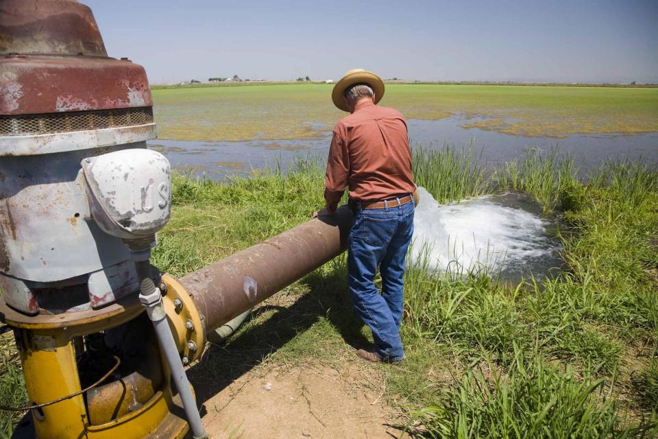
Irrigation is the artificial supply
of water to grow crops or plants. Obtained from either surface or groundwater, it optimizes
agricultural production when the amount of rain and where it
falls is insufficient. Different irrigation
systems are not necessarily mutually exclusive, but in
practical use are often combined. Much of the agriculture in
California and the West relies on irrigation.
C.W. “Bill” Jones (1918-2003) was an historical water figure
known for his pioneering efforts in bringing water deliveries to
the agricultural land in the San Joaquin Valley.
David N. Kennedy (1936-2007) was at the helm as the director of
the California Department of Water Resources (DWR) for 15 years,
the longest serving director to date, and a champion of the State
Water Project (SWP).
Flowing from the high Sierra Nevada to the bottomlands
of the southern San
Joaquin Valley, the Kern River is relied on for many uses –
as a fishery, a place of recreation and whitewater rafting, a
resource for generating hydroelectricity and a vital supply of
drinking water and agricultural irrigation. The Kern has
inspired song, slaked the thirst of growing communities and
supported a multi-billion-dollar farm economy.
The 272-mile long Kings River drops sharply in elevation from its
headwaters high in the Sierra
Nevada Mountain Range on its way to the Central Valley,
flowing just south-east of Fresno.
The dramatic descent generates electric power for dams and
the river also helps irrigate cropland and provides fresh water
to Central Valley communities.
The Klamath Basin’s Chinook salmon and coho salmon serve a vital
role in the watershed.
Together, they are key to the region’s water management, habitat
restoration and fishing.
However, years of declining population have led to federally
mandated salmon restoration plans—plans that complicate the
diversion of Klamath water for agriculture and other uses.
On the Klamath River, the Upper Klamath Basin’s aquatic
ecosystems are naturally very productive due to its
phosphorus-rich geology.
However, this high productivity makes the Basin’s lakes
vulnerable to water quality problems.
Nutrient loads in the Upper Klamath Basin are a primary driver of
water quality problems along the length of the Klamath River,
including algal blooms in the Klamath Hydroelectric Project
reservoirs. Municipal and industrial discharges of wastewater in
the Klamath Falls area add to the nutrient load.
The Klamath River Basin is one of the West’s most important and
contentious watersheds.
The watershed is known for its unusual geography straddling
California and Oregon. Unlike many western rivers, the
Klamath does not originate in snowcapped mountains but rather on
a volcanic plateau.
A broad patchwork of spring-fed streams and rivers in
south-central Oregon drains into Upper Klamath Lake and down into
Lake Ewauna in the city of Klamath Falls. The outflow from Ewauna
marks the beginning of the 263-mile Klamath River.
Lois Krieger (1917–2014) was one of
the true pioneers of the California water world. She was the
first woman elected chair of the Metropolitan Water District of
Southern California’s board of directors, the first female
president of the Association of California Water Agencies and a
long-time champion of the wise development and use of water in
the state.
Scientifically and legislatively, lakes are indistinguishable
from ponds, but lakes generally are considered to be longer and
deeper lentic, or still, waters. In the 18th and
19th centuries, scientists attempted to distinguish
the two more formally, stating that ponds were shallow enough to
allow sunlight to penetrate to the bottom, but this exists
today as an unofficial point.
Lake Havasu is a reservoir on the
Colorado River that
supplies water to the Colorado River
Aqueduct and Central Arizona Project. It is located at
the California/Arizona border, approximately 150 miles southeast
of Las Vegas, Nevada and 30 miles southeast of Needles,
California.
Situated in southwest Riverside County near the Santa Ana
Mountains – about 60 miles southeast of Los Angeles – Lake
Mathews is a
major reservoir in Southern California.
Lake Mead is the main reservoir formed by Hoover Dam on the border between
Southern Nevada and northwestern Arizona.
Created in the 1930s as part of Hoover Dam [see also Elwood Mead], Lake Mead provides
water storage in the Lower Basin of the Colorado River. The reservoir is
designed to hold 28,945,000 acre-feet of water and at 248
square miles its capacity is the largest in United States.
The State Water
Project facility Lake Perris, in northwestern Riverside
County, stores water for Inland Empire cities such as San
Bernardino and Riverside. [See also Santa Ana River.]
Built between 1970 and 1974, Lake Perris is the SWP’s
southernmost reservoir and is one of the most popular
recreational lakes in the system.
The construction of Glen Canyon Dam
in 1964 created Lake Powell. Both are located in north-central
Arizona near the Utah border. Lake Powell acts as a holding tank
for outflow from the Colorado River Upper Basin States: Colorado,
New Mexico, Utah and Wyoming.
The water stored in Lake Powell is used for recreation, power
generation and delivering water to the Lower Basin states of
California, Arizona, and Nevada.
Lake Tahoe is one of the world’s most beautiful yet vulnerable
lakes. Renowned for its remarkable clarity, Tahoe straddles the
Nevada-California border, stretching 22 miles long and 12 miles
wide in a granitic bowl high in the Sierra Nevada.
Tahoe sits 6,225 feet above sea level. Its deepest point is 1,645
feet, making it the second-deepest lake in the nation, after
Oregon’s Crater Lake, and the tenth deepest in the world.
Land retirement is a practice that takes agricultural lands out
of production due to poor drainage and soils containing high
levels of salt and selenium (a mineral found in soil).
Typically, landowners are paid to retire land. The purchaser,
often a local water district, then places a deed restriction on
the land to prevent growing crops with irrigation water (a source
of salt). Growers in some cases may continue to farm using rain
water, a method known as dry farming.
Land subsidence is the lowering of the land-surface elevation due
to changes that take place underground.
Throughout California, subsidence has damaged buildings,
aqueducts, well casings, bridges and highways. Common causes
include pumping water, oil or gas, dissolution of limestone
aquifers known as sinkholes, drainage of organic soils and
initial wetting of dry soils, according to the U.S. Geological
Survey.
The Landsat satellite program is a series of Earth-observing
satellite missions jointly managed by the National Aeronautics
and Space Administration and the U.S. Geological
Survey. Launched in 1972, Landsat is the longest
continuous global record of Earth observations. Landsat
data is used to evaluate agricultural production.
Lee Ferry on the Arizona-Utah border is a key dividing point
between the Colorado River’s Upper and Lower basins.
This split is important when it comes to determining how much
water will be delivered from the Upper Basin to the Lower Basin
[for a description of the Upper and Lower basins, visit the
Colorado River page].
California would not exist as it does today were it not for the
extensive system of levees, weirs and flood bypasses that have
been built through the years, particularly in the Sacramento-San Joaquin
Delta.
These levees have been in place dating back to 1850, when
California first joined the union.
The Los Angeles River is gradually being transformed from a
giant, trash-strewn stormwater channel to a recreational and open
space corridor that continues to provide flood control.
Deadly floods in the 1930s led the U.S. Army Corps of Engineers
to straighten and pave nearly all 52 miles of the river channel
in concrete. The trough was designed to keep flood water from
destroying property, to manage the discharges from sewage
treatment plants and to flush stormwater to the Pacific
Ocean.
Since the 1990s, a grassroots campaign to restore some of the
natural character of the river has gained political traction.
Los Angeles has the lowest ratio of open space per capita of
any major American city, due to rapid growth and poor urban
planning.
A bill passed by the state Legislature in 1992 established a Los
Angeles River Conservancy to develop comprehensive planning
strategies along the concrete corridor.
Additionally, a citizens’ group, Friends of the Los Angeles
River, has helped coordinate the cleanup and rejuvenation of the
river.
In the past, river advocates considered painting the river
channel blue to give it a more natural look.
In 2010, the U.S. EPA deemed the river navigable and subject
to the protections of the Clean Water Act. A year later, the
Army Corps permitted kayaking along soft-bottom stretches north
of downtown.
In 2014, the Army Corps recommended approval of Los Angeles
County’s plan to restore habitat, widen the river, create
wetlands, and invite new commercial and residential development.
The county Board of Supervisors approved the Los Angeles River Master
Plan in 2022.
In the winter of 2024, the river captured near-record
precipitation from a series of intense atmospheric
rivers, thanks to drain clearing and dredging of debris, Army
Corps officials said.
Los Angeles River supporters are looking beyond the river’s banks
toward improved management of the Los Angeles River watershed as
a whole. Advocates seek a strategy that integrates and
coordinates the management of water quality, flood control
and habitat restoration across jurisdictional boundaries.
Robert B. Marshall (1867-1949), whose career at the U.S.
Geological Survey culminated in 1908 when he became chief
geographer for the entire USGS, first proposed the concept of a
statewide water plan for a series of dams, canals and aqueducts
to bring water to California’s Central Valley.
As a result of his 1919 Marshall Plan, he earned the nickname of
“Father of the Central Valley Project.”
According to the California Department of Water Resources, the
Marshall Plan became the precursor of the first State Water Plan
in 1930.
Don McCrea was one of the founding members of the Water Education
Foundation and signed its original Articles of Incorporation in
1977.
His background was in power and energy issues, including
hydrology and the state’s hydrologic system, from a career at the
Pacific Gas & Electric Company in San Francisco. He was involved
in the development of the State Water Project as a proponent of
the value of hydroelectricity.
Lake Mead is the main reservoir formed by Hoover Dam on the border between
Southern Nevada and northwestern Arizona.
Created in the 1930s as part of Hoover Dam [see also Elwood Mead], Lake Mead provides
water storage in the Lower Basin of the Colorado River. The reservoir is
designed to hold 28,945,000 acre-feet of water and at 248
square miles its capacity is the largest in United States.
Elwood Mead (1858-1936) was the commissioner of the U.S. Bureau
of Reclamation during the era of the development of Hoover Dam on
the Colorado River between Arizona and Nevada, Grand Coulee Dam
in Washington and Owyhee Dam in Oregon, among other large water
projects.
The Mendota Pool, located at the confluence of the
San Joaquin River and the Fresno Slough in California’s San
Joaquin Valley, is a historic piece of irrigation infrastructure
that now plays a pivotal role for the federal Central Valley Project
(CVP).
The Colorado River Delta is located
at the natural terminus of the Colorado River at the Gulf of
California, just south of the U.S.-Mexico border. The desert
ecosystem was formed by silt flushed downstream from the Colorado
and fresh and brackish water mixing at the Gulf.
The Colorado River Delta once covered 9,650 square miles but has
shrunk to less than 1 percent of its original size due to
human-made water diversions.
The Mexican Water Treaty of 1944 committed the U.S. to deliver
1.5 million acre-feet of water to Mexico on an annual basis, plus
an additional 200,000 acre-feet under surplus conditions. The
treaty is overseen by the International Boundary and Water
Commission.
Colorado River water is delivered to Mexico at Morelos Dam,
located 1.1 miles downstream from where the California-Baja
California land boundary intersects the river between the town of
Los Algodones in northwestern Mexico and Yuma County, Ariz.
Microplastics – plastic debris
measuring less than 5 millimeters – are an
increasing water quality concern. They enter waterways and
oceans as industrial microbeads from various consumer
products or larger plastic litter that degrades into small bits.
Microbeads have been used in exfoliating agents, cosmetic washes
and large-scale cleaning processes. Microplastics are used
pharmaceutically for efficient drug delivery to affected sites in
patients’ bodies and by textile companies to create artificial
fibers.
Microplastics disperse easily and widely throughout surface waters and sediments. UV
light, microbes and erosion degrade the tiny fragments, making
them even smaller and more difficult for wastewater treatment
plants to remove.
The particles, usually made of polyethylene or polypropylene
plastic, take thousands of years to biodegrade
naturally. It takes prohibitively high temperatures to
break microplastics down fully. Consequently, most water treatment plants cannot remove
them.
The health effects of consumption are currently under
investigation.
Responses
Many advocacy groups have published lists of products containing
microbeads to curb their purchase and pollution.
The U.S. Environmental Protection Agency regulates microbeads in
industrial, but not domestic, wastewater.
Federal
law required microbeads to be phased out of rinse-off
cosmetics beginning in July 2017. Dozens of states also
regulate microbeads in products. California has the strictest
limitation, prohibiting even the use of biodegradable microbeads.
Microplastics in California Water
In 2019, the San Francisco Estuary Institute published a
study estimating that 7 trillion pieces of microplastic
enter San Francisco
Bay annually from stormwater runoff, about 300
times the amount in all wastewater treatment effluent entering
the bay.
California lawmakers in 2018 passed a package of bills to raise
awareness of the risks of microplastics and microfibers in the
marine environment and drinking water. As
directed by the legislation, the State Water Resources Control
Board in 2020 adopted an official
definition of microplastics in drinking water and in 2022
developed the world’s standardized methods for testing drinking
water for microplastics.
The water board was expected by late 2023 to begin testing
for microplastics in untreated drinking water sources tapped by
30 of the state’s largest water utilities. After two years, the
testing was expected to extend to treated tap water served
to consumers. A progress report and recommendations for
policy changes or additional research are required by the end of
2025.
Flowing into the heart of the Mojave Desert, the Mojave River exists mostly underground. Surface channels are usually dry absent occasional groundwater surfacing and flooding from extreme weather events like El Niño.
Mono Lake is an inland sea located east of Yosemite National Park
near the Nevada border. It became the focus of a major
environmental battle from the 1970s to the 1990s.
The lake has a surface area of about 70 square miles and is the
second largest lake in California and one of the oldest in North
America. Its salty waters occupy former volcanic craters. The old
volcanoes contribute to the geology of the lake basin, which
includes sulfates, salt and carbonates.
The Monterey Amendment, a 1994 pact between Department of Water
Resources and State Water Project contractors, helped ease
environmental stresses on the Sacramento San Joaquin Delta.
As part of large-scale restructuring of water supply contracts,
the Monterey Amendment allowed for storage of excess flows during
wet years in groundwater banks and surface storage reservoir.
This stored water could then be used later during dry periods or
to help the Delta.
Adolph Moskovitz (1923-1996) is remembered as one of the leading
water resources attorneys in the country and has been described
as “brilliant” by his many peers in the legal profession.
John Muir (1838-1914) was a famous
and influential naturalist and conservationist who founded the
Sierra Club in 1892 and was its president until he died.
Throughout his life, this man from Scotland was also a farmer,
inventor, sheepherder, explorer and writer.
William Mulholland (1855-1935), an immigrant from Ireland, is
infamous in the history of California water and the state’s water
wars for both his far-sightedness and no-holds-barred approach to
delivering a controversial water supply to Southern California.
He is a love-hate character with a story that has many tellings,
including in the 1974 fictional movie, Chinatown.
Passed in 1970, the federal National Environmental Policy Act
requires lead public agencies to prepare and submit for public
review environmental impact reports and statements on major
federal projects under their purview with potentially significant
environmental effects.
According to the Department of Energy, administrator of NEPA:
Variations in the statistical analysis of the climate on all time
and space scales beyond that of individual weather events is
known as natural variability. Natural variations in climate over
time are caused by internal processes of the climate system, such
as El Niño, and
phenomena such as volcanic activity and variations in the output
of the sun.
Completed in 1979, the New Melones Dam on California’s Stanislaus
River includes a 2.4 million acre-feet reservoir and a
power-generating capacity of 283 megawatts.
The Central Valley Project facility was built to help with
irrigation, flood control and power production. It replaced an
older dam from the 1920s that supplied water for agriculture to
two local irrigation districts.
Nitrate—the oxidized form of dissolved nitrogen— is the main
source of nitrogen for plants. It occurs naturally in soil and
dissipates when the soil is extensively farmed. Thus, nitrogen
fertilizers are applied to replenish the soil. However, these
nitrates can be toxic, especially when they enter the food chain
via groundwater and surface water.
In California, the State Water Resources Control Board lists
nitrate as one of California’s most challenging and growing water
problems.
Also known as the Lost Coast, California’s remote north coast is
home to mostly undeveloped rivers.
The Klamath, Trinity, Eel, Russian and Smith
rivers are the major northern streams that drain this sparsely
populated, forested coastal area that stretches from San
Francisco to the Oregon border.
These rivers and their tributaries flow west to the Pacific Ocean
and account for about 40 percent of the state’s total runoff.
Nutria are large, beaver-like
rodents native to South America that have caused alarm in
California since their rediscovery along Central Valley rivers
and other waterways in 2017.
Contrary to popular belief,
“100-Year Flood” does not refer to a flood that happens every
century. Rather, the term describes the statistical chance of a
flood of a certain magnitude (or greater) taking place once in
100 years. It is also accurate to say a so-called “100-Year
Flood” has a 1 percent chance of occurring in a given year, and
those living in a 100-year floodplain have, each year, a 1
percent chance of being flooded.
Oroville Dam is the tallest in the
United States and impounds the largest reservoir in
California’s State Water
Project, which brings water to 27 million residents and
750,000 acres of farmland.
Completed in 1968, the 770-foot earthfill embankment impounds the
northern Sierra Nevada’s Feather River, creating a reservoir that
can hold 3.5 million acre-feet
of water.
Owens Lake is a dry lake at the terminus of the Owens River
just west of Death Valley and on the eastern side of the Sierra Nevada. For at least
800,000 years, the lake had a continuous flow of water, until
1913 when the Los Angeles Department of Water and Power
(LADWP) completed the 233-mile Los Angeles
Aqueduct to supplement the budding metropolis’
increasing water demands.
The Pacific Flyway is one of four
major North American migration routes for birds, especially
waterbirds, and stretches from Alaska in the north
to Patagonia in South America.
Each year, birds follow ancestral patterns as they travel the
flyway on their annual north-south migration. Along the way, they
need stopover sites such as wetlands with suitable habitat and
food supplies. In California, 95 percent of historic
wetlands have been lost, yet the Central Valley hosts some of the
world’s largest populations of wintering birds.
Lake Havasu is a reservoir on the
Colorado River that
supplies water to the Colorado River
Aqueduct and Central Arizona Project. It is located at
the California/Arizona border, approximately 150 miles southeast
of Las Vegas, Nevada and 30 miles southeast of Needles,
California.
For both small and large concentrations, parts-per notation is a
very convenient way to communicate numbers that would ordinarily
have many zeros (either before or after a decimal point). For
example, 3 ppt (parts per trillion) is much cleaner than
reporting 0.000000000003. Additionally, it is important to
distinguish what units are being described. Is it 3 particles per
trillion particles? 3 grams per trillion grams? In other words,
parts-per notation offers a unit-less ratio, and in scientific
literature the true units are either directly stated or implied
from context.
Pelagic fish are those that live near the water’s surface rather
than on the bottom. In California, pelagic fish species include
the Delta smelt, longfin
smelt, striped bass and salmon.
In California, the fate of pelagic fish has been closely tied to
the use of the water that supports them.
Fred T. Perris (1837-1916)
became the chief engineer and superintendent of construction of
the California Southern Railway. A civil engineer, he also played
a role in surveying and taking water measurements in San
Bernardino and Los Angeles counties. The Lake Perris State
Recreation Area and the city of Perris are named after him.
The State Water
Project facility Lake Perris, in northwestern Riverside
County, stores water for Inland Empire cities such as San
Bernardino and Riverside. [See also Santa Ana River.]
Built between 1970 and 1974, Lake Perris is the SWP’s
southernmost reservoir and is one of the most popular
recreational lakes in the system.
The Pit River is the longest
tributary of the Sacramento River and largest river in northeast
California. It connects to the Sacramento River at Shasta Lake and has headwaters at the
confluence of its two tributaries – the
North and South Forks.
Point sources release pollutants from discrete conveyances, such
as a discharge pipe, and are regulated by federal and state
agencies. The main point source dischargers are factories and
sewage treatment plants, which release treated
wastewater.
Carley V. Porter (1906-1972) was
the longtime chairman of the California Legislature’s Assembly
Committee on Water who has two historical and important water
laws named after him. He was a Democrat from Compton in Los
Angeles County and a teacher before being elected to the Assembly
in 1949.
Porter made the state’s water problems a major focus of his
legislative career. He served on the Legislature’s Joint Water
Problems Committee in the 1950s and chaired the Assembly Water
Committee from its creation in 1959.
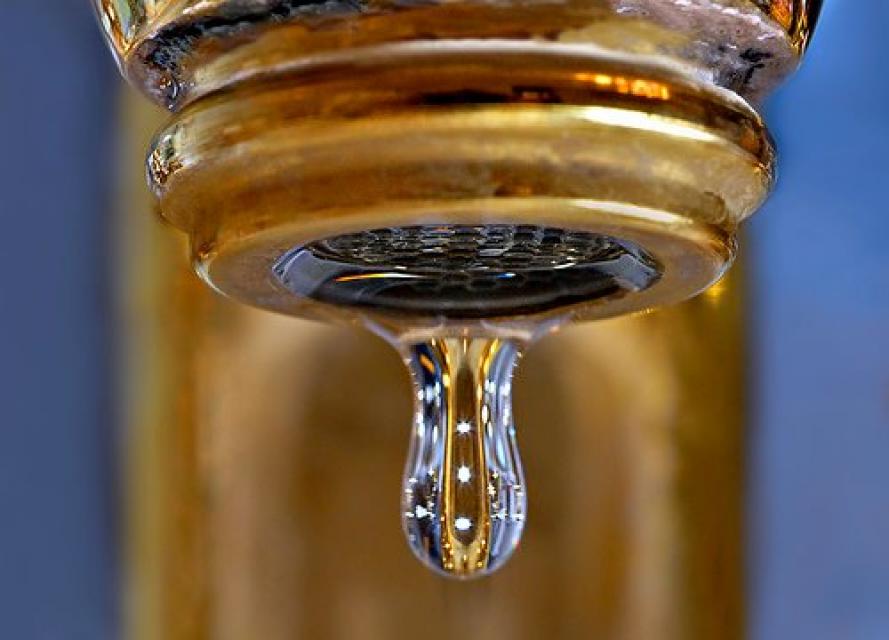
Potable water, also known as
drinking water, comes from surface and ground sources and is
treated to levels that that meet state and federal standards for
consumption.
Water from natural sources is treated for microorganisms,
bacteria, toxic chemicals, viruses and fecal matter. Drinking
raw, untreated water can cause gastrointestinal problems such as
diarrhea, vomiting or fever.
John Wesley Powell (1834-1902) was historic and heroic for being
first to lead an expedition down the Colorado River in 1869. A major
who lost an arm in the Civil War Battle of Shiloh, he was an
explorer, geologist, geographer and ethnologist.
The construction of Glen Canyon Dam
in 1964 created Lake Powell. Both are located in north-central
Arizona near the Utah border. Lake Powell acts as a holding tank
for outflow from the Colorado River Upper Basin States: Colorado,
New Mexico, Utah and Wyoming.
The water stored in Lake Powell is used for recreation, power
generation and delivering water to the Lower Basin states of
California, Arizona, and Nevada.
Prado Dam – built in 1941 in
response to the Santa Ana
River’s flood-prone past – separates the river into its
upper and lower watersheds. After the devastation of the
deadly
Los Angeles Flood of 1938 that impacted much of Southern
California, it became evident that flood protection was woefully
inadequate, prompting the U.S. Army Corps of Engineers to
construct Prado Dam.
Prescriptive Rights are water use rights gained illicitly that
evolve into a title. Typically this occurs with rights to
chronically overdraftedgroundwater basins gained
through trespass or unauthorized use.
In California, the California Supreme Court developed the
doctrine of prescriptive rights in 1949.
Rooted in Roman law, the public
trust doctrine recognizes the public right to many natural
resources including “the air, running water, the sea and its
shore.”
The doctrine requires the sovereign, or state, to hold in trust
designated resources for the benefit of the people.
Traditionally, the public trust applied to commerce and fishing
in navigable waters, but its uses were expanded in California in
1971 to include fish, wildlife, habitat and recreation.
A troublesome invasive species is
the quagga mussel, a tiny freshwater mollusk that attaches itself
to water utility infrastructure and reproduces at a rapid rate,
causing damage to pipes and pumps.
First found in the Great Lakes in 1988 (dumped with ballast water
from overseas ships), the quagga mussel along with the zebra
mussel are native to the rivers and lakes of eastern Europe and
western Asia, including the Black, Caspian and Azov Seas and the
Dneiper River drainage of Ukraine and Ponto-Caspian
Sea.
The Quantification Settlement Agreement (QSA), signed in 2003,
defined the rights to a portion of Colorado River water for the San
Diego County Water Authority, Coachella Valley Water District,
Imperial Irrigation District and the Metropolitan Water District
of Southern California.
The QSA responded to California consistently using more than its
annual Colorado River entitlement of 4.4 million acre-feet.
Additionally, the water needs of six other Colorado River Basin
states had grown, making the river’s shared use increasingly
crucial.
All water is naturally recycled and
reused as part of the hydrologic cycle. Recycled
water is also produced by purifying wastewater for safe use in
drinking (potable) water and for non-potable uses such as
irrigation.
Recycling wastewater provides a new, costly but renewable water
resource that can bolster local water supplies, save energy and
reduce the amount of sewage treatment plant effluent emptied into
rivers and oceans.
The Red Bluff Diversion Dam, its gates raised since 2011 to allow
fish passage, spans the Sacramento River two miles
southeast of Red Bluff on the Sacramento River in Tehama County.
It is owned by the Bureau of Reclamation and operated and
maintained by the Tehama-Colusa Canal Authority.
Front-line responsibility for protecting California’s water
quality and policing waste discharges in the state rests
primarily with nine regional water quality control boards
overseeing water quality in major watersheds from Oregon to
Mexico.
The nine regional boards are semi-autonomous from the State Water
Resources Control Board, which is charged with allocating surface
water rights and setting statewide policy on water quality. The
regional boards are comprised of seven part-time board members
appointed by the Governor and confirmed by the state Senate.
Regional boundaries are based on watersheds and water quality
requirements are based on the unique differences in climate,
topography, geology and hydrology for each watershed. Each
regional board makes critical water quality decisions for its
region, including setting standards, issuing waste discharge
requirements, determining compliance with those requirements, and
taking appropriate enforcement actions.
BACKGROUND
World War II brought rapid industrial development and population
growth to California, and with them came water pollution and
water-borne disease outbreaks. Attempts to regulate the sources
of water pollution were complicated by conflicting
interpretations of existing laws and overlapping authority among
government agencies.
In an attempt to better address California’s water pollution
concerns, the state Legislature in 1949 passed the Dickey Water
Pollution Act. Authored by Randal F. Dickey, a Republican
assemblyman from the city of Alameda, the act created a State
Water Pollution Control Board to oversee statewide water
pollution policy, and regional water pollution control boards to
be the enforcing agency in each of the state’s nine major
watersheds.
Over the next two decades, new legislation would rename the state
and regional water boards, expand the state board’s duties to
include surface water rights, and – with the enactment in 1969 of
the Porter-Cologne Water Quality Control Act – strengthen the
state’s oversight of water quality affecting beneficial uses of
surface and groundwater. The Porter-Cologne Water Quality Control
Act – coauthored by Sen.
Gordon Cologne, a Riverside County Republican, and Assemblyman Carley Porter, a Los
Angeles County Democrat – became the model for the federal Clean
Water Act in 1972.
Below are the nine regional water quality control boards and the
counties they cover.
Marc Reisner (1948-2000), an environmental writer who became a
celebrity in the water world, was the author of Cadillac Desert:
The American West and Its Disappearing Water (1986), a
best-seller about Western water history and politics and a
full-blown critique of 20th century water development, especially
in California and the West. “Based on 10 years of research,
Cadillac Desert is a stunning expose and a dramatic, provocative
history of the creation of an Eden — an Eden that may be only a
mirage,” according to the book’s back flap.
Remote sensing technology brings greater information and detail
about things such as levee integrity, microclimate conditions in
a farm field and the depth of the Sierra Nevada snowpack. If not
from satellite cameras, the imagery is often relayed through
high-flying aircraft.
Surface water is water
found in rivers, lakes, streams, and ponds. There are a limited
number of instances in which water in a defined underground
channel is classified as surface water. There are several types
of water rights that apply to surface water.
A landowner whose property borders a river has a right to use
water from that river on his land. This is called riparian
rights.
Ronald B. Robie, an associate justice on the California Court of
Appeal, Third Appellate District, has made his mark on state
water issues during a career in public service that has spanned
all three branches of government.
Theodore “Teddy” Roosevelt (1858-1919) was the 26th president of
the United States who established the U.S. Bureau of Reclamation
and created the U.S. Forest Service.
During his term of office from 1901-1909, he is credited for his
efforts on conservation, increasing the number of national
forests, protecting land for the public and promoting irrigation
projects. For Roosevelt, water was instrumental to developing the
Western states.
The Russian River is one of the major northern streams that drain
the sparsely populated, forested coastal area that stretches from
San Francisco to the Oregon border.
California’s largest river, the Sacramento, provides about
30 percent of the state’s surface water runoff.
Once called “the Nile of the West,” the Sacramento River drains
the inland slopes of the Klamath Mountains, the Cascade Range,
the Coast Ranges and the western slopes of the northern Sierra Nevada. The river stretches
some 384 miles from its headwaters near Mount Shasta to the
Sacramento-San
Joaquin Delta.
The Sacramento-San Joaquin Delta is
the largest freshwater tidal estuary of its kind on the west
coast of the Americas, providing important habitat for birds on
the Pacific Flyway and
for salmon and other fish that live in or pass through the Delta.
It’s also the hub of California’s two largest surface water
delivery projects, the federal Central Valley Project
and the State Water
Project. The Delta provides a portion of the drinking
water for some 30 million Californians and irrigation water
for large portions of the state’s $61 billion agricultural
industry.
For nearly half a century, the Delta has been embroiled in
continuing controversy over the struggle to restore the faltering
ecosystem while maintaining its role as the hub of the state’s
water supply. That challenge continues to this day and will be
made more difficult by the growing impacts of climate
change.
The Sacramento-San
Joaquin Delta, part of the largest freshwater tidal estuary
on the West Coast, supports more than 55 fish species and more
than 750 plant and wildlife species. The Delta’s most iconic
native fish is salmon, which rely on a healthy ecosystem for food
and refuge during their migration from the streams where they
were born through the estuary to the ocean, and then back again
to spawn. But the Delta ecosystem has been put under increasing
stress by a combination of factors, imperiling not just
populations of salmon, but several other species as well.
Dozens of agencies have interests
or jurisdiction in the Sacramento-San
Joaquin Delta, ranging from federal and state water supply
and wildlife agencies to local governments and water agencies
that rely on the Delta for their supplies. While that makes for a
messy and constantly changing regulatory tangle, two state
agencies, the State Water Resources Control Board and, to a
somewhat lesser extent, the Delta Stewardship Council, act as the
primary water management referees. State and federal courts have,
at times, weighed in as well.
For roughly a century, between the
mid-1800s and the 1950s, the primary infrastructure in the Delta
consisted of levees built to enable farming in the Delta itself.
But with construction of the Central Valley Project
(CVP) and the State
Water Project (SWP), the Delta became a critical link in
the state’s complex water distribution system. Today, the
majority of people, farms and businesses in California depend on
water transported through the Sacramento-San
Joaquin Delta.
The Sacramento-San Joaquin Delta always has been at the mercy of
river flows and brackish tides.
Before human intervention, salty ocean water from the San
Francisco Bay flooded the vast Delta marshes during dry summers
when mountain runoff ebbed. Then, during winter, heavy runoff
from the mountains repelled sea water intrusion.
The fresh water inflow and outflow of the Sacramento-San Joaquin
Delta is critical to its vitality and survival.
Freshwater flows from the Delta meets saltwater from the ocean
near Suisun Marsh located to the east of San Francisco Bay.
Suisun Marsh and adjoining
bays are the brackish transition between fresh and salt water.
But the location of that transition is not fixed.
The federal Safe Drinking Water Act sets standards for drinking
water quality in the United States.
Launched in 1974 and administered by the U.S. Environmental
Protection Agency, the Safe Drinking Water Act oversees states,
communities, and water suppliers who implement the drinking water
standards at the local level.
The act’s regulations apply to every public water system in the
United States but do not include private wells serving less than
25 people.
According to the EPA, there are more than 160,000 public water
systems in the United States.
Excess salinity poses a growing
threat to food production, drinking water quality and public
health. Salts increase the cost of urban drinking water and
wastewater treatment, which are paid for by residents and
businesses. Increasing salinity is likely the largest long-term
chronic water quality impairment to surface and groundwater in California’s Central
Valley.
As part of the historic Colorado
River Delta, the Salton Sea regularly filled and dried for
thousands of years due to its elevation of 237 feet below
sea level.
The most recent version of the Salton Sea was formed in 1905 when
the Colorado River broke
through a series of dikes and flooded the seabed for two years,
creating California’s largest inland body of water. The
Salton Sea, which is saltier than the Pacific Ocean, includes 130
miles of shoreline and is larger than Lake Tahoe.
Flowing 366 miles from the Sierra
Nevada to Suisun Bay, the San Joaquin River provides irrigation
water to thousands of acres of San Joaquin Valley farms and
drinking water to some of the valley’s cities. It also is the
focal point for one of the nation’s most ambitious river
restoration projects to revive salmon populations.
Located in the middle of California, the San Joaquin Valley is
bracketed on both sides by mountain ranges. Long and flat, the
valley’s hot, dry summers are followed by cool, foggy winters
that make it one of the most productive agricultural regions in
the world.
The valley stretches from across mid-California between coastal
ranges in west and the Sierras on the east. The region includes
large cities such as Fresno and Bakersfield, national parks such
as Yosemite and Kings, millions of people, and fertile farmland.
The San Luis Reservoir is the nation’s largest off-stream
reservoir, serving as a key water facility for both the
State Water
Project (SWP) and the federal Central Valley Project
(CVP).
Southern California’s Santa Ana River is the largest watershed
drainage south of the Sierra and is located largely in a highly
urbanized, highly regulated setting.
At about 100 miles long and with more than 50 tributaries, the
Santa Ana spans parts of San Bernardino, Riverside and Orange
counties as it drains 2,840 square miles of land.
Anne J. Schneider (1947-2010) is
acknowledged as one of the first women to become well-known and
well-respected in the field of California and Western water law.
“Anne was an amazing person — an accomplished college athlete,
mountain climber, skier, marathon runner, velodrome and
long-distance cyclist; a devoted mother; a dedicated
conservationist,” said Justice Ronald B. Robie in the Inaugural
Anne J. Schneider Memorial Lecture in May 2012.
Seawater intrusion can harm groundwater quality in a variety of
places, both coastal and inland, throughout California.
Along the coast, seawater intrusion into aquifers is connected to overdrafting of
groundwater. Additionally, in the interior, groundwater
pumping can draw up salty water from ancient seawater isolated in
subsurface sediments.
In rural areas with widely dispersed houses, reliance upon a
centralized
sewer system is not practical compared to individual
wastewater treatment methods. These on-site management facilities
– or septic systems – are more commonplace given their simpler
structure, efficiency and easy maintenance.
Completed in 1999, the Seven Oaks
Dam is a 550-feet-high earthen dam
on the Santa Ana River.
Its construction at the base of the San Bernardino Mountains was
a major component of the Santa Ana River
Mainstem Project, costing $534 million and meant to protect
the more than 2 million citizens of Orange, Riverside and San
Bernardino counties from flooding. To accomplish this, the dam
releases only 7,000 cubic feet per second (cfs) of the 85,000 cfs
flowing into it, giving it 350-year flood
protection. The rest of this flood control project
consisted of raising the already existing Prado Dam downstream and
building additional channels.
Shasta Dam forms California’s
largest storage reservoir, Shasta Lake, which can hold about 4.5
million acre-feet.
As the keystone of the federal Central Valley Project,
Shasta stands among the world’s largest dams. Construction on the dam began in 1938
and was completed in 1945, with flood control as the
highest priority.
Stretching 450 miles long and up to
50 miles wide, the Sierra Nevada makes up more than a quarter of
California’s land area and forms its largest watersheds,
providing more than half of the state’s developed water supply to
residents, agriculture and other businesses.*
Silverwood Lake in the San Bernardino Mountains in Southern
California is part of the State Water
Project (SWP), storing water for Inland Empire cities
such as San Bernardino and Riverside. The water is conveyed to
Silverwood Lake via the SWP’s East Branch Aqueduct.
Formed by the 249-foot-high Cedar Springs Dam, Silverwood Lake
was constructed between 1968 and 1971 to provide water storage
and recreation and assure flows through the Devil Canyon
Powerplant near San Bernardino.
Sinkholes are caused by erosion of rocks beneath soil’s surface.
Groundwater dissolves soft rocks such as gypsum, salt and
limestone, leaving gaps in the originally solid structure. This
is exacerbated when water is acidic from contact with carbon
dioxide or acid rain. Even humidity can play a major role in
destabilizing water underground.
The land remains intact until the spaces become too big to
support the surface above – called “overburden” – causing it to
collapse and create a “sinkhole.” They can be undetectably
small or hundreds of miles in diameter.
Bernice Frederic “B.F.” “Bernie” Sisk (1910-1995) represented the
San Joaquin Valley in the U.S. Congress for nearly a quarter of a
century from 1955-1978.
The proposed Sites Reservoir would
be a 1.5 million-acre-foot off-river storage basin on the west
side of the Sacramento Valley, about 78 miles northwest of
Sacramento. It would capture stormwater flows from the Sacramento River for release in
dry years for fish and wildlife, farms, communities and
businesses.
Robert A. Skinner (1895-1986) was the Metropolitan Water District
of Southern California general manager from 1962-1967. An
engineer, he was instrumental in negotiating the district’s
contract with the California Department of Water Resources for
delivery of water from Northern California. Both Lake Skinner and
a treatment plant in southwestern Riverside County were named in
his honor.
Sloughs (pronounced “slews”) are shallow lakes or swamps. Generally
they serve as backwaters –
or a stagnant part of a river – and are consequently located at
edges of rivers where a stream or other canal once flowed.
Lester A. Snow, the mastermind behind
countless water resources management projects, has been involved
in water issues in two states, both the public and private
sectors and on regional, state and federal levels of government.
In a timeline of his career, Snow served from 1988-1995 as the
general manager of the San Diego County Water Authority after
leaving the Arizona Department of Water Resources. From
1995-1999, he was the executive director of the CALFED Bay-Delta
Program, which included a team of both federal and state
agencies.
Springs are where groundwater becomes surface water, acting as openings
where subsurface water can discharge onto the ground or directly
into other water bodies. They can also be considered the
consequence of an overflowing
aquifer. As a result, springs often serve as headwaters to streams.
The Stanislaus River empties into the San Joaquin River from the
east along with the Merced
and Tuolumne rivers.
Although some agricultural drainage
flows into these rivers in their lower reaches, the water quality
is relatively good in each of the three tributaries.
The State Water Project is a lifeline for California because of its vital role in bringing water to cities and farms. Without it, California would never have developed into the economic powerhouse it is.
One of two State Water
Project aqueducts serving Southern California, the East
Branch Aqueduct stores water in Silverwood Lake and Lake Perris.
After being pumped over the Tehachapi Mountains from the Edmonston Pumping
Plant, water for the East Branch Aqueduct passes through
Palmdale and Lancaster [see also West Branch Aqueduct]. The
water is then stored for distribution to Inland Empire cities
such as San Bernardino and Riverside.
The West Branch Aqueduct supplies water for Los Angeles and other
Southern California cities.
The West Branch is one of two State Water Project
aqueducts serving Southern California.
After being pumped over the Tehachapi Mountains from the Edmonston Pumping
Plant, water for the West Branch Aqueduct is then stored in
Pyramid Lake and Castaic Lake [See also East Branch Aqueduct, which
serves the Inland Empire near Riverside.]
Ron Stork, the award-winning policy director of the Friends of
the River, joined the statewide California river conservation
group in 1987 as its associate conservation director. Previously
he was executive director of the Merced Canyon Committee, where
he directed the successful effort to obtain the National Wild and
Scenic River designation for the Merced River.
For all the benefits of precipitation, stormwater also brings
with it many challenges.
In urban areas, after long dry periods rainwater runoff can
contain heavy accumulations of pollutants that have built up over
time. For example, a rainbow like shine on a roadway puddle can
indicate the presence of oil or gasoline. Stormwater does not go
into the sewer. Instead, pollutants can be flushed into waterways
with detrimental effects on the environment and water quality.
Sinking of land(s) due to compaction, oxidation of peat soils,
and/or wind erosion, can occur when groundwater is overdrafted.
For a more detailed discussion of subsidence effects on
infrastructure, see the entry on Land Subsidence.
Rita Schmidt Sudman, who led the Water Education Foundation as
executive director for more than 30 years, is widely recognized
for her work since the 1980s as a journalist and communicator who
developed programs to foster public understanding of water issues
and for her work with stakeholders to find solutions. A former
radio and television reporter and producer, she oversaw the
development of print and digital publications, public television
programs, poster maps, tours, press briefings and a school
program.
Suisun Marsh is where fresh water
from the Sacramento-San Joaquin
Delta mixes with salt water from San Francisco Bay. The
116,000-acre marsh is the largest contiguous brackish-water
wetland in California and perhaps the entire western coast of
North America, providing food and habitat for thousands of
migratory birds on the Pacific Flyway and many species of plants,
fish and wildlife.
The story of California’s surface water— water that remains on
the earth’s surface, in rivers, streams, lakes, reservoirs or
oceans—is one that reflects the state’s geographic complexity.
About 75 percent of California’s surface water supply originates
in the northern third of the state, but around 80 percent of
water demand occurs in the southern two-thirds of the state. And
the demand for water is highest during the dry summer months when
there is little natural precipitation or snowmelt.
A tremendous amount of time and technology is expended to make
surface water safe to drink. Surface water undergoes many
processes before it reaches a consumer’s tap.
California entered a new era of
groundwater management in 2014 with the passage of the
Sustainable Groundwater Management Act (SGMA), becoming the last
state in the arid West to enact some kind of comprehensive
groundwater
management program.
Sustainability is defined as that
which “meets the needs of the present without compromising the
ability of future generations to meet their own needs.” In
California, several efforts have been undertaken in recent years
to address the sustainability and resilience of the state’s vital
water resources.
Lake Tahoe is one of the world’s most beautiful yet vulnerable
lakes. Renowned for its remarkable clarity, Tahoe straddles the
Nevada-California border, stretching 22 miles long and 12 miles
wide in a granitic bowl high in the Sierra Nevada.
Tahoe sits 6,225 feet above sea level. Its deepest point is 1,645
feet, making it the second-deepest lake in the nation, after
Oregon’s Crater Lake, and the tenth deepest in the world.
John R. Teerink (1921-1992) was the director of the California
Department of Water Resources (DWR) from 1973-1975 during
Governor Ronald Reagan’s administration.He had various lead roles
in the implementation of the State Water Project during his
29-year career at DWR. He progressed through the ranks as junior
engineer, assistant chief engineer and then deputy director until
his appointment to head the department.
The Tehama-Colusa and Corning canals
receive water from the Sacramento River just upstream of the
Red Bluff Diversion Dam. That water is then used to irrigate
the west side of the Sacramento Valley as part of the federal
Central Valley
Project.
A tributary is a river or stream
that enters a larger body of water, especially a lake or river.
The receiving water into which a tributary feeds is called the
“mainstem,” and the point where they come together is referred to
as the “confluence.”
Trihalomethanes are the most common type of “disinfection
byproduct,” which is a substance created from the treatment of
water with organic matter.
How They Form
Chlorine is the most popular water disinfectant, used widely
since the beginning of the 20th century to kill viruses and
microorganisms in water. It has had a major role in significantly
reducing global instances of cholera and typhoid given its
effectiveness and relatively low cost.
The Trinity River flows for 700
twisting, winding miles from the rugged Trinity Alps in
northwestern California to the Pacific Ocean. In the upper reach
of the Trinity River are two dams – Trinity Dam and Lewiston Dam
– that store and divert water to the Sacramento Valley as part of
the Central Valley
Project (CVP).
From it headwaters high in California’s Sierra Nevada, the
Truckee River flows into and through Lake Tahoe, continuing down
the Truckee River canyon to the Reno metropolitan area and then
across miles of Nevada high desert before flowing into Pyramid
Lake, 40 miles northeast of Reno.
The river’s 145-mile course takes it from alpine forests to high
desert sagebrush. (The portion of the Truckee that begins in
California in the Sierra Nevada and flows into Lake Tahoe is
called the Upper Truckee River.)
Until the early 1900s, Central
California’s Tulare Lake appeared every winter as the
southernmost rivers flowing out of the Sierra Nevada filled the
dry lakebed with rainfall and melted snow.
In the spring, the shallow lake near Visalia could cover as much
as 790 square miles or four times the surface area of Lake Tahoe.
However, by the end of the hot San Joaquin Valley summer, the
giant lake – once the largest freshwater body west of the
Mississippi River – could disappear primarily due to evaporation.
The Tuolumne River is one of the major tributaries draining the
western Sierra Nevada.
Beginning high in the mountains of Yosemite at 13,000 feet, the
Tuolumne River forms at Mt. Lyell, flows through Tuolumne
Meadows, and cascades through canyons including the Grand Canyon
of the Tuolumne, as it descends 150 miles into the San Joaquin
Valley. There, the Tuolumne empties into the San Joaquin River.
The water helps irrigate the agriculturally-rich region,
particularly Stanislaus County. The dam at Don Pedro Reservoir
near Turlock is also used to generate electricity.
Despite droughts, recession and natural disasters, California’s
urban population continues to grow.
This population growth means increasing demand for water by urban
areas—home to most of California’s population [see also Agricultural
Conservation]. As of 2021, three of the nation’s 10 most
populated cities are in California.
Henry J. Vaux Jr. is the professor of resource economics,
emeritus, of the University of California, Berkeley, and the
University of California, Riverside.
Hiram W. Wadsworth (1862-1939) is known as the father of
Metropolitan Water District of Southern California. As the mayor
of Pasadena, he called for a regional partnership of
municipalities to bring water to Southern California. After
initiating the Colorado River Aqueduct Association and being
elected its president, he directed the campaign from 1924-1929
that led to the establishment of the district. The pumping plant
at Diamond Valley Lake, located 90 miles southeast of Los Angeles
in Riverside County, was named the Hiram W. Wadsworth
Pumping/Hydro-generating Facility in his honor.
William E. “Bill” Warne (1905-1996) had a career for the record
books that prominently featured water issues at state, federal
and international levels.
He served under Governor Edmund G. “Pat” Brown as the second
director of the state Department of Water Resources (DWR) from
1961-1967 along with also being the first Resources Agency
secretary from 1961-1963 at the beginning of the construction of
the California State
Water Project.
Wastewater management in California centers on the collection,
conveyance,
treatment, reuse and disposal of wastewater. This process is
conducted largely by public agencies, though there are also
private systems in places where a publicly owned treatment plant
is not feasible.
In California, wastewater treatment takes place through 100,000
miles of sanitary sewer lines and at more than 900 wastewater
treatment plants that manage the roughly 4 billion gallons of
wastewater generated in the state each day.
Water conservation has become a way of life throughout the West
with a growing recognition that water supply is not unlimited.
Drought is the most common motivator of increased water
conservation. However, the gradual drying of the West due to
climate change means the amount of fresh water available for
drinking, irrigation, industry and other uses must be used as
efficiently as possible.
Water marketing is the transfer or sale of water or water rights
from one user to another, typically from an agricultural to an
urban water agency, often without investing in new infrastructure
Most exchanges involve a transfer of the resource itself, not a
transfer of the right to use the water.
Reallocating the available water on a supply-and-demand basis is
viewed by proponents as the best financial, political and
environmental means of accommodating an increase in population.
A watermaster can be an individual or committee charged with
overall management of a groundwater basin. Watermasters
are typically appointed by a court to ensure that pumping in an
adjudicated groundwater basin conforms to the limits defined by
the adjudication.
California’s nearly 40 million residents all depend on clean
water to thrive, as do the fish and wildlife and industries such
as agriculture, food processing and electronics that help power
the world’s fourth-largest economy.
Rivers and other surface
waters, however, can carry a host of pollutants, both natural
and manufactured, that can contaminate drinking water, harm
wildlife and livestock and damage crops.
California’s growth has closely paralleled an evolving and
complex system of water rights.
After California became a state in 1850, it followed the practice
of Eastern states and adopted riparian rights based on
ownership of land bordering a waterway. The riparian
property owner has the right to use that water, a right that
cannot be transferred apart from the land.
Adjudicate -To determine rights by a
lawsuit in court.
Appropriative Right – A right based on physical
control of water and since 1914 in relation to surface water, a state-issued
permit or license for its beneficial use. Appropriative
water rights in California are divided into pre-1914 and
post-1914 rights, depending on whether they were initiated after
the December 19, 1914 effective date of the Water Commission Act
of 1913. Post-1914 rights can only be initiated by filing an
application and obtaining a permit from the state. The program is
now administered by the State Water Resources Control
Board.
California’s “Mediterranean”
climate, characterized by
warm, dry summers and mild winters, is considered one of its
great attractions, but it also can be unpredictable with flooding followed by drought and few years of “normal”
precipitation. [See also Hydrologic Cycle].
Finding and maintaining a clean
water supply for drinking and other uses has been a constant
challenge throughout human history.
Today, significant technological developments in water treatment,
including monitoring and assessment, help ensure a drinking water
supply of high quality in California and the West.
The source of water and its initial condition prior to being
treated usually determines the water treatment process. [See also
Water Recycling.]
The message is oft-repeated that
water must be conserved and used as wisely as possible.
The California Water Code calls water use efficiency “the
efficient management of water resources for beneficial uses,
preventing waste, or accomplishing additional benefits with the
same amount of water.”
A watershed is the land area that drains snowmelt and rain into a
network of lakes, streams, rivers and other waterways. It
typically is identified by the largest draining watercourse
within the system. In California, for example, the Sacramento River Basin is the
state’s largest watershed.
The atmospheric condition at any given time or place, measured by
wind, temperature, humidity, atmospheric pressure, cloudiness and
precipitation. Weather changes from hour to hour, day to day, and
season to season. Climate in a narrow sense is usually defined as
the average weather, during a period of time ranging from months
to thousands or millions of years.
Frank Elwin “F.E.” Weymouth (1874-1941) was Metropolitan Water
District of Southern California’s first general manager and chief
engineer, serving from 1929-1941. The Colorado River Aqueduct and
initial distribution system were constructed during his tenure.
Metropolitan’s first treatment plant at La Verne in Los Angeles
County was named the F.E. Weymouth Treatment Plant in his honor.
Whiskeytown Lake, a major reservoir in the foothills of the
Klamath Mountains nine miles west of Redding, was
built at the site of one of Shasta County’s first Gold Rush
communities. Whiskeytown, originally called Whiskey Creek
Diggings, was founded in 1849 and named in reference to a whiskey
barrel rolling off a citizen’s pack mule; it may also refer to
miners drinking a barrel per day.
From the Greek “xeros” and Middle Dutch “scap,”
xeriscape was coined
in 1978 and literally translates to “dry scene.”
Xeriscaping, by extension, is making an environment which can
tolerate dryness. This involves installing drought-resistant and
slow-growing plants to reduce water use.
Yolo Bypass occupies a historic floodplain between Davis and
Sacramento, California. The Yolo Bypass is part of a larger
engineered system developed on the Sacramento River to
provide bypass flood areas, which act as catch basins to
deter flooding in communities such as Sacramento and West
Sacramento.
The Yuba Accord is a landmark multi-agency agreement that
balances the interests of environmental groups, agriculture,
water agencies and hydroelectric operators relying on water from
the Yuba River north of Sacramento. A tributary of the
Feather River, the Yuba is the fourth-largest river in the
Sacramento River
watershed.
Pieced together after two decades of lawsuits, the Yuba Accord
allows for freshwater flows to support native fish while also
providing water for hydropower, transfers and irrigation.
Zooplankton, which are floating
aquatic microorganisms too small and weak to swim against
currents, are are important food sources for many fish species in
the Delta such as salmon, sturgeon and Delta smelt.


")


")
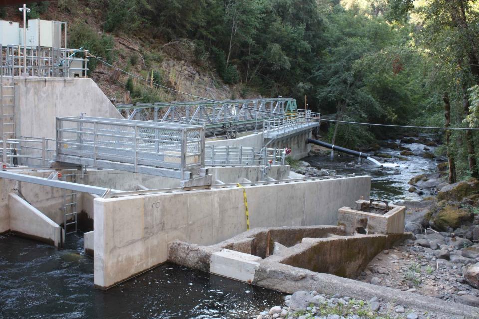


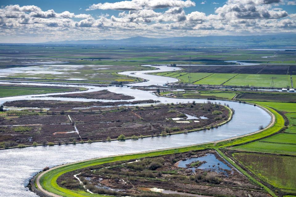


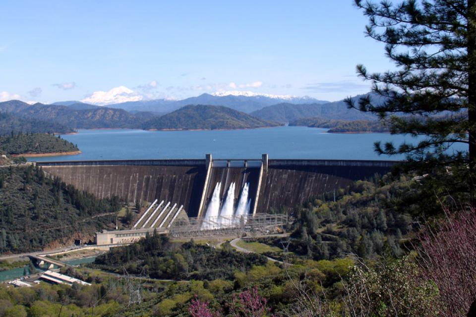

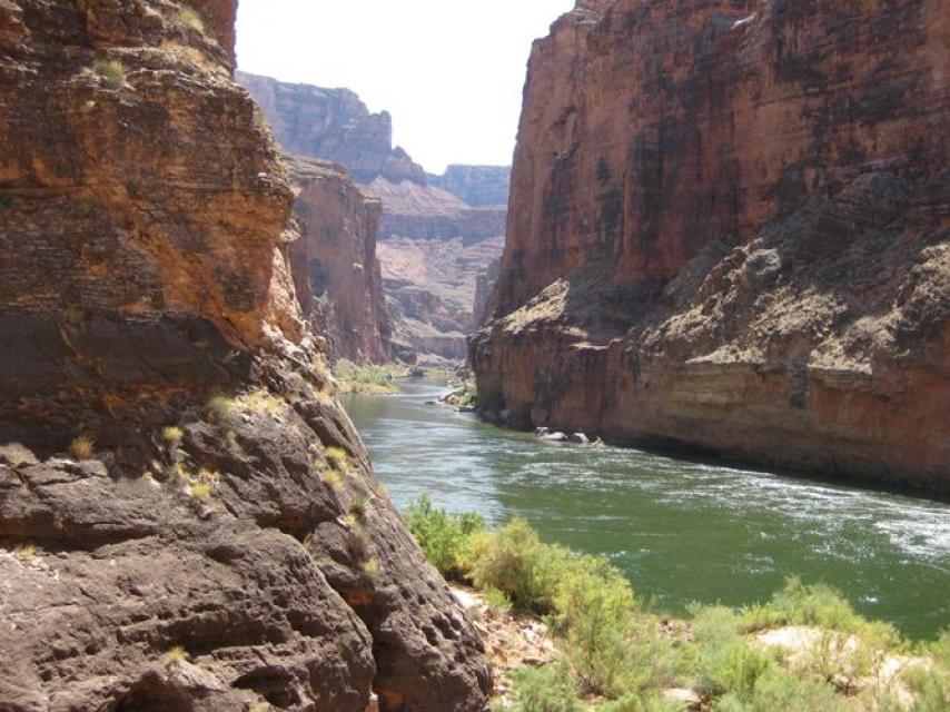


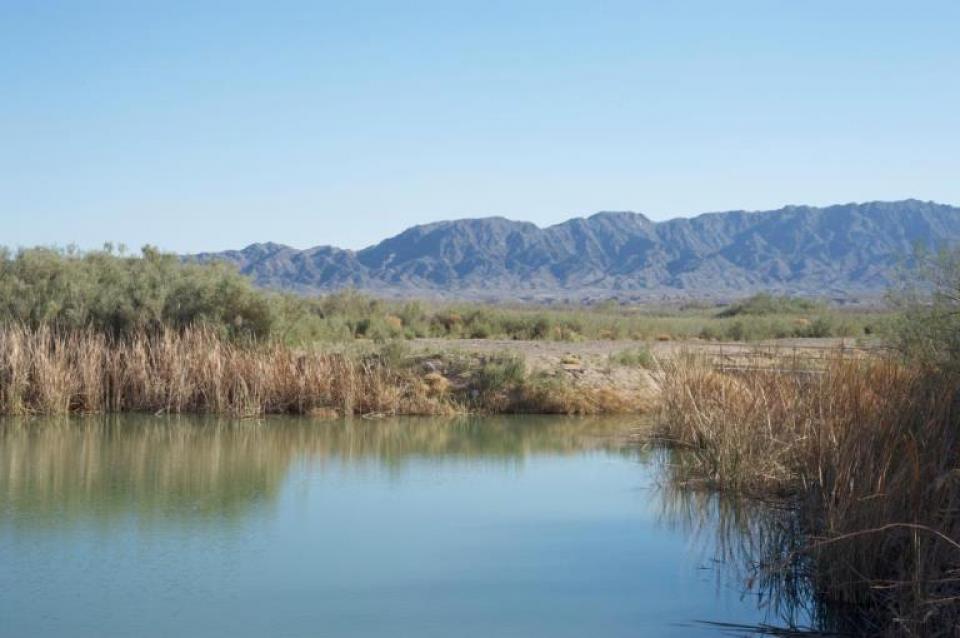
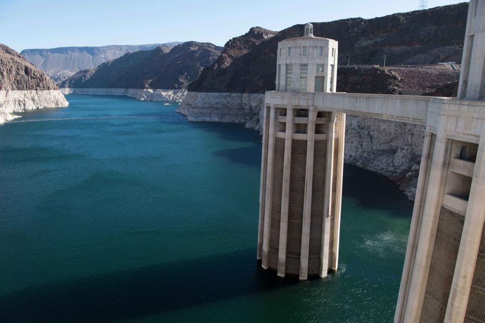
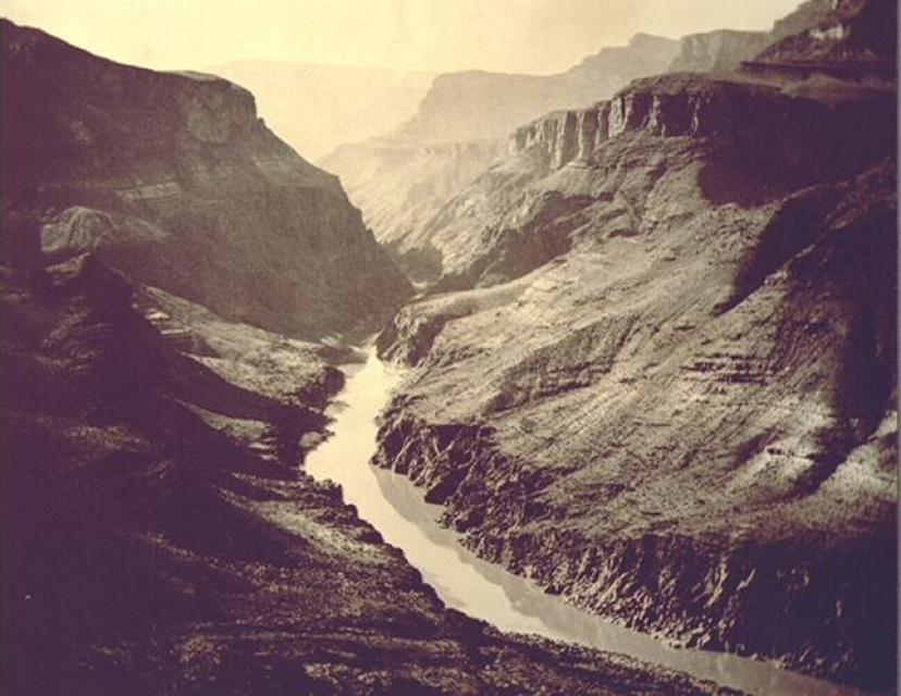

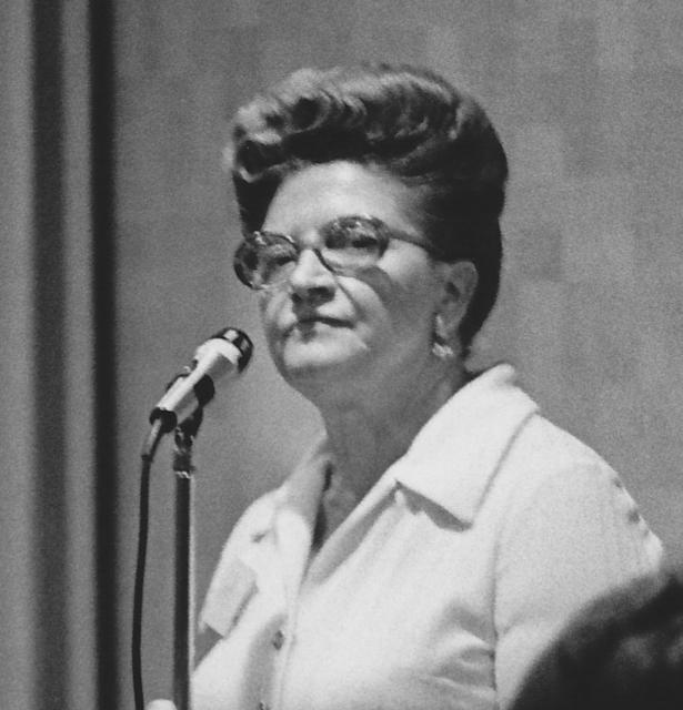


 overtops the Tisdale Weir in Sutter County south of Yuba City on Feb. 6, 2024. Weirs allow flood flows above the downstream channel capacity to escape into a bypass channel or basin. Credit: California Department of Water Resources")

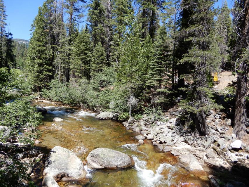

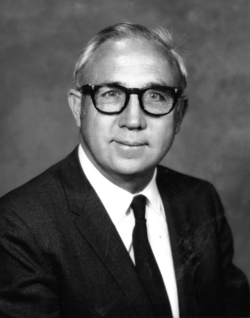
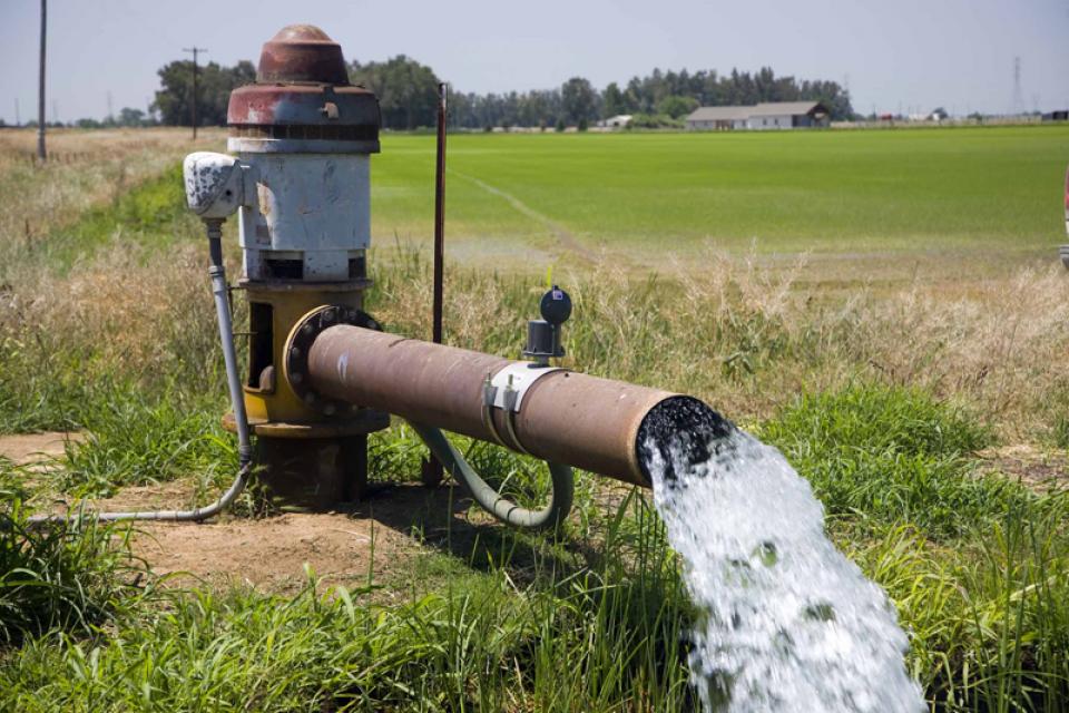
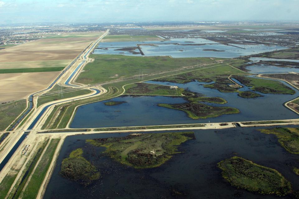


 drains to the Salton Sea. Credit: Wikimedia Commons, 2012.")

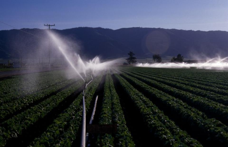
")
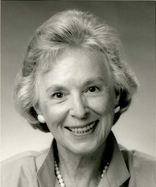

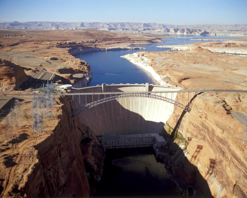
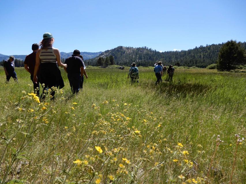
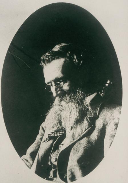
")


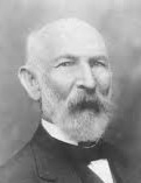

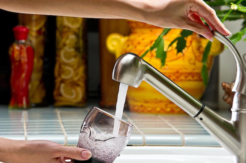


")


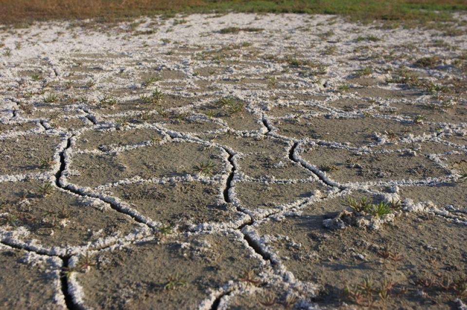
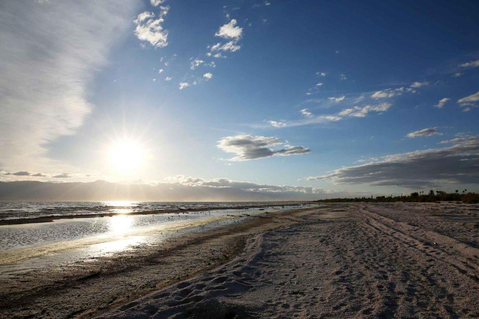
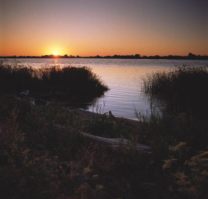
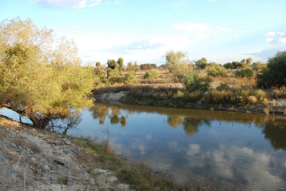
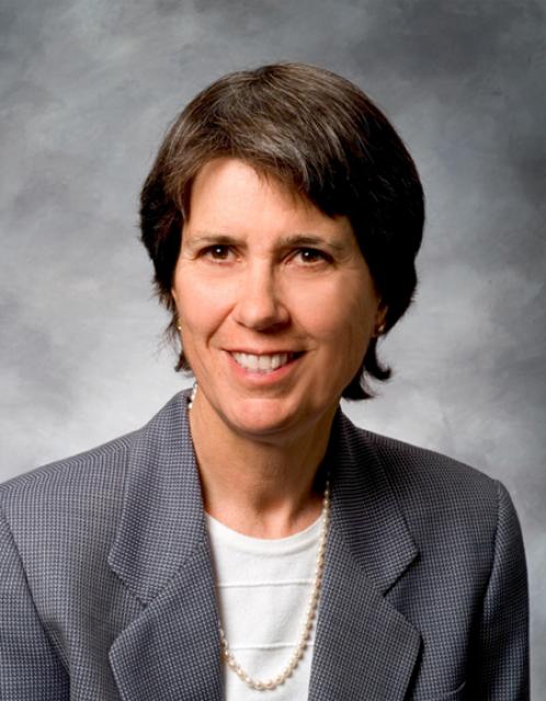
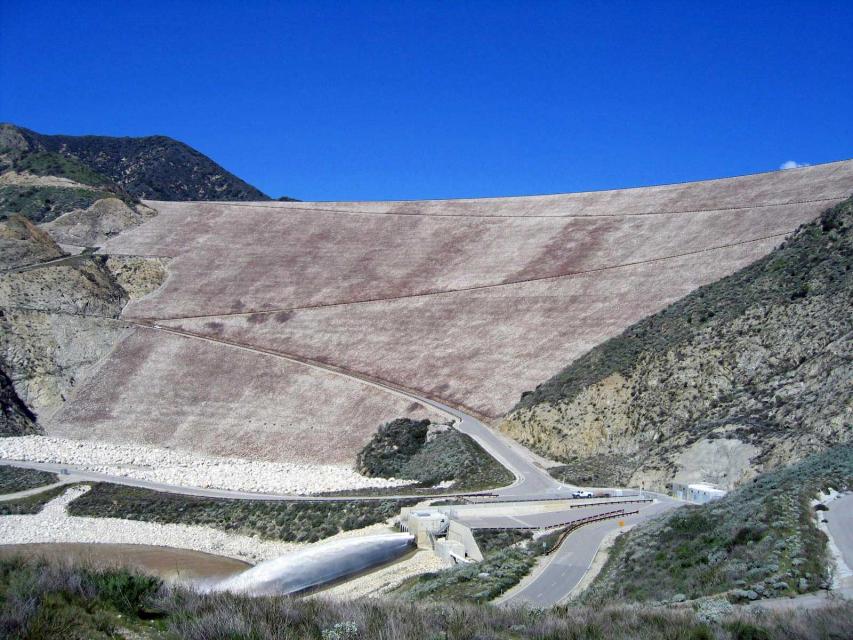


")