Header link June 22, 2020

LinkedIn

  • Read more
Header link September 15, 2014

Cart

  • Read more
Header link November 3, 2015

Donate Now

  • Read more
Header link May 15, 2014

Twitter

  • Read more
Header link May 15, 2014

Facebook

  • Read more
Instagram
Header link May 15, 2014

Instagram

  • Read more
Header link May 15, 2014

Contact Us

  • Read more
More options
Water Education Foundation
Home

Water Education Foundation

Everything about California water that matters
  • Water Academy
    • Agriculture
      • Agricultural Conservation
      • Agricultural Drainage
    • Background Information
      • Legislation — California and Federal
      • Regulations — California and Federal
      • Water History
      • Water Rights
    • Bay-Delta
      • Bay Delta
      • Bay Delta Conservation Plan
      • Delta Issues
      • Delta Smelt
      • Sacramento San Joaquin Delta
      • San Francisco Bay
      • Suisun Marsh
    • Dams, Reservoirs and Water Projects
      • California Aqueduct
      • Central Valley Project
      • Folsom Dam
      • Friant Dam
      • Hetch Hetchy
      • Hoover Dam
      • Infrastructure
      • Lake Mead
      • Lake Powell
      • Oroville Dam
      • San Luis Dam
      • Shasta Dam
      • State Water Project
    • Environmental Issues
      • Anadromous Fish Restoration
      • Ecosystem
      • Endangered Species Act
      • Invasive species
      • Lake Tahoe
      • Mono Lake
      • Public Trust Doctrine
      • Salmon
      • San Joaquin River Restoration
      • Watershed
      • Wetlands
    • Leaders and Experts
    • Regions
      • Central Coast
      • Central Valley
      • Mexico
      • Nevada
      • North Coast
      • Pyramid Lake
      • Sacramento Valley
      • Salton Sea
      • San Joaquin Valley
      • Sierra Nevada
      • Southern California
      • Tulare Lake Basin
    • Rivers
      • Carson River
      • Colorado River
      • Klamath River
      • New River
      • North Coast Rivers
      • Russian River
      • Sacramento River
      • Truckee River
      • San Joaquin River
    • Water Issues
      • Climate Change
      • Coronavirus
      • Drought
      • Earthquakes
      • Energy and Water
      • Floods
      • Fracking
      • Growth
      • Hydropower
      • Levees
      • Tribal Water Issues
      • Water Conservation
    • Water Quality
      • Drinking Water
      • Nitrate contamination
      • Pollution
      • Stormwater
      • Wastewater
      • Water Quality
    • Water Supply and Management
      • Acre Foot
      • Aquifers
      • California Water Plan
      • Conjunctive Use
      • Desalination
      • Grey water
      • Groundwater
      • Integrated Regional Water Management
      • Recreation
      • Surface Water
      • Water Marketing and Banking
      • Water Rates
      • Water Recycling
      • Water Supply
      • Water Transfers
  • Tours & Events
    • Water Tours
      • 2024 Tour Sponsors
    • Events
    • Event Calendar
    • Past Tours & Events
      • Anne J. Schneider Fund Lecture Series
  • Specialized Programs
    • Water Leaders
      • Cohort Rosters
      • Yearly Class Reports
      • Your Alumni Network
      • Alumni Profiles
    • Project WET
      • Workshops
      • Special Workshops & Events
      • Supplementary Materials
      • California Content Standard Correlations
      • Facilitator's Trainings
      • Foundation School Programs
        • Elementary Programs
        • Secondary Programs
      • Water Kids
      • California Project WET Gazette
      • Gazette Archives
    • Colorado River Project
    • GRA Scholastic Fund Program
  • Maps & Guides
    • Maps & Posters
    • Layperson's Guides
    • Map & Guide Bundles
    • Books
    • Colorado River Materials
    • California Runoff Rundown
    • Other Publications
    • Water Awareness Materials
    • Downloadable Publications
    • Videos and DVDs
      • Video Clips
    • School Age Publications
    • Stickers
    • Free Programs and Publications
  • Newsroom
    • Western Water News
    • Aquafornia
      • About Aquafornia
    • Information Desk
    • Western Water Magazine Archive
      • Full Print Edition
      • Print Edition Excerpts
    • River Report Archive
  • Aquapedia
    • Alphabetical List of Subjects
      • A
      • B
      • C
      • D
      • E
      • F
      • G
      • H
      • I
      • J
      • K
      • L
      • M
      • N
      • O
      • P
      • Q
      • R
      • S
      • T
      • U
      • V
      • W
      • X
      • Y
      • Z
    • Historical Water People
    • Where Does My Water Come From?
      • Northern California
      • Sacramento
      • North Bay
      • South Bay
      • Central Valley
      • Los Angeles
      • Inland Empire
      • San Diego
      • All California Water Sources
    • Timelines
    • Videos
    • Image Gallery
    • Water Directory
      • Federal Agencies
      • State Agencies in California
      • Environmental Organizations
      • Other California Organizations
      • State and Federal Legislative Committees
      • Water Associations and Groups
      • Western States Water Agencies and Districts
    • Online Resources
    • Useful Acronyms
    • About Aquapedia
  • About
    • About Us
      • Board of Directors
      • Staff Biographies
      • Job Openings
    • Announcements
    • Support Our Mission
      • Become a Member
      • Donate in Honor/Memory
      • Planned Giving
    • Contact Us
Aquapedia background September 1, 2016 Lake Tahoe Lake Mead Mono Lake Diamond Valley Lake

Lakes

Definition

Lake Tahoe
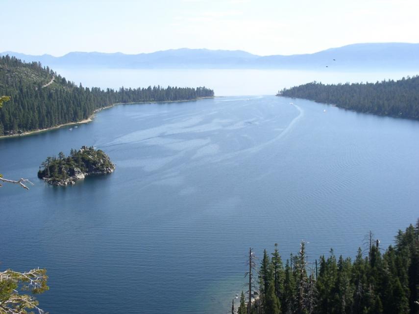
A lake is an inland standing body of water.

Lake, Pond or Wetland?

Scientifically and legislatively, lakes are indistinguishable from ponds, but lakes generally are considered to be longer and deeper lentic, or still, waters. In the 18th and 19th centuries, scientists attempted to distinguish the two more formally, stating that ponds were shallow enough to allow sunlight to penetrate to the bottom, but this exists today as an unofficial point.

According to limnology, or the study of inland waters, lentic waters tend to fill in with land over time. Thus, they generally slowly evolve from lake to pond to wetland. Ponds filled with plants that break the surface of the water would generally be considered a wetland, which includes marshes, bogs and swamps.

Lake or Reservoir?

Reservoirs are artificial lakes, usually built by damming a river and flooding a valley. When reservoirs are filled by rivers, the area in which the river flows has a current and is quite similar, physically and biologically, to a river. Depending on the reservoir, this semblance of a river can occupy most or even the entire reservoir. If the water remains in the reservoir for a short period of time, giving it a short residence time, it is more river-like. Longer residence times make reservoirs more similar to natural lakes. Reservoirs are used for recreation, water storage and hydroelectric power. Lake Mead is the largest reservoir in the United States, and Shasta Lake is California’s largest. 

Freshwater or Saline Lake?

Drier climates often have saltier lakes, due to high evaporation rates that leave behind larger concentrations of salt. While water in freshwater lakes tends to flow somewhere else, when lakes are the terminus of rivers, they are saline and called “endorheic” or “inland seas.” Endorheic lakes are technically defined as lakes with salt concentrations exceeding 5,000 parts per million and such formations are present on every continent. 

Salton SeaThe most famous endorheic lake in California is Mono Lake. The 343-square mile Salton Sea in Riverside and Imperial counties was formed between 1905 and 1907 when the Colorado River broke through a levee. Situated 237 feet below sea level, the Salton Sea is becoming increasingly saline (about 60 parts per thousand) as it recedes. By comparison, seawater is 35 parts per thousand.

The Great Salt Lake in Utah is another example of a highly saline lake. Saline lakes such as these can be too salty to be habitable, or host uniquely tolerant life such as brine shrimp. Additionally, saline waters, specifically their salt concentrations, are particularly sensitive to changes in precipitation. Reduced freshwater input (as through rainfall) would increase salt concentrations, and even slight fluctuations in this could drastically affect what life is able to exist.

  • Print-friendly

Referring Pages

Aquapedia background February 11, 2014 Lakes Public Trust Doctrine

Mono Lake

Mono Lake, on the east side of the Sierra Nevada.

Mono Lake is an inland sea located east of Yosemite National Park near the Nevada border. It became the focus of a major environmental battle from the 1970s to the 1990s.

The lake has a surface area of about 70 square miles and is the second largest lake in California and one of the oldest in North America. Its salty waters occupy former volcanic craters. The old volcanoes contribute to the geology of the lake basin, which includes sulfates, salt and carbonates.

  • Read more
Aquapedia background February 11, 2014 Lakes Unwelcome Visitors Layperson's Guide to Climate Change and Water Resources

Lake Tahoe

Lake Tahoe is one of the world’s most beautiful yet vulnerable lakes. Renowned for its remarkable clarity, Tahoe straddles the Nevada-California border, stretching 22 miles long and 12 miles wide in a granitic bowl high in the Sierra Nevada.

Tahoe sits 6,225 feet above sea level. Its deepest point is 1,645 feet, making it the second-deepest lake in the nation, after Oregon’s Crater Lake, and the tenth deepest in the world.

  • Read more

Share this page

  • Share on Facebook
  • Share on Twitter
  • Share on LinkedIn
  • Sent to a friend.
Print-friendly

Related Links

Aquapedia background September 1, 2016 Lake Tahoe Lake Mead Mono Lake Diamond Valley Lake
Aquapedia background February 11, 2014 Lakes Unwelcome Visitors Layperson's Guide to Climate Change and Water Resources

Lake Tahoe

Lake Tahoe is one of the world’s most beautiful yet vulnerable lakes. Renowned for its remarkable clarity, Tahoe straddles the Nevada-California border, stretching 22 miles long and 12 miles wide in a granitic bowl high in the Sierra Nevada.

Tahoe sits 6,225 feet above sea level. Its deepest point is 1,645 feet, making it the second-deepest lake in the nation, after Oregon’s Crater Lake, and the tenth deepest in the world.

  • Read more
Aerial view of Lake Mead
Aquapedia background February 11, 2014 Colorado River Basin Map Elwood Mead Colorado River Hoover Dam

Lake Mead

Lake Mead is the main reservoir formed by Hoover Dam on the border between Southern Nevada and northwestern Arizona.

Created in the 1930s as part of Hoover Dam [see also Elwood Mead], Lake Mead provides water storage in the Lower Basin of the Colorado River. The reservoir is designed to hold 28,945,000 acre-feet of water and at 248 square miles its capacity is the largest in United States.

  • Read more
Mono Lake, on the east side of the Sierra Nevada.
Aquapedia background February 11, 2014 Lakes Public Trust Doctrine

Mono Lake

Mono Lake is an inland sea located east of Yosemite National Park near the Nevada border. It became the focus of a major environmental battle from the 1970s to the 1990s.

The lake has a surface area of about 70 square miles and is the second largest lake in California and one of the oldest in North America. Its salty waters occupy former volcanic craters. The old volcanoes contribute to the geology of the lake basin, which includes sulfates, salt and carbonates.

  • Read more
Aquapedia background August 25, 2016

Diamond Valley Lake

With a holding capacity of more than 260 billion gallons, Diamond Valley Lake is Southern California’s largest reservoir. It sits about 90 miles southeast of Los Angeles and just west of Hemet in Riverside County where it was built in 2000. The offstream reservoir was created by three large dams that connect the surrounding hills, costing around $1.9 billion and doubling the region’s water storage capacity.

  • Read more
Back
This item appears in:
  • Topic: Salton Sea
  • Topic: Surface Water
  • L
Footer pod May 20, 2014

Water Education Foundation

Copyright © 2025 Water Education Foundation. All rights reserved.

The Water Education Foundation is a nonprofit, tax-exempt, 501(c)3 organization, federal tax ID #942419885.

Privacy Policy

Donor Privacy Policy

  • Read more
Footer pod May 20, 2014

Contact Information

2151 River Plaza Drive, Suite 205
Sacramento CA 95833

Telephone (916) 444-6240

Contact Us via email

  • Read more

Quicklinks

Footer quicklink May 20, 2014

Contact Us

  • Read more
Footer quicklink May 20, 2014

Donate Today

  • Read more
Footer quicklink May 20, 2014

Tours

  • Read more
Footer quicklink May 20, 2014

Newsletter Signup

  • Read more
Footer quicklink May 20, 2014

Foundation News

  • Read more
Footer quicklink May 20, 2014

Calendar

  • Read more

Log in

  • Create new account
  • Request new password

Commands

  • Support portal
  • Log in