The U.S. Bureau of Land Management (BLM) has approved a
right-of-way (ROW) grant allowing construction to begin on the
conversion of the Cadiz Northern Pipeline from a natural gas
pipeline to a water conveyance system, clearing a major federal
hurdle for the Mojave Groundwater Bank project being developed
by Cadiz Inc. in partnership with the Lytton
Rancheria. … While Cadiz and its tribal partner
describe the project as a critical long-term water supply
investment for Southern California, the proposal has faced
years of scrutiny and opposition from some environmental
organizations and desert conservation advocates who have raised
concerns about groundwater extraction in the Mojave Desert. The
BLM’s approval marks one of the final major federal
authorizations needed before construction can move forward.
Despite firm opposition from the Havasupai Tribe, Arizona
regulators on July 6 permitted a higher level of
arsenic in groundwater under a uranium mine near the
tribe’s place of emergence. Before the approval, two
groundwater scientists submitted comments urging the state
Department of Environmental Quality (ADEQ) to require the owner
of the Pinyon Plain uranium mine to give more proof that the
higher levels were naturally occurring and not due to mining
discharge or activities. Energy Fuels Resources, the mine
owner, says its investigation was thorough and that operators
aren’t at fault. It also disputed those scientists’
findings.
A deal to bring Colorado River water to Native American
communities in northern Arizona, where a third of homes lack
running water, is being blocked by neighboring states, caught
up in a broader battle over how to divide the dwindling river.
The largest tribal water rights settlement in U.S. history —
the product of decades of negotiations to secure water for the
Navajo Nation, Hopi Tribe and San Juan Southern Paiute Tribe —
was on the verge of being realized before Colorado, New
Mexico, Utah and Wyoming stepped in to oppose it being
codified by Congress. “We have significant unresolved concerns
with the legislation that may affect each of our states’ rights
to and interests in Colorado River water,” negotiators for
Utah and Wyoming wrote in March to the Senate Committee on
Indian Affairs in a previously unreported letter.
The Bureau of Reclamation has awarded Flatland Energy Services
LLC a $75.5 million contract to build a section of pipeline
that will help deliver water to parts of the Navajo Nation in
New Mexico. Flatland will install 10,000 feet of pipeline
starting at the Frank Chee Willetto Reservoir 17 miles east of
Shiprock as part of the Navajo-Gallup Water Supply Project,
according to the bureau. When the project is finished, 300
miles of pipeline, two water treatment plants and at least 19
pumping facilities will carry water from the San Juan
River to the southwestern portions of the Jicarilla Apache
Nation and Gallup. This section will cross beneath the
San Juan River, a major tributary of the Colorado
River, and the Chaco River to avoid difficult terrain
and existing infrastructure.
A new study out of the University of Arizona measures the
scale and economic output of tribal agriculture in Arizona
— and it’s big. University of Arizona professor and Hopi
dry farmer Michael Kotutwa Johnson co-authored the study. It
found American Indians operate 62% of farms in the state and
manage more than 80% of the state’s total agricultural land —
to the tune of 20 million acres. But, as Kotutwa Johnson told
The Show, it’s a seriously under-researched area. …
[Johnson:] I don’t think people really understand the
agricultural imprint and footprint that we have here in Arizona
and have since almost like to say time immemorial. We’ve got
canal infrastructure that was basically built upon existing
Hohokam agriculture that was done before the state was even
founded and the country was founded.
The Navajo Nation has officially declared a drought emergency
after President Buu Nygren signed the declaration on Wednesday,
June 10, putting immediate measures into effect to address
worsening conditions across the reservation. The declaration,
which was unanimously approved by the Commission on Emergency
Management (CEM) on Tuesday before being signed by Nygren,
responds to severe and ongoing drought conditions that
have reduced precipitation, strained water supplies, degraded
rangelands, lowered reservoir levels, and threatened
the economic well-being of Navajo communities. … The
commission also recommended allocating $6,553,730 from the
Agricultural Infrastructure Fund to support drought mitigation
efforts, including windmill repairs and related water
infrastructure improvements.
Wednesday, U.S. Sen. Ben Ray Luján (D-N.M.), a member of the
Senate Committee on Indian Affairs, and U.S. Sen. Martin
Heinrich (D-N.M.) introduced the Protecting Indian Water Rights
Settlements Act of 2026, legislation to ensure the federal
government fulfills its trust responsibilities by
providing dedicated, mandatory funding for Indian water rights
settlements through the Bureau of Indian Affairs’
Indian Water Rights Settlement Completion Fund. … While the
Bipartisan Infrastructure Law established the Indian Water
Rights Settlement Completion Fund to support settlements
authorized before November 2021, there is currently no
guaranteed funding source for agreements enacted after that
date. The Protecting Indian Water Rights Settlements Act of
2026 addresses this gap by amending the existing fund to
provide $2.95 billion in mandatory funding over ten years for
both already enacted and future settlements.
In a report and fact sheet released last month, we analyzed the
development and current status of Tribal water rights in
California. … Of the 103 federally recognized
Indian reservations in California, only about 20 consistently
host irrigated agriculture, and most of these are relatively
small-scale (less than 100 acres). In an average water year,
about 15,800 acres are irrigated on Tribal reservations (about
0.2% of statewide irrigated acreage), including by non-Tribal
residents. Irrigated acreage tends to decline slightly during
drought years and rebounds during wet and normal water years.
Water demands for this agriculture amount to about
60,000–70,000 acre-feet per year (about 0.2% of total statewide
applied water).
An Assembly Bill sponsored by the Karuk Tribe, which seeks to
expand consultation between state water agencies and tribes
during water policy decisions, passed through the California
Assembly last week. … If signed into law, Assembly Bill 2218
would declare, as statewide policy, recognition of “the
inequities regarding access to, and control over, water caused
by state-sanctioned acts of termination, removal, and
assimilation inflicted upon all California Native American
tribes.” … A key provision of the bill is
requiring consultation with tribes when certain water policies
are revisited by state agencies. The State Water
Board, when investigating the basis of a water right, would
need to consult with a California Native American tribe whose
ancestral territory includes the water body, when requested.
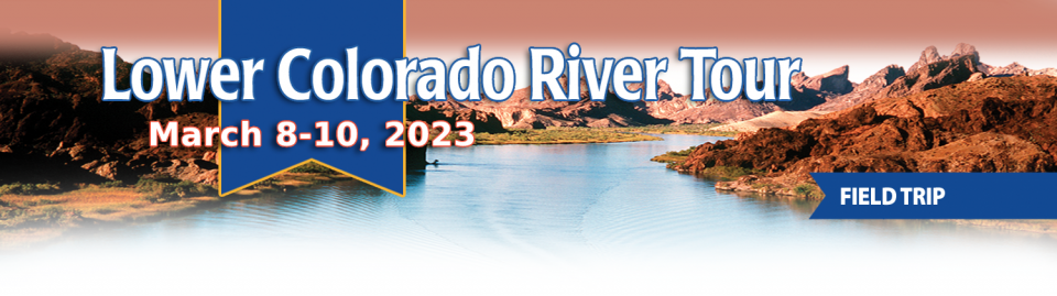
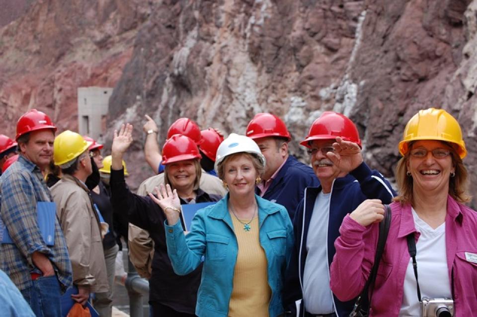
This tour explored the lower Colorado River firsthand where virtually every drop of the river is allocated, yet demand is growing from myriad sources — increasing population, declining habitat, drought and climate change.
The 1,450-mile river is a lifeline to some 40 million people in the Southwest across seven states, 30 tribal nations and Mexico. How the Lower Basin states – Arizona, California and Nevada – use and manage this water to meet agricultural, urban, environmental and industrial needs was the focus of this tour.
Hilton Garden Inn Las Vegas Strip South
7830 S Las Vegas Blvd
Las Vegas, NV 89123
On this first-ever Foundation water tourwe examined water issues along the 263-mile Klamath River, from its spring-fed headwaters in south-central Oregon to its redwood-lined estuary on the Pacific Ocean in California.
Running Y Resort
5500 Running Y Rd
Klamath Falls, OR 97601
Six tribes in the Upper Colorado River Basin, including two in
Colorado, have gained long-awaited access to discussions about
the basin’s water issues — talks that were formerly
limited to states and the federal government. Under an
agreement finalized this month, the tribes will meet every two
months to discuss Colorado River issues with an interstate
water policy commission, the Upper Colorado River Commission,
or UCRC. It’s the first time in the commission’s 76-year
history that tribes have been formally included, and the timing
is key as negotiations about the river’s future intensify.
… Most immediately, the commission wants a key number:
How much water goes unused by tribes and flows down to the
Lower Basin?
Sustaining the American Southwest is the Colorado River. But
demand, damming, diversion, and drought are draining this vital
water resource at alarming rates. The future of water in the
region – particularly from the Colorado River – was top of mind
at the 10th Annual Eccles Family Rural West Conference, an
event organized by the Bill Lane Center for the American West
that brings together policymakers, practitioners, and scholars
to discuss solutions to urgent problems facing rural Western
regions.
This tour explored the lower Colorado River firsthand where virtually every drop of the river is allocated, yet demand is growing from myriad sources — increasing population, declining habitat, drought and climate change.
The 1,450-mile river is a lifeline to some 40 million people in the Southwest across seven states, 30 tribal nations and Mexico. How the Lower Basin states – Arizona, California and Nevada – use and manage this water to meet agricultural, urban, environmental and industrial needs was the focus of this tour.
Hilton Garden Inn Las Vegas Strip South
7830 S Las Vegas Blvd
Las Vegas, NV 89123
Learn the history and challenges facing the West’s most dramatic
and developed river.
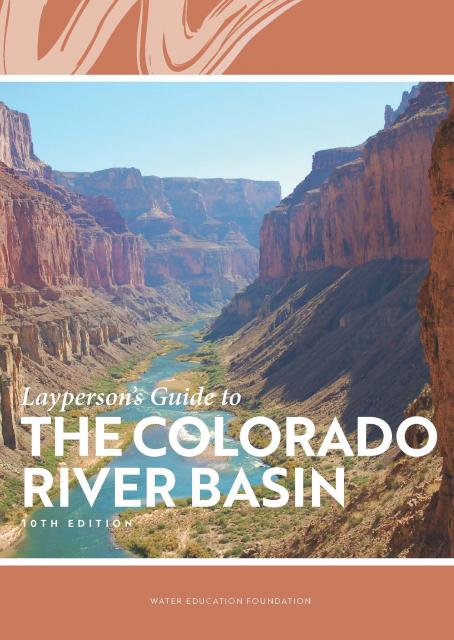
The Layperson’s Guide to the Colorado River Basin introduces the
1,450-mile river that sustains 40 million people and millions of
acres of farmland spanning seven states and parts of northern
Mexico.
The 28-page primer explains how the river’s water is shared and
managed as the Southwest transitions to a hotter and drier
climate.
The U.S. Senate Indian Affairs Committee is holding an
important hearing Thursday on S. 2385, a bill to
refine the tools needed to help Tribal communities gain access
to something that most non-Indian communities in the western
United States have long taken for granted: federally subsidized
systems to deliver safe, clean drinking water to our homes.
… This is the sort of bill (there’s a companion on the
House side) that makes a huge amount of sense, but could easily
get sidetracked in the chaos of Congress. The ideal path is for
the crucial vetting to happen in a process such as Thursday’s
hearing, and then to attach it to one of those omnibus things
that Congress uses these days to get non-controversial stuff
done. Clean water for Native communities should pretty clearly
be non-controversial.
The climate-driven shrinking of the
Colorado River is expanding the influence of Native American
tribes over how the river’s flows are divided among cities, farms
and reservations across the Southwest.
The tribes are seeing the value of their largely unused river
water entitlements rise as the Colorado dwindles, and they are
gaining seats they’ve never had at the water bargaining table as
government agencies try to redress a legacy of exclusion.
The states of the Lower Colorado
River Basin have traditionally played an oversized role in
tapping the lifeline that supplies 40 million people in the West.
California, Nevada and Arizona were quicker to build major canals
and dams and negotiated a landmark deal that requires the Upper
Basin to send predictable flows through the Grand Canyon, even
during dry years.
But with the federal government threatening unprecedented water
cuts amid decades of drought and declining reservoirs, the Upper
Basin states of Wyoming, Utah, Colorado and New Mexico are
muscling up to protect their shares of an overallocated river
whose average flows in the Upper Basin have already dropped
20 percent over the last century.
They have formed new agencies to better monitor their interests,
moved influential Colorado River veterans into top negotiating
posts and improved their relationships with Native American
tribes that also hold substantial claims to the river.
This tour explored the lower Colorado River firsthand where virtually every drop of the river is allocated, yet demand is growing from myriad sources — increasing population, declining habitat, drought and climate change.
The 1,450-mile river is a lifeline to some 40 million people in the Southwest across seven states, 30 tribal nations and Mexico. How the Lower Basin states – Arizona, California and Nevada – use and manage this water to meet agricultural, urban, environmental and industrial needs was the focus of this tour.
Hilton Garden Inn Las Vegas Strip South
7830 S Las Vegas Blvd
Las Vegas, NV 89123
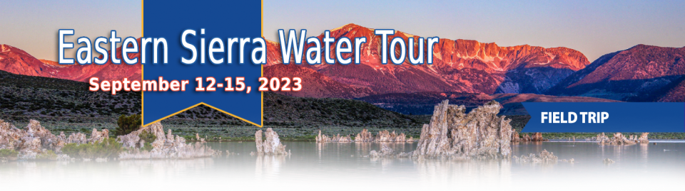
This special Foundation water tour journeyed along the Eastern Sierra from the Truckee River to Mono Lake, through the Owens Valley and into the Mojave Desert to explore a major source of water for Southern California, this year’s snowpack and challenges for towns, farms and the environment.
When the Colorado River Compact was
signed 100 years ago, the negotiators for seven Western states
bet that the river they were dividing would have ample water to
meet everyone’s needs – even those not seated around the table.
A century later, it’s clear the water they bet on is not there.
More than two decades of drought, lake evaporation and overuse of
water have nearly drained the river’s two anchor reservoirs, Lake
Powell on the Arizona-Utah border and Lake Mead near Las Vegas.
Climate change is rendering the basin drier, shrinking spring
runoff that’s vital for river flows, farms, tribes and cities
across the basin – and essential for refilling reservoirs.
The states that endorsed the Colorado River Compact in 1922 – and
the tribes and nation of Mexico that were excluded from the table
– are now straining to find, and perhaps more importantly accept,
solutions on a river that may offer just half of the water that
the Compact assumed would be available. And not only are
solutions not coming easily, the relationships essential for
compromise are getting more frayed.
With 25 years of experience working
on the Colorado River, Chuck Cullom is used to responding to
myriad challenges that arise on the vital lifeline that seven
states, more than two dozen tribes and the country of Mexico
depend on for water. But this summer problems on the
drought-stressed river are piling up at a dizzying pace:
Reservoirs plummeting to record low levels, whether Hoover Dam
and Glen Canyon Dam can continue to release water and produce
hydropower, unprecedented water cuts and predatory smallmouth
bass threatening native fish species in the Grand Canyon.
“Holy buckets, Batman!,” said Cullom, executive director of the
Upper Colorado River Commission. “I mean, it’s just on and on and
on.”
As water interests in the Colorado
River Basin prepare to negotiate a new set of operating
guidelines for the drought-stressed river, Amelia Flores wants
her Colorado River Indian Tribes (CRIT) to be involved in the
discussion. And she wants CRIT seated at the negotiating table
with something invaluable to offer on a river facing steep cuts
in use: its surplus water.
CRIT, whose reservation lands in California and Arizona are
bisected by the Colorado River, has some of the most senior water
rights on the river. But a federal law enacted in the late 1700s,
decades before any southwestern state was established, prevents
most tribes from sending any of its water off its reservation.
The restrictions mean CRIT, which holds the rights to nearly a
quarter of the entire state of Arizona’s yearly allotment of
river water, is missing out on financial gain and the chance to
help its river partners.
Martha Guzman recalls those awful
days working on water and other issues as a deputy legislative
secretary for then-Gov. Jerry Brown. California was mired in a
recession and the state’s finances were deep in the red. Parks
were cut, schools were cut, programs were cut to try to balance a
troubled state budget in what she remembers as “that terrible
time.”
She now finds herself in a strikingly different position: As
administrator of the U.S. Environmental Protection Agency’s
Region 9, she has a mandate to address water challenges across
California, Nevada, Arizona and Hawaii and $1 billion to help pay
for it. It is the kind of funding, she said, that is usually
spread out over a decade. Guzman called it the “absolutely
greatest opportunity.”
This tour explored the lower Colorado River firsthand where virtually every drop of the river is allocated, yet demand is growing from myriad sources — increasing population, declining habitat, drought and climate change.
The 1,450-mile river is a lifeline to some 40 million people in the Southwest across seven states, 30 tribal nations and Mexico. How the Lower Basin states – Arizona, California and Nevada – use and manage this water to meet agricultural, urban, environmental and industrial needs was the focus of this tour.
Hyatt Place Las Vegas At Silverton Village
8380 Dean Martin Drive
Las Vegas, NV 89139
Climate scientist Brad Udall calls
himself the skunk in the room when it comes to the Colorado
River. Armed with a deck of PowerPoint slides and charts that
highlight the Colorado River’s worsening math, the Colorado State
University scientist offers a grim assessment of the river’s
future: Runoff from the river’s headwaters is declining, less
water is flowing into Lake Powell – the key reservoir near the
Arizona-Utah border – and at the same time, more water is being
released from the reservoir than it can sustainably provide.
For more than 20 years, Tanya
Trujillo has been immersed in the many challenges of the Colorado
River, the drought-stressed lifeline for 40 million people from
Denver to Los Angeles and the source of irrigation water for more
than 5 million acres of winter lettuce, supermarket melons and
other crops.
Trujillo has experience working in both the Upper and Lower
Basins of the Colorado River, basins that split the river’s water
evenly but are sometimes at odds with each other. She was a
lawyer for the state of New Mexico, one of four states in the
Upper Colorado River Basin, when key operating guidelines for
sharing shortages on the river were negotiated in 2007. She later
worked as executive director for the Colorado River Board of
California, exposing her to the different perspectives and
challenges facing California and the other states in the river’s
Lower Basin.
The Colorado River is arguably one
of the hardest working rivers on the planet, supplying water to
40 million people and a large agricultural economy in the West.
But it’s under duress from two decades of drought and decisions
made about its management will have exceptional ramifications for
the future, especially as impacts from climate change are felt.
We have an unknown distance yet to run, an unknown river to explore. What falls there are, we know not; what rocks beset the channel, we know not; what walls ride over the river, we know not. Ah, well! We may conjecture many things.
~John Wesley Powell
Powell scrawled those words in his journal as he and his expedition paddled their way into the deep walls of the Grand Canyon on a stretch of the Colorado River in August 1869. Three months earlier, the 10-man group had set out on their exploration of the iconic Southwest river by hauling their wooden boats into a major tributary of the Colorado, the Green River in Wyoming, for their trip into the “great unknown,” as Powell described it.
Even as stakeholders in the Colorado River Basin celebrate the recent completion of an unprecedented drought plan intended to stave off a crashing Lake Mead, there is little time to rest. An even larger hurdle lies ahead as they prepare to hammer out the next set of rules that could vastly reshape the river’s future.
Set to expire in 2026, the current guidelines for water deliveries and shortage sharing, launched in 2007 amid a multiyear drought, were designed to prevent disputes that could provoke conflict.
The growing leadership of women in water. The Colorado River’s persistent drought and efforts to sign off on a plan to avert worse shortfalls of water from the river. And in California’s Central Valley, promising solutions to vexing water resource challenges.
These were among the topics that Western Water news explored in 2018.
We’re already planning a full slate of stories for 2019. You can sign up here to be alerted when new stories are published. In the meantime, take a look at what we dove into in 2018:
As the Colorado River Basin becomes
drier and shortage conditions loom, one great variable remains:
How much of the river’s water belongs to Native American tribes?
Native Americans already use water from the Colorado River and
its tributaries for a variety of purposes, including leasing it
to non-Indian users. But some tribes aren’t using their full
federal Indian reserved water right and others have water rights
claims that have yet to be resolved. Combined, tribes have rights
to more water than some states in the Colorado River Basin.
Amy Haas recently became the first non-engineer and the first woman to serve as executive director of the Upper Colorado River Commission in its 70-year history, putting her smack in the center of a host of daunting challenges facing the Upper Colorado River Basin.
Yet those challenges will be quite familiar to Haas, an attorney who for the past year has served as deputy director and general counsel of the commission. (She replaced longtime Executive Director Don Ostler). She has a long history of working within interstate Colorado River governance, including representing New Mexico as its Upper Colorado River commissioner and playing a central role in the negotiation of the recently signed U.S.-Mexico agreement known as Minute 323.
We explored the lower Colorado River where virtually every drop
of the river is allocated, yet demand is growing from myriad
sources — increasing population, declining habitat, drought and
climate change.
The 1,450-mile river is a lifeline to 40 million people in
the Southwest across seven states and Mexico. How the Lower Basin
states – Arizona, California and Nevada – use and manage this
water to meet agricultural, urban, environmental and industrial
needs was the focus of this tour.
Hampton Inn Tropicana
4975 Dean Martin Drive, Las Vegas, NV 89118
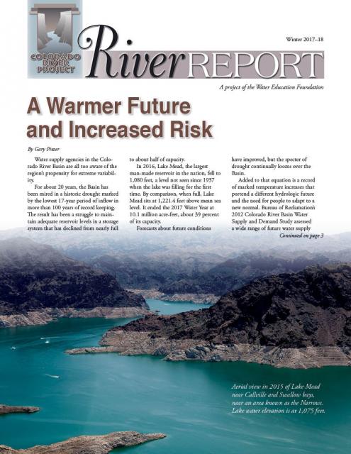
Rising temperatures from climate change are having a noticeable
effect on how much water is flowing down the Colorado River. Read
the latest River Report to learn more about what’s
happening, and how water managers are responding.
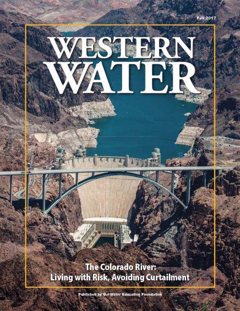
This issue of Western Water discusses the challenges
facing the Colorado River Basin resulting from persistent
drought, climate change and an overallocated river, and how water
managers and others are trying to face the future.
The American River originates high
in the Sierra Nevada just west of Lake Tahoe, in the Tahoe and
Eldorado national forests.
The birthplace of the California Gold Rush, the river today is a
prime recreational destination and a major water supply source
for the federal Central Valley Project.
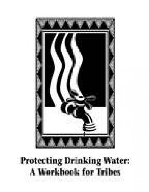
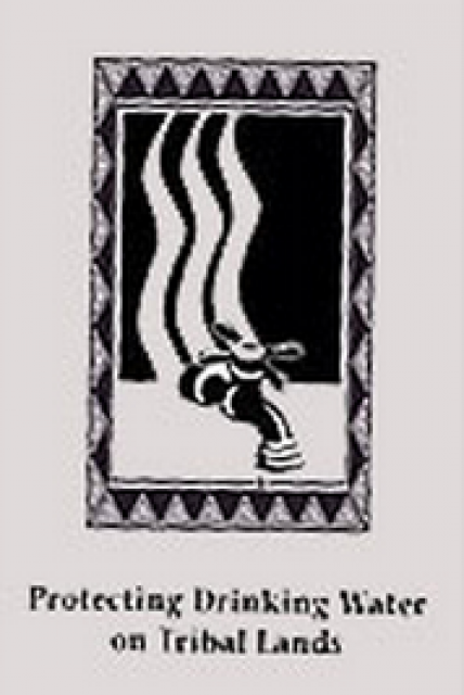
This 109-page publication details the importance of protecting
source water – surface water and groundwater – on reservations
from pollution and includes a step-by-step work plan for tribes
interested in developing a protection plan for their drinking
water. The workbook is designed to serve as a template for such
programs, with forms and tables for photocopying. It also offers
a simplified approach for assessment and protection that focuses
on identifying and managing immediate contamination threats.
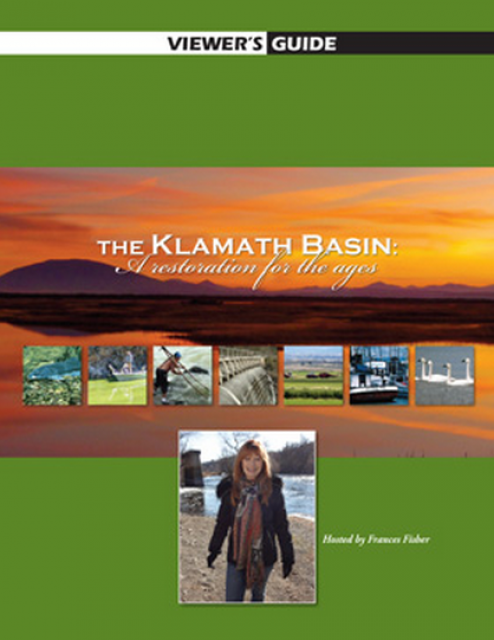
20-minute version of the 2012 documentary The Klamath Basin: A
Restoration for the Ages. This DVD is ideal for showing at
community forums and speaking engagements to help the public
understand the complex issues related to complex water management
disputes in the Klamath River Basin. Narrated by actress Frances
Fisher.
For over a century, the Klamath River Basin along the Oregon and
California border has faced complex water management disputes. As
relayed in this 2012, 60-minute public television documentary
narrated by actress Frances Fisher, the water interests range
from the Tribes near the river, to energy producer PacifiCorp,
farmers, municipalities, commercial fishermen, environmentalists
– all bearing legitimate arguments for how to manage the water.
After years of fighting, a groundbreaking compromise may soon
settle the battles with two epic agreements that hold the promise
of peace and fish for the watershed. View an excerpt from the
documentary here.
This 30-minute DVD explains the importance of developing a source
water assessment program (SWAP) for tribal lands and by profiling
three tribes that have created SWAPs. Funded by a grant from the
U.S. Environmental Protection Agency, the video complements the
Foundation’s 109-page workbook, Protecting Drinking Water: A
Workbook for Tribes, which includes a step-by-step work plan for
Tribes interested in developing a protection plan for their
drinking water.
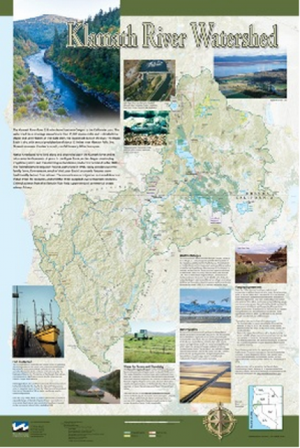
This beautiful 24×36-inch poster, suitable for framing, displays
the rivers, lakes and reservoirs, irrigated farmland, urban areas
and Indian reservations within the Klamath River Watershed. The
map text explains the many issues facing this vast,
15,000-square-mile watershed, including fish restoration;
agricultural water use; and wetlands. Also included are
descriptions of the separate, but linked, Klamath Basin
Restoration Agreement and the Klamath Hydroelectric Agreement,
and the next steps associated with those agreements. Development
of the map was funded by a grant from the U.S. Fish and Wildlife
Service.
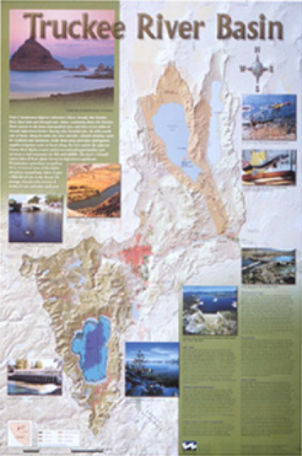
This beautiful 24×36-inch poster, suitable for framing, displays
the rivers, lakes and reservoirs, irrigated farmland, urban areas
and Indian reservations within the Truckee River Basin, including
the Newlands Project, Pyramid Lake and Lake Tahoe. Map text
explains the issues surrounding the use of the Truckee-Carson
rivers, Lake Tahoe water quality improvement efforts, fishery
restoration and the effort to reach compromise solutions to many
of these issues.
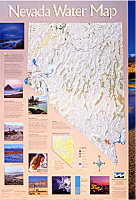
This 24×36 inch poster, suitable for framing, illustrates the
water resources available for Nevada cities, agriculture and the
environment. It features natural and manmade water resources
throughout the state, including the Truckee and Carson rivers,
Lake Tahoe, Pyramid Lake and the course of the Colorado River
that forms the state’s eastern boundary.
Redesigned in 2017, this beautiful map depicts the seven
Western states that share the Colorado River with Mexico. The
Colorado River supplies water to nearly 40 million people in
Arizona, California, Colorado, Nevada, New Mexico, Utah, Wyoming
and Mexico. Text on this beautiful, 24×36-inch map, which is
suitable for framing, explains the river’s apportionment, history
and the need to adapt its management for urban growth and
expected climate change impacts.
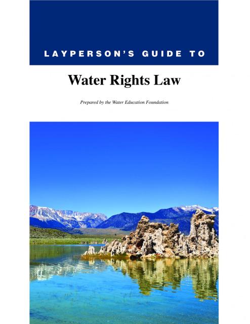
The 28-page Layperson’s Guide to Water Rights Law, recognized as
the most thorough explanation of California water rights law
available to non-lawyers, traces the authority for water flowing
in a stream or reservoir, from a faucet or into an irrigation
ditch through the complex web of California water rights.
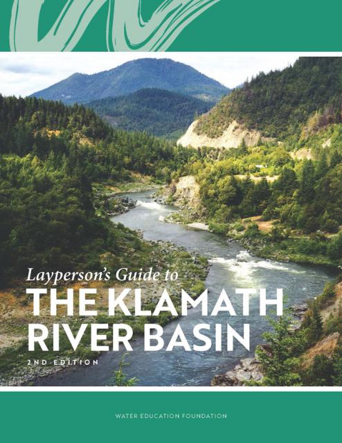
The Water Education Foundation’s second edition of
the Layperson’s Guide to The Klamath River Basin is
hot off the press and available for purchase.
Updated and redesigned, the easy-to-read overview covers the
history of the region’s tribal, agricultural and environmental
relationships with one of the West’s largest rivers — and a
vast watershed that hosts one of the nation’s oldest and
largest reclamation projects.
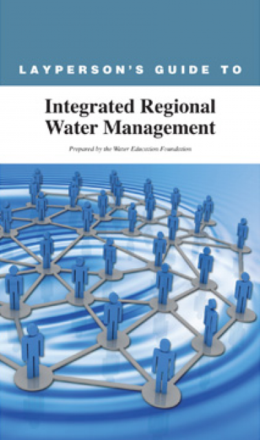
The 24-page Layperson’s Guide to Integrated Regional Water
Management (IRWM) is an in-depth, easy-to-understand publication
that provides background information on the principles of IRWM,
its funding history and how it differs from the traditional water
management approach.
The Klamath River Basin is one of the West’s most important and
contentious watersheds.
The watershed is known for its unusual geography straddling
California and Oregon. Unlike many western rivers, the
Klamath does not originate in snowcapped mountains but rather on
a volcanic plateau.
A broad patchwork of spring-fed streams and rivers in
south-central Oregon drains into Upper Klamath Lake and down into
Lake Ewauna in the city of Klamath Falls. The outflow from Ewauna
marks the beginning of the 263-mile Klamath River.
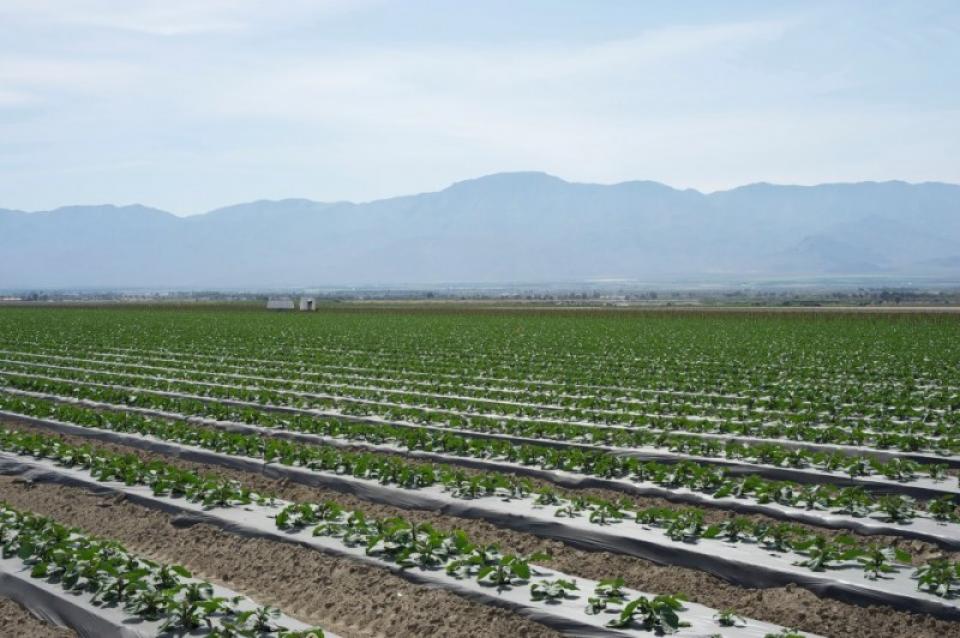
The Coachella Valley in Southern California’s Inland Empire is
one of several valleys throughout the state with a water district
established to support agriculture.
Like the others, the Coachella Valley Water District in Riverside
County delivers water to arid agricultural lands and constructs,
operates and maintains a regional agricultural drainage system.
These systems collect drainage water from individual farm drain
outlets and convey the water to a point of reuse, disposal or
dilution.
Every five years the California Department of Water Resources
updates its strategic plan for managing the state’s water
resources, as required by state law.
The California Water Plan, or Bulletin 160, projects the
status and trends of the state’s water supplies and demands
under a range of future scenarios.
This printed issue of Western Water explores the
historic nature of some of the key agreements in recent years,
future challenges, and what leading state representatives
identify as potential “worst-case scenarios.” Much of the content
for this issue of Western Water came from the in-depth
panel discussions at the Colorado River Symposium. The Foundation
will publish the full proceedings of the Symposium in 2012.
This printed issue of Western Water explores some of the major
challenges facing Colorado River stakeholders: preparing for
climate change, forging U.S.-Mexico water supply solutions and
dealing with continued growth in the basins states. Much of the
content for this issue of Western Water came from the in-depth
panel discussions at the September 2009 Colorado River Symposium.
This issue of Western Water examines the challenges facing state,
federal and tribal officials and other stakeholders as they work
to manage terminal lakes. It includes background information on
the formation of these lakes, and overviews of the water quality,
habitat and political issues surrounding these distinctive bodies
of water. Much of the information in this article originated at
the September 2004 StateManagement Issues at Terminal Water
Bodies/Closed Basins conference.


 and other tributaries of the upper Colorado River have declined dramatically and contributed to the precipitous declines of Lake Powell and Lake Mead. (Source: The Water Desk)")

")
")
")
")
")
")
")
")
")
: Karla Nemeth, director, California Department of Water Resources; Gloria Gray, chair, Metropolitan Water District of Southern California; Brenda Burman, Bureau of Reclamation Commissioner; Jayne Harkins, commissioner, International Boundary and Water Commission, U.S. and Mexico; Amy Haas, executive director, Upper Colorado River Commission.")

")
")

. Credit: U.S. Bureau of Reclamation")