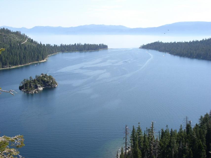
Header link June 22, 2020

LinkedIn

  • Read more
Header link September 15, 2014

Cart

  • Read more
Header link November 3, 2015

Donate Now

  • Read more
Header link May 15, 2014

Twitter

  • Read more
Header link May 15, 2014

Facebook

  • Read more
Instagram
Header link May 15, 2014

Instagram

  • Read more
Header link May 15, 2014

Contact Us

  • Read more
More options
Water Education Foundation
Home
Water Education Foundation
Everything about California water that matters
  • Water Academy
    • Agriculture
      • Agricultural Conservation
      • Agricultural Drainage
    • Background Information
      • Legislation — California and Federal
      • Regulations — California and Federal
      • Water History
      • Water Rights
    • Bay-Delta
      • Bay Delta
      • Bay Delta Conservation Plan
      • Delta Issues
      • Delta Smelt
      • Sacramento San Joaquin Delta
      • San Francisco Bay
      • Suisun Marsh
    • Dams, Reservoirs and Water Projects
      • California Aqueduct
      • Central Valley Project
      • Folsom Dam
      • Friant Dam
      • Hetch Hetchy
      • Hoover Dam
      • Infrastructure
      • Lake Mead
      • Lake Powell
      • Oroville Dam
      • San Luis Dam
      • Shasta Dam
      • State Water Project
    • Environmental Issues
      • Anadromous Fish Restoration
      • Ecosystem
      • Endangered Species Act
      • Invasive species
      • Lake Tahoe
      • Mono Lake
      • Public Trust Doctrine
      • Salmon
      • San Joaquin River Restoration
      • Watershed
      • Wetlands
    • Leaders and Experts
    • Regions
      • Central Coast
      • Central Valley
      • Mexico
      • Nevada
      • North Coast
      • Pyramid Lake
      • Sacramento Valley
      • Salton Sea
      • San Joaquin Valley
      • Sierra Nevada
      • Southern California
      • Tulare Lake Basin
    • Rivers
      • Carson River
      • Colorado River
      • Klamath River
      • New River
      • North Coast Rivers
      • Russian River
      • Sacramento River
      • Truckee River
      • San Joaquin River
    • Water Issues
      • Climate Change
      • Coronavirus
      • Drought
      • Earthquakes
      • Energy and Water
      • Flood Management
      • Fracking
      • Growth
      • Hydropower
      • Levees
      • Tribal Water Issues
      • Water Conservation
      • Water Equity
    • Water Quality
      • Drinking Water
      • Nitrate contamination
      • Pollution
      • Stormwater
      • Wastewater
      • Water Quality
    • Water Supply and Management
      • Acre Foot
      • Aquifers
      • California Water Plan
      • Conjunctive Use
      • Desalination
      • Grey water
      • Groundwater
      • Integrated Regional Water Management
      • Recreation
      • Surface Water
      • Water Marketing and Banking
      • Water Rates
      • Water Recycling
      • Water Supply
      • Water Transfers
  • Tours & Events
    • Water Tours
      • 2023 Tour Sponsors
    • Events
    • Event Calendar
    • Past Tours & Events
      • Anne J. Schneider Fund Lecture Series
  • Specialized Programs
    • Water Leaders
      • Class Rosters
      • Yearly Class Reports
      • Your Alumni Network
      • Alumni Profiles
    • Project WET
      • Workshops
      • Special Workshops & Events
      • Supplementary Materials
      • California Content Standard Correlations
      • Facilitator's Trainings
      • Foundation School Programs
        • Elementary Programs
        • Secondary Programs
      • Water Kids
      • California Project WET Gazette
      • Gazette Archives
    • Colorado River Project
    • GRA Scholastic Fund Program
  • Maps & Guides
    • Maps & Posters
    • Layperson's Guides
    • Map & Guide Bundles
    • Books
    • Colorado River Materials
    • California Runoff Rundown
    • Other Publications
    • Water Awareness Materials
    • Downloadable Publications
    • Videos and DVDs
      • Video Clips
    • School Age Publications
    • Stickers
    • Free Programs and Publications
  • Newsroom
    • Western Water News
    • Aquafornia
      • About Aquafornia
    • Information Desk
    • Western Water Magazine Archive
      • Full Print Edition
      • Print Edition Excerpts
    • River Report Archive
  • Aquapedia
    • Alphabetical List of Subjects
      • A
      • B
      • C
      • D
      • E
      • F
      • G
      • H
      • I
      • J
      • K
      • L
      • M
      • N
      • O
      • P
      • Q
      • R
      • S
      • T
      • U
      • V
      • W
      • X
      • Y
      • Z
    • Historical Water People
    • Where Does My Water Come From?
      • Northern California
      • Sacramento
      • North Bay
      • South Bay
      • Central Valley
      • Los Angeles
      • Inland Empire
      • San Diego
      • All California Water Sources
    • Timelines
    • Videos
    • Image Gallery
    • Water Directory
      • Federal Agencies
      • State Agencies in California
      • Environmental Organizations
      • Other California Organizations
      • State and Federal Legislative Committees
      • Water Associations and Groups
      • Western States Water Agencies and Districts
    • Online Resources
    • Useful Acronyms
    • About Aquapedia
  • About
    • About Us
      • Board of Directors
      • Staff Biographies
      • Job Openings
    • Announcements
    • Support Our Mission
      • Become a Member
      • Donate in Honor/Memory
      • Donate to Aquapedia or Aquafornia
      • Shop Amazon
      • Planned Giving
    • Contact Us
Aquapedia banner
Banner May 22, 2014

Your Online Water Encyclopedia

  • Read more

T

Overview February 11, 2014

T

  • Read more
Aquapedia background February 11, 2014 Lakes

Lake Tahoe

World-renowned for its crystal clear, azure water, Lake Tahoe straddles the Nevada-California border, stretching 22 miles long and 12 miles wide and hemmed in by Sierra Nevada peaks.

At 1,645 feet deep, Tahoe is the second-deepest lake in the United States and the 10th deepest in the world. The iconic lake sits 6,225 feet above sea level.

  • Read more
Aquapedia background August 15, 2016

Tailwater

Excess surface water from land under cultivation, or water below a dam or hydropower development.

  • Read more
Aquapedia background February 10, 2014

John R. Teerink

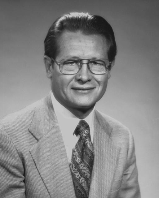
John R. Teerink (1921-1992) was the director of the California Department of Water Resources (DWR) from 1973-1975 during Governor Ronald Reagan’s administration.He had various lead roles in the implementation of the State Water Project during his 29-year career at DWR. He progressed through the ranks as junior engineer, assistant chief engineer and then deputy director until his appointment to head the department.

  • Read more
Aquapedia background February 11, 2014

Tehama-Colusa and Corning Canals

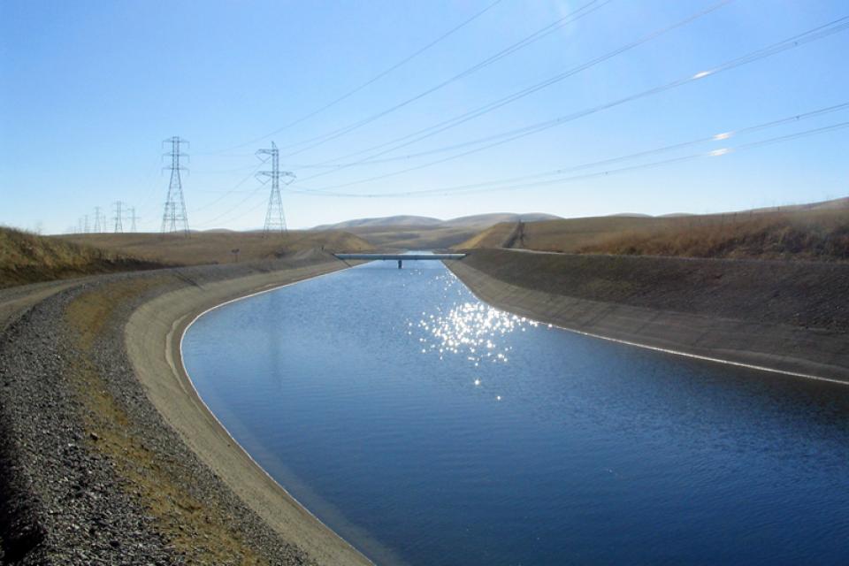
The Tehama-Colusa and Corning canals receive water from the Red Bluff Diversion Dam.

That water is then used to irrigate the west side of the Sacramento Valley as part of the federal Central Valley Project.

  • Read more
Aquapedia background August 15, 2016

Tidal Excursions

Mixing of waters caused by daily tidal movements in and out of an estuary.

  • Read more
Aquapedia background August 15, 2016

Transpiration

Process by which plants release water vapor to the atmosphere through the pores of their leaves.

  • Read more
Aquapedia background August 25, 2016

Tributaries

A tributary of the Feather River.A tributary is a river or stream that enters a larger body of water, especially a lake or river. The receiving water into which a tributary feeds is called the “mainstem,” and the point where they come together is referred to as the “confluence.”

  • Read more
Aquapedia background September 8, 2016

Trihalomethanes (THMs)

Trihalomethanes are the most common type of “disinfection byproduct,” which is a substance created from the treatment of water with organic matter.

How They Form

Chlorine is the most popular water disinfectant, used widely since the beginning of the 20th century to kill viruses and microorganisms in water. It has had a major role in significantly reducing global instances of cholera and typhoid given its effectiveness and relatively low cost. 

  • Read more
Aquapedia background February 11, 2014 Dams Shasta Dam

Trinity Dam and Trinity River

Though seemingly a long-way from California’s Central Valley, the Trinity Dam helps supply irrigation water for Valley farmers and for hydropower production.

Constructed in the far northwest of California in the 1950s, Trinity Dam and Lewiston Dam, just downstream, increased the storage capacity of the federal Central Valley Project by more than 2.5 million acre-feet.

  • Read more
Truckee River
Aquapedia background February 11, 2014

Truckee River

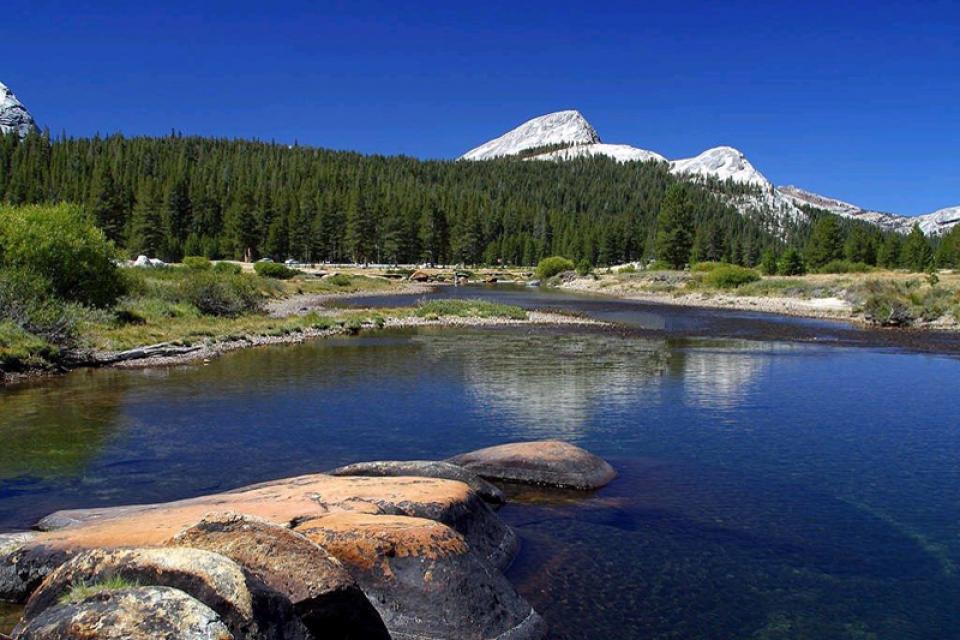
From it headwaters high in California’s Sierra Nevada, the Truckee River flows into and through Lake Tahoe, continuing down the Truckee River canyon to the Reno metropolitan area and then across miles of Nevada high desert before flowing into Pyramid Lake, 40 miles northeast of Reno.

The river’s 145-mile course takes it from alpine forests to high desert sagebrush. (The portion of the Truckee that begins in California in the Sierra Nevada and flows into Lake Tahoe is called the Upper Truckee River.)
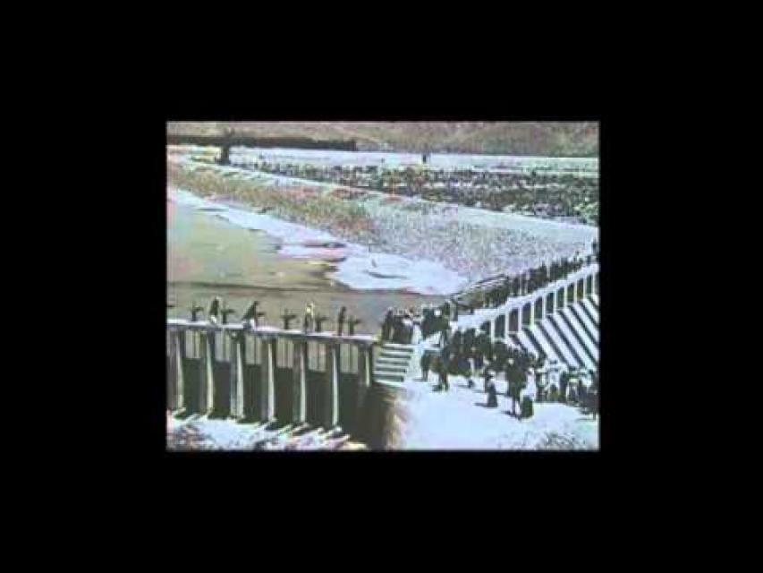
  • Read more
Aquapedia background February 11, 2014

Tulare Lake Basin

Until the early 1900s, central California’s Tulare Lake naturally appeared every winter as the southernmost rivers flowing out of the Sierra Nevada Mountains filled the dry lakebed with rainfall and melted snow.

In the spring, the shallow lake could be larger in area than Lake Tahoe. By the end of the hot San Joaquin Valley summer, however, it could disappear.

  • Read more
Aquapedia background February 11, 2014

Tuolumne River

The Tuolumne River is one of the major tributaries draining the western Sierra Nevada.

Beginning high in the mountains of Yosemite at 13,000 feet, the Tuolumne River forms at Mt. Lyell, flows through Tuolumne Meadows, and cascades through canyons including the Grand Canyon of the Tuolumne , as it descends 150 miles into the San Joaquin Valley. There, the Tuolumne empties into the San Joaquin River. The water helps irrigate the agriculturally-rich region, particularly Stanislaus County. The dam at Don Pedro Reservoir near Turlock is also used to generate electricity.

  • Read more

Aquapedia

  • Alphabetical List of Subjects
    • A
    • B
    • C
    • D
    • E
    • F
    • G
    • H
    • I
    • J
    • K
    • L
    • M
    • N
    • O
    • P
    • Q
    • R
    • S
    • T
    • U
    • V
    • W
    • X
    • Y
    • Z
  • Historical Water People
  • Where Does My Water Come From?
  • Timelines
  • Videos
  • Image Gallery
  • Water Directory
  • Online Resources
  • Useful Acronyms
  • About Aquapedia
Footer pod May 20, 2014

Water Education Foundation

Copyright © 2023 Water Education Foundation. All rights reserved.

The Water Education Foundation is a nonprofit, tax-exempt, 501(c)3 organization, federal tax ID #942419885.

Privacy Policy

Donor Privacy Policy

  • Read more
Footer pod May 20, 2014

Contact Information

2151 River Plaza Drive, Suite 205
Sacramento CA 95833

Telephone (916) 444-6240

Contact Us via email

  • Read more

Quicklinks

Footer quicklink May 20, 2014

Contact Us

  • Read more
Footer quicklink May 20, 2014

Donate Today

  • Read more
Footer quicklink May 20, 2014

Tours

  • Read more
Footer quicklink May 20, 2014

Newsletter Signup

  • Read more
Footer quicklink May 20, 2014

Foundation News

  • Read more
Footer quicklink May 20, 2014

Calendar

  • Read more

Log in

  • Create new account
  • Request new password

Commands

  • Support portal
  • Log in