California has pioneered some of the
toughest state environmental legislation to address environmental
issues. For example, laws focused attention on “instream uses” of
water to benefit fish and wildlife, recreation, water quality and
aesthetics. Among water-related issues, in general, are
climate change, toxic waste disposal, pollution and loss of
wildlife and habitat.
Also, the California Legislature was the first in the country to
protect rare plants and animals through passage of the California
Endangered Species Act in 1970.
Like some dystopian astronaut, Melissa Cobo would hike the
searing flats of the dried-out Great Salt Lake every
couple of weeks, hauling a heavy backpack attached by a hose to
what looked like the lid of a cake dome. … Through
these grueling treks, Cobo, then a Utah State University
graduate student, and her adviser, Soren Brothers, discovered
more disturbing evidence that dried-out lakes are a significant
source of carbon dioxide emissions — one that has not
been included in the official accounting of how much carbon the
world is releasing into the warming atmosphere. In
a new study in the journal One Earth, the researchers
calculated that 4.1 million tons of carbon dioxide and other
greenhouse gases were released from the drying bed of
the Great Salt Lake in 2020, the year Cobo and others
collected the samples. This would amount to about a 7 percent
increase in Utah’s human-caused emissions, the
authors found.
The California Department of Fish and Wildlife (CDFW) has
completed its 2024 waterfowl breeding population survey. The
resulting data indicate the overall number of breeding ducks
has decreased by 25 percent, while mallards decreased 12
percent, the most abundant duck in the survey. “Despite another
good water year, the lack of adequate nesting habitat,
particularly in the Central Valley, continues to restrict
waterfowl population growth in California,” said CDFW Waterfowl
Program Biologist Melanie Weaver. The complete
2024 California Waterfowl Breeding Population Survey
Report is available at the CDFW website. The total numbers of
ducks (all species combined) decreased from 495,438 in 2023 to
373,864 this year. This estimate is 30 percent below the
long-term average.
California’s Geologic Energy Management Division is in the
midst of finalizing regulations to ban fracking across the
state, which will officially go into effect on October 1.
The department submitted its rule-making package for the ban to
the state’s Office of Administrative Law on July 15, where it
will be given a final review. It’s the last step needed to
formalize the regulation, which would prohibit CalGEM from
issuing fracking permits for oil and gas wells. ….
Fracking, also known as hydraulic fracturing, is a process
where water, chemicals and sand are injected into oil and gas
wells at a high pressure to increase production. It’s long
received criticism from environmental groups because of the
pollutants emitted during the process.
Dos Rios, named for the Tuolumne and San Joaquin rivers that
meet at the edge of the park, is the first new California state
park in more than a decade. But it isn’t like most state parks.
In addition to bringing much-needed green space to an
underserved area, its unusual design uses nature-based climate
solutions that reinvigorate native wildlife. By restoring the
natural floodplain, the park will also help mitigate flooding
that threatens residents in the area. … Dos Rios is like
a time machine. Just 15 years ago, this plot of land looked
much like its surroundings. “These floodplains were once
laser-leveled fields that grew alfalfa, or a rotation of corn
and winter wheat, which would be harvested and moved over to
where the dairies are to feed the cows,” says conservationist
Julie Rentner. Now, the land looks more like it did hundreds of
years ago, before farms and towns cropped up, before the
Central Valley became an agricultural hub of America.
On Monday, July 22, the city of Malibu posted on its website
that members of the community can review the proposed Final
Environmental Impact Report (FEIR) for the Topanga Lagoon
Restoration Project from July 15 through August 13. The
proposed FEIR identifies the range of closely related
alternatives considered for the project, as well as the
preferred alternative. The Topanga Lagoon Restoration Project
is a multiagency cooperative effort by California State Parks,
CalTrans, County of Los Angeles Department of Beaches and
Harbors and the Resource Conservation District of the Santa
Monica Mountains to restore the Topanga Lagoon ecosystem. It is
one of the last coastal wetlands in Southern California. The
project aims to protect and restore precious biological and
cultural resources, create an integrated program for coastal
access, emergency response and interpretation, and proactively
address the effects of sea level rise at the Topanga Lagoon
ecosystem.
Government agencies, insurance companies and disaster planners
rely on national flood risk models from the private sector that
aren’t reliable at smaller levels such as neighborhoods and
individual properties, according to researchers at the
University of California, Irvine. In a paper published recently
in the American Geophysical Union journal Earth’s Future,
experts in UC Irvine’s Department of Civil and Environmental
Engineering caution that relatively new, nation-scale flood
data provides an inadequate representation of local topography
and infrastructure, factors known to control the spread of
floods in urban areas. … Sanders and colleagues at UC
Irvine and the University of Miami developed a more detailed
model named PRIMo-Drain that, they said, improves the accuracy
of flood inundation predictions by including fine-resolution
topographic data; information about levees and channel
conditions; and particulars about stormwater infrastructure
such as culverts, subsurface pipes and street drains.
A violent hydrothermal explosion at Yellowstone National Park
sent visitors fleeing Tuesday as mud and debris erupted from a
geyser just north of Old Faithful, according to park rangers.
Video of the explosion showed a column of steam and dark earth
launching high into the sky. “Run, run, run, run …” a woman
shouted as parkgoers began running along a wooden
boardwalk. The explosion occurred around 10:19 a.m. near
Sapphire Pool in Biscuit Basin, just north of the Old Faithful
geyser, the park service said in a news release. No
injuries have been reported, but the event is still under
investigation. Hydrothermal explosions occur when “water
suddenly flashes to steam underground,” according to
a statement from the U.S. Geological Survey. The agency
said such explosions are “relatively common” at the park.
Global temperatures hit the highest levels in recorded history
on Sunday, according to preliminary data from Europe’s top
climate monitor — another worrying sign of how human-caused
climate change is pushing the planet into dangerous new
territory. The results from the Copernicus Climate Change
Service show the planet’s average temperature on July 21 was
17.09 degrees Celsius (62.76 degrees Fahrenheit) — breaking a
record set only last year. The historic day comes on the
heels of 13 straight months of unprecedented
temperatures and the hottest year scientists have
ever seen. “We are in truly uncharted territory,” Copernicus
director Carlo Buontempo said in a statement. “And as the
climate keeps warming, we are bound to see records being broken
in future months and years.”
Ecologists and climate scientists agree that “nature-based
solutions” like the reforestation of degraded pasture lands and
restoration of coastal wetlands can play a key role in
combatting climate change. These projects take advantage of the
natural carbon cycle—in particular, photosynthesis’ conversion
of carbon dioxide into biomass—to remove excess carbon dioxide
from the atmosphere. Investing in nature-based solutions also
can increase community resilience to destructive climate
impacts such as sea rise and storm surges in coastal areas,
excessive heat, catastrophic wildfires, and the like. And
nature-based investments can produce other valuable “ecosystem
services” such as clean water, biodiversity, and multiple
cultural and socio-economic benefits…
Test results at Lake San Antonio in southern Monterey County
suggest the culprit in a recent massive fish die-off that
closed the lake may have been an algae bloom spurred by high
heat that depleted the oxygen in the water and suffocated the
fish. According to officials, there is no threat to public
health and the lake will reopen Wednesday. After reports
surfaced of a massive die-off of small fish around July 5 when
temperatures climbed to 114 degrees at the lake, and then
spread to larger fish in the following days, the recreation
area was closed to the public July 10.
The spring waters that emerge from the volcanic rocks of
northern California’s Cascade Range are of critical importance
for water security for both fish and people, yet relatively
little is known about them and how they have been affected by
recent drought and other climate change impacts. In 2023,
CalTrout and our partners embarked on a three-year study to
provide a scientifically based toolset to better understand,
manage, and advance the protection of the cold, clean spring
waters in the Upper Sacramento Basin. Building on our
past efforts to assess baseline conditions of springs in the
Mount Shasta region, this study will define and quantify source
areas and flows, assess ecosystem sensitivity to climate
change, and determine how these systems support the diverse
life history of wild cold-water fish. Study locations include
the spring-fed streams above Shasta Reservoir: the McCloud,
Upper Sacramento, Rising, and Fall rivers, Hat Creek, and
Burney Creek, which feeds the iconic Burney
Falls.
Climate change is driving record-setting droughts, uncontrolled
wildfires, and extreme temperatures, all of which jeopardize
our water security. At CalTrout, we believe in taking proactive
measures to safeguard our watersheds. Waiting until the damage
is done is not an option – the time to act is now. Fortunately,
we have a powerful tool at our disposal: the Outstanding
National Resource Waters (Outstanding Waters)
designation. After years of studies, campaign
building, and advocacy, the North Coast Regional Water Quality
Board approved CalTrout’s request to designate Elder Creek and
Cedar Creek as Outstanding Waters, the first step in the
official designation process. Over the next few months, our
experts will be collaborating closely with the Board to secure
these critical protections – an important step towards ensuring
water security for all Californians, people, and
wildlife.
… Harris, a Californian who has previously described climate
change as an “existential threat” that must be treated with a
sense of urgency, has prioritized investments in clean energy
jobs, air and water protections, fossil fuel accountability,
climate action and environmental justices… … Harris’
environmental platform stands in stark contrast to that of
Republican nominee Donald Trump, whose previous climate record
includes rolling back more than 100 climate
regulations and appointing climate change deniers to
senior posts in the Environmental Protection Agency and the
Department of the Interior. Project 2025, touted as a road map
for a Republican administration, outlines plans to expand
oil and gas drilling, dismantle the National Oceanic and
Atmospheric Administration and its offices — including the
National Weather Service — and other steps that would address
the Biden administration’s “radical climate policy” and
“unprovoked war on fossil fuels,” according to the document.
Congressman Josh Harder uses the State of California’s own
words to make his case to make it impossible for the $20
billion Delta bypass tunnel to be built. It would: Increase
salinity, devastate San Joaquin County agricultural production,
deteriorate critical ecological systems that fish rely on, land
a severe economic blow to the region. And just how would Harder
make it impossible from his position in Congress to pull the
plug on a state water project pushed by urban Southern
California and large southern San Joaquin Valley corporate farm
concerns? Harder is pushing for the adoption of legislation
directing the Army Corps of Engineers not to issue a required
permit to allow federally controlled Central Valley Project
water — essentially flows from Shasta Dam — to be diverted into
the proposed tunnel south of Sacramento. Without the permit or
the participation of the federal Bureau of Reclamation, the
tunnel can’t be built or the water diverted.
Despite decades of evidence, there is still a false binary
choice being hoisted upon Coloradans by municipalities and
water development entities — either we almost completely
dewater our rivers as they flow through lower elevation
communities, decimating river health, river recreation and
local economic opportunities, or we provide municipal water to
rapidly growing suburban cities on the Front Range. Instead,
our state government should help prioritize river restoration
by championing in-channel water delivery projects. Water
should be left in river channels until it reaches the nearest
adjacent diversion point to its delivery location. Hundreds, if
not thousands of ditches, tunnels and pipelines already exist,
and basin-wide assessments of these diversion points were done
under the Colorado Water Plan. —Written by Evan Stafford, communications director for
American Whitewater
As firefighters continue to battle more than two dozen active
wildfires in California, new research has found that millions
of people are living in close proximity to oil and gas wells
that are in the potential path of flames. More than 100,000
wells in 19 states west of the Mississippi River are in areas
that have burned in recent decades and face a high risk of
burning in the future, with the vast majority in California,
according to a study published recently in the journal One
Earth. What’s more, nearly 3 million Americans live within
3,200 feet of those wells, putting them at heightened risk of
explosions, air and water pollution, infrastructure damage and
other hazards.
The Medicine Lake Highlands complex of public lands, some 30
miles northeast of Mt. Shasta in California’s Cascade region,
is a truly remarkable place. … This area has been
called Sáttítla for time immemorial by the Pit River
Tribe. It is remote and hardly a blip on most people’s radar.
Yet it is on the radar of resource developers. The Pit River
Tribe has been fighting for three decades to safeguard this
landscape and the waters, cultural values and habitats it
provides from proposed development. Last November, the
Tribe launched a new initiative to permanently protect the
Sáttítla region as a national monument. Trout Unlimited,
Backcountry Hunters and Anglers and other conservation-oriented
angling and hunting groups are supporting this campaign.
Laura Norman stood by the trickling stream and let the
enchantment of her surroundings wash over her. The landscape
was verdant, lush even, but Norman wasn’t standing in a
tropical paradise. In fact, her oasis was in one of the driest,
hottest regions in the world, and only a handful of years ago,
this gully was virtually barren of plants. … But it
wasn’t a spell or a massive feat of engineering that caused
moisture to seep into the land, allowing plants to grow and
creating habitat for aquatic animals. It was simple technology
that when carefully applied, allowed the laws of nature to
transform the land. The simple technology Norman and her
team used was a type of nature-based solution they call Natural
Infrastructure in Dryland Streams, or NIDS. Essentially, NIDS
are structures made of rock, wood or mud that people or
reintroduced beavers construct across the flow of water in a
gully, creek or stream.
NOAA is recommending nearly $220 million in funding for 32
transformational habitat restoration and coastal resilience
projects this year, as well as an additional $66 million in
funding in future years. The projects are funded under the
Biden-Harris Administration’s Bipartisan Infrastructure Law and
Inflation Reduction Act. This is a historic investment in
strengthening the climate resilience of our nation’s coastal
ecosystems and communities. … landscape-scale effort in
California’s Sacramento River watershed will restore habitat
for endangered Sacramento River winter-run Chinook salmon,
a NOAA Species in the Spotlight. A suite of projects along
the Oregon coast will support the recovery of five populations
of threatened Oregon Coast coho salmon. The projects will
restore floodplain, wetland, and estuary habitats on which the
juvenile coho rely.
The Bay’s white sturgeon—huge, slow-to-reproduce “living
fossils” that have hardly changed over their approximately 200
million years on Earth—are now facing such peril that the state
of California has closed fishing for them under emergency
regulations while it considers listing them as a threatened
species. White sturgeon lurk in the murky bottom of San
Francisco Bay and the Delta, stealthily making their way
upriver to spawn and slurping up clams. Of San Francisco Bay’s
two sturgeon species, white sturgeon are the homebodies (in
contrast to anadromous green sturgeon, which spend much of
their lives at sea). But adult white sturgeon numbers have been
in decline for two decades, says UC Davis fish biologist Andrea
Schreier. “Changes to the Bay-Delta system and changes to
our climate are happening too quickly for them,” Schreier says.
… William A. Selby’s comprehensive account of California’s
varied meteorological phenomena, multitudinous microclimates
and seasonal extremes, “The California Sky Watcher:
Understanding Weather Patterns and What Comes Next,” solves
many such mysteries of the climate that creates — and is
created by — the state’s landscape and civilization.
Raised in Santa Ana, Selby is a retired Santa Monica College
professor who has conducted research for the National Weather
Service. His latest book, complete with helpful, dizzying and
sobering diagrams and photographs, could easily serve as the
text for a college earth science course. It takes a thoroughly
empirical approach to California’s four seasons and their
manifestation across its myriad topographies.
Lithium needed for batteries that power electric vehicles and
store electricity from renewable energy projects is likely to
deplete—and in some cases, contaminate—local water supplies,
according to a new paper published this week. … And at
the Salton Sea in California, often referred to as
Lithium Valley due to its potential to provide enough of the
mineral by itself to support the nation’s energy transition,
local community groups and environmentalists have sued to try
to stop a [Direct Lithium Extraction] site on the verge of
beginning operation. They claim county officials conducted an
inadequate study of the project’s impacts on the
area’s freshwater supply. Much of what is needed for the
project will come from the declining Colorado River.
We asked our senior fellow Brian Gray, a retired environmental
law professor, to help us understand the implications of the US
Supreme Court’s recent decision in Loper Bright Enterprises v.
Raimondi, which overruled the “Chevron doctrine.” … What
are likely consequences of the Loper decision for
California water policy? I believe that the effects
of Loper will be relatively muted. Most aspects of
California water management and regulation are governed by
state law, and the California courts have generally deferred to
state agency interpretations of statutes governing water
rights, water quality, protection of fish and wildlife, and
management of wetlands and intermittent streams. In fact, the
California Supreme Court has held that judicial deference is
heightened when the statutory text is “technical, obscure,
complex, open-ended, or entwined with issues of fact, policy,
and discretion” and the agency has “expertise and technical
knowledge” over the subject.
As Mother Nature continues to turn up the heat this summer,
those looking to cool off along the California coast might want
to reconsider where they’re swimming. Ten California and Baja
California beaches, including around the Santa Monica Pier and
a stretch of Mother’s Beach in Marina del Rey, received the
poorest water quality grades based on measurements taken last
year during dry periods between April and October. Four
locations in San Diego County, two in Baja and two in San Mateo
County also made the list, which was part of Heal the Bay’s
34th annual report card of the state’s beaches released
Wednesday.
The leaders of California’s embryonic hydrogen hub announced
Wednesday that they have signed a contract with the U.S.
Department of Energy worth billions. The California hub is part
of a $7-billion federal project to build the infrastructure for
a “clean” hydrogen economy to replace fossil fuels and reduce
greenhouse gas emissions. The California hub — known as ARCHES,
or the Alliance for Renewable Clean Hydrogen Energy Systems —
will net $1.2 billion of that federal money, with plans to
bring in another $11.2 billion in private investment.
California was awarded hub status in October.
Huge die-offs of white sturgeon in the San Francisco
Bay/Sacramento-San Joaquin Delta estuary over the last two
years were so devastating that the California Fish and Game
Commission recently moved to list the iconic gamefish under the
state Endangered Species Act. But that decision is hardly an
adequate substitute for meaningful action, said Tom Cannon, a
fisheries expert and consulting biologist for the California
Water Impact Network. The reasons adult white sturgeon died by
the thousands in 2022 and 2023 were warm water and algae
blooms, conditions caused by excessive state and federal water
diversions for corporate San Joaquin agriculture. “The one
meaningful thing the Newsom administration could do to avoid
another kill is increase cool water flows down the Delta,” said
Cannon. “But they aren’t doing that, and now we’re seeing the
same conditions in the Bay/Delta that we saw in 2022 and 2023
just prior to the die-offs.”
The U.S. Bureau of Reclamation has begun water releases from
Glen Canyon Dam to cool the temperature of the Colorado River
and slow the reproduction of an unwanted fish. The exotic and
predatory smallmouth bass poses a threat to native species like
the threatened humpback chub. KNAU’s Melissa Sevigny spoke with
Reclamation’s Bill Stewart about the experimental program. So
how often do you anticipate having to do these cool water
releases? We’re in the really early phases of the
implementation…and we anticipate intermittently continuing
flows are needed to maintain that daily average water
temperature below that target of 15.5 degrees Celsius. We’re
doing this at locations where we know or suspect smallmouth
bass to reside below the dam.
… Situated at the confluence of the Central Valley’s two main
river systems and just upstream of the San Francisco Bay, the
Delta is an important hub for both commercial and recreational
boat traffic, leaving it highly susceptible to non-native
species invasion. The Delta is not the only waterway dealing
with invasives – other popular California lakes and rivers used
for recreational activities like boating, camping, and fishing
are fighting similar battles. Non-native species of flora that
take root in important California waterways not only compromise
the native plant and fish communities that live there, but can
also impede human agricultural, industrial, and recreational
activity that rely on clear and healthy channels.
The agencies that sampled water at El Dorado Beach and Nevada
Beach last week have detected no toxins associated with harmful
algal blooms in the lake. These are sites viral social media
posts purported could be where a dog ingested harmful
cyanobacteria and later died. “The agencies involved in
water-sample testing cannot draw conclusions about the cause of
death for the dog from these results;” the California State
Water Resources Control Board and Nevada Department of
Conservation and Natural Resources’ announcement reads, “they
can only speak to evaluating water quality and the presence of
HABs.” Last week, the Lahontan Regional Water Quality Control
Board told the tribune that the California Department of Fish
and Wildlife attempted to reach the dog owner to get
information on veterinarian who treated the dog.
Last Sunday marked the 2024 Trinity River Clean Up in Hoopa.
The clean-up is an on-river and land effort to clean up, and
share information about protecting, the Trinity River. This
year at least 65 people collected over two truckloads of trash,
while also swimming and rafting. The local Rios to Rivers 2024
Paddle Tribal Waters cohort and Warrior Institute were among
them, along with many local youth. “The river clean-up was a
great success. It gave our community an opportunity to take
pride in our valley and keep our rivers clean,” explained new
Hoopa Valley Tribe councilman and longtime clean-up supporter
Joseph Marshall.
Colorado Parks and Wildlife announced Tuesday that it has
discovered zebra mussels in the Colorado River and the
Government Highline Canal, nearly two years after the invasive
species was first detected in the state. The small,
freshwater mussels are native to lakes in Russia and Ukraine,
but they are known globally for their rapid reproduction rate.
Wildlife officials say the species poses an extreme risk to
local ecosystems because zebra mussels kill off native plankton
that native species rely on for food. Infestations can also
devastate water infrastructure because the mussels attach
themselves to surfaces in large clusters, clogging waterways
and drainage systems. CPW said they discovered the newly
confirmed zebra mussel population through routine plankton
samples taken in early July.
When salmon return from the ocean to the Klamath River after
the world’s largest dam removal project ends this fall, they
will regain access to 400 miles of historical spawning habitat
their species has been cut off from for more than a century.
From the river to the lab, looking at the very ear bones of
fish, scientists with the University of California, Davis, are
playing a key role helping to answer a big dam question: Will
it work? Will a diverse population of salmon thrive again once
the dams are removed and the Klamath River restored? The
answers are important not only for the Klamath but also for
dams across the world that have outlived their usefulness. Less
than 100 miles south of Klamath, for instance, is the Eel
River, where a dam is slated to be removed in 2028. In 2023
alone, 80 dams were demolished across the U.S.
As California continues to experience sweltering heat waves
this summer, many of us might be tempted to seek out the
nearest body of water for some refreshing respite from the high
temperatures when they arrive. Unfortunately, this weather can
also bring potential danger to those waters in the form of
algae blooms that discolor our lakes and bays and pose serious
health hazards for humans and animals. One such algae bloom in
Discovery Bay, in eastern Contra Costa County, has already
prompted the California State Water Resources Control Board to
issue a danger advisory last week, warning of harmful algal
blooms. … Down in Monterey County, officials also closed Lake
San Antonio to the public on the heels of a massive fish
die-off. While they are still waiting on the results of water
testing, the California Department of Fish and Wildlife said
that oxygen depletion due to warm water may be to blame.
In California, nearly 4,000 native plant and animal species
depend on the state’s freshwater ecosystems. Trout,
salmon and smelt run the rivers and carry nutrients to and from
the oceans. Nutrients feed the invertebrates that fuel the food
chain that’s hunted by wading birds and mammals. Amphibians
reproduce in fresh water where snakes lay in wait nearby.
Beavers build their dams, which create habitat and food sources
for fish, which people eat. And freshwater flora —
plants, trees, shrubs, flowers and grasses — have coevolved
alongside the animal communities, and their interwoven
relationships help define the very nature and function of
freshwater ecosystems. But California’s freshwater ecosystems
are in peril. Nearly half of the state’s freshwater species are
vulnerable to extinction, while only 6% are protected under
endangered regulations, according to a new report,
Climate-Smart Tools to Protect Freshwater Ecosystems, published
in May by the Public Policy Institute of California.
Erosion is happening before our eyes. I took
pictures on June 21 to remember this moment that is now
commonplace worldwide, people meeting extreme weather at home —
in our case, Castle Valley, Utah. Add other pictures of most of
Grand County flooding, including downtown Moab and you have a
more complete picture of the week we had two flash floods
within days of each other. Highway 124, locally known as
the “River Road,” looked like the first day of creation as
dozens and dozens of pink sediment-laden waterfalls were
cascading off red rock cliffs reaching the Colorado River in
seconds. I didn’t know there could be that much free falling
water in the desert in times of drought. San Juan
County also experienced violent flash floods that
reshaped and redistributed sand and land within the Valley of
the Gods that no god of flesh or stone could control.
— By Terry Tempest Williams, writer-in-residence at the
Harvard Divinity School. She divides her time between Utah and
Massachusetts
The world’s first hydrogen-powered commercial passenger ferry
will start operating on San Francisco Bay as part of plans to
phase out diesel-powered vessels and reduce planet-warming
carbon emissions, California officials said Friday,
demonstrating the ship. The 70-foot (21-meter) catamaran called
the MV Sea Change will transport up to 75 passengers along the
waterfront between Pier 41 and the downtown San Francisco ferry
terminal starting July 19, officials said. … Sea Change
can travel about 300 nautical miles and operate for 16 hours
before it needs to refuel. The fuel cells produce electricity
by combining oxygen and hydrogen in an electrochemical reaction
that emits water as a byproduct. The technology could help
clean up the shipping industry, which produces nearly 3% of the
world’s total greenhouse gas emissions, officials said. That’s
less than from cars, trucks, rail or aviation but still a lot —
and it’s rising.
When Bill Keener started working at the Marine Mammal Center as
a field biologist in the 1970s, there were no whales or
dolphins in San Francisco Bay. The waters east of the Golden
Gate Bridge were chock- full of life — sea lions and harbor
seals galore — but not a cetacean to be seen. Starting in the
late 2000s, things began to change. There are now four cetacean
species living in or regularly visiting the busy waters east of
the Golden Gate — harbor porpoises, gray whales, humpback
whales and bottle-nosed dolphins. Yet Keener and other marine
researchers aren’t sure if the animals’ presence is a sign of
ecosystem health and rejuvenation or a portent of planetary
disaster. And in each case, the story is a little
different. Regardless of the cause for their return,
they’re growing increasingly worried that as the numbers of
these charismatic megafauna grow, so too does their risk of
injury and death in these high-traffic waters.
… In this California WaterBlog post, we summarize a
recent PPIC report that describes innovations that will
help the state protect native biodiversity under climate
change. We propose the adoption of climate-smart conservation
frameworks and tools in all efforts to protect and restore
native species. This includes utilizing a portfolio of
actions—some controversial and experimental—along with a
willingness to take risks. We hope that this report inspires
scientists, engineers, resource managers, decision makers,
watershed groups, and many others to take urgent action before
we lose our legacy of freshwater biodiversity.
Intraspecific biodiversity is vital for species persistence in
an increasingly volatile world. By embracing methods that
integrate information at different spatiotemporal scales, we
can directly monitor and reconstruct changes in intraspecific
biodiversity. Here we combined genetics and otolith
biochronologies to describe the genotypic and phenotypic
diversity of Chinook salmon (Oncorhynchus tshawytscha) in the
Yuba River, California, comparing cohorts that experienced a
range of hydroclimatic conditions. Yuba River salmon have been
heavily impacted by habitat loss and degradation, and large
influxes of unmarked hatchery fish each year have led to
concern about introgression and uncertainty around the
viability of its wild populations, particularly the rarer
spring-run salmon.
… Shorelines are the backbone of any lake, pond, stream, or
coastal zone. They provide the structure around the water and
act as a zone of transition between the land and the water. …
In Clear Lake, because the majority of the lake is a shallow
basin or bordered by shallow-sloped shorelines and the lake
water level can go from very full to very low within a couple
years, the shoreline around the lake and the littoral zone
share a lot of the same physical space and features. Sometimes
the shoreline zone is inundated with water and sometimes it’s
not. When you consider this variability, you realize that
shorelines truly are special. They provide habitat for a unique
and specific range of organisms, flora, and fauna. When
shorelines are removed, converted, or become degraded, we can
see significant species and biodiversity loss because of the
specific niche habitat the shoreline provides. —Written Angela De Palma-Dow, limnologist who lives
and works in Lake County, certified lake manager with
the North American Lake Management Society and
current president/chair of the California chapter of the
Society for Freshwater Science
Colorado Parks and Wildlife is investigating an outbreak of
sores on rainbow trout in Eagle County waterways, with bacteria
and stress the primary suspects. The rainbow trout have been
reported by anglers and guiding companies in recent days, and
CPW has engaged with those parties to collect samples of the
affected fish, which were sent to the state’s Aquatic
Animal Health Lab in Brush. While the results are not yet
in, CPW aquatic biologist Kendall Bakich said she has seen
similar lesions on fish in the Eagle River in the past, as well
as other nearby water bodies. A case in Steamboat Lake showed a
similar pathology in rainbow trout, Bakich said, occurring
directly after the spawning season during warmer water
temperatures.
After brutal wildfire seasons in 2020 and 2021, California has
enjoyed two mild years in a row. The good fortune was driven
largely by rain and snow that ended three years of drought.
What’s on tap for this summer and fall? Nobody knows for sure.
But three points are key, experts say. First, California had a
wet winter this year, with rainfall since Oct. 1 in San
Francisco at 113% of normal, 157% in Los Angeles, and 92% in
Fresno. The Sierra Nevada snowpack was 111% of normal on April
1. Second, California has a Mediterranean climate, and
wildfires are part of the state’s natural landscape. Third,
wildfires have generally been getting worse across the West in
recent decades. Climate change is raising temperatures and
drying out vegetation more than in the past. Forests in many
areas are unnaturally dense after generations of fire
suppression by state and federal agencies. And more people are
moving to fire-prone areas, increasing fire risk from power
lines, vehicles and other human causes.
Another fish native to the San Francisco Bay estuary may be
joining the queue filing toward extinction. That’s the fear of
a coalition of environmental groups that have petitioned the
California Fish and Game Commission to list the white sturgeon,
one of the largest freshwater fishes in the world, as a
threatened species under California’s Endangered Species Act.
At its June 19th meeting in Mammoth Lakes, the commission
responded to the petition by calling for a full status review
of the species, which could lead to a formal listing. The
decision gives the white sturgeon full protected status while
the review is underway. This will mean a pause on recreational
sturgeon fishing—popular in the Bay and Delta—and more careful
operation of water pumping stations in the south Delta. Water
supply proponents have publicly opposed the review and feel the
impacts it will have on water supply operations are unfair when
the species is merely a candidate for listing.
For the first time since October 2023, parts of California are
now classified under a moderate drought by the U.S. Drought
Monitor. This marks the end of a nine-month period without
drought conditions in the state, the longest such stretch since
the end of 2011. In its weekly update delivered on Thursday,
the U.S. Drought Monitor listed a portion of Siskiyou
County as being under moderate drought conditions. This
designation signals early damage to crops and pastures, lowered
water levels in streams and creeks, and the potential for water
shortages. … The rapid shift underscores how swiftly
California has transitioned from two consecutive years of
abundant precipitation to a period marked by below-average
rainfall. The back-to-back abnormally wet seasons have
kept nearly all of California’s reservoirs at or near full
capacity. The return of drought conditions will increase
the risk of hazardous fire weather conditions over the next
several weeks.
Head down towards the waterways of Discovery Bay in East Contra
Costa County, and you’ll be greeted with a somewhat unpleasant
site. “People who come in, the first thing they’ll do is come
into the bay and see this green goo,” says Tony George. The
California State Water Resources Control Board has issued a
warning to stay out of the water after the discovery of algae
blooms. George is the vice president of the town’s chamber of
commerce. He says while the algae bloom has happened every
summer for the past few years, the recent heat waves have made
it occur earlier than normal. “This year, especially with the
temperatures we’ve had out here up to 112, 113 degrees, it’s
been worse than it has been in a while,” George said. An issue,
George believes, impacts the town not just environmentally but
also economically.
California’s Eel River got its modern name from the swarms of
Pacific lamprey that once plowed up and down its length, but
it’s more famous for its wild steelhead and salmon –– and,
unfortunately, for the dramatic decline in those fisheries over
the past century. Trout Unlimited has been working over
the past 25 years to improve habitat and fish passage for
steelhead and salmon in the Eel watershed, much of which
remains largely intact. Two recent developments in which TU has
played a major role should dramatically improve the prospects
for wild salmon and steelhead in California’s third largest
river system. The first is that Pacific Gas & Electric,
the utility that owns two old hydropower dams on the river, has
agreed to remove them. … The second is that the North Coast
Regional Water Quality Control Board recently approved a
proposal to designate two important tributaries to the Eel’s
south fork as Outstanding National Resource Waters
(ONRW).
The Biden administration pushed out a flurry of major
environmental rules early this year under a looming threat of
rollbacks if former President Donald Trump clinches the White
House in November’s election. But some significant rules won’t
get out the door in time to shield them from being reversed if
Trump wins, a reality that was on stark display last week when
the Biden administration released its plans for upcoming
regulations. … Earlier this year, Biden’s agencies
finished a series of significant regulations, including a
high-stakes power plant rule on climate pollution, a policy
governing conservation of public lands and drinking water
standards for some members of the “forever chemicals” family
known as per- and polyfluoroalkyl substances, or PFAS. … EPA
is expected to roll out a revised lead and copper rule for
drinking water systems, which would trigger action sooner to
reduce lead exposure and require lead pipes to be replaced
within 10 years. That rule isn’t expected to be
completed until October.
A massive fish die-off has closed a popular lake and recreation
area in Monterey County amid speculation by state officials
that warming water caused the kill. Lake San Antonio, a county
park in southern Monterey County, was closed Tuesday as crews
deal with the removal of up to hundreds of thousands of
freshwater fish of multiple species that have washed up against
the shoreline. Among the species in the die-off are trout,
carp, crappie and bass, including one 4-pound trophy
bass. The water is being tested in an attempt to
determine the cause. A preliminary indication is oxygen
depletion due to warm water, according to the California
Department of Fish and Wildlife.
The Bureau of Reclamation today finalized its process to
protect the humpback chub and other federally protected fish
species with the signing of the Supplemental Environmental
Impact Statement for the 2016 Long-Term Experimental and
Management Plan Final Environmental Impact Statement Record of
Decision. Reclamation initiated the environmental review
process in response to the increasing numbers of smallmouth
bass in the Colorado River below Glen Canyon Dam. As Lake
Powell’s elevation has declined and water released from Glen
Canyon Dam has warmed in recent years, warmwater invasive fish
such as smallmouth bass residing in the upper layer of Lake
Powell can pass through the dam and successfully spawn
downstream in the Grand Canyon. These warmwater predatory fish
can prey on Federally protected native fish species in the
Grand Canyon. With the completion of the environmental process,
Reclamation can now use water releases from the dam to disrupt
smallmouth bass spawning.
Northern California steelhead require continued protection as a
threatened species under the U.S. Endangered Species Act,
according to a recent 5-year review by NOAA Fisheries. State
and federal agencies, tribes, and private landowners have
completed numerous habitat restoration projects since the last
review in 2016. However, the population faces continued threats
from drought, high water temperatures, and water use, all
exacerbated by the changing climate. The 5-year review also
found that water conservation should be integrated into habitat
restoration projects to achieve maximum benefits.
On a bright morning in early January near the confluence of the
San Joaquin and Tuolumne rivers in Central California, John
Cain looks out over a small, curved lake. The trees are mostly
bare for winter, but Cain, senior director of conservation of
the nonprofit organization River Partners, points out … the
wild landscape in front of him is buzzing. … Until a
little more than a decade ago, this area was productive
farmland … Now it’s set to be California’s next state park
after a restoration project spearheaded by River
Partners converted the ranch into rewilded riverside
habitat. As climate change has doubled the likelihood of
flooding in California, and is projected to increase runoff
from storms by as much as 200 percent to 400 percent, this
restored floodplain is proving to be a promising approach. Not
only does the area help buffer downstream communities from
flood damage, it also maximizes environmental benefits from
high waters. “When we step back from the river, when we give
the river more room, flooding actually is a very productive
process for the ecosystem,” says Cain. “It recharges
groundwater. It filters polluted water. It nourishes riparian
forests that support all kinds of wildlife. It’s alive.”
The tangle of pipes at this industrial plant [in Corpus
Christi, Texas] doesn’t stand out in this city built around the
carbon-heavy business of pumping oil and refining it into fuel
for planes, ships, trucks and cars. But this plant produces
fuel from a different source, one that doesn’t belch greenhouse
pollution: hydrogen. Specifically, hydrogen made from water
using renewable electricity, also known as green hydrogen. This
process could represent the biggest change in how fuel for
planes, ships, trains and trucks is made since the first
internal combustion engine fired up in the 19th century. …
Turning hydrogen into liquid fuel could help slash
planet-warming pollution from heavy vehicles, cutting a key
source of emissions that contribute to climate change. But to
fulfill that promise, companies will have to build massive
numbers of wind turbines and solar panels to power the
energy-hungry process. Regulators will have to make sure
hydrogen production doesn’t siphon green energy that could go
towards cleaning up other sources of global warming gases, such
as homes or factories.
A family of beavers — three adults, one subadult and three
babies, known as “kits” — were released into the South Fork
Tule River watershed on June 12, the California Department of
Fish and Wildlife said. Two other beavers were released into
Miner Creek on June 17. … A decade ago, tribal leaders
called for the animals to be returned, driven by traditional
Indigenous knowledge about beavers’ importance to the ecosystem
— and inspired by the 500-to-1,000-year-old beaver images left
at the Yokuts village site known as Painted Rock. In 2022, Fish
and Wildlife received state funding to start a restoration
program to prepare sites in California for the semiaquatic
animals. Beavers aid the environment by building dams that help
to keep landscapes well-hydrated and more resilient in droughts
and wildfires. That enhanced water retention could also protect
the Tule River Indian Tribe’s drinking water supply — 80% of
which comes from the river’s watershed, the CDFW said.
In 2022–23, the state of California allocated $100 million to
the University of California to fund research grants supporting
climate change resilience in communities across the state.
Three of the California Climate Action Seed Grant-funded
research projects are establishing collaborations between
academic institutions and Tribal nations to support climate
change resilience through tribal resource management. The
projects involve investigating pinyon pine forest ecology and
cultural values in the Eastern Sierra, monitoring fisheries on
the North Coast, and surveying the changing landscapes of
California Indian Public Domain Lands.
Contra Costa County received $1,499,285 from the California
Ocean Protection Council’s Senate Bill 1 Sea Level Rise
Adaptation Planning Grant Program, which aims to provide
funding for coastal communities to develop plans to combat sea
level rise and projects to build resilience along the entire
coast of California and the San Francisco Bay, according to a
press release from the state. The Contra Costa Resilient
Shoreline Plan will create a comprehensive roadmap to address
sea level rise across the entire 90-miles of the county’s
shoreline with a focus on impacted communities. It will serve a
coordinating and organizational role for local plans in
alignment with Bay Conservation and Development Commission
guidelines and explore natural and constructed infrastructure
improvements.
Last year, the U.S. Supreme Court ruled that the 1972 Clean
Water Act should only apply to waters that are navigable
year-round, and not to ephemeral streams — waterways that
are underground for much of the year, until there is
significant rainfall. In doing so, the court significantly
rolled back federal environmental protections that had been
around for half a century. A new study seeks, for the first
time, to quantify the volume of water that was affected by last
year’s ruling. According to the paper, published Thursday in
the journal Science, ephemeral streams are responsible for
roughly 55% of all water that comes from regional river systems
in the U.S. In other words, more than half of the water flowing
in and out of rivers in the U.S. is no longer under the
protection of federal law. This newly opened loophole in the
Clean Water Act could have massive implications, the study’s
authors say. Waterways are, after all, connected, and
pollutants from one stream inevitably make their way
downstream. … Some states, like California, have their own
protections. But many do not, and have relied on federal law,
which gives third parties the right to sue for polluting
waterways. Much of the enforcement of the Clean Water Act is
done by nonprofits like the Waterkeeper Alliance and
Riverkeeper suing polluters. Now, it will be left up to the
states to regulate ephemeral streams.
Wildfires are on the rise. The smoke they bring darkens the sky
and deposits ash. Ocean research has provided clues about how
smoke affects marine ecosystems, but little is known about how
it affects freshwater ecosystems like lakes. A new study
published in Communications Earth and Environment shows that in
some California lakes, smoke can alter physical and biological
processes that are key to systems such as nutrient cycling,
rates of carbon sequestration, and food web structure. Both the
number of smoky days and the extent of smoke coverage have
climbed in recent decades, said Adrianne Smits, an
environmental scientist at the University of California, Davis,
and coauthor of the new study. “Smoke cover in California is
really no longer an ephemeral event,” she said, but “could be
thought of more as a seasonal phenomenon.”
Officials from the California Water Resources Control Board are
urging people to avoid Lake Elsinore due to an algae bloom
that’s created dangerous levels of harmful toxins. Visitors are
urged to stay out of the water, keep their pets at a safe
distance and do not drink water or eat any fish or shellfish
from the lake. Five “distinct areas” of Lake Elsinore were
tested and high levels of toxins were detected that officials
say pose a significant health risk.
… The role of inland saline lakes like the Salton Sea in
providing biofilm to migrating birds is a new and intriguing
line of inquiry and emphasizes the already dire need to
conserve the limited number of stopover habitats suitable for
shorebirds. Saline lakes across the interior western U.S. are
at risk of ecological collapse as fresh water is diverted away
and salinity rises to unhealthy levels. This puts millions of
birds already devastated by habitat loss at further risk and
exposes human residents to toxic sediments as shorelines recede
and form large dust clouds. Maintaining the ecological function
of these lakes is essential to both public health and the
recovery of migratory bird populations in the western United
States.
A Texas lawmaker has reinforced Republican-led efforts to roll
back Endangered Species Act protections with new legislation
that targets seven kinds of fresh-water mussels with funny
names. In the latest Congressional Review Act salvo focused on
ESA listings, Rep. Jodey Arrington (R-Texas) introduced H.J.
Res. 169 to erase the Guadalupe fatmucket, Texas pimpleback and
five other mussels from the list of threatened and endangered
species. Arrington’s resolution, introduced with two
co-sponsors Friday, comes about three weeks after the Fish and
Wildlife Service announced the final decision listing the seven
species and designating 1,578 river miles as critical
habitat… In making the listing decisions, the Fish and
Wildlife Service cited water diversions from the Colorado
River, Rio Grande and other river networks as leading threats
to the species, along with drought, flooding and pollution. But
on a more positive note, the administration also pointed to
conservation measures undertaken by the Brazos River Authority,
the Lower Colorado River Authority and the Trinity River
Authority.
Conservation advocates say a new Bureau of Land Management
final Environmental Impact Statement takes positive steps
toward developing a management plan to conserve public lands in
Northwest California. The Northwest California Integrated
Resource Management Plan will manage more than 380,000 acres in
Butte, Humboldt, Mendocino, Shasta, Siskiyou, Tehama and
Trinity counties for at least the next two decades. … The
lands covered by the plan stretch from the North Coast to the
Central Valley and the foothills of the Sierra Nevada
Mountains. They include isolated redwood groves, oak woodlands,
rivers and streams, and are home to elk, bald eagles, sandhill
cranes, salmon and steelhead.
… Despite two wet years, California’s long drought continues
to impact where water is diverted and how salmon spawn. Salmon
like cold, clear, clean water. Industrialized water systems
such as canals, levees, and dams with low levels result in
water being diverted for macro level agriculture. The small
amount of water being allocated leaves little room for salmon
and fishermen. Last year’s closure cost California fishermen
approximately $45 million, with some sources saying that is
only a fraction of the loss.
A 20-year conservation effort to restore the lower Siuslaw
River just got a big boost. A cattle farmer recently
transferred 245 acres of land to continue restoration of the
tidal estuary. The act will mean a lot for salmon. If the
Siuslaw River estuary were a puzzle, a good-sized piece of it
was just put back. The latest land deal helps expand more than
1,200 acres of existing conservation lands in the area. It took
the work of state and federal agencies and area nonprofits to
make it happen.
Lake Hemet will be closed for swimming this summer due to toxic
algae that has bloomed at area lakes in recent months,
officials announced earlier this week. In a social media post,
Lake Hemet Campground said it received test results Tuesday,
June 18, showing that while there has been some improvement,
enough algae is present to keep swimmers out of the water even
as temperatures begin to climb. … Toxic algal blooms
pose a threat to people and their pets. The blooms of
cyanobacteria, commonly called blue-green algae, often look
like streaks of spilled paint, and can produce toxins that can
harm the liver, kidneys, brain, digestive system and skin.
… The Delta smelt benefited from massive releases of stored
water to send more fresh water into the Delta in a bid to help
them. That also meant less water for growers in the southern
part of the San Joaquin Valley. Those releases have been
criticized by impacted farmers who argue the water is simply
going out to sea and not being diverted for human uses
especially during drought periods. They point to surveys
of Delta smelt populations before and after such massive
releases and note the decline in numbers haven’t slowed down.
… There are Delta smelt being bred in programs the University
of California at Davis operates near Stockton and at a fish
hatchery near Shasta Dam managed by the U.S. Fish & Wildlife
Service. And it is those hatchery bred Delta smelt that farmers
contend are now being used to enforce federal and state
regulations requiring the reduction in Delta water exports
despite a flush year of precipitation year. —Written by Dennis Wyatt, editor with the Manteca
Bulletin
A Sacramento County judge on Thursday ruled in favor of several
water districts and local governments over California’s planned
delta tunnel project that would divert water from Northern
California to the south of the state, saying that exploratory
work can’t continue until the state completes a necessary
certification process. The decision by Superior Court Judge
Stephen Acquisto is a win for the groups that had argued the
state Department of Water Resources hadn’t completed all
documentation required by the California Environmental Quality
Act and complied with the Delta Plan. The department had sought
to perform geotechnical work, like initial drilling and the
installation of monitoring equipment. … An attorney for the
groups argued at a May hearing that drilling holes, along with
other moves, did physically change the environment. That meant
it fell under the act’s purview, and the department didn’t yet
have the authority. On Thursday, Acquisto agreed.
Experts are warning Californians to brace for a ‘very active’
wildfire season this fall as two back-to-back wet winters and
forecasts for a warmer-than-normal summer are likely to prime
the state’s landscape for fire. Even as recent blazes triggered
evacuations in Los Angeles and Sonoma counties, those incidents
may prove to be relatively tame compared with what the rest of
the year could have in store, said Daniel Swain, a UCLA climate
scientist and extreme weather expert. … Climate change is
also driving warmer global temperatures and a
thirstier atmosphere, both of which can extract more water from
the landscape and pave the way for hotter and faster fires in
the West and other arid areas, Swain said. In fact, he said the
state’s recent cycling between wet and dry conditions is in
some ways the worst setup for wildfire activity in a warming
world.
Forest thinning increases water supplies downstream while
reducing wildfire risk, according to a study conducted by Salt
River Project and Arizona State University. Land managers
and scientists knew forest thinning — a technique that clears
smaller trees and vegetation to reduce fuel loads in forests —
decreases wildfire hazard, but wanted to quantify how
restoration projects also benefit watersheds. …One acre-foot
of water can supply three Arizona families with water for a
year. SRP provides water for much of metro Phoenix from
snowfall and rain runoff across 8 million acres of land in
northern Arizona.
How much money will it take to save the Colorado River? And is
money the answer?It turns out with money, as is with water,
every drop in the bucket helps and can work to achieve water
savings, restore ecosystems, provide additional recreational
opportunities and prevent flooding. … A Monday webinar hosted
by the Water Hub featuring local elected officials, nonprofit
organizations and others detailed some of the progress made so
far with on-the-ground projects, particularly in the Upper
Colorado River Basin and the look ahead. The projects targeted
water savings, agricultural efficiency, habitat restoration,
and flood and drought mitigation in a basin increasingly
challenged by drought that has scorched the West, sapped river
flows, increased sediment, and put in jeopardy wildlife and
vital aquatic ecosystems.
As work proceeds to remove four dams along the Klamath River,
more than the salmon runs will be restored: The lands long buried
by the now-drained reservoirs will be reclaimed by the people who
were robbed of them more than 100 years ago. The Shasta Indian
Nation will celebrate Tuesday as California Gov. Gavin Newsom
returns about 2,800 acres of the tribe’s most sacred and
culturally important lands that were drowned by the Copco I dam
in the early 20th century. The date also marks the fifth
anniversary of a historic apology made to California tribes by
Newsom. It’s the latest chapter in the nation’s largest-ever dam
removal.
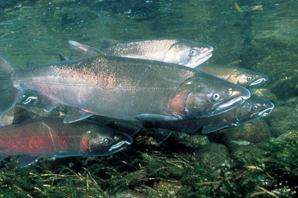
After nearly a century of people building dams on most of the
world’s major rivers, artificial reservoirs now represent an
immense freshwater footprint across the landscape. Yet, these
reservoirs are understudied and overlooked for their fisheries
production and management potential, indicates a study from the
University of California, Davis. The study, published
in the journal Scientific Reports, estimates that U.S.
reservoirs hold 3.5 billion kilograms (7.7 billion pounds) of
fish. Properly managed, these existing reservoir ecosystems
could play major roles in food security and fisheries
conservation.
California has unveiled an ambitious plan to help combat the
worsening climate crisis with one of its invaluable assets: its
land. Over the next 20 years, the state will work to transform
more than half of its 100 million acres into multi-benefit
landscapes that can absorb more carbon than they release,
officials announced Monday. … The plan also calls for
11.9 million acres of forestland to be managed for biodiversity
protection, carbon storage and water supply protection by 2045,
and 2.7 million acres of shrublands and chaparral to be managed
for carbon storage, resilience and habitat connectivity, among
other efforts.
Tiny pieces of plastic waste shed
from food wrappers, grocery bags, clothing, cigarette butts,
tires and paint are invading the environment and every facet of
daily life. Researchers know the plastic particles have even made
it into municipal water supplies, but very little data exists
about the scope of microplastic contamination in drinking
water.
After years of planning, California this year is embarking on a
first-of-its-kind data-gathering mission to illuminate how
prevalent microplastics are in the state’s largest drinking water
sources and help regulators determine whether they are a public
health threat.
Algal blooms are sudden overgrowths
of algae. Their occurrence is increasing in California’s
rivers, creeks and lakes and along the coast, threatening the
lives of people, pets and fisheries.
Only a few types of algae can produce poisons, but even nontoxic
blooms hurt the environment and local economies. When masses
of algae die, the decaying can deplete oxygen in the water to the
point of causing devastating fish kills.
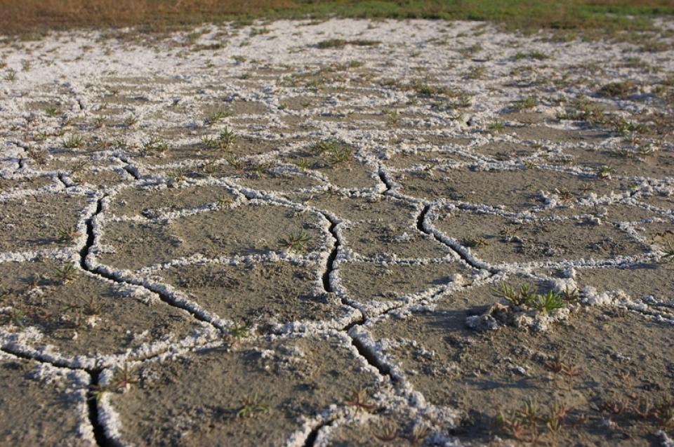
Excess salinity poses a growing
threat to food production, drinking water quality and public
health. Salts increase the cost of urban drinking water and
wastewater treatment, which are paid for by residents and
businesses. Increasing salinity is likely the largest long-term
chronic water quality impairment to surface and groundwater in California’s Central
Valley.
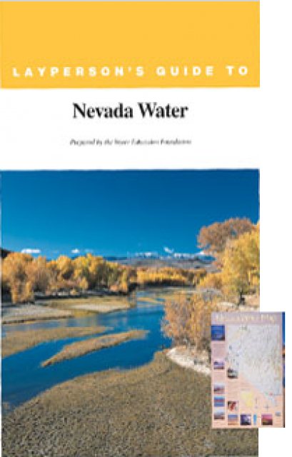
The 28-page Layperson’s Guide to Nevada Water provides an
overview of the history of water development and use in Nevada.
It includes sections on Nevada’s water rights laws, the history
of the Truckee and Carson rivers, water supplies for the Las
Vegas area, groundwater, water quality, environmental issues and
today’s water supply challenges.
Stretching 450 miles long and up to
50 miles wide, the Sierra Nevada makes up more than a quarter of
California’s land area and forms its largest watersheds,
providing more than half of the state’s developed water supply to
residents, agriculture and other businesses.*
The California Environmental Quality
Act, commonly known as CEQA, is foundational to the state’s
environmental protection efforts. The law requires proposed
developments with the potential for “significant” impacts on the
physical environment to undergo an environmental review.
Since its passage in 1970, CEQA (based on the National
Environmental Policy Act) has served as a model for
similar legislation in other states.
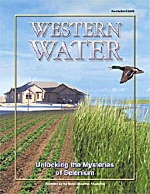
This issue of Western Water examines that process. Much
of the information is drawn from discussions that occurred at the
November 2005 Selenium Summit sponsored by the Foundation and the
California Department of Water Resources. At that summit, a
variety of experts presented findings and the latest activities
from areas where selenium is of primary interest.