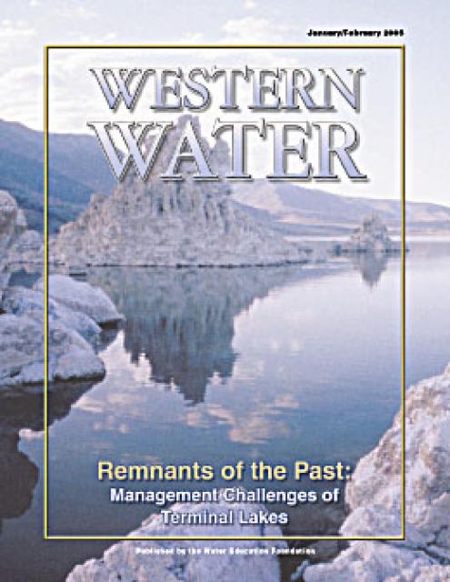
Mono Lake is an inland sea sitting near the border of the Nevada
state line, east of Yosemite National Park. It was the target of
a major environmental battle between the 1970s and the 1990s.
The lake has a surface area of about 70 square miles, is the
second largest lake in California and one of the oldest in North
America. Its salty water occupies former volcanic craters and is
highly alkaline.
Los Angeles began diverting water from Mono Lake tributaries in
the 1940s, extending the Los Angeles Aqueduct from the Owens
Valley. Forty years later, the water level of the lake had
dropped more than 40 feet to threaten wildlife (shrimp and birds)
and uncover stretches of the lake bed, which in dust storms stirs
up toxic dust.
In 1983, the California Supreme Court held the public trust
doctrine applied to Los Angeles’ rights to divert water from Mono
Lake’s feeder streams. In 1991, a superior court halted LADWP’s
water exports. Restoration is underway to increase the water
level by 20 feet by 2021.
If it was just another avalanche, residents of California’s
Sierra Nevada might yawn. Winters in the mountains are chock
full of wobbly snow, especially this winter. But last month’s
avalanche just north of the town of Lee Vining, on the Sierra’s
east side, was different. It buried a portion of a major U.S.
highway, cut off a string of small communities heavily reliant
on one another and stranded food deliveries, mail and even
people. For weeks, road crews have been struggling with how to
get rid of it.
Even with winter’s remarkable rainfall, Mono Lake will not rise
enough to reduce unhealthy dust storms that billow off the
exposed lakebed and violate air quality standards. Nor will it
offset increasing salinity levels that threaten Mono Lake
Kutzadika’a tribe’s cultural resources and food for millions of
migratory birds. Any gain Mono Lake makes surely won’t last due
to the [Los Angeles Department of Water and Power's] ongoing
diversions….If DWP won’t voluntarily cooperate in finding a
way to protect Mono Lake, then the State Water Board needs to
step up and save Mono Lake – again. -Written by Martha Davis, a board member for the
Mono Lake Committee.
In many ways, Owens Lake — which dried up early last century
when the city of Los Angeles began diverting the lake’s water
supply to a major aqueduct — is a cautionary tale and a
harbinger of disasters to come. Climate change is altering
patterns of drought and rainfall across the world, and demand
for water is growing. Just 500 miles from Owens Lake, Utah’s
Great Salt Lake is drying rapidly and creating another stream
of toxic dust. And while Owens Lake has finally managed to get
its air pollution problems in check, it came at enormous cost.
In a sense, it is lucky that there is such an example already
out there, if only to demonstrate how important it will be to
avoid a similar fate.
Yesterday’s Los Angeles Times article, “LA’s new water war:
Keeping supply from Mono Lake flowing as critics want it cut
off,” on the State Water Board’s Mono Lake workshop left
readers and workshop attendees, well … wondering. Print
space and attention spans are always tight, but the article
missed information key to understanding the issue at Mono
Lake, the diversity of voices calling Mono Lake protection, and
the water supply solutions that are right at hand for Los
Angeles. The State Water Board’s five-hour
workshop was attended by 365 people, and 49 of the 53
public commenters spoke in support of raising Mono Lake.
With its haunting rock spires and salt-crusted shores, Mono
Lake is a Hollywood vision of the apocalypse. To the city of
Los Angeles, however, this Eastern Sierra basin represents the
very source of L.A.’s prosperity — the right to free water. For
decades, the Los Angeles Department of Water and Power has
relied on long-standing water rights to divert from the streams
that feed this ancient lake as part of the city’s far-flung
water empire. But in the face of global warming, drought and
lawsuits from environmentalists, the DWP is now facing the
previously unthinkable prospect of ending its diversions there.
In the coming months, the State Water Resources Control Board
will decide whether Mono Lake’s declining water level — and the
associated ecological impacts — constitute an emergency that
outweighs L.A.’s right to divert up to 16,000 acre-feet of
supplies each year.
California authorities face renewed pressure to preserve the
valuable salty waters of the Mono Lake — as despite recent
rainfall, a historic drought and demands from the Los Angeles
area have depleted it. In a workshop Wednesday, the state Water
Resources Control Board discussed Mono Lake’s current
conditions amid the impacts of severe drought and ongoing
diversions. Mono Lake is an ancient, naturally saline lake at
the eastern edge of the Sierra Nevada, with a surface area of
70 square miles. It is fed by several rivers and hosts a unique
ecosystem and critical habitat for millions of migratory birds.
That includes California gulls, whose nesting population on
lake islands has steadily declined for the last 40 years due to
low water levels, increasing coyote populations and human
interference.
Against the backdrop of a severe drought linked with global
warming, conservation advocates and Native Americans in
California are calling for a temporary emergency stop to all
surface water diversions from Mono Lake, contending that
continuing to drain the watershed, along with the long-term
drought, threaten critical ecosystems, as well as the
Kootzaduka’a tribe’s cultural connection with the lake. In
a pair of letters written in December 2022, the Mono Lake
Committee and California Indian Legal Services claimed that
Mono Lake’s water has dropped to a level requiring emergency
action, and asked that all surface water diversions be
curtailed until the lake’s elevation gets closer to an
elevation of 6,392 feet. That was set as a protective level for
Mono by the state in 1994, but the lake has never come close to
reaching it. The emergency request will be considered
on Feb. 15 during a public workshop arranged by
the California State Water Resources Control
Board.
This 25-minute documentary-style DVD, developed in partnership
with the California Department of Water Resources, provides an
excellent overview of climate change and how it is already
affecting California. The DVD also explains what scientists
anticipate in the future related to sea level rise and
precipitation/runoff changes and explores the efforts that are
underway to plan and adapt to climate.
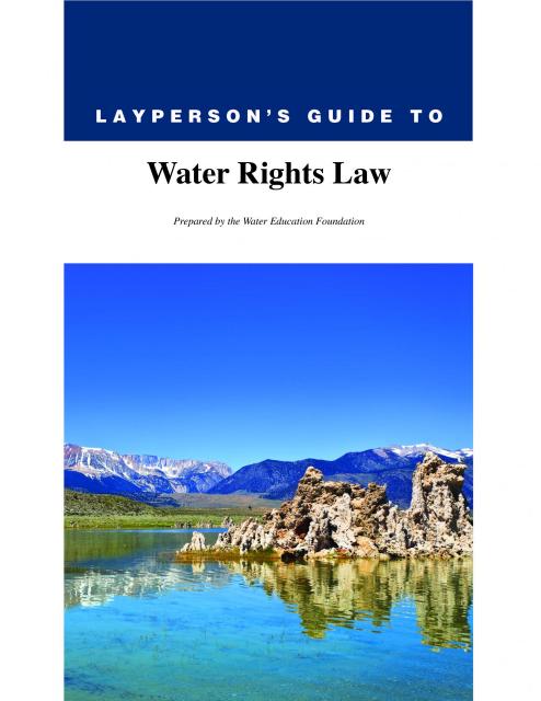
The 28-page Layperson’s Guide to
Water Rights Law, recognized as the most thorough explanation of
California water rights law available to non-lawyers, traces the
authority for water flowing in a stream or reservoir, from a
faucet or into an irrigation ditch through the complex web of
California water rights.
The 24-page Layperson’s Guide to California Water provides an
excellent overview of the history of water development and use in
California. It includes sections on flood management; the state,
federal and Colorado River delivery systems; Delta issues; water
rights; environmental issues; water quality; and options for
stretching the water supply such as water marketing and
conjunctive use. New in this 10th edition of the guide is a
section on the human need for water.
A new look for our most popular product! And it’s the perfect
gift for the water wonk in your life.
Our 24×36 inch California Water Map is widely known for being the
definitive poster that shows the integral role water plays in the
state. On this updated version, it is easier to see California’s
natural waterways and man-made reservoirs and aqueducts
– including federally, state and locally funded
projects – the wild and scenic rivers system, and
natural lakes. The map features beautiful photos of
California’s natural environment, rivers, water projects,
wildlife, and urban and agricultural uses and the
text focuses on key issues: water supply, water use, water
projects, the Delta, wild and scenic rivers and the Colorado
River.
The Pacific Flyway is one of four
major North American migration routes for birds, especially
waterfowl, and extends from Alaska and Canada, through
California, to Mexico and South America. Each year, birds follow
ancestral patterns as they travel the flyway on their annual
north-south migration. Along the way, they need stopover sites
such as wetlands with suitable habitat and food supplies. In
California, 90 percent of historic wetlands have been lost.
Mono Lake is an inland sea located east of Yosemite National Park
near the Nevada border. It became the focus of a major
environmental battle from the 1970s to the 1990s.
The lake has a surface area of about 70 square miles and is the
second largest lake in California and one of the oldest in North
America. Its salty waters occupy former volcanic craters. The old
volcanoes contribute to the geology of the lake basin, which
includes sulfates, salt and carbonates.
They are remnants of another time. A time when the Southwest’s
climate was much cooler and probably wetter, and large lakes
covered vast tracts of land in Nevada, Utah, southeastern Oregon
and California’s Eastern Sierra. Beginning some 14,000 years ago,
the region’s climate grew warmer and drier, shrinking these
lakes’ shorelines and leaving behind an arid landscape dotted
with isolated bodies of water including Pyramid Lake, Mono Lake
and the Great Salt Lake.
This issue of Western Water examines the challenges facing state,
federal and tribal officials and other stakeholders as they work
to manage terminal lakes. It includes background information on
the formation of these lakes, and overviews of the water quality,
habitat and political issues surrounding these distinctive bodies
of water. Much of the information in this article originated at
the September 2004 StateManagement Issues at Terminal Water
Bodies/Closed Basins conference.