Header link June 22, 2020

LinkedIn

  • Read more
Header link September 15, 2014

Cart

  • Read more
Header link November 3, 2015

Donate Now

  • Read more
Header link May 15, 2014

Twitter

  • Read more
Header link May 15, 2014

Facebook

  • Read more
Instagram
Header link May 15, 2014

Instagram

  • Read more
Header link May 15, 2014

Contact Us

  • Read more
More options
Water Education Foundation
Home

Water Education Foundation

Everything about California water that matters
  • Water Academy
    • Agriculture
      • Agricultural Conservation
      • Agricultural Drainage
    • Background Information
      • Legislation — California and Federal
      • Regulations — California and Federal
      • Water History
      • Water Rights
    • Bay-Delta
      • Bay Delta
      • Bay Delta Conservation Plan
      • Delta Issues
      • Delta Smelt
      • Sacramento San Joaquin Delta
      • San Francisco Bay
      • Suisun Marsh
    • Dams, Reservoirs and Water Projects
      • California Aqueduct
      • Central Valley Project
      • Folsom Dam
      • Friant Dam
      • Hetch Hetchy
      • Hoover Dam
      • Infrastructure
      • Lake Mead
      • Lake Powell
      • Oroville Dam
      • San Luis Dam
      • Shasta Dam
      • State Water Project
    • Environmental Issues
      • Anadromous Fish Restoration
      • Ecosystem
      • Endangered Species Act
      • Invasive species
      • Lake Tahoe
      • Mono Lake
      • Public Trust Doctrine
      • Salmon
      • San Joaquin River Restoration
      • Watershed
      • Wetlands
    • Leaders and Experts
    • Regions
      • Central Coast
      • Central Valley
      • Mexico
      • Nevada
      • North Coast
      • Pyramid Lake
      • Sacramento Valley
      • Salton Sea
      • San Joaquin Valley
      • Sierra Nevada
      • Southern California
      • Tulare Lake Basin
    • Rivers
      • Carson River
      • Colorado River
      • Klamath River
      • New River
      • North Coast Rivers
      • Russian River
      • Sacramento River
      • Truckee River
      • San Joaquin River
    • Water Issues
      • Climate Change
      • Coronavirus
      • Drought
      • Earthquakes
      • Energy and Water
      • Floods
      • Fracking
      • Growth
      • Hydropower
      • Levees
      • Tribal Water Issues
      • Water Conservation
    • Water Quality
      • Drinking Water
      • Nitrate contamination
      • Pollution
      • Stormwater
      • Wastewater
      • Water Quality
    • Water Supply and Management
      • Acre Foot
      • Aquifers
      • California Water Plan
      • Conjunctive Use
      • Desalination
      • Grey water
      • Groundwater
      • Integrated Regional Water Management
      • Recreation
      • Surface Water
      • Water Marketing and Banking
      • Water Rates
      • Water Recycling
      • Water Supply
      • Water Transfers
  • Tours & Events
    • Water Tours
      • 2025 Tour Sponsors
    • Events
    • Event Calendar
    • Past Tours & Events
      • Anne J. Schneider Fund Lecture Series
  • Specialized Programs
    • Water Leaders
      • Cohort Rosters
      • Yearly Class Reports
      • Your Alumni Network
      • Alumni Profiles
    • Project WET
      • Workshops
      • Supplementary Materials
      • California Content Standard Correlations
      • Foundation School Programs
        • Elementary Programs
        • Secondary Programs
      • Water Kids
      • California Project WET Gazette
      • Gazette Archives
    • Colorado River Project
    • GRA Scholastic Fund Program
  • Maps & Guides
    • Maps & Posters
    • Layperson's Guides
    • Map & Guide Bundles
    • Books
    • Colorado River Materials
    • California Runoff Rundown
    • Other Publications
    • Water Awareness Materials
    • Downloadable Publications
    • Videos and DVDs
      • Video Clips
    • School Age Publications
    • Stickers
    • Free Programs and Publications
  • Newsroom
    • Western Water News
    • Aquafornia
      • About Aquafornia
    • Information Desk
    • Western Water Magazine Archive
      • Full Print Edition
      • Print Edition Excerpts
    • River Report Archive
  • Aquapedia
    • Alphabetical List of Subjects
      • A
      • B
      • C
      • D
      • E
      • F
      • G
      • H
      • I
      • J
      • K
      • L
      • M
      • N
      • O
      • P
      • Q
      • R
      • S
      • T
      • U
      • V
      • W
      • X
      • Y
      • Z
    • Historical Water People
    • Where Does My Water Come From?
      • Northern California
      • Sacramento
      • North Bay
      • South Bay
      • Central Valley
      • Los Angeles
      • Inland Empire
      • San Diego
      • All California Water Sources
    • Timelines
    • Videos
    • Image Gallery
    • Water Directory
      • Federal Agencies
      • State Agencies in California
      • Environmental Organizations
      • Other California Organizations
      • State and Federal Legislative Committees
      • Water Associations and Groups
      • Western States Water Agencies and Districts
    • Online Resources
    • Useful Acronyms
    • About Aquapedia
  • About
    • About Us
      • Board of Directors
      • Staff Biographies
      • Job Openings
    • Announcements
    • Support Our Mission
      • Become a Member
      • Donate in Honor/Memory
      • Planned Giving
    • Contact Us
Publication March 24, 2026 California Water Map

Layperson’s Guide to California Water
Updated 2026

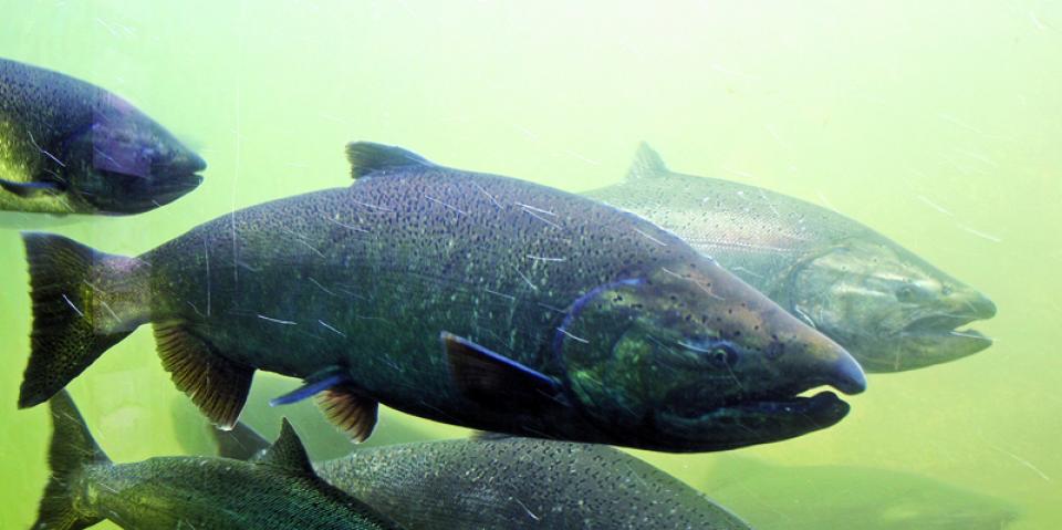
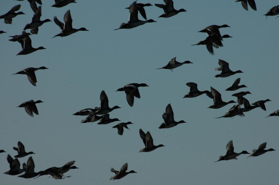
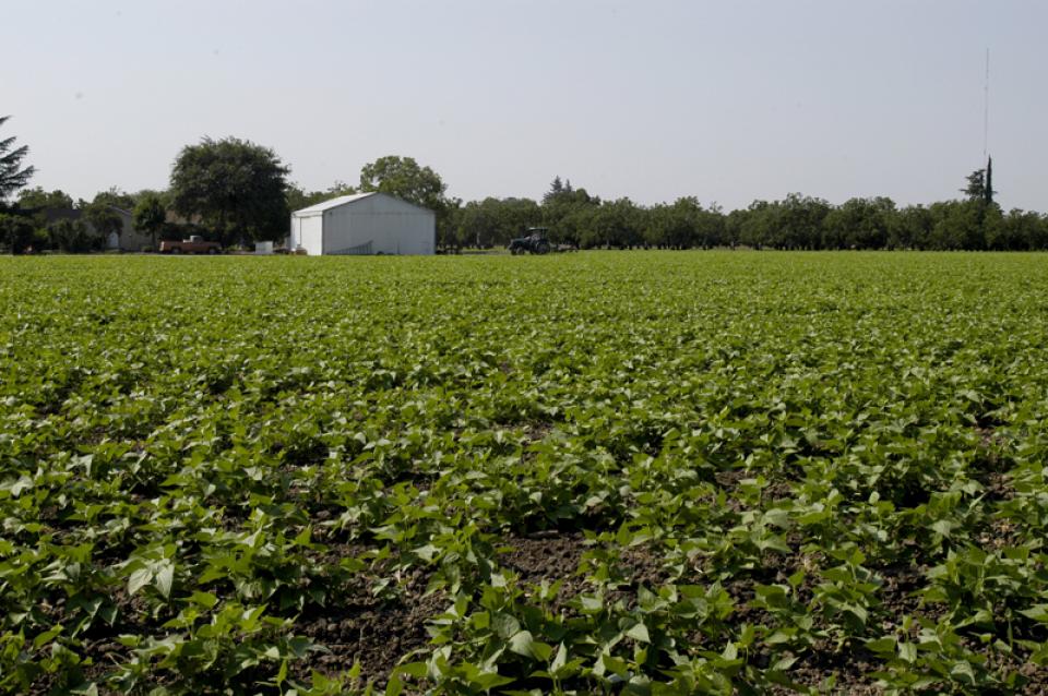
The 24-page Layperson’s Guide to California Water provides an excellent overview of the history of water development and use in California. It includes the latest information on the state’s changing hydrology, recent water conservation legislation and the state’s efforts to stretch the available water supplies.

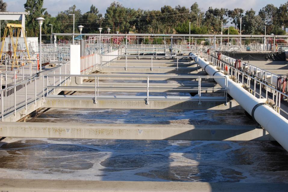
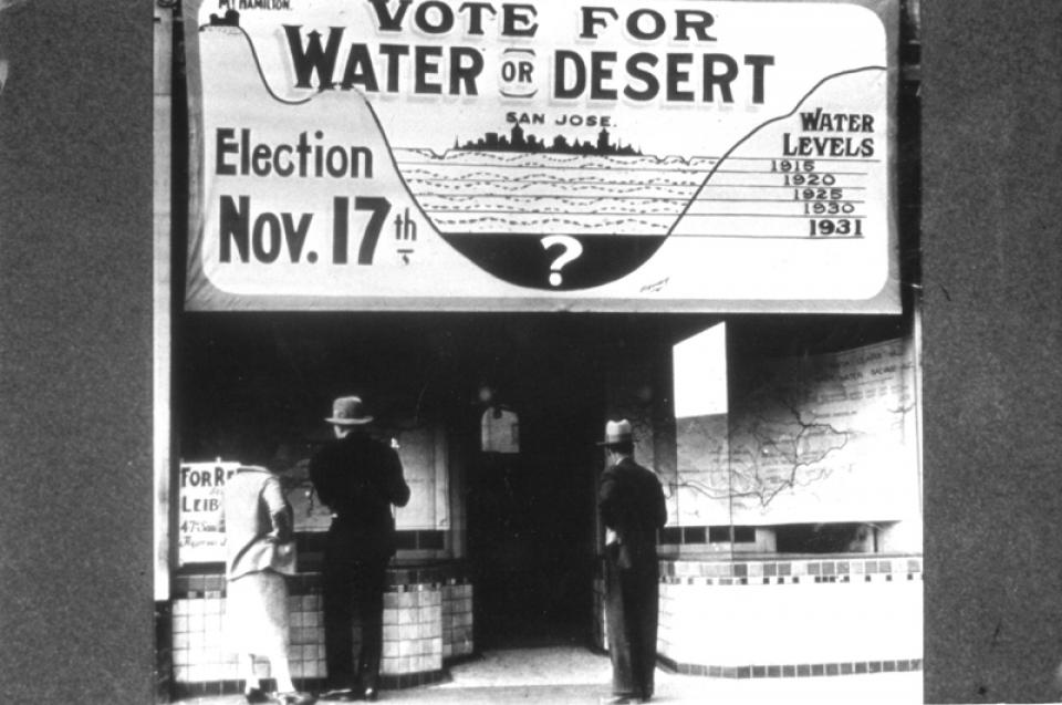
The guide includes an updated chronology of California water history and sections on the state, federal and Colorado River delivery systems; Delta issues; water rights; environmental issues; water quality; water access and affordability; and options for stretching the water supply.

Complementing the guide is the California Water Map.

Order in bulk (25 or more copies of the same guide) for a reduced fee. Contact the Foundation, 916-444-6240, for details.
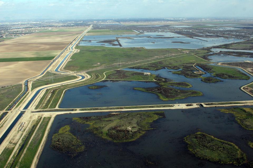
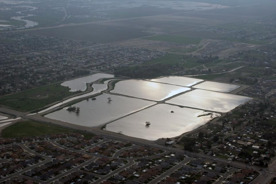
  • Print-friendly

Referring Pages

Publication April 7, 2026 Nic Russo California Water Map Layperson's Guide to California Water Nic Russo

The Frozen Reservoir: Teaching California’s 2026 Snow Drought with Project WET
California Project WET Gazette - Spring 2026

 As California faces unseasonably warm temperatures and sparse mountain snowfall this spring, educators are looking for ways to translate complex hydrological data into tangible lessons for their students. Project WET offers a timely solution through its activity Snow Me the Water in the Water in Earth Systems guide (or Snow and Tell in Guides 1.0 & 2.0), which provides a hands-on framework to explore how snowpack serves as the state’s most critical “frozen reservoir.”

The Crisis: California’s Disappearing Snowpack

As of the April 2026 survey, the California Department of Water Resources (DWR) reported a statewide snowpack that has effectively vanished, plummeting to just 18% of the historical average for April 1. A record-hot and dry March, combined with high-elevation rain, completely wiped out the snowpack at the critical Phillips Station survey site, which now holds no measurable snow. This rapid decline, which began weeks ahead of schedule, marks the second-lowest April snowpack on record for the state.

  • Read more
Aquapedia background July 20, 2017 California Groundwater Map Layperson's Guide to California Water Layperson's Guide to Groundwater

Groundwater Replenishment

Groundwater replenishment happens through direct recharge and in-lieu recharge. Water used for direct recharge most often comes from flood flows, water conservation, recycled water, desalination and water transfers.

  • Read more
Aquapedia background February 14, 2014 California Water Map Layperson's Guide to California Water Layperson's Guide to Flood Management California Spent Decades Trying to Keep Central Valley Floods at Bay. Now It Looks to Welcome Them Back

Floodplains in California

Restored floodplain at Dos Rios Ranch Preserve near Modesto

With the dual threats of aging levees and anticipated rising sea levels, floodplains — low areas along waterways that flood during wet years — are increasingly at the forefront of many public policy and water issues in California.

Adding to the challenges, many floodplains have been heavily developed and are home to major cities such as Sacramento. Large parts of California’s valleys are historic floodplains as well.

  • Read more
Aquapedia background February 14, 2014 Layperson's Guide to California Water Layperson's Guide to Flood Management Layperson's Guide to Climate Change and Water Resources California Water Map

Flooding and Flood Management

Image shows floodwaters from a series of atmospheric rivers that caused a road closure at Highway 20 near Williams in Colusa County in January 2023. When people think of natural disasters in California, they typically think about earthquakes. Yet the natural disaster that residents are most likely to face involves flooding, not fault lines. In fact, all 58 counties in the state have declared a state of emergency from flooding at least three times since 1950. And the state’s capital, Sacramento, is considered one of the nation’s most flood-prone cities. Floods also affect every Californian because flood management projects and damages are paid with public funds.

  • Read more
Aquapedia background February 14, 2014 Layperson's Guide to California Water

Flood Forecasting

Flood Forecasting

Flood forecasting allows flood control managers to predict, with a high degree of accuracy, when local flooding is likely to take place.

Forecasts typically use storm runoff data, reservoir levels and releases to predict the rise in river levels.

In Northern California the National Weather Service, in cooperation with the state’s California-Nevada River Forecast Center in Sacramento, forecasts flooding.

  • Read more
Aquapedia background February 11, 2014 California Water Map Layperson's Guide to California Water

Water Supply in California

SnowmeltCalifornia’s “Mediterranean” climate, characterized by warm, dry summers and mild winters, is considered one of its great attractions, but it also can be unpredictable with flooding followed by drought and few years of “normal” precipitation.  [See also Hydrologic Cycle].

  • Read more
Aquapedia background February 11, 2014 Layperson's Guide to California Water Layperson's Guide to Water Rights Law

Water Rights in California

All-American Canal

California’s growth has closely paralleled an evolving and complex system of water rights.

After California became a state in 1850, it followed the practice of Eastern states and adopted riparian rights based on ownership of land bordering a waterway. The riparian property owner has the right to use that water, a right that cannot be transferred apart from the land.

  • Read more
Aquapedia background February 11, 2014 Layperson's Guide to Water Recycling Layperson's Guide to California Water Colorado River Shortages Drive Major Advances in Recycled Sewage Water Use

Recycled Water

Image shows samples of cleaned wastewater before and after reverse osmosis filtration at the Pure Water Southern California Demonstration Plant in Carson.All water is naturally recycled and reused as part of the hydrologic cycle. Recycled water is also produced by purifying wastewater for safe use in drinking (potable) water and for non-potable uses such as irrigation.

Recycling wastewater provides a new, costly but renewable water resource that can bolster local water supplies, save energy and reduce the amount of sewage treatment plant effluent emptied into rivers and oceans.

  • Read more
Aquapedia background February 11, 2014 Layperson's Guide to Water Conservation Layperson's Guide to California Water Water Conservation Tips Up Close and Personal: Water Use at Home

Water Conservation

Drought-tolerant landscaping reduces the amount of water used on traditional lawns

Water conservation has become a way of life throughout the West with a growing recognition that water supply is not unlimited.

Drought is the most common motivator of increased water conservation. However, the gradual drying of the West due to climate change means the amount of fresh water available for drinking, irrigation, industry and other uses must be used as efficiently as possible.

  • Read more
Aquapedia background February 11, 2014 Layperson's Guide to California Water Layperson's Guide to California Wastewater

Wastewater Treatment Process in California

Wastewater management in California centers on the collection, conveyance, treatment, reuse and disposal of wastewater. This process is conducted largely by public agencies, though there are also private systems in places where a publicly owned treatment plant is not feasible.

In California, wastewater treatment takes place through 100,000 miles of sanitary sewer lines and at more than 900 wastewater treatment plants that manage the roughly 4 billion gallons of wastewater generated in the state each day.

  • Read more
Aquapedia background February 11, 2014 Layperson's Guide to California Water

Regional Water Quality Control Boards in California

Front-line responsibility for protecting California’s water quality and policing waste discharges in the state rests primarily with nine regional water quality control boards overseeing water quality in major watersheds from Oregon to Mexico.

The nine regional boards are semi-autonomous from the State Water Resources Control Board, which is charged with allocating surface water rights and setting statewide policy on water quality. The regional boards are comprised of seven part-time board members appointed by the Governor and confirmed by the state Senate.

Regional boundaries are based on watersheds and water quality requirements are based on the unique differences in climate, topography, geology and hydrology for each watershed. Each regional board makes critical water quality decisions for its region, including setting standards, issuing waste discharge requirements, determining compliance with those requirements, and taking appropriate enforcement actions.

BACKGROUND

World War II brought rapid industrial development and population growth to California, and with them came water pollution and water-borne disease outbreaks. Attempts to regulate the sources of water pollution were complicated by conflicting interpretations of existing laws and overlapping authority among government agencies.

In an attempt to better address California’s water pollution concerns, the state Legislature in 1949 passed the Dickey Water Pollution Act. Authored by Randal F. Dickey, a Republican assemblyman from the city of Alameda, the act created a State Water Pollution Control Board to oversee statewide water pollution policy, and regional water pollution control boards to be the enforcing agency in each of the state’s nine major watersheds.

Over the next two decades, new legislation would rename the state and regional water boards, expand the state board’s duties to include surface water rights, and – with the enactment in 1969 of the Porter-Cologne Water Quality Control Act – strengthen the state’s oversight of water quality affecting beneficial uses of surface and groundwater. The Porter-Cologne Water Quality Control Act – coauthored by Sen. Gordon Cologne, a Riverside County Republican, and Assemblyman Carley Porter, a Los Angeles County Democrat – became the model for the federal Clean Water Act in 1972.

Below are the nine regional water quality control boards and the counties they cover.

  • Read more
Aquapedia background February 11, 2014 Layperson's Guide to California Water

Stormwater

For all the benefits of precipitation, stormwater also brings with it many challenges.

In urban areas, after long dry periods rainwater runoff can contain heavy accumulations of pollutants that have built up over time. For example, a rainbow like shine on a roadway puddle can indicate the presence of oil or gasoline. Stormwater does not go into the sewer. Instead, pollutants can be flushed into waterways with detrimental effects on the environment and water quality.

  • Read more
Aquapedia background February 11, 2014 California Water Map Layperson's Guide to California Water Layperson's Guide to the State Water Project

State Water Project

California Aqueduct

The State Water Project is a lifeline for California because of its vital role in bringing water to cities and farms. Without it, California would never have developed into the economic powerhouse it is.

  • Read more
Aquapedia background February 11, 2014 Layperson's Guide to California Water

Flood Protection, State Liability and the Paterno Decision

Liability for levee failure in California took a new turn after a court ruling found the state liable for hundreds of millions of dollars from the 1986 Linda Levee collapse in Yuba County. The levee failure killed two people and destroyed or damaged about 3,000 homes.

The collapse also had long-term legal ramifications.

The Paterno Decision

California’s Supreme Court found that, “when a public entity operates a flood management system built by someone else, it accepts liability as if it had planned and built the system itself.”

  • Read more
Aquapedia background February 11, 2014 Layperson's Guide to California Water

Groundwater Safe Yield

Image shows a groundwater pump sending water into a field.

Landowners in California are entitled to pump and use a reasonable amount of groundwater from a basin underlying their land. When there is insufficient water to meet demand, property owners are expected to extract only the safe yield—the rate at which groundwater can be withdrawn without causing long-term decline of water levels.

If the amount of groundwater withdrawn exceeds the safe yield amounts, the well can go dry.

  • Read more
Aquapedia background February 11, 2014 California Water Map Layperson's Guide to California Water

Safe Drinking Water Act

The federal Safe Drinking Water Act sets standards for drinking water quality in the United States.

Launched in 1974 and administered by the U.S. Environmental Protection Agency, the Safe Drinking Water Act oversees states, communities, and water suppliers who implement the drinking water standards at the local level.

The act’s regulations apply to every public water system in the United States but do not include private wells serving less than 25 people.

According to the EPA, there are more than 160,000 public water systems in the United States.

  • Read more
Aquapedia background February 11, 2014 California Groundwater Map Layperson's Guide to Groundwater Layperson's Guide to California Water

Groundwater Pollutants

barrel half-buried in the ground, posing a threat to groundwater.

The natural quality of groundwater in California depends on the surrounding geology and on the source of water that recharges the aquifer.

  • Read more
Aquapedia background February 11, 2014 Layperson's Guide to California Water

Groundwater Overdraft

Overdraft occurs when, over a period of years, more water is pumped from a groundwater basin than is replaced from all sources – such as rainfall, irrigation water, streams fed by mountain runoff and intentional recharge. [See also Hydrologic Cycle.]

While many of its individual aquifers are not overdrafted, California as a whole uses more groundwater than is replaced.

  • Read more
Aquapedia background February 11, 2014 Lakes Public Trust Doctrine Layperson's Guide to California Water

Mono Lake

Mono Lake is an inland sea located east of Yosemite National Park near the Nevada border. It became the focus of a major environmental battle from the 1970s to the 1990s.

The lake has a surface area of about 70 square miles and is the second largest lake in California and one of the oldest in North America. Its salty waters occupy former volcanic craters. The old volcanoes contribute to the geology of the lake basin, which includes sulfates, salt and carbonates.

  • Read more
Aquapedia background February 4, 2014 Layperson's Guide to California Water

Groundwater Treatment

The treatment of groundwater— the primary source of drinking water and irrigation water in many parts of the United States — varies from community to community, and even from well to well within a city depending on what contaminants the water contains.

In California, one-half of the state’s population drinks water drawn from underground sources [the remainder is provided by surface water].

  • Read more
Aquapedia background February 4, 2014 California Groundwater Map Layperson's Guide to Groundwater Sustainable Groundwater Management Act (SGMA) Layperson's Guide to California Water

Groundwater Management

Groundwater pump in California's Central ValleyGroundwater management is recognized as critical to supporting the long-term viability of California’s aquifers and protecting the nearby surface waters that are connected to groundwater.

  • Read more
Aquapedia background February 4, 2014 Layperson's Guide to California Water

Groundwater Legislation

California has considered, but not implemented, a comprehensive groundwater strategy many times over the last century.

One hundred years ago, the California Conservation Commission considered adding  groundwater regulation into the Water Commission Act of 1913.  After hearings were held, it was decided to leave groundwater rights out of the Water Code.

  • Read more
Aquapedia background February 4, 2014 Layperson's Guide to California Water

Groundwater Law

California, like most arid Western states, has a complex system of surface water rights that accounts for nearly all of the water in rivers and streams.

  • Read more
Aquapedia background February 3, 2014 Layperson's Guide to California Water

Groundwater Banking

An aerial view of a groundwater bank

Groundwater banking is a process of diverting floodwaters or other surface water into an aquifer where it can be stored until it is needed later. In a twist of fate, the space made available by emptying some aquifers opened the door for the banking activities used so extensively today.

  • Read more
Aquapedia background February 3, 2014 Layperson's Guide to California Water

Groundwater Adjudication

When multiple parties withdraw water from the same aquifer, groundwater pumpers can ask the court to adjudicate, or hear arguments for and against, to better define the rights that various entities have to use groundwater resources. This is known as  groundwater adjudication. [See also California water rights and Groundwater Law.]

  • Read more
Aquapedia background February 3, 2014 California Groundwater Map Layperson's Guide to Groundwater Layperson's Guide to California Water

Groundwater

Groundwater pump in a Northern California farm field.

If California were flat, its groundwater would be enough to flood the entire state 8 feet deep. The enormous cache of underground water helped the state become the nation’s top agricultural producer. Groundwater also provides a critical hedge against drought to sustain California’s overall water supply.

In years of average precipitation, about 40 percent of the state’s water supply comes from underground. During a drought, the amount can approach 60 percent.

  • Read more
Aquapedia background February 3, 2014 Layperson's Guide to California Water

Environmental Issues and Water

Environmental concerns have closely followed California’s development of water resources since its earliest days as a state.

Early miners harnessed water to dislodge gold through hydraulic mining. Debris resulting from these mining practices washed down in rivers and streams, choking them and harming aquatic life and causing flooding.

  • Read more
Aquapedia background February 3, 2014 Layperson's Guide to California Water

Desalination

Charles E. Meyer Desalination Plant in Santa Barbara,  Calif.

Recurrent droughts and uncertainties about future water supplies have led several California communities to look to treat salty water for supplemental supplies through a process known as desalination.

Desalination removes salt and other dissolved minerals from water and is one method to reclaim water for other uses. This can occur with ocean water along the coast and in the interior at spots that draw from ancient salt water deep under the surface or where groundwater has been tainted by too much salt.

  • Read more
Aquapedia background January 30, 2014 Layperson's Guide to California Water

Central Valley Wetlands and Riparian Habitat

In the Central Valley, wetlands—partly or seasonally saturated land that supports aquatic life and distinct ecosystems— provide critical habitat for a variety of wildlife.

  • Read more
Aquapedia background January 30, 2014 Layperson's Guide to the Central Valley Project Layperson's Guide to California Water

Central Valley Project Improvement Act

The Central Valley Project Improvement Act supports a major federal effort to store and transport water in California’s Central Valley.

The 1992 Act changed operations of Central Valley Project; a major project that addresses flooding, storage and irrigation issues in the valley [see also Central Valley Project].

  • Read more
Aquapedia background January 30, 2014 Layperson's Guide to the Central Valley Project Layperson's Guide to California Water

Central Valley Project

Birthed in part by a long-ago federal effort to create farmland, the Central Valley Project today is one of the largest water storage and transport systems in the world. In years of normal precipitation, it stores and distributes about 20 percent of the state’s developed water through its massive system of reservoirs and canals.

  • Read more
Aquapedia background January 30, 2014 Layperson's Guide to California Water

California Wild and Scenic Rivers Act

North Fork of the American River,  a section deemed wild and scenic. California’s Legislature passed the Wild and Scenic Rivers Act in 1972, following the passage of the federal Wild and Scenic Rivers Act by Congress in 1968. Under California law, “[c]ertain rivers which possess extraordinary scenic, recreational, fishery, or wildlife values shall be preserved in their free-flowing state, together with their immediate environments, for the benefit and enjoyment of the people of the state.”

Rivers are classified as:

  • Read more
Aquapedia background January 30, 2014 Layperson's Guide to California Water

California Water Timeline

1769 First permanent Spanish settlements established. Water rights established by Spanish law.

1848 Gold discovered on the American River. Treaty of Guadalupe signed, California ceded from Mexico, California republic established.

1850 California admitted to Union. Construction begins on Delta levees and channels.

1860 Legislature authorizes the formation of levee and reclamation districts.

1862  Major flood in Sacramento Valley inundates new city.

  • Read more
Aquapedia background January 30, 2014 California Water Map Layperson's Guide to California Water

California Water Plan

Every five years the California Department of Water Resources updates its strategic plan for managing the state’s water resources, as required by state law.

The California Water Plan, or Bulletin 160, projects the status and trends of the state’s water supplies and demands under a range of future scenarios.

  • Read more
Aquapedia background January 30, 2014 California Water Map Layperson's Guide to California Water Water & the Shaping of California

California Water Overview

Aerial view of the Sacramento-San Joaquin DeltaCalifornia will always be inextricably linked to its water resources. Water continues to shape the state’s development and no resource is as vital to California’s urban centers, farms, industry, recreation, scenic beauty and environmental preservation.

But California’s relationship to water is also one that continues to generate controversy.

  • Read more
Aquapedia background January 30, 2014 Layperson's Guide to California Water

California Gold Rush and Today’s Water

More than 100 years ago, California’s Gold Rush left a toxic legacy that continues to cause problems in Northern California watersheds.

The discovery of gold in John Sutter’s millrace at Coloma in the 1840s drew people from around the globe.

Over the course of decades, intense efforts were focused on washing and prying gold from the hills of the Sierra Nevada.

  • Read more
Aquapedia background January 30, 2014 California Water Map Layperson's Guide to California Water

California Environmental Quality Act

The California Environmental Quality Act, commonly known as CEQA, is foundational to the state’s environmental protection efforts. The law requires proposed developments with the potential for “significant” impacts on the physical environment to undergo an environmental review. 

Since its passage in 1970, CEQA (based on the National Environmental Policy Act) has served as a model for similar legislation in other states.

  • Read more
Aquapedia background January 30, 2014 Layperson's Guide to California Water California Water Map

Endangered Species Act – California

California was the first state in the nation to protect fish, flora and fauna with the enactment of the California Endangered Species Act in 1970. (Congress followed suit in 1973 by passing the federal Endangered Species Act. See also the Convention on International Trade in Endangered Species of Wild Fauna and Flora, or CITES.)

  • Read more
Aquapedia background January 30, 2014 Layperson's Guide to California Water California Water Map Layperson's Guide to the State Water Project

California Aqueduct

California Aqueduct

The California Aqueduct, a critical part of the State Water Project, carries water from the Sacramento-San Joaquin Delta to the San Joaquin Valley and Southern California.

Established as part of a $1.75 billion bond passed by voters in 1960, the 444-mile-long California Aqueduct (formally known as the Edmund G. Brown California Aqueduct) begins at the Harvey O. Banks Pumping Plant in the Delta. It parallels Interstate 5 south to the Tehachapi Mountains.

  • Read more
Aquapedia background January 30, 2014 Layperson's Guide to California Water

Area-of-Origin and California Water

The legal term “area-of-origin” dates back to 1931 in California.

At that time, concerns over water transfers prompted enactment of four “area-of-origin” statutes. With water transfers from Yosemite’s Hetch Hetchy Valley to supply water for San Francisco and from Owens Valley to Los Angeles fresh in mind, the California statutes were intended to protect local areas against export of water.

In particular, counties in Northern California had concerns about the state tapping their water to develop California’s supply.

  • Read more
Aquapedia background January 30, 2014 Layperson's Guide to California Water

Aquifers

Graphic: California DWR

Aquifers are an unseen but critical resource in California’s water supply system.

These natural basins that sit below the surface are found underneath 40 percent of California’s land area.

  • Read more
Aquapedia background January 30, 2014 Layperson's Guide to California Water

Agricultural Drainage Environmental Impacts

Agriculture drainage issues date back to the earliest farming. In ancient times, farmers let fields stay fallow hoping rain would flush out salt.

Today, salt and other contaminants continue to cause agricultural drainage problems, particularly in California. Whether a field is adequately drained, or saturated with water, the water still has to be removed.

The disposal of this often-contaminated water continues to be a challenge in California, with the environmental effects of selenium and other drainage-related elements changing the course of drainage planning.

  • Read more
Aquapedia background January 30, 2014 Layperson's Guide to California Water

Agricultural Drainage and the Sacramento-San Joaquin Delta

Few regions are as important to California water as the Sacramento-San Joaquin Delta, where the Sacramento and San Joaquin rivers converge to discharge into San Francisco Bay.

  • Read more

Share this page

  • Share on Facebook
  • Share on Twitter
  • Share on LinkedIn
  • Sent to a friend.
Print-friendly

Related Links

Publication March 24, 2026 California Water Map
Maps & Posters April 17, 2014 California Water Bundle

California Water Map
Updated December 2016

A new look for our most popular product! And it’s the perfect gift for the water wonk in your life.

Our 24×36-inch California Water Map is widely known for being the definitive poster that shows the integral role water plays in the state. On this updated version, it is easier to see California’s natural waterways and man-made reservoirs and aqueducts – including federally, state and locally funded projects – the wild and scenic rivers system, and natural lakes. The map features beautiful photos of California’s natural environment, rivers, water projects, wildlife, and urban and agricultural uses and the text focuses on key issues: water supply, water use, water projects, the Delta, wild and scenic rivers and the Colorado River.

  • Read more
Back
This item appears in:
  • Topic: Acre Foot
  • Topic: Anadromous Fish Restoration
  • Topic: Bay Delta
  • Topic: California Aqueduct
  • Topic: Drinking Water
  • Layperson's Guides
  • Topic: Central Valley
  • Topic: Central Valley Project
  • Topic: Colorado River
  • Topic List: Background Information
  • Topic: Drought
  • Topic: Water History
  • Topic: Water Rights
  • Topic: Energy and Water
  • Topic: Sacramento San Joaquin Delta
  • Topic: Floods
  • Topic: Mono Lake
  • Topic: Groundwater
  • Topic: Public Trust Doctrine
  • Topic: Water Quality
  • Topic: Salmon
  • Topic List: Water Issues
  • Topic: Oroville Dam
  • Topic: Surface Water
  • Topic List: Water Supply and Management
  • Topic: Shasta Dam
  • Topic: State Water Project
  • Topic: Water Supply
Footer pod May 20, 2014

Water Education Foundation

Copyright © 2026 Water Education Foundation. All rights reserved.

The Water Education Foundation is a nonprofit, tax-exempt, 501(c)3 organization, federal tax ID #942419885.

Privacy Policy

Donor Privacy Policy

  • Read more
Footer pod May 20, 2014

Contact Information

2151 River Plaza Drive, Suite 205
Sacramento CA 95833

Telephone (916) 444-6240

Contact Us via email

  • Read more

Quicklinks

Footer quicklink May 20, 2014

Contact Us

  • Read more
Footer quicklink May 20, 2014

Donate Today

  • Read more
Footer quicklink May 20, 2014

Tours

  • Read more
Footer quicklink May 20, 2014

Newsletter Signup

  • Read more
Footer quicklink May 20, 2014

Foundation News

  • Read more
Footer quicklink May 20, 2014

Calendar

  • Read more

Log in

  • Create new account
  • Request new password

Commands

  • Support portal
  • Log in