Hydroelectric power is generated by the ability to turn falling
water into electricity and in California accounts for about 15
percent of the state’s power supply annually.
The US Bureau of Reclamation has added two new categorical
exclusions for hydropower-related activities under the National
Environmental Policy Act, in a move the agency says will speed
up environmental reviews for selected projects and maintenance
work across its hydropower portfolio. The changes were
announced on Friday as part of Reclamation’s ongoing Hydropower
Action Plan, which the agency says is intended to support
capital investment, regulatory efficiency and technological
innovation in the US hydropower sector. … The agency
said the exclusions were developed after identifying categories
of hydropower activity that have “consistently demonstrated no
significant environmental impacts.”
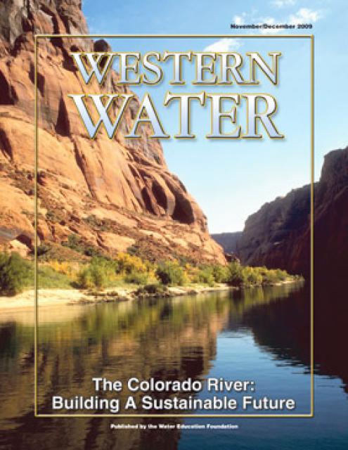
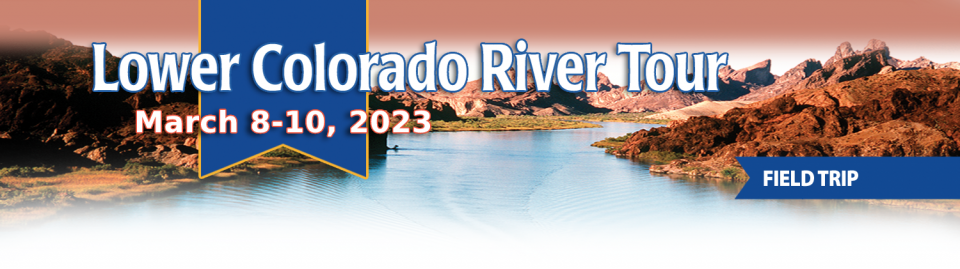
This tour explored the lower Colorado River firsthand where virtually every drop of the river is allocated, yet demand is growing from myriad sources — increasing population, declining habitat, drought and climate change.
The 1,450-mile river is a lifeline to some 40 million people in the Southwest across seven states, 30 tribal nations and Mexico. How the Lower Basin states – Arizona, California and Nevada – use and manage this water to meet agricultural, urban, environmental and industrial needs was the focus of this tour.
Hilton Garden Inn Las Vegas Strip South
7830 S Las Vegas Blvd
Las Vegas, NV 89123
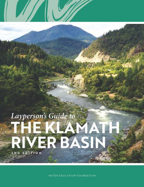
On this first-ever Foundation water tourwe examined water issues along the 263-mile Klamath River, from its spring-fed headwaters in south-central Oregon to its redwood-lined estuary on the Pacific Ocean in California.
Running Y Resort
5500 Running Y Rd
Klamath Falls, OR 97601
This tour explored the lower Colorado River firsthand where virtually every drop of the river is allocated, yet demand is growing from myriad sources — increasing population, declining habitat, drought and climate change.
The 1,450-mile river is a lifeline to some 40 million people in the Southwest across seven states, 30 tribal nations and Mexico. How the Lower Basin states – Arizona, California and Nevada – use and manage this water to meet agricultural, urban, environmental and industrial needs was the focus of this tour.
Hilton Garden Inn Las Vegas Strip South
7830 S Las Vegas Blvd
Las Vegas, NV 89123
The Klamath River Basin was once one
of the world’s most ecologically magnificent regions, a watershed
teeming with salmon, migratory birds and wildlife that thrived
alongside Native American communities. The river flowed rapidly
from its headwaters in southern Oregon’s high deserts into Upper
Klamath Lake, collected snowmelt along a narrow gorge through the
Cascades, then raced downhill to the California coast in a misty,
redwood-lined finish.
The states of the Lower Colorado
River Basin have traditionally played an oversized role in
tapping the lifeline that supplies 40 million people in the West.
California, Nevada and Arizona were quicker to build major canals
and dams and negotiated a landmark deal that requires the Upper
Basin to send predictable flows through the Grand Canyon, even
during dry years.
But with the federal government threatening unprecedented water
cuts amid decades of drought and declining reservoirs, the Upper
Basin states of Wyoming, Utah, Colorado and New Mexico are
muscling up to protect their shares of an overallocated river
whose average flows in the Upper Basin have already dropped
20 percent over the last century.
They have formed new agencies to better monitor their interests,
moved influential Colorado River veterans into top negotiating
posts and improved their relationships with Native American
tribes that also hold substantial claims to the river.
This tour explored the lower Colorado River firsthand where virtually every drop of the river is allocated, yet demand is growing from myriad sources — increasing population, declining habitat, drought and climate change.
The 1,450-mile river is a lifeline to some 40 million people in the Southwest across seven states, 30 tribal nations and Mexico. How the Lower Basin states – Arizona, California and Nevada – use and manage this water to meet agricultural, urban, environmental and industrial needs was the focus of this tour.
Hilton Garden Inn Las Vegas Strip South
7830 S Las Vegas Blvd
Las Vegas, NV 89123
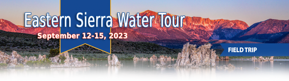
This special Foundation water tour journeyed along the Eastern Sierra from the Truckee River to Mono Lake, through the Owens Valley and into the Mojave Desert to explore a major source of water for Southern California, this year’s snowpack and challenges for towns, farms and the environment.
With 25 years of experience working
on the Colorado River, Chuck Cullom is used to responding to
myriad challenges that arise on the vital lifeline that seven
states, more than two dozen tribes and the country of Mexico
depend on for water. But this summer problems on the
drought-stressed river are piling up at a dizzying pace:
Reservoirs plummeting to record low levels, whether Hoover Dam
and Glen Canyon Dam can continue to release water and produce
hydropower, unprecedented water cuts and predatory smallmouth
bass threatening native fish species in the Grand Canyon.
“Holy buckets, Batman!,” said Cullom, executive director of the
Upper Colorado River Commission. “I mean, it’s just on and on and
on.”
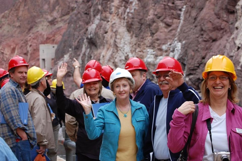
This tour explored the lower Colorado River firsthand where virtually every drop of the river is allocated, yet demand is growing from myriad sources — increasing population, declining habitat, drought and climate change.
The 1,450-mile river is a lifeline to some 40 million people in the Southwest across seven states, 30 tribal nations and Mexico. How the Lower Basin states – Arizona, California and Nevada – use and manage this water to meet agricultural, urban, environmental and industrial needs was the focus of this tour.
Hyatt Place Las Vegas At Silverton Village
8380 Dean Martin Drive
Las Vegas, NV 89139
Climate scientist Brad Udall calls
himself the skunk in the room when it comes to the Colorado
River. Armed with a deck of PowerPoint slides and charts that
highlight the Colorado River’s worsening math, the Colorado State
University scientist offers a grim assessment of the river’s
future: Runoff from the river’s headwaters is declining, less
water is flowing into Lake Powell – the key reservoir near the
Arizona-Utah border – and at the same time, more water is being
released from the reservoir than it can sustainably provide.
The majestic beauty of the Sierra
Nevada forest is awe-inspiring, but beneath the dazzling blue
sky, there is a problem: A century of fire suppression and
logging practices have left trees too close together. Millions of
trees have died, stricken by drought and beetle infestation.
Combined with a forest floor cluttered with dry brush and debris,
it’s a wildfire waiting to happen.
Fires devastate the Sierra watersheds upon which millions of
Californians depend — scorching the ground, unleashing a
battering ram of debris and turning hillsides into gelatinous,
stream-choking mudflows.
Even as stakeholders in the Colorado River Basin celebrate the recent completion of an unprecedented drought plan intended to stave off a crashing Lake Mead, there is little time to rest. An even larger hurdle lies ahead as they prepare to hammer out the next set of rules that could vastly reshape the river’s future.
Set to expire in 2026, the current guidelines for water deliveries and shortage sharing, launched in 2007 amid a multiyear drought, were designed to prevent disputes that could provoke conflict.
The growing leadership of women in water. The Colorado River’s persistent drought and efforts to sign off on a plan to avert worse shortfalls of water from the river. And in California’s Central Valley, promising solutions to vexing water resource challenges.
These were among the topics that Western Water news explored in 2018.
We’re already planning a full slate of stories for 2019. You can sign up here to be alerted when new stories are published. In the meantime, take a look at what we dove into in 2018:
Amy Haas recently became the first non-engineer and the first woman to serve as executive director of the Upper Colorado River Commission in its 70-year history, putting her smack in the center of a host of daunting challenges facing the Upper Colorado River Basin.
Yet those challenges will be quite familiar to Haas, an attorney who for the past year has served as deputy director and general counsel of the commission. (She replaced longtime Executive Director Don Ostler). She has a long history of working within interstate Colorado River governance, including representing New Mexico as its Upper Colorado River commissioner and playing a central role in the negotiation of the recently signed U.S.-Mexico agreement known as Minute 323.
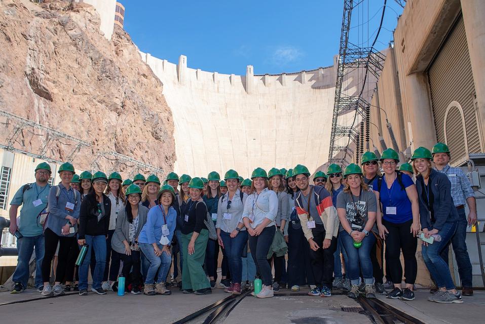
We explored the lower Colorado River where virtually every drop
of the river is allocated, yet demand is growing from myriad
sources — increasing population, declining habitat, drought and
climate change.
The 1,450-mile river is a lifeline to 40 million people in
the Southwest across seven states and Mexico. How the Lower Basin
states – Arizona, California and Nevada – use and manage this
water to meet agricultural, urban, environmental and industrial
needs was the focus of this tour.
Hampton Inn Tropicana
4975 Dean Martin Drive, Las Vegas, NV 89118
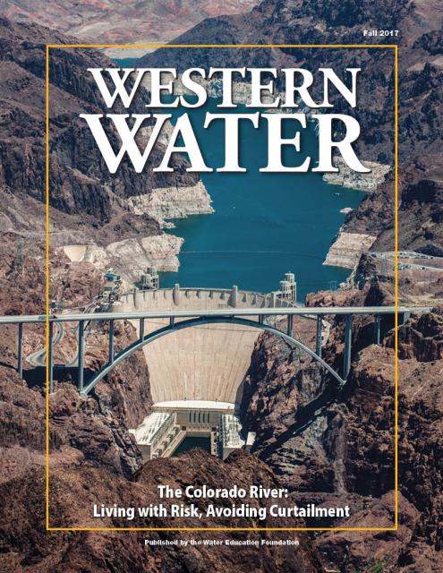
This issue of Western Water discusses the challenges
facing the Colorado River Basin resulting from persistent
drought, climate change and an overallocated river, and how water
managers and others are trying to face the future.
Whiskeytown Lake, a major reservoir in the foothills of the
Klamath Mountains nine miles west of Redding, was
built at the site of one of Shasta County’s first Gold Rush
communities. Whiskeytown, originally called Whiskey Creek
Diggings, was founded in 1849 and named in reference to a whiskey
barrel rolling off a citizen’s pack mule; it may also refer to
miners drinking a barrel per day.
The All-American Canal delivers
Colorado River water to
the Imperial Valley,
sustaining a desert valley that is one of the most productive
agricultural regions in the world. The canal, about 80 miles
long, joins the Imperial
Dam (and its desilting works) and the 123-mile-long
Coachella Canal to complete the All-American Canal System.
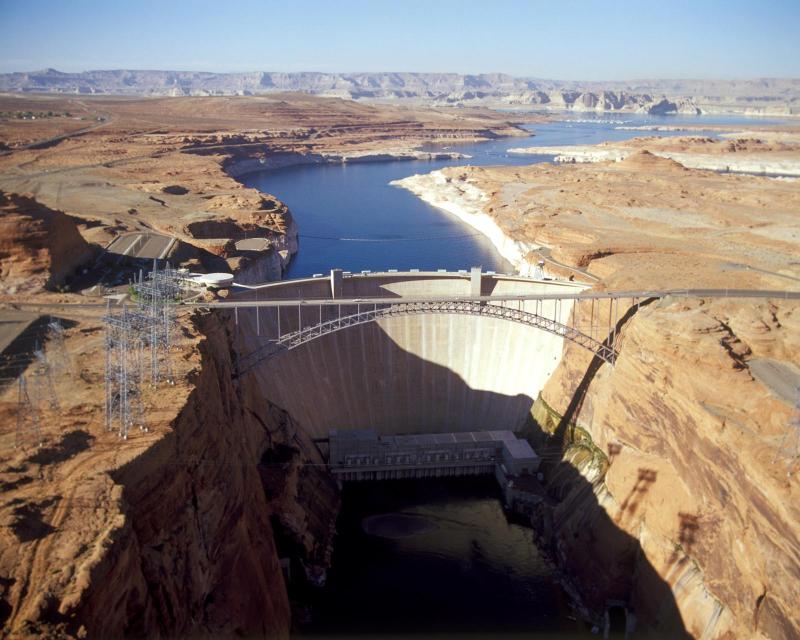
The construction of Glen Canyon Dam
in 1964 created Lake Powell. Both are located in north-central
Arizona near the Utah border. Lake Powell acts as a holding tank
for outflow from the Colorado River Upper Basin States: Colorado,
New Mexico, Utah and Wyoming.
The water stored in Lake Powell is used for recreation, power
generation and delivering water to the Lower Basin states of
California, Arizona, and Nevada.
The Klamath River Basin is one of the West’s most important and
contentious watersheds.
The watershed is known for its unusual geography straddling
California and Oregon. Unlike many western rivers, the
Klamath does not originate in snowcapped mountains but rather on
a volcanic plateau.
A broad patchwork of spring-fed streams and rivers in
south-central Oregon drains into Upper Klamath Lake and down into
Lake Ewauna in the city of Klamath Falls. The outflow from Ewauna
marks the beginning of the 263-mile Klamath River.
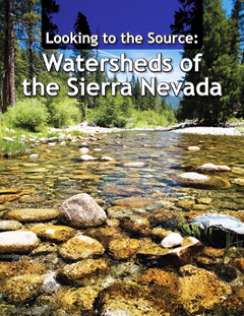
This 28-page report describes the watersheds of the Sierra Nevada
region and details their importance to California’s overall water
picture. It describes the region’s issues and challenges,
including healthy forests, catastrophic fire, recreational
impacts, climate change, development and land use.
The report also discusses the importance of protecting and
restoring watersheds in order to retain water quality and enhance
quantity. Examples and case studies are included.
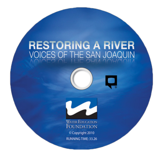
This 30-minute documentary-style DVD on the history and current
state of the San Joaquin River Restoration Program includes an
overview of the geography and history of the river, historical
and current water delivery and uses, the genesis and timeline of
the 1988 lawsuit, how the settlement was reached and what was
agreed to.
Many Californians don’t realize that when they turn on the
faucet, the water that flows out could come from a source close
to home or one hundreds of miles away. Most people take their
water for granted; not thinking about the elaborate systems and
testing that go into delivering clean, plentiful water to
households throughout the state. Where drinking water comes from,
how it’s treated, and what people can do to protect its quality
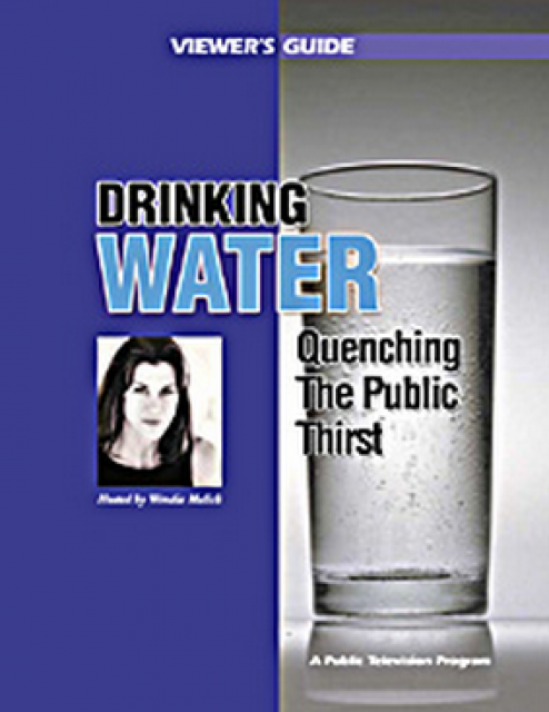
are highlighted in this 2007 PBS documentary narrated by actress
Wendie Malick.
A 30-minute version of the 2007 PBS documentary Drinking Water:
Quenching the Public Thirst. This DVD is ideal for showing at
community forums and speaking engagements to help the public
understand the complex issues surrounding the elaborate systems
and testing that go into delivering clean, plentiful water to
households throughout the state.
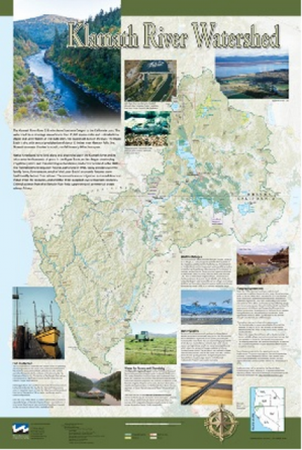
This beautiful 24×36-inch poster, suitable for framing, displays
the rivers, lakes and reservoirs, irrigated farmland, urban areas
and Indian reservations within the Klamath River Watershed. The
map text explains the many issues facing this vast,
15,000-square-mile watershed, including fish restoration;
agricultural water use; and wetlands. Also included are
descriptions of the separate, but linked, Klamath Basin
Restoration Agreement and the Klamath Hydroelectric Agreement,
and the next steps associated with those agreements. Development
of the map was funded by a grant from the U.S. Fish and Wildlife
Service.
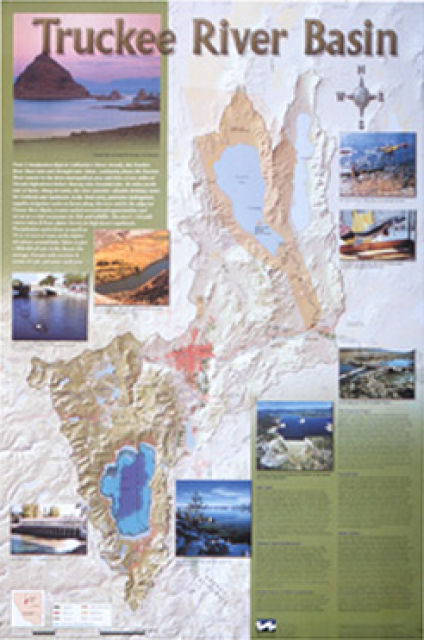
This beautiful 24×36-inch poster, suitable for framing, displays
the rivers, lakes and reservoirs, irrigated farmland, urban areas
and Indian reservations within the Truckee River Basin, including
the Newlands Project, Pyramid Lake and Lake Tahoe. Map text
explains the issues surrounding the use of the Truckee-Carson
rivers, Lake Tahoe water quality improvement efforts, fishery
restoration and the effort to reach compromise solutions to many
of these issues.
Redesigned in 2017, this beautiful map depicts the seven
Western states that share the Colorado River with Mexico. The
Colorado River supplies water to nearly 40 million people in
Arizona, California, Colorado, Nevada, New Mexico, Utah, Wyoming
and Mexico. Text on this beautiful, 24×36-inch map, which is
suitable for framing, explains the river’s apportionment, history
and the need to adapt its management for urban growth and
expected climate change impacts.
The 24-page Layperson’s Guide to the State Water Project provides
an overview of the California-funded and constructed State Water
Project.
The State Water Project is best known for the 444-mile-long
aqueduct that provides water from the Delta to San Joaquin Valley
agriculture and southern California cities. The guide contains
information about the project’s history and facilities.
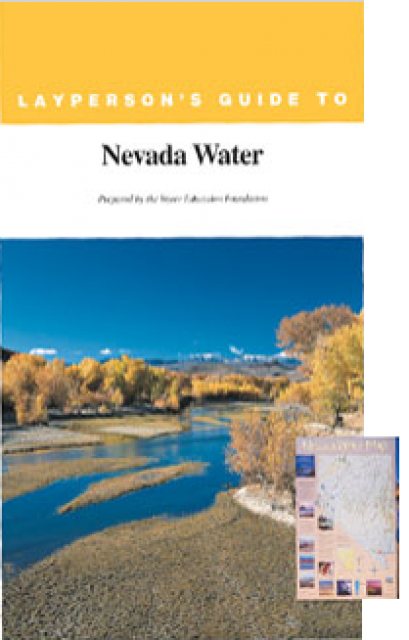
The 28-page Layperson’s Guide to Nevada Water provides an
overview of the history of water development and use in Nevada.
It includes sections on Nevada’s water rights laws, the history
of the Truckee and Carson rivers, water supplies for the Las
Vegas area, groundwater, water quality, environmental issues and
today’s water supply challenges.
The Water Education Foundation’s second edition of
the Layperson’s Guide to The Klamath River Basin is
hot off the press and available for purchase.
Updated and redesigned, the easy-to-read overview covers the
history of the region’s tribal, agricultural and environmental
relationships with one of the West’s largest rivers — and a
vast watershed that hosts one of the nation’s oldest and
largest reclamation projects.
Hydroelectric power is a relatively
pollution-free source of electricity generated at a comparatively
low cost. Its ability to generate electricity, however, can drop
significantly during a drought.
In 2024, hydropower accounted for more than
24% of all renewable electricity generation in the nation,
according to the U.S. Department of Energy.
The Yuba River is a major tributary
to the Feather River and the larger Sacramento River watershed with
an average annual runoff of about 2.4 million acre-feet. The
river originates high in the snow-capped Sierra Nevada and flows through
granitic canyons and rolling foothills before joining the Feather
River at Yuba City.
The Trinity River flows for 700
twisting, winding miles from the rugged Trinity Alps in
northwestern California to the Pacific Ocean. In the upper reach
of the Trinity River are two dams – Trinity Dam and Lewiston Dam
– that store and divert water to the Sacramento Valley as part of
the Central Valley
Project (CVP).
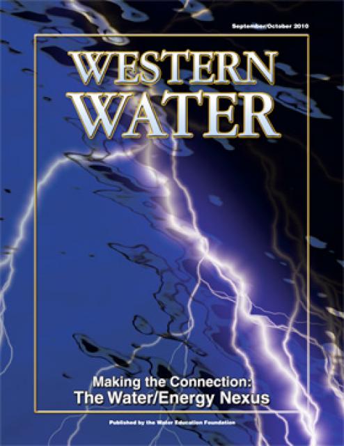
This printed issue of Western Water looks at the energy
requirements associated with water use and the means by which
state and local agencies are working to increase their knowledge
and improve the management of both resources.
Diverting water for farms and cities, generating hydro-electric
power, supplying an ever-growing urban population and protecting
endangered species have all shaped the development and management
of the Colorado River we know today. How to sustain the system
and build a resilient future for what is known as the “lifeline
of the Southwest” is the task facing the region and the river’s
multiple users.
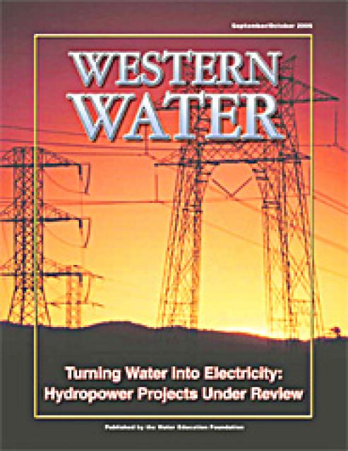
Hydropower generation is prevalent in the West, where rapidly
flowing river systems have been tapped for generations to produce
electricity. Hydropower is a clean, steady and reliable energy
source, but the damming of rivers has exacted a toll on the
environment, affecting, among other things, the migration of fish
to vestigial spawning grounds. Many of those projects are due to
be relicensed by the Federal Energy Regulatory Commission.
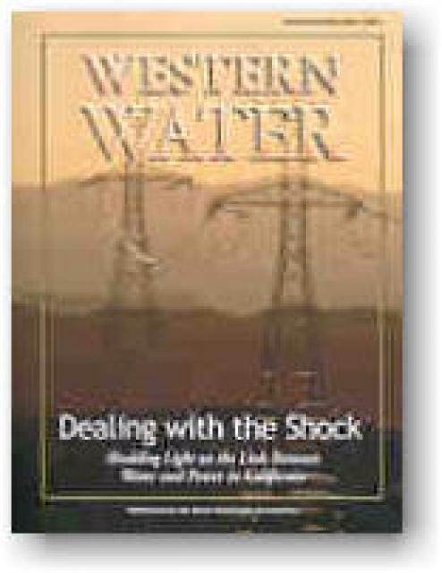
The vital importance of water in the West is a given. It is the
basis upon which everything moves forward – the burgeoning
subdivisions, the seemingly limitless acreage of fruits and
vegetables and the remaining stretches of wilderness that support
fish, fowl and wildlife. In addition to its life-sustaining
properties, water, more specifically the force of moving water,
plays a significant part of the nation’s power system by
providing an inexpensive, reliable and renewable generation
source.
Those on the California water insider track know all too well the
fine line the state walks with regard to maintaining its water
supply. Hydrologic conditions put California at the mercy of the
weather and some are predicting this year could be the start of a
dry cycle not just for the state, but the Southwest as a whole.
Combine that with a regional dry spell in the Northwest and
California’s power woes, and a potential recipe for disaster
begins to solidify.


 and other tributaries of the upper Colorado River have declined dramatically and contributed to the precipitous declines of Lake Powell and Lake Mead. (Source: The Water Desk)")

")
")
")
")
: Karla Nemeth, director, California Department of Water Resources; Gloria Gray, chair, Metropolitan Water District of Southern California; Brenda Burman, Bureau of Reclamation Commissioner; Jayne Harkins, commissioner, International Boundary and Water Commission, U.S. and Mexico; Amy Haas, executive director, Upper Colorado River Commission.")
")


. Credit: U.S. Bureau of Reclamation")


")