Header link June 22, 2020

LinkedIn

  • Read more
Header link September 15, 2014

Cart

  • Read more
Header link November 3, 2015

Donate Now

  • Read more
Header link May 15, 2014

Twitter

  • Read more
Header link May 15, 2014

Facebook

  • Read more
Instagram
Header link May 15, 2014

Instagram

  • Read more
Header link May 15, 2014

Contact Us

  • Read more
More options
Water Education Foundation
Home

Water Education Foundation

Everything about California water that matters
  • Water Academy
    • Agriculture
      • Agricultural Conservation
      • Agricultural Drainage
    • Background Information
      • Legislation — California and Federal
      • Regulations — California and Federal
      • Water History
      • Water Rights
    • Bay-Delta
      • Bay Delta
      • Bay Delta Conservation Plan
      • Delta Issues
      • Delta Smelt
      • Sacramento San Joaquin Delta
      • San Francisco Bay
      • Suisun Marsh
    • Dams, Reservoirs and Water Projects
      • California Aqueduct
      • Central Valley Project
      • Folsom Dam
      • Friant Dam
      • Hetch Hetchy
      • Hoover Dam
      • Infrastructure
      • Lake Mead
      • Lake Powell
      • Oroville Dam
      • San Luis Dam
      • Shasta Dam
      • State Water Project
    • Environmental Issues
      • Anadromous Fish Restoration
      • Ecosystem
      • Endangered Species Act
      • Invasive species
      • Lake Tahoe
      • Mono Lake
      • Public Trust Doctrine
      • Salmon
      • San Joaquin River Restoration
      • Watershed
      • Wetlands
    • Leaders and Experts
    • Regions
      • Central Coast
      • Central Valley
      • Mexico
      • Nevada
      • North Coast
      • Pyramid Lake
      • Sacramento Valley
      • Salton Sea
      • San Joaquin Valley
      • Sierra Nevada
      • Southern California
      • Tulare Lake Basin
    • Rivers
      • Carson River
      • Colorado River
      • Klamath River
      • New River
      • North Coast Rivers
      • Russian River
      • Sacramento River
      • Truckee River
      • San Joaquin River
    • Water Issues
      • Climate Change
      • Coronavirus
      • Drought
      • Earthquakes
      • Energy and Water
      • Flood Management
      • Fracking
      • Growth
      • Hydropower
      • Levees
      • Tribal Water Issues
      • Water Conservation
      • Water Equity
    • Water Quality
      • Drinking Water
      • Nitrate contamination
      • Pollution
      • Stormwater
      • Wastewater
      • Water Quality
    • Water Supply and Management
      • Acre Foot
      • Aquifers
      • California Water Plan
      • Conjunctive Use
      • Desalination
      • Grey water
      • Groundwater
      • Integrated Regional Water Management
      • Recreation
      • Surface Water
      • Water Marketing and Banking
      • Water Rates
      • Water Recycling
      • Water Supply
      • Water Transfers
  • Tours & Events
    • Water Tours
      • 2023 Tour Sponsors
    • Events
    • Event Calendar
    • Past Tours & Events
      • Anne J. Schneider Fund Lecture Series
  • Specialized Programs
    • Water Leaders
      • Class Rosters
      • Yearly Class Reports
      • Your Alumni Network
      • Alumni Profiles
    • Project WET
      • Workshops
      • Special Workshops & Events
      • Supplementary Materials
      • California Content Standard Correlations
      • Facilitator's Trainings
      • Foundation School Programs
        • Elementary Programs
        • Secondary Programs
      • Water Kids
      • California Project WET Gazette
      • Gazette Archives
    • Colorado River Project
    • GRA Scholastic Fund Program
  • Maps & Guides
    • Maps & Posters
    • Layperson's Guides
    • Map & Guide Bundles
    • Books
    • Colorado River Materials
    • California Runoff Rundown
    • Other Publications
    • Water Awareness Materials
    • Downloadable Publications
    • Videos and DVDs
      • Video Clips
    • School Age Publications
    • Stickers
    • Free Programs and Publications
  • Newsroom
    • Western Water News
    • Aquafornia
      • About Aquafornia
    • Information Desk
    • Western Water Magazine Archive
      • Full Print Edition
      • Print Edition Excerpts
    • River Report Archive
  • Aquapedia
    • Alphabetical List of Subjects
      • A
      • B
      • C
      • D
      • E
      • F
      • G
      • H
      • I
      • J
      • K
      • L
      • M
      • N
      • O
      • P
      • Q
      • R
      • S
      • T
      • U
      • V
      • W
      • X
      • Y
      • Z
    • Historical Water People
    • Where Does My Water Come From?
      • Northern California
      • Sacramento
      • North Bay
      • South Bay
      • Central Valley
      • Los Angeles
      • Inland Empire
      • San Diego
      • All California Water Sources
    • Timelines
    • Videos
    • Image Gallery
    • Water Directory
      • Federal Agencies
      • State Agencies in California
      • Environmental Organizations
      • Other California Organizations
      • State and Federal Legislative Committees
      • Water Associations and Groups
      • Western States Water Agencies and Districts
    • Online Resources
    • Useful Acronyms
    • About Aquapedia
  • About
    • About Us
      • Board of Directors
      • Staff Biographies
      • Job Openings
    • Announcements
    • Support Our Mission
      • Become a Member
      • Donate in Honor/Memory
      • Donate to Aquapedia or Aquafornia
      • Shop Amazon
      • Planned Giving
    • Contact Us
Aquapedia background February 10, 2014

Klamath River Basin

 Klamath River Basin

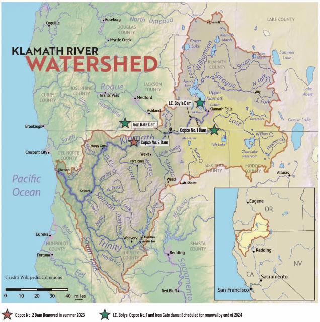
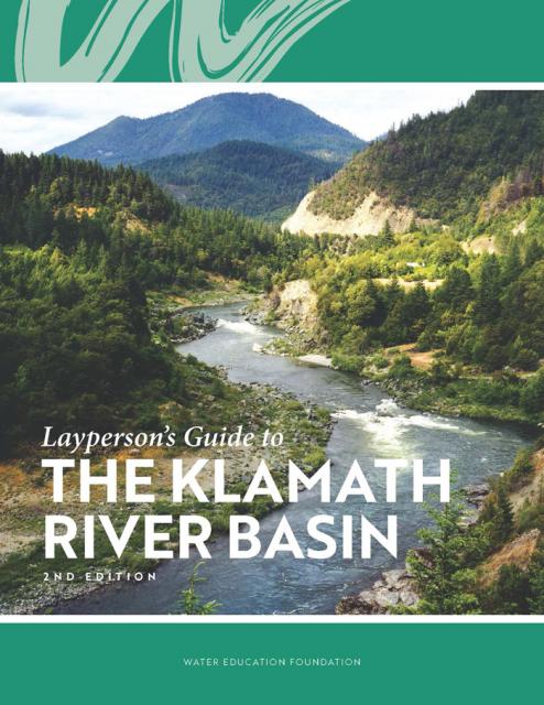
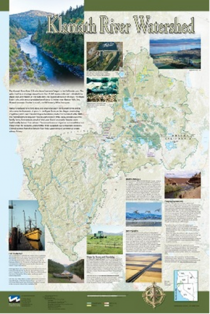
The Klamath River flows 253 miles from Southern Oregon to the California coast, draining a basin of more than 15,000 square miles.

The watershed and its fisheries have been the subject of negotiation since the 1860—negotiations that have intensified and continue to this day [see also Klamath River timeline].

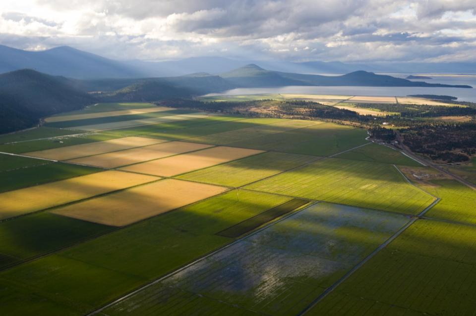
Irrigation water has been drawn from these rivers since the late 19th century, and agricultural development drained vast areas of wetlands  on the periphery of Upper Klamath Lake and in upstream watersheds. Some of this drained acreage has been restored and is now managed primarily for wetland benefits. More recently, dams in the basin have generated hydroelectric power, but have impacted aquatic species.

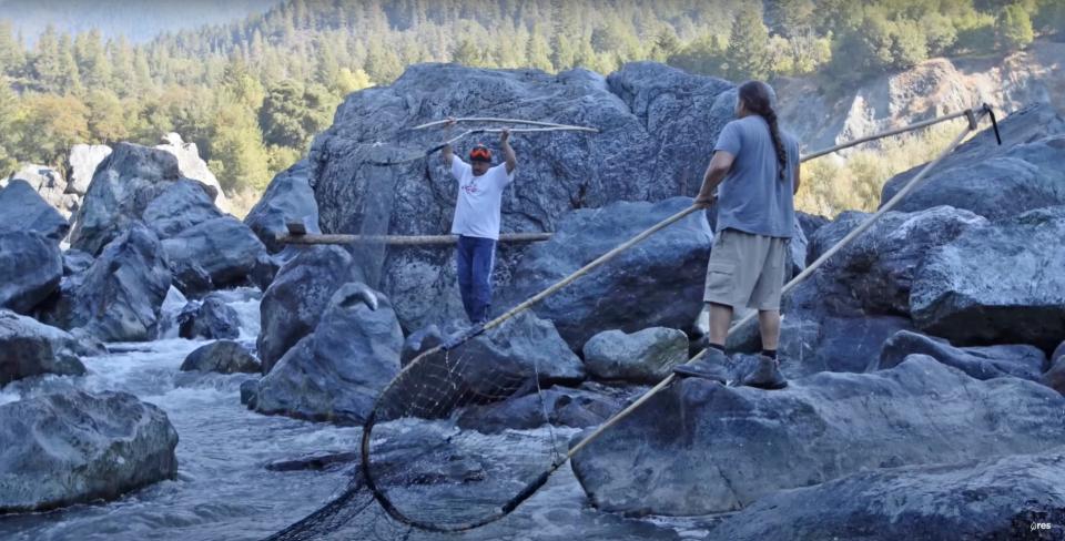
Native Americans have a significant presence in the Klamath Basin. Four major tribes have been influential in water negotiations: the Klamath Tribes, the Karuk Tribe, the Hoopa Valley Tribe and the Yurok Tribe.

The watershed is divided geographically into two basins, upper and lower, divided by Iron Gate Dam, the lower most dam on the river.

The Upper Basin is dry, with annual precipitation of about 13 inches at the river’s origin near Klamath Falls, Ore. Downstream, the climate grows wetter. [See also Klamath Basin Water Quality.]

Klamath River Basin Challenges

Today, about 85 percent of the Klamath Project’s roughly 210,000 acres of farmland is irrigated with water from the Klamath River system via canals from Upper Klamath Lake and Keno Reservoir.

Since 1992, water management in the Klamath Basin has been influenced by federal mandates to restore populations of fish protected by the Endangered Species Act. These mandates have led, in some years, to reductions in water deliveries to Klamath Project irrigators.

At Klamath, California, near the river’s mouth, rainfall is nearly 80 inches a year.

In Upper Klamath Lake, the water surface must be kept above certain levels to maintain habitat for the endangered shortnose sucker and Lost River sucker. In the Klamath River below Iron Gate Dam, flows must be regulated for the benefit of threatened Klamath Basin coho salmon. The coho flow requirements also impact the management of water levels in the Upper Klamath Lake because the lake is the headwaters of the river.

Efforts to protect these fish have sparked controversy, however.

In early April 2001, for instance, the U.S. Fish and Wildlife Service and National Marine Fisheries Service issued biological opinions concerning the Klamath Project to protect endangered suckers and coho salmon. These biological opinions raised the minimum level of water required in Upper Klamath Lake and mandated certain minimum flows in the Klamath River.  In turn, the water cutoff affected about 85 percent of Klamath Project acreage, alarming farmers and local businesses and communities.

In March 2002, a National Academy of Sciences committee concluded that there was insufficient scientific support for the fish-driven restrictions on irrigation deliveries imposed in 2001.

Also in 2002, an unprecedented disease outbreak in the lower reaches of the Klamath River killed tens of thousands of migrating salmon.

After the die-off, the Pacific Coast Federation of Fishermen’s Associations sued Reclamation, alleging that irrigation deliveries to the Klamath Project had violated the ESA. The fishermen eventually prevailed and a federal court ordered an increase to minimum flows in the lower river.

Klamath River Next Steps

The Klamath River Basin’s water disputes have been notoriously intractable.

The needs of each of the Basin’s many water interests — from farmers to tribes to commercial salmon fishermen to wildlife refuges — have often conflicted with one another.

In recent years, there has been a major multilateral effort to reach a compromise.

This effort has yielded two linked agreements, the Klamath Basin Restoration Agreement and the Klamath Hydroelectric Settlement Agreement. The agreements include:

  • removal of four hydroelectric dams as early as 2020 if the secretary of the Interior determines that this step is in the overall public interest and beneficial to fish
  • division of water in the Upper Klamath Basin among farmers, wildlife refuges and environmental uses in a way that is acceptable to the parties that signed the agreements
  • funding of a 10-year habitat restoration effort focused on salmon recovery

These proposals aim to ease tensions among stakeholders and to bring about a major salmon restoration effort.

In early 2010, after years of difficult negotiations, the final package of agreements was signed. The deals were endorsed by many farmers and ranchers, three tribes, commercial and sport fishing groups, river conservation groups, Klamath and Humboldt counties, the governments of California and Oregon, PacifiCorp and the federal government. However, the agreements depend on approval of Congress and have yet to be enacted.

In the meantime, Klamath tribes were awarded water rights to the Upper Klamath Basin in March, 2013. The tribes now have oversight of Klamath River flows under the “the first in time, first in use” water doctrine. With the Klamath River basin experiencing a severe drought, area farmer are concerned about access to Klamath water for irrigation.  These developments have the potential to trigger a new round of Klamath water wars and unravel the Klamath Basin Restoration Agreement.

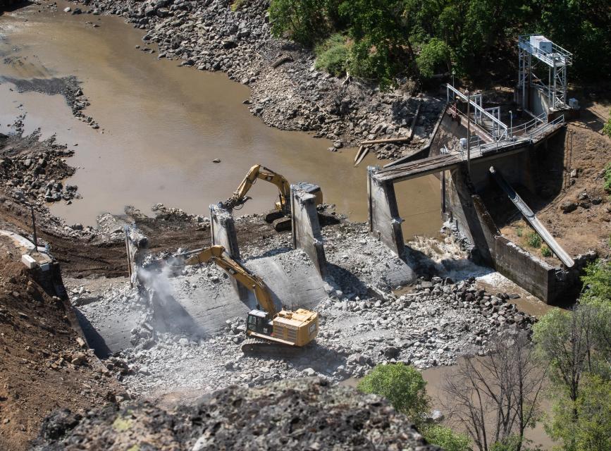
In April 2016, stakeholders signed an agreement to inaugurate the removal of four hydropower-producing dams in California - Copco 1, Copco 2 and the Iron Gate Dam – and the John C. Boyle Dam in Oregon. Even though owner PacifiCorp’s license to operate the dams expired in 2006, an attempt to forge a comprehensive restoration aided by the federal government collapsed because of Congress’ failure to act on it.

Instead, California and Oregon are proceeding based on the framework of the Klamath Hydropower Settlement Act, the Klamath Basin Restoration Agreement and the Upper Klamath Basin Comprehensive Agreement, which were developed to resolve what the California Natural Resources Agency has called the “long-standing, complex, and intractable conflicts over natural resources in the Klamath Basin.”

The two states formed a nonprofit organization called the Klamath River Renewal Corporation to take control of the four dams and commence the decommissioning process through the Federal Energy Regulatory Commission (FERC). The dam removals are expected to begin in 2023.

The Klamath dams exist solely for hydropower generation and bringing them up to FERC standards would cost about $400 million. Removing the dams is estimated to cost as much as $450 million and PacifiCorp has agreed to pay the first $200 million. California has pledged $250 million from Proposition 1, the water bond approved by voters in November 2014.

  • Print-friendly

Referring Pages

Share this page

  • Share on Facebook
  • Share on Twitter
  • Share on LinkedIn
  • Sent to a friend.
Print-friendly

Related Links

Aquapedia background February 10, 2014
Back
This item appears in:
  • K
Footer pod May 20, 2014

Water Education Foundation

Copyright © 2023 Water Education Foundation. All rights reserved.

The Water Education Foundation is a nonprofit, tax-exempt, 501(c)3 organization, federal tax ID #942419885.

Privacy Policy

Donor Privacy Policy

  • Read more
Footer pod May 20, 2014

Contact Information

2151 River Plaza Drive, Suite 205
Sacramento CA 95833

Telephone (916) 444-6240

Contact Us via email

  • Read more

Quicklinks

Footer quicklink May 20, 2014

Contact Us

  • Read more
Footer quicklink May 20, 2014

Donate Today

  • Read more
Footer quicklink May 20, 2014

Tours

  • Read more
Footer quicklink May 20, 2014

Newsletter Signup

  • Read more
Footer quicklink May 20, 2014

Foundation News

  • Read more
Footer quicklink May 20, 2014

Calendar

  • Read more

Log in

  • Create new account
  • Request new password

Commands

  • Support portal
  • Log in