Federal reserved rights were created when the United States
reserved land from the public domain for uses such as Indian
reservations, military bases and national parks, forests and
monuments. [See also Pueblo Rights].
One of the major characteristics of federal reserved water rights
is that they often are senior in priority to water rights
established under state law. The date of priority of a federal
reserved right is the date the reservation was established, and
many were established prior to state water claims.
Flood forecasting allows flood control managers to predict,
with a high degree of accuracy, when local flooding is
likely to take place.
Forecasts typically use storm runoff data, reservoir levels and
releases to predict the rise in river levels.
In Northern California the National Weather Service, in
cooperation with the state’s California-Nevada River Forecast
Center in Sacramento, forecasts flooding.
When people think of natural
disasters in California, they typically think about earthquakes.
Yet the natural disaster that residents are most likely to face
involves flooding, not fault lines. In fact, all 58 counties in
the state have declared a state of emergency from flooding at
least three times since 1950. And the state’s capital,
Sacramento, is considered one of the nation’s most flood-prone
cities. Floods also affect every Californian because flood
management projects and damages are paid with public funds.
Liability for levee failure in California took a new turn after a
court ruling found the state liable for hundreds of millions of
dollars from the 1986 Linda Levee collapse in Yuba County. The
levee failure killed two people and destroyed or damaged about
3,000 homes.
The collapse also had long-term legal ramifications.
The Paterno Decision
California’s Supreme Court found that, “when a public entity
operates a flood management system built by someone else, it
accepts liability as if it had planned and built the system
itself.”
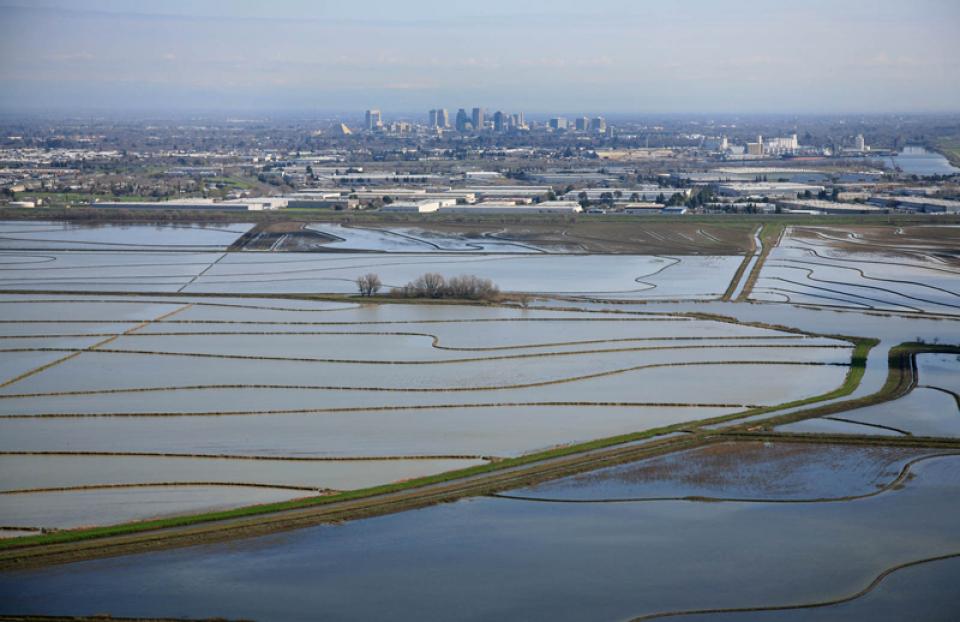
With the dual threats of aging levees and anticipated rising sea levels,
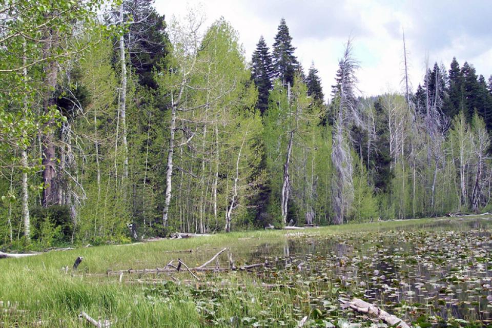
floodplains — low
areas along waterways that flood during wet years — are
increasingly at the forefront of many public policy and water
issues in California.
Adding to the challenges, many floodplains have been heavily
developed and are home to major cities such as Sacramento. Large
parts of California’s valleys are historic floodplains as well.
Folsom Dam is a multi-purpose dam
on the American
River about 23 miles east of Sacramento. Originally
authorized in 1944 solely as a flood control facility, Folsom Dam
was reauthorized in 1949, a year after construction began, as a
multi-purpose facility for flood
control, water storage and hydroelectric generation.
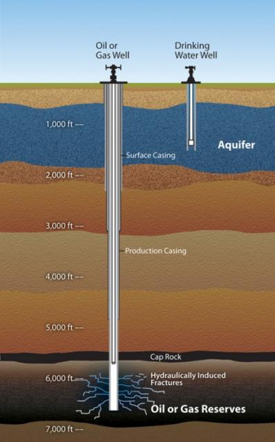
Hydraulic fracturing, commonly known as fracking, injects high
pressure volumes of water, sand and chemicals into existing wells
to unlock natural gas and oil. The technique essentially
fractures the rock to get to the otherwise unreachable deposits.
The United States
Geological Survey (USGS) defines freshwater as containing
less than 1,000 milligrams per liter dissolved solids. However,
500 milligrams per liter is usually the cutoff for municipal and
commercial use. Most of the Earth’s water is saline, 97.5
percent with only 2.5 percent fresh.
Friant Dam, located just north of
Fresno, is a part of the federal Central Valley
Project and captures the upper
San Joaquin River’s flow in Millerton Lake. The 319-foot-high
concrete gravity dam diverts water into the 152-mile
Friant-Kern Canal,
which delivers water south to Bakersfield, and the Madera Canal,
which runs 36 miles to the north.
A part of the federal Central Valley
Project (CVP), the 152-mile Friant-Kern Canal in
California’s San Joaquin
Valley plays a critical role in delivering water to 1 million
acres of farmland and 250,000 people from the Fresno area south
to Bakersfield.
The Friant-Kern Canal was designed as a gravity-fed facility and
does not rely on pumps to move water. It is part of the CVP’s
Friant Division Project that stores water from the
San Joaquin River in Millerton Lake behind Friant Dam, 10 miles northeast of
Fresno. The Madera Canal takes some of that water north to
Chowchilla.


 overtops the Tisdale Weir in Sutter County south of Yuba City on Feb. 6, 2024. Weirs allow flood flows above the downstream channel capacity to escape into a bypass channel or basin. Credit: California Department of Water Resources")