Header link June 22, 2020

LinkedIn

  • Read more
Header link September 15, 2014

Cart

  • Read more
Header link November 3, 2015

Donate Now

  • Read more
Header link May 15, 2014

Twitter

  • Read more
Header link May 15, 2014

Facebook

  • Read more
Instagram
Header link May 15, 2014

Instagram

  • Read more
Header link May 15, 2014

Contact Us

  • Read more
More options
Water Education Foundation
Home

Water Education Foundation

Everything about California water that matters
  • Water Academy
    • Agriculture
      • Agricultural Conservation
      • Agricultural Drainage
    • Background Information
      • Legislation — California and Federal
      • Regulations — California and Federal
      • Water History
      • Water Rights
    • Bay-Delta
      • Bay Delta
      • Bay Delta Conservation Plan
      • Delta Issues
      • Delta Smelt
      • Sacramento San Joaquin Delta
      • San Francisco Bay
      • Suisun Marsh
    • Dams, Reservoirs and Water Projects
      • California Aqueduct
      • Central Valley Project
      • Folsom Dam
      • Friant Dam
      • Hetch Hetchy
      • Hoover Dam
      • Infrastructure
      • Lake Mead
      • Lake Powell
      • Oroville Dam
      • San Luis Dam
      • Shasta Dam
      • State Water Project
    • Environmental Issues
      • Anadromous Fish Restoration
      • Ecosystem
      • Endangered Species Act
      • Invasive species
      • Lake Tahoe
      • Mono Lake
      • Public Trust Doctrine
      • Salmon
      • San Joaquin River Restoration
      • Watershed
      • Wetlands
    • Leaders and Experts
    • Regions
      • Central Coast
      • Central Valley
      • Mexico
      • Nevada
      • North Coast
      • Pyramid Lake
      • Sacramento Valley
      • Salton Sea
      • San Joaquin Valley
      • Sierra Nevada
      • Southern California
      • Tulare Lake Basin
    • Rivers
      • Carson River
      • Colorado River
      • Klamath River
      • New River
      • North Coast Rivers
      • Russian River
      • Sacramento River
      • Truckee River
      • San Joaquin River
    • Water Issues
      • Climate Change
      • Coronavirus
      • Drought
      • Earthquakes
      • Energy and Water
      • Floods
      • Fracking
      • Growth
      • Hydropower
      • Levees
      • Tribal Water Issues
      • Water Conservation
    • Water Quality
      • Drinking Water
      • Nitrate contamination
      • Pollution
      • Stormwater
      • Wastewater
      • Water Quality
    • Water Supply and Management
      • Acre Foot
      • Aquifers
      • California Water Plan
      • Conjunctive Use
      • Desalination
      • Grey water
      • Groundwater
      • Integrated Regional Water Management
      • Recreation
      • Surface Water
      • Water Marketing and Banking
      • Water Rates
      • Water Recycling
      • Water Supply
      • Water Transfers
  • Tours & Events
    • Water Tours
      • 2024 Tour Sponsors
    • Events
    • Event Calendar
    • Past Tours & Events
      • Anne J. Schneider Fund Lecture Series
  • Specialized Programs
    • Water Leaders
      • Cohort Rosters
      • Yearly Class Reports
      • Your Alumni Network
      • Alumni Profiles
    • Project WET
      • Workshops
      • Special Workshops & Events
      • Supplementary Materials
      • California Content Standard Correlations
      • Facilitator's Trainings
      • Foundation School Programs
        • Elementary Programs
        • Secondary Programs
      • Water Kids
      • California Project WET Gazette
      • Gazette Archives
    • Colorado River Project
    • GRA Scholastic Fund Program
  • Maps & Guides
    • Maps & Posters
    • Layperson's Guides
    • Map & Guide Bundles
    • Books
    • Colorado River Materials
    • California Runoff Rundown
    • Other Publications
    • Water Awareness Materials
    • Downloadable Publications
    • Videos and DVDs
      • Video Clips
    • School Age Publications
    • Stickers
    • Free Programs and Publications
  • Newsroom
    • Western Water News
    • Aquafornia
      • About Aquafornia
    • Information Desk
    • Western Water Magazine Archive
      • Full Print Edition
      • Print Edition Excerpts
    • River Report Archive
  • Aquapedia
    • Alphabetical List of Subjects
      • A
      • B
      • C
      • D
      • E
      • F
      • G
      • H
      • I
      • J
      • K
      • L
      • M
      • N
      • O
      • P
      • Q
      • R
      • S
      • T
      • U
      • V
      • W
      • X
      • Y
      • Z
    • Historical Water People
    • Where Does My Water Come From?
      • Northern California
      • Sacramento
      • North Bay
      • South Bay
      • Central Valley
      • Los Angeles
      • Inland Empire
      • San Diego
      • All California Water Sources
    • Timelines
    • Videos
    • Image Gallery
    • Water Directory
      • Federal Agencies
      • State Agencies in California
      • Environmental Organizations
      • Other California Organizations
      • State and Federal Legislative Committees
      • Water Associations and Groups
      • Western States Water Agencies and Districts
    • Online Resources
    • Useful Acronyms
    • About Aquapedia
  • About
    • About Us
      • Board of Directors
      • Staff Biographies
      • Job Openings
    • Announcements
    • Support Our Mission
      • Become a Member
      • Donate in Honor/Memory
      • Planned Giving
    • Contact Us
Publication May 20, 2014

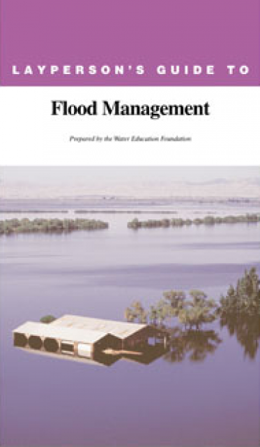
Layperson’s Guide to Flood Management
Updated 2009

The 24-page Layperson’s Guide to Flood Management explains the physical flood control system, including levees; discusses previous flood events (including the 1997 flooding); explores issues of floodplain management and development; provides an overview of flood forecasting; and outlines ongoing flood control projects. 

The 2009 version includes information on California’s new FloodSAFE effort, ongoing and expected levee repairs, and how climate change could affect precipitation and runoff patterns. Order in bulk (25 or more copies of the same guide) for a reduced fee. Contact the Foundation, 916-444-6240, for details.

  • Print-friendly

Referring Pages

Western Water February 28, 2019 California Groundwater Map Layperson's Guide to Flood Management Gary Pitzer

Southern California Water Providers Think Local in Seeking to Expand Supplies
WESTERN WATER SIDEBAR: Los Angeles and San Diego among agencies pursuing more diverse water portfolio beyond imports

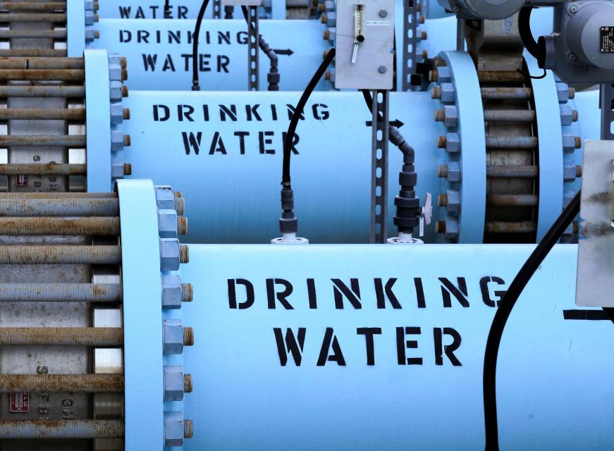
The Claude “Bud” Lewis Desalination Plant in Carlsbad last December marked 40 billion gallons of drinking water delivered to San Diego County during its first three years of operation. The desalination plant provides the county with more than 50 million gallons of water each day.Although Santa Monica may be the most aggressive Southern California water provider to wean itself from imported supplies, it is hardly the only one looking to remake its water portfolio.

In Los Angeles, a city of about 4 million people, efforts are underway to dramatically slash purchases of imported water while boosting the amount from recycling, stormwater capture, groundwater cleanup and conservation. Mayor Eric Garcetti in 2014 announced a plan to reduce the city’s purchase of imported water from Metropolitan Water District by one-half by 2025 and to provide one-half of the city’s supply from local sources by 2035. (The city considers its Eastern Sierra supplies as imported water.)

  • Read more
Aquapedia background December 1, 2017 Layperson's Guide to Flood Management

Atmospheric Rivers

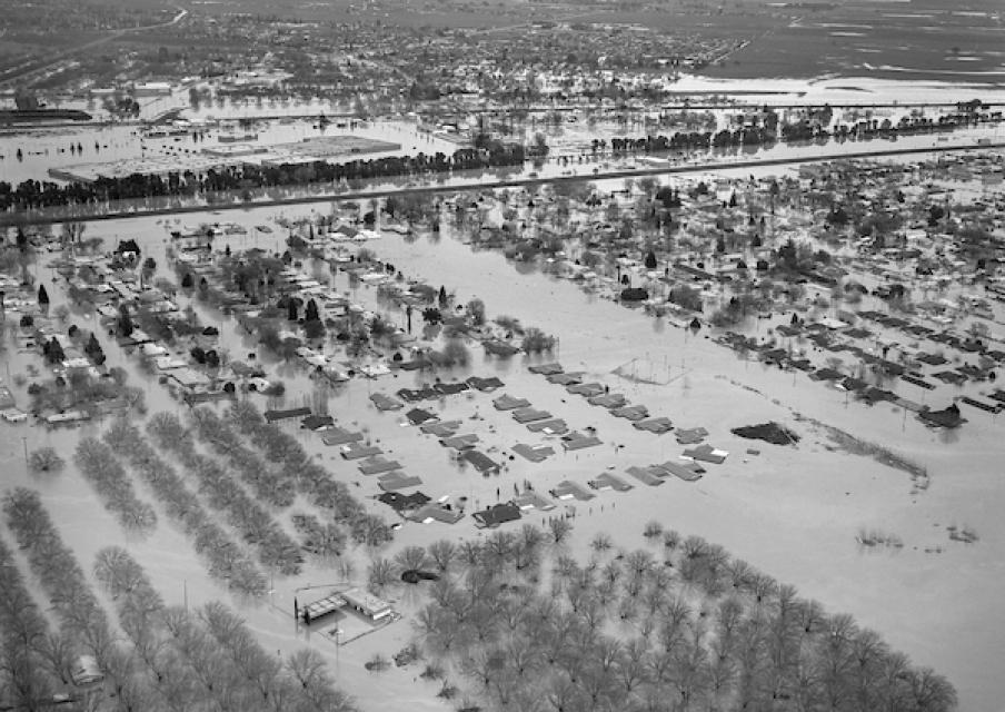
A massive 1986 Northern California flood near Marysville, north of Sacramento, caused the south levee of the Yuba River to breach, forcing thousands of residents to evacuate their homes.Atmospheric rivers are relatively narrow bands of moisture that ferry precipitation across the Pacific Ocean to the West Coast and are key to California’s water supply.

They are commonly referred to as the “Pineapple Express” because of their origins in tropical regions. While atmospheric rivers are necessary to keep California’s water reservoirs full, some of them are dangerous because the extreme rainfall and wind can cause catastrophic flooding and damage. Their presence has been likened to the West Coast version of the hurricane hazard posed to the southeastern United States.

  • Read more
Aquapedia background December 29, 2016 Layperson's Guide to Flood Management

ARkStorm

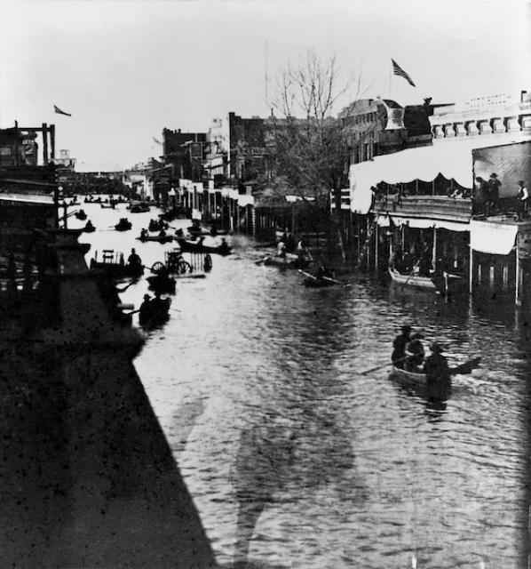
Sacramento's K Street during the 1862 flood that inundated the Central Valley.ARkStorm stands for an atmospheric river (“AR”) that carries precipitation levels expected to occur once every 1,000 years (“k”). The concept was presented in a 2011 report by the U.S. Geological Survey (USGS) intended to elevate the visibility of the very real threats to human life, property and ecosystems posed by extreme storms on the West Coast.

  • Read more
Aquapedia background August 30, 2016 Layperson's Guide to Flood Management Dams

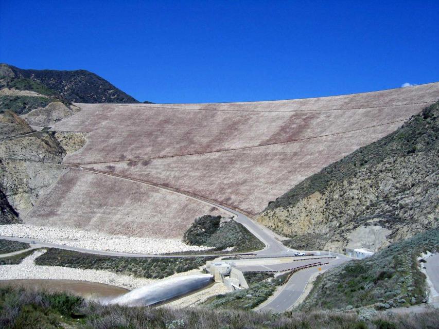
Seven Oaks Dam

Image shows Seven Oaks Dam in the San Bernardino Mountains. Completed in 1999, the Seven Oaks Dam is a 550-feet-high earthen dam on the Santa Ana River.

Its construction at the base of the San Bernardino Mountains was a major component of the Santa Ana River Mainstem Project, costing $464 million and meant to protect the more than 2 million citizens of Orange, Riverside and San Bernardino counties from flooding. To accomplish this, the dam releases only 7,000 cubic feet per second (cfs) of the 85,000 cfs flowing into it, giving it 350-year flood protection. The rest of this flood control project consisted of raising the already existing Prado Dam downstream and building additional channels.

  • Read more
  • Layperson's Guide to Flood Management
Aquapedia background September 10, 2014 Water Cycle Poster Layperson's Guide to Flood Management

El Niño/La Niña

California’s seasonal weather is influenced by El Niño and La Niña – temporary climatic conditions that, depending on their severity, make the weather wetter or drier than normal.

El Niño and La Niña episodes typically last 9 to 12 months, but some may last for years. While their frequency can be quite irregular, El Niño and La Niña events occur on average every two to seven years. Typically, El Niño occurs more frequently than La Niña, according to the National Oceanic and Atmospheric Administration (NOAA).

  • Read more
Aquapedia background February 14, 2014 California Water Map Layperson's Guide to Flood Management California Spent Decades Trying to Keep Central Valley Floods at Bay. Now It Looks to Welcome Them Back

Floodplains in California

Restored floodplain at Dos Rios Ranch Preserve near Modesto

With the dual threats of aging levees and anticipated rising sea levels, floodplains — low areas along waterways that flood during wet years — are increasingly at the forefront of many public policy and water issues in California.

Adding to the challenges, many floodplains have been heavily developed and are home to major cities such as Sacramento. Large parts of California’s valleys are historic floodplains as well.

  • Read more
Aquapedia background February 14, 2014 Layperson's Guide to Flood Management Layperson's Guide to Climate Change and Water Resources California Water Map

Flooding and Flood Management

Image shows floodwaters from a series of atmospheric rivers that caused a road closure at Highway 20 near Williams in Colusa County in January 2023. When people think of natural disasters in California, they typically think about earthquakes. Yet the natural disaster that residents are most likely to face involves flooding, not fault lines. In fact, all 58 counties in the state have declared a state of emergency from flooding at least three times since 1950. And the state’s capital, Sacramento, is considered one of the nation’s most flood-prone cities. Floods also affect every Californian because flood management projects and damages are paid with public funds.

  • Read more
Aquapedia background February 11, 2014 Layperson's Guide to Flood Management

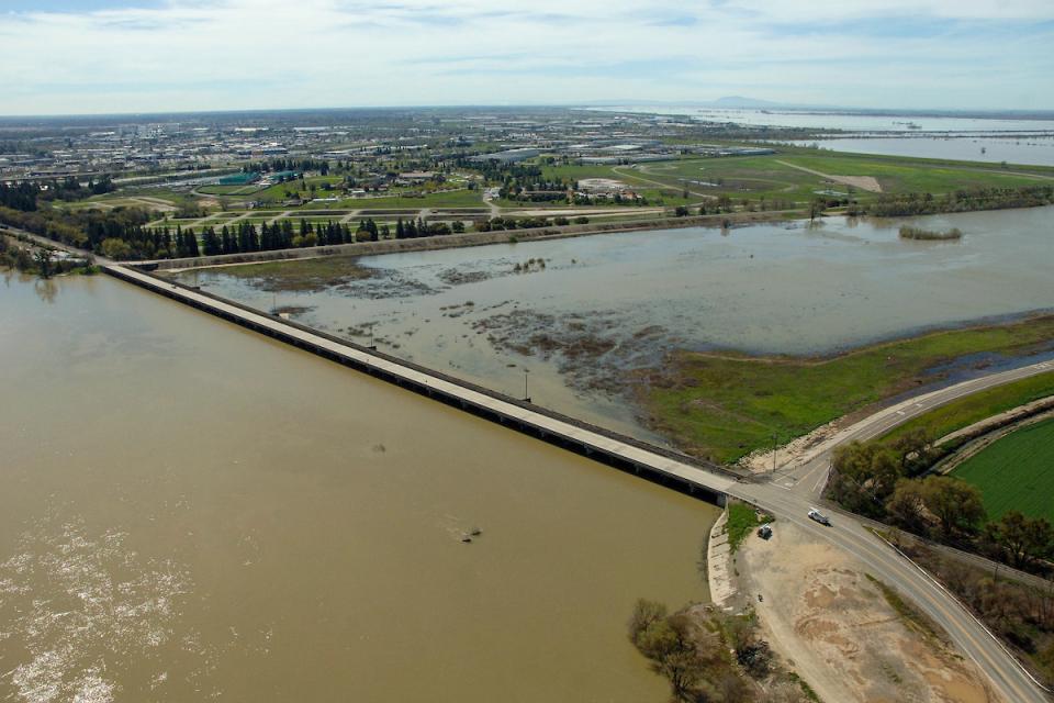
Yolo Bypass

Yolo Bypass occupies a historic floodplain between Davis and Sacramento, California. The Yolo Bypass is part of a larger engineered system developed on the Sacramento River to provide bypass flood areas, which act as catch basins to deter flooding in communities such as Sacramento and West Sacramento.

  • Read more

Share this page

  • Share on Facebook
  • Share on Twitter
  • Share on LinkedIn
  • Sent to a friend.
Print-friendly

Related Links

Publication May 20, 2014
Back
This item appears in:
  • Topic: Acre Foot
  • Topic: Bay Delta
  • Topic: Legislation — California and Federal
  • Layperson's Guides
  • Topic: Central Valley
  • Topic: Central Valley Project
  • Topic: Water History
  • Topic List: Bay-Delta
  • Topic: Earthquakes
  • Topic List: Dams, Reservoirs and Water Projects
  • Topic: Sacramento San Joaquin Delta
  • Topic: Floods
  • Topic: Sacramento Valley
  • Topic: Sacramento River
  • Topic: Salmon
  • Topic: San Joaquin Valley
  • Topic: Levees
  • Topic: Surface Water
  • Topic: Watershed
  • Topic List: Water Supply and Management
  • Topic: State Water Project
Footer pod May 20, 2014

Water Education Foundation

Copyright © 2025 Water Education Foundation. All rights reserved.

The Water Education Foundation is a nonprofit, tax-exempt, 501(c)3 organization, federal tax ID #942419885.

Privacy Policy

Donor Privacy Policy

  • Read more
Footer pod May 20, 2014

Contact Information

2151 River Plaza Drive, Suite 205
Sacramento CA 95833

Telephone (916) 444-6240

Contact Us via email

  • Read more

Quicklinks

Footer quicklink May 20, 2014

Contact Us

  • Read more
Footer quicklink May 20, 2014

Donate Today

  • Read more
Footer quicklink May 20, 2014

Tours

  • Read more
Footer quicklink May 20, 2014

Newsletter Signup

  • Read more
Footer quicklink May 20, 2014

Foundation News

  • Read more
Footer quicklink May 20, 2014

Calendar

  • Read more

Log in

  • Create new account
  • Request new password

Commands

  • Support portal
  • Log in