Header link June 22, 2020

LinkedIn

  • Read more
Header link September 15, 2014

Cart

  • Read more
Header link November 3, 2015

Donate Now

  • Read more
Header link May 15, 2014

Twitter

  • Read more
Header link May 15, 2014

Facebook

  • Read more
Instagram
Header link May 15, 2014

Instagram

  • Read more
Header link May 15, 2014

Contact Us

  • Read more
More options
Water Education Foundation
Home

Water Education Foundation

Everything about California water that matters
  • Water Academy
    • Agriculture
      • Agricultural Conservation
      • Agricultural Drainage
    • Background Information
      • Legislation — California and Federal
      • Regulations — California and Federal
      • Water History
      • Water Rights
    • Bay-Delta
      • Bay Delta
      • Bay Delta Conservation Plan
      • Delta Issues
      • Delta Smelt
      • Sacramento San Joaquin Delta
      • San Francisco Bay
      • Suisun Marsh
    • Dams, Reservoirs and Water Projects
      • California Aqueduct
      • Central Valley Project
      • Folsom Dam
      • Friant Dam
      • Hetch Hetchy
      • Hoover Dam
      • Infrastructure
      • Lake Mead
      • Lake Powell
      • Oroville Dam
      • San Luis Dam
      • Shasta Dam
      • State Water Project
    • Environmental Issues
      • Anadromous Fish Restoration
      • Ecosystem
      • Endangered Species Act
      • Invasive species
      • Lake Tahoe
      • Mono Lake
      • Public Trust Doctrine
      • Salmon
      • San Joaquin River Restoration
      • Watershed
      • Wetlands
    • Leaders and Experts
    • Regions
      • Central Coast
      • Central Valley
      • Mexico
      • Nevada
      • North Coast
      • Pyramid Lake
      • Sacramento Valley
      • Salton Sea
      • San Joaquin Valley
      • Sierra Nevada
      • Southern California
      • Tulare Lake Basin
    • Rivers
      • Carson River
      • Colorado River
      • Klamath River
      • New River
      • North Coast Rivers
      • Russian River
      • Sacramento River
      • Truckee River
      • San Joaquin River
    • Water Issues
      • Climate Change
      • Coronavirus
      • Drought
      • Earthquakes
      • Energy and Water
      • Flood Management
      • Fracking
      • Growth
      • Hydropower
      • Levees
      • Tribal Water Issues
      • Water Conservation
      • Water Equity
    • Water Quality
      • Drinking Water
      • Nitrate contamination
      • Pollution
      • Stormwater
      • Wastewater
      • Water Quality
    • Water Supply and Management
      • Acre Foot
      • Aquifers
      • California Water Plan
      • Conjunctive Use
      • Desalination
      • Grey water
      • Groundwater
      • Integrated Regional Water Management
      • Recreation
      • Surface Water
      • Water Marketing and Banking
      • Water Rates
      • Water Recycling
      • Water Supply
      • Water Transfers
  • Tours & Events
    • Water Tours
      • 2023 Tour Sponsors
    • Events
    • Event Calendar
    • Past Tours & Events
      • Anne J. Schneider Fund Lecture Series
  • Specialized Programs
    • Water Leaders
      • Class Rosters
      • Yearly Class Reports
      • Your Alumni Network
      • Alumni Profiles
    • Project WET
      • Workshops
      • Special Workshops & Events
      • Supplementary Materials
      • California Content Standard Correlations
      • Facilitator's Trainings
      • Foundation School Programs
        • Elementary Programs
        • Secondary Programs
      • Water Kids
      • California Project WET Gazette
      • Gazette Archives
    • Colorado River Project
    • GRA Scholastic Fund Program
  • Maps & Guides
    • Maps & Posters
    • Layperson's Guides
    • Map & Guide Bundles
    • Books
    • Colorado River Materials
    • California Runoff Rundown
    • Other Publications
    • Water Awareness Materials
    • Downloadable Publications
    • Videos and DVDs
      • Video Clips
    • School Age Publications
    • Stickers
    • Free Programs and Publications
  • Newsroom
    • Western Water News
    • Aquafornia
      • About Aquafornia
    • Information Desk
    • Western Water Magazine Archive
      • Full Print Edition
      • Print Edition Excerpts
    • River Report Archive
  • Aquapedia
    • Alphabetical List of Subjects
      • A
      • B
      • C
      • D
      • E
      • F
      • G
      • H
      • I
      • J
      • K
      • L
      • M
      • N
      • O
      • P
      • Q
      • R
      • S
      • T
      • U
      • V
      • W
      • X
      • Y
      • Z
    • Historical Water People
    • Where Does My Water Come From?
      • Northern California
      • Sacramento
      • North Bay
      • South Bay
      • Central Valley
      • Los Angeles
      • Inland Empire
      • San Diego
      • All California Water Sources
    • Timelines
    • Videos
    • Image Gallery
    • Water Directory
      • Federal Agencies
      • State Agencies in California
      • Environmental Organizations
      • Other California Organizations
      • State and Federal Legislative Committees
      • Water Associations and Groups
      • Western States Water Agencies and Districts
    • Online Resources
    • Useful Acronyms
    • About Aquapedia
  • About
    • About Us
      • Board of Directors
      • Staff Biographies
      • Job Openings
    • Announcements
    • Support Our Mission
      • Become a Member
      • Donate in Honor/Memory
      • Donate to Aquapedia or Aquafornia
      • Shop Amazon
      • Planned Giving
    • Contact Us
Aquapedia background February 3, 2014 Oroville Dam Shasta Dam Hoover Dam Layperson's Guide to the Central Valley Project Layperson's Guide to the State Water Project

Dams

Folsom Dam on the American River east of Sacramento

Dams have allowed Californians and others across the West to harness and control water dating back to pre-European settlement days when Native Americans had erected simple dams for catching salmon.

Today, California and neighboring states are home to a vast integrated system of federal, state and locally owned dams that help with flood management, water storage and water transport. Flood management projects, for example, have prevented billions of dollars’ worth of damage and countless lives from being lost. Hydropower from dams also provides a relatively pollution-free source of electricity, and has helped lessen dependence on oil, gas and coal. Hydropower typically generates about 15 percent of the annual electricity in California, according to the California Energy Commission.

There are 1,472 federal dams and state-regulated dams in California, with an unknown number of smaller, private dams that do not fall under the state’s jurisdiction.

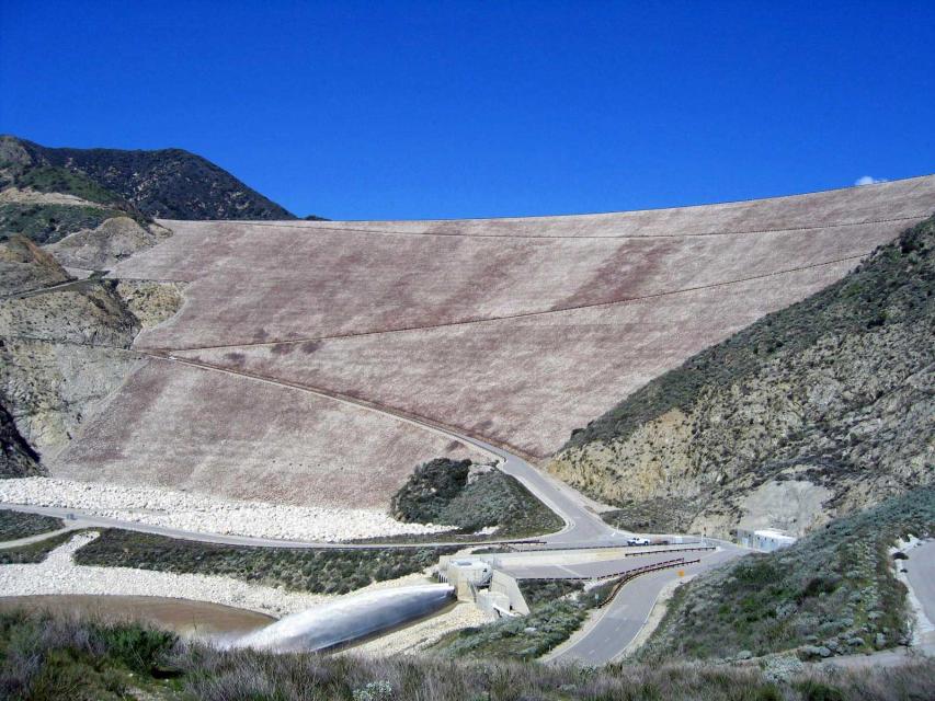
There are many types of dams (concrete, timber, masonry and earthen) for a variety of purposes (flood control, water supply, mining tailings impoundment, debris and diversion). Major water supply and flood control dams such as Shasta, Oroville and Folsom are concrete or embankment dams, which describes the type of materials used to build the dams. Primary types of concrete dams are gravity, arch and roller-compacted concrete. Embankment dams like Oroville are very common and can be comprised of soil, rock or a blending of the two.

Dams focus primarily on storing water and then getting the water to the right place at the right time. In California, this system has helped spark important economic activity in arid or semi-arid areas of the state, including the agricultural Central Valley and Southern California.

Shasta Dam on the Sacramento River, near Redding.As part of this, nearly 75 percent of the available water originates in the northern third of the state (north of Sacramento), while 80 percent of the demand occurs in the southern two-thirds of the state. The demand for water is highest during the dry summer months when there is little natural precipitation or snowmelt. California’s capricious climate also leads to extended periods of drought and major floods.

To help meet this demand, a series of dams were built on the western slope of the Sierra Nevada for both flood control and water supply. These include Oroville Dam on the Feather River, Folsom Dam on the American River and Friant Dam on the San Joaquin River.

Dams and the Future

Changing public values and a greater awareness about ecosystems and the importance of keeping them healthy have generated governmental and private efforts to lessen some of the impacts caused by damming rivers. Water officials say achieving a careful balance among agricultural, urban, and environmental interests is considered key.

In 1972, for instance, the state Legislature moved to preserve the North Coast’s free-flowing rivers from development by passing the California Wild and Scenic Rivers Act, preserving about a quarter of the state’s undeveloped water in its natural state. The act prohibits construction of dams or diversion facilities, except to serve local needs, on portions or entire rivers around the state.

More recently, there has been a growing trend of storing water underground and interest in off-stream dams. Sub-surface storage in aquifers has several advantages over surface water storage. Sub-surface storage is far less damaging to the environment than the construction of reservoirs and dams, and usually does not require an extensive distribution system. Water banked underground also has a much lower evaporation rate than surface reservoirs. One drawback, however, is sometimes litigious water rights issues.

In November 2014 voters passed Proposition 1, the Water Quality, Supply and Infrastructure Improvement Act, which included $2.7 billion for the public benefit aspect of surface water reservoirs and groundwater storage. In 2018, the California Water Commission conditionally awarded $816 million in Prop. 1 money to build Sites Reservoir, an off-stream reservoir an hour northwest of Sacramento, and $459 million to expand Los Vaqueros Reservoir, an off-stream reservoir in eastern Contra Costa County. Construction of both projects is tentatively scheduled for completion in 2029.

There are some dams in the state being eyed for removal because they are obsolete – choked by accumulated sediment, seismically vulnerable or out of compliance with federal regulations that require environmental balance. Dam removal is expensive, usually exceeding $100 million, not including the cost of initial studies. But for some dam owners the cost of removal is less expensive than effecting the necessary modifications such as fish ladders or seismic safety retrofits.

In the Klamath River Basin there is an effort to restore the river by removing four hydroelectric dams — the largest such project in U.S. history. The aim is to improve water quality, revive fisheries and boost tourism. A 2020 agreement by California, Oregon, the Yurok Tribe, the Karuk Tribe, PacifiCorp and the Klamath River Renewal Corporation describes how the parties will implement the 2016 Klamath Hydroelectric Settlement Agreement and sets the terms for the removal of the four dams in 2023.

The spillway at Oroville Dam shows the damage resulting from storm releases in 2017. The spillway has since been repaired.

In California, the average age of the 1,246 dams that fall under the jurisdiction of the Department of Water Resources’ Division of Safety of Dams (DSOD) is 70 years. Following the 2017 Oroville spillways incident, then-Gov. Jerry Brown directed DSOD to conduct more detailed evaluations of dam appurtenance structures, such as spillways, to include geologic assessment and hydrological modeling. Brown ordered the new review to be expedited for dams that have spillways and structures similar to Oroville Dam before the next flood season. In 2020, a team of experts, including an independent review board, determined that the Oroville Dam complex is safe to operate and no urgent repairs are needed.

DSOD’s dam condition assessments were largely based on the U.S. Army Corps of Engineers’ National Inventory of Dams’ five condition-rating definitions: satisfactory, fair, poor, unsatisfactory and not rated. Dams rated as satisfactory have no identified dam safety deficiencies. Dams rated as fair, poor or unsatisfactory have at least one identified dam safety deficiency.

According to DSOD, 1,145 dams within its jurisdiction are rated satisfactory, with no identified deficiencies. There are 101 dams with identified dam safety deficiencies that are rated as fair, poor, or unsatisfactory. DSOD may require a restriction of the reservoir storage to a specific level if unsafe conditions exist or require the dam owner to implement other risk reduction measures until remedial actions can be implemented.

  • Print-friendly

Referring Pages

Aquapedia background August 30, 2016 Layperson's Guide to Flood Management Dams

Seven Oaks Dam

Image shows Seven Oaks Dam in the San Bernardino Mountains. Completed in 1999, the Seven Oaks Dam is a 550-feet-high earthen dam on the Santa Ana River.

  • Read more
  • Layperson's Guide to Flood Management
Aquapedia background February 14, 2014 Dams

Friant Dam

Friant DamLocated just north of Fresno, the Friant Dam helps deliver water as it runs towards the Merced River, though its environmental impacts have caused controversy.

  • Read more
Aquapedia background February 11, 2014 Dams Shasta Dam

Trinity Dam and Trinity River

Though seemingly a long-way from California’s Central Valley, the Trinity Dam helps supply irrigation water for Valley farmers and for hydropower production.

Constructed in the far northwest of California in the 1950s, Trinity Dam and Lewiston Dam, just downstream, increased the storage capacity of the federal Central Valley Project by more than 2.5 million acre-feet.

  • Read more
Aquapedia background February 11, 2014 Dams Layperson's Guide to the Central Valley Project California Water Map

Shasta Dam

Image shows Shasta Dam from a distance, with the reservoir largely filled.Shasta Dam forms California’s largest storage reservoir, Shasta Lake, which can hold about 4.5 million acre-feet.

As the keystone of the federal Central Valley Project, Shasta stands among the world’s largest dams. Construction on the dam began in 1938 and was completed in 1945, with flood control as the highest priority.

  • Read more
Aquapedia background February 11, 2014 Dams

San Luis Reservoir

The San Luis Reservoir is the largest off-stream reservoir in the United States, serving as a key water facility for both the State Water Project (SWP) and the federal Central Valley Project (CVP).

  • Read more
Aquapedia background February 11, 2014 All Things Drought Dams Layperson's Guide to the State Water Project

Oroville Dam

Oroville Dam, a key part of California's State Water Project.Oroville Dam is the centerpiece of the State Water Project (SWP) and its largest water storage facility.

Located about 70 miles north of Sacramento at the confluence of the three forks of the Feather River, Oroville Dam is an earthfill dam (consisting of an impervious core surrounded by sands, gravels and rockfill materials) that creates a reservoir that can hold 3.5 million acre-feet of water.

  • Read more
Aquapedia background February 11, 2014 Dams

New Melones Dam

Completed in 1979, the New Melones Dam on California’s Stanislaus River includes a 2.4 million acre-feet reservoir and a power-generating capacity of 283 megawatts.

The Central Valley Project facility was built to help with irrigation, flood control and power production. It replaced an older dam from the 1920s that supplied water for agriculture to two local irrigation districts.

  • Read more
Aquapedia background February 4, 2014 Dams Layperson's Guide to the Colorado River

Hoover Dam

Hoover DamHoover Dam, one of the tallest dams in the United States and a National Historic Landmark that draws tourists from across the globe, is a key reservoir providing flood control, water storage and irrigation along the lower Colorado River. It also is one of the nation’s largest hydroelectric facilities, generating on average about 4 billion kilowatt-hours of hydroelectric power each year, enough electricity to serve more than 1.3 million people in Nevada, Arizona and California.

  • Read more

Share this page

  • Share on Facebook
  • Share on Twitter
  • Share on LinkedIn
  • Sent to a friend.
Print-friendly

Related Links

Aquapedia background February 3, 2014 Oroville Dam Shasta Dam Hoover Dam Layperson's Guide to the Central Valley Project Layperson's Guide to the State Water Project
Aquapedia background February 11, 2014 All Things Drought Dams Layperson's Guide to the State Water Project

Oroville Dam

Oroville Dam, a key part of California's State Water Project.Oroville Dam is the centerpiece of the State Water Project (SWP) and its largest water storage facility.

Located about 70 miles north of Sacramento at the confluence of the three forks of the Feather River, Oroville Dam is an earthfill dam (consisting of an impervious core surrounded by sands, gravels and rockfill materials) that creates a reservoir that can hold 3.5 million acre-feet of water.

  • Read more
Aquapedia background February 11, 2014 Dams Layperson's Guide to the Central Valley Project California Water Map

Shasta Dam

Image shows Shasta Dam from a distance, with the reservoir largely filled.Shasta Dam forms California’s largest storage reservoir, Shasta Lake, which can hold about 4.5 million acre-feet.

As the keystone of the federal Central Valley Project, Shasta stands among the world’s largest dams. Construction on the dam began in 1938 and was completed in 1945, with flood control as the highest priority.

  • Read more
Aquapedia background February 4, 2014 Dams Layperson's Guide to the Colorado River

Hoover Dam

Hoover DamHoover Dam, one of the tallest dams in the United States and a National Historic Landmark that draws tourists from across the globe, is a key reservoir providing flood control, water storage and irrigation along the lower Colorado River. It also is one of the nation’s largest hydroelectric facilities, generating on average about 4 billion kilowatt-hours of hydroelectric power each year, enough electricity to serve more than 1.3 million people in Nevada, Arizona and California.

  • Read more
Publication May 20, 2014

Layperson’s Guide to the Central Valley Project
Updated 2021

The 24-page Layperson’s Guide to the Central Valley Project explores the history and development of the federal Central Valley Project (CVP), California’s largest surface water delivery system. In addition to the project’s history, the guide describes the various CVP facilities, CVP operations, the benefits the CVP brought to the state and the CVP Improvement Act (CVPIA).

  • Read more
Publication May 20, 2014

Layperson’s Guide to the State Water Project
Updated 2013

The 24-page Layperson’s Guide to the State Water Project provides an overview of the California-funded and constructed State Water Project.

  • Read more
Back
This item appears in:
  • Topic: Regulations — California and Federal
  • D
  • Topic List: Dams, Reservoirs and Water Projects
  • Topic: Flood Management
  • Infrastructure
  • Topic: Hydropower
  • Topic: Surface Water
  • Topic: Water Supply
Footer pod May 20, 2014

Water Education Foundation

Copyright © 2023 Water Education Foundation. All rights reserved.

The Water Education Foundation is a nonprofit, tax-exempt, 501(c)3 organization, federal tax ID #942419885.

Privacy Policy

Donor Privacy Policy

  • Read more
Footer pod May 20, 2014

Contact Information

2151 River Plaza Drive, Suite 205
Sacramento CA 95833

Telephone (916) 444-6240

Contact Us via email

  • Read more

Quicklinks

Footer quicklink May 20, 2014

Contact Us

  • Read more
Footer quicklink May 20, 2014

Donate Today

  • Read more
Footer quicklink May 20, 2014

Tours

  • Read more
Footer quicklink May 20, 2014

Newsletter Signup

  • Read more
Footer quicklink May 20, 2014

Foundation News

  • Read more
Footer quicklink May 20, 2014

Calendar

  • Read more

Log in

  • Create new account
  • Request new password

Commands

  • Support portal
  • Log in