Sites Reservoir
 The proposed Sites Reservoir would
be an off-river storage basin on the west side of the Sacramento
Valley, about 78 miles northwest of Sacramento. It would capture
stormwater flows from the Sacramento River for release in dry
years for fish and wildlife, farms, communities and
businesses.
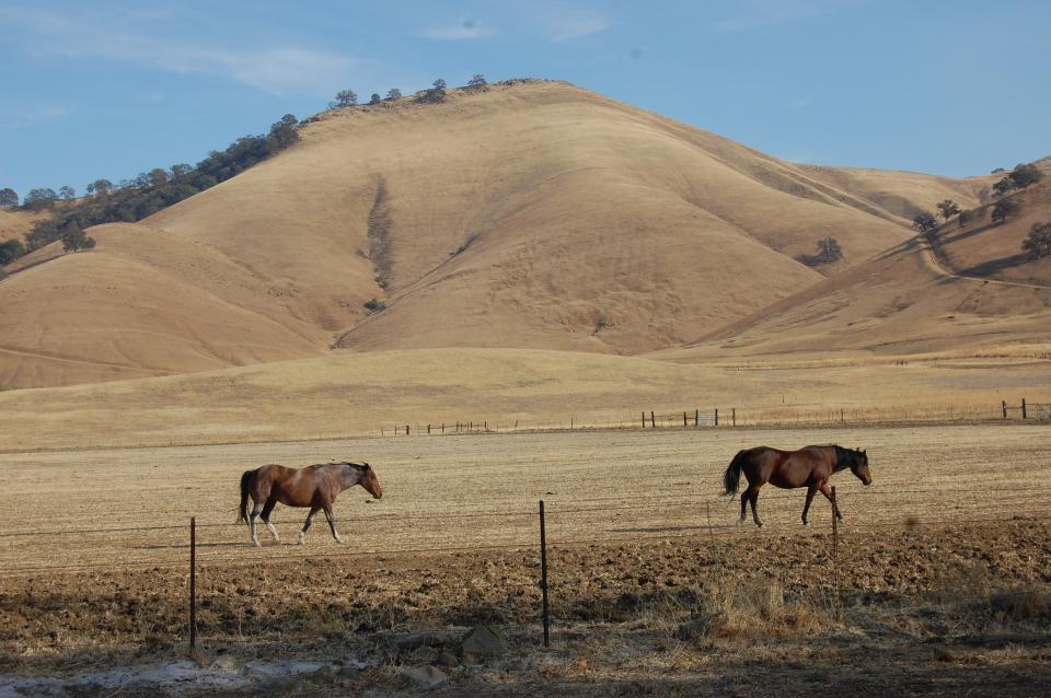
The water would be held in a 14,000-acre basin of grasslands surrounded by the rolling eastern foothills of the Coast Range. Known as Antelope Valley, the sparsely populated area in Glenn and Colusa counties is used for livestock grazing.
The reservoir would be owned by the Sites Project Authority, a group of Sacramento Valley agricultural interests, cities and water districts, and operated in coordination with other Northern California reservoirs such as Shasta, Oroville and Folsom.
Proponents say they favor the project because it would increase the flexibility and reliability of the State Water Project and federal Central Valley Project. Though Site Reservoir would not dam a river or block fish migration, critics say diversions for the reservoir could at times take more than 60 percent of the Sacramento River flows, potentially harming the river’s riparian and aquatic ecosystems and the many fish and wildlife species that depend on them.
In dry years, the reservoir would help preserve the colder water in Lake Shasta to help critically endangered salmon and improve water quality in the Sacramento River, according to the Sites Project Authority.
Project Goals
Sites Reservoir is designed to achieve the following objectives when operated in coordination with existing Northern California reservoirs:
- Improve water supply reliability for agricultural, urban and environmental uses
- Increase anadromous and endemic fish populations
- Improve environmental and drinking water quality in the Delta
Modified Plan
In 2020, the Sites proposal was modified, with estimated costs reduced from $5.1 billion to $3 billion. The revised plan decreases the reservoir capacity from 1.8 to 1.5 million acre-feet, dropping the reservoir’s average delivery capacity from 505,000 to 243,000 acre-feet a year. In May 2023, the Sites Project Authority estimated the costs at $4.5 billion.
 The modified plan also eliminates an
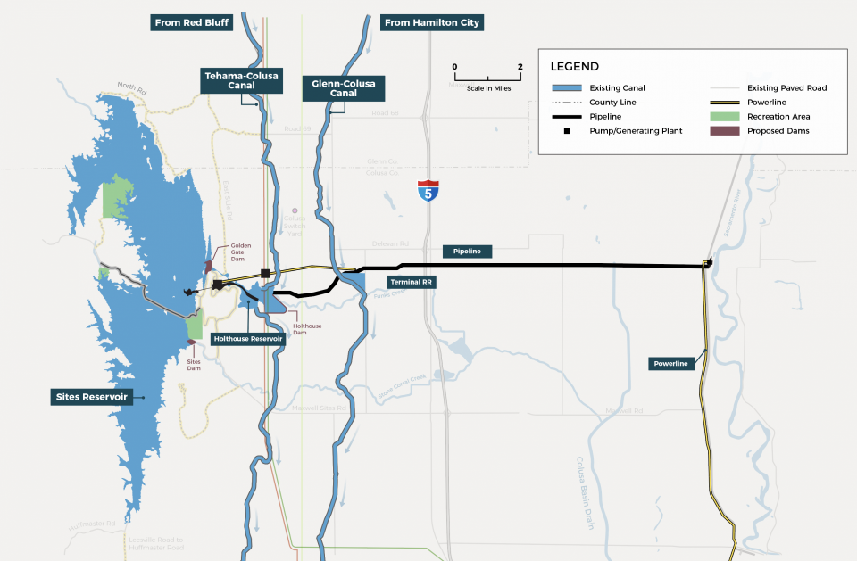
18-mile pipeline to the Sacramento River. Instead, the river
would be diverted to the reservoir through the Tehama-Colusa
and Glenn-Colusa canals and released back into the river to
augment natural flows and releases from other reservoirs.
Milestones
Sites reached two procedural milestones in late 2023. The federal Bureau of Reclamation completed the project’s final environmental impact report and statement. Just days later, California Gov. Gavin Newsom, who favors the reservoir, used a new state law to shorten the window for filing environmental challenges against the project.
If the reservoir is built, the foothills would provide a natural barrier to the basin and facilitate the flooding of the long and narrow Antelope Valley. The reservoir would be fortified by several dams connecting the hills. The main dams, Sites and Golden Gate, would be built across Stone Corral and Funks creeks. Sites Dam, the larger of the two, would stand about 310 feet high. Six smaller saddle dikes would be built at the north end of the lake, according to Reclamation.
Background
The reservoir takes its name from a small community in the basin that was home to John Sites, a pioneer rancher in the late 19th century. Though the reservoir would inundate the basin, many residents support the water storage proposal. The area where the 13-mile-long reservoir would be built also holds relics of Native American settlements, burial grounds and sacred sites, mainly those of the Patwin people
First conceived in the 1950s, Sites Reservoir emerged in the 1980s as part of a proposed second stage of the State Water Project, but the plan was abandoned.
Interest in the reservoir renewed in the 2000s as the frequency and severity of droughts grew under climate change and declines in native fish populations led to tighter restrictions on exporting water from the Sacramento-San Joaquin Delta.
Sites Project Authority Board
The board consists of representatives of Sacramento Valley water interests, including Colusa and Glenn counties, the Colusa County Water District, Glenn-Colusa Irrigation District, Tehama-Colusa Canal Authority, Westside Water District, Reclamation District 108, the cities of Roseville and Sacramento, Sacramento County Water Agency and Placer County Water Agency.
The project includes a reservoir committee of water agencies and irrigation districts across the state investing in a share of the water.
Since 2017, Metropolitan Water District of Southern California has invested about $31 million into the planning, permitting and environmental review effort for Sites Reservoir. Metropolitan’s board will have to consider any future investment.
In 2018, the project received $816 million from the Proposition 1 water bond. In August 2025, the California Water Commission awarded nearly $220 million in additional money for the project from the water bond after plans to expand Los Vaqueros Reservoir in Contra Costa County fell through and from Proposition 4 funds dedicated to Water Storage Investment Program (WSIP) storage projects.
On the federal side, the project also received $134 million in funds in March 2025 from the Water Infrastructure Improvements for the Nation Act (WIIN Act), which provides funding to improve water infrastructure throughout the United States. In all, the project had been designated $780 million in federal contributions.
One hurdle to moving forward with the project may be getting a water right from the State Water Board to take the river water needed to fill the reservoir. The board set public hearings in October and November 2024 on the project’s water right permit application.
The hearings are continuing on the water right application filed by the Sites Project Authority and on what specific terms or conditions should be included in any approvals. If the Board approves the application, the project would have a right to divert water from the Sacramento River into the planned reservoir.
Meanwhile, the cost to build the new reservoir has increased by $2 billion to at least $6.2 billion.
Updated in August 2025


