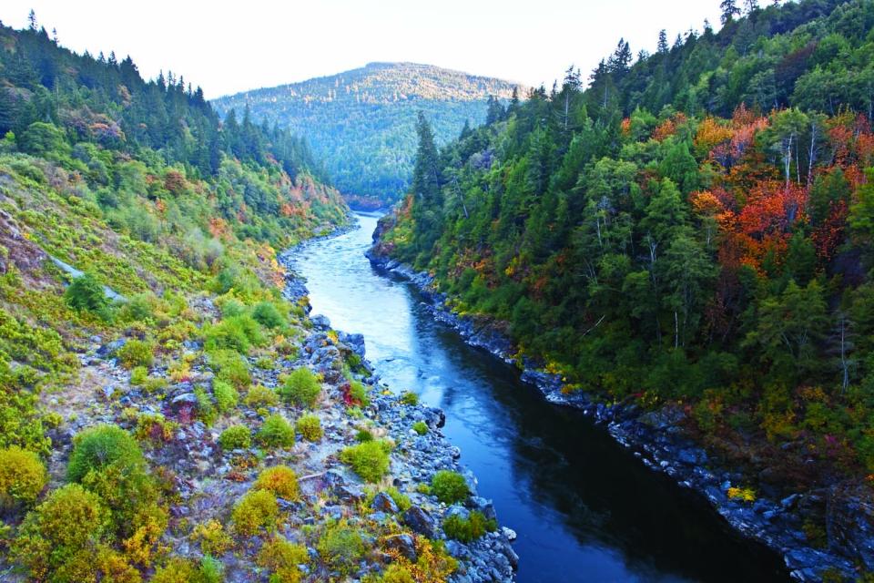
The Klamath River flows 253 miles
from Southern Oregon to the California coast, draining a basin of
more than 15,000 square miles. The watershed and its fisheries
have been the subject of negotiation since the 1860s negotiations
that have intensified and continue to this day.
The river has provided irrigation to ag lands since the late 19th
century. Agricultural development drained vast areas of
wetlands on the periphery of Upper Klamath Lake and in
upstream watersheds. Some of this drained acreage has been
restored and is now managed primarily for wetland benefits.
The watershed is divided geographically into two basins, upper
and lower, divided by Iron Gate Dam, the lower most dam on the
river. The Upper Basin is dry, with annual precipitation of about
13 inches at the river’s origin near Klamath Falls, Ore.
Downstream, the climate grows wetter.
Native Americans have a significant presence in the Klamath
Basin. Four major tribes have been influential in water
negotiations: the Klamath Tribes, the Karuk Tribe, the Hoopa
Valley Tribe and the Yurok Tribe.
Recreational activities are temporarily restricted along a
1.25-mile stretch of the Klamath River because of an upcoming
river restoration project, according to the Klamath National
Forest. The restoration project, led by the Yurok Tribe and its
partners, covers the area from the confluence of Humbug Creek
downstream to the Klamath River’s confluence with Brushy
Creek. The work is intended to repair damage caused by
historic mining practices and the 2022 McKinney Fire. Heavy
rainfall after the fire triggered flooding and debris flows
that carried large amounts of sediment into the Klamath River,
reducing water quality, degrading fish habitat and limiting
river access.
… Earlier this year, the Bureau of Indian Affairs and the
National Oceanic and Atmospheric Administration, or NOAA,
jointly offered a $5.9 million grant for tribal salmon
restoration and called for tribes to apply for the
competitive funding. … But because salmon had been
extirpated from Klamath ancestral territory for 114 years, the
federal government did not consider them a restoration tribe.
… Fortunately, the tribes’ downriver relatives had their
back; Mike Belchik, the Yurok Tribe’s senior fisheries
biologist, moved to assist. … The BIA awarded the grant
jointly between the Yurok Tribe, the Klamath Tribes, and Oregon
Fish and Wildlife. Belchik said the Yurok Tribe will act as a
pass-through, sending the money to the Klamath Tribes and
serving in an administrative capacity only.
Two years after crews pulled the last of four dams off the
Klamath River, the question has shifted from whether the fish
would return to how far they can go. California Trout has
answered part of that with a new recovery blueprint
built around steelhead, the wild, sea-running trout
that once climbed the river’s full length before concrete walls
cut them off. The report lays out a long-term plan for
rebuilding steelhead runs across the more than 400 miles of
habitat reopened by the 2024 demolition, the largest dam
removal in United States history. It draws on monitoring that
has already produced surprises, including thousands of Chinook
pushing past the old Iron Gate Dam site and salmon
reaching Upper Klamath Lake for the first time in over a
century.
California’s troubled commercial salmon fleet, fishing this
year for the first time since 2022, is in store for some
federal disaster aid after the Trump administration announced
it would allocate $21.3 million to support the state’s
beleaguered fishery. The June 17 announcement by the National
Oceanic and Atmospheric Administration, or NOAA, follows years
of requests for help from a West Coast industry still reeling
after a historic closure that banned all California salmon
fishing in 2023, 2024 and 2025 due to low ocean forecasts of
returning fish. … Salmon stocks have
weathered sharp declines amid waves of drought,
shifting ocean conditions and longstanding effects from dams,
river diversions and other development that have decimated
their spawning runs.
The Yurok Marine Department and the UC Davis Bodega Marine
Laboratory announced they recently deployed a real-time ocean
monitoring buoy near the mouth of the Klamath River. Installed
in about 60 feet of water, the Klamath River Spotter buoy
collects and transmits data on water temperature, wave
conditions, wind speed and direction, and barometric pressure.
The information is publicly available through the SOFAR Ocean
platform. The Yurok tribe says the buoy will help researchers
better understand the Klamath River plume. … Researchers
plan to use the data to study environmental conditions near the
river mouth and monitor potential long-term changes
following the removal of four dams on the Klamath
River.
Wildlife experts in both California and Oregon report they’re
seeing a high number of newly released Chinook
salmon sickened and killed by a parasite. The
salmon have been found dead at multiple traps in Oregon
and California in the Klamath River. The deaths, first
reported by Oregon Public Broadcasting, are believed to
primarily be due to a parasite called Ceratonova shasta. The
parasite, which is linked to the salmon, has reached farther
north in the river than ever before following the destruction
of four dams near the Oregon-California border. … A
recent count from the U.S. Fish and Wildlife Service found that
almost half, or 46%, of nearly 700 salmon found in traps have
tested positive for C. shasta.
The National Oceanic and Atmospheric Administration said a
package of fishery disaster relief for West Coast and Alaska
fishermen is on the way. NOAA announced the
allocation of $123.6 million in fishery resource disaster
funding, appropriated by Congress in the American Relief
Act, 2025. The money will go to address fishery resource
disasters that occurred in Oregon, California, the Squaxin
Island tribe in Washington State, and multiple Alaska fisheries
between 2019 and 2023. … The aid allocations apply to
previously declared fishery resource disasters, including: …
2024 California Sacramento River Fall Chinook and Klamath River
Fall Chinook ocean and inland salmon fisheries.
The Ninth Circuit delivered a victory to the Yurok Tribe and
fishing advocates on Wednesday, affirming a lower court’s
finding that the U.S. Bureau of Reclamation must comply with
the Endangered Species Act when operating the Klamath
Irrigation Project. In a 2-1 decision, the appeals panel
held the Endangered Species Act applies to the
government’s operation of the Klamath Irrigation Project and
that the rights of Klamath Project water users are subject to
the requirements of the ESA. The panel largely
focused on the applicability of Section 7 of the ESA — which
requires federal agencies to ensure that agency action “is not
likely to jeopardize the continued existence of any endangered
species or threatened species or result in the destruction or
adverse modification of habitat of such species” — on the
Klamath Irrigation Project.
Dead juvenile Chinook salmon have been found on sections of the
lower Klamath River and near the Oregon-California border.
Scientists believe the deaths are caused by parasites
that are proliferating because of the low winter snowpack and
warm spring temperatures. “We’re seeing dead and dying
fish,” Sascha Hallett, a fish parasitologist and associate
professor at Oregon State University’s Department of
Microbiology, said. … Hallett said studies indicate the
die-offs are being caused by a parasite, Ceratonova shasta. She
said OSU researchers, in cooperation with state and federal
agencies, tribes, and other agencies, believe the low winter
snowpack and warmer than average spring temperatures
accelerated the proliferation of the parasites, which thrive in
warm, slow-moving water and attack the intestinal lining of
young salmon.
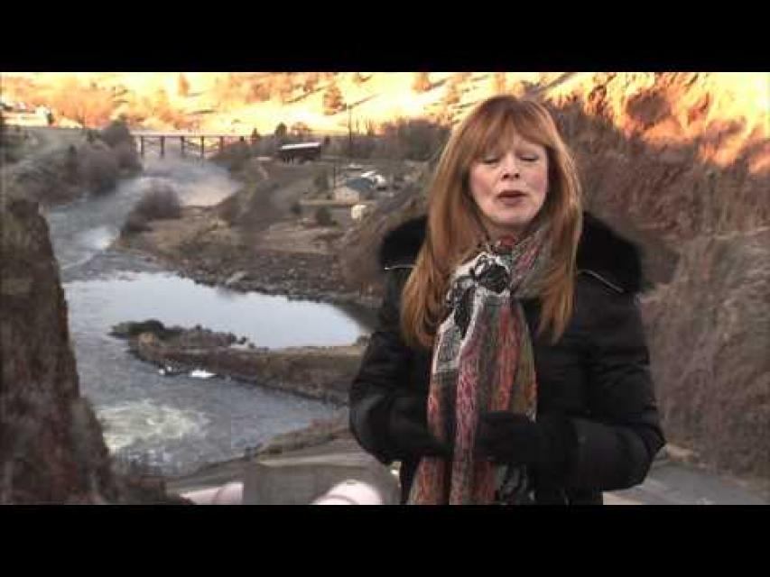
On this first-ever Foundation water tourwe examined water issues along the 263-mile Klamath River, from its spring-fed headwaters in south-central Oregon to its redwood-lined estuary on the Pacific Ocean in California.
Running Y Resort
5500 Running Y Rd
Klamath Falls, OR 97601
The dam removal projects- aimed at sustaining the salmon
population, are underway, with the latest drawdown being three
reservoirs on the Klamath River. The removal process has
already dramatically changed the landscape in Southern Oregon
and far Northern California, along the course of the river. The
lowest of the three remaining dams- Iron Gate, was initially
breached on January 9, followed by the J.C. Boyle reservoir on
January 16. A concrete plug in the tunnel at the base of Copco
1 was blasted away on January 23, with the reservoirs draining
quickly, leaving vast expanses of fissured mud that was the
consistency and color of chocolate cake batter. Shaping its new
course, the Klamath River is winding through the bare
landscape, but the transformation has had some unintended
consequences and saddened some residents.
…Tuesday, the State Water Resources Control Board took
action to protect the salmon,
unanimously extending the region’s
expired emergency drought measures. Ground and surface
water for farms will be restricted for another year if flows in
the Shasta and Scott rivers dip below minimum thresholds. State
officials say these measures are likely to kick in next
year. Water board chair Joaquin Esquivel said action
is needed because “a fish emergency” remains on the rivers.
“Time isn’t our friend,” he said at a previous meeting in
August. “There is an urgency.” The water board also
is investigating the possibility of permanent requirements to
keep more water in the rivers, after the Karuk Tribe and the
fishing industry petitioned the state for stronger protections.
That decision, however, could take years.
The Klamath River Basin was once one
of the world’s most ecologically magnificent regions, a watershed
teeming with salmon, migratory birds and wildlife that thrived
alongside Native American communities. The river flowed rapidly
from its headwaters in southern Oregon’s high deserts into Upper
Klamath Lake, collected snowmelt along a narrow gorge through the
Cascades, then raced downhill to the California coast in a misty,
redwood-lined finish.
California is chock full of rivers and creeks, yet the state’s network of stream gauges has significant gaps that limit real-time tracking of how much water is flowing downstream, information that is vital for flood protection, forecasting water supplies and knowing what the future might bring.
That network of stream gauges got a big boost Sept. 30 with the signing of SB 19. Authored by Sen. Bill Dodd (D-Napa), the law requires the state to develop a stream gauge deployment plan, focusing on reactivating existing gauges that have been offline for lack of funding and other reasons. Nearly half of California’s stream gauges are dormant.
In 1983, a landmark California Supreme Court ruling extended the public trust doctrine to tributary creeks that feed Mono Lake, which is a navigable water body even though the creeks themselves were not. The ruling marked a dramatic shift in water law and forced Los Angeles to cut back its take of water from those creeks in the Eastern Sierra to preserve the lake.
Now, a state appellate court has for the first time extended that same public trust doctrine to groundwater that feeds a navigable river, in this case the Scott River flowing through a picturesque valley of farms and alfalfa in Siskiyou County in the northern reaches of California.
Headwaters are the source of a
stream or river. They are located at the furthest point from
where the water body empties or merges with
another. Two-thirds of California’s surface water supply
originates in these mountainous and typically forested regions.
Mired in drought, expectations are high that new storage funded
by Prop. 1 will be constructed to help California weather the
adverse conditions and keep water flowing to homes and farms.
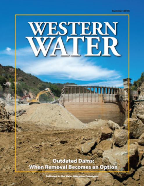
At the same time, there are some dams in the state eyed for
removal because they are obsolete – choked by accumulated
sediment, seismically vulnerable and out of compliance with
federal regulations that require environmental balance.
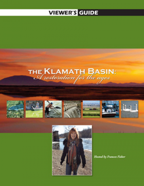
20-minute version of the 2012 documentary The Klamath Basin: A
Restoration for the Ages. This DVD is ideal for showing at
community forums and speaking engagements to help the public
understand the complex issues related to complex water management
disputes in the Klamath River Basin. Narrated by actress Frances
Fisher.
For over a century, the Klamath River Basin along the Oregon and
California border has faced complex water management disputes. As
relayed in this 2012, 60-minute public television documentary
narrated by actress Frances Fisher, the water interests range
from the Tribes near the river, to energy producer PacifiCorp,
farmers, municipalities, commercial fishermen, environmentalists
– all bearing legitimate arguments for how to manage the water.
After years of fighting, a groundbreaking compromise may soon
settle the battles with two epic agreements that hold the promise
of peace and fish for the watershed. View an excerpt from the
documentary here.
This 25-minute documentary-style DVD, developed in partnership
with the California Department of Water Resources, provides an
excellent overview of climate change and how it is already
affecting California. The DVD also explains what scientists
anticipate in the future related to sea level rise and
precipitation/runoff changes and explores the efforts that are
underway to plan and adapt to climate.
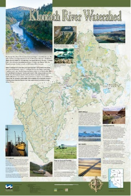
This beautiful 24×36-inch poster, suitable for framing, displays
the rivers, lakes and reservoirs, irrigated farmland, urban areas
and Indian reservations within the Klamath River Watershed. The
map text explains the many issues facing this vast,
15,000-square-mile watershed, including fish restoration;
agricultural water use; and wetlands. Also included are
descriptions of the separate, but linked, Klamath Basin
Restoration Agreement and the Klamath Hydroelectric Agreement,
and the next steps associated with those agreements. Development
of the map was funded by a grant from the U.S. Fish and Wildlife
Service.
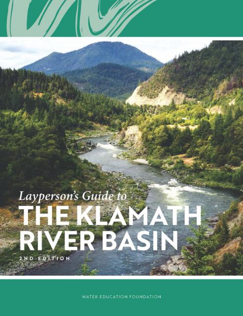
The Water Education Foundation’s second edition of
the Layperson’s Guide to The Klamath River Basin is
hot off the press and available for purchase.
Updated and redesigned, the easy-to-read overview covers the
history of the region’s tribal, agricultural and environmental
relationships with one of the West’s largest rivers — and a
vast watershed that hosts one of the nation’s oldest and
largest reclamation projects.
A new look for our most popular product! And it’s the perfect
gift for the water wonk in your life.
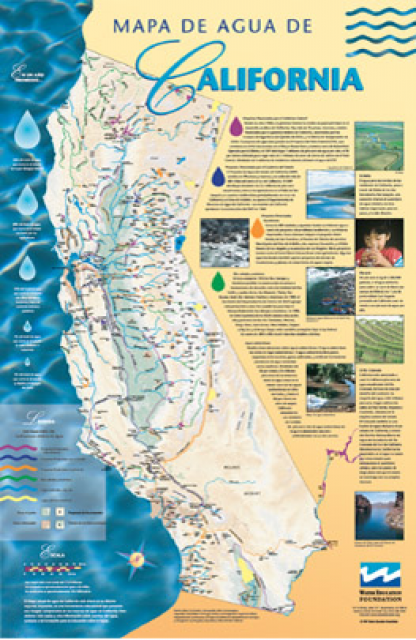
Our 24×36-inch California Water Map is widely known for being the
definitive poster that shows the integral role water plays in the
state. On this updated version, it is easier to see California’s
natural waterways and man-made reservoirs and aqueducts
– including federally, state and locally funded
projects – the wild and scenic rivers system, and
natural lakes. The map features beautiful photos of
California’s natural environment, rivers, water projects,
wildlife, and urban and agricultural uses and the
text focuses on key issues: water supply, water use, water
projects, the Delta, wild and scenic rivers and the Colorado
River.
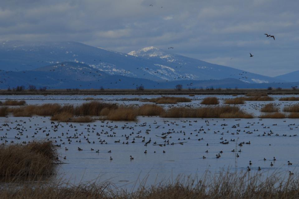
The Pacific Flyway is one of four
major North American migration routes for birds, especially
waterbirds, and stretches from Alaska in the north
to Patagonia in South America.
Each year, birds follow ancestral patterns as they travel the
flyway on their annual north-south migration. Along the way, they
need stopover sites such as wetlands with suitable habitat and
food supplies. In California, 95 percent of historic
wetlands have been lost, yet the Central Valley hosts some of the
world’s largest populations of wintering birds.
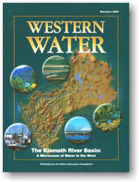
The Klamath River Basin is one of the West’s most important and
contentious watersheds.
The watershed is known for its unusual geography straddling
California and Oregon. Unlike many western rivers, the
Klamath does not originate in snowcapped mountains but rather on
a volcanic plateau.
A broad patchwork of spring-fed streams and rivers in
south-central Oregon drains into Upper Klamath Lake and down into
Lake Ewauna in the city of Klamath Falls. The outflow from Ewauna
marks the beginning of the 263-mile Klamath River.
On the Klamath River, the Upper Klamath Basin’s aquatic
ecosystems are naturally very productive due to its
phosphorus-rich geology.
However, this high productivity makes the Basin’s lakes
vulnerable to water quality problems.
Nutrient loads in the Upper Klamath Basin are a primary driver of
water quality problems along the length of the Klamath River,
including algal blooms in the Klamath Hydroelectric Project
reservoirs. Municipal and industrial discharges of wastewater in
the Klamath Falls area add to the nutrient load.
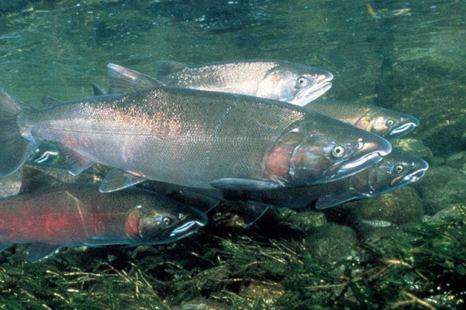
The Klamath Basin’s Chinook salmon and coho salmon serve a vital
role in the watershed.
Together, they are key to the region’s water management, habitat
restoration and fishing.
However, years of declining population have led to federally
mandated salmon restoration plans—plans that complicate the
diversion of Klamath water for agriculture and other uses.
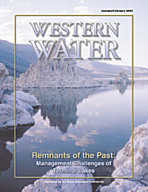
This issue of Western Water examines the challenges facing state,
federal and tribal officials and other stakeholders as they work
to manage terminal lakes. It includes background information on
the formation of these lakes, and overviews of the water quality,
habitat and political issues surrounding these distinctive bodies
of water. Much of the information in this article originated at
the September 2004 StateManagement Issues at Terminal Water
Bodies/Closed Basins conference.
The story of the Klamath River is the story of two basins.
In the upper basin, farming has long been the way of life. Even
before passage of the 1902 Reclamation Act, settlers had begun
the arduous process of reclaiming vast tracts of wetlands and
transforming them into rich farmland.


 and temperature. This gauge near downtown Sacramento measures water depth. (Source: California Department of Water Resources)")
")


. Credit: U.S. Bureau of Reclamation")