A watershed is a land area that helps drain runoff (snowmelt and
rain) into a diverse system of lakes, streams, rivers, and other
waterways.
Watersheds may be as small as a patch of land draining into a
tiny pond or as large as the Sacramento River Basin, which drains
an area about 27,000 square miles.
Watersheds follow natural boundaries and are usually separated
from one another by ridges or mountains. A watershed has many
important natural functions. It collects water from
precipitation, stores groundwater in aquifers, releases
water as runoff and provides habitat for plants and animals.
The public’s input is being sought on ideas for long-term
resilience of two Tulare County waterways at a meeting July 7
from 1 to 3 p.m. via Zoom. The Tulare Basin Watershed
Partnership is kicking off “Sequoias to the Sloughs (S2S): A
Watershed Assessment and Stewardship Initiative” thanks to a
$300,000 grant from the Bureau of Reclamation’s WaterSMART
Cooperative Watershed Management Program. The meeting is the
inaugural event of implementing the grant. The goal is to begin
developing a unified vision for connecting the people,
agencies, and organizations along the Tule River and Deer Creek
watersheds, which begin high in the southern Sierra Nevada and
wind their way to the San Joaquin Valley floor.
High-severity wildfires that kill large numbers of trees are
now burning far more acreage in California than they did four
decades ago, according to a UCLA study published Monday. The
study, appearing in the journal Proceedings of the National
Academy of Sciences, found that the area burned by
high-severity fires in California increased thirtyfold between
1985 and 2024, while overall forest acreage burned annually
increased tenfold. Researchers said severe fires, which often
kill entire stands of trees rather than allowing forests to
recover naturally, have overtaken lower- severity fires as the
dominant type of forest fire in California. … Researchers
linked the trend to increasingly warm and dry conditions
associated with climate change, as well as decades of fire
suppression that have allowed dense vegetation and underbrush
to accumulate in many forests.
A major restoration project in the lower Eel River estuary is
moving closer to construction after California Trout received a
$4 million grant to advance work on the Cannibal Island Unit.
The funding will support restoration of the 850-acre Cannibal
Island Unit in the lower Eel River estuary, an area that once
contained some of the most productive wetland habitat on
California’s North Coast. The award advances the California
Salmon Strategy for a Hotter, Drier Future and Gov. Gavin
Newsom’s goal of conserving 30 percent of California’s lands
and coastal waters by 2030 to protect biodiversity and help
California adapt to the impacts of a changing climate.
The nonprofit Truckee River Watershed Council (TRWC), alongside
staff from the Tahoe National Forest, is launching a new forest
health project near Boca Reservoir later this month that will
help reduce the risk of catastrophic wildfire locally, and
protect the drinking water for hundreds of thousands of people
living downstream in the Reno-Sparks area. In total, the
project anticipates treating approximately 1,940 acres of US
Forest Service lands over the next three years to improve
overall forest health. The project will remove ladder and
surface fuels and use mechanical thinning to produce a healthy
distribution of trees of varying sizes to decrease stand
density and improve forest resilience and wildlife habitat.
Fireline construction and any necessary trail reconstruction
will also be completed.
After a wildfire, rivers and streams can take years to recover.
Native plants and wildlife are often crowded out by invasive
species in the aftermath. But in Nevada’s Virgin River
watershed, a collaboration between federal agencies and
conservation groups is pointing to early signs of recovery. The
work is unfolding in a remote stretch of desert in southern
Nevada, where the tributary winds through a system that
eventually feeds into the Colorado River, a critical water
source for millions across the Mountain West. … The
habitat supports rare species, including the Southwestern
willow flycatcher, and fish, such as the Virgin River chub. …
[T]he effort is only the first step in a longer restoration
process that includes invasive plant removal and water
management improvements designed to slow runoff and increase
soil absorption.
The Wildlife Conservation Board (WCB) approved $80,450,797 in
grants for 23 projects across 16 counties to protect
biodiversity, restore wildlife habitat and expand public access
to nature. The board met today at the California Natural
Resources Agency headquarters in Sacramento. Among these, seven
projects advance the California Salmon Strategy for a Hotter,
Drier Future(external link), restoring floodplains,
improving stream function and enhancing habitat for
coho salmon, Chinook salmon and steelhead trout. Projects also
include investments in wildlife corridors, wildfire resiliency,
wildlife-oriented recreation and butterfly pollinators.
Growing up in the shadow of the
Rocky Mountains, Andrew Schwartz never missed an opportunity to
play in – or study – a Colorado snowstorm. During major
blizzards, he would traipse out into the icy wind and heavy
drifts of snow pretending to be a scientist researching in
Antarctica.
Decades later, still armed with an obsession for extreme weather,
Schwartz has landed in one of the snowiest places in the West,
leading a research lab whose mission is to give California water
managers instant information on the depth and quality of snow
draping the slopes of the Sierra Nevada.
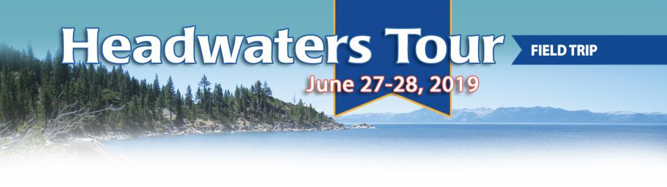
This tour ventured through California’s Central Valley, known as the nation’s breadbasket thanks to an imported supply of surface water and local groundwater. Covering about 20,000 square miles through the heart of the state, the valley provides 25 percent of the nation’s food, including 40 percent of all fruits, nuts and vegetables consumed throughout the country.
Land and waterway managers labored
hard over the course of a century to control California’s unruly
rivers by building dams and levees to slow and contain their
water. Now, farmers, environmentalists and agencies are undoing
some of that work as part of an accelerating campaign to restore
the state’s major floodplains.
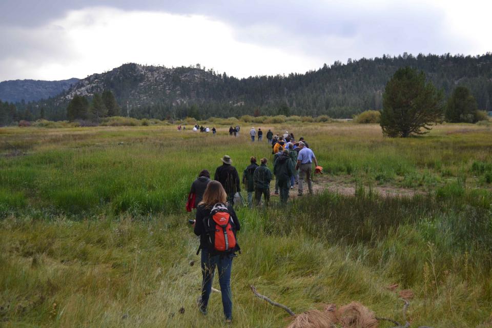
On average, more than 60 percent of
California’s developed water supply originates in the Sierra
Nevada and the southern spur of the Cascade Range. Our water
supply is largely dependent on the health of our Sierra forests,
which are suffering from ecosystem degradation, drought,
wildfires and widespread tree mortality.
This tour ventured into the Sierra to examine water issues
that happen upstream but have dramatic impacts downstream and
throughout the state.
Many of California’s watersheds are
notoriously flashy – swerving from below-average flows to jarring
flood conditions in quick order. The state needs all the water it
can get from storms, but current flood management guidelines are
strict and unyielding, requiring reservoirs to dump water each
winter to make space for flood flows that may not come.
However, new tools and operating methods are emerging that could
lead the way to a redefined system that improves both water
supply and flood protection capabilities.
It’s been a year since two devastating wildfires on opposite ends
of California underscored the harsh new realities facing water
districts and cities serving communities in or adjacent to the
state’s fire-prone wildlands. Fire doesn’t just level homes, it
can contaminate water, scorch watersheds, damage delivery systems
and upend an agency’s finances.
The southern part of California’s Central Coast from San Luis Obispo County to Ventura County, home to about 1.5 million people, is blessed with a pleasing Mediterranean climate and a picturesque terrain. Yet while its unique geography abounds in beauty, the area perpetually struggles with drought.
Indeed, while the rest of California breathed a sigh of relief with the return of wet weather after the severe drought of 2012–2016, places such as Santa Barbara still grappled with dry conditions.
The majestic beauty of the Sierra
Nevada forest is awe-inspiring, but beneath the dazzling blue
sky, there is a problem: A century of fire suppression and
logging practices have left trees too close together. Millions of
trees have died, stricken by drought and beetle infestation.
Combined with a forest floor cluttered with dry brush and debris,
it’s a wildfire waiting to happen.
Fires devastate the Sierra watersheds upon which millions of
Californians depend — scorching the ground, unleashing a
battering ram of debris and turning hillsides into gelatinous,
stream-choking mudflows.
High in the headwaters of the Colorado River, around the hamlet of Kremmling, Colorado, generations of families have made ranching and farming a way of life, their hay fields and cattle sustained by the river’s flow. But as more water was pulled from the river and sent over the Continental Divide to meet the needs of Denver and other cities on the Front Range, less was left behind to meet the needs of ranchers and fish.
“What used to be a very large river that inundated the land has really become a trickle,” said Mely Whiting, Colorado counsel for Trout Unlimited. “We estimate that 70 percent of the flow on an annual average goes across the Continental Divide and never comes back.”
Each day, people living on the streets and camping along waterways across California face the same struggle – finding clean drinking water and a place to wash and go to the bathroom.
Some find friendly businesses willing to help, or public restrooms and drinking water fountains. Yet for many homeless people, accessing the water and sanitation that most people take for granted remains a daily struggle.
Even as stakeholders in the Colorado River Basin celebrate the recent completion of an unprecedented drought plan intended to stave off a crashing Lake Mead, there is little time to rest. An even larger hurdle lies ahead as they prepare to hammer out the next set of rules that could vastly reshape the river’s future.
Set to expire in 2026, the current guidelines for water deliveries and shortage sharing, launched in 2007 amid a multiyear drought, were designed to prevent disputes that could provoke conflict.
There’s going to be a new governor
in California next year – and a host of challenges both old and
new involving the state’s most vital natural resource, water.
So what should be the next governor’s water priorities?
That was one of the questions put to more than 150 participants
during a wrap-up session at the end of the Water Education
Foundation’s Sept. 20 Water Summit in Sacramento.
Water means life for all the Grand Canyon’s inhabitants, including the many varieties of insects that are a foundation of the ecosystem’s food web. But hydropower operations upstream on the Colorado River at Glen Canyon Dam, in Northern Arizona near the Utah border, disrupt the natural pace of insect reproduction as the river rises and falls, sometimes dramatically. Eggs deposited at the river’s edge are often left high and dry and their loss directly affects available food for endangered fish such as the humpback chub.
An hour’s drive north of Sacramento sits a picture-perfect valley hugging the eastern foothills of Northern California’s Coast Range, with golden hills framing grasslands mostly used for cattle grazing.
Back in the late 1800s, pioneer John Sites built his ranch there and a small township, now gone, bore his name. Today, the community of a handful of families and ranchers still maintains a proud heritage.
Amy Haas recently became the first non-engineer and the first woman to serve as executive director of the Upper Colorado River Commission in its 70-year history, putting her smack in the center of a host of daunting challenges facing the Upper Colorado River Basin.
Yet those challenges will be quite familiar to Haas, an attorney who for the past year has served as deputy director and general counsel of the commission. (She replaced longtime Executive Director Don Ostler). She has a long history of working within interstate Colorado River governance, including representing New Mexico as its Upper Colorado River commissioner and playing a central role in the negotiation of the recently signed U.S.-Mexico agreement known as Minute 323.
Sixty percent of California’s developed water supply
originates high in the Sierra Nevada mountains. Our water
supply is largely dependent on the health of our Sierra forests,
which are suffering from ecosystem degradation, drought,
wildfires and widespread tree mortality.
We headed into the foothills and the mountains to examine
water issues that happen upstream but have dramatic impacts
downstream and throughout the state.
GEI (Tour Starting Point)
2868 Prospect Park Dr.
Rancho Cordova, CA 95670.
Lake
Tahoe, the iconic high Sierra water body that straddles
California and Nevada, has sat for more than 10,000 years at the
heart of the Washoe tribe’s territory. In fact, the name Tahoe
came from the tribal word dá’aw, meaning lake.
The lake’s English name was the source of debate for about 100
years after it was first “discovered” in 1844 by people of
European descent when Gen. John C. Fremont’s expedition made its
way into the region. Not long after, a man who carried mail on
snowshoes from Placerville to Nevada City named it Lake Bigler in
honor of John Bigler, who served as California’s third governor.
But because Bigler was an ardent secessionist, the federal
Interior Department during the Civil War introduced the name
Tahoe in 1862. Meanwhile, California kept it as Lake Bigler and
didn’t officially recognize the name as Lake Tahoe until 1945.
For decades, cannabis has been grown
in California – hidden away in forested groves or surreptitiously
harvested under the glare of high-intensity indoor lamps in
suburban tract homes.
In the past 20 years, however, cannabis — known more widely as
marijuana – has been moving from being a criminal activity to
gaining legitimacy as one of the hundreds of cash crops in the
state’s $46 billion-dollar agriculture industry, first legalized
for medicinal purposes and this year for recreational use.
As we continue forging ahead in 2018
with our online version of Western Water after 40 years
as a print magazine, we turned our attention to a topic that also
got its start this year: recreational marijuana as a legal use.
State regulators, in the last few years, already had been beefing
up their workforce to tackle the glut in marijuana crops and
combat their impacts to water quality and supply for people, fish
and farming downstream. Thus, even if these impacts were perhaps
unbeknownst to the majority of Californians who approved
Proposition 64 in 2016, we thought it important to see if
anything new had evolved from a water perspective now that
marijuana was legal.
California voters may experience a sense of déjà vu this year when they are asked twice in the same year to consider water bonds — one in June, the other headed to the November ballot.
Both tackle a variety of water issues, from helping disadvantaged communities get clean drinking water to making flood management improvements. But they avoid more controversial proposals, such as new surface storage, and they propose to do some very different things to appeal to different constituencies.
A new study could help water
agencies find solutions to the vexing challenges the homeless
face in gaining access to clean water for drinking and
sanitation.
The Santa Ana Watershed Project
Authority (SAWPA) in Southern California has embarked on a
comprehensive and collaborative effort aimed at assessing
strengths and needs as it relates to water services for people
(including the homeless) within its 2,840 square-mile area that
extends from the San Bernardino Mountains to the Orange County
coast.
Sixty percent of California’s developed water supply
originates high in the Sierra Nevada mountains. Our water
supply is largely dependent on the health of our Sierra forests,
which are suffering from ecosystem degradation, drought,
wildfires and widespread tree mortality.
ARkStorm stands for an atmospheric
river (“AR”) that carries precipitation levels expected to occur
once every 1,000 years (“k”). The concept was presented in a 2011
report by the U.S. Geological Survey (USGS) intended to elevate
the visibility of the very real threats to human life, property
and ecosystems posed by extreme storms on the West Coast.
Potable water, also known as
drinking water, comes from surface and ground sources and is
treated to levels that that meet state and federal standards for
consumption.
Water from natural sources is treated for microorganisms,
bacteria, toxic chemicals, viruses and fecal matter. Drinking
raw, untreated water can cause gastrointestinal problems such as
diarrhea, vomiting or fever.
The Eel River supports one of California’s largest wild salmon
and steelhead runs in a watershed that hosts the world’s largest
surviving stands of ancient redwoods.
The Eel flows generally northward from Northern California’s
Mendocino National Forest to the Pacific, a few miles south of
Eureka. The river and its tributaries drain
more than 3,500 square miles, the state’s
third-largest watershed.
This 24-page booklet details the conflict between
environmentalists, fish organizations and the Yuba County Water
Agency and how it was resolved through the Lower Yuba River
Accord – a unique agreement supported by 18 agencies and
non-governmental organizations. The publication details
the history and hydrology of the Yuba River, past and present
environmental concerns, and conflicts over dam operations and
protecting endangered fish is included.
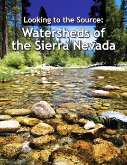
This 28-page report describes the watersheds of the Sierra Nevada
region and details their importance to California’s overall water
picture. It describes the region’s issues and challenges,
including healthy forests, catastrophic fire, recreational
impacts, climate change, development and land use.
The report also discusses the importance of protecting and
restoring watersheds in order to retain water quality and enhance
quantity. Examples and case studies are included.
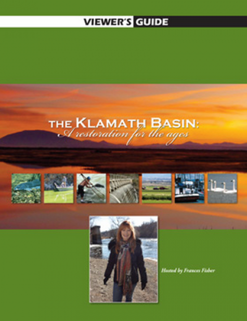
20-minute version of the 2012 documentary The Klamath Basin: A
Restoration for the Ages. This DVD is ideal for showing at
community forums and speaking engagements to help the public
understand the complex issues related to complex water management
disputes in the Klamath River Basin. Narrated by actress Frances
Fisher.
For over a century, the Klamath River Basin along the Oregon and
California border has faced complex water management disputes. As
relayed in this 2012, 60-minute public television documentary
narrated by actress Frances Fisher, the water interests range
from the Tribes near the river, to energy producer PacifiCorp,
farmers, municipalities, commercial fishermen, environmentalists
– all bearing legitimate arguments for how to manage the water.
After years of fighting, a groundbreaking compromise may soon
settle the battles with two epic agreements that hold the promise
of peace and fish for the watershed. View an excerpt from the
documentary here.
This 25-minute documentary-style DVD, developed in partnership
with the California Department of Water Resources, provides an
excellent overview of climate change and how it is already
affecting California. The DVD also explains what scientists
anticipate in the future related to sea level rise and
precipitation/runoff changes and explores the efforts that are
underway to plan and adapt to climate.
20-minute DVD that explains the problem with polluted stormwater,
and steps that can be taken to help prevent such pollution and
turn what is often viewed as a “nuisance” into a water resource
through various activities.
Many Californians don’t realize that when they turn on the
faucet, the water that flows out could come from a source close
to home or one hundreds of miles away. Most people take their
water for granted; not thinking about the elaborate systems and
testing that go into delivering clean, plentiful water to
households throughout the state. Where drinking water comes from,
how it’s treated, and what people can do to protect its quality
are highlighted in this 2007 PBS documentary narrated by actress
Wendie Malick.
A 30-minute version of the 2007 PBS documentary Drinking Water:
Quenching the Public Thirst. This DVD is ideal for showing at
community forums and speaking engagements to help the public
understand the complex issues surrounding the elaborate systems
and testing that go into delivering clean, plentiful water to
households throughout the state.
Water truly has shaped California into the great state it is
today. And if it is water that made California great, it’s the
fight over – and with – water that also makes it so critically
important. In efforts to remap California’s circulatory system,
there have been some critical events that had a profound impact
on California’s water history. These turning points not only
forced a re-evaluation of water, but continue to impact the lives
of every Californian. This 2005 PBS documentary offers a
historical and current look at the major water issues that shaped
the state we know today. Includes a 12-page viewer’s guide with
background information, historic timeline and a teacher’s lesson.
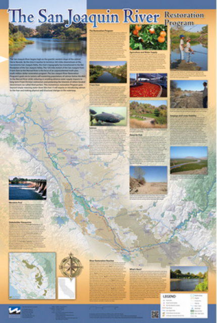
This beautiful 24×36 inch poster, suitable for framing, features
a map of the San Joaquin River. The map text focuses on the San
Joaquin River Restoration Program, which aims to restore flows
and populations of Chinook salmon to the river below Friant Dam
to its confluence with the Merced River. The text discusses the
history of the program, its goals and ongoing challenges with
implementation.
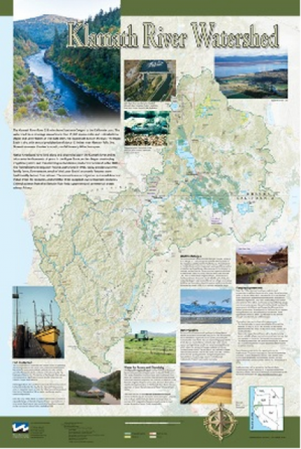
This beautiful 24×36-inch poster, suitable for framing, displays
the rivers, lakes and reservoirs, irrigated farmland, urban areas
and Indian reservations within the Klamath River Watershed. The
map text explains the many issues facing this vast,
15,000-square-mile watershed, including fish restoration;
agricultural water use; and wetlands. Also included are
descriptions of the separate, but linked, Klamath Basin
Restoration Agreement and the Klamath Hydroelectric Agreement,
and the next steps associated with those agreements. Development
of the map was funded by a grant from the U.S. Fish and Wildlife
Service.
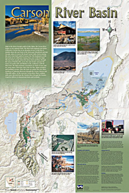
A companion to the Truckee River Basin Map poster, this
24×36-inch poster, suitable for framing, explores the Carson
River, and its link to the Truckee River. The map includes the
Lahontan Dam and reservoir, the Carson Sink, and the farming
areas in the basin. Map text discusses the region’s hydrology and
geography, the Newlands Project, land and water use within the
basin and wetlands. Development of the map was funded by a grant
from the U.S. Bureau of Reclamation Mid-Pacific Region, Lahontan
Basin Area Office.
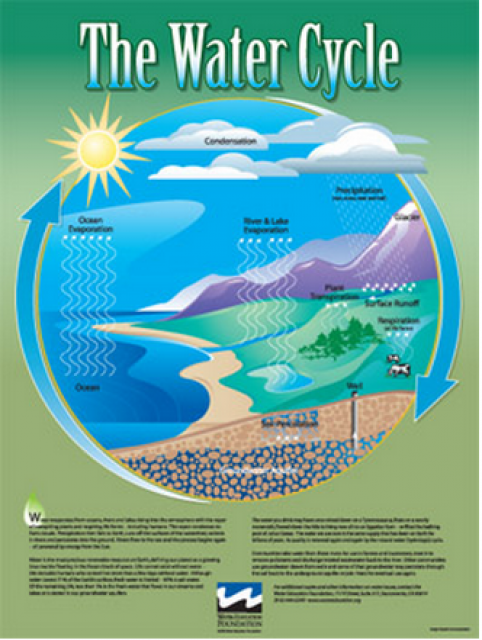
Water as a renewable resource is depicted in this 18×24 inch
poster. Water is renewed again and again by the natural
hydrologic cycle where water evaporates, transpires from plants,
rises to form clouds, and returns to the earth as precipitation.
Excellent for elementary school classroom use.
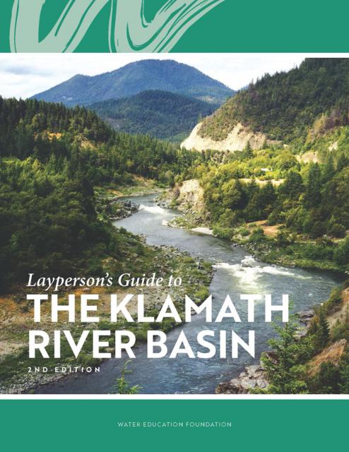
The Water Education Foundation’s second edition of
the Layperson’s Guide to The Klamath River Basin is
hot off the press and available for purchase.
Updated and redesigned, the easy-to-read overview covers the
history of the region’s tribal, agricultural and environmental
relationships with one of the West’s largest rivers — and a
vast watershed that hosts one of the nation’s oldest and
largest reclamation projects.
The 24-page Layperson’s Guide to Flood Management explains the
physical flood control system, including levees; discusses
previous flood events (including the 1997 flooding); explores
issues of floodplain management and development; provides an
overview of flood forecasting; and outlines ongoing flood control
projects.
A watershed is the land area that drains snowmelt and rain into a
network of lakes, streams, rivers and other waterways. It
typically is identified by the largest draining watercourse
within the system. In California, for example, the Sacramento River Basin is the
state’s largest watershed.
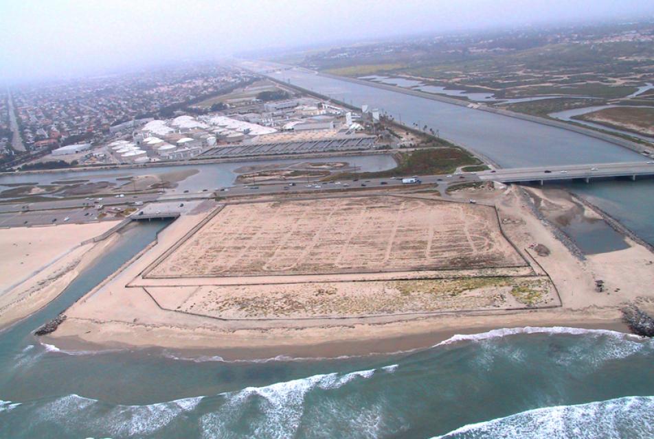
Southern California’s Santa Ana River is the largest watershed
drainage south of the Sierra and is located largely in a highly
urbanized, highly regulated setting.
At about 100 miles long and with more than 50 tributaries, the
Santa Ana spans parts of San Bernardino, Riverside and Orange
counties as it drains 2,840 square miles of land.
Drawn from a special stakeholder symposium held in September 1999
in Keystone, Colorado, this issue explores how we got to where we
are today on the Colorado River; an era in which the traditional
water development of the past has given way to a more
collaborative approach that tries to protect the environment
while stretching available water supplies.
Lake Tahoe is one of the Sierra Nevada’s crown jewels, renowned
for its breathtaking clarity. The high-altitude, clear blue lake
and its surrounding basin, which lie on the California-Nevada
state line, is a spectacular natural resource that provides
environmental, economic, recreational and aesthetic benefits.


")
")
")
")
")
")
")
")
")
")
")
")
")
")
")