

Eel River

The Eel River supports one of California’s largest wild salmon and steelhead runs in a watershed that hosts the world’s largest surviving stands of ancient redwoods.
The Eel flows generally northward from Northern California’s Mendocino National Forest to the Pacific, a few miles south of Eureka. The river and its tributaries drain more than 3,500 square miles, the state’s third-largest watershed.
The Eel River system hosts the longest salmon run in the state. NOAA Fisheries has made the watershed a high priority for rebuilding salmon populations. Portions of the river system are “wild and scenic.” The designation by California (1972) and the federal government (1981) protects these stretches from dams.
The Eel River is a major water source and recharges the groundwater basins that support agricultural and domestic water supplies. Its flows vary as much as a hundredfold because of the changing Pacific storm patterns.
The River’s Course
The river’s mainstem runs about 200 miles north through the Coast Range toward its mouth just south of Humboldt Bay. Along the way, it joins four tributaries: the Van Duzen River, North Fork, Middle Fork and South Fork.
The Eel originates on the south side of Bald Mountain in Mendocino National Forest. From there it flows south to Lake Pillsbury, a reservoir built in 1921 — decades before Congress created the National Wild & Scenic Rivers System.
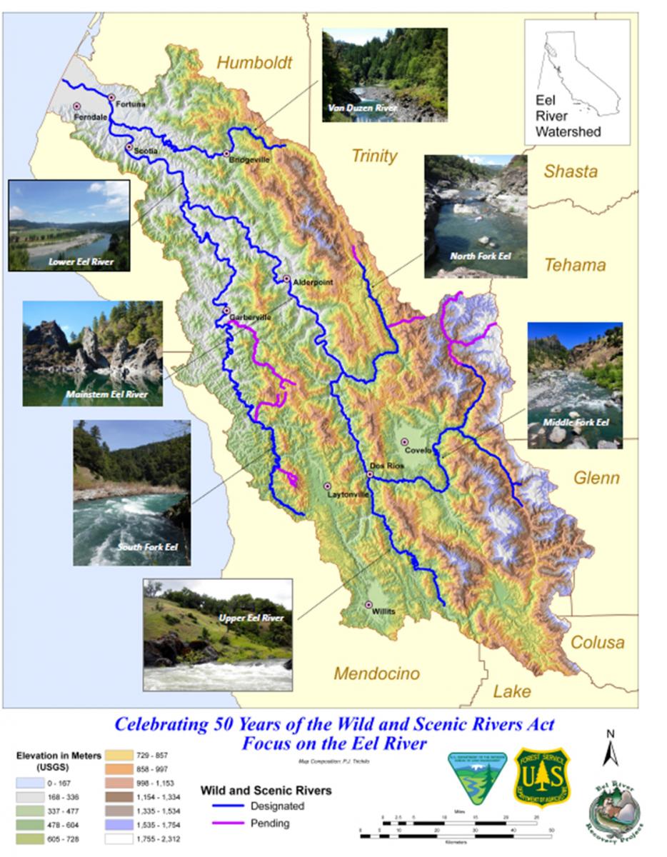
The Eel then flows west. On this stretch, Pacific Gas & Electric diverts some of the flows to its Potter Valley hydroelectric turbines in the headwaters of the Russian River.
The river then courses north. It meets the Middle Fork and then the North Fork from the east, enclosing the Round Valley Indian Reservation. The mainstem then joins the South Fork from the west and the Van Duzen from the east before reaching the city of Fortuna where it bends west through an estuary to empty into the Pacific.
Potter Valley Project
The Cape Horn and Scott dams that comprise PG&E’s Potter Valley Project have blocked fish passage for more than 100 years, contributing to the decline of salmon and steelhead populations. Seismic concerns, maintenance costs and endangered species protections prompted PG&E in 2023 to begin the process of surrendering its federal license to operate the hydroelectric project.
PG&E says demolition of the two dams could begin as soon as 2028, pending regulatory approval. The dam removals would make the Eel the longest free-flowing river in California.
Wildlife and History
The Eel supports steelhead, chinook salmon and lamprey. The river is also home to a population of coho salmon that lives primarily in the South Fork, though there is a run that travels up the mainstem to a tributary called Outlet Creek.
The watershed’s temperate forests of mainly Douglas fire and western hemlock have supplied vast amounts of timber since the arrival of the earliest settlers.
For thousands of years before European settlement, several Athabaskan Indian tribes inhabited the lands surrounding the Eel River, including the Wailaki, Lassik, Nongatl and Sinkyone peoples.
The Wiyot Tribe’s ancestral territory is near the mouth of the Eel. The tribe’s Natural Resources Department, established in 1996, has collaborated with federal agencies and university researchers in monitoring and managing populations of native fish, including lamprey, green sturgeon and pikeminnow.


