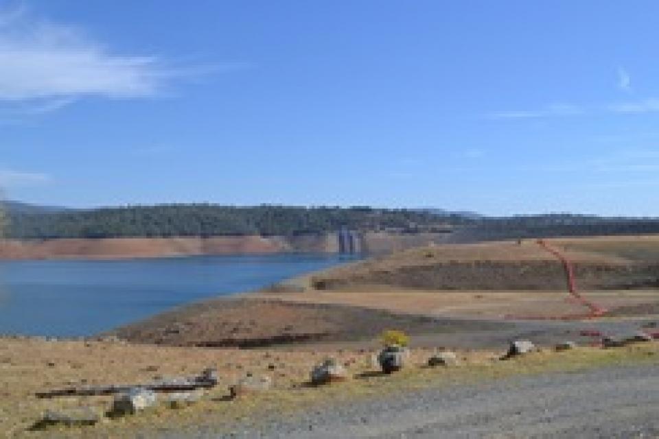
Oroville Dam is the centerpiece and largest water storage
facility of the State Water Project. Located about 70 miles north
of Sacramento at the Feather River confluence, Oroville Dam
creates a reservoir that can hold 3.5 million acre-feet of water.
Features such as a fish barrier dam and pool at Oroville Dam made
the SWP one of the first major water projects built with
environmental protections as a major consideration.
Besides storing water, the dam also protects downstream residents
from the floodprone Feather River—the main feeder of the SWP— and
provides major water recreation facilities such as boating,
fishing and camping.
Golden mussels are creating a growing challenge for
California’s waterways, and environmental advocates say the
state still lacks a consistent strategy to prevent the invasive
species from spreading. … The mussels have already
forced several counties to declare emergencies, while agencies
across California work to slow their spread. But as officials
respond, one major question remains: why are some waterways
requiring boat inspections while others are not? Advocates
argue that without consistent prevention measures across the
state, one waterway’s efforts could be undermined by another’s
weaker protections. … The criticism comes after the
California Department of Water Resources ended mandatory
watercraft inspections and decontamination requirements at Lake
Oroville.
The state of California is walking back protections meant to
keep destructive golden mussels out of Lake Oroville, one of
the largest and most important reservoirs in the
state. The move follows a new state-funded risk assessment
that the invasive species poses a lower risk to the lake, which
water managers say changes the state’s calculus on costly and
difficult measures aimed at keeping the invaders at
bay. No state agencies or scientists have found mussels in
Oroville yet. But invasive species experts say the revised
policy of the Department of Water Resources increases the
likelihood that golden mussels will invade Lake Oroville and
hitch a ride on boats to other lakes. They disagree,
though, about whether preventing such an incursion is even
possible.
The 24-page Layperson’s Guide to California Water provides an
excellent overview of the history of water development and use in
California. It includes the latest information on the state’s
changing hydrology, recent water conservation legislation and the
state’s efforts to stretch the available water supplies.
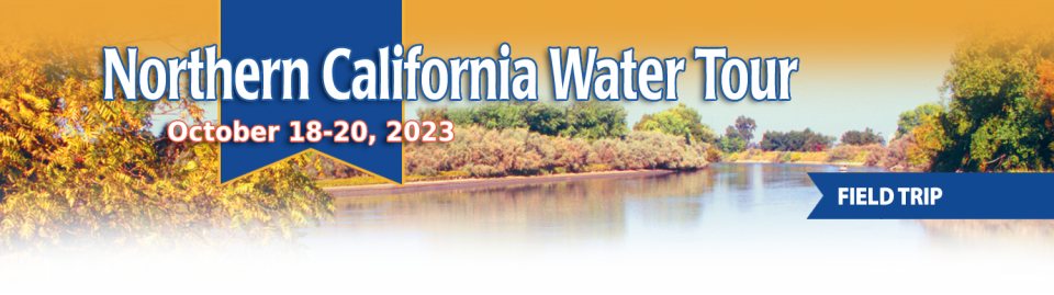
This tour explored the Sacramento River and its tributaries through a scenic landscape while learning about the issues associated with a key source for the state’s water supply.
All together, the river and its tributaries supply 35 percent of California’s water and feed into two major projects: the State Water Project and the federal Central Valley Project.
Water Education Foundation
2151 River Plaza Drive, Suite 205
Sacramento, CA 95833
This tour explored the Sacramento River and its tributaries
through a scenic landscape while learning about the issues
associated with a key source for the state’s water supply.
All together, the river and its tributaries supply 35 percent of
California’s water and feed into two major projects: the State
Water Project and the federal Central Valley Project.
Water Education Foundation
2151 River Plaza Drive, Suite 205
Sacramento, CA 95833
Land and waterway managers labored
hard over the course of a century to control California’s unruly
rivers by building dams and levees to slow and contain their
water. Now, farmers, environmentalists and agencies are undoing
some of that work as part of an accelerating campaign to restore
the state’s major floodplains.
This tour guided participants on a virtual exploration of the Sacramento River and its tributaries and learn about the issues associated with a key source for the state’s water supply.
All together, the river and its tributaries supply 35 percent of California’s water and feed into two major projects: the State Water Project and the federal Central Valley Project.
The deadliest and most destructive
wildfire in California history had a severe impact on the water
system in the town of Paradise. Participants on our Oct. 2-4
Northern California
Tour will hear from Kevin Phillips, general manager of
Paradise Irrigation District, on the scope of the damages, the
obstacles to recovery and the future of the water district.
The Camp Fire destroyed 90 percent of the structures in Paradise,
and 90 percent of the irrigation district’s ratepayer base. The
fire did not destroy the irrigation district’s water storage or
treatment facilities, but it did melt plastic pipes, releasing
contaminants into parts of the system and prompting do-not-drink
advisories to water customers.
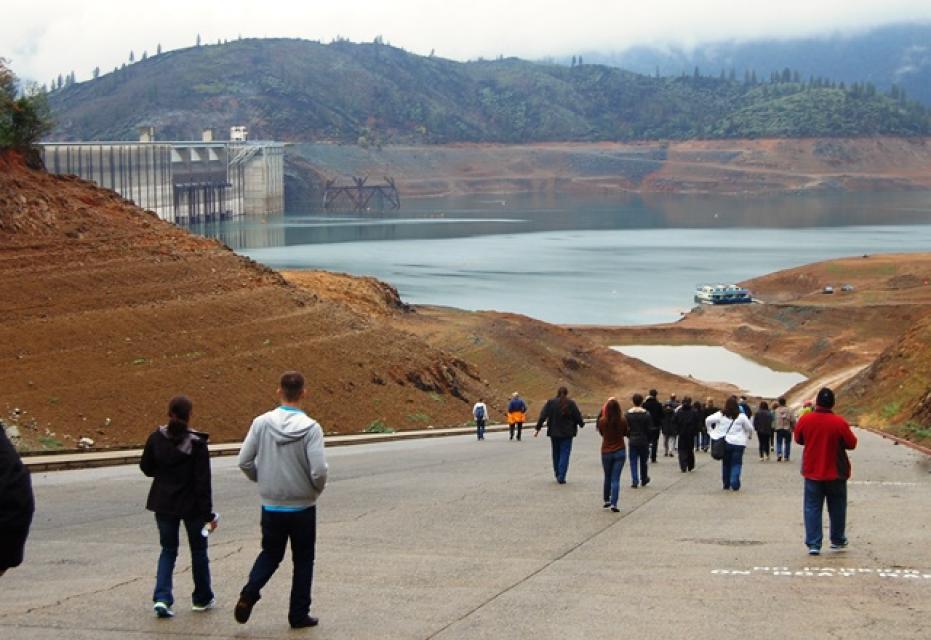
This tour explored the Sacramento River and its tributaries
through a scenic landscape as participants learned about the
issues associated with a key source for the state’s water supply.
All together, the river and its tributaries supply 35 percent of
California’s water and feed into two major projects: the State
Water Project and the federal Central Valley Project. Tour
participants got an on-site update of Oroville Dam spillway
repairs.
This tour explored the Sacramento River and its tributaries
through a scenic landscape as participants learned about the
issues associated with a key source for the state’s water supply.
All together, the river and its tributaries supply 35 percent of
California’s water and feed into two major projects: the State
Water Project and the federal Central Valley Project. Tour
participants got an on-site update of repair efforts on the
Oroville Dam spillway.
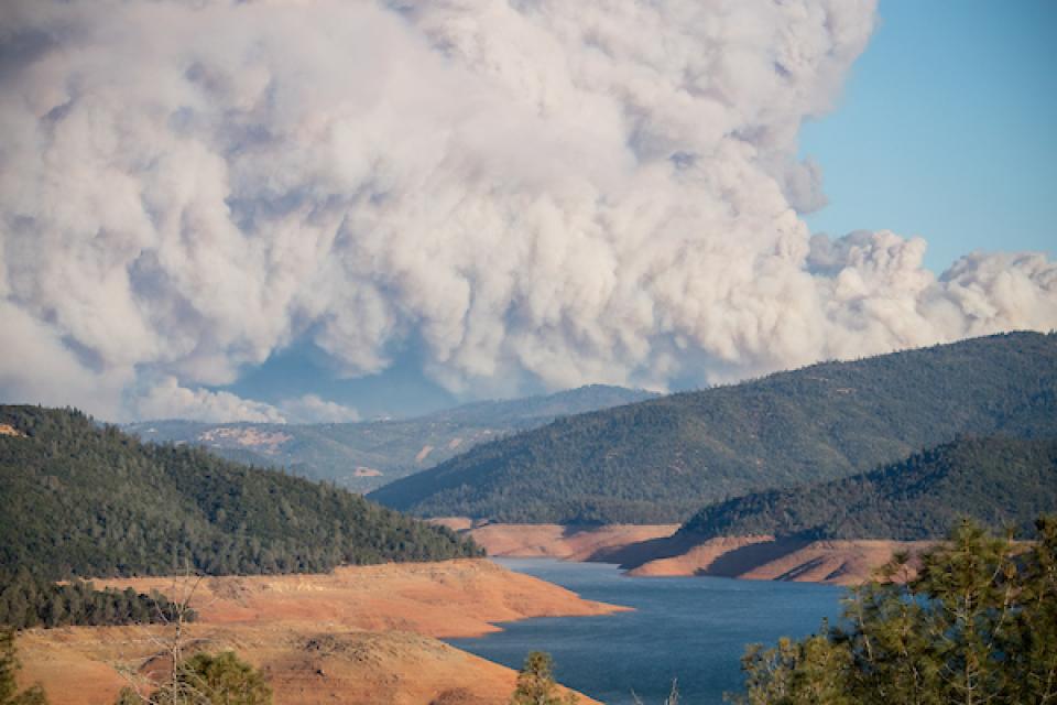
In 2017, it is likely that no other water story grabbed as many
headlines in California and across the country as the flood
incident at Oroville Dam, the centerpiece of the State Water Project and
its largest water storage facility.
On our upcoming Northern California
Tour, we will spend time at the Oroville Dam visitor’s
center and meet with California Department of Water Resources
staff. You’ll see drone footage from February’s flood
incident, learn the engineering background on what led to it, and
hear about plans to stabilize the spillway before the next winter
storms and to finalize repairs by 2018.
One of the wettest years in California history that ended a
record five-year drought has rejuvenated the call for new storage
to be built above and below ground.
In a state that depends on large surface water reservoirs to help
store water before moving it hundreds of miles to where it is
used, a wet year after a long drought has some people yearning
for a place to sock away some of those flood flows for when they
are needed.
California Natural Resources Agency Secretary John Laird said
Tuesday that the February crisis with the broken spillway at
Oroville Dam offers an “important opportunity” to assess the
safety of the more than 1,400 dams in the state.
“We really want to use the focus on this to look at the issue of
dam safety in California,” he said during a hearing of the Senate
Natural Resources and Water Committee. “We have the best
inspection program of the 50 states but it is clear we can do
better.”
Work crews repairing Oroville Dam’s damaged emergency spillway
are dumping 1,200 tons of rock each hour and using shotcrete to
stabilize the hillside slope, an official with the Department of
Water Resources told the California Water Commission today.
The pace of work is “round the clock,” said Kasey Schimke,
assistant director of DWR’s legislative affairs office.
This 25-minute documentary-style DVD, developed in partnership
with the California Department of Water Resources, provides an
excellent overview of climate change and how it is already
affecting California. The DVD also explains what scientists
anticipate in the future related to sea level rise and
precipitation/runoff changes and explores the efforts that are
underway to plan and adapt to climate.
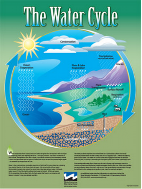
Water as a renewable resource is depicted in this 18×24 inch
poster. Water is renewed again and again by the natural
hydrologic cycle where water evaporates, transpires from plants,
rises to form clouds, and returns to the earth as precipitation.
Excellent for elementary school classroom use.
The 24-page Layperson’s Guide to the State Water Project provides
an overview of the California-funded and constructed State Water
Project.
The State Water Project is best known for the 444-mile-long
aqueduct that provides water from the Delta to San Joaquin Valley
agriculture and southern California cities. The guide contains
information about the project’s history and facilities.
A new look for our most popular product! And it’s the perfect
gift for the water wonk in your life.
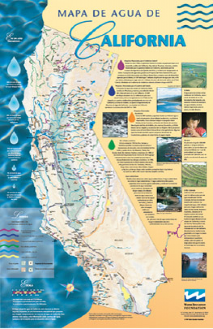
Our 24×36-inch California Water Map is widely known for being the
definitive poster that shows the integral role water plays in the
state. On this updated version, it is easier to see California’s
natural waterways and man-made reservoirs and aqueducts
– including federally, state and locally funded
projects – the wild and scenic rivers system, and
natural lakes. The map features beautiful photos of
California’s natural environment, rivers, water projects,
wildlife, and urban and agricultural uses and the
text focuses on key issues: water supply, water use, water
projects, the Delta, wild and scenic rivers and the Colorado
River.
Oroville Dam is the tallest in the
United States and impounds the largest reservoir in
California’s State Water
Project, which brings water to 27 million residents and
750,000 acres of farmland.
Completed in 1968, the 770-foot earthfill embankment impounds the
northern Sierra Nevada’s Feather River, creating a reservoir that
can hold 3.5 million acre-feet
of water.
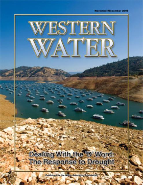
This printed copy of Western Water examines California’s drought
– its impact on water users in the urban and agricultural sector
and the steps being taken to prepare for another dry year should
it arrive.


")