It took a major disaster and the prolonged displacement of
hundreds of farmworkers, but the small Monterey County
community of Pajaro is finally getting the help and attention
of federal, state and local lawmakers its residents have sought
for decades. On Tuesday, California lawmakers sent a letter to
Michael Connor, assistant secretary of the Army for Civil
Works, urging him to speed construction on a levee that failed
earlier this month, flooding the small town, and to provide
immediate emergency relief funds to shore up the damaged
infrastructure. In addition, Gov. Gavin Newsom requested a
presidential major disaster declaration that, if approved,
could bring support and relief to the more than 2,000 residents
who had to evacuate as the Pajaro River poured onto their
streets and into their homes.
Most of the country’s lettuce and other leafy greens come from
California’s Salinas Valley, where 13 atmospheric rivers this
winter have obliterated local drought conditions. Farmers have
welcomed the water and also sometimes struggled with the
deluge. Reporter Amy Mayer has this look at what it all means
for spring salads. AMY MAYER, BYLINE: Andrew Regalado and his
father trudge through sticky mud on the edge of a field at
World’s Finest Farm in Hollister, Calif. They’ve owned the
organic vegetable and herb farm for about 17 years. In a creek
bed just beyond the field, cloudy brown water leaps at the
banks, and that’s days after floodwaters have mostly receded.
Another storm is coming. ANDREW REGALADO: If this water’s still
here, there’s a good chance we might get flooded again. Yeah,
so it’ll be a tough year.
Shaun Kinetic rests his hand on what looks like an out-of-place
pile of hay bales. The bales, which are actually the leftovers
from a corn harvest, sit under a shade structure in a parking
lot in an industrial area of San Francisco sandwiched between
highways. Those corn stalks, leaves and cobs would normally get
plowed back into the field they came from in Half Moon Bay, or
be left to decompose, releasing the carbon inside them back
into the atmosphere. Only some of these leftovers are needed to
maintain soil health and prevent erosion.
… Unlike carbon capture, which involves trapping
polluting greenhouse gasses at their source of emissions,
carbon removal entails pulling the gas out of the atmosphere
through either nature-based approaches, like conserving
existing wetlands, or technological methods, like that used by
Charm.
A coalition of federal lawmakers from California are pressing
the U.S. Army Corps of Engineers to speed up extensive repair
work on the Pajaro River levee system in Monterey County that
has taken decades to begin despite multiple breaches of the
levee, most recently on the night of March 10, when the entire
community of Pajaro was evacuated because of flooding. In a
letter to the Corps dated Monday, U.S. Sens. Alex Padilla and
Dianne Feinstein and U.S. Reps. Jimmy Panetta and Zoe Lofgren
asked the Corps to use emergency funding to expedite technical
and direct assistance with the flood control work, speed up the
review process and expedite the release of $149 million that
was already approved for the levee project in late 2021 as part
of the Infrastructure Investment and Jobs Act.
From his pickup truck, Fernando Estrada sees an ocean of water.
… A dozen feet ahead of his truck, the asphalt
disappears into seemingly endless blue, interrupted only by a
lone shed or occasional power pole jutting from the
surface. Estrada is witnessing the return of Tulare Lake.
… Some Corcoran residents fear the Sierra’s majestic,
snow-capped peaks have become a ticking time bomb – waiting to
explode over the life many have created for themselves on the
lakebed. As the weather warms, biblical amounts of water are
waiting to gush into already-overloaded dams and
rivers. That’s why Rosie Garza says she purchased a home
flood-insurance policy on Friday. … Garza says “a lot of
people” in Corcoran are scared of what’s to come, and are
buying flood insurance fast.
A powerful Pacific storm continues to bring more
rain, snow and damaging winds to California, a state already
waterlogged from at least 12 atmospheric rivers that
have delivered a barrage of rain and snow in recent
months. Up to 3 inches of rain have fallen over the
central California coast, and more is one the way Wednesday. Up
to 4 feet snow is likely in the northern coastal mountain
ranges and the Sierra by Wednesday. A slight, Level 2 of
4, risk for excessive rainfall remains across the central
California coast through early Wednesday morning, with the
expectation the risk will weaken throughout the day.
State officials were supposed to take a conservative approach
to approving salmon fishing season this year — and they did.
California’s fishing season had been scheduled to open April 1.
Instead, as a result of low salmon projections, the season has
been canceled. Salmon provides more to the state than meets the
eye. … According to the California Department of Fish
and Wildlife, salmon numbers are irregular during the three
year life cycle. Data has shown that in years following wetter
seasons fish stock has increased. Consequently there has been a
decline in stock for years following drier seasons.
This winter’s atmospheric river storms, coastal flooding,
erosion, sea level rise, saltwater intrusion into rivers, and
sedimentation dumping thousands of tons of soil into the ocean
were only the most recent of the state’s disasters. The year
2022 alone brought a massive red tide in San Francisco Bay, the
continued die-off of 95% of northern California’s kelp forest
between the Golden Gate and Cape Mendocino, and a spike of gray
whale deaths along the entire coast. Climate impacts threaten
communities, both human and wild, ranging from whales and their
ice-dependent Arctic prey to the 26 million people living in
the state’s 19 coastal counties that, as of 2021, generated
around 85% of the state’s $3.3 trillion dollar GDP. -Written by David Helvarg, author and executive
director of Blue Frontier, an ocean conservation and policy
group.
While the world’s oceans have hit a record high temperature,
the Pacific Ocean off the California coast remains colder than
average. In fact, in virtually no place in the world is the
ocean so much colder than normal, according to a map from the
National Oceanic and Atmospheric Administration.
… The stormy weather is clearly a factor. The
winds associated with storms have pushed water from the north
to the south. The weather has also brought upwelling, when
frigid water from the depths is pulled to the surface. San
Francisco Bay has also been unusually cool.
In the early hours of 11 March, pummeling rains wore down a
levee on the Pajaro River, unleashing a torrent. [Theresa]
Barajas, 50, had escaped with her daughter and grandson under
the blare of sirens. But the floods swallowed the town – and
perhaps their future here. … Most of the US’s summer
strawberries are grown in the Pajaro valley and nearby Salinas,
as are a number of other berries and greens. But without urgent
government intervention and investment, the immigrant farm
workers who pick them could become climate migrants. Many lack
legal status, and are therefore ineligible for federal disaster
relief funds or unemployment insurance. Even those who do are
struggling to feed themselves and their families in one of the
most expensive and under-resourced agricultural communities in
the US.
Doris Padilla, 65, stood almost catatonic Thursday outside her
mud-covered house on Florence Street in Pajaro, unable to begin
the grueling work of rebuilding. Unlike the neighbors busying
themselves shoveling contaminated mud and debris and moving
waterlogged furniture and carpets out of their homes, Padilla
just couldn’t move. She waited outside her house for her son to
come home from work and start cleaning up. … Monterey County
authorities Thursday morning lifted evacuation orders for the
flood-ravaged farm town, allowing residents to return to their
homes in most cases for the first time since they were forced
to flee in the middle of the night March 11 after a levee
failed upriver and inundated their community.
The costs of California’s relentless winter storms keep rising.
And outside of the human toll — with at least 28 people killed
since January — the price will be measured in billions. The
“bomb cyclone” that lashed San Francisco on Tuesday was the
latest in an epic series of extreme weather events to hit
California since New Year’s Eve. It blew out windows from
skyscrapers, flung barges into a historic bridge, sent trees
tumbling across roads, knocked down power lines, and threatened
a major freeway as the waterlogged hillside beneath it started
to collapse….The price tag for all this
mayhem — road repairs, damaged homes, lost
crops — won’t become clear for months. But the early
estimates are sobering.
For the first time in more than two years, much of the
southwest portion of California is free of both drought and
“abnormally dry” conditions. According to the U.S. Drought
Monitor, Santa Barbara, Ventura and Orange counties are
drought-free. San Diego and Los Angeles counties, although they
show improvement in the last seven days, haven’t completely
shaken “abnormal dry” and “moderate drought” statuses. The
bird’s eye view: Every week, California moves further away from
its once drought-stricken conditions. Most of the central
Sierra, foothills, Central Valley and the entire coast have
exited drought conditions. Roughly 64% of the state is
drought-free.
The Monterey Peninsula Water Management District
… announced it has finalized its appraisal of Cal Am,
the private utility water provider for the Monterey Peninsula,
to buy it out in what could be a friendly—but likely
hostile—attempted takeover. It will most certainly end up in
court—Cal Am has repeatedly said it’s not for sale—but this is
nonetheless a long-awaited moment. On Monday April 3, at
5:30pm in the Monterey City Hall council chambers, the district
will host a public presentation outlining the methodology
its consultants used in the appraisal, followed by a Q&A.
But regardless, the die will have already been cast: the
district’s statement notes that while the presentation is
occurring, “it is expected that an offer to purchase the system
will be made to Cal Am on or about the same time.”
The state has been deluged by storms this winter, hit by 12
atmospheric rivers that have led to evacuation orders, rising
rivers and broken levees. In some parts of the Sierra Nevada,
more than 55 feet of snow have fallen. With reservoirs filling
up, many Californians are eager to put the severe, 3-year
drought behind them. A major water supplier in Southern
California recently lifted mandatory conservation rules that
limited outdoor watering. Large parts of the state are now free
of drought, according to the federal government’s Drought
Monitor, which looks at rainfall and soil moisture. But in
California, water shortages aren’t just due to a lack of rain,
and the state’s chronic water problems are far from over.
As the latest storm associated with a strong atmospheric river
sweeps through California, already strained farmworkers across
the state are bracing for yet another setback. The big picture:
The rounds of atmospheric river events have decimated crops and
reduced work opportunities for many of the state’s farmworkers,
who lack access to social safety nets. What they’re saying:
Hernan Hernandez, executive director of the nonprofit
California Farmworker Foundation, tells Axios that lasting
structural damages from the rounds of storms are compounding
with the loss of work for farmworkers, particularly in
Monterey, Santa Cruz, Santa Barbara and Ventura counties.
The March 16 Coastal Climate Resilience Symposium at the
Seymour Marine Discovery Center focused on the role of
insurance and nature-based solutions in reducing the risks of
flooding and other natural disasters, which are being
exacerbated by climate change and rising sea levels. Coastal
scientists, insurance industry experts, and representatives of
state and federal agencies came together at the meeting to
address challenges and opportunities for building coastal
resilience to climate change. The flooding from a levee breach
in nearby Pajaro served as a somber reminder of the urgency of
the issues they had gathered to discuss.
A strong late-season Pacific storm that brought damaging winds
and more rain and snow to saturated California was blamed for
two deaths and forecasters said additional flooding was
possible Wednesday in parts of the state. Tuesday’s
storm focused most of its energy on central and southern
parts of the state, bringing threats of heavy runoff and
mountain snowfall. In the north, intense hail was reported in
Sacramento, the state capital. Locally heavy rain and
snowmelt may cause flooding Wednesday in southern California
and central Arizona, the National Weather Service warned.
Atmospheric river-fueled storms have hammered the network of
hundreds of levees in coastal counties near the San Francisco
Bay — from the agricultural fields of Monterey County to urban
places like San Leandro, Walnut Creek and Richmond to more
rural parts of the North Bay. At least two major levees, in
Salinas and Pajaro, have failed since New Year’s Eve. The levee
breach along the Pajaro River, which divides Santa Cruz and
Monterey counties, left the entire town of Pajaro in a deluge
of water. More than 3,000 residents could be displaced for
several weeks. The disastrous flood submerged a significant
acreage of agricultural land there, and the mostly lower-income
Latino community now faces overwhelming economic and housing
uncertainty.
Earthquakes, snow, wildfires, flooding, smog, fog, heat,
drought — these are just some of extreme natural disasters and
climate conditions experienced in the Golden State in any given
year. California is notoriously the “land of extremes,”
Kristina Dahl, senior climate scientist at the Union of
Concerned Scientists, told ABC News. Snowpack from the winter
could quickly melt into flooding come spring. Heat waves in the
summer pave the way for wildfires in the fall. Now, intense
moisture from atmospheric rivers is walloping the West Coast
with an inundation of precipitation — oftentimes too much at
once. A pervasive megadrought has been plaguing the region for
decades and to top it off, tectonic shifts could cause an
earthquake at almost any given moment.
Too much thing, rain, is sinking farmers’ bottom lines across
California’s Central Coast. The area some call “America’s salad
bowl” more resembles a soup bowl as round after round of
atmospheric river-fueled storms overwhelmed farmland. We all
may start to notice a difference in the grocery store as some
staples become harder to find. FOX Weather brought you to
Pajaro, California when the levee failed recently. The farming
community in the Pajaro River Valley disappeared under feet of
water. Similar scenes played out across the Salinas River
Valley, another iconic farm area in Monterey County which is
the fourth top agricultural producer in the state, according to
the California Department of Food and Agriculture.
For Brenda Eskenazi, what once seemed merely a rich vein of
epidemiological knowledge has turned out to be a mother lode.
Eskenazi, who runs the Center for the Health Assessment of
Mothers and Children of Salinas study (known as CHAMACOS,
Mexican Spanish slang for “little kids”), has tracked pairs of
mothers and their children for more than 20 years. She’s
collected hundreds of thousands of samples of blood, urine and
saliva, along with exposure and health records. … So
when Charles Limbach, a doctor at a Salinas health clinic, saw
an explosion of fatty liver disease in his young patients and
found a study linking the condition in adults to the
weed killer glyphosate, he contacted Eskenazi.
Though California may be ending its winter with quenched
reservoirs and near record snowpack, meteorologists are warning
that the state will face increased flooding risk in the coming
months as Sierra Nevada snowmelt fills rivers and streams. On
Thursday, the National Oceanic and Atmospheric Administration’s
spring flood outlook reported that drought conditions will
continue to improve in much of the state, but the potential for
flooding will worsen in the face of heavy snowpack and elevated
soil moisture. … The severity of that flooding remains
to be seen, however, and depends on a variety of weather
factors, experts say. … Potential triggers for rapid
snowmelt could be an early season heat wave or another series
of warm storms, Swain said …
California is finally seeing a break from the rain. That is
giving people time to take stock of the damage in flooded
areas, areas including the town of Pajaro in the state’s
central coast. A levee broke there last weekend and forced
thousands of residents, many of them farm workers, to evacuate.
Farida Jhabvala Romero from member station KQED went there
yesterday. And, Farida, what did you see? … The first thing
is that the water has receded a lot in the main parts of town.
And so I was able to drive through Main Street, which was
impossible just a couple of days ago, when everything was
underwater. And you could really tell the water mark about two
to three feet up on building walls. You could tell the damage
is going to be really extensive. I saw a beauty salon, for
example, that was missing part of its front wall.
After more than a year of wrangling, California American Water
Co. has agreed in principle to sign an agreement to purchase
water from a major expansion of a Monterey Peninsula water
recycling project that when completed will provide for
thousands of acre-feet of additional water. Evan Jacobs,
external affairs manager for Cal Am, confirmed Thursday that
what was agreed upon was a filing made by the state Public
Advocates Office that gave Cal Am a portion of what it wanted.
The filing still must be approved by the California Public
Utilities Commission, or CPUC, but it’s the first time all
sides have agreed in principle since September of 2021. The
Public Advocates Office helps to ensure Californians are
represented at the CPUC by recommending solutions and
alternatives in utility customers’ best interests.
The winter of 2022-23 has been devastating for California’s
strawberry industry. After storms in December and January
caused over $200 million in crop damage from wind, rain and
floods, damage from recent flooding from the Pajaro and Salinas
rivers in Monterey County has caused hundreds of millions of
dollars more in losses, the California Strawberry Commission
reports. The latest disaster comes as farmers had borrowed
money to prepare the fields and were weeks away from beginning
to harvest, said Rick Tomlinson, the commission’s president. As
soon as the cleanup is complete, farmers will begin the process
of preparing the fields and starting over, he said.
The 11th atmospheric river storm of the season left a trail of
soggy misery in California as it broke decades-old rainfall
records and breached levees this week. In the Tulare County
city of Porterville, residents on both sides of the Tule River
were ordered to evacuate Wednesday morning as levels rose at
Lake Success, sending water running over the spillway at
Schafer Dam. … Lake Success saw a significant increase
in inflows overnight, peaking at nearly 19,800 cubic feet of
water rushing in per second Wednesday morning, according
to state data. Visalia and Porterville have declared a
state of emergency. The increased flow from the spillway
is adding more water to the river and tributaries below, both
of which are already full from the last storm, Monteiro said,
adding that there is “flood concern.”
In the wake of flooding caused by a breach of the Pajaro River
levee around midnight between March 10 and 11, the Pajaro/Sunny
Mesa water systems were put on a “do not drink” order on March
11, just before 1pm. That means even boiling the water,
filtering it or otherwise treating it will not necessarily make
it safe. That’s not because the water is known to be unsafe—it
hasn’t been tested yet—it’s just that it might be. Judy
Varela with Pajaro/Sunny Mesa says that three wells have been
impacted by the flooding, and it’s not known if any of the
floodwaters have seeped down the well shafts and into the
groundwater supply, and it’s also not yet known what
contaminants, if any, are in those floodwaters.
It was late Friday morning when muddy, brown water started
rushing onto Michelle Hackett’s Salinas Valley farms. On one
side of her family’s Riverview Farms cannabis business, a
county-mandated retention pond overflowed. Next door, a farm
abandoned by another grower — one of dozens of cannabis
businesses to shut down in Monterey County in recent years —
spawned another small river headed straight for Hackett and her
skeleton crew. … Cannabis businesses like Hackett’s —
along with thousands of undocumented farmworkers and the area’s
unhoused residents — fear they’ll be left to fend for
themselves as yet another winter storm batters California’s
Central Coast, local officials and advocates say.
California’s 11th atmospheric river storm of the season
barreled through a beleaguered state this week, dropping more
rain and snow, sending thousands scrambling for higher ground
and leaving more than 300,000 without power. The rain was
expected to continue into Wednesday across Southern California,
which saw rainfall records Tuesday. … The storm arrives amid
near-record snowpack and one of California’s wettest winters in
recent memory. Nine back-to-back atmospheric river storms hit
the state in late December and early January, and a 10th
deluged the state last week. Though conditions are
expected to clear after the storm, the relief will be
short-lived as yet another atmospheric river has set its sights
on California next week, forecasters said — just in time for
the first day of spring.
This winter devastating floods and mudslides in California
killed at least 17 people, closed roads for days and caused
thousands to be evacuated. Mud and water ripped through the
hillside town of Montecito five years to the day after a 2018
slide there killed 23 people and destroyed more than 100 homes.
Between 1998 and 2017 landslides and mudslides affected nearly
five million people worldwide and took the lives of more than
18,000, according to the World Health Organization. In
contrast, wildfires and volcanic activity killed 2,400. In the
U.S. alone, slides and other debris flows kill 25 to 50 people
every year. Yet by and large we don’t hear very much about
hazardous slides. Tornadoes, volcanoes, wildfires and
hurricanes get more headlines. They get more scientific
attention, too.
“Atmospheric river storm” is becoming part of Californians’
everyday vocabulary in 2023. Kicking off the year, these
systems have been unrelenting. Floods, broken levees and record
rain have berated communities across the state. There have been
not one, two or five of these storms this year — but at least
10, the National Weather Service told The Bee. A silver lining:
Drought conditions have improved dramatically. In Sacramento,
the most notorious of these storms hit in early January, with
the latest round the first two weeks of March.
California is no stranger to big swings between wet and dry
weather. The “atmospheric river” storms that have battered the
state this winter are part of a system that has long
interrupted periods of drought with huge bursts of rain —
indeed, they provide somewhere between 30 and 50 percent of all
precipitation on the West Coast. The parade of storms
that has struck California in recent months has dropped more
than 30 trillion gallons of water on the state, refilling
reservoirs that had sat empty for years and burying mountain
towns in snow. But climate change is making these storms
much wetter and more intense, ratcheting up the risk of
potential flooding in California and other states along the
West Coast.
The atmospheric rivers that flowed over California in January
dumped about a foot of rain — equal to an entire year’s average
— in many parts of the state’s parched Central Valley, which
encompasses only 1% of U.S. farmland but produces 40% of the
nation’s table fruits, vegetables, and nuts. With February,
ordinarily the second wettest month, still to be counted, talks
of all the land that will have to fallowed as a result of the
drought have quieted for now. But most Golden State growers
have come to realize that droughts will simply be a part of
farming going forward, and the safety net is gone. That
safety net was groundwater pumping. For more than a
half-century, farmers in the Central Valley, the multi-faceted
state’s chief production area, have been pumping more water
from aquifers than can be replenished, causing wells to be
drilled deeper and deeper.
Ask any of the wine grape growers planting own-rooted stock why
they’re farming these massively risky grapevines and they’ll
all tell you the same thing: They just want to make really
great wine. But there’s another benefit to the gamble,
too—unlike most American wine grapes, which are overwhelmingly
grown on grafted rootstock, own-rooted vines are especially
drought-tolerant, produce a more predictable crop and use
significantly fewer resources. There’s a huge downside to
using own-rooted vines, though. If they get attacked
by phylloxera, the entire crop will die. It won’t be a
loss of just one season’s grapes—the entire vineyard itself
will be totally destroyed. And the invasive species is present
in the soil in vineyards throughout America.
California is once again bearing the brunt of inclement
weather, as a low-pressure system off the coast rapidly
intensifies and becomes a storm, tapping into another
atmospheric river that’s flowing between Hawaii and
California. The storm that started Monday night is
forecast to raise powerful winds along the coast that will
spread to all corners of the Bay Area, Central Coast and
Central Valley and peak just before sunrise on Tuesday. These
winds will ferry heavy rainfall, thunderstorms and the risk for
more flooding across most of the California coast and
eventually Southern California.
The levee breach that left an entire California town underwater
this weekend is putting a spotlight on how the state’s vital
flood control infrastructure is being weakened by age, drought,
climate change, rodents and neglect — leaving scores of
communities at risk. On Friday night, the swollen
Pajaro River burst through the worn-down levee, flooding the
entire town of Pajaro and sending its roughly 3,000 residents
into what officials are now estimating to be a multi-month-long
exile. A second breach was reported on Monday…. Experts say
similar weaknesses plague levee systems across California and
the nation. As climate change threatens to intensify and
exacerbate extreme weather events — such as flooding and even
drought — the unease and desperation of residents and emergency
responders in communities near these crumbling systems is
growing.
Legal challenges to a Monterey Peninsula water district’s
ratepayer fee that dates back a least a decade reached fruition
this week when a judge ruled against the district and ordered
it to stop collecting the fee. The ruling could have a huge
impact on district revenues at a time when the Monterey
Peninsula Water Management District is partnering with Monterey
One Water to invest in the Pure Water Monterey expansion
project, which the district says could supply enough water to
the Monterey Peninsula for the next few decades. At issue are
two fees. The first is a “user fee” that was collected as a
pass-through charge on California American Water Company’s
bills. But state regulators in 2011 ordered a halt to it, so
the district created another fee called a “water supply fee”
that was collected through property taxes.
After enduring historic drought conditions exacerbated by three
years of the La Niña weather phenomenon, California is finally
free from her clutches, the National Oceanic and Atmospheric
Administration said Thursday. However, El Niño may be looming,
and with it, comes a whole new set of weather and climate
challenges. Unlike the typically dry years La
Niña brings to California, El Niño tends to bring
increased chances of torrential storms, flooding, mudslides and
coastal erosion. It typically occurs every three to five years
when surface water in the equatorial Pacific becomes warmer
than average. This week, the World Meteorological Organization
forecast a 55 percent chance of an El Niño developing heading
into autumn.
In another sign that the drought is ending across much of
California, state water officials opened the floodgates at
Oroville Dam on Friday to let water out of the state’s
second-largest reservoir to reduce the risk of flooding to
downstream communities. … At noon, water began
cascading down the huge concrete spillway for the first time in
four years. On Friday, Oroville reservoir was 75% full —
or 115% of its historical average for early March. It has risen
180 feet since Dec. 1, and continued to expand steadily with
millions of gallons of water pouring in from recent storms.
Still reeling from storms that inundated neighborhoods, forced
rescues and damaged roads, storm-battered California is bracing
for another atmospheric river that threatens even more flooding
Monday. More than 17 million people remain under flood watches
across California and Nevada early Monday as the storm makes
its menacing approach – the 11th atmospheric river to hit the
West this winter season. The new storm, arriving on the heels
of another atmospheric river, could exacerbate flooding and
damage in some places. Already, those in the central and
northern parts of California are crowding into shelters and
dealing with flooded neighborhoods, along with mudslides,
dangerous rushing rivers, collapsed bridges and unusable roads.
In the coming years, Cal Am ratepayers could see a
surcharge on their property tax bills disappear. Or, maybe
not. On March 3, Monterey County Judge Carrie Panetta
ruled that the continued collection of the surcharge—which is
collected by California American Water and then paid to the
Monterey Peninsula Water Management District—violated the
sunset clause in an ordinance MPWMD approved in 2012 to create
that charge. Collectively, it costs Cal Am ratepayers about
$3.4 million annually. The reason that charge might not
go away soon is that on March 20, MPWMD’s board will be meeting
in closed session to decide, among other things, whether or not
to appeal the ruling. If they do appeal, it could take a couple
of years or more before the appeal is decided.
The 30×30 initiative is a global effort to set aside 30% of
land and sea area for conservation by 2030, a move scientists
hope will reverse biodiversity loss and mitigate the effects of
climate change. Now adopted by state and national governments
around the world, 30×30 creates an unprecedented opportunity to
advance global conservation. When it comes to the water side of
30×30, most programs focus primarily on conservation of oceans,
but a new study by researchers at the University of California,
Berkeley argues that freshwater ecosystems must not be
neglected. Published Tuesday in the journal Frontiers in
Ecology and the Environment, the paper urges policy makers to
explicitly include freshwater ecosystems like rivers, lakes,
and wetlands in 30×30 plans, and outlines how their
conservation will be critical to achieving the initiative’s
broader goals.
Sara Rubin here, looking at a glass of water on my desk and
appreciating all of the technology and infrastructure and
people behind the scenes who worked to bring me that water.
Specifically, I am thinking about Pure Water Monterey, a
high-tech water recycling system at Monterey One Water in
Marina, that uses a four-step process to treat wastewater—the
same stuff that goes out the drains of our showers and gets
flushed down our toilets. The four-step process includes ozone
pre-treatment, membrane filtration, reverse osmosis and
oxidation with UV light and hydrogen peroxide. Like I said—to
all of you working to build this stuff and get me my glass of
water, thank you. -Written by Sara Rubin, editor of the Monterey County
Weekly.
Gov. Gavin Newsom’s proposed budget would cut funding for
coastal resilience projects almost in half, eliminating more
than half a billion dollars of state funds this year that would
help protect the coast against rising seas and climate change.
The cuts are part of Newsom’s proposed $6 billion in reductions
to California’s climate change programs in response to a
projected $22.5 billion statewide deficit. California’s coastal
resilience programs provide funding for local governments to
prepare coastal plans and pay for some projects that protect
beaches, homes and infrastructure at risk from rising sea
levels. Greenhouse gases are responsible for warming the
planet, which melts ice and causes sea levels to rise.
In 1910, the Los Angeles real estate developer J. Harvey
McCarthy decided that this small agricultural town in the
Central Valley would be his “city beautiful,” a model community
and an automobile stop along the road to Yosemite. An infusion
of money brought Planada a bank, hotel, school, church and its
own newspaper, the Planada Enterprise, by the following year. A
celebration for the town’s first anniversary drew an estimated
10,000 people (though Planada had only several hundred
residents) as the city had become the best-known place in
Merced County. But McCarthy eventually abandoned the community,
located nine miles east of Merced, leaving its settlers to pick
up the pieces. It remained a farming town and is now home to
4,000 mostly low-income and Spanish-speaking residents who work
at nearby orchards.
The stubborn La Niña climate pattern that gripped the tropical
Pacific for a rare three years in a row is waning, and the odds
of an El Niño system forming later this year are getting
stronger, according to recent meteorological reports. The El
Niño-La Niña Southern Oscillation, sometimes referred to as
ENSO, has a major influence on temperature and rainfall
patterns in different parts of the world, with La Niña often
associated with drier-than-normal conditions in California,
especially the southern part of the state. El Niño, on the
other hand, is linked to an enhanced probability of
above-normal rainfall in California, along with accompanying
landslides, floods and coastal erosion, though it is not a
guarantee.
The Department of Water Resources (DWR) today kicked
off National Groundwater Awareness Week 2023 with an
engaging educational event held at the California Natural
Resources Agency headquarters in Sacramento. The event featured
an array of groundwater partners who
provided presentations describing their work in
groundwater and why groundwater is such an important water
resource in California. After the presentations, the in-person
audience visited educational stations where they engaged with
the day’s speakers and other groundwater professionals.
Northern California could be in for a new atmospheric
river storm by the end of the week, potentially blasting the
Bay Area with substantial rain, and the Sierra with even more
heavy snow, but likely not as fierce as the wet storms that
wreaked damage across the region at the start of the year,
forecasters say…. Daniel Swain, a climate scientist at
UCLA and the Nature Conservancy, said Sunday
evening that an atmospheric river could be a concern
regarding the state’s snowpack, which on Friday reached
its highest level this century for the start of
March. Such rain-on-snow events — when heavy rain
falls on snow in higher elevations — could result in
snow melting faster, flooding downstream areas, overwhelming
rivers and overloading buildings with heavy
slush, weather experts say.
David Schmalz here, thinking about water. More specifically,
I’m thinking about the water supply in the northern Salinas
Valley, which has long been in a critical state of
overdraft. In last week’s issue of the Weekly, I wrote a
story about how seawater intrusion continues to worsen in the
northern part of the valley, which is a result of that
overdraft. In natural conditions, without any pumping, the
water in the aquifers moves downward, toward the Monterey Bay,
but when over-pumping occurs, that pressure differential
reverses as groundwater levels decline—seawater starts to
intrude inland into the aquifers, eventually reaching a point
of salinity to where it can’t be used to irrigate crops. -Written by Weekly columnist David Schmalz.
State water officials on Thursday rejected six local
groundwater plans for the San Joaquin Valley, where basins
providing drinking and irrigation water are severely depleted
from decades of intensive pumping by farms. The plans —
submitted by local agencies tasked with the job of protecting
underground supplies — outline strategies for complying with a
state law requiring sustainable groundwater
management. The Department of Water Resources deemed the
plans inadequate … Groundwater depletion has hurt the San
Joaquin Valley’s small, rural communities, home to many
low-income Latino residents who have been forced to live on
bottled water and drill deeper wells, which can cost tens of
thousands of dollars.
The Carmel River Watershed has seen record rainfall this winter
beating out 1998 for the wettest year to date and the rain is
not done yet. But most of that water won’t end up in your tap
instead it’s flowing out to the ocean. … That 91,000
acre-feet is equivalent to roughly 29.6 million gallons of
water going out to sea or nine years’ worth of drinking water
for the Peninsula. … Not every drop of rainwater
this winter went out to the Pacific. To date his water year the
Peninsula’s water utility California American Water has banked
about 500 acre-feet of water off the Carmel River, less than a
tenth of what the Peninsula will use in a year, the water’s
been piped to the Seaside Basin and stored in injection wells.
A conversation with UCCE Viticulture Advisor Dr. Chris Chen
(Sonoma, Lake, Mendocino Counties) and soil scientist Noelymar
Gonzalez-Maldonado (UC Davis) about regenerative viticulture,
soils, and climate resilience in vineyards. Released February
24, 2023.
January’s relentless storms brought power outages, floods,
landslides and falling trees. But Santa Cruz residents had one
critical resource they never had to worry about — clean
drinking water. … Santa Cruz draws drinking water from
multiple surface water sources. It’s a complex system and it
keeps the operators on their toes, especially during storms.
… Loch Lomond Reservoir, which is held by the Newell
Creek Dam, holds about one year’s worth of drinking water
supply. That supply, which workers sometimes refer to as “the
lake,” can be pulled in for treatment as needed, but operators
try to use other sources first. “We kind of look at the lake as
it’s a reserve for the dry years,” said Ben Curson, a water
treatment operator.
Apocalyptic scenes of wildfires and floods are now familiar to
Californians. However, the ecological impacts from these events
remain understudied in California and across the world. Gaps in
awareness and understanding on the issue are especially intense
for freshwater mussels, whose cryptic and sedentary
life-histories belie their importance to freshwater ecosystems
and biodiversity (see previous post on freshwater mussels). One
difficulty in studying effects of wildfire on freshwater
ecosystems is that there is often a “right time in the right
place” factor to appropriately conduct the science. For
example, researchers and biologists often need to be studying a
population or ecosystem before a burn so effects afterwards can
be quantified – ideally alongside nearby unaffected control
sites. Yet such natural experiments are rare because we never
know when and where major wildfires will strike.
Morro Bay officials celebrated the start of operation for the
city’s $160 million wastewater treatment facility — months
ahead of a state-imposed deadline — on a chilly, rainy Thursday
morning. The Morro Bay Water Resources Center is the largest
municipal project in the city’s history, Scott Collins, Morro
Bay’s outgoing city manager, said at Thursday’s ceremony.
Located at 555 South Bay Blvd. south of town, the new sewage
treatment facility will use “scientifically proven, advanced
purification processes,” including reverse osmosis and
ultraviolet advanced oxidation, according to a news release.
The plant processes an average of 1 million gallons of
wastewater a day, but can process up to 8.14 million gallons
per day during storm events, according to engineer Erick
Bevington.
Despite the storms that have deluged California this winter,
the state remains dogged by drought. And one of the simplest
solutions — collecting and storing rainfall — is far more
complicated than it seems. Much of California’s water
infrastructure hinges on storing precipitation during the late
fall and winter for use during the dry spring and summer. The
state’s groundwater aquifers can hold vast quantities of water
— far more than its major reservoirs. But those aquifers have
been significantly depleted in recent decades, especially in
the Central Valley, where farmers have increasingly pumped out
water for their crops. And as Raymond Zhong, a New York Times
climate journalist, recently reported, the state’s strict
regulations surrounding water rights limit the diversion of
floodwaters for storage as groundwater, even during fierce
storms …
Among the homes and businesses severely damaged by flooding
along the Carmel River on Jan. 9 was a critical steelhead trout
facility protecting the endangered fish that have suffered
because of over-pumping of the river to provide drinking water
for the Monterey Peninsula. Operated by the Monterey Peninsula
Water Management District, the Sleepy Hollow Steelhead Rearing
Facility in Carmel Valley was designed in the early 1990s and
came online in 1996 to rescue federally listed endangered
steelhead trout that have been cut off from upstream spawning
grounds. The over-pumping has turned parts of the river into
ponds that trap the steelhead.
Honeybees are essential pollinators for our local and global
food supply, and after years of drought and other threats, a
local beekeeper is optimistic about the coming season. Jeremy
Rose teaches beekeeping at Cal Poly San Luis Obispo. He also
owns a local bee business. He said honeybee colonies managed by
beekeepers live in wooden boxes that stack on top of one
another. The boxes have small openings so the worker bees can
go in and out.
A significant winter storm is expected to deliver heavy rain
and snow to a wide swath of the United States this week, from
the West Coast to the Northeast. Cold air from Canada will
interact with a pair of fronts, causing “numerous weather
hazards” and abnormal temperatures while “almost all of the
country [experiences] some form of notable weather,”
the National Weather Service said. Snow accumulation
of 1 to 2 feet is expected for most mountain ranges across the
West, where the storm is arriving at an ideal time to lift the
region’s already impressive snowpack. As of
Tuesday, snowpack in California was sitting at 174%
of normal for Feb. 21, according to the California Department
of Water Resources. Regionally, the Southern Sierra was at
208%, Central Sierra at 176% and the Northern Sierra/Trinity at
144%.
It sounds like an obvious fix for California’s whipsawing
cycles of deluge and drought: Capture the water from downpours
so it can be used during dry spells. Pump it out of
flood-engorged rivers and spread it in fields or sandy basins,
where it can seep into the ground and replenish the region’s
huge, badly depleted aquifers. … Yet even this winter, when
the skies delivered bounties of water not seen in half a
decade, large amounts of it surged down rivers and out into the
ocean. Water agencies and experts say California
bureaucracy is increasingly to blame — the state tightly
regulates who gets to take water from streams and creeks to
protect the rights of people downriver, and its rules don’t
adjust nimbly even when storms are delivering a torrent of new
supply.
Nine atmospheric rivers hit California from Dec. 27 to Jan. 16,
with an average of 12 inches of rainfall, including nearly 40
inches in Santa Cruz. Almost half of the rainfall on the
Central Coast entered Monterey Bay National Marine Sanctuary
(MBNMS) through rivers and streams, carrying with it millions
of tons of natural and human-made debris. Human debris
comes in many forms, much of it consisting of lightweight and
mass-produced plastic products used by Californians every
day…. Aside from the eyesore marine debris evokes,
plastics may have acute and chronic effects on the marine
ecosystem and its inhabitants. - Written by Lisa Wooninck, superintendent of NOAA’s
Monterey Bay National Marine Sanctuary.
As Prudy Foxx walked through rows of ripening fruit at several
vineyards nestled among the Santa Cruz Mountains last
September, she cringed at the spindly shoots rising from the
stocky grapevine trunks. … A similar scene played out
last fall at many vineyards around the Bay Area: years of
drought taking a destructive toll on the vines, threatening a
billion-dollar industry and putting more stress on California’s
scant stored water resources. Then, like a “godsend,” the
rains came. Over several weeks in December and January,
storms dropped more than a foot of rain on Northern California,
smashing historic records and leaving a wide swath of
devastation in their wake.
For three weeks after Christmas, California was pounded with a
series of nine atmospheric river storms. The drenching rains
replenished reservoirs that had been seriously depleted during
three years of severe drought. But they also caused flooding
from the Central Valley to Santa Barbara, triggering mudslides,
sinkholes and power outages, and left 22 people dead. Along the
coast, big waves ripped a 40-foot hole in the Capitola Wharf,
destroyed facilities at Seacliff Beach State Park, flooded
homes, wrecked businesses and caused millions of dollars in
erosion. For the past 55 years, Gary Griggs, a Distinguished
Professor of Earth Sciences at UC Santa Cruz, has studied big
storms, sea level rise and California’s changing coastline.
UCSC’s longest-serving professor, he is one of the nation’s
experts in the ways oceans reshape the land.
A Change.org petition asking the city of Carpinteria and Santa
Barbara County to stop moving rock and sand from local basins
onto the Carpinteria beach has amassed over 400 signatures,
quickly gaining traction across local social media channels
since its launch late last week. The petition – created by
Carpinteria resident Michelle Carlen – urges the city, the
county and First District supervisor Das Williams to “stop
using (the area) as a dumping ground.” … The debris
removal began in January, through the Santa Barbara County
Flood Control, following the rough storms where debris and
other items flooded nearby debris basins. Workers began
clearing out the Arroyo Paredon, Santa Monica and Toro Canyon
debris basins, removing rocks and sediments to Carpinteria
beach near Ash Avenue.
Monitoring the pollutants that result from desalination is
critical for ensuring that the process is carried out in an
environmentally sustainable manner. There are several
instruments that are commonly used to monitor pollutants in the
marine environment, including chemical sensors, optical
sensors, and biological indicators. Chemical sensors are
used to measure the concentration of various pollutants in the
water, including heavy metals, organic matter, and pathogens.
These sensors can be deployed in real-time, providing
continuous monitoring of water quality, and can be used to
detect changes in water quality over time. Some chemical
sensors are also capable of measuring multiple parameters
simultaneously, which can help to provide a more comprehensive
picture of water quality.
Torrential rains and floods submerged whole towns and killed
more than 20 people in parts of California in January. They
also caused thousands of farmworkers to lose weeks of pay
because the flooded fields and orchards were surrounded by
treacherous, watery and muddy roads. The steep storm-related
losses — along with recent revelations that some farmworkers
are living in substandard conditions — are bolstering
advocates’ argument that California should expand its safety
net to help its agricultural workforce survive such setbacks.
Some lawmakers are listening to them. State Sen. María Elena
Durazo and Assemblymembers Wendy Carrillo and Miguel Santiago —
all Democrats from Los Angeles — introduced SB 227, which would
create an Excluded Workers Program to pay undocumented,
unemployed workers $300 per week for each week of unemployment,
up to 20 weeks.
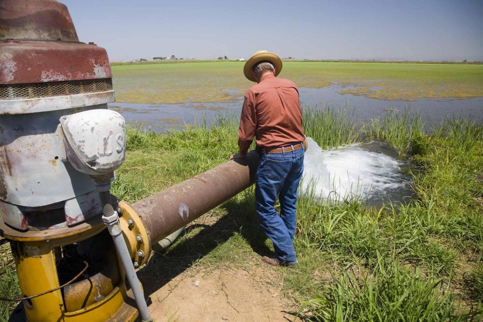
A pilot program in the Salinas Valley run remotely out of Los Angeles is offering a test case for how California could provide clean drinking water for isolated rural communities plagued by contaminated groundwater that lack the financial means or expertise to connect to a larger water system.
Innovative efforts to accelerate
restoration of headwater forests and to improve a river for the
benefit of both farmers and fish. Hard-earned lessons for water
agencies from a string of devastating California wildfires.
Efforts to drought-proof a chronically water-short region of
California. And a broad debate surrounding how best to address
persistent challenges facing the Colorado River.
These were among the issues Western Water explored in
2019, and are still worth taking a look at in case you missed
them.
To survive the next drought and meet
the looming demands of the state’s groundwater sustainability
law, California is going to have to put more water back in the
ground. But as other Western states have found, recharging
overpumped aquifers is no easy task.
Successfully recharging aquifers could bring multiple benefits
for farms and wildlife and help restore the vital interconnection
between groundwater and rivers or streams. As local areas around
California draft their groundwater sustainability plans, though,
landowners in the hardest hit regions of the state know they will
have to reduce pumping to address the chronic overdraft in which
millions of acre-feet more are withdrawn than are naturally
recharged.
The southern part of California’s Central Coast from San Luis Obispo County to Ventura County, home to about 1.5 million people, is blessed with a pleasing Mediterranean climate and a picturesque terrain. Yet while its unique geography abounds in beauty, the area perpetually struggles with drought.
Indeed, while the rest of California breathed a sigh of relief with the return of wet weather after the severe drought of 2012–2016, places such as Santa Barbara still grappled with dry conditions.
New to this year’s slate of water
tours, our Edge of
Drought Tour Aug. 27-29 will venture into the Santa
Barbara area to learn about the challenges of limited local
surface and groundwater supplies and the solutions being
implemented to address them.
Despite Santa Barbara County’s decision to lift a drought
emergency declaration after this winter’s storms replenished
local reservoirs, the region’s hydrologic recovery often has
lagged behind much of the rest of the state.
This 2-day, 1-night tour offered participants the opportunity to
learn about water issues affecting California’s scenic Central
Coast and efforts to solve some of the challenges of a region
struggling to be sustainable with limited local supplies that
have potential applications statewide.
There’s going to be a new governor
in California next year – and a host of challenges both old and
new involving the state’s most vital natural resource, water.
So what should be the next governor’s water priorities?
That was one of the questions put to more than 150 participants
during a wrap-up session at the end of the Water Education
Foundation’s Sept. 20 Water Summit in Sacramento.
Spurred by drought and a major
policy shift, groundwater management has assumed an unprecedented
mantle of importance in California. Local agencies in the
hardest-hit areas of groundwater depletion are drawing plans to
halt overdraft and bring stressed aquifers to the road of
recovery.
Along the way, an army of experts has been enlisted to help
characterize the extent of the problem and how the Sustainable
Groundwater Management Act of 2014 is implemented in a manner
that reflects its original intent.
ARkStorm stands for an atmospheric
river (“AR”) that carries precipitation levels expected to occur
once every 1,000 years (“k”). The concept was presented in a 2011
report by the U.S. Geological Survey (USGS) intended to elevate
the visibility of the very real threats to human life, property
and ecosystems posed by extreme storms on the West Coast.
Mired in drought, expectations are high that new storage funded
by Prop. 1 will be constructed to help California weather the
adverse conditions and keep water flowing to homes and farms.
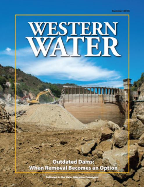
At the same time, there are some dams in the state eyed for
removal because they are obsolete – choked by accumulated
sediment, seismically vulnerable and out of compliance with
federal regulations that require environmental balance.
A new era of groundwater management
began in 2014 with the passage of the Sustainable Groundwater
Management Act (SGMA), which aims for local and regional agencies
to develop and implement sustainable groundwater management
plans with the state as the backstop.
SGMA defines “sustainable groundwater management” as the
“management and use of groundwater in a manner that can be
maintained during the planning and implementation horizon without
causing undesirable results.”
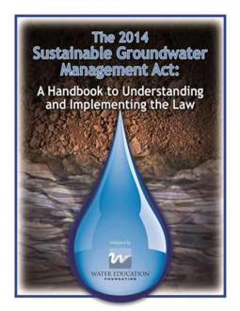
This handbook provides crucial
background information on the Sustainable Groundwater Management
Act, signed into law in 2014 by Gov. Jerry Brown. The handbook
also includes a section on options for new governance.