Sustainable Groundwater Management Act (SGMA)
 California entered a new era of
groundwater management in 2014 with the passage of the
Sustainable Groundwater Management Act (SGMA), becoming the last
state in the arid West to enact some kind of comprehensive
groundwater
management program. The law created a framework to protect
groundwater resources over the long term, placed responsibility
for developing and implementing groundwater sustainability plans
with local and regional agencies and designated the state as the
backstop if local efforts were insufficient.
California entered a new era of
groundwater management in 2014 with the passage of the
Sustainable Groundwater Management Act (SGMA), becoming the last
state in the arid West to enact some kind of comprehensive
groundwater
management program. The law created a framework to protect
groundwater resources over the long term, placed responsibility
for developing and implementing groundwater sustainability plans
with local and regional agencies and designated the state as the
backstop if local efforts were insufficient.
Since the law’s passage, more than 250 groundwater sustainability agencies have been formed to develop and implement sustainability plans. All high and medium priority basins have submitted plans or approved alternatives, and nine low-priority basins have voluntarily done the same.
BACKGROUND
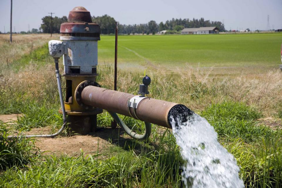
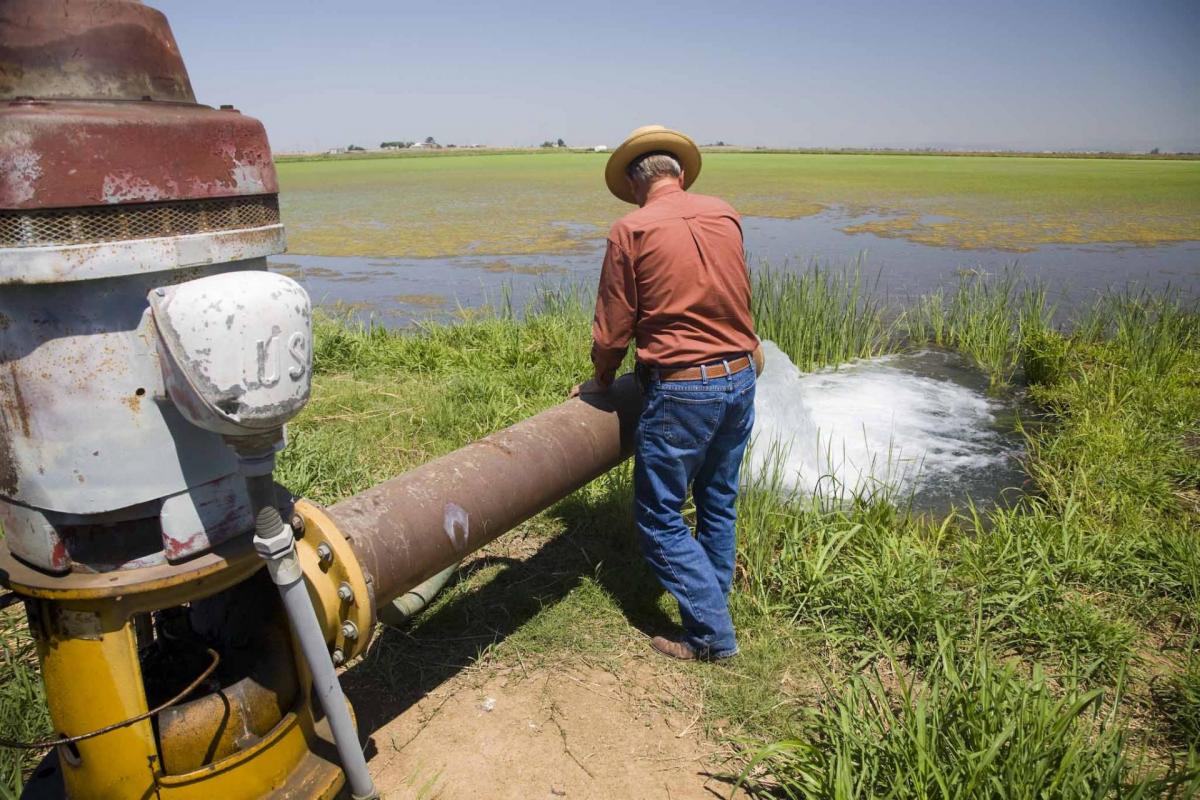
In California, groundwater is a critical source of water for both farms and cities, supplying 40 percent of water in a typical year and as much as 60 percent in drought years. Groundwater serves as a primary source of drinking and household water for about 82 percent of the state’s population and is an essential baseflow for ecosystems.
Managing groundwater and protecting aquifers for the long-term is a critical part of the state’s climate resilience strategy. As the Sustainable Groundwater Management Act notes: “Excessive groundwater extraction can cause overdraft, failed wells, deteriorated water quality, environmental damage and irreversible land subsidence that damages infrastructure and diminishes the capacity of aquifers to store water for the future.”
Under SGMA, high- and medium-priority basins as designated by the California Department of Water Resources (DWR) must establish Groundwater Sustainability Agencies (GSAs). The GSAs, made up of one or more local agencies overlying a groundwater basin, were required to develop Groundwater Sustainability Plans (GSPs). GSAs responsible for high- and medium-priority basins were required to adopt their sustainability plans by January 2020 or January 2022, depending on whether the basin is in critical overdraft. Agencies could adopt a single plan covering an entire basin or combine several plans created by multiple agencies. Groundwater basins where a court adjudication has set safe yield pumping limits are not required to prepare a sustainability plan under SGMA.
More than 250 GSAs have formed around California to begin the process of bringing overdrafted basins into balance and just over 100 plans have been developed. SGMA gives those agencies numerous new tools and authorities to manage the groundwater and implement the objectives of their sustainability plans. These include the authority to conduct investigations, determine the sustainable yield of a groundwater basin, measure and limit extraction and impose fees for groundwater management.
GSPs, which have a 20-year implementation schedule and a 50-year planning horizon, must include a physical description of the basin, including groundwater levels, groundwater quality, subsidence, information on groundwater-surface water interaction, data on historical and projected water demands and supplies, monitoring and management provisions and a description of how the plan will affect other plans, including city and county general plans. GSPs can build upon existing groundwater plans.
Where multiple GSPs within a basin are developed, a single, coordinated plan must be submitted to DWR. The idea behind a single document is to “synthesize and connect” the technical and management elements from each GSP “so that there is a consistent and orchestrated plan to sustainably manage the groundwater for the entire basin,” according to DWR.
CHALLENGES AND CONTROVERSIES
Basins in overdraft must achieve groundwater sustainability by 2040 or 2042, predicated on the completion of plans. If deadlines aren’t met, the State Water Resources Control Board (State Water Board) can intervene and establish an interim management plan.
Most sustainability plans submitted to DWR were approved outright or after revisions were made. A handful of plans were deemed inadequate and placed under the enforcement powers of the State Water Resources Control Board to develop a plan that met the law’s requirements.
SGMA stipulates that it is not a “one size fits all” approach and that each groundwater basin is different. It does not remove the distinction between surface water rights and the personal, private property right to pump groundwater and does not allow the disclosure of how much water an individual takes. The state can intervene only in extreme conditions when local control is inadequate.
SGMA’s schedule recognizes that it took decades, if not more than a century, to get groundwater basins into overdraft and that it will take a reasonable amount of time to get troubled areas on the right track. Every five years, sustainability agencies must report to the state on their progress in meeting the sustainability goals of their plans.
The San Joaquin Valley’s annual groundwater deficit has averaged about 2 million acre-feet and only about a quarter of that deficit can be filled with new supplies at prices farmers can afford, according to the Public Policy Institute of California. Ending overdraft could require taking at least 500,000 acres of irrigated cropland out of production.
Since adopting their plans, groundwater sustainability agencies have pursued a variety of strategies to track groundwater use, reduce excessive pumping, expand opportunities for recharge, repair damage from subsidence and build needed infrastructure to move and sink water into aquifers. Strategies have included retiring farmland from irrigated agriculture, creating groundwater trading efforts and diverting stormflows onto farmland for recharge. But the changes have not come without resistance: Some farmers in the San Joaquin Valley, for example, have resisted new fees on groundwater pumping, voting them down or challenging them in court. That has complicated efforts by sustainability agencies to fund infrastructure or repair damage from land subsidence caused by overpumping.
LOOKING AHEAD
In its first 10 years, which included wet years and SGMA-driven management, well levels showed signs of improvement. Compared to 2014 levels, water levels in 81 percent of wells either rose or stayed within 5 feet of 2014 levels. Only about 20 percent of wells declined by five feet or more, according to DWR.
Climate change is expected to alter precipitation patterns and intensify droughts and flooding, which will present both opportunities and challenges for water capture and groundwater recharge. In wet years, sustainability agencies will need to have infrastructure and water diversion permits in place to capture flood flows and get them in the ground. In dry years, groundwater will remain a crucial fallback and sustainability agencies will need to balance protections for shallow domestic wells and aquifers with demands for irrigation water and ecosystem needs.
In the coming years, groundwater sustainability agencies will likely need to refine their plans as they track progress toward meeting their goals and learn what works and what doesn’t.
Updated April 2026