Header link June 22, 2020

LinkedIn

  • Read more
Header link September 15, 2014

Cart

  • Read more
Header link November 3, 2015

Donate Now

  • Read more
Header link May 15, 2014

Twitter

  • Read more
Header link May 15, 2014

Facebook

  • Read more
Instagram
Header link May 15, 2014

Instagram

  • Read more
Header link May 15, 2014

Contact Us

  • Read more
More options
Water Education Foundation
Home

Water Education Foundation

Everything about California water that matters
  • Water Academy
    • Agriculture
      • Agricultural Conservation
      • Agricultural Drainage
    • Background Information
      • Legislation — California and Federal
      • Regulations — California and Federal
      • Water History
      • Water Rights
    • Bay-Delta
      • Bay Delta
      • Bay Delta Conservation Plan
      • Delta Issues
      • Delta Smelt
      • Sacramento San Joaquin Delta
      • San Francisco Bay
      • Suisun Marsh
    • Dams, Reservoirs and Water Projects
      • California Aqueduct
      • Central Valley Project
      • Folsom Dam
      • Friant Dam
      • Hetch Hetchy
      • Hoover Dam
      • Infrastructure
      • Lake Mead
      • Lake Powell
      • Oroville Dam
      • San Luis Dam
      • Shasta Dam
      • State Water Project
    • Environmental Issues
      • Anadromous Fish Restoration
      • Ecosystem
      • Endangered Species Act
      • Invasive species
      • Lake Tahoe
      • Mono Lake
      • Public Trust Doctrine
      • Salmon
      • San Joaquin River Restoration
      • Watershed
      • Wetlands
    • Leaders and Experts
    • Regions
      • Central Coast
      • Central Valley
      • Mexico
      • Nevada
      • North Coast
      • Pyramid Lake
      • Sacramento Valley
      • Salton Sea
      • San Joaquin Valley
      • Sierra Nevada
      • Southern California
      • Tulare Lake Basin
    • Rivers
      • Carson River
      • Colorado River
      • Klamath River
      • New River
      • North Coast Rivers
      • Russian River
      • Sacramento River
      • Truckee River
      • San Joaquin River
    • Water Issues
      • Climate Change
      • Coronavirus
      • Drought
      • Earthquakes
      • Energy and Water
      • Flood Management
      • Fracking
      • Growth
      • Hydropower
      • Levees
      • Tribal Water Issues
      • Water Conservation
      • Water Equity
    • Water Quality
      • Drinking Water
      • Nitrate contamination
      • Pollution
      • Stormwater
      • Wastewater
      • Water Quality
    • Water Supply and Management
      • Acre Foot
      • Aquifers
      • California Water Plan
      • Conjunctive Use
      • Desalination
      • Grey water
      • Groundwater
      • Integrated Regional Water Management
      • Recreation
      • Surface Water
      • Water Marketing and Banking
      • Water Rates
      • Water Recycling
      • Water Supply
      • Water Transfers
  • Tours & Events
    • Water Tours
      • 2023 Tour Sponsors
    • Events
    • Event Calendar
    • Past Tours & Events
      • Anne J. Schneider Fund Lecture Series
  • Specialized Programs
    • Water Leaders
      • Class Rosters
      • Yearly Class Reports
      • Your Alumni Network
      • Alumni Profiles
    • Project WET
      • Workshops
      • Special Workshops & Events
      • Supplementary Materials
      • California Content Standard Correlations
      • Facilitator's Trainings
      • Foundation School Programs
        • Elementary Programs
        • Secondary Programs
      • Water Kids
      • California Project WET Gazette
      • Gazette Archives
    • Colorado River Project
    • GRA Scholastic Fund Program
  • Maps & Guides
    • Maps & Posters
    • Layperson's Guides
    • Map & Guide Bundles
    • Books
    • Colorado River Materials
    • California Runoff Rundown
    • Other Publications
    • Water Awareness Materials
    • Downloadable Publications
    • Videos and DVDs
      • Video Clips
    • School Age Publications
    • Stickers
    • Free Programs and Publications
  • Newsroom
    • Western Water News
    • Aquafornia
      • About Aquafornia
    • Information Desk
    • Western Water Magazine Archive
      • Full Print Edition
      • Print Edition Excerpts
    • River Report Archive
  • Aquapedia
    • Alphabetical List of Subjects
      • A
      • B
      • C
      • D
      • E
      • F
      • G
      • H
      • I
      • J
      • K
      • L
      • M
      • N
      • O
      • P
      • Q
      • R
      • S
      • T
      • U
      • V
      • W
      • X
      • Y
      • Z
    • Historical Water People
    • Where Does My Water Come From?
      • Northern California
      • Sacramento
      • North Bay
      • South Bay
      • Central Valley
      • Los Angeles
      • Inland Empire
      • San Diego
      • All California Water Sources
    • Timelines
    • Videos
    • Image Gallery
    • Water Directory
      • Federal Agencies
      • State Agencies in California
      • Environmental Organizations
      • Other California Organizations
      • State and Federal Legislative Committees
      • Water Associations and Groups
      • Western States Water Agencies and Districts
    • Online Resources
    • Useful Acronyms
    • About Aquapedia
  • About
    • About Us
      • Board of Directors
      • Staff Biographies
      • Job Openings
    • Announcements
    • Support Our Mission
      • Become a Member
      • Donate in Honor/Memory
      • Donate to Aquapedia or Aquafornia
      • Shop Amazon
      • Planned Giving
    • Contact Us
Aquapedia background February 11, 2014

Surface Water

Surface Water

The story of California’s surface water— water that remains on the earth’s surface, in rivers, streams, lakes, reservoirs or oceans—is one that reflects the state’s geographic complexity.

About 75 percent of California’s surface water supply originates in the northern third of the state, but around 80 percent of water demand occurs in the southern two-thirds of the state. And the demand for water is highest during the dry summer months when there is little natural precipitation or snowmelt.

Geography also affects precipitation patterns and rates. The Sierra Nevada mountain range catches clouds before they reach Nevada, and the snowpack provides significant runoff for downstream reservoirs on the Sierra Nevada’s west slope. The northwestern part of the state can receive more than 140 inches per year while the inland deserts bordering Mexico can receive less than 4 inches. In addition to the state’s runoff, California annually receives about 1.5 million acre-feet in runoff from Oregon and 4.4 million acre-feet from the Colorado River.

Consequently, the basic issues affecting California’s water supply are distribution and sharing the resource — getting the water to the right place at the right time.

Surface Water Challenges

To balance the geographic disparity between supply and demand, starting in the 1930s the federal and state governments built complex storage and distribution systems to collect surface water in northern California and move it through the Bay Delta formed by the Sacramento and San Joaquin rivers and manmade canals to farms and cities sometimes hundreds of miles away. While other projects stored and moved water east to west from the Sierras to the coast.

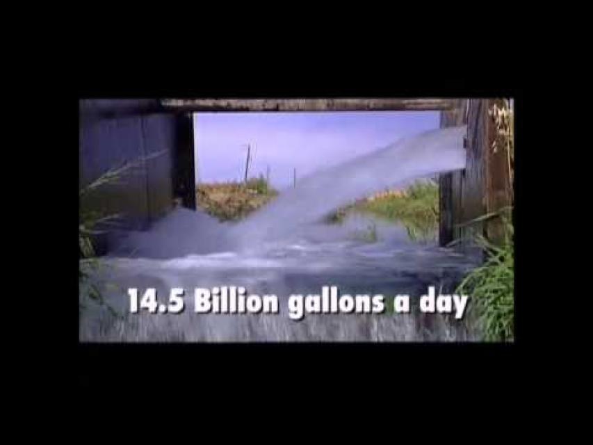
In a normal precipitation year, for example, about half of the state’s available surface water— 35 million acre-feet — is collected in over 1,300 local, state and federal reservoirs. This water is called “developed water” because it is managed, stored, diverted from rivers or otherwise developed for human or environmental use.

Such development of California’s surface water resources has been a diverse process performed by private companies and local, state and federal agencies, yielding a variety of benefits and problems.

On the plus side, the state has greatly improved its navigable waterways and provided water for hydroelectric power, homes, farms, industry, recreation and managed wildlife areas. Flood management projects have prevented billions of dollars’ worth of damage and countless lost lives.

The negative side of the development is that many of California’s rivers and streams, marshlands and valleys, and the fish and wildlife inhabiting these areas, have been significantly altered or destroyed. With stream channelization, 90 percent of the state’s original wetlands have disappeared. Dams and agricultural diversion on the Sacramento and San Joaquin river systems have blocked salmon spawning migrations and reduced stream flow, eliminating salmon runs in some stretches and threatening the continued survival of others.

Such diversions and movements of water over great distances have also created intense rivalries, both geographic—particularly north and south—and among agricultural, urban and environmental interest groups.

Surface Water and Groundwater

Although the state’s surface water and groundwater have traditionally been treated as separate resources, today water experts recognize they are intimately connected.

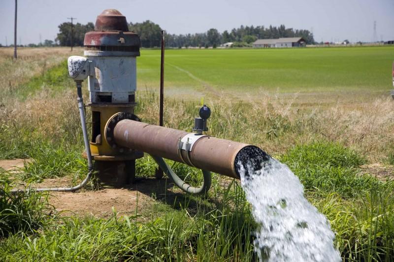
Precipitation seeps into the earth to become groundwater, later resurfacing in a spring, river, spring-fed lake or wetlands. Hydrologists estimate that as much as 30 percent of the water found in lakes or streams comes from groundwater. The use, transfer, depletion or contamination of one can directly affect the other. And unless surface water is available to recharge aquifers [see also Conjunctive Use], groundwater levels will decline and the water quality will degrade.

State, regional and local water management planners increasingly recognize the connection between groundwater and surface water and incorporate this nexus in water use strategies.

More long-term, crafting politically and economically acceptable management plans that are effective requires more detailed scientific assessments about the functions of particular aquifers, surface water-groundwater connection and associated ecosystems, and an increased and collaborative role in management at the local levels.

  • Print-friendly

Referring Pages

Share this page

  • Share on Facebook
  • Share on Twitter
  • Share on LinkedIn
  • Sent to a friend.
Print-friendly

Related Links

Aquapedia background February 11, 2014
Back
This item appears in:
  • Topic: Surface Water
  • S
Footer pod May 20, 2014

Water Education Foundation

Copyright © 2023 Water Education Foundation. All rights reserved.

The Water Education Foundation is a nonprofit, tax-exempt, 501(c)3 organization, federal tax ID #942419885.

Privacy Policy

Donor Privacy Policy

  • Read more
Footer pod May 20, 2014

Contact Information

2151 River Plaza Drive, Suite 205
Sacramento CA 95833

Telephone (916) 444-6240

Contact Us via email

  • Read more

Quicklinks

Footer quicklink May 20, 2014

Contact Us

  • Read more
Footer quicklink May 20, 2014

Donate Today

  • Read more
Footer quicklink May 20, 2014

Tours

  • Read more
Footer quicklink May 20, 2014

Newsletter Signup

  • Read more
Footer quicklink May 20, 2014

Foundation News

  • Read more
Footer quicklink May 20, 2014

Calendar

  • Read more

Log in

  • Create new account
  • Request new password

Commands

  • Support portal
  • Log in