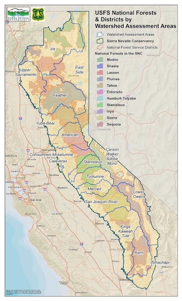
Header link June 22, 2020

LinkedIn

  • Read more
Header link September 15, 2014

Cart

  • Read more
Header link November 3, 2015

Donate Now

  • Read more
Header link May 15, 2014

Twitter

  • Read more
Header link May 15, 2014

Facebook

  • Read more
Instagram
Header link May 15, 2014

Instagram

  • Read more
Header link May 15, 2014

Contact Us

  • Read more
More options
Water Education Foundation
Home

Water Education Foundation

Everything about California water that matters
  • Water Academy
    • Agriculture
      • Agricultural Conservation
      • Agricultural Drainage
    • Background Information
      • Legislation — California and Federal
      • Regulations — California and Federal
      • Water History
      • Water Rights
    • Bay-Delta
      • Bay Delta
      • Bay Delta Conservation Plan
      • Delta Issues
      • Delta Smelt
      • Sacramento San Joaquin Delta
      • San Francisco Bay
      • Suisun Marsh
    • Dams, Reservoirs and Water Projects
      • California Aqueduct
      • Central Valley Project
      • Folsom Dam
      • Friant Dam
      • Hetch Hetchy
      • Hoover Dam
      • Infrastructure
      • Lake Mead
      • Lake Powell
      • Oroville Dam
      • San Luis Dam
      • Shasta Dam
      • State Water Project
    • Environmental Issues
      • Anadromous Fish Restoration
      • Ecosystem
      • Endangered Species Act
      • Invasive species
      • Lake Tahoe
      • Mono Lake
      • Public Trust Doctrine
      • Salmon
      • San Joaquin River Restoration
      • Watershed
      • Wetlands
    • Leaders and Experts
    • Regions
      • Central Coast
      • Central Valley
      • Mexico
      • Nevada
      • North Coast
      • Pyramid Lake
      • Sacramento Valley
      • Salton Sea
      • San Joaquin Valley
      • Sierra Nevada
      • Southern California
      • Tulare Lake Basin
    • Rivers
      • Carson River
      • Colorado River
      • Klamath River
      • New River
      • North Coast Rivers
      • Russian River
      • Sacramento River
      • Truckee River
      • San Joaquin River
    • Water Issues
      • Climate Change
      • Coronavirus
      • Drought
      • Earthquakes
      • Energy and Water
      • Floods
      • Fracking
      • Growth
      • Hydropower
      • Levees
      • Tribal Water Issues
      • Water Conservation
      • Water Equity
    • Water Quality
      • Drinking Water
      • Nitrate contamination
      • Pollution
      • Stormwater
      • Wastewater
      • Water Quality
    • Water Supply and Management
      • Acre Foot
      • Aquifers
      • California Water Plan
      • Conjunctive Use
      • Desalination
      • Grey water
      • Groundwater
      • Integrated Regional Water Management
      • Recreation
      • Surface Water
      • Water Marketing and Banking
      • Water Rates
      • Water Recycling
      • Water Supply
      • Water Transfers
  • Tours & Events
    • Water Tours
      • 2023 Tour Sponsors
    • Events
    • Event Calendar
    • Past Tours & Events
      • Anne J. Schneider Fund Lecture Series
  • Specialized Programs
    • Water Leaders
      • Class Rosters
      • Yearly Class Reports
      • Your Alumni Network
      • Alumni Profiles
    • Project WET
      • Workshops
      • Special Workshops & Events
      • Supplementary Materials
      • California Content Standard Correlations
      • Facilitator's Trainings
      • Foundation School Programs
        • Elementary Programs
        • Secondary Programs
      • Water Kids
      • California Project WET Gazette
      • Gazette Archives
    • Colorado River Project
    • GRA Scholastic Fund Program
  • Maps & Guides
    • Maps & Posters
    • Layperson's Guides
    • Map & Guide Bundles
    • Books
    • Colorado River Materials
    • California Runoff Rundown
    • Other Publications
    • Water Awareness Materials
    • Downloadable Publications
    • Videos and DVDs
      • Video Clips
    • School Age Publications
    • Stickers
    • Free Programs and Publications
  • Newsroom
    • Western Water News
    • Aquafornia
      • About Aquafornia
    • Information Desk
    • Western Water Magazine Archive
      • Full Print Edition
      • Print Edition Excerpts
    • River Report Archive
  • Aquapedia
    • Alphabetical List of Subjects
      • A
      • B
      • C
      • D
      • E
      • F
      • G
      • H
      • I
      • J
      • K
      • L
      • M
      • N
      • O
      • P
      • Q
      • R
      • S
      • T
      • U
      • V
      • W
      • X
      • Y
      • Z
    • Historical Water People
    • Where Does My Water Come From?
      • Northern California
      • Sacramento
      • North Bay
      • South Bay
      • Central Valley
      • Los Angeles
      • Inland Empire
      • San Diego
      • All California Water Sources
    • Timelines
    • Videos
    • Image Gallery
    • Water Directory
      • Federal Agencies
      • State Agencies in California
      • Environmental Organizations
      • Other California Organizations
      • State and Federal Legislative Committees
      • Water Associations and Groups
      • Western States Water Agencies and Districts
    • Online Resources
    • Useful Acronyms
    • About Aquapedia
  • About
    • About Us
      • Board of Directors
      • Staff Biographies
      • Job Openings
    • Announcements
    • Support Our Mission
      • Become a Member
      • Donate in Honor/Memory
      • Donate to Aquapedia or Aquafornia
      • Shop Amazon
      • Planned Giving
    • Contact Us
Aquapedia background February 11, 2014

Sierra Nevada

The Sierra NevadaStretching along the eastern edge of the state, the Sierra Nevada region incorporates more than 25 percent of California’s land area and forms one of the world’s most diverse watersheds.

On average, 60 percent of California’s total annual precipitation – in the form of rain and snow – falls in the Sierra Nevada and a portion of the southern Cascades.

The Sierra Nevada is 450 miles long and 40 to 50 miles wide and includes granite cliffs, lush forests and alpine meadows on the west slope, and stark desert landscapes at the base of the east slope. Its habitats support 66 percent of the bird and mammal species and about 50 percent of the reptile and amphibian species found in California, including bighorn sheep, mule deer, black bear and mountain lions, hawks, eagles, and trout.

Snowmelt from the Sierra provides water for irrigation for farms that produce half of the nation’s fruit, nuts and vegetables, and also is a vital source for dairies, which have made California the largest milk producer in the country.

Hetch Hetchy ReservoirIn addition, Sierra snowmelt provides drinking water to Sierra Nevada residents and a portion of drinking water to more than 27 million people living in cities stretching from the San Francisco Bay Area to Southern California.

For example, Hetch Hetchy Reservoir in Yosemite National Park provides 85 percent of San Francisco’s total water needs. The Mokolumne River, which originates in the high Sierra, provides more than 90 percent of the East Bay’s water and the Owens Valley in the eastern Sierra serves as a key source of water for Los Angeles.

Sierra Nevada Water Cycle

The Sierra Nevada watershed provides much of California’s water because of its mountains, which “catch” eastern-moving clouds fattened by the Pacific before they reach Nevada.

Sierra Nevada watershedsIn the Sierra, precipitation falls and accumulates during the winter months in higher elevations as snow. The snowpack acts as a natural reservoir that holds water until temperatures rise in late spring. In spring, the snowpack melts to provide significant runoff on the Sierra Nevada’s west slope and, to a lesser extent, on the Sierra Nevada’s eastern slopes.

The rain and snowmelt captured in the upper elevations flow to fill rivers and surface water reservoirs and recharge groundwater basins in the Central Valley.

Sierra snowmelt in spring typically contributes half of the total annual runoff from the region. After the high risks of floods have passed during spring, water is allowed to fill the reservoirs. By late summer, when natural river flows are at very low levels, water releases from the reservoirs provide much of the downstream water supply.

Snowmelt and rain running off from the Sierra Nevada and southern Cascades also flow through creeks and streams and into larger rivers, including California’s two longest rivers, the Sacramento (447 miles) and the San Joaquin (330 miles), which come together just south of Sacramento. Here, the two rivers mingle with smaller tributaries and tidal flows to form a 700-mile maze of sloughs and water­ways surrounding more than 60 leveed tracts and islands that make up the Sacramento-San Joaquin Delta.

About half the water that historically flowed into and through the Delta is now diverted for human use — by upstream users, Delta farmers or for export.

Sierra Nevada water is pumped into California’s two largest water delivery projects, the State Water Project and the federal Central Valley Project, which transport it to farms and cities throughout Central and Southern California and portions of the Bay Area.

Sierra Nevada Watershed Challenges

The Sierra Nevada faces several challenges including:

  • Water supply demands from a surging number of people in California — a challenge that brings with it wastewater treatment, pollution and encroachment into wilderness.
  • The 2018 Ferguson fire burned nearly 97,000 acres around Yosemite National Park, fueled in part by beetle-killed trees.Forest fires that are increasing in severity; the fires lead to significant increases in erosion resulting in reduced storage capacity in reservoirs and water quality concerns. For instance, the 2018 Ferguson fire burned nearly 97,000 acres around Yosemite National Park, fueled in part by beetle-killed trees.
  • Tree mortality; 129 million trees have died across the state due to drought and bark beetles since 2010, and 85 percent of those dead trees are in the Sierra, according to the Sierra Nevada Conservancy.
  • Gold mining’s legacy, including mercury and other pollutants used by miners that continue to find their way into streams and waterways.
  • With the Sierra Nevada already experiencing increased temperatures and earlier snowmelt, concerns related to climate change include loss of snowpack, more flooding, unpredictable water supplies, more and larger wildfires, and migration of wildlife to more suitable habitat.

In the past 100 years, annual runoff that occurs during April to July has decreased by 23 percent for the Sacramento basin and 19 percent for the San Joaquin basin, according to state climate statistics.

Sierra Nevada Watershed Going Forward

Many groups and agencies at the local, regional, state and federal levels are focusing efforts on management, restoration and protection of the Sierra Nevada.

Projects center on enhancing and restoring the upper watershed forests and meadow systems, reducing the risk of large, damaging fires, improving water quality and water supply reliability, and safeguarding significant habitats and migratory corridors. Significant state funds from bond measures have been invested in the Sierra watershed by the Sierra Nevada Conservancy, California Department of Water Resources, and the California Wildlife Conservation Board.

Restoration projects are ongoing throughout the Sierra Nevada by local governments and agencies, nongovernmental agencies and private enterprises. Project sizes vary from stream cleanups by community volunteers to multimillion-dollar efforts funded by several sources and involving years of planning and work.

  • Print-friendly

Referring Pages

Share this page

  • Share on Facebook
  • Share on Twitter
  • Share on LinkedIn
  • Sent to a friend.
Print-friendly

Related Links

Aquapedia background February 11, 2014
Back
This item appears in:
  • Topic: Sierra Nevada
  • S
Footer pod May 20, 2014

Water Education Foundation

Copyright © 2023 Water Education Foundation. All rights reserved.

The Water Education Foundation is a nonprofit, tax-exempt, 501(c)3 organization, federal tax ID #942419885.

Privacy Policy

Donor Privacy Policy

  • Read more
Footer pod May 20, 2014

Contact Information

2151 River Plaza Drive, Suite 205
Sacramento CA 95833

Telephone (916) 444-6240

Contact Us via email

  • Read more

Quicklinks

Footer quicklink May 20, 2014

Contact Us

  • Read more
Footer quicklink May 20, 2014

Donate Today

  • Read more
Footer quicklink May 20, 2014

Tours

  • Read more
Footer quicklink May 20, 2014

Newsletter Signup

  • Read more
Footer quicklink May 20, 2014

Foundation News

  • Read more
Footer quicklink May 20, 2014

Calendar

  • Read more

Log in

  • Create new account
  • Request new password

Commands

  • Support portal
  • Log in