Header link June 22, 2020

LinkedIn

  • Read more
Header link September 15, 2014

Cart

  • Read more
Header link November 3, 2015

Donate Now

  • Read more
Header link May 15, 2014

Twitter

  • Read more
Header link May 15, 2014

Facebook

  • Read more
Instagram
Header link May 15, 2014

Instagram

  • Read more
Header link May 15, 2014

Contact Us

  • Read more
More options
Water Education Foundation
Home

Water Education Foundation

Everything about California water that matters
  • Water Academy
    • Agriculture
      • Agricultural Conservation
      • Agricultural Drainage
    • Background Information
      • Legislation — California and Federal
      • Regulations — California and Federal
      • Water History
      • Water Rights
    • Bay-Delta
      • Bay Delta
      • Bay Delta Conservation Plan
      • Delta Issues
      • Delta Smelt
      • Sacramento San Joaquin Delta
      • San Francisco Bay
      • Suisun Marsh
    • Dams, Reservoirs and Water Projects
      • California Aqueduct
      • Central Valley Project
      • Folsom Dam
      • Friant Dam
      • Hetch Hetchy
      • Hoover Dam
      • Infrastructure
      • Lake Mead
      • Lake Powell
      • Oroville Dam
      • San Luis Dam
      • Shasta Dam
      • State Water Project
    • Environmental Issues
      • Anadromous Fish Restoration
      • Ecosystem
      • Endangered Species Act
      • Invasive species
      • Lake Tahoe
      • Mono Lake
      • Public Trust Doctrine
      • Salmon
      • San Joaquin River Restoration
      • Watershed
      • Wetlands
    • Leaders and Experts
    • Regions
      • Central Coast
      • Central Valley
      • Mexico
      • Nevada
      • North Coast
      • Pyramid Lake
      • Sacramento Valley
      • Salton Sea
      • San Joaquin Valley
      • Sierra Nevada
      • Southern California
      • Tulare Lake Basin
    • Rivers
      • Carson River
      • Colorado River
      • Klamath River
      • New River
      • North Coast Rivers
      • Russian River
      • Sacramento River
      • Truckee River
      • San Joaquin River
    • Water Issues
      • Climate Change
      • Coronavirus
      • Drought
      • Earthquakes
      • Energy and Water
      • Floods
      • Fracking
      • Growth
      • Hydropower
      • Levees
      • Tribal Water Issues
      • Water Conservation
      • Water Equity
    • Water Quality
      • Drinking Water
      • Nitrate contamination
      • Pollution
      • Stormwater
      • Wastewater
      • Water Quality
    • Water Supply and Management
      • Acre Foot
      • Aquifers
      • California Water Plan
      • Conjunctive Use
      • Desalination
      • Grey water
      • Groundwater
      • Integrated Regional Water Management
      • Recreation
      • Surface Water
      • Water Marketing and Banking
      • Water Rates
      • Water Recycling
      • Water Supply
      • Water Transfers
  • Tours & Events
    • Water Tours
      • 2023 Tour Sponsors
    • Events
    • Event Calendar
    • Past Tours & Events
      • Anne J. Schneider Fund Lecture Series
  • Specialized Programs
    • Water Leaders
      • Class Rosters
      • Yearly Class Reports
      • Your Alumni Network
      • Alumni Profiles
    • Project WET
      • Workshops
      • Special Workshops & Events
      • Supplementary Materials
      • California Content Standard Correlations
      • Facilitator's Trainings
      • Foundation School Programs
        • Elementary Programs
        • Secondary Programs
      • Water Kids
      • California Project WET Gazette
      • Gazette Archives
    • Colorado River Project
    • GRA Scholastic Fund Program
  • Maps & Guides
    • Maps & Posters
    • Layperson's Guides
    • Map & Guide Bundles
    • Books
    • Colorado River Materials
    • California Runoff Rundown
    • Other Publications
    • Water Awareness Materials
    • Downloadable Publications
    • Videos and DVDs
      • Video Clips
    • School Age Publications
    • Stickers
    • Free Programs and Publications
  • Newsroom
    • Western Water News
    • Aquafornia
      • About Aquafornia
    • Information Desk
    • Western Water Magazine Archive
      • Full Print Edition
      • Print Edition Excerpts
    • River Report Archive
  • Aquapedia
    • Alphabetical List of Subjects
      • A
      • B
      • C
      • D
      • E
      • F
      • G
      • H
      • I
      • J
      • K
      • L
      • M
      • N
      • O
      • P
      • Q
      • R
      • S
      • T
      • U
      • V
      • W
      • X
      • Y
      • Z
    • Historical Water People
    • Where Does My Water Come From?
      • Northern California
      • Sacramento
      • North Bay
      • South Bay
      • Central Valley
      • Los Angeles
      • Inland Empire
      • San Diego
      • All California Water Sources
    • Timelines
    • Videos
    • Image Gallery
    • Water Directory
      • Federal Agencies
      • State Agencies in California
      • Environmental Organizations
      • Other California Organizations
      • State and Federal Legislative Committees
      • Water Associations and Groups
      • Western States Water Agencies and Districts
    • Online Resources
    • Useful Acronyms
    • About Aquapedia
  • About
    • About Us
      • Board of Directors
      • Staff Biographies
      • Job Openings
    • Announcements
    • Support Our Mission
      • Become a Member
      • Donate in Honor/Memory
      • Donate to Aquapedia or Aquafornia
      • Shop Amazon
      • Planned Giving
    • Contact Us
Aquapedia background September 1, 2016

Meadows

While less a scientific term than a colloquial one, meadows are defined by their aquatic, soil and vegetative properties. They use surface or shallow groundwater of no more than a few feet, with fine soil, growing predominantly herbs – or nonwoody plants like ferns, grasses and wildflowers – but also sometimes hosting bushes and trees. They feature a unique and wide range of species, accounting for as much as one-third of Yosemite National Park’s plant species while only comprising 3 percent of its area (according to the National Park Service). 

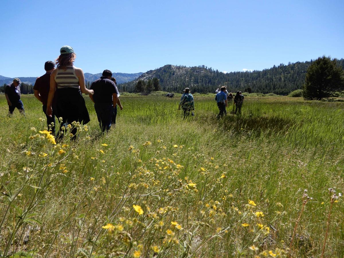
The Sierra Nevada is home to some of the nation’s largest, biologically richest and most functional meadows. Meadows are analogous to sponges in their absorption and storage of water, particularly melted snow, a feature which largely decreases the Sacramento Valley’s flood risk while preserving river flow in drier summer months. The meadows of the Sierra Nevada are unique in their nearly exclusive reliance on melted snow over precipitation for their water supply. Sediment is naturally filtered in meadows, cleaning water for both the resident species and humans. Yosemite’s meadows have a hand in filtering most of San Francisco’s drinking water.

Formation of Meadows

Until only the last several years, it was widely believed that meadows developed from basins carved by glaciers, which eventually formed lakes that filled with sediment until a meadow evolved, ultimately populating with trees until it became a forest. Despite the elegance of this process, it has been since demonstrated, for example on the western slope of the Sierra Nevada, that many form from flat plains flanked by steep watersheds with appropriate soil and hydrologic conditions.

Types of Meadows

Meadows are characterized by a variety of criteria, most notably height and surrounding landscape. The meadows of lowest elevation, “montane meadows,” are bounded by forest. “Subalpine meadows” approach the height of the surrounding treetops, and “alpine meadows” surpass the tree line to be enveloped by rocks.

“Transitional meadows” are generally a consequence of man-made clearing of the land, in which shallow plants like herbs begin dominating since trees and other deep-rooted plants have been removed. Unless artificially maintained, a transitional meadow will be naturally replaced with the original forest. “Coastal meadows” neighbor the sea and are sometimes surrounded by mountains. These meadows primarily use sea spray for water, and are thus inhabited by only very salt-tolerant plants. “Agricultural meadows” refer to farmlands and pastures, nurturing human-reared crops, differentiated from transitional meadows only by the nonnative nature of the growing plants. 

A single meadow frequently has varying moisture throughout. “Fens” are the wettest regions, decaying plants to produce peat soil. Consistently dry areas host xeric, or drought-tolerant, plants. Moist expanses generally fluctuate in wetness depending on the water table, snowmelt and precipitation.

Hazards to Meadows

Mountain meadows, like in the Sierra Nevada, have especially limited soil and are particularly impacted by even small changes in water levels. Being so dependent on melted snowpack, any human action that might affect its timing and quantity put meadows at risk, as do air pollution, introduction of invasive species, infrastructure and fire regimes. 

Over time, meadows have been receding, as records from the 19th century show them as being wetter and larger than they are currently. Coniferous trees – spruces, pines and firs – are becoming especially problematic as they invade meadows and disrupt their unique ecosystem and biodiversity. Climate change may also be to blame for altered groundwater levels and changes in plant life.

Damage from poor land use practices limits the ability of meadows to provide these critical functions. Some meadow streams have become gullies that quickly move water, leaving the meadows high and dry. Forest meadows experience further degradation as they lose soil and vegetation. For downstream residents and water users, this means increased winter flooding, poor water quality and a reduced amount of water available during drier times of the year.

Restoration requires accounting for the specific hydrological conditions needed for optimal meadow health, including efforts to decompact soil, alter routes of misplaced trails and remove nonnative species. It is crucial that visitors to meadows remain on designated paths, as trampling can kill plants, expose precious soil and allow for erosion. 

  • Print-friendly

Referring Pages

Share this page

  • Share on Facebook
  • Share on Twitter
  • Share on LinkedIn
  • Sent to a friend.
Print-friendly

Related Links

Aquapedia background September 1, 2016
Back
This item appears in:
  • Topic: Climate Change
  • Topic: Invasive species
  • Topic: Sierra Nevada
  • M
Footer pod May 20, 2014

Water Education Foundation

Copyright © 2023 Water Education Foundation. All rights reserved.

The Water Education Foundation is a nonprofit, tax-exempt, 501(c)3 organization, federal tax ID #942419885.

Privacy Policy

Donor Privacy Policy

  • Read more
Footer pod May 20, 2014

Contact Information

2151 River Plaza Drive, Suite 205
Sacramento CA 95833

Telephone (916) 444-6240

Contact Us via email

  • Read more

Quicklinks

Footer quicklink May 20, 2014

Contact Us

  • Read more
Footer quicklink May 20, 2014

Donate Today

  • Read more
Footer quicklink May 20, 2014

Tours

  • Read more
Footer quicklink May 20, 2014

Newsletter Signup

  • Read more
Footer quicklink May 20, 2014

Foundation News

  • Read more
Footer quicklink May 20, 2014

Calendar

  • Read more

Log in

  • Create new account
  • Request new password

Commands

  • Support portal
  • Log in