“Infrastructure” in general can be defined as the components and
equipment needed to operate, as well as the structures needed
for, public works systems. Typical examples include roads,
bridges, sewers and water supply systems.Various dams and
infrastructural buildings have given Californians and the West
the opportunity to control water, dating back to the days of
Native Americans.
Water management infrastructure focuses on the parts, including
pipes, storage reservoirs, pumps, valves, filtration and
treatment equipment and meters, as well as the buildings to
house process and treatment equipment. Irrigation infrastructure
includes reservoirs, irrigation canals. Major flood control
infrastructure includes dikes, levees, major pumping stations and
floodgates.
A bipartisan water infrastructure bill that includes funding
authorizations and policy changes affecting water projects
across Arizona advanced unanimously out of the Senate
Environment and Public Works Committee this week, with Sen.
Mark Kelly highlighting provisions aimed at improving water
reliability, flood protection and wildfire resilience. The
Water Resources Development Act of 2026, known as WRDA,
authorizes U.S. Army Corps of Engineers water projects
nationwide and reauthorizes several Environmental Protection
Agency drinking water and wastewater infrastructure programs.
The legislation must still be approved by the full Senate and
House before becoming law.
The trunk line that ruptured early Thursday, sending thousands
of gallons of water rushing down Sunset Strip and surrounding
communities, was installed 110 years ago and has emerged as the
latest example of L.A.’s struggles to overhaul its aging water
system. The break was on a riveted steel pipe from 1916 that
forms the major arteries for water delivery from reservoirs and
tanks to smaller distribution mainlines across Los Angeles. The
section of the Sunset Trunk Line was slated to be replaced in
2031, according to the utility. … In 2019, the Los
Angeles Department of Water and Power said roughly 29% of the
city’s pipes were over 80 years old, approaching their typical
lifespan of 100 years. Utilities have been struggling to
keep the system going, given funds are limited for any kind of
major overhaul of the aging pipes.
The Marin Municipal Water District is entering a $2.65 million
deal with the U.S. Army Corps of Engineers to advance a major
drought resiliency project. The water district board voted
unanimously Tuesday to approve the partnership agreement,
charging the Army Corps to support the “atmospheric
river capture” project. The project is a proposed
pipeline that would replenish Marin reservoirs with
Sonoma County rainwater during droughts. Under the
agreement, the Army Corps will design a section of the pipeline
that is 18,000 feet long. The agreement is a necessary step for
the district to use federal funding from the 2022 Water
Resources Development Act, or WRDA, slated for the project.
… Estimated at $214 million, the planned 13-mile,
36-inch pipe would tap into an aqueduct system that runs along
Highway 101, carrying water from the Russian River into Marin.
The House of Transportation and Infrastructure Committee
approved on July 1 the authorization of $155 million under the
latest Water Resources and Development Act (WRDA) bill to
support the Sacramento River Basin, newly elected Congressman
James Gallagher (CA-01) announced. The authorization is part of
the House Water Resource Development Act (WRDA) 2026 bill,
which operates through the U.S. Army Corps of Engineers’
Environmental Infrastructure program. … If the WRDA 2026
bill passes, the $155 million would support the basin’s
water and wastewater infrastructure, environmental restoration
and surface water protection. It would support
environmental restoration meant to improve drought resilience,
salmon recovery, and bird migration without increasing flood
risk.
The Bureau of Reclamation has awarded Flatland Energy Services
LLC a $75.5 million contract to build a section of pipeline
that will help deliver water to parts of the Navajo Nation in
New Mexico. Flatland will install 10,000 feet of pipeline
starting at the Frank Chee Willetto Reservoir 17 miles east of
Shiprock as part of the Navajo-Gallup Water Supply Project,
according to the bureau. When the project is finished, 300
miles of pipeline, two water treatment plants and at least 19
pumping facilities will carry water from the San Juan
River to the southwestern portions of the Jicarilla Apache
Nation and Gallup. This section will cross beneath the
San Juan River, a major tributary of the Colorado
River, and the Chaco River to avoid difficult terrain
and existing infrastructure.
… To many, the functionality of Glen Canyon Dam’s river
outlet works has been a slow-moving crisis. If levels at Lake
Powell fall too low, water deliveries to Lake Mead
could be cut off due to potential damage of those release
tubes, spelling trouble for Southern Nevada and its
neighbor states in the Lower Colorado River Basin. … In
a Friday statement, the Southern Nevada Water Authority said
the uncertainty of Glen Canyon Dam’s infrastructure is another
reason for every state to take swift action to cut water use in
order to protect reservoir storage. “While Reclamation has
acknowledged the engineering feasibility exists to operate at
these levels, the bypass tubes were not envisioned to
be the sole release mechanism,” the statement said.
“Gambling on how much we can safely release while the reservoir
is near empty seems less than prudent.”
California has taken a significant step forward in its
long-term water storage agenda, with Governor Gavin
Newsom announcing that the California Water
Commission has approved an additional $268.9 million for the
Sites Reservoir project. The new tranche brings the state’s
total eligible investment through the Water Storage
Investment Program to $1.363 billion. … The
facility is seen as a cornerstone of California’s strategy to
cope with increasingly volatile precipitation patterns driven
by climate change, which have produced sharper swings between
drought and flooding in recent years. … Before funding
can be formally disbursed, the project must still
satisfy a series of voter-mandated conditions,
including securing financing, obtaining permits, completing
environmental review, and contracting with the relevant state
agencies.
Building on years of progress, Governor Gavin Newsom today
announced that California is advancing the state’s Sites
Reservoir project with an additional $268.9 million funding
increase from the California Water Commission — strengthening
long-term water storage and helping prepare for a hotter, drier
future. … Sites Reservoir is a key component of the
Governor’s water strategy and will capture water from
the Sacramento River during wet seasons and store it for use
during drier seasons – holding up to 1.5 million
acre-feet of water, enough to supply over 4.5 million homes for
a year. … With this additional funding, the Sites
Project is eligible for a total of $1.363 billion in Water
Storage Investment Program (WSIP) funding from Proposition 1
and Proposition 4.
The Arizona Corporation Commission recently approved
significant rate increases for two small rural water systems in
Gila County, near Payson. The proceedings for Jake’s Corner
Water System and Tonto Creek Water Company are local regulatory
actions, but what they describe is playing out at water
utilities across the country: decades of kept-low rates that
deferred maintenance until the infrastructure failure became
unavoidable. … The Arizona cases illustrate a structural
problem that Pew Charitable Trusts research quantified in May
2026: small and rural water systems, defined as those serving
fewer than 3,300 people, make up 81% of all public water
systems in the U.S. but account for 93% of violations for
noncompliance with federal drinking water standards. Small
systems spend more than double what larger systems pay per
capita to address deferred maintenance.
Cities across California and the Southwest are significantly
increasing and diversifying their use of recycled wastewater as
traditional water supplies grow tighter.
The 5th edition of our Layperson’s Guide to Water Recycling
covers the latest trends and statistics on water reuse as a
strategic defense against prolonged drought and climate change.
As the permitting battle over the proposed Sites Reservoir
Project in Northern California heats up, it’s become clear that
the project would further heat up the atmosphere as well. Just
as California has made bold commitments to achieve carbon
neutrality in the next few decades, the state seems ready to
approve a dam project that would put that progress in jeopardy.
A new report, “Estimate of Greenhouse Gas Emissions for the
Proposed Sites Reservoir Project Using the All-Res Modeling
Tool,” created by a science team at my organization, Tell The
Dam Truth, exposes the climate impacts caused by this massive
dam and reservoir system. -Written by Gary Wockner, PhD, who directs Tell The
Dam Truth
Residents living below the Isabella Auxiliary Dam were thrilled
earlier this month with a temporary fix that finally dried up
excessive seepage from the dam that had been swamping septic
systems and breeding forests of mosquito-infested weeds around
their homes. The didn’t realize how temporary the fix would be,
however. After only 12 days without a river cutting through his
land, rancher Gerald Wenstrand woke up to see the seepage back
on Saturday.
It was exactly the sort of deluge
California groundwater agencies have been counting on to
replenish their overworked aquifers.
The start of 2023 brought a parade of torrential Pacific storms
to bone dry California. Snow piled up across the Sierra Nevada at
a near-record pace while runoff from the foothills gushed into
the Central Valley, swelling rivers over their banks and filling
seasonal creeks for the first time in half a decade.
Suddenly, water managers and farmers toiling in one of the
state’s most groundwater-depleted regions had an opportunity to
capture stormwater and bank it underground. Enterprising agencies
diverted water from rushing rivers and creeks into manmade
recharge basins or intentionally flooded orchards and farmland.
Others snagged temporary permits from the state to pull from
streams they ordinarily couldn’t touch.
Managers of California’s most
overdrawn aquifers were given a monumental task under the state’s
landmark Sustainable Groundwater Management Act: Craft viable,
detailed plans on a 20-year timeline to bring their beleaguered
basins into balance. It was a task that required more than 250
newly formed local groundwater agencies – many of them in the
drought-stressed San Joaquin Valley – to set up shop, gather
data, hear from the public and collaborate with neighbors on
multiple complex plans, often covering just portions of a
groundwater basin.
Martha Guzman recalls those awful
days working on water and other issues as a deputy legislative
secretary for then-Gov. Jerry Brown. California was mired in a
recession and the state’s finances were deep in the red. Parks
were cut, schools were cut, programs were cut to try to balance a
troubled state budget in what she remembers as “that terrible
time.”
She now finds herself in a strikingly different position: As
administrator of the U.S. Environmental Protection Agency’s
Region 9, she has a mandate to address water challenges across
California, Nevada, Arizona and Hawaii and $1 billion to help pay
for it. It is the kind of funding, she said, that is usually
spread out over a decade. Guzman called it the “absolutely
greatest opportunity.”
When you oversee the largest
supplier of treated water in the United States, you tend to think
big.
Jeff Kightlinger, general manager of the Metropolitan Water
District of Southern California for the last 15 years, has
focused on diversifying his agency’s water supply and building
security through investment. That means looking beyond MWD’s
borders to ensure the reliable delivery of water to two-thirds of
California’s population.
As California slowly emerges from
the depths of the COVID-19 pandemic, one remnant left behind by
the statewide lockdown offers a sobering reminder of the economic
challenges still ahead for millions of the state’s residents and
the water agencies that serve them – a mountain of water debt.
Water affordability concerns, long an issue in a state where
millions of people struggle to make ends meet, jumped into
overdrive last year as the pandemic wrenched the economy. Jobs
were lost and household finances were upended. Even with federal
stimulus aid and unemployment checks, bills fell by the wayside.
A government agency that controls much of California’s water
supply released its initial allocation for 2021, and the
numbers reinforced fears that the state is falling into another
drought. The U.S. Bureau of Reclamation said Tuesday that most
of the water agencies that rely on the Central Valley Project
will get just 5% of their contract supply, a dismally low
number. Although the figure could grow if California gets more
rain and snow, the allocation comes amid fresh weather
forecasts suggesting the dry winter is continuing. The National
Weather Service says the Sacramento Valley will be warm and
windy the next few days, with no rain in the forecast.
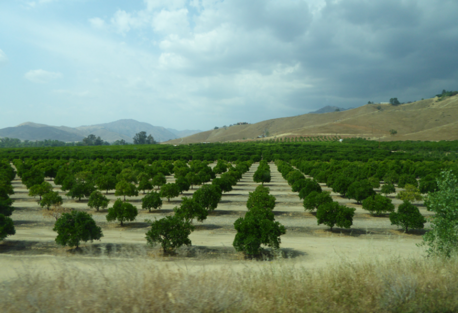
Across a sprawling corner of southern Tulare County snug against the Sierra Nevada, a bounty of navel oranges, grapes, pistachios, hay and other crops sprout from the loam and clay of the San Joaquin Valley. Groundwater helps keep these orchards, vineyards and fields vibrant and supports a multibillion-dollar agricultural economy across the valley. But that bounty has come at a price. Overpumping of groundwater has depleted aquifers, dried up household wells and degraded ecosystems.
Innovative efforts to accelerate
restoration of headwater forests and to improve a river for the
benefit of both farmers and fish. Hard-earned lessons for water
agencies from a string of devastating California wildfires.
Efforts to drought-proof a chronically water-short region of
California. And a broad debate surrounding how best to address
persistent challenges facing the Colorado River.
These were among the issues Western Water explored in
2019, and are still worth taking a look at in case you missed
them.
It’s been a year since two devastating wildfires on opposite ends
of California underscored the harsh new realities facing water
districts and cities serving communities in or adjacent to the
state’s fire-prone wildlands. Fire doesn’t just level homes, it
can contaminate water, scorch watersheds, damage delivery systems
and upend an agency’s finances.
The southern part of California’s Central Coast from San Luis Obispo County to Ventura County, home to about 1.5 million people, is blessed with a pleasing Mediterranean climate and a picturesque terrain. Yet while its unique geography abounds in beauty, the area perpetually struggles with drought.
Indeed, while the rest of California breathed a sigh of relief with the return of wet weather after the severe drought of 2012–2016, places such as Santa Barbara still grappled with dry conditions.
For the bulk of her career, Jayne
Harkins has devoted her energy to issues associated with the
management of the Colorado River, both with the U.S. Bureau of
Reclamation and with the Colorado River Commission of Nevada.
Now her career is taking a different direction. Harkins, 58, was
appointed by President Trump last August to take the helm of the
United States section of the U.S.-Mexico agency that oversees
myriad water matters between the two countries as they seek to
sustainably manage the supply and water quality of the Colorado
River, including its once-thriving Delta in Mexico, and other
rivers the two countries share. She is the first woman to be
named the U.S. Commissioner of the International Boundary and
Water Commission for either the United States or Mexico in the
commission’s 129-year history.
The San Joaquin Valley, known as the
nation’s breadbasket, grows a cornucopia of fruits, nuts and
other agricultural products.
During our three-day Central Valley Tour April
3-5, you will meet farmers who will explain how they prepare
the fields, irrigate their crops and harvest the produce that
helps feed the nation and beyond. We also will drive through
hundreds of miles of farmland and visit the rivers, dams,
reservoirs and groundwater wells that provide the water.
In the universe of California water, Tim Quinn is a professor emeritus. Quinn has seen — and been a key player in — a lot of major California water issues since he began his water career 40 years ago as a young economist with the Rand Corporation, then later as deputy general manager with the Metropolitan Water District of Southern California, and finally as executive director of the Association of California Water Agencies. In December, the 66-year-old will retire from ACWA.
There’s going to be a new governor
in California next year – and a host of challenges both old and
new involving the state’s most vital natural resource, water.
So what should be the next governor’s water priorities?
That was one of the questions put to more than 150 participants
during a wrap-up session at the end of the Water Education
Foundation’s Sept. 20 Water Summit in Sacramento.
New water storage is the holy grail
primarily for agricultural interests in California, and in 2014
the door to achieving long-held ambitions opened with the passage
of Proposition
1, which included $2.7 billion for the public benefits
portion of new reservoirs and groundwater storage projects. The
statute stipulated that the money is specifically for the
benefits that a new storage project would offer to the ecosystem,
water quality, flood control, emergency response and recreation.
It’s high-stakes time in Arizona. The state that depends on the
Colorado River to help supply its cities and farms — and is
first in line to absorb a shortage — is seeking a unified plan
for water supply management to join its Lower Basin neighbors,
California and Nevada, in a coordinated plan to preserve water
levels in Lake Mead before
they run too low.
If the lake’s elevation falls below 1,075 feet above sea level,
the secretary of the Interior would declare a shortage and
Arizona’s deliveries of Colorado River water would be reduced by
320,000 acre-feet. Arizona says that’s enough to serve about 1
million households in one year.
Get a unique view of the San Joaquin Valley’s key dams and
reservoirs that store and transport water on our March Central
Valley Tour.
Our Central Valley
Tour, March 14-16, offers a broad view of water issues
in the San Joaquin Valley. In addition to the farms, orchards,
critical habitat for threatened bird populations, flood bypasses
and a national wildlife refuge, we visit some of California’s
major water infrastructure projects.
One of the wettest years in California history that ended a
record five-year drought has rejuvenated the call for new storage
to be built above and below ground.
In a state that depends on large surface water reservoirs to help
store water before moving it hundreds of miles to where it is
used, a wet year after a long drought has some people yearning
for a place to sock away some of those flood flows for when they
are needed.
Contrary to popular belief,
“100-Year Flood” does not refer to a flood that happens every
century. Rather, the term describes the statistical chance of a
flood of a certain magnitude (or greater) taking place once in
100 years. It is also accurate to say a so-called “100-Year
Flood” has a 1 percent chance of occurring in a given year, and
those living in a 100-year floodplain have, each year, a 1
percent chance of being flooded.
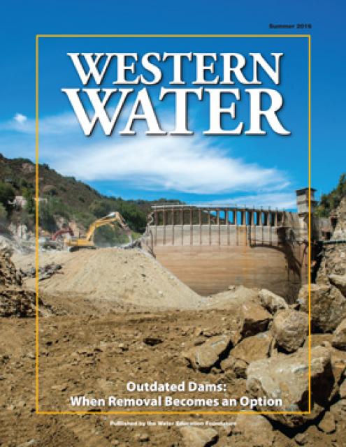
Mired in drought, expectations are high that new storage funded
by Prop. 1 will be constructed to help California weather the
adverse conditions and keep water flowing to homes and farms.
At the same time, there are some dams in the state eyed for
removal because they are obsolete – choked by accumulated
sediment, seismically vulnerable and out of compliance with
federal regulations that require environmental balance.
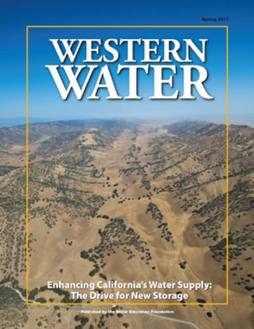
The proposed Sites Reservoir would
be a 1.5 million-acre-foot off-river storage basin on the west
side of the Sacramento Valley, about 78 miles northwest of
Sacramento. It would capture stormwater flows from the Sacramento River for release in
dry years for fish and wildlife, farms, communities and
businesses.
This 25-minute documentary-style DVD, developed in partnership
with the California Department of Water Resources, provides an
excellent overview of climate change and how it is already
affecting California. The DVD also explains what scientists
anticipate in the future related to sea level rise and
precipitation/runoff changes and explores the efforts that are
underway to plan and adapt to climate.
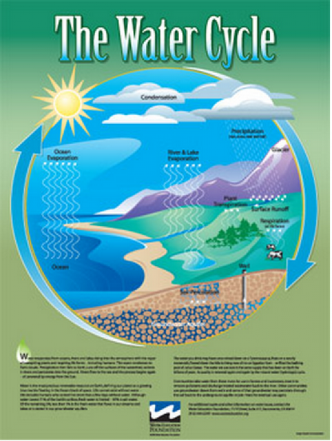
Water as a renewable resource is depicted in this 18×24 inch
poster. Water is renewed again and again by the natural
hydrologic cycle where water evaporates, transpires from plants,
rises to form clouds, and returns to the earth as precipitation.
Excellent for elementary school classroom use.
Redesigned in 2017, this beautiful map depicts the seven
Western states that share the Colorado River with Mexico. The
Colorado River supplies water to nearly 40 million people in
Arizona, California, Colorado, Nevada, New Mexico, Utah, Wyoming
and Mexico. Text on this beautiful, 24×36-inch map, which is
suitable for framing, explains the river’s apportionment, history
and the need to adapt its management for urban growth and
expected climate change impacts.
The 24-page Layperson’s Guide to the State Water Project provides
an overview of the California-funded and constructed State Water
Project.
The State Water Project is best known for the 444-mile-long
aqueduct that provides water from the Delta to San Joaquin Valley
agriculture and southern California cities. The guide contains
information about the project’s history and facilities.
The 24-page Layperson’s Guide to Integrated Regional Water
Management (IRWM) is an in-depth, easy-to-understand publication
that provides background information on the principles of IRWM,
its funding history and how it differs from the traditional water
management approach.
The 24-page Layperson’s Guide to the Central Valley Project
explores the history and development of the federal Central
Valley Project (CVP), California’s largest surface water delivery
system. In addition to the project’s history, the guide describes
the various facilities, operations and benefits the water
project brings to the state along with the CVP
Improvement Act (CVPIA).
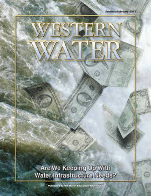
This printed issue of Western Water examines water
infrastructure – its costs and the quest to augment traditional
brick-and-mortar facilities with sleeker, “green” features.
Everywhere you look water infrastructure is working hard to keep
cities, farms and industry in the state running. From the massive
storage structures that dot the West to the aqueducts that convey
water hundreds of miles to large urban areas and the untold miles
of water mains and sewage lines under every city and town, the
semiarid West would not exist as it does without the hardware
that meets its water needs.
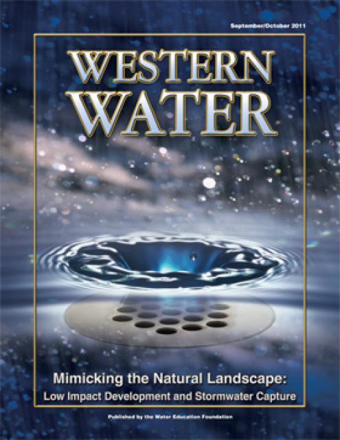
This printed issue of Western Water discusses low
impact development and stormwater capture – two areas of emerging
interest that are viewed as important components of California’s
future water supply and management scenario.
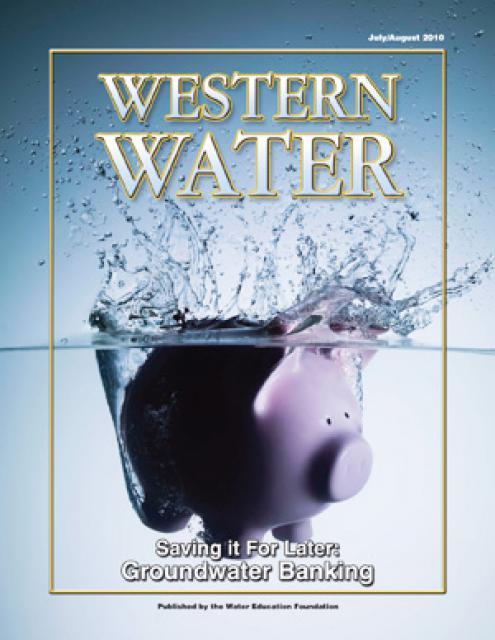
This printed issue of Western Water examines
groundwater banking, a water management strategy with appreciable
benefits but not without challenges and controversy.
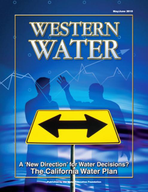
This printed issue of Western Water examines the
changed nature of the California Water Plan, some aspects of the
2009 update (including the recommendation for a water finance
plan) and the reaction by certain stakeholders.
This printed issue of Western Water looks at some of
the pieces of the 2009 water legislation, including the Delta
Stewardship Council, the new requirements for groundwater
monitoring and the proposed water bond.
It’s no secret that providing water in a state with the size and
climate of California costs money. The gamut of water-related
infrastructure – from reservoirs like Lake Oroville to the pumps
and pipes that deliver water to homes, businesses and farms –
incurs initial and ongoing expenses. Throw in a new spate of
possible mega-projects, such as those designed to rescue the
ailing Sacramento-San Joaquin Delta, and the dollar amount grows
exponentially to billion-dollar amounts that rival the entire
gross national product of a small country.
This printed issue of Western Water examines the
financing of water infrastructure, both at the local level and
from the statewide perspective, and some of the factors that
influence how people receive their water, the price they pay for
it and how much they might have to pay in the future.
They are located in urban areas and in some of the most rural
parts of the state, but they have at least one thing in common:
they provide water service to a very small group of people. In a
state where water is managed and delivered by an organization as
large as the Metropolitan Water District of Southern California,
most small water systems exist in obscurity – financed by
shoestring budgets and operated by personnel who wear many hats.
This issue of Western Water looks at water
infrastructure – from the large conveyance systems to the small
neighborhood providers – and the many challenges faced by water
agencies in their continuing mission of assuring a steady and
reliable supply for their customers.
Chances are that deep within the ground beneath you as you read
this is a vast network of infrastructure that is busy providing
the necessary services that enable life to proceed at the pace it
does in the 21st century. Electricity zips through cables to
power lights and computers while other conduits move infinite
amounts of information that light up computer screens and phone
lines.
This issue of Western Water explores the question of whether the
state needs more surface storage, with a particular focus on the
five proposed projects identified in the CALFED 2000 ROD and the
politics and funding issues of these projects.


")
")
")
")
")
")
")
")
")
")
")
")
")
")


")