Header link June 22, 2020

LinkedIn

  • Read more
Header link September 15, 2014

Cart

  • Read more
Header link November 3, 2015

Donate Now

  • Read more
Header link May 15, 2014

Twitter

  • Read more
Header link May 15, 2014

Facebook

  • Read more
Instagram
Header link May 15, 2014

Instagram

  • Read more
Header link May 15, 2014

Contact Us

  • Read more
More options
Water Education Foundation
Home

Water Education Foundation

Everything about California water that matters
  • Water Academy
    • Agriculture
      • Agricultural Conservation
      • Agricultural Drainage
    • Background Information
      • Legislation — California and Federal
      • Regulations — California and Federal
      • Water History
      • Water Rights
    • Bay-Delta
      • Bay Delta
      • Bay Delta Conservation Plan
      • Delta Issues
      • Delta Smelt
      • Sacramento San Joaquin Delta
      • San Francisco Bay
      • Suisun Marsh
    • Dams, Reservoirs and Water Projects
      • California Aqueduct
      • Central Valley Project
      • Folsom Dam
      • Friant Dam
      • Hetch Hetchy
      • Hoover Dam
      • Infrastructure
      • Lake Mead
      • Lake Powell
      • Oroville Dam
      • San Luis Dam
      • Shasta Dam
      • State Water Project
    • Environmental Issues
      • Anadromous Fish Restoration
      • Ecosystem
      • Endangered Species Act
      • Invasive species
      • Lake Tahoe
      • Mono Lake
      • Public Trust Doctrine
      • Salmon
      • San Joaquin River Restoration
      • Watershed
      • Wetlands
    • Leaders and Experts
    • Regions
      • Central Coast
      • Central Valley
      • Mexico
      • Nevada
      • North Coast
      • Pyramid Lake
      • Sacramento Valley
      • Salton Sea
      • San Joaquin Valley
      • Sierra Nevada
      • Southern California
      • Tulare Lake Basin
    • Rivers
      • Carson River
      • Colorado River
      • Klamath River
      • New River
      • North Coast Rivers
      • Russian River
      • Sacramento River
      • Truckee River
      • San Joaquin River
    • Water Issues
      • Climate Change
      • Coronavirus
      • Drought
      • Earthquakes
      • Energy and Water
      • Floods
      • Fracking
      • Growth
      • Hydropower
      • Levees
      • Tribal Water Issues
      • Water Conservation
      • Water Equity
    • Water Quality
      • Drinking Water
      • Nitrate contamination
      • Pollution
      • Stormwater
      • Wastewater
      • Water Quality
    • Water Supply and Management
      • Acre Foot
      • Aquifers
      • California Water Plan
      • Conjunctive Use
      • Desalination
      • Grey water
      • Groundwater
      • Integrated Regional Water Management
      • Recreation
      • Surface Water
      • Water Marketing and Banking
      • Water Rates
      • Water Recycling
      • Water Supply
      • Water Transfers
  • Tours & Events
    • Water Tours
      • 2023 Tour Sponsors
    • Events
    • Event Calendar
    • Past Tours & Events
      • Anne J. Schneider Fund Lecture Series
  • Specialized Programs
    • Water Leaders
      • Class Rosters
      • Yearly Class Reports
      • Your Alumni Network
      • Alumni Profiles
    • Project WET
      • Workshops
      • Special Workshops & Events
      • Supplementary Materials
      • California Content Standard Correlations
      • Facilitator's Trainings
      • Foundation School Programs
        • Elementary Programs
        • Secondary Programs
      • Water Kids
      • California Project WET Gazette
      • Gazette Archives
    • Colorado River Project
    • GRA Scholastic Fund Program
  • Maps & Guides
    • Maps & Posters
    • Layperson's Guides
    • Map & Guide Bundles
    • Books
    • Colorado River Materials
    • California Runoff Rundown
    • Other Publications
    • Water Awareness Materials
    • Downloadable Publications
    • Videos and DVDs
      • Video Clips
    • School Age Publications
    • Stickers
    • Free Programs and Publications
  • Newsroom
    • Western Water News
    • Aquafornia
      • About Aquafornia
    • Information Desk
    • Western Water Magazine Archive
      • Full Print Edition
      • Print Edition Excerpts
    • River Report Archive
  • Aquapedia
    • Alphabetical List of Subjects
      • A
      • B
      • C
      • D
      • E
      • F
      • G
      • H
      • I
      • J
      • K
      • L
      • M
      • N
      • O
      • P
      • Q
      • R
      • S
      • T
      • U
      • V
      • W
      • X
      • Y
      • Z
    • Historical Water People
    • Where Does My Water Come From?
      • Northern California
      • Sacramento
      • North Bay
      • South Bay
      • Central Valley
      • Los Angeles
      • Inland Empire
      • San Diego
      • All California Water Sources
    • Timelines
    • Videos
    • Image Gallery
    • Water Directory
      • Federal Agencies
      • State Agencies in California
      • Environmental Organizations
      • Other California Organizations
      • State and Federal Legislative Committees
      • Water Associations and Groups
      • Western States Water Agencies and Districts
    • Online Resources
    • Useful Acronyms
    • About Aquapedia
  • About
    • About Us
      • Board of Directors
      • Staff Biographies
      • Job Openings
    • Announcements
    • Support Our Mission
      • Become a Member
      • Donate in Honor/Memory
      • Donate to Aquapedia or Aquafornia
      • Shop Amazon
      • Planned Giving
    • Contact Us
Aquapedia background February 11, 2014 Colorado River Basin Map Layperson's Guide to the Colorado River Elwood Mead Colorado River Hoover Dam

Lake Mead

Aerial view of Lake Mead

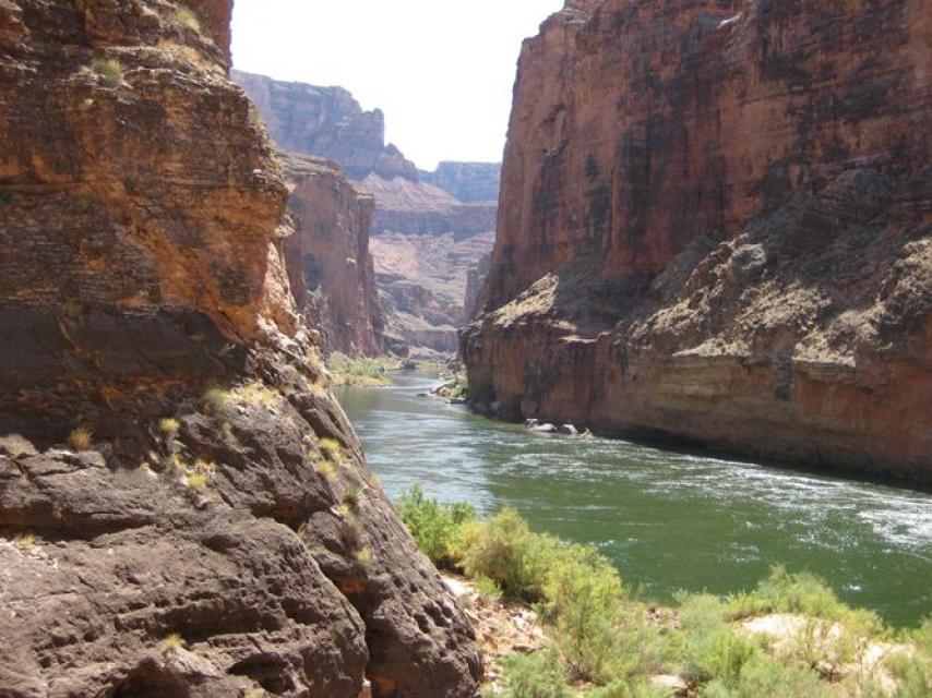
Lake Mead is the main reservoir formed by Hoover Dam on the border between Southern Nevada and northwestern Arizona.

Created in the 1930s as part of Hoover Dam [see also Elwood Mead], Lake Mead provides water storage in the Lower Basin of the Colorado River. The reservoir is designed to hold 28,945,000 acre-feet of water and at 248 square miles its capacity is the largest in United States.

Most of the water in Lake Mead is drawn from Rocky Mountain snowmelt and runoff. The water is drawn from a vast storage and distribution network, including Lake Powell on the Utah-Arizona border. Lake Powell serves a bank account for the Upper Basin states of Colorado, New Mexico, Utah and Wyoming, and helps regulate the required delivery of water to the Lower Basin states of Arizona, Nevada and California through Lake Mead.

However, one of the largest droughts on record in the region dating back to 2000 has lowered Lake Mead’s water level. The combined storage at Lake Powell and Lake Mead is expected to drop below 30 percent by late 2022 due to declining inflows of runoff. In addition, Lake Mead loses about 800,000 acre-feet of water annually through evaporation.

The water supply crunch in the Colorado River Basin has a ripple effect, including on recreation and on water allocation to Arizona, California and Nevada.

Due to the sharp decline of water storage in Lake Mead, the Bureau of Reclamation in August 2021 declared the first-ever shortage at the pivotal reservoir. Reclamation’s declaration triggered mandatory curtailments to water users in Arizona and Nevada. The impact has been felt chiefly by Arizona farmers reliant on Colorado River water delivered by the Central Arizona Project. Further declines in Lake Mead’s elevation would spur additional water cuts to users in Arizona, Nevada and California, as well as Mexico under binational agreements.

The Bureau of Reclamation oversees Lake Mead as well as Hoover Dam. The National Park Service oversees recreational activities as part of the Lake Mead National Recreation Area.

Lake Mead Agreements

In 2007, the Seven States Agreement established new guidelines for both Lake Powell and Lake Mead. The agreement includes rules to allow Arizona, California, and Nevada to store conserved water in Lake Mead.

In 2012, Minute 319 was signed between the United State and Mexico. Minute 319 established new rules for sharing Colorado River water. Under the 5-year agreement—one in a series of U.S.-Mexico Colorado River agreements dating back to 1944—Mexico may store some of its of Colorado River water in Lake Mead. However, if a water shortage is declared in the Lower Basin, less water is sent to Mexico. 

In 2017, U.S. and Mexican representatives with the International Boundary and Water Commission signed Minute 323, which enables Mexico to continue to store its water in Lake Mead, helping to keep reservoir levels high enough to avoid triggering dramatic cuts to Colorado River water users.

In 2019, a Drought Contingency Plan was enacted for both the Lower and Upper Basin states. The Upper Basin plan centers on reduced water demand. In the Lower Basin, cities and farms in Arizona, California and Nevada agreed to scale back and take deeper cuts as Lake Mead reaches threshold elevations that trigger those cutbacks.

  • Print-friendly

Referring Pages

Aquapedia background September 1, 2016 Lake Tahoe Lake Mead Mono Lake Diamond Valley Lake

Lakes

Definition

Lake TahoeA lake is an inland standing body of water.

Lake, Pond or Wetland?

Scientifically and legislatively, lakes are indistinguishable from ponds, but lakes generally are considered to be longer and deeper lentic, or still, waters. In the 18th and 19th centuries, scientists attempted to distinguish the two more formally, stating that ponds were shallow enough to allow sunlight to penetrate to the bottom, but this exists today as an unofficial point.

  • Read more

Share this page

  • Share on Facebook
  • Share on Twitter
  • Share on LinkedIn
  • Sent to a friend.
Print-friendly

Related Links

Aquapedia background February 11, 2014 Colorado River Basin Map Layperson's Guide to the Colorado River Elwood Mead Colorado River Hoover Dam
Maps & Posters May 20, 2014 Colorado River Bundle

Colorado River Basin Map
Redesigned in 2017

Redesigned in 2017, this beautiful map depicts the seven Western states that share the Colorado River with Mexico. The Colorado River supplies water to nearly 40 million people in Arizona, California, Colorado, Nevada, New Mexico, Utah, Wyoming and the country of Mexico. Text on this beautiful, 24×36-inch map, which is suitable for framing, explains the river’s apportionment, history and the need to adapt its management for urban growth and expected climate change impacts.

  • Read more
Cover page for the Layperson's Guide to the Colorado River .
Publication May 20, 2014 Colorado River Basin Map

Layperson’s Guide to the Colorado River
Updated 2018

The Colorado River provides water to 40 million people and 4 million acres of farmland in a region encompassing some 246,000 square miles in the southwestern United States. The 32-page Layperson’s Guide to the Colorado River covers the history of the river’s development; negotiations over division of its water; the items that comprise the Law of the River; and a chronology of significant Colorado River events.

  • Read more
Aquapedia background February 3, 2014

Elwood Mead

Elwood Mead (1858-1936) was the commissioner of the U.S. Bureau of Reclamation during the era of the development of Hoover Dam on the Colorado River between Arizona and Nevada, Grand Coulee Dam in Washington and Owyhee Dam in Oregon, among other large water projects.

  • Read more
Aquapedia background January 30, 2014 Colorado River Basin Map Layperson's Guide to the Colorado River Layperson's Guide to the Colorado River Delta

Colorado River

Colorado RiverThe turbulent Colorado River is one of the most heavily regulated and hardest working rivers in the world.

Geography

The Colorado falls some 10,000 feet on its way from the Rocky Mountains to the Gulf of California, helping to sustain a range of habitats and ecosystems as it weaves through mountains and deserts.

  • Read more
  • Colorado River Timeline
Aquapedia background February 4, 2014 Dams Layperson's Guide to the Colorado River

Hoover Dam

Hoover DamHoover Dam, one of the tallest dams in the United States and a National Historic Landmark that draws tourists from across the globe, is a key reservoir providing flood control, water storage and irrigation along the lower Colorado River. It also is one of the nation’s largest hydroelectric facilities, generating on average about 4 billion kilowatt-hours of hydroelectric power each year, enough electricity to serve more than 1.3 million people in Nevada, Arizona and California.

  • Read more
Back
This item appears in:
  • Topic: Lake Mead
  • L
  • M
Footer pod May 20, 2014

Water Education Foundation

Copyright © 2023 Water Education Foundation. All rights reserved.

The Water Education Foundation is a nonprofit, tax-exempt, 501(c)3 organization, federal tax ID #942419885.

Privacy Policy

Donor Privacy Policy

  • Read more
Footer pod May 20, 2014

Contact Information

2151 River Plaza Drive, Suite 205
Sacramento CA 95833

Telephone (916) 444-6240

Contact Us via email

  • Read more

Quicklinks

Footer quicklink May 20, 2014

Contact Us

  • Read more
Footer quicklink May 20, 2014

Donate Today

  • Read more
Footer quicklink May 20, 2014

Tours

  • Read more
Footer quicklink May 20, 2014

Newsletter Signup

  • Read more
Footer quicklink May 20, 2014

Foundation News

  • Read more
Footer quicklink May 20, 2014

Calendar

  • Read more

Log in

  • Create new account
  • Request new password

Commands

  • Support portal
  • Log in