Header link June 22, 2020

LinkedIn

  • Read more
Header link September 15, 2014

Cart

  • Read more
Header link November 3, 2015

Donate Now

  • Read more
Header link May 15, 2014

Twitter

  • Read more
Header link May 15, 2014

Facebook

  • Read more
Instagram
Header link May 15, 2014

Instagram

  • Read more
Header link May 15, 2014

Contact Us

  • Read more
More options
Water Education Foundation
Home

Water Education Foundation

Everything about California water that matters
  • Water Academy
    • Agriculture
      • Agricultural Conservation
      • Agricultural Drainage
    • Background Information
      • Legislation — California and Federal
      • Regulations — California and Federal
      • Water History
      • Water Rights
    • Bay-Delta
      • Bay Delta
      • Bay Delta Conservation Plan
      • Delta Issues
      • Delta Smelt
      • Sacramento San Joaquin Delta
      • San Francisco Bay
      • Suisun Marsh
    • Dams, Reservoirs and Water Projects
      • California Aqueduct
      • Central Valley Project
      • Folsom Dam
      • Friant Dam
      • Hetch Hetchy
      • Hoover Dam
      • Infrastructure
      • Lake Mead
      • Lake Powell
      • Oroville Dam
      • San Luis Dam
      • Shasta Dam
      • State Water Project
    • Environmental Issues
      • Anadromous Fish Restoration
      • Ecosystem
      • Endangered Species Act
      • Invasive species
      • Lake Tahoe
      • Mono Lake
      • Public Trust Doctrine
      • Salmon
      • San Joaquin River Restoration
      • Watershed
      • Wetlands
    • Leaders and Experts
    • Regions
      • Central Coast
      • Central Valley
      • Mexico
      • Nevada
      • North Coast
      • Pyramid Lake
      • Sacramento Valley
      • Salton Sea
      • San Joaquin Valley
      • Sierra Nevada
      • Southern California
      • Tulare Lake Basin
    • Rivers
      • Carson River
      • Colorado River
      • Klamath River
      • New River
      • North Coast Rivers
      • Russian River
      • Sacramento River
      • Truckee River
      • San Joaquin River
    • Water Issues
      • Climate Change
      • Coronavirus
      • Drought
      • Earthquakes
      • Energy and Water
      • Floods
      • Fracking
      • Growth
      • Hydropower
      • Levees
      • Tribal Water Issues
      • Water Conservation
      • Water Equity
    • Water Quality
      • Drinking Water
      • Nitrate contamination
      • Pollution
      • Stormwater
      • Wastewater
      • Water Quality
    • Water Supply and Management
      • Acre Foot
      • Aquifers
      • California Water Plan
      • Conjunctive Use
      • Desalination
      • Grey water
      • Groundwater
      • Integrated Regional Water Management
      • Recreation
      • Surface Water
      • Water Marketing and Banking
      • Water Rates
      • Water Recycling
      • Water Supply
      • Water Transfers
  • Tours & Events
    • Water Tours
      • 2023 Tour Sponsors
    • Events
    • Event Calendar
    • Past Tours & Events
      • Anne J. Schneider Fund Lecture Series
  • Specialized Programs
    • Water Leaders
      • Class Rosters
      • Yearly Class Reports
      • Your Alumni Network
      • Alumni Profiles
    • Project WET
      • Workshops
      • Special Workshops & Events
      • Supplementary Materials
      • California Content Standard Correlations
      • Facilitator's Trainings
      • Foundation School Programs
        • Elementary Programs
        • Secondary Programs
      • Water Kids
      • California Project WET Gazette
      • Gazette Archives
    • Colorado River Project
    • GRA Scholastic Fund Program
  • Maps & Guides
    • Maps & Posters
    • Layperson's Guides
    • Map & Guide Bundles
    • Books
    • Colorado River Materials
    • California Runoff Rundown
    • Other Publications
    • Water Awareness Materials
    • Downloadable Publications
    • Videos and DVDs
      • Video Clips
    • School Age Publications
    • Stickers
    • Free Programs and Publications
  • Newsroom
    • Western Water News
    • Aquafornia
      • About Aquafornia
    • Information Desk
    • Western Water Magazine Archive
      • Full Print Edition
      • Print Edition Excerpts
    • River Report Archive
  • Aquapedia
    • Alphabetical List of Subjects
      • A
      • B
      • C
      • D
      • E
      • F
      • G
      • H
      • I
      • J
      • K
      • L
      • M
      • N
      • O
      • P
      • Q
      • R
      • S
      • T
      • U
      • V
      • W
      • X
      • Y
      • Z
    • Historical Water People
    • Where Does My Water Come From?
      • Northern California
      • Sacramento
      • North Bay
      • South Bay
      • Central Valley
      • Los Angeles
      • Inland Empire
      • San Diego
      • All California Water Sources
    • Timelines
    • Videos
    • Image Gallery
    • Water Directory
      • Federal Agencies
      • State Agencies in California
      • Environmental Organizations
      • Other California Organizations
      • State and Federal Legislative Committees
      • Water Associations and Groups
      • Western States Water Agencies and Districts
    • Online Resources
    • Useful Acronyms
    • About Aquapedia
  • About
    • About Us
      • Board of Directors
      • Staff Biographies
      • Job Openings
    • Announcements
    • Support Our Mission
      • Become a Member
      • Donate in Honor/Memory
      • Donate to Aquapedia or Aquafornia
      • Shop Amazon
      • Planned Giving
    • Contact Us
Aquapedia background February 4, 2014 Dams Layperson's Guide to the Colorado River

Hoover Dam

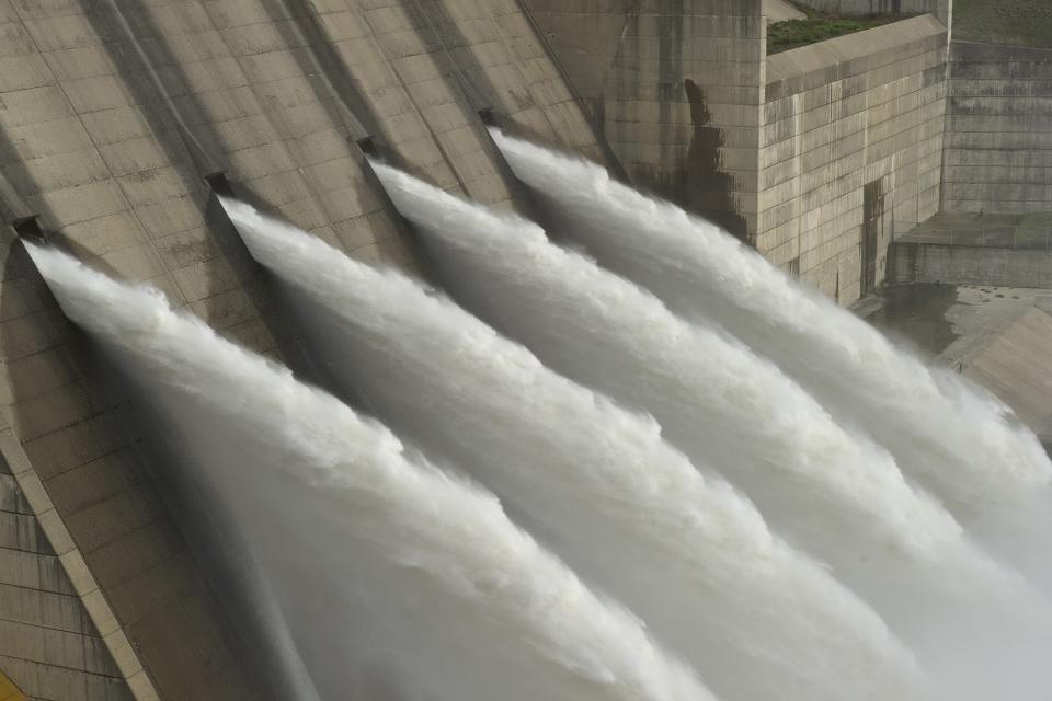
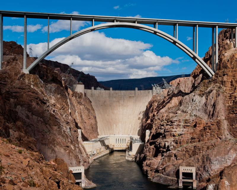
Hoover DamHoover Dam, one of the tallest dams in the United States and a National Historic Landmark that draws tourists from across the globe, is a key reservoir providing flood control, water storage and irrigation along the lower Colorado River. It also is one of the nation’s largest hydroelectric facilities, generating on average about 4 billion kilowatt-hours of hydroelectric power each year, enough electricity to serve more than 1.3 million people in Nevada, Arizona and California.

Completed in 1936, Hoover Dam was built to provide irrigation water and hydroelectric power, and to control seasonal flooding of the Colorado River, which made downstream settlement possible.

The federal government authorized the construction of Hoover Dam, spanning the Nevada-Arizona border about 30 miles southeast of Las Vegas, as part of the 1928 Boulder Canyon Project Act. The dam was initially named Hoover Dam, in honor of then-President Herbert Hoover, who had led negotiations for the 1922 Colorado River Compact that apportioned the river’s waters between the Upper Basin and Lower Basin. Once President Franklin Roosevelt took office in 1933, his Interior secretary, Harold Ickes, changed the name to Boulder Dam. Congress changed it back to Hoover Dam in 1947.

Watch a video on the history of Hoover Dam.

Hoover Dam, a concrete-arch gravity dam, captures water from the Colorado River and fills Lake Mead. At capacity (1,221.4 feet above sea level), the lake is the nation’s largest reservoir, able to contain 28.9 million acre-feet of water covering about 248 square miles. The lake extends about 110 miles upstream from the dam.

With the Colorado River water heavily sought after, there are legal limits on how much water each party can take from the Colorado River.

In California—as a condition of Hoover Dam’s construction—the state has a limit of 4.4 million-acre-feet of annual use of the Colorado River in “normal” years plus one-half of all surplus water when it is available. [See also Colorado River 4.4 Agreement centering on California living within its means of Colorado River water.]

A two-decade drought has severely affected the Colorado River. Between 2000 and 2004, the Colorado River Basin saw the lowest 5-year average annual hydrology on record, reducing the combined storage in Lake Powell and Lake Mead from about 94 percent of capacity to about 52 percent of capacity. Between 2000 and 2020, there has been above average inflow only five times. 

Looking toward Lake Mead from Hoover DamLake Mead’s declining elevation is most noticeable by the giant bathtub ring at its outer edge. Mead’s surface elevation has flirted with 1,075 feet above sea level, the level at which the secretary of the Interior declares a water shortage for the states in the Colorado River’s Lower Basin — Arizona, Nevada and California. Four other states – Colorado, New Mexico, Utah and Wyoming – comprise the Upper Basin.

In 2019, representatives from the seven Colorado River Basin states and the federal government met at Hoover Dam to sign a historic agreement on how to deal with the ongoing drought in the West. The Drought Contingency Plans for the Upper and Lower Basins outline how water users will cooperatively take voluntary reductions in water to preserve Lake Mead’s elevation.

Despite those agreements, the water level in Lake Mead continued to drop. That triggered a first-ever shortage declaration by the Department of the Interior, requiring Arizona, Nevada and the country of Mexico to reduce their take of the river in 2022. In August 2022, as Lake Mead continued to drop, the Interior Department announced even deeper cuts for 2023 to Arizona, Nevada and Mexico. With the largest share of the river, California was not required to cut back, but could still face reductions if the water level in Lake Mead drops further.

Hoover Dam has also altered the ecosystem of the Colorado River Delta in Mexico, particularly causing a decline in fish populations downstream. Downstream water users and the federal government cooperatively work to address endangered species issues through the Lower Colorado River Multi-Species Conservation Program, a 50-year habitat conservation plan that works toward the recovery of species listed under the federal Endangered Species Act.

  • Print-friendly

Referring Pages

Aquapedia background February 11, 2014 Colorado River Basin Map Layperson's Guide to the Colorado River Elwood Mead Colorado River Hoover Dam

Lake Mead

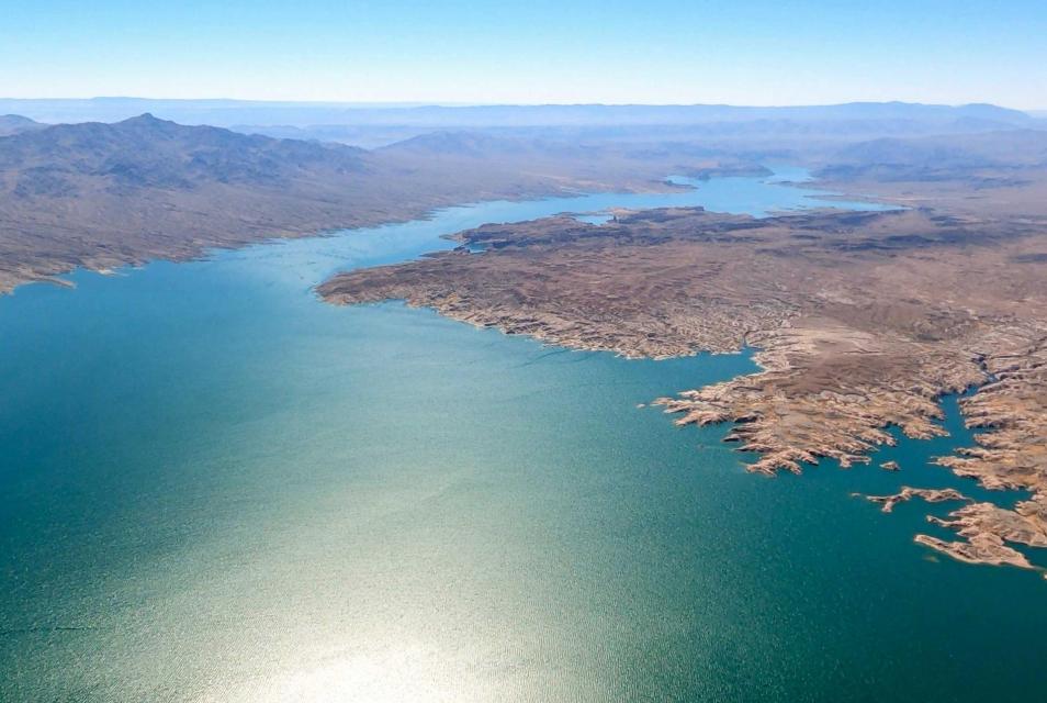
Aerial view of Lake Mead

Lake Mead is the main reservoir formed by Hoover Dam on the border between Southern Nevada and northwestern Arizona.

Created in the 1930s as part of Hoover Dam [see also Elwood Mead], Lake Mead provides water storage in the Lower Basin of the Colorado River. The reservoir is designed to hold 28,945,000 acre-feet of water and at 248 square miles its capacity is the largest in United States.

  • Read more
Aquapedia background February 3, 2014 Oroville Dam Shasta Dam Hoover Dam Layperson's Guide to the Central Valley Project Layperson's Guide to the State Water Project

Dams

Folsom Dam on the American River east of Sacramento

Dams have allowed Californians and others across the West to harness and control water dating back to pre-European settlement days when Native Americans had erected simple dams for catching salmon.

  • Read more

Share this page

  • Share on Facebook
  • Share on Twitter
  • Share on LinkedIn
  • Sent to a friend.
Print-friendly

Related Links

Aquapedia background February 4, 2014 Dams Layperson's Guide to the Colorado River
Folsom Dam on the American River east of Sacramento
Aquapedia background February 3, 2014 Oroville Dam Shasta Dam Hoover Dam Layperson's Guide to the Central Valley Project Layperson's Guide to the State Water Project

Dams

Dams have allowed Californians and others across the West to harness and control water dating back to pre-European settlement days when Native Americans had erected simple dams for catching salmon.

  • Read more
Cover page for the Layperson's Guide to the Colorado River .
Publication May 20, 2014 Colorado River Basin Map

Layperson’s Guide to the Colorado River
Updated 2018

The Colorado River provides water to 40 million people and 4 million acres of farmland in a region encompassing some 246,000 square miles in the southwestern United States. The 32-page Layperson’s Guide to the Colorado River covers the history of the river’s development; negotiations over division of its water; the items that comprise the Law of the River; and a chronology of significant Colorado River events.

  • Read more
Back
This item appears in:
  • Topic: Hoover Dam
  • H
Footer pod May 20, 2014

Water Education Foundation

Copyright © 2023 Water Education Foundation. All rights reserved.

The Water Education Foundation is a nonprofit, tax-exempt, 501(c)3 organization, federal tax ID #942419885.

Privacy Policy

Donor Privacy Policy

  • Read more
Footer pod May 20, 2014

Contact Information

2151 River Plaza Drive, Suite 205
Sacramento CA 95833

Telephone (916) 444-6240

Contact Us via email

  • Read more

Quicklinks

Footer quicklink May 20, 2014

Contact Us

  • Read more
Footer quicklink May 20, 2014

Donate Today

  • Read more
Footer quicklink May 20, 2014

Tours

  • Read more
Footer quicklink May 20, 2014

Newsletter Signup

  • Read more
Footer quicklink May 20, 2014

Foundation News

  • Read more
Footer quicklink May 20, 2014

Calendar

  • Read more

Log in

  • Create new account
  • Request new password

Commands

  • Support portal
  • Log in