Flooding and Flood Management
 When people think of natural
disasters in California, they typically think about earthquakes.
Yet the natural disaster that residents are most likely to face
involves flooding, not fault lines. In fact, all 58 counties in
the state have declared a state of emergency from flooding at
least three times since 1950. And the state’s capital,
Sacramento, is considered one of the nation’s most flood-prone
cities. Floods also affect every Californian because flood
management projects and damages are paid with public funds.
Overview
During heavy rains and atmospheric rivers that barrel through California, large rivers as well as smaller streams and creeks can become dangerous. Most of the state is vulnerable to flooding. Areas adjacent to rivers are prone to flooding as are lowland coastal regions. Parts of Southern California often experience flash floods.
The Central Valley, bordered by the Sierra Nevada on the east and the Coast Range on the west, is similar to a large bowl that collects most of California’s rainfall. More than 1.3 million Californians live and work in the floodplains of the Sacramento and San Joaquin valleys, where flood risks are among the highest in the nation.
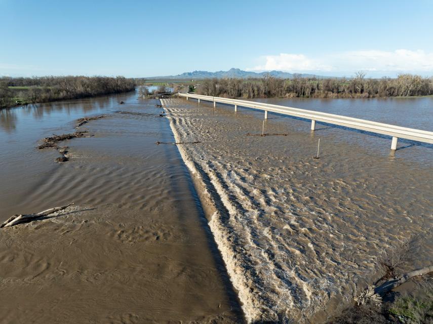
Watch a video of the Sacramento weir and the Yolo Bypass.
Flooding in California is not caused only by hard rains. In the Sacramento-San Joaquin Delta, there are approximately 1,100 miles of levees protecting 700,000 acres of lowland. In the Suisun Marsh, at the western edge of the Delta, there are approximately 230 miles of levees protecting over 50,000 acres of marshland. According to the California Department of Water Resources, a 6.5-magnitude earthquake in the western Delta could produce more than 30 levee breaches on 16 Delta islands, causing about $30 billion in damages.
The Delta is particularly vulnerable to flooding because of its aging, insufficient levees. On a sunny day in 2004, a levee crumbled and sent surging river water into Upper and Lower Jones Tract west of Stockton, causing $90 million in damages, including millions of dollars in direct flood-fighting and levee-repair costs and millions more in losses of crops and property.
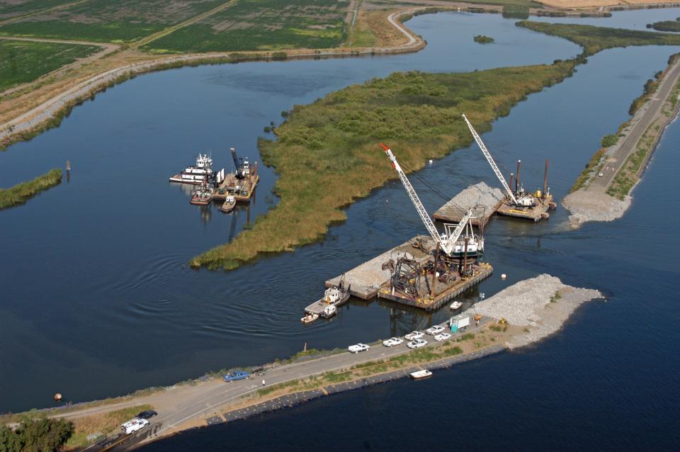 Upstream dams have done much to reduce flooding
risks in California, but whether downstream levees can provide
adequate protection in some areas is a big concern. These
concerns deepened in 2005 after the destruction of New Orleans by
Hurricane Katrina brought new attention to levees throughout the
United States, including California.
Situated at the confluence of two major rivers, the city of Sacramento is considered the second-most flood-prone major city in the United States after New Orleans. State laws enacted in 2007 to implement better flood management policies and practices also required that Central Valley communities ensure they can safely withstand a 200-year flood by 2025.
In 2018, Sacramento received about $1.8 billion in federal money to strengthen levees, raise Folsom Dam and widen the Sacramento Weir, which channels flood waters into the Yolo Bypass.
Challenges
Flood management is inextricably intertwined with politics, economics and values. Meanwhile, historic floodplains have been heavily developed for agricultural, commercial and residential use.
The effects of climate change further complicate flood risk management in California. Precipitation and runoff patterns are changing, which could affect the timing and magnitude of flows. Expected effects include more precipitation falling as rain rather than snow. An earlier melt to the winter snowpack is also expected. In addition, the California Climate Change Center says more coastal floods are expected due to increasingly severe winter storms, rising sea levels and high tides. These severe weather events are expected to cause more frequent and more severe flooding, erosion and damage to structures along the coast.
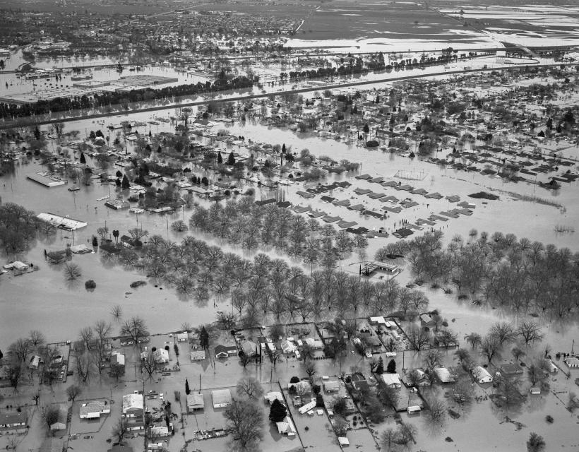 California’s flood protection system
is facing unprecedented challenges, including increasing
floodplain development, rising flood peaks, higher costs that
delay fixing problem levee sites,
the need for environmental protection and greater state liability
for levee breaches.
Through the years, California voters have approved water bonds with flood protection elements, including 2018’s Proposition 68, which, among other things, included $1.3 billion for flood protection improvements.
In 2022, the Central Valley Flood Protection Board updated the 2017 Central Valley Flood Protection Plan, setting out a $25-$30 billion blueprint for managing Central Valley flood risk over the next three decades to better respond to a changing and more volatile climate. Among the revisions laid out in the update are plans to strengthen urban levees to protect populated areas and set back levees in more rural areas to allow flood waters to spread out, slow down and sink into the ground. The update also calls for using weather forecasts to more flexibly operate flood control reservoirs, capturing and storing flood waters in aquifers and reservoirs, and more multi-benefit flood improvements that mesh with other statewide water priorities.
Management Issues
As impacts of climate change become more apparent, flood management is increasingly critical in California, particularly when heavy winter rains fall. Compounding the issue are human-made flood hazards such as levee instability and stormwater runoff. Flood management includes giving constricted rivers more breathing room by setting back levees, reducing floodplain development and giving equal weight to environmental and economic factors in making management decisions.
Flood management is often in conflict with water supply practices and needs. Flood control managers must keep enough reservoir storage space available to accept runoff surges and reduce the risk of floods downstream, while water suppliers hope to keep enough water in reservoirs to protect against drought. New strategies, known as Forecast Informed Reservoir Operations (FIRO), are being implemented that give reservoir operators more flexibility to determine storage needs based on what the weather forecast holds instead of sticking with an inflexible guideline.
Additionally, flood control involves many different local, state and federal agencies [see list at bottom of the page], and their management philosophies change with the political and economic times. The state also has many local flood management agencies responsible for the day-to-day operations and maintenance of facilities, development and implementation of flood management and stormwater drainage plans, and coordination with other state and federal agencies.
Regional Management Efforts
In Sacramento, the Sacramento Flood Control Project consists of a system of levees, overflow weirs, pumping plants and bypass channels. In times of high flows, the Sacramento and Yolo bypasses divert vast amounts of water from the Sacramento River.
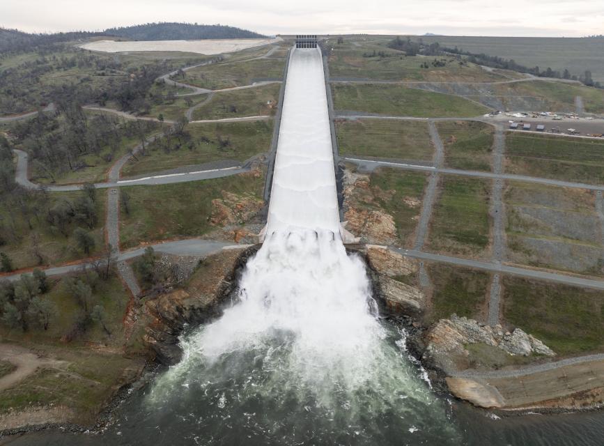 The Central Valley has a flood
protection network that includes 23 reservoirs with flood
detention space and more than 1,760 miles of federally designated
levees, overflow weirs and channels. In addition, a series
of dams were built on the western slope of the Sierra Nevada and
Cascade mountain ranges for both flood control and water supply.
These include Shasta Dam on the Sacramento River, Oroville Dam on
the Feather River and Folsom Dam on the American River.
In the more arid Southern California region, flash floods prompted the formation of the state’s first flood control district in 1915 in Los Angeles. Today, the Los Angeles County Department of Public Works, in coordination with the U.S. Army Corps of Engineers, operates 14 dams, 115 debris basins, 26 groundwater recharge facilities, 524 miles of major channels, 29 pump plants, 77,990 catch basins, and 2,800 miles of tributary storm drains.
The state also has more than 2,600 miles of levees and sloughs that fan out from the San Pablo Bay northeast of San Francisco up to Sacramento and Stockton. Many of the state’s levees are simply mounds of river mud constructed in the 1800s and not designed to protect buildings.
Despite progress, flood management still faces significant obstacles. Many floodplains already are developed, and providing rivers with more room to roam is controversial, expensive and difficult. Virtually all of the natural floodplains along the Los Angeles River are urbanized. Much of the city of Sacramento lies in the historic floodplain. Other areas throughout the state are experiencing rapid development.
Key Agencies in Flood Management
- The U.S. Army Corps of Engineers (Corps) is the primary federal flood management agency, developing guidelines for flood management storage in federally funded reservoirs and monitoring reservoir operations. The Corps also constructs flood management projects, operates multiple-purpose projects, and provides resources, equipment and personnel for emergency floods.
- The Bureau of Reclamation operates several multipurpose projects throughout the state, including the Central Valley Project and the Colorado River system.
- The National Weather Service (NWS) issues weather forecasts and flood warnings. It helps communities establish flood warning systems and conducts flood hazard analyses and provides other technical assistance.
- The Federal Emergency Management Agency (FEMA) runs the National Flood Insurance Program, disaster planning and recovery programs. FEMA works closely with states and communities and provides financial and technical assistance, flood hazard maps and data to better manage floodplains.
- The California Department of Water Resources (DWR) operates the State Water Project, runs the state-federal Flood Operations Center and assists the NWS in flood forecasting. It is responsible for the operation and maintenance of the Sacramento and San Joaquin flood management projects. DWR funds flood management projects outside the Central Valley, carries out the state’s floodplain management laws and coordinates the floodplain management aspects of FEMA in California.
- The Central Valley Flood Protection Board cooperates with the Corps in the planning, construction, operation and maintenance of flood management projects in the Central Valley. Once a project is completed, the board holds the federal government harmless, accepts legal responsibility for its maintenance and then turns the maintenance responsibility over to a local agency or DWR. The board also controls, through a permitting process, activities and development in state-designated floodways.
- The California Office of Emergency Services (OES) may allocate funds for investigation, estimates, reports and repairs regarding disaster recovery financial assistance for flood management works that do not come under the provisions of another authority. It runs FEMA’s hazard mitigation program in California.
Updated February 2024


