Header link June 22, 2020

LinkedIn

  • Read more
Header link September 15, 2014

Cart

  • Read more
Header link November 3, 2015

Donate Now

  • Read more
Header link May 15, 2014

Twitter

  • Read more
Header link May 15, 2014

Facebook

  • Read more
Instagram
Header link May 15, 2014

Instagram

  • Read more
Header link May 15, 2014

Contact Us

  • Read more
More options
Water Education Foundation
Home

Water Education Foundation

Everything about California water that matters
  • Water Academy
    • Agriculture
      • Agricultural Conservation
      • Agricultural Drainage
    • Background Information
      • Legislation — California and Federal
      • Regulations — California and Federal
      • Water History
      • Water Rights
    • Bay-Delta
      • Bay Delta
      • Bay Delta Conservation Plan
      • Delta Issues
      • Delta Smelt
      • Sacramento San Joaquin Delta
      • San Francisco Bay
      • Suisun Marsh
    • Dams, Reservoirs and Water Projects
      • California Aqueduct
      • Central Valley Project
      • Folsom Dam
      • Friant Dam
      • Hetch Hetchy
      • Hoover Dam
      • Infrastructure
      • Lake Mead
      • Lake Powell
      • Oroville Dam
      • San Luis Dam
      • Shasta Dam
      • State Water Project
    • Environmental Issues
      • Anadromous Fish Restoration
      • Ecosystem
      • Endangered Species Act
      • Invasive species
      • Lake Tahoe
      • Mono Lake
      • Public Trust Doctrine
      • Salmon
      • San Joaquin River Restoration
      • Watershed
      • Wetlands
    • Leaders and Experts
    • Regions
      • Central Coast
      • Central Valley
      • Mexico
      • Nevada
      • North Coast
      • Pyramid Lake
      • Sacramento Valley
      • Salton Sea
      • San Joaquin Valley
      • Sierra Nevada
      • Southern California
      • Tulare Lake Basin
    • Rivers
      • Carson River
      • Colorado River
      • Klamath River
      • New River
      • North Coast Rivers
      • Russian River
      • Sacramento River
      • Truckee River
      • San Joaquin River
    • Water Issues
      • Climate Change
      • Coronavirus
      • Drought
      • Earthquakes
      • Energy and Water
      • Floods
      • Fracking
      • Growth
      • Hydropower
      • Levees
      • Tribal Water Issues
      • Water Conservation
    • Water Quality
      • Drinking Water
      • Nitrate contamination
      • Pollution
      • Stormwater
      • Wastewater
      • Water Quality
    • Water Supply and Management
      • Acre Foot
      • Aquifers
      • California Water Plan
      • Conjunctive Use
      • Desalination
      • Grey water
      • Groundwater
      • Integrated Regional Water Management
      • Recreation
      • Surface Water
      • Water Marketing and Banking
      • Water Rates
      • Water Recycling
      • Water Supply
      • Water Transfers
  • Tours & Events
    • Water Tours
      • 2024 Tour Sponsors
    • Events
    • Event Calendar
    • Past Tours & Events
      • Anne J. Schneider Fund Lecture Series
  • Specialized Programs
    • Water Leaders
      • Cohort Rosters
      • Yearly Class Reports
      • Your Alumni Network
      • Alumni Profiles
    • Project WET
      • Workshops
      • Special Workshops & Events
      • Supplementary Materials
      • California Content Standard Correlations
      • Facilitator's Trainings
      • Foundation School Programs
        • Elementary Programs
        • Secondary Programs
      • Water Kids
      • California Project WET Gazette
      • Gazette Archives
    • Colorado River Project
    • GRA Scholastic Fund Program
  • Maps & Guides
    • Maps & Posters
    • Layperson's Guides
    • Map & Guide Bundles
    • Books
    • Colorado River Materials
    • California Runoff Rundown
    • Other Publications
    • Water Awareness Materials
    • Downloadable Publications
    • Videos and DVDs
      • Video Clips
    • School Age Publications
    • Stickers
    • Free Programs and Publications
  • Newsroom
    • Western Water News
    • Aquafornia
      • About Aquafornia
    • Information Desk
    • Western Water Magazine Archive
      • Full Print Edition
      • Print Edition Excerpts
    • River Report Archive
  • Aquapedia
    • Alphabetical List of Subjects
      • A
      • B
      • C
      • D
      • E
      • F
      • G
      • H
      • I
      • J
      • K
      • L
      • M
      • N
      • O
      • P
      • Q
      • R
      • S
      • T
      • U
      • V
      • W
      • X
      • Y
      • Z
    • Historical Water People
    • Where Does My Water Come From?
      • Northern California
      • Sacramento
      • North Bay
      • South Bay
      • Central Valley
      • Los Angeles
      • Inland Empire
      • San Diego
      • All California Water Sources
    • Timelines
    • Videos
    • Image Gallery
    • Water Directory
      • Federal Agencies
      • State Agencies in California
      • Environmental Organizations
      • Other California Organizations
      • State and Federal Legislative Committees
      • Water Associations and Groups
      • Western States Water Agencies and Districts
    • Online Resources
    • Useful Acronyms
    • About Aquapedia
  • About
    • About Us
      • Board of Directors
      • Staff Biographies
      • Job Openings
    • Announcements
    • Support Our Mission
      • Become a Member
      • Donate in Honor/Memory
      • Planned Giving
    • Contact Us
Aquapedia background February 11, 2014 Colorado River Basin Map

Salton Sea

As part of the historic Colorado River Delta, the Salton Sea regularly filled and dried for thousands of years due to its elevation of 237 feet below sea level.

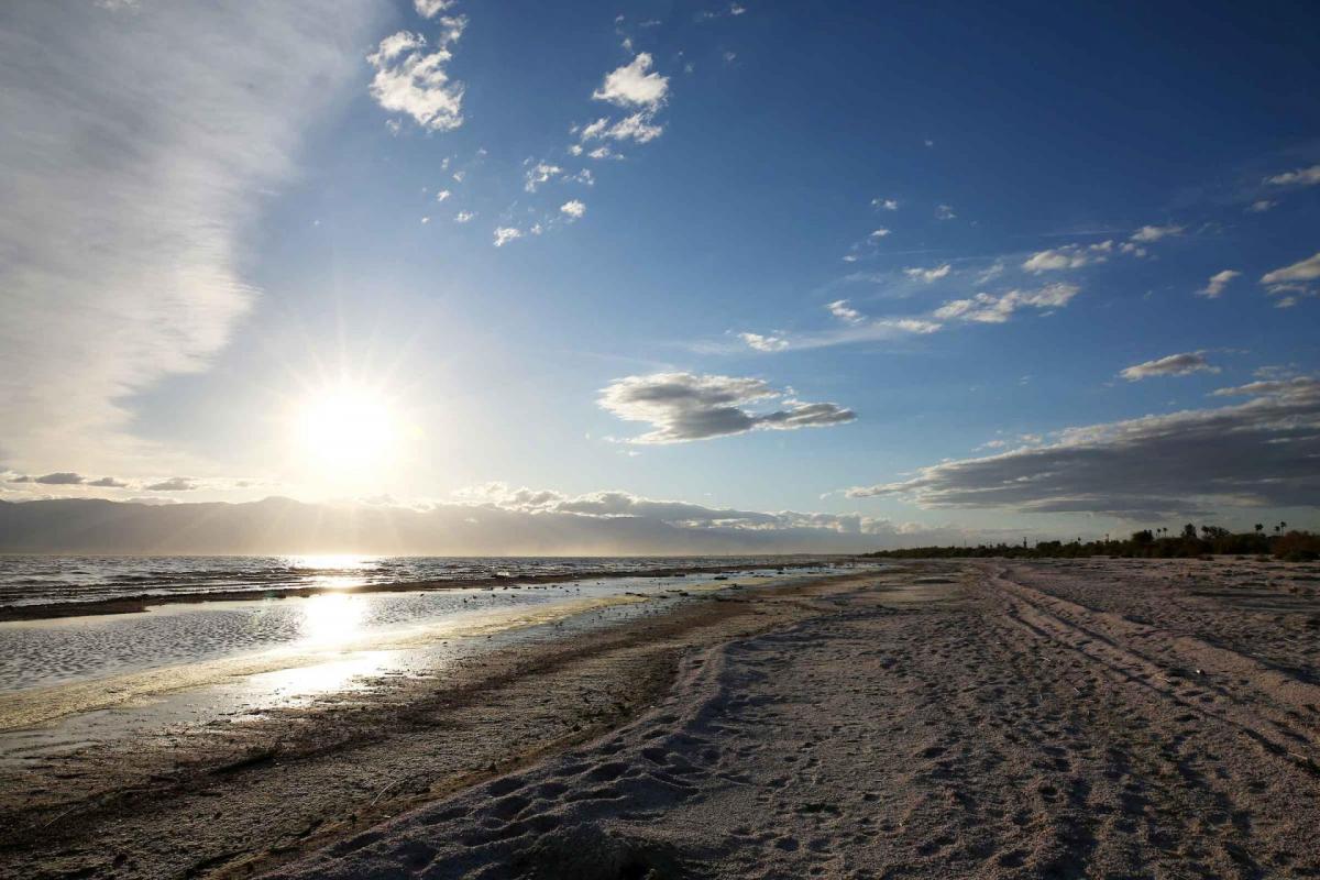
The most recent version of the Salton Sea was formed in 1905 when the Colorado River broke through a series of dikes and flooded the seabed for two years, creating California’s largest inland body of water. The Salton Sea, which is saltier than the Pacific Ocean, includes 130 miles of shoreline and is larger than Lake Tahoe. 

The Salton Sea is an important stopping point for migratory waterfowl, and serves as critical habitat for birds moving south to Mexico and Central America. The sea’s role in the Pacific Flyway – the 5,000-mile route for migratory birds from the Arctic to South America – has earned it the designation of a bird area of global significance by the National Audubon Society. More than 400 species of birds make regular use of the Salton Sea, including the Yuma Ridgway’s rail, California brown pelican, Western snowy plover, black-necked stilt, Western sandpiper and American avocet.

For more than a century, the Salton Sea has existed primarily by the agricultural runoff from the Imperial and Coachella valleys. Because of its ecological importance and due to concerns about dust-borne emissions, much attention has been paid to keeping the Salton Sea from completely drying up. Through the years, proposals ranged from building dikes to downsize the sea to constructing ocean-to-sea canals to maintain a steady source of water.

In 2007, the state released a $9 billion, 75-year restoration plan that featured a smaller sea and select habitat sites. The plan was never acted on by the California Legislature and the subsequent economic downturn shut the door on it completely. The need to take action at the sea has reached the highest levels, with a 2015 governor’s task force of the California Natural Resources Agency, Department of Water Resources, Department of Fish and Wildlife, the State Water Resources Control Board and the Air Resources Board assigned to come up with possible solutions.

Learn more about the Salton Sea in this video. 

In 2017, the State Water Board approved a 10-year, $400 million plan that aims to restore a smaller but sustainable sea through a suite of actions, including:

  • Continued implementation of the mitigation program approved as part of the Quantification Settlement Agreement for Colorado River water rights, which provided for a water transfer from the agriculturally rich Imperial Valley to urban San Diego. Without as much farm runoff from the Imperial Valley helping to sustain the sea, the lake will diminish faster, exposing more playa at a faster rate.
  • Dust control and habitat for 30,000 acres of exposed playa.
  • Granting the State Water Board oversight authority of restoration efforts.
  • Development of a draft long-term plan for restoration by 2022.

Although the Imperial Irrigation District (IID) believed royalties from geothermal energy production could be used for Salton Sea restoration projects, the district discovered that would price geothermal out of the market, especially with California utilities having access to low-cost solar and wind energy. The district has pledged royalties for any land it leases to renewable energy companies. There have yet to be any new ones developed.

Nonetheless, the district believes renewable energy projects around the sea are still a good idea because they cover exposed playa, are normally habitat- and bird-friendly and are required to do mitigation work as part of their environmental permitting process.

Salton Sea Background

At one time, the Colorado River Delta’s wetlands and riparian habitat spanned nearly 2 million acres and stretched from the northern tip of the Gulf of California to Southern California’s Salton Sea, providing rich habitat for more than 200 plant species, countless fish, hundreds of species of migratory birds and waterfowl, and wildlife such as deer, quail, raccoon, bobcat and even jaguar.

But the course of the river varied and changed direction. At least three times it altered course, pouring northwest into the Salton Sink. The volume of water was enough to create ancient Lake Cahuilla, which filled portions of the Imperial and Coachella valleys and was six times the size of today’s Salton Sea.

Since its formation, the Salton Sea has acted as a collection basin for a significant portion of agricultural runoff in the Imperial, Coachella and Mexicali valleys. The nutrient-rich runoff includes a high volume of salt and helps support a vibrant aquatic community, home to fish and wildlife. In the recent past, the Salton Sea also was a popular spot for recreational boating and fishing.

Its formation as an endorheic (closed) lake with no natural outlet other than seepage or evaporation complicates the continued vitality of the Salton Sea. Located in a desert region, the Salton Sea also receives minimal runoff from rain. Its closed nature also generated concern with plans to lessen California’s use of Colorado River water, a drawdown that could impact the Salton Sea [see also Colorado River 4.4 Plan].

Salton Sea Environmental Issues

With the sea already saltier than the Pacific Ocean, salt continues to build up. Freshwater transfers between the Imperial Irrigation District and San Diego County Water Authority have further concentrated the salt. Reduced water supply, minimal rainfall and evaporation also could significantly lower the water levels in the already quite shallow Salton Sea, placing wildlife habitat at risk. Exposed lake bed also could lead to potentially harmful dust storms. (It also is directly on the earthquake-prone San Andreas Fault).

  • Print-friendly

Referring Pages

Share this page

  • Share on Facebook
  • Share on Twitter
  • Share on LinkedIn
  • Sent to a friend.
Print-friendly

Related Links

Aquapedia background February 11, 2014 Colorado River Basin Map
Maps & Posters May 20, 2014

Colorado River Basin Map
Redesigned in 2017

Redesigned in 2017, this beautiful map depicts the seven Western states that share the Colorado River with Mexico. The Colorado River supplies water to nearly 40 million people in Arizona, California, Colorado, Nevada, New Mexico, Utah, Wyoming and Mexico. Text on this beautiful, 24×36-inch map, which is suitable for framing, explains the river’s apportionment, history and the need to adapt its management for urban growth and expected climate change impacts.

  • Read more
Back
This item appears in:
  • Topic: Legislation — California and Federal
  • Topic: Agricultural Drainage
  • Topic: Colorado River
  • Topic: Ecosystem
  • Topic: Regulations — California and Federal
  • Topic: Mexico
  • Topic: Pollution
  • Topic: Salton Sea
  • Topic: Water Quality
  • Topic: Water Transfers
  • S
Footer pod May 20, 2014

Water Education Foundation

Copyright © 2025 Water Education Foundation. All rights reserved.

The Water Education Foundation is a nonprofit, tax-exempt, 501(c)3 organization, federal tax ID #942419885.

Privacy Policy

Donor Privacy Policy

  • Read more
Footer pod May 20, 2014

Contact Information

2151 River Plaza Drive, Suite 205
Sacramento CA 95833

Telephone (916) 444-6240

Contact Us via email

  • Read more

Quicklinks

Footer quicklink May 20, 2014

Contact Us

  • Read more
Footer quicklink May 20, 2014

Donate Today

  • Read more
Footer quicklink May 20, 2014

Tours

  • Read more
Footer quicklink May 20, 2014

Newsletter Signup

  • Read more
Footer quicklink May 20, 2014

Foundation News

  • Read more
Footer quicklink May 20, 2014

Calendar

  • Read more

Log in

  • Create new account
  • Request new password

Commands

  • Support portal
  • Log in