

San Francisco Bay
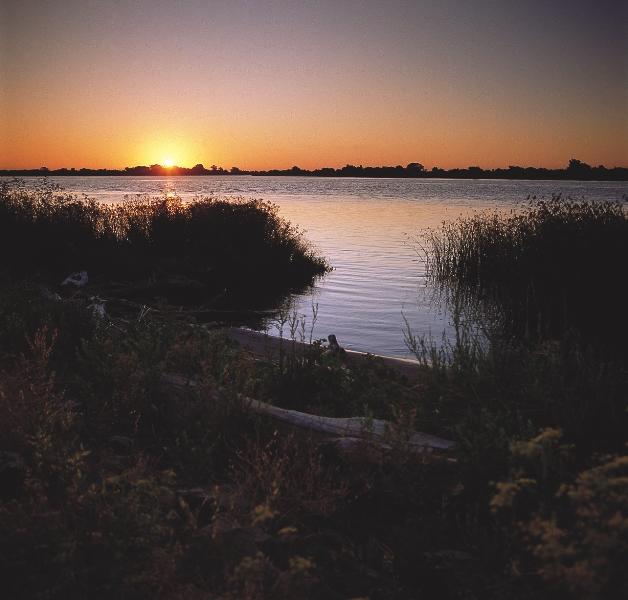 San Francisco Bay and the
inter-connected Sacramento-San Joaquin
Delta form the largest estuary on the Pacific West Coast.
San Francisco Bay and the
inter-connected Sacramento-San Joaquin
Delta form the largest estuary on the Pacific West Coast.
The estuary is shaped by water flows from two directions.
Ocean water flows into the estuary at the Golden Gate in San Francisco. Miles inland, fresh water from the Central Valley and the Sacramento and San Joaquin rivers converges at the Delta and makes its way to the ocean. [See also Bay Model]
Along the way, the tidal waters flow past large cities, industrial shorelines, suburban communities, marshes, wetlands and rural farmland. Reflecting this diversity, San Francisco Bay’s watershed includes the largest urban salt water lake in the United States, Oakland’s Lake Merritt, and the largest contiguous brackish marsh on the West Coast, Suisun Marsh.
San Francisco Bay also contains 90 percent of California’s coastal wetlands and its upper watershed drains 40 percent of California’s landmass (including runoff from the Sierra Nevada and the Coastal Range). More than 130 species of fish, 500 species of wildlife, millions of native and migratory birds and other plant and animal species are supported by the estuarine environment.
San Francisco Bay Overview
San Francisco Bay consists of three main bays—San Francisco, San Pablo and Suisun—and several smaller bays. Together with the Delta, the Bay Delta covers some 1,600 square miles and flows more than 70 miles from the coast to the center of the California. At the eastern edge of Suisun Bay, the waters also form Suisun Marsh, which follows a maze of interconnected waterways and leveed and unleveed islands through the Delta.
The estuary contains salt water for more than 30 miles inland to the Carquinez Strait. From the other direction, fresh water from the Central Valley flows through the Delta to the sea, meeting salt water at a shifting point just past Carquinez.
This point is known as X2 in reference to its distance from the Golden Gate Bridge and the concentration of its bottom salinity (with the amounts of dissolved salts in the water averaging 2 parts per thousand).
The location of the X2 point shifts depending on whether it is a wet year or dry year. In a wet year, more fresh water flowing out of the Delta pushes salty water further back into San Francisco Bay. In a dry year, salty water can move further up into the Delta and potentially damage crops. With this in mind, the State Water Project’s Salinity Control Gates in Suisun Bay modify tidal flow to limit movement of saline water upstream.
 Combined, San Francisco Bay’s saline
and fresh water create a biologically rich mix of nutrients in a
“null” zone with the heavier salt water on the bottom and
brackish water on top supporting a range of plants, fish,
wildlife, amphibians and other creatures. This mix also supports
the endangered Delta smelt,
which prefers to feed at the X2 point and has led to legal
controversy (see Judge
Wanger Rulings).
Combined, San Francisco Bay’s saline
and fresh water create a biologically rich mix of nutrients in a
“null” zone with the heavier salt water on the bottom and
brackish water on top supporting a range of plants, fish,
wildlife, amphibians and other creatures. This mix also supports
the endangered Delta smelt,
which prefers to feed at the X2 point and has led to legal
controversy (see Judge
Wanger Rulings).
The San Francisco Bay and the Delta waters, home to nearly 10 million people, also support a number of commercial activities, including shipping, fisheries and agriculture.
San Francisco Bay Challenges
Since the 1848 Gold Rush, the Bay and Delta have rapidly urbanized and added millions of people. Along the way, the estuary has experienced a number of challenges to its vitality. These challenges include:
- Urban and industrial pollution
- Agricultural runoff from the Central Valley
- Freshwater diversions from the Delta
- Man-made changes to natural waterways and shorelines
- Loss of habitat, particularly wetlands
- Introduction of native-species such as the Asian clam
- Intensified land use and development
These challenges are further compounded by past problems and future ones. Gold and other mining has left remnants such as mercury in Bay Delta waterways—a toxic legacy that continues to pose health risks to humans and aquatic creatures.
Since the 1850s, roughly 40 percent of San Francisco Bay has been filled in and more than 80 percent of the original tidal wetlands converted to other uses.
Looking ahead, the changing climate and along with it the likelihood of more extreme weather events present challenges that are being assessed. In one scenario, anticipated rising seas as a part of climate change are expected to create flooding hazards for a number of San Francisco Bay communities. Rising sea levels could also make fresh water more salty further inland, impacting agriculture and aquatic species.
With these issues in mind, a number of federal, state and private organizations are working on ways to improve the health of San Francisco Bay through such projects as wetlands restoration, water flow management and mitigating adverse effects on fish and wildlife.


