Bay Model
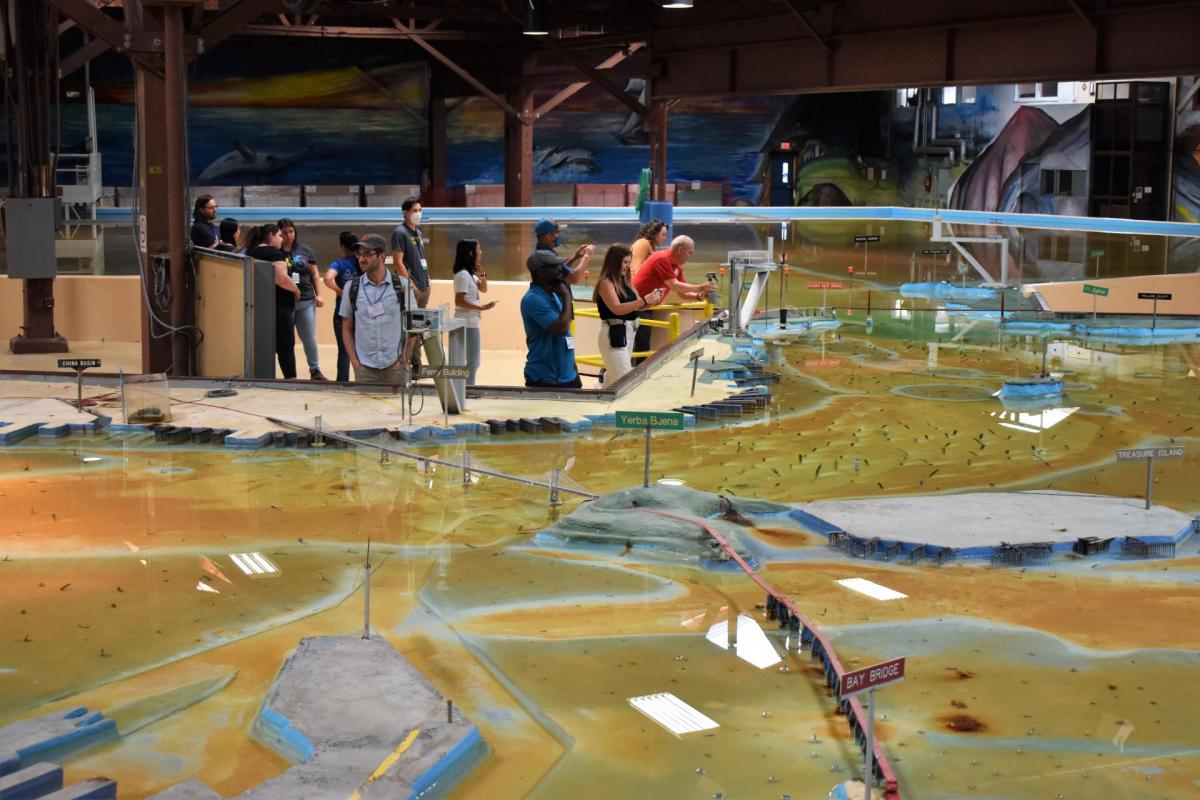
Operated by the U.S. Army Corps of Engineers, the Bay Model is a giant hydraulic replica of San Francisco Bay and the Sacramento-San Joaquin Delta. It is housed in a converted World II-era warehouse in Sausalito near San Francisco.
Hundreds of gallons of water are pumped through the three-dimensional, 1.5-acre model to simulate a tidal ebb and flow lasting 14 minutes.
The Corps built the model in 1957 to predict the effects of proposed developments on the estuary’s tidal currents, sedimentation, circulation patterns and the interactions of fresh and saltwater flows.
There have been many proposals to prevent salt water from mixing with fresh water in the estuary over the past 150 years.
One proposal, the Reber Plan, would have converted the bay into freshwater lakes. The plan gained serious consideration in the 1950s and led to the establishment of the Bay Model to determine its effects.
John Reber, a theatrical producer, pitched the construction of two large dams and several canals to separate the salt water from fresh water and convert 85 percent of the bay into freshwater reservoirs. The plan was never realized. Model tests showed the saltwater barriers would cause major flooding, among other disruptions.
Engineers also used the model to predict the effects of dredging and oil spills.
Since 2000, computer modeling has replaced scientific use of the Bay Model. Today, it serves to educate the public about the scale and ecological complexity of the estuary.