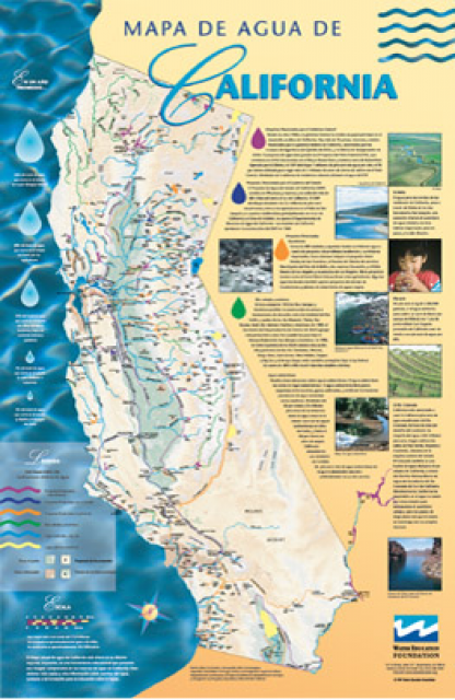
Header link June 22, 2020

LinkedIn

  • Read more
Header link September 15, 2014

Cart

  • Read more
Header link November 3, 2015

Donate Now

  • Read more
Header link May 15, 2014

Twitter

  • Read more
Header link May 15, 2014

Facebook

  • Read more
Instagram
Header link May 15, 2014

Instagram

  • Read more
Header link May 15, 2014

Contact Us

  • Read more
More options
Water Education Foundation
Home

Water Education Foundation

Everything about California water that matters
  • Water Academy
    • Agriculture
      • Agricultural Conservation
      • Agricultural Drainage
    • Background Information
      • Legislation — California and Federal
      • Regulations — California and Federal
      • Water History
      • Water Rights
    • Bay-Delta
      • Bay Delta
      • Bay Delta Conservation Plan
      • Delta Issues
      • Delta Smelt
      • Sacramento San Joaquin Delta
      • San Francisco Bay
      • Suisun Marsh
    • Dams, Reservoirs and Water Projects
      • California Aqueduct
      • Central Valley Project
      • Folsom Dam
      • Friant Dam
      • Hetch Hetchy
      • Hoover Dam
      • Infrastructure
      • Lake Mead
      • Lake Powell
      • Oroville Dam
      • San Luis Dam
      • Shasta Dam
      • State Water Project
    • Environmental Issues
      • Anadromous Fish Restoration
      • Ecosystem
      • Endangered Species Act
      • Invasive species
      • Lake Tahoe
      • Mono Lake
      • Public Trust Doctrine
      • Salmon
      • San Joaquin River Restoration
      • Watershed
      • Wetlands
    • Leaders and Experts
    • Regions
      • Central Coast
      • Central Valley
      • Mexico
      • Nevada
      • North Coast
      • Pyramid Lake
      • Sacramento Valley
      • Salton Sea
      • San Joaquin Valley
      • Sierra Nevada
      • Southern California
      • Tulare Lake Basin
    • Rivers
      • Carson River
      • Colorado River
      • Klamath River
      • New River
      • North Coast Rivers
      • Russian River
      • Sacramento River
      • Truckee River
      • San Joaquin River
    • Water Issues
      • Climate Change
      • Coronavirus
      • Drought
      • Earthquakes
      • Energy and Water
      • Floods
      • Fracking
      • Growth
      • Hydropower
      • Levees
      • Tribal Water Issues
      • Water Conservation
    • Water Quality
      • Drinking Water
      • Nitrate contamination
      • Pollution
      • Stormwater
      • Wastewater
      • Water Quality
    • Water Supply and Management
      • Acre Foot
      • Aquifers
      • California Water Plan
      • Conjunctive Use
      • Desalination
      • Grey water
      • Groundwater
      • Integrated Regional Water Management
      • Recreation
      • Surface Water
      • Water Marketing and Banking
      • Water Rates
      • Water Recycling
      • Water Supply
      • Water Transfers
  • Tours & Events
    • Water Tours
      • 2024 Tour Sponsors
    • Events
    • Event Calendar
    • Past Tours & Events
      • Anne J. Schneider Fund Lecture Series
  • Specialized Programs
    • Water Leaders
      • Cohort Rosters
      • Yearly Class Reports
      • Your Alumni Network
      • Alumni Profiles
    • Project WET
      • Workshops
      • Special Workshops & Events
      • Supplementary Materials
      • California Content Standard Correlations
      • Facilitator's Trainings
      • Foundation School Programs
        • Elementary Programs
        • Secondary Programs
      • Water Kids
      • California Project WET Gazette
      • Gazette Archives
    • Colorado River Project
    • GRA Scholastic Fund Program
  • Maps & Guides
    • Maps & Posters
    • Layperson's Guides
    • Map & Guide Bundles
    • Books
    • Colorado River Materials
    • California Runoff Rundown
    • Other Publications
    • Water Awareness Materials
    • Downloadable Publications
    • Videos and DVDs
      • Video Clips
    • School Age Publications
    • Stickers
    • Free Programs and Publications
  • Newsroom
    • Western Water News
    • Aquafornia
      • About Aquafornia
    • Information Desk
    • Western Water Magazine Archive
      • Full Print Edition
      • Print Edition Excerpts
    • River Report Archive
  • Aquapedia
    • Alphabetical List of Subjects
      • A
      • B
      • C
      • D
      • E
      • F
      • G
      • H
      • I
      • J
      • K
      • L
      • M
      • N
      • O
      • P
      • Q
      • R
      • S
      • T
      • U
      • V
      • W
      • X
      • Y
      • Z
    • Historical Water People
    • Where Does My Water Come From?
      • Northern California
      • Sacramento
      • North Bay
      • South Bay
      • Central Valley
      • Los Angeles
      • Inland Empire
      • San Diego
      • All California Water Sources
    • Timelines
    • Videos
    • Image Gallery
    • Water Directory
      • Federal Agencies
      • State Agencies in California
      • Environmental Organizations
      • Other California Organizations
      • State and Federal Legislative Committees
      • Water Associations and Groups
      • Western States Water Agencies and Districts
    • Online Resources
    • Useful Acronyms
    • About Aquapedia
  • About
    • About Us
      • Board of Directors
      • Staff Biographies
      • Job Openings
    • Announcements
    • Support Our Mission
      • Become a Member
      • Donate in Honor/Memory
      • Planned Giving
    • Contact Us
Aquapedia background February 11, 2014 California Water Map California Water Map, Spanish

Los Angeles Aqueduct and Owens Valley

Los Angeles Aqueduct Cascades The Owens Valley in eastern California helped transform distant Los Angeles into today’s sprawling megalopolis.

More than 100 years ago, Los Angeles recognized the need to augment local water supplies and decided to tap faraway sources.

In 1905, the city filed for water rights on the Owens River in the eastern Sierra Nevada, 250 miles away. Municipal crews began work on a 233-mile aqueduct capable of delivering four times more water than the city then required. The Los Angeles Aqueduct was completed in 1913, and with this firm water supply, the city grew. By 1920, Los Angeles was as populous as San Francisco.

To protect its rights, Los Angeles began buying land and associated water rights in the Owens Valley and converting cropland to a less water-intensive use: cattle grazing. Irrigated acreage in the valley dropped from about 75,000 acres in 1920 to 23,625 acres in 1940.

Early on, in 1924, area ranchers and businessmen feared for the valley’s agricultural future and waged a “water war,” dynamiting the aqueduct 17 times in a futile attempt to stop the water from flowing south.

Dust storm on the dry Owens Lake bed.With Los Angeles as landlord, the Owens Valley became a recreation area with leased rather than owner-occupied farms.

Today, Los Angeles controls nearly all the land on the valley floor. Until recent court decisions reduced the amount of exported water, valley water provided up to 75 percent of the city’s annual supply. After years of legal battles, Inyo County and Los Angeles agreed in 1991 to jointly manage the valley’s water and regulate the amount of exported water based on environmental effects.

The water exports also created an air pollution hazard in the Owens Valley. Diverting the Owens River and streams feeding the 100-square-mile Owens Lake left it mostly dry. Aerosols of fine mineral dust from the lake bed raised health concerns among the region’s residents, particularly those with respiratory problems. Since the 1990s, the Los Angeles Department of Water and Power has spent more than $2.5 billion on projects that have reduced dust emissions by nearly 100%, according to the utility


  • Print-friendly

Referring Pages

Share this page

  • Share on Facebook
  • Share on Twitter
  • Share on LinkedIn
  • Sent to a friend.
Print-friendly

Related Links

Aquapedia background February 11, 2014 California Water Map California Water Map, Spanish
Maps & Posters April 17, 2014 California Water Bundle

California Water Map
Updated December 2016

A new look for our most popular product! And it’s the perfect gift for the water wonk in your life.

Our 24×36-inch California Water Map is widely known for being the definitive poster that shows the integral role water plays in the state. On this updated version, it is easier to see California’s natural waterways and man-made reservoirs and aqueducts – including federally, state and locally funded projects – the wild and scenic rivers system, and natural lakes. The map features beautiful photos of California’s natural environment, rivers, water projects, wildlife, and urban and agricultural uses and the text focuses on key issues: water supply, water use, water projects, the Delta, wild and scenic rivers and the Colorado River.

  • Read more
Maps & Posters May 20, 2014

California Water Map, Spanish

Spanish language version of our California Water Map

Versión en español de nuestro mapa de agua de California

  • Read more
Back
This item appears in:
  • Topic: Water History
  • Topic: Water Rights
  • Topic: Growth
  • L
  • Topic: Water Supply
Footer pod May 20, 2014

Water Education Foundation

Copyright © 2025 Water Education Foundation. All rights reserved.

The Water Education Foundation is a nonprofit, tax-exempt, 501(c)3 organization, federal tax ID #942419885.

Privacy Policy

Donor Privacy Policy

  • Read more
Footer pod May 20, 2014

Contact Information

2151 River Plaza Drive, Suite 205
Sacramento CA 95833

Telephone (916) 444-6240

Contact Us via email

  • Read more

Quicklinks

Footer quicklink May 20, 2014

Contact Us

  • Read more
Footer quicklink May 20, 2014

Donate Today

  • Read more
Footer quicklink May 20, 2014

Tours

  • Read more
Footer quicklink May 20, 2014

Newsletter Signup

  • Read more
Footer quicklink May 20, 2014

Foundation News

  • Read more
Footer quicklink May 20, 2014

Calendar

  • Read more

Log in

  • Create new account
  • Request new password

Commands

  • Support portal
  • Log in