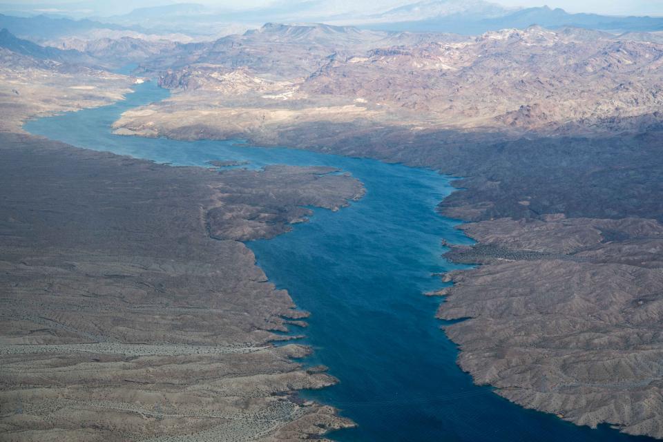
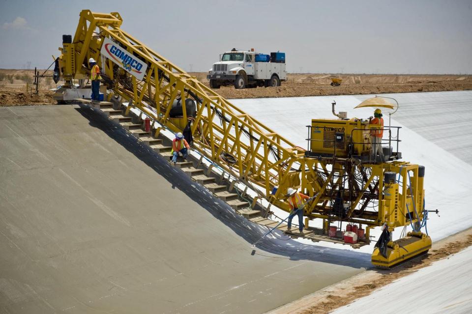
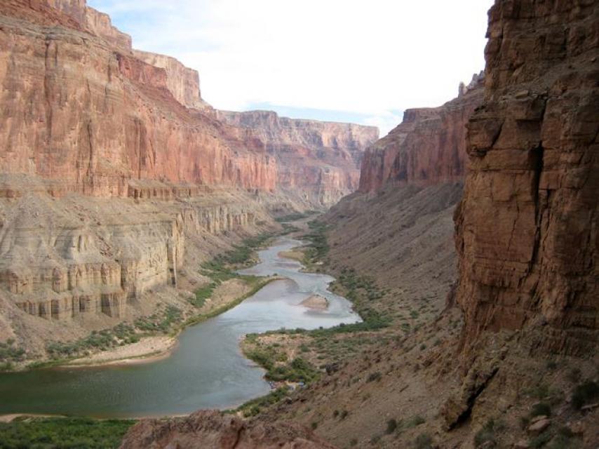
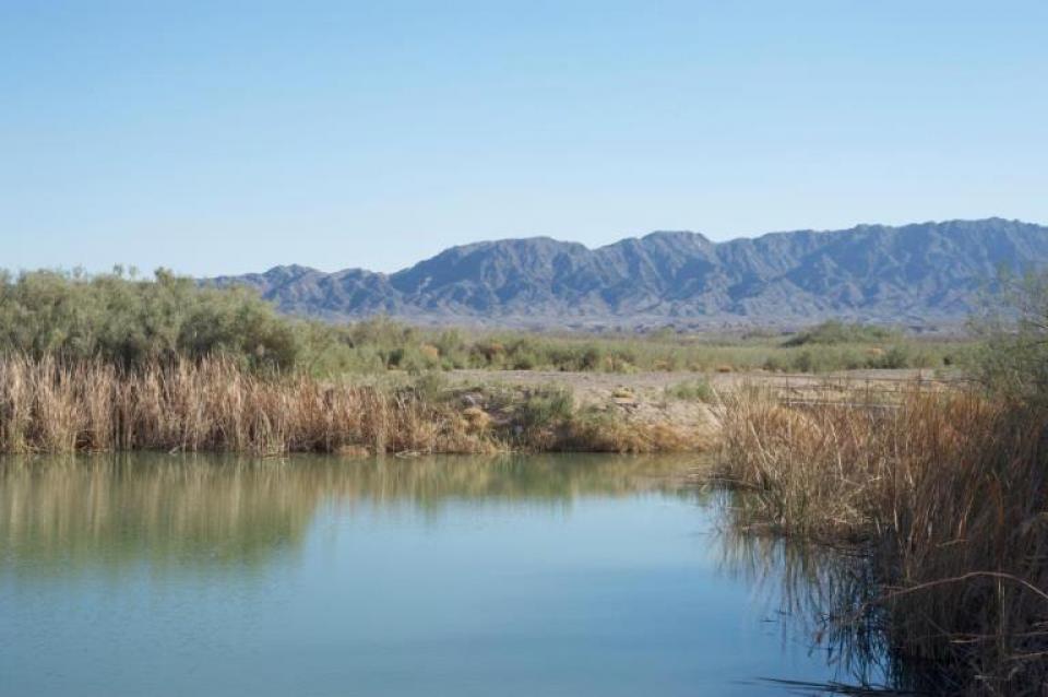
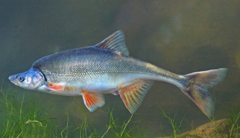
Serving as the “lifeline of the
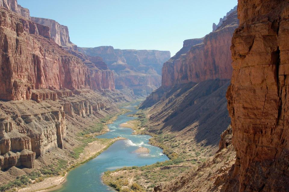
Southwest,” and one of the most heavily regulated rivers in the
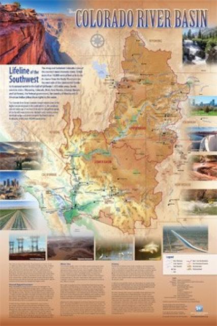
world, the Colorado River provides water to 35 million people and
more than 4 million acres of farmland in a region encompassing
some 246,000 square miles.
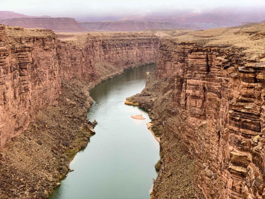
From its headwaters northwest of Denver in the Rocky Mountains,
the 1,450-mile long river and its tributaries pass through parts
of seven states: Arizona, California, Colorado, New Mexico,
Nevada, Utah and Wyoming and is also used by the
Republic of Mexico. Along the way, almost every drop of the
Colorado River is allocated for use.
The Colorado River Basin is also home to a range of habitats and
ecosystems from mountain to desert to ocean.
The Colorado River Conservation Water District’s multi-year bid
to acquire the historic Shoshone water rights on the
Colorado River has required collaboration, strange
bedfellows, bipartisan support and intense
fellowship. While the River District wants this spirit of
partnership to continue as the deal moves through
Colorado Water Court, it won’t compromise values — nor
those of the 17 Western Slope counties the district represents
— to do so, according to General Manager Andy Mueller.
… The Shoshone water rights are among the oldest
non-consumptive rights on the Colorado River, dating back to
1902 and 1929. …With the 1902 Shoshone right senior
to many others on the Colorado River, it gets priority
over junior rights — including those on the Western Slope and
many transmountain diversions that carry water to the Front
Range — when flows drop below 1,480 cubic feet per second.
A Phoenix suburb ditched a plan to send recycled water
from toilets and other sources directly to residents’
taps, after political candidates made unproven claims
that the water is contaminated “poop water.” The affluent city
of Scottsdale mainly uses purified water from the city’s liquid
waste to recharge aquifers that can be drawn when other sources
are running low. But in June, as criticism mounted, the city
council replaced funding for the recycling program and
other water projects with a vague $100 million allocation for
new water sources and supplies. … Some experts
and residents said the budget change — along with a council
majority that frowns upon wastewater reuse — could
weaken resilience at a time when the West is mired in drought
and cities are facing significant cuts from the Colorado
River.
Colorado State Sen. Dylan Roberts, D-Frisco, was elected last
week as the Upper Basin co-chair of the Colorado River Forum
(CRF), a program that fosters cooperation between state
lawmakers in the Colorado River Basin states locked in critical
negotiations over the future of the river. The CRF, part
of the Council of State Governments West (CSG West), is led by
co-chairs representing the Upper (Colorado, Wyoming, New
Mexico, Utah) and Lower (California, Arizona, Nevada) basins
who rotate and are elected by the membership. … Roberts
will serve as co-chair with Republican Arizona state Sen. Tim
Dunn — a Yuma farmer — who was elected Lower Basin co-chair
last week.
A Yuma desalting plant would be restored under
federal legislation introduced by Congressman Andy Biggs of
Arizona, Republican state government leaders said late last
week. The GOP Arizona State Legislators announced their support
for the bill they said would authorize $19 billion to
increase the water supply for people living in the
Colorado River basin. Republicans say the bill, the
Colorado River Basin Water Security and Infrastructure Act,
would develop additional water. One way the bill would help is
to direct the U.S. Department of the Interior to restore the
Yuma Desalting Plant within 180 days and authorize $1 billion
for the project. The plant would allow treated
agricultural drainage water to reduce the amount of Colorado
River water that must be delivered from the U.S.,
Republican leaders said.
The Yuma City Council is preparing for a legal fight on two
fronts to protect the region’s water supply as competition for
the Colorado River intensifies. Council
members voted unanimously to authorize legal action
over water transfers from rural areas to growing
suburbs, as well as potential federal mandates that
could reduce water allocations across the desert
Southwest. … One of the city’s primary targets is a
proposed transfer of Colorado River water from GSC Farm
in La Paz County to the fast-growing town of Queen
Creek. Yuma is joining Mohave and La Paz counties to
challenge the transfer. Local leaders worry the move could
set a dangerous precedent, allowing expanding
municipalities to buy up and redirect water rights away from
rural agricultural hubs.
It’ll take a lot of money to help save water from the shrinking
Colorado River. Now, Amazon is helping foot the bill. The
ecommerce giant announced that it would send $20
million to water-saving projects in Arizona and
California, kicking off a new longer-term effort to
rally money for water conservation. The company formed a new
coalition, dubbed the “Colorado River Basin
Collaborative,” and aims to spend $100 million
on water conservation across two years. …
[Amazon Water Sustainability Lead Will] Hewes cited a new
$2.4 million project that aims to improve irrigation efficiency
on tribal farmland in northern Arizona. … [T]he project
would install high-tech sensors that give farmers
real-time data about when crops need water, ultimately
reducing their draw on Lake Mead, the nation’s largest
reservoir.
The Colorado River Indian Tribes and the Central Arizona Water
Conservation District reached an agreement on Colorado
River, CRIT officials announced. The CRIT and CAWCD
agreement will deliver more than 9,000 acre-feet of
CRIT Intentionally Created Surplus, or ICS, water to the
district. … CRIT officials said the agreement
with the CAWCD represents the last remaining water CRIT
made available as part of a Drought Contingency Plan that was
agreed to in 2019. The surplus water was
previously conserved between 2020 and 2022 after requests from
the federal government. CRIT leaders conserved water to
help stabilize Lake Mead. … Under the
agreement, the CAWC District will compensate the CRIT at
$590 per acre-foot, for a total of
$5.3 million in two payments.
The state water board has given the green light to a one-year,
state-run water conservation program. On Wednesday, the
Colorado Water Conservation Board unanimously
approved the application review process and criteria for what
state officials are calling Colorado’s near-term
contribution program for 2027. … The
contribution program aims to use $100 million in funding from
the U.S. Bureau of Reclamation to pay water users in
the Upper [Colorado River] Basin states (Colorado, New
Mexico, Utah and Wyoming) to voluntarily cut
back. … The approval comes at a
pivotal moment, as the federal government has taken
over operations for the Colorado River and the
nation’s biggest reservoirs after the seven states that share
the river failed to find agreement after years of negotiations.
The city of Peoria has signed a $100 million agreement to buy
water from a private company, as Arizona faces cuts to its
supply from the Colorado River. Peoria says it will receive
about 173,672 acre feet of water in storage credits to help
shore up the city’s supply. That’s roughly enough to
provide half a million homes with water for a year.
The city says it bought a 120 acre campus that includes two
wells from Vidler Water Company in the Harquahala irrigation
area in La Paz County. When all permitting is finished,
Peoria plans to pump groundwater into the Central Arizona
Project canal, and eventually into a treatment facility for the
city’s use.
Rep. Andy Biggs on Wednesday introduced a sweeping water bill
that would pour $19 billion in federal funding into new
infrastructure while cutting permit requirements across the
drought-stricken Colorado River Basin. … His bill would
remove environmental review requirements that
can hold up water projects for years, require the federal
government to make permitting decisions within six months and
pay two-thirds of the cost of new water projects. The bill
would also reopen a shuttered desalination plant near
Yuma, partner with Mexico to desalinate
seawater and study how to capture California
stormwater before it drains into the Pacific Ocean.
The commission that represents Colorado, New Mexico, Utah and
Wyoming received sobering updates on declining reservoir
levels, worsening conditions on the Colorado
River and the ongoing struggle to keep Lake
Powell from dropping to record lows. The states
offered grim reports of their snowpack conditions, underscoring
the drought hammering them. … The Upper Colorado
River Commission met Monday for the first time since Interior
Secretary Doug Burgum released his agency’s decision on how to
manage the river for the next two years. The decision was left
to Burgum after the seven states of the Colorado River
Basin failed to reach an agreement after two years of
negotiations on how to operate when the river’s
current agreement ends on Sept. 30.
Denver Water can finish its Gross Dam expansion and fill the
controversial reservoir in western Boulder County, the 10th
U.S. Circuit Court of Appeals ruled Tuesday, lifting an
injunction by a lower court judge and confirming the dam’s
permits as sound. The appeals court said the U.S.
Army Corps of Engineers had acted responsibly in issuing
construction permits for the $600 million expansion,
which is largely complete and will be filled using
water rights Denver holds in the Colorado River basin
on the western side of the Continental Divide. While a
federal district judge in Denver had issued the injunction
after declaring the Corps had failed to consider less-damaging
alternatives, or the fact that climate change could rob
Colorado of river water, the appeals court rejected that
view.
Officials in the Upper Colorado River Basin plan to continue
draining Flaming Gorge in Wyoming to protect Lake Powell, one
of the basin’s largest reservoirs. The Colorado River
Basin, which extends from Colorado to California and northern
Mexico, uses a network of reservoirs to store vital water
supplies for cities, farms, recreation, the environment and
millions of people. But the basin’s overall storage has
dropped to a third of its capacity, officials said
during an Upper Colorado River Basin meeting
Monday. Lake Powell holds about 22% of its total
capacity. Since April, the Bureau of Reclamation has
released about 450,000 acre-feet of water to help boost storage
in Lake Powell. Colorado and other Upper Basin state officials
agreed Monday that those releases should continue
through April.
The Department of the Interior last month announced Colorado
River supply cuts affecting the basin states of Arizona, Nevada
and California, leaving many communities bracing for reduced
water access. San Diego, though, says decades of costly
investments — some criticized for driving up water bills — have
positioned the region to avoid the pain other Southwest
communities now face. … San Diego
continues to grapple with the costs of securing its own water
future, but its investments have shielded it from the outcomes
of other Colorado River communities that are vulnerable to
shortages. That’s created an opportunity for San Diego
to sell its water to those communities — such as
a deal it made with Riverside, netting $100 million in
the first five years.
Water officials from the United States and Mexico have signed a
new agreement for sharing the Colorado River. Mexico will take
less water from the river under the new deal, but gain a degree
of certainty about its ability to access a shrinking river with
a shaky future. Expert onlookers are heralding the deal
as a success and a rare example of cross-border
collaboration. They said the cuts are necessary in
response to a severely depleted Colorado River. … A
previous agreement from 2017 will expire at the end of this
year. The new one will be in effect from the beginning of 2027
to the end of 2028. For that term, Mexico will take larger cuts
than it has in the past. The new deal reduces Mexico’s
share of the Colorado River by 250,000 acre-feet, about 17% of
its original allocation from the Colorado River.
Officials from the United States and Mexico announced Wednesday
a Colorado River water-sharing dealfor next two years as the
basin continues to be overstressed by prolonged drought. The
short-term deal, formally known as Minute 334,
calls for Mexico to cut 250,000 acre-feet, or
more than 100,000 Olympic swimming pools’ worth of water, in
both 2027 and 2028. It also establishes an environmental work
group and a pilot program to manage the salinity of
Colorado River water as it reaches Mexico.
… Under the new international plan, Mexico’s share of
the Colorado River could decrease or increase based on
forecasts for upstream reservoir conditions at Lake Mead, on
the Arizona-Nevada border.
The drama engulfing the seven states in the Colorado River
Basin could take another, more perilous, turn in a few weeks.
Water experts are warning that by October, the river’s
flow may cross a critical threshold at Lee’s Ferry, a
bend in the river in Arizona that has been a bellwether of the
river’s health for decades. The 1922 Colorado River Compact —
the river’s foundational agreement — states that the river’s
flow must stay above a certain level at Lee’s Ferry in order to
provide enough water for downstream states. If the flow
falls below that point, which some experts equate to a
“tripwire,” it could trigger prolonged and expensive
litigation at the Supreme Court, a turning point that
could have terrible consequences for basin states.
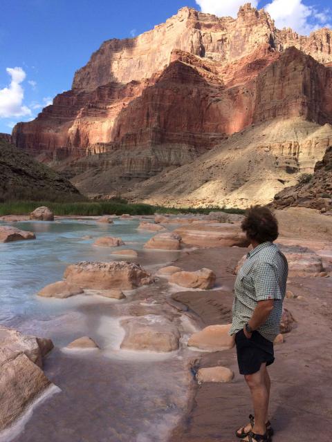
The Navajo Nation Council has taken a major step toward
protecting one of its most precious water resources. A
unanimously passed measure formally acknowledges the Confluence
— where the Colorado and Little Colorado rivers meet — as a
sacred site under tribal law. Doing so formally documents what
Navajos already know — the spiritual and natural significance
of where these two life-giving rivers converge in northern
Arizona’s high desert. … Cataloging information from the
Confluence may also be used to potentially deter future
commercial development by industries like hydropower — while
the Trump administration is eyeing energy projects on tribal
lands.
… [F]or the last three years, the seven states have been
negotiating a new set of rules for sharing a dwindling supply
of water before current ones expire in December. But
the public has had little view inside the negotiating
rooms. … KUNC requested work calendars for the
seven negotiators earlier this year. The information wasn’t
always easy to find. Some states – Arizona, New Mexico and Utah
– were either not responsive to the requests or their state
offices said they didn’t hold the records. Colorado would have
charged about $280 for the documents. … States have said
this closed-door process is needed to reach a deal —
and it’s worked in the past. But this time, it hasn’t.
The tension has only grown.
The Central Arizona Project’s board authorized its legal
counsel to take legal action “if necessary”
against a federal plan to cut Arizona’s share of
Colorado River water dramatically in coming
years. Board members went into a closed executive session
before the Sept. 3 vote to discuss certain “occurrences” that
could trigger a lawsuit or other legal filing, and did not
specify them when voting unanimously for the authorization.
Board member Alexandra Arboleda introduced the motion at the
meeting and prefaced it with a statement that the United States
Department of the Interior’s 10-year framework for
dealing with water shortage “contemplates operations
that are contrary to law and devastating to the water users of
the Central Arizona Project.”
The Colorado River is on the brink of collapse because of
climate change and overuse of water. Reservoirs supplying water
to tens of millions of people in the southwest reached record
lows this summer.The nation is racing to
refill them with conservation measures so they can
still generate hydropower and reliably deliver water to users
downstream. Fish are struggling. Rafters are having
trouble navigating low water. Despite all this, the seven
states sharing the water supply remain at a yearslong
impasse over how to conserve the river. “The Colorado
River is in as bad a shape as it’s ever been,” said Doug
Kenney, chairman of the Colorado River Research Group at CU
Boulder’s Getches-Wilkinson Center.
Last weekend, monsoon rains sent a flash flood rushing through
the Grand Canyon. The massive surge of roiling brown water
carried trees, rocks and debris into the Colorado River,
leaving at least two people dead and damaging bridges and
plumbing. … Floods happen throughout the canyon fairly
often. It stretches across 277 miles and includes many side
canyons, which spider out from the main channel of the Colorado
River. The amount of rain that caused the recent flood, Crossey
said, probably wasn’t particularly extraordinary. The place
where those rains fell, though, is what makes Saturday’s
flooding so unique. The heavy monsoon rains fell on the burn
scar left behind by the 2025 Dragon Bravo Fire, which scorched
nearly 150,000 acres.
A deadly flash flood in the Grand Canyon over the weekend was
probably driven by a confluence of climate factors,
including drought, wildfire scarring and warming temperatures
in the Pacific Ocean that can supercharge storms. At
least two people have died, nearly 80 people were rescued and
one remained unaccounted for after a surge of water and debris
swept through the immensely popular tourist destination on
Saturday. … Along with the potential impact from a
previous fire, a severe drought that continues
to affect the Grand Canyon region – and the Colorado
River basin that runs through it – could have
contributed to the disaster. The deluge unleashed torrents of
rain on hardened and sparsely vegetated steep terrain that is
less able to absorb and contain abrupt increases in moisture.
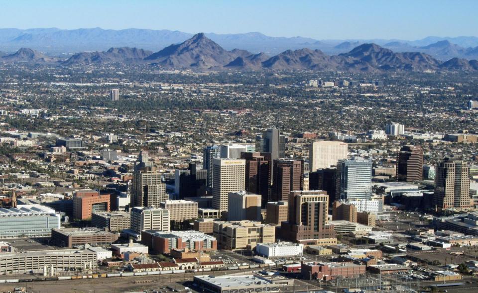
… [C]entral Arizona cities are charting a course through a
future with less Colorado River water. Water managers across
the Phoenix metro say they have robust backup plans in
place to keep taps flowing, thanks to years of
preparation and huge construction projects. Those upgrades,
though, come with a big price tag, and will
carry the area into a future that is still rife with
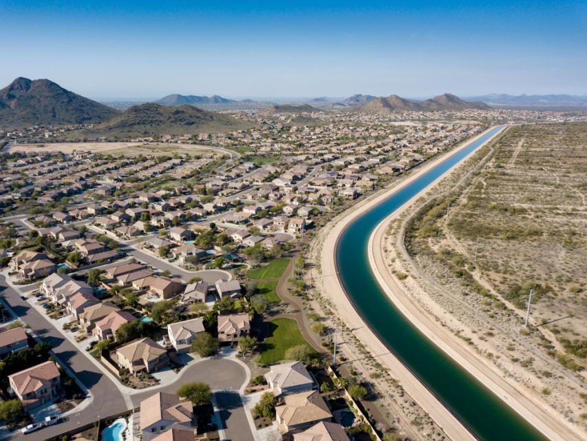
uncertainty. … The very fact that Phoenix and its
neighbors can receive water from the Colorado River is a feat
of engineering. The canal system that carries it from western
Arizona is a gravity-defying product of 1960s optimism and more
than $4 billion in building costs. Soon, with less water in
that canal, it will take more feats of engineering to survive.
The steep costs of those projects will likely be passed along
to residents.
The U.S. government needs to launch a massive federal public
works program to build more infrastructure to help Arizona and
other Southwestern states cope with impending Colorado River
water cutbacks, said U.S. Sen. Ruben Gallego and Tucson Mayor
Regina Romero. “We’re going to have to have a massive
government works program like what created the CAP, to help
towns update their water systems … to create and conserve
water, to make up for the loss we are going to end up
taking,” Gallego said Friday at a “Water Summit” panel
discussion in Tucson. He was talking about the
construction of the 330-mile-long Central Arizona Project canal
system that delivers drinking and irrigation water to the
Tucson and Phoenix areas.
Nevada’s decision to take the federal government to court over
the Colorado River’s new operating rules could stall
the Navajo Nation’s push to get its Arizona water rights
settlement through Congress before the year ends, a
Navajo Nation water rights attorney said this week. “We’re on
an extremely limited window of time,” said Dwight Witherspoon,
an attorney with the Water Rights Unit of the Navajo Nation
Department of Justice. … The state of Nevada, the Colorado
River Commission of Nevada and the Southern Nevada Water
Authority filed a complaint Monday, Aug. 24, in U.S. District
Court for the District of Nevada against Interior Secretary
Doug Burgum, the Department of the Interior, the Bureau of
Reclamation and Aubrey Bettencourt, the bureau’s principal
deputy commissioner.
The San Diego region appears well-positioned to weather sharp
cuts to California’s share of Colorado River water. The U.S.
Department of Interior on Friday announced California, Arizona
and Nevada need to reduce their water usage by 1.25 million
acre-feet annually between 2027-2028, as climate change and
overuse push the Colorado River watershed further into crisis.
California is absorbing the second-largest cut, at
440,000 acre-feet of water. But Felicia Marcus, former
chair of the California State Water Resources Control Board,
said in an interview that local leaders have spent “smart
money” bolstering the water supply here. … Those factors
have contributed to a supply glut for the Water Authority,
which allows the utility to sell water to other California
agencies. The Water Authority is also exploring how to
sell water to other thirsty Western states.
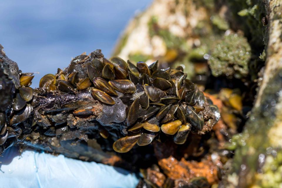
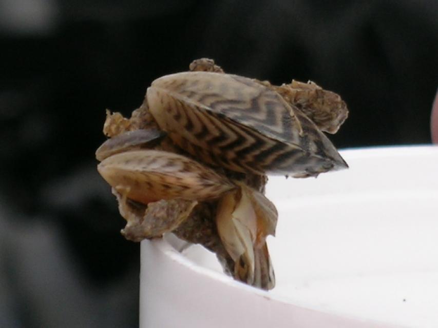
DNA fragments from zebra mussels have been detected in Utah’s
section of the Colorado River for the first time, raising new
concerns for the river because of the challenges that the
species is associated with. The DNA fragments were found within
four of 22 samples collected in June and July near the Potash
Boat Ramp, nearly 15 miles downstream of Moab, Utah Division of
Wildlife Resources officials said in a statement on Tuesday. It
follows an infestation that was found last year near Loma,
Colorado, just upstream of the Utah-Colorado border. Zebra
mussels, much like quagga mussels, which have been an issue at
Lake Powell, are invasive and clog pipes and infrastructure,
while also creating new hazards on rocks and beaches,
potentially causing millions in damage.
In an unfortunate first, state wildlife managers say fragments
of invasive zebra mussel DNA have been found in a stretch of
the Colorado River near Moab. The
discovery is concerning because the tiny striped mussels
pose an outsized threat to rivers and lakes,
clogging pipes, covering beaches with razor-sharp shells and
damaging ecosystems. … The department sees the mussels
as an emerging threat after an infestation was recorded near
Loma, Colorado last year. And while detection of DNA in the
water indicates the presence of an animal somewhere upstream,
the division said it does not confirm that living mussels are
present in the test area.
The Upper Basin is on the verge of violating the Colorado River
Compact for the first time in the agreement’s 104-year history,
failing to send enough water downstream to the Lower
Basin, Central Arizona Project President Terry Goddard
told KTAR News 92.3 FM. … Nevada filed a
lawsuit Monday, arguing the agreement placed the burden of the
shortages on the Lower Basin, which could negatively impact its
economy. At an Arizona Reconsultation Committee meeting Monday,
Goddard said there are many parallels between Nevada’s lawsuit
and Arizona’s position. … He said it’s possible
Arizona joins Nevada’s lawsuit or files one of its
own.
Just days after the federal government released new plans for
sharing water from the shrinking Colorado River, it is getting
sued by one of the states impacted by the plan. Water officials
in Nevada filed a lawsuit against the Interior Department on
Monday morning. … Arizona’s leaders are still
figuring out how to respond to the
lawsuit. … Much of the recent chatter
about Colorado River lawsuits has been focused on Arizona, and
a legal move called a “compact call.”
… Nevada’s lawsuit does something different. It alleges
that the federal government violated procedural laws
while drawing up its new plans for managing the river.
In short, the lawsuit argues that Interior failed to check
certain legally required boxes while writing its new strategy.
In a major escalation of tensions between the seven states that
share the Colorado River, Nevada officials have filed a federal
lawsuit challenging the Trump administration’s order for cuts
in water use. The complaint, filed early Monday morning in the
U.S. District Court of Nevada, asserts that the federal
government’s operating plan unlawfully authorizes the federal
government to reduce the state’s allocation of the
river by up to 71 percent annually, or a 213,556 acre-feet
reduction. Such a cut would slash the state’s share of
water far past its actual use, which came in at 198,000
acre-feet last year. Lawyers for the Colorado River Commission
of Nevada, the Southern Nevada Water Authority and the state as
a whole requested an injunction to halt
implementation.
The Southern Nevada Water Authority has agreed to leave some of
its water in Lake Mead this year in exchange for cash to comply
with what water managers expect to be a firm
requirement to do so through 2028. At a board meeting
Thursday, directors ratified an agreement between the water
authority and the U.S. Bureau of Reclamation that gives Nevada
$16.25 million in federal funds for conserving an
amount equal to one-sixth of its total Colorado River
allocation. In 2026, the authority will leave 50,000
acre-feet in Lake Mead — the struggling reservoir that supplies
about 90 percent of Southern Nevada’s water supply and
is falling to new record lows each month.
Arizona’s water finance agency took a step toward implementing
two projects that could increase the state’s water supply
through partnerships with California and Mexico. The state
Water Infrastructure Finance Authority solicited ideas for
long-term water augmentation projects last year and is
exploring seven proposals. The board voted Wednesday to approve
“scopes of work” for two of those proposals. … The
two proposals WIFA discussed this week involve potable
reuse and groundwater
storage.… This project
would involve Arizona paying to store excess water flows from
the Sacramento and San Joaquin rivers and tributaries via the
California State Water Project in exchange for
some of California’s share of Colorado River
water.
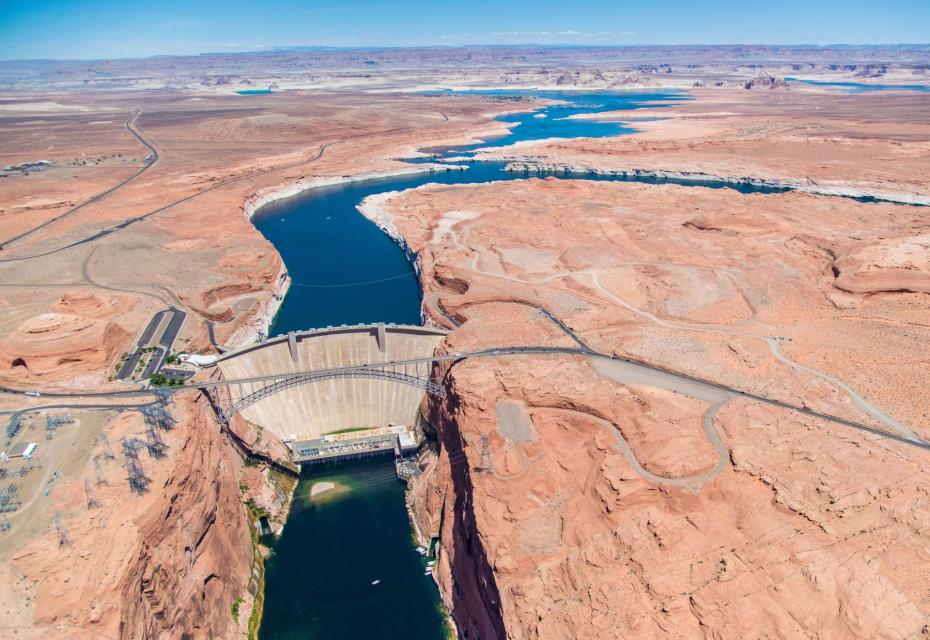
The news of Lake Powell hitting a record low is triggering some
alarm bells on Utah’s Capitol Hill. On Saturday, Lake Powell
recorded its lowest elevation — 3,519.91 ft. That is currently
about 30 feet above the minimum power pool level. Any lower and
Glen Canyon Dam ceases to generate power. … During a
hearing on Tuesday before the Utah State Legislature’s Interim
Natural Resources Appropriations Subcommittee, [Colorado River
Authority of Utah Executive Director Amy] Haas outlined where
things are. … To prop up Lake Powell, the Bureau
of Reclamation has ordered up to a million acre-feet of water
to be released from Flaming Gorge upstream. … Asked
if it has been effective, Haas told FOX 13 News it is possible
the U.S. Department of the Interior orders more releases from
Flaming Gorge.
A regional aquatic team for Colorado Parks and Wildlife, geared
up in waders, waterproof neoprene socks and safety gloves,
moved along last week in the waters of the Lower Dolores River.
The venture Aug. 12 was a fishing operation near the Dove Creek
Pump Station to survey native fish populations. … The stretch
referred to starts below McPhee Reservoir, flowing more than
100 miles until merging with the San Miguel River. It is seen
by CPW biologists as a particularly significant stronghold for
the residential roundtail chub, bluehead sucker, flannelmouth
sucker and a secondary fourth native, the Colorado River
sculpin, which all together support the wider ecosystem’s
health that eventually flows 87 more miles to reach the
Colorado River. The team at CPW uses 30 years worth of data to
understand trends and the overall fishery health at multiple
sites.
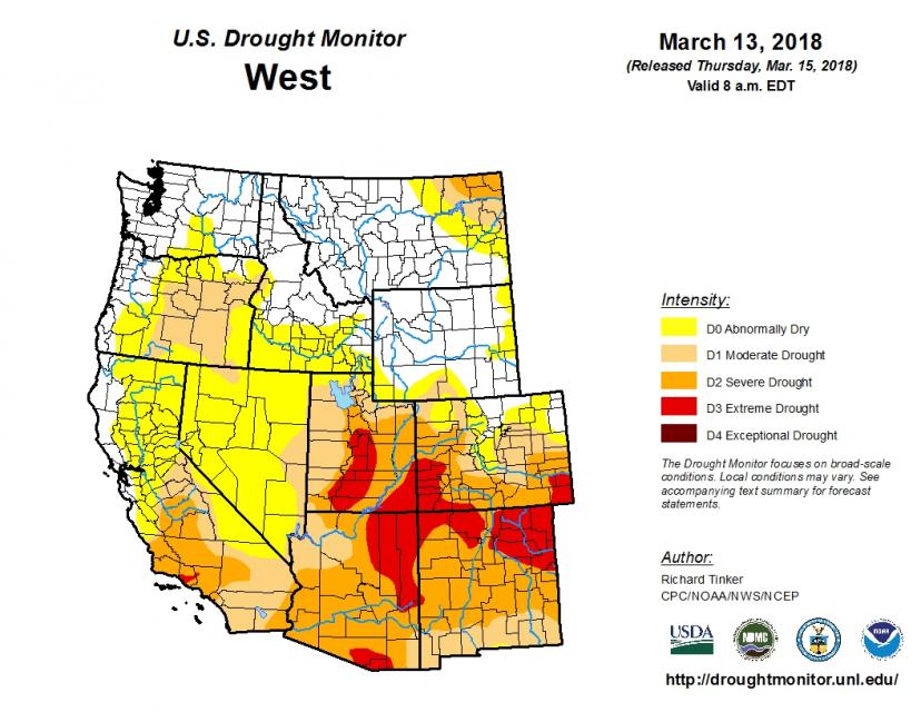
Want to water your grass limitlessly without risking a fine? In
some Front Range towns,residents still can water without
inhibition despite searing drought.Nearly the entire state is
in some level of drought, according to U.S. Drought Monitor
data released Thursday, but the aridity is especially intense
over the highly populated urban corridor and the mountains that
are the source of much of Colorado’s water. … Despite
widespread severe drought, 13 of the 25 largest cities
and towns in Colorado have not implemented additional mandatory
water use restrictions. … Water managers in many of
the communities without additional drought restrictions have
asked customers to voluntarily cut back water use, to varying
degrees of success.
The Trump administration’s plan for dealing with worsening
water shortages along the Colorado River is encountering strong
opposition from Arizona’s leaders, who are warning they could
sue to challenge mandatory water cutbacks that they say would
harm their state. A legal fight could end up before the
U.S. Supreme Court and further complicate efforts by
seven Western states to agree on how to share water from the
shrinking river and its reservoirs, which have fallen to record
low levels. Arizona laid out its objections in a sharply worded
letter to the federal government last week. It said the Trump
administration’s 10-year plan doesn’t adhere to the
Colorado River Compact, the 1922 agreement that originally
divided the water among the states.
Is climate change enough justification to stop the expansion of
a reservoir that will take more water from the dwindling
Colorado River? That’s the central question in a lawsuit
pitting the U.S. Army Corps of Engineers and Colorado’s largest
water utility against a consortium of environmental nonprofits.
The environmentalists say the Colorado River has no more water
to give, while Denver Water, the utility whose Gross
Reservoir would nearly triple in capacity, argues it
is ensuring its customers can withstand droughts. The Corps
contends it is not required to consider climate change or the
downstream effects of its expansion of a dam to grow the
reservoir. The case in the 10th U.S. Circuit Court of Appeals
has the potential to ripple through Western water
management as states, tribes, cities and the federal
government struggle to find a compromise on how to steeply cut
water use.
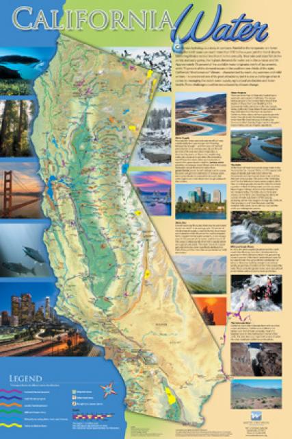
La Guía para el Público en General sobre el Agua en California,
de 24 páginas, ofrece una visión integral de la historia del
desarrollo de los recursos hídricos en California y de la gestión
de los numerosos desafíos que enfrenta el estado en la
actualidad.
For the past 20 years, the Colorado
River has been operated under a set of guidelines negotiated
between the seven states that depend on the river. Those
guidelines expire this year, and after five years of grinding
negotiations over a new agreement, the upstream states of
Colorado, Wyoming, Utah and New Mexico remain deadlocked against
the downstream states of California, Arizona and Nevada.
Some 40 million people and 5.5 million acres of farmland depend
on the river’s water. But after the states failed to meet two
federal deadlines in three months, the river is in a moment of
unprecedented crisis. A dire snowpack has left flows just 15
percent of normal, many farms without water and several cities
scrambling to secure water supplies as they gird themselves for
shortages.
The 24-page Layperson’s Guide to California Water provides a
comprehensive overview of the history of water development in
California and management of its many challenges today.
Are you an emerging leader
passionate about shaping the future of the Colorado River Basin?
If so, consider applying for our 2026 Colorado
River Water Leaders program to deepen your
knowledge of the iconic Southwest river, build leadership
skills and develop policy ideas with a cohort to improve
management of the region’s most crucial natural resource.
The application window is now open
for our 2026 Colorado
River Water Leaders program, which will run
from March through September next year.
Our biennial program is patterned after our highly
successful California Water Leaders
programand selects rising stars
from the seven states that rely on the river -
California, Nevada, Arizona, Colorado, Wyoming, Utah and New
Mexico – as well as tribal nations and Mexico to take part in
the cohort.
During the seven-month program designed for working
professionals, the cohort members explore issues surrounding the
iconic Southwest river, deepen their water knowledge and build
leadership skills.
Acceptance to the program is highly competitive. Get a
program overview and tips on applying by attending our
virtual Q&A session on Dec. 10at 12:30
p.m. (Mountain Time) / 11:30 a.m. (Pacific Time).
Applications
are due by Jan. 26, 2026, no later
than5 p.m. (Pacific Time).
“I highly recommend the program to emerging water leaders.
The program’s immersive experience, relationship building and
mentorship opportunities cultivate leadership and collaborative
skills crucial for addressing complex challenges faced by all
those who rely upon the Colorado River now and into the
future.”
– JB Hamby, Class of ‘22 & Chair of the Colorado River
Board of California
After four years of contentious negotiations, the seven states that rely on water from the Colorado River are racing against the clock to reach agreement on a new long-term operating strategy for the river’s dams and reservoirs. They face a Nov. 11 deadline from U.S. Interior Department officials to signal whether they think a deal among them is likely.
Before the construction of Hoover Dam on the lower Colorado River, as well as a slew of smaller sisters downstream, the stretch downriver served as a biological oasis in the middle of the unrelenting Mojave and Sonoran deserts. The marshes and backwaters along the river’s edge provided sheltered areas for fish to spawn and rear their young, and mesquite and cottonwood-willow forests provided important habitat for numerous species of birds and other animals.
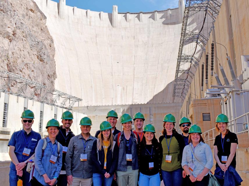
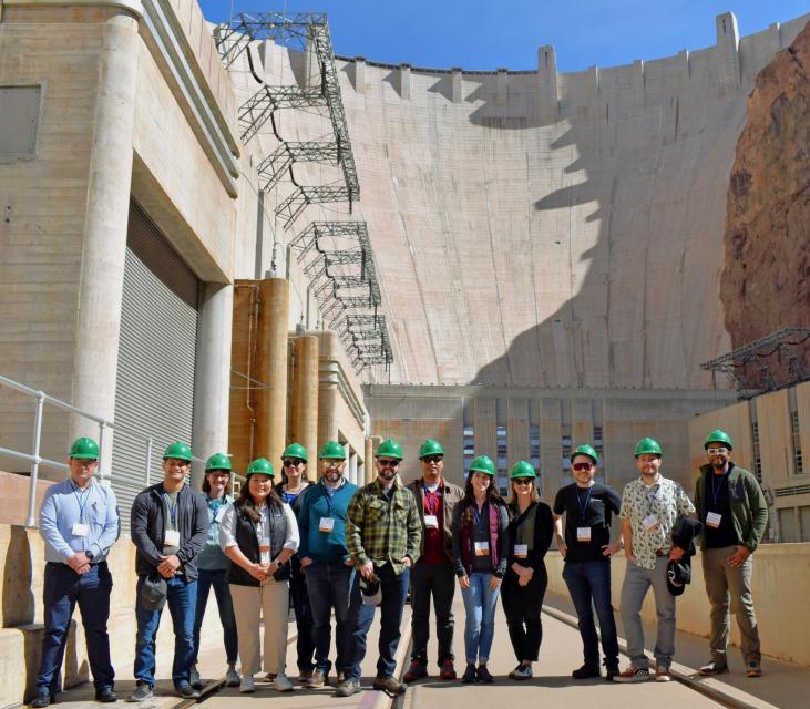
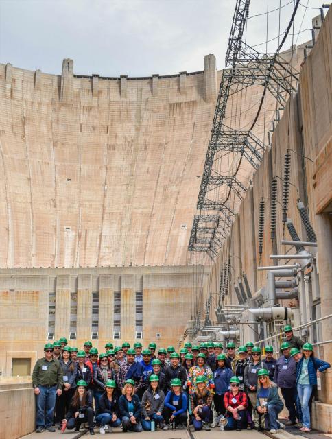
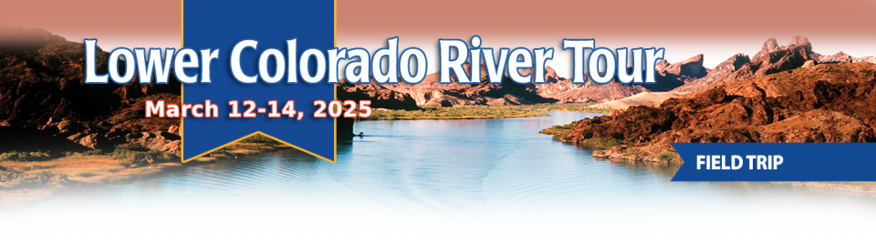
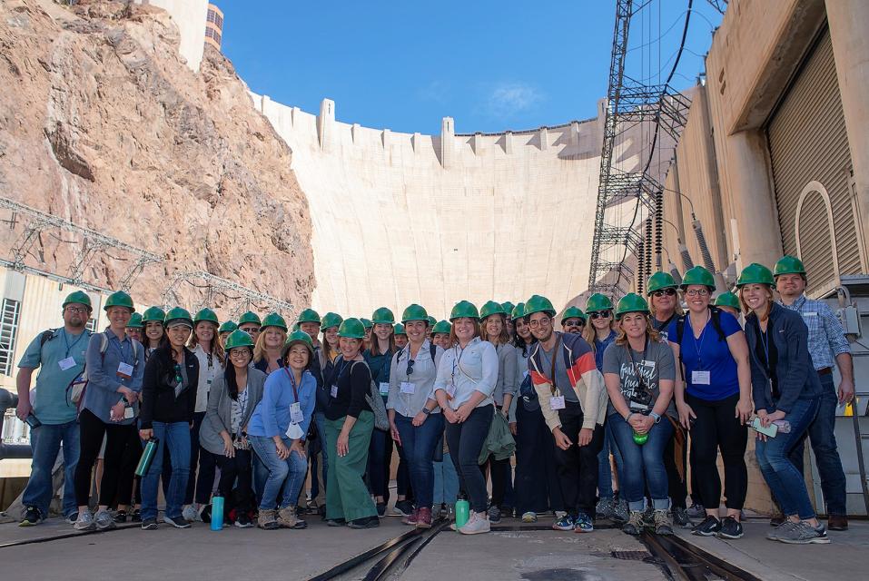
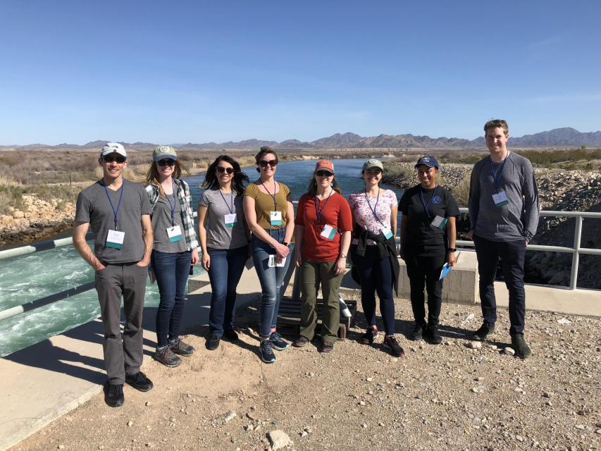
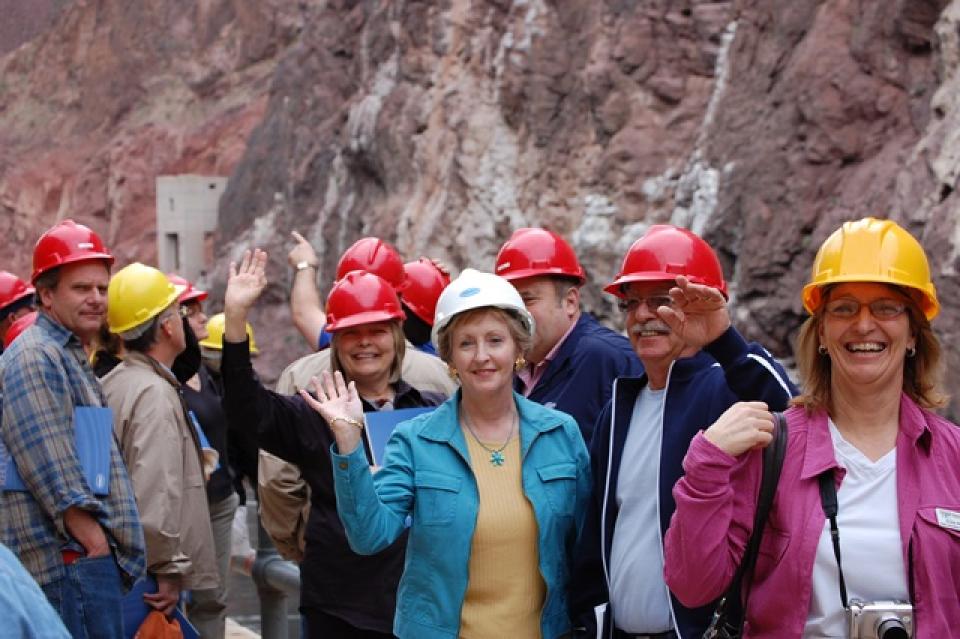
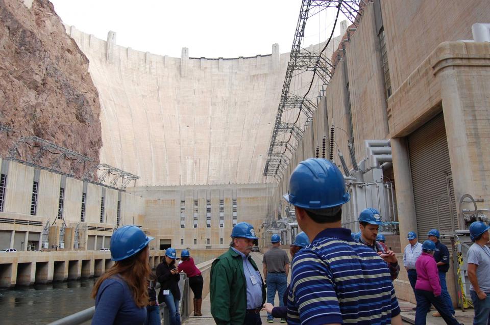
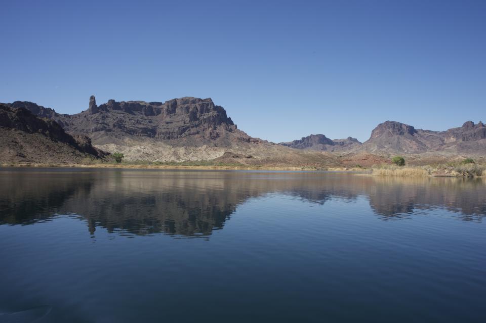
This tour explored the lower Colorado River firsthand where virtually every drop of the river is allocated, yet demand is growing from myriad sources — increasing population, declining habitat, drought and climate change.
The 1,450-mile river is a lifeline to some 40 million people in the Southwest across seven states, 30 tribal nations and Mexico. How the Lower Basin states – Arizona, California and Nevada – use and manage this water to meet agricultural, urban, environmental and industrial needs was the focus of this tour.
Hilton Garden Inn Las Vegas Strip South
7830 S Las Vegas Blvd
Las Vegas, NV 89123
A new aquatic invader, the golden mussel, has penetrated California’s ecologically fragile Sacramento-San Joaquin Delta, the West Coast’s largest tidal estuary and the hub of the state’s vast water export system. While state officials say they’re working to keep this latest invasive species in check, they concede it may be a nearly impossible task: The golden mussel is in the Golden State to stay – and it is likely to spread.
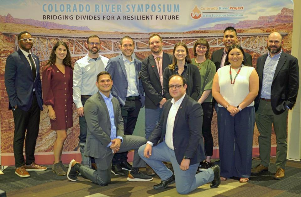
The 2024 Colorado River Water
Leaders cohort completed its seven-month program
with policy recommendations involving ”augmentation” –
projects that increase the availability and supply of water – as
the Colorado River Basin grows hotter and drier.
The cohort of
12 up-and-coming leaders included engineers,
lawyers, resource specialists and others working for public,
private and non-governmental organizations from across the
river’s basin. The cohort had full editorial control to choose
its recommendations.
State water management officials must work more closely with
local agencies to properly prepare California for the effects
of climate change, water scientists say. Golden State
officials said in the newly revised California Water
Plan that as the nation’s most populous state, California
is too diverse and complex for a singular approach to manage a
vast water network. On Monday, they recommended expanding the
work to better manage the state’s precious water resources —
including building better partnerships with communities most at
risk during extreme drought and floods and improving critical
infrastructure for water storage, treatment and distribution
among different regions and watersheds.
Six tribes in the Upper Colorado River Basin, including two in
Colorado, have gained long-awaited access to discussions about
the basin’s water issues — talks that were formerly
limited to states and the federal government. Under an
agreement finalized this month, the tribes will meet every two
months to discuss Colorado River issues with an interstate
water policy commission, the Upper Colorado River Commission,
or UCRC. It’s the first time in the commission’s 76-year
history that tribes have been formally included, and the timing
is key as negotiations about the river’s future intensify.
… Most immediately, the commission wants a key number:
How much water goes unused by tribes and flows down to the
Lower Basin?
Sustaining the American Southwest is the Colorado River. But
demand, damming, diversion, and drought are draining this vital
water resource at alarming rates. The future of water in the
region – particularly from the Colorado River – was top of mind
at the 10th Annual Eccles Family Rural West Conference, an
event organized by the Bill Lane Center for the American West
that brings together policymakers, practitioners, and scholars
to discuss solutions to urgent problems facing rural Western
regions.
This tour explored the lower Colorado River firsthand where virtually every drop of the river is allocated, yet demand is growing from myriad sources — increasing population, declining habitat, drought and climate change.
The 1,450-mile river is a lifeline to some 40 million people in the Southwest across seven states, 30 tribal nations and Mexico. How the Lower Basin states – Arizona, California and Nevada – use and manage this water to meet agricultural, urban, environmental and industrial needs was the focus of this tour.
Hilton Garden Inn Las Vegas Strip South
7830 S Las Vegas Blvd
Las Vegas, NV 89123
Learn the history and challenges facing the West’s most dramatic
and developed river.
The Layperson’s Guide to the Colorado River Basin introduces the
1,450-mile river that sustains 40 million people and millions of
acres of farmland spanning seven states and parts of northern
Mexico.
The 28-page primer explains how the river’s water is shared and
managed as the Southwest transitions to a hotter and drier
climate.
A much-anticipated water bill brought by one of the most
powerful lawmakers on Capitol Hill became public Thursday.
Senate President Stuart Adams’s SB 211, titled “Generational
Water Infrastructure Amendments,” seeks to secure a water
supply for decades to come. It forms a new council comprised of
leadership from the state’s biggest water districts that will
figure out Utah’s water needs for the next 50 to 75 years. It
also creates a new governor-appointed “Utah Water Agent” with a
$1 million annual budget that will “coordinate with the council
to ensure Utah’s generational water needs are met,” according
to a news release. But combing through the text of the bill
reveals the water agent’s main job will be finding an
out-of-state water supply. … The bill also notes the
water agent won’t meddle with existing water compacts with
other states on the Bear and Colorado rivers.
Moab is a growing town of 5,300 that up to 5 million people
visit each year to hike nearby Arches and Canyonlands national
parks, ride mountain bikes and all-terrain vehicles, or raft
the Colorado River. Like any western resort town, it
desperately needs affordable housing. What locals say it
doesn’t need is a high-end development on a sandbar projecting
into the Colorado River, where groves of cottonwoods, willows
and hackberries flourish. “Delusional,” shameful” or
“outrageous” is what many locals call this Kane Creek
Preservation and Development project. - Written by Mary Moran, a contributor to Writers on
the Range
The attention is on Southern California right now, but an
atmospheric river’s path will extend inland with potential
flooding — and possible drought relief. If you’re watching the
weather, it’s still a little early to tell whether these storms
will go where they can hope Las Vegas the most. That’s anywhere
in the Upper Colorado River Basin, where there’s a chance they
could produce snow to help the river that supplies 90% of the
water used in Southern Nevada. … The paths of this
year’s atmospheric rivers are unlike the ones that slammed
the Sierras last year. Those storms carried snow straight
east through Northern Nevada and Utah, feeding the Rocky
Mountains with snowpack levels that reached 160% of normal by
the end of winter.
Water regulation in Arizona has devolved into a game of
chicken. The governor and farmers are rivals revving their
engines, hoping their opponent will flinch first. Caught
in the middle is Gila Bend, a groundwater basin south of
Buckeye, where the state could decide to impose its most
stringent form of regulation, whether folks like it or not.
Both sides are using Gila Bend as a bargaining chip to win
support for competing legislative proposals. But to what
end? - Written by Joanna Allhands, Arizona Republic digital
opinions editor
Colorado legislators in 2022 passed a bill that delivered $2
million to programs across the state for removal of turf in
urban areas classified as nonfunctional. By that, legislators
mean Kentucky bluegrass and other thirsty-grass species that
were meant to be seen but rarely, if ever, otherwise
used. Now, they are taking the next step. The Colorado
Senate on Tuesday, Jan. 30 voted in favor of a
bill, Senate Bill 24-005, that would prevent thirsty turf
species from being planted in certain places that rarely, if
ever, get foot traffic, except perhaps to be mowed.
The U.S. Senate Indian Affairs Committee is holding an
important hearing Thursday on S. 2385, a bill to
refine the tools needed to help Tribal communities gain access
to something that most non-Indian communities in the western
United States have long taken for granted: federally subsidized
systems to deliver safe, clean drinking water to our homes.
… This is the sort of bill (there’s a companion on the
House side) that makes a huge amount of sense, but could easily
get sidetracked in the chaos of Congress. The ideal path is for
the crucial vetting to happen in a process such as Thursday’s
hearing, and then to attach it to one of those omnibus things
that Congress uses these days to get non-controversial stuff
done. Clean water for Native communities should pretty clearly
be non-controversial.
For as long as he can remember, Rob Sowby has heard people call
Utah the second-driest state in the nation. Over the years,
that claim has become nearly inescapable, echoed by everyone
from state departments, city governments and water conservancy
districts to national news outlets without a clear citation for
what data it’s based on. … Now a Brigham Young
University civil engineering assistant professor focused on
sustainable water supplies, he decided to get to the bottom of
it. Using precipitation data, he found that Utah is actually
the nation’s third-driest state, behind Nevada and
Arizona.
The Topock Marsh has seen a significant drop in water levels
recently, with dry patches visible and locals concerned about
the effects on wildlife. The 4,000-acre Bureau of Reclamation
marsh is adjacent to the Colorado River in the Havasu National
Wildlife Refuge. Managed by the U.S. Fish and Wildlife Service,
it serves as a recreation area and wildlife habitat for the
Tri-state.
Apply for our 2024 Colorado River Water
Leaders program to deepen your knowledge
of the inconic Southwest river, build leadership
skills and develop policy ideas with a cohort to improve
management of the region’s most crucial natural resource.
Our biennial Water Leaders program, part of our Colorado River Project,
selects rising stars from the seven states that rely on
the river – Arizona, California, Colorado, New Mexico, Nevada,
Utah and Wyoming.
Get an overview of the program and tips on applying by watching
this virtual Q&A
session. Applications are due Jan. 22,
2024 and you can find
application materials here along with mandatory
program dates.
“I highly recommend the program to emerging water leaders.
The program’s immersive experience, relationship building and
mentorship opportunities cultivate leadership and collaborative
skills crucial for addressing complex challenges faced by all
those who rely upon the Colorado River now and into the
future.”
– JB Hamby, Class of ‘22 and Chair of the
Colorado River Board of California
After more than two decades of
drought, water utilities serving the largest urban regions in the
arid Southwest are embracing a drought-proof source of drinking
water long considered a supply of last resort: purified sewage.
Water supplies have tightened to the point that Phoenix and the
water supplier for 19 million Southern California residents are
racing to adopt an expensive technology called “direct potable
reuse” or “advanced purification” to reduce their reliance on
imported water from the dwindling Colorado River.
Join a
virtual Q&A session Dec. 7 to learn more about
applying for our 2024 Colorado River Water
Leaders cohort.
The biennial
program, which will run from March to September next
year, selects about a dozen rising stars from the
seven states that rely on the river – California, Nevada,
Arizona, Colorado, Wyoming, Utah and New Mexico.
The climate-driven shrinking of the
Colorado River is expanding the influence of Native American
tribes over how the river’s flows are divided among cities, farms
and reservations across the Southwest.
The tribes are seeing the value of their largely unused river
water entitlements rise as the Colorado dwindles, and they are
gaining seats they’ve never had at the water bargaining table as
government agencies try to redress a legacy of exclusion.
The application window is now open
for our Colorado River Water
Leaders program, which will run from March to
September next year.
Our biennial program, part of our Colorado River Project,
is patterned after our highly successful California Water Leaders
programand selects rising stars
from the seven states that rely on the river -
California, Nevada, Arizona, Colorado, Wyoming, Utah and New
Mexico – to take part in a cohort.
During the seven-month program designed for working
professionals, the cohort members explore issues surrounding the
iconic Southwest river, deepen their water knowledge and build
leadership skills.
“I highly recommend the program to emerging water leaders.
The program’s immersive experience, relationship building and
mentorship opportunities cultivate leadership and collaborative
skills crucial for addressing complex challenges faced by all
those who rely upon the Colorado River now and into the
future.”
– JB Hamby, Class of ‘22 & Chair of the Colorado River
Board of California
The states of the Lower Colorado
River Basin have traditionally played an oversized role in
tapping the lifeline that supplies 40 million people in the West.
California, Nevada and Arizona were quicker to build major canals
and dams and negotiated a landmark deal that requires the Upper
Basin to send predictable flows through the Grand Canyon, even
during dry years.
But with the federal government threatening unprecedented water
cuts amid decades of drought and declining reservoirs, the Upper
Basin states of Wyoming, Utah, Colorado and New Mexico are
muscling up to protect their shares of an overallocated river
whose average flows in the Upper Basin have already dropped
20 percent over the last century.
They have formed new agencies to better monitor their interests,
moved influential Colorado River veterans into top negotiating
posts and improved their relationships with Native American
tribes that also hold substantial claims to the river.
This tour explored the lower Colorado River firsthand where virtually every drop of the river is allocated, yet demand is growing from myriad sources — increasing population, declining habitat, drought and climate change.
The 1,450-mile river is a lifeline to some 40 million people in the Southwest across seven states, 30 tribal nations and Mexico. How the Lower Basin states – Arizona, California and Nevada – use and manage this water to meet agricultural, urban, environmental and industrial needs was the focus of this tour.
Hilton Garden Inn Las Vegas Strip South
7830 S Las Vegas Blvd
Las Vegas, NV 89123
This special Foundation water tour journeyed along the Eastern Sierra from the Truckee River to Mono Lake, through the Owens Valley and into the Mojave Desert to explore a major source of water for Southern California, this year’s snowpack and challenges for towns, farms and the environment.
When the Colorado River Compact was
signed 100 years ago, the negotiators for seven Western states
bet that the river they were dividing would have ample water to
meet everyone’s needs – even those not seated around the table.
A century later, it’s clear the water they bet on is not there.
More than two decades of drought, lake evaporation and overuse of
water have nearly drained the river’s two anchor reservoirs, Lake
Powell on the Arizona-Utah border and Lake Mead near Las Vegas.
Climate change is rendering the basin drier, shrinking spring
runoff that’s vital for river flows, farms, tribes and cities
across the basin – and essential for refilling reservoirs.
The states that endorsed the Colorado River Compact in 1922 – and
the tribes and nation of Mexico that were excluded from the table
– are now straining to find, and perhaps more importantly accept,
solutions on a river that may offer just half of the water that
the Compact assumed would be available. And not only are
solutions not coming easily, the relationships essential for
compromise are getting more frayed.
With 25 years of experience working
on the Colorado River, Chuck Cullom is used to responding to
myriad challenges that arise on the vital lifeline that seven
states, more than two dozen tribes and the country of Mexico
depend on for water. But this summer problems on the
drought-stressed river are piling up at a dizzying pace:
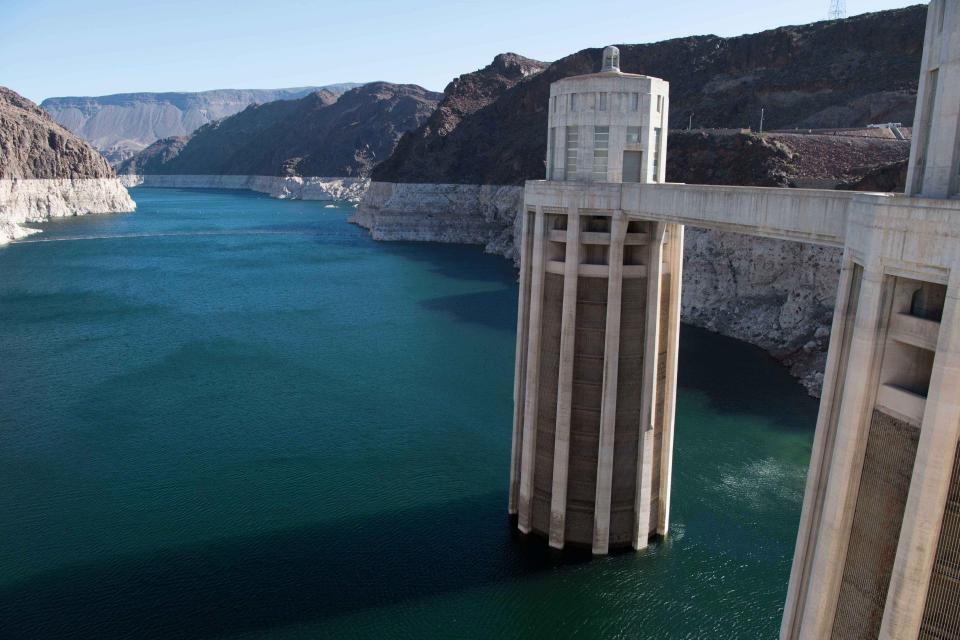
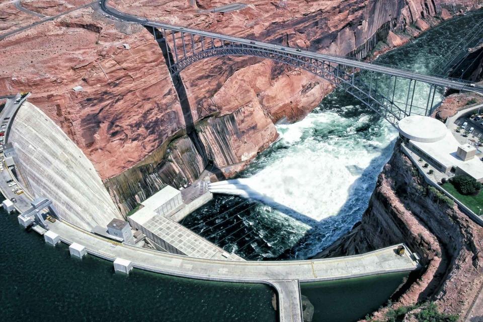
Reservoirs plummeting to record low levels, whether Hoover Dam
and Glen Canyon Dam can continue to release water and produce
hydropower, unprecedented water cuts and predatory smallmouth
bass threatening native fish species in the Grand Canyon.
“Holy buckets, Batman!,” said Cullom, executive director of the
Upper Colorado River Commission. “I mean, it’s just on and on and
on.”
As water interests in the Colorado
River Basin prepare to negotiate a new set of operating
guidelines for the drought-stressed river, Amelia Flores wants
her Colorado River Indian Tribes (CRIT) to be involved in the
discussion. And she wants CRIT seated at the negotiating table
with something invaluable to offer on a river facing steep cuts
in use: its surplus water.
CRIT, whose reservation lands in California and Arizona are
bisected by the Colorado River, has some of the most senior water
rights on the river. But a federal law enacted in the late 1700s,
decades before any southwestern state was established, prevents
most tribes from sending any of its water off its reservation.
The restrictions mean CRIT, which holds the rights to nearly a
quarter of the entire state of Arizona’s yearly allotment of
river water, is missing out on financial gain and the chance to
help its river partners.
Momentum is building for a unique
interstate deal that aims to transform wastewater from Southern
California homes and business into relief for the stressed
Colorado River. The collaborative effort to add resiliency to a
river suffering from overuse, drought and climate change is being
shaped across state lines by some of the West’s largest water
agencies.
This tour explored the lower Colorado River firsthand where virtually every drop of the river is allocated, yet demand is growing from myriad sources — increasing population, declining habitat, drought and climate change.
The 1,450-mile river is a lifeline to some 40 million people in the Southwest across seven states, 30 tribal nations and Mexico. How the Lower Basin states – Arizona, California and Nevada – use and manage this water to meet agricultural, urban, environmental and industrial needs was the focus of this tour.
Hyatt Place Las Vegas At Silverton Village
8380 Dean Martin Drive
Las Vegas, NV 89139
There is just about a week left to
apply for our inaugural Colorado River Water Leaders
program in 2022, which marks the 100th anniversary
of the Colorado River Compact.
The biennial program is modeled after our highly successful
Water Leaders
program in California, now 25 years strong.
Our Colorado River program will select rising stars from the
seven U.S. states and tribal nations that rely on the river -
California, Nevada, Arizona, Colorado, Wyoming, Utah and New
Mexico – to participate in the seven-month class designed for
working professionals. Class members will explore issues
surrounding the iconic Southwest river, deepen their water
knowledge and build leadership skills.
Climate scientist Brad Udall calls
himself the skunk in the room when it comes to the Colorado
River. Armed with a deck of PowerPoint slides and charts that
highlight the Colorado River’s worsening math, the Colorado State
University scientist offers a grim assessment of the river’s
future: Runoff from the river’s headwaters is declining, less
water is flowing into Lake Powell – the key reservoir near the
Arizona-Utah border – and at the same time, more water is being
released from the reservoir than it can sustainably provide.
For more than 20 years, Tanya
Trujillo has been immersed in the many challenges of the Colorado
River, the drought-stressed lifeline for 40 million people from
Denver to Los Angeles and the source of irrigation water for more
than 5 million acres of winter lettuce, supermarket melons and
other crops.
Trujillo has experience working in both the Upper and Lower
Basins of the Colorado River, basins that split the river’s water
evenly but are sometimes at odds with each other. She was a
lawyer for the state of New Mexico, one of four states in the
Upper Colorado River Basin, when key operating guidelines for
sharing shortages on the river were negotiated in 2007. She later
worked as executive director for the Colorado River Board of
California, exposing her to the different perspectives and
challenges facing California and the other states in the river’s
Lower Basin.
Known for our popular Water Leaders
program in California – about to mark its 25th anniversary – we
are now launching a Colorado
River Water Leaders program in 2022, the 100th
anniversary of the Colorado River Compact.
The biennial program will select rising stars from the seven
U.S. states that rely on the river – California, Nevada, Arizona,
Colorado, Wyoming, Utah and New Mexico – to participate in the
seven-month class designed for working professionals. Class
members will explore issues surrounding the iconic Southwest
river, deepen their water knowledge and build leadership
skills.
Water is flowing once again
to the Colorado River’s delta in Mexico, a vast region that
was once a natural splendor before the iconic Western river was
dammed and diverted at the turn of the last century, essentially
turning the delta into a desert.
In 2012, the idea emerged that water could be intentionally sent
down the river to inundate the delta floodplain and regenerate
native cottonwood and willow trees, even in an overallocated
river system. Ultimately, dedicated flows of river water were
brokered under cooperative
efforts by the U.S. and Mexican governments.
Las Vegas, known for its searing summertime heat and glitzy casino fountains, is projected to get even hotter in the coming years as climate change intensifies. As temperatures rise, possibly as much as 10 degrees by end of the century, according to some models, water demand for the desert community is expected to spike. That is not good news in a fast-growing region that depends largely on a limited supply of water from an already drought-stressed Colorado River.
When you oversee the largest
supplier of treated water in the United States, you tend to think
big.
Jeff Kightlinger, general manager of the Metropolitan Water
District of Southern California for the last 15 years, has
focused on diversifying his agency’s water supply and building
security through investment. That means looking beyond MWD’s
borders to ensure the reliable delivery of water to two-thirds of
California’s population.
Twenty years ago, the Colorado River
Basin’s hydrology began tumbling into a historically bad stretch.
The weather turned persistently dry. Water levels in the system’s
anchor reservoirs of Lake Powell and Lake Mead plummeted. A river
system relied upon by nearly 40 million people, farms and
ecosystems across the West was in trouble. And there was no guide
on how to respond.
Managing water resources in the Colorado River Basin is not for the timid or those unaccustomed to big challenges. Careers are devoted to responding to all the demands put upon the river: water supply, hydropower, recreation and environmental protection.
All of this while the Basin endures a seemingly endless drought and forecasts of increasing dryness in the future.
Practically every drop of water that flows through the meadows, canyons and plains of the Colorado River Basin has reams of science attached to it. Snowpack, streamflow and tree ring data all influence the crucial decisions that guide water management of the iconic Western river every day.
Dizzying in its scope, detail and complexity, the scientific information on the Basin’s climate and hydrology has been largely scattered in hundreds of studies and reports. Some studies may conflict with others, or at least appear to. That’s problematic for a river that’s a lifeline for 40 million people and more than 4 million acres of irrigated farmland.
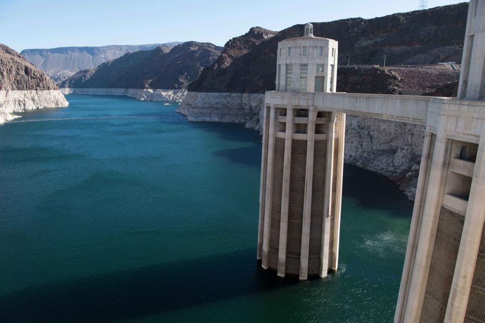
The Colorado River Compact of 1922
marked the first time in U.S. history that more than three states
negotiated an agreement among themselves to apportion the waters
of a stream or river.
The compact is the cornerstone of the “Law of the River” – a
complex set of interstate compacts, federal laws, court decisions
and decrees, contracts and federal actions that regulate use of
the Colorado River.
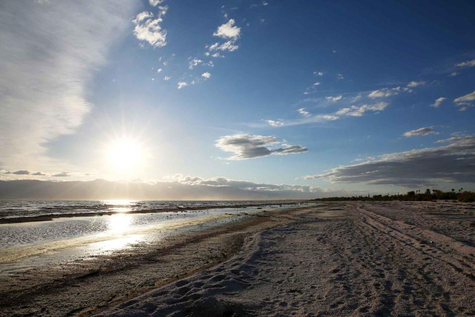
Out of sight and out of mind to most
people, the Salton Sea in California’s far southeast corner has
challenged policymakers and local agencies alike to save the
desert lake from becoming a fetid, hyper-saline water body
inhospitable to wildlife and surrounded by clouds of choking
dust.
The sea’s problems stretch beyond its boundaries in Imperial and
Riverside counties and threaten to undermine multistate
management of the Colorado River. A 2019 Drought Contingency Plan for the
Lower Colorado River Basin was briefly stalled when the Imperial
Irrigation District, holding the river’s largest water
allocation, balked at participating in the plan because, the
district said, it ignored the problems of the Salton Sea.
Colorado is home to the headwaters
of the Colorado River and the water policy decisions made in the
Centennial State reverberate throughout the river’s sprawling
basin that stretches south to Mexico. The stakes are huge in a
basin that serves 40 million people, and responding to the water
needs of the economy, productive agriculture, a robust
recreational industry and environmental protection takes
expertise, leadership and a steady hand.
Sprawled across a desert expanse
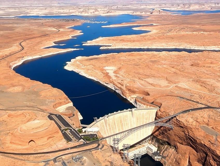
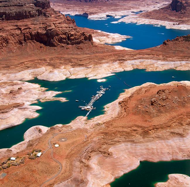
along the Utah-Arizona border, Lake Powell’s nearly 100-foot high
bathtub ring etched on its sandstone walls belie the challenges
of a major Colorado River reservoir at less than half-full. How
those challenges play out as demand grows for the river’s water
amid a changing climate is fueling simmering questions about
Powell’s future.
Innovative efforts to accelerate
restoration of headwater forests and to improve a river for the
benefit of both farmers and fish. Hard-earned lessons for water
agencies from a string of devastating California wildfires.
Efforts to drought-proof a chronically water-short region of
California. And a broad debate surrounding how best to address
persistent challenges facing the Colorado River.
These were among the issues Western Water explored in
2019, and are still worth taking a look at in case you missed
them.
The Colorado River is arguably one
of the hardest working rivers on the planet, supplying water to
40 million people and a large agricultural economy in the West.
But it’s under duress from two decades of drought and decisions
made about its management will have exceptional ramifications for
the future, especially as impacts from climate change are felt.
Every other year we hold an
invitation-only Colorado River Symposium attended by various
stakeholders from across the seven Western states and Mexico that
rely on the iconic river. We host this three-day event in Santa
Fe, N.M., where the 1922 Colorado River Compact was signed, as
part of our mission to catalyze critical conversations to build
bridges and inform collaborative decision-making.
The Colorado River Basin’s 20 years
of drought and the dramatic decline in water levels at the
river’s key reservoirs have pressed water managers to adapt to
challenging conditions. But even more extreme — albeit rare —
droughts or floods that could overwhelm water managers may lie
ahead in the Basin as the effects of climate change take hold,
say a group of scientists. They argue that stakeholders who are
preparing to rewrite the operating rules of the river should plan
now for how to handle these so-called “black swan” events so
they’re not blindsided.
Dates are now set for two key
Foundation events to kick off 2020 — our popular Water 101
Workshop, scheduled for Feb. 20 at McGeorge School of Law in
Sacramento, and our Lower Colorado River Tour, which will run
from March 11-13.
In addition, applications will be available by the first week of
October for our 2020 class of Water Leaders, our competitive
yearlong program for early to mid-career up-and-coming water
professionals. To learn more about the program, check out our
Water Leaders program
page.
High in the headwaters of the Colorado River, around the hamlet of Kremmling, Colorado, generations of families have made ranching and farming a way of life, their hay fields and cattle sustained by the river’s flow. But as more water was pulled from the river and sent over the Continental Divide to meet the needs of Denver and other cities on the Front Range, less was left behind to meet the needs of ranchers and fish.
“What used to be a very large river that inundated the land has really become a trickle,” said Mely Whiting, Colorado counsel for Trout Unlimited. “We estimate that 70 percent of the flow on an annual average goes across the Continental Divide and never comes back.”
Summer is a good time to take a
break, relax and enjoy some of the great beaches, waterways and
watersheds around California and the West. We hope you’re getting
a chance to do plenty of that this July.
But in the weekly sprint through work, it’s easy to miss
some interesting nuggets you might want to read. So while we’re
taking a publishing break to work on other water articles planned
for later this year, we want to help you catch up on
Western Water stories from the first half of this year
that you might have missed.
We have an unknown distance yet to run, an unknown river to explore. What falls there are, we know not; what rocks beset the channel, we know not; what walls ride over the river, we know not. Ah, well! We may conjecture many things.
~John Wesley Powell
Powell scrawled those words in his journal as he and his expedition paddled their way into the deep walls of the Grand Canyon on a stretch of the Colorado River in August 1869. Three months earlier, the 10-man group had set out on their exploration of the iconic Southwest river by hauling their wooden boats into a major tributary of the Colorado, the Green River in Wyoming, for their trip into the “great unknown,” as Powell described it.
Even as stakeholders in the Colorado River Basin celebrate the recent completion of an unprecedented drought plan intended to stave off a crashing Lake Mead, there is little time to rest. An even larger hurdle lies ahead as they prepare to hammer out the next set of rules that could vastly reshape the river’s future.
Set to expire in 2026, the current guidelines for water deliveries and shortage sharing, launched in 2007 amid a multiyear drought, were designed to prevent disputes that could provoke conflict.
Bruce Babbitt, the former Arizona
governor and secretary of the Interior, has been a thoughtful,
provocative and sometimes forceful voice in some of the most
high-profile water conflicts over the last 40 years, including
groundwater management in Arizona and the reduction of
California’s take of the Colorado River. In 2016, former
California Gov. Jerry Brown named Babbitt as a special adviser to
work on matters relating to the Sacramento-San Joaquin Delta and
the Delta tunnels plan.
For the bulk of her career, Jayne
Harkins has devoted her energy to issues associated with the
management of the Colorado River, both with the U.S. Bureau of
Reclamation and with the Colorado River Commission of Nevada.
Now her career is taking a different direction. Harkins, 58, was
appointed by President Trump last August to take the helm of the
United States section of the U.S.-Mexico agency that oversees
myriad water matters between the two countries as they seek to
sustainably manage the supply and water quality of the Colorado
River, including its once-thriving Delta in Mexico, and other
rivers the two countries share. She is the first woman to be
named the U.S. Commissioner of the International Boundary and
Water Commission for either the United States or Mexico in the
commission’s 129-year history.
Imported water from the Sierra
Nevada and the Colorado River built Southern California. Yet as
drought, climate change and environmental concerns render those
supplies increasingly at risk, the Southland’s cities have ramped
up their efforts to rely more on local sources and less on
imported water.
Far and away the most ambitious goal has been set by the city of
Santa Monica, which in 2014 embarked on a course to be virtually
water independent through local sources by 2023. In the 1990s,
Santa Monica was completely dependent on imported water. Now, it
derives more than 70 percent of its water locally.
The growing leadership of women in water. The Colorado River’s persistent drought and efforts to sign off on a plan to avert worse shortfalls of water from the river. And in California’s Central Valley, promising solutions to vexing water resource challenges.
These were among the topics that Western Water news explored in 2018.
We’re already planning a full slate of stories for 2019. You can sign up here to be alerted when new stories are published. In the meantime, take a look at what we dove into in 2018:
As stakeholders labor to nail down
effective and durable drought contingency plans for the Colorado
River Basin, they face a stark reality: Scientific research is
increasingly pointing to even drier, more challenging times
ahead.
The latest sobering assessment landed the day after Thanksgiving,
when U.S. Global Change Research Program’s Fourth National Climate
Assessment concluded that Earth’s climate is changing rapidly
compared to the pace of natural variations that have occurred
throughout its history, with greenhouse gas emissions largely the
cause.
As the Colorado River Basin becomes
drier and shortage conditions loom, one great variable remains:
How much of the river’s water belongs to Native American tribes?
Native Americans already use water from the Colorado River and
its tributaries for a variety of purposes, including leasing it
to non-Indian users. But some tribes aren’t using their full
federal Indian reserved water right and others have water rights
claims that have yet to be resolved. Combined, tribes have rights
to more water than some states in the Colorado River Basin.
The Colorado River Basin is more
than likely headed to unprecedented shortage in 2020 that could
force supply cuts to some states, but work is “furiously”
underway to reduce the risk and avert a crisis, Bureau of
Reclamation Commissioner Brenda Burman told an audience of
California water industry people.
During a keynote address at the Water Education Foundation’s
Sept. 20 Water Summit in Sacramento, Burman said there is
opportunity for Colorado River Basin states to control their
destiny, but acknowledged that in water, there are no guarantees
that agreement can be reached.
Water means life for all the Grand Canyon’s inhabitants, including the many varieties of insects that are a foundation of the ecosystem’s food web. But hydropower operations upstream on the Colorado River at Glen Canyon Dam, in Northern Arizona near the Utah border, disrupt the natural pace of insect reproduction as the river rises and falls, sometimes dramatically. Eggs deposited at the river’s edge are often left high and dry and their loss directly affects available food for endangered fish such as the humpback chub.
Amy Haas recently became the first non-engineer and the first woman to serve as executive director of the Upper Colorado River Commission in its 70-year history, putting her smack in the center of a host of daunting challenges facing the Upper Colorado River Basin.
Yet those challenges will be quite familiar to Haas, an attorney who for the past year has served as deputy director and general counsel of the commission. (She replaced longtime Executive Director Don Ostler). She has a long history of working within interstate Colorado River governance, including representing New Mexico as its Upper Colorado River commissioner and playing a central role in the negotiation of the recently signed U.S.-Mexico agreement known as Minute 323.
Nowhere is the domino effect in
Western water policy played out more than on the Colorado River,
and specifically when it involves the Lower Basin states of
California, Nevada and Arizona. We are seeing that play out now
as the three states strive to forge a Drought Contingency Plan.
Yet that plan can’t be finalized until Arizona finds a unifying
voice between its major water players, an effort you can read
more about in the latest in-depth article of Western Water.
Even then, there are some issues to resolve just within
California.
It’s high-stakes time in Arizona. The state that depends on the
Colorado River to help supply its cities and farms — and is
first in line to absorb a shortage — is seeking a unified plan
for water supply management to join its Lower Basin neighbors,
California and Nevada, in a coordinated plan to preserve water
levels in Lake Mead before
they run too low.
If the lake’s elevation falls below 1,075 feet above sea level,
the secretary of the Interior would declare a shortage and
Arizona’s deliveries of Colorado River water would be reduced by
320,000 acre-feet. Arizona says that’s enough to serve about 1
million households in one year.
As California embarks on its unprecedented mission to harness groundwater pumping, the Arizona desert may provide one guide that local managers can look to as they seek to arrest years of overdraft.
Groundwater is stressed by a demand that often outpaces natural and artificial recharge. In California, awareness of groundwater’s importance resulted in the landmark Sustainable Groundwater Management Act in 2014 that aims to have the most severely depleted basins in a state of balance in about 20 years.
We explored the lower Colorado River where virtually every drop
of the river is allocated, yet demand is growing from myriad
sources — increasing population, declining habitat, drought and
climate change.
The 1,450-mile river is a lifeline to 40 million people in
the Southwest across seven states and Mexico. How the Lower Basin
states – Arizona, California and Nevada – use and manage this
water to meet agricultural, urban, environmental and industrial
needs was the focus of this tour.
Hampton Inn Tropicana
4975 Dean Martin Drive, Las Vegas, NV 89118
Dramatic swings in weather patterns
over the past few years in California are stark reminders of
climate variability and regional vulnerability. Alternating years
of drought and intense rain events make long-term planning for
storing and distributing water a challenging task.
Current weather forecasting capabilities provide details for
short time horizons. Attend the Paleo Drought
Workshop in San Pedro on April 19 to learn more about
research efforts to improve sub-seasonal to seasonal
precipitation forecasting, known as S2S, and how those models
could provide more useful weather scenarios for resource
managers.
A drought has lingered in the
Colorado River Basin since 2000, causing reservoir storage to
decline from nearly full to about half of capacity. So far this
year, a meager snowpack in the Rocky Mountains hasn’t helped
much.
In fact, forecasters say this winter will likely go down as the
sixth-driest on record for the river system that supplies water
to seven states, including California, and Mexico.
On our Lower
Colorado River Tour, April 11-13, you will meet with water
managers from the three Lower Basin states: Nevada, Arizona and
California. The three states are working to finalize a Drought
Contingency Plan to take voluntary cuts to keep Lake Mead, the
nation’s largest reservoir, from hitting critical levels and
causing a shortage declaration.
California’s 2012-2016 drought
revealed vulnerabilities for water users throughout the state,
and the long-term record suggests more challenges may lie ahead.
An April 19
workshop in San Pedro will highlight new information about
drought durations in Southern California watersheds dating
back centuries.
Most people see the Grand Canyon from the rim, thousands of feet above where the Colorado River winds through it for almost 300 miles.
But to travel it afloat a raft is to experience the wondrous majesty of the canyon and the river itself while gaining perspective about geology, natural beauty and the passage of time.
Beginning at Lees Ferry, some 30,000 people each year launch downriver on commercial or private trips. Before leaving, they are dutifully briefed by a National Park Service ranger who explains to them about the unique environment that awaits them, how to keep it protected and, most importantly, how to protect themselves.
They also are told about the pair of ravens that will inevitably follow them through the canyon, seizing every opportunity to scrounge food.
Tickets are now on sale for the Water Education Foundation’s April 11-13 tour of the Lower Colorado River.
Don’t miss this opportunity to visit key sites along one of the nation’s most famous rivers, including a private tour of Hoover Dam, Central Arizona Project’s Mark Wilmer pumping plant and the Havasu National Wildlife Refuge. The tour also visits the Salton Sea, Slab City, the All-American Canal and farming regions in the Imperial and Coachella valleys.
Drought and climate change are having a noticeable impact on the
Colorado River Basin, and that is posing potential challenges to
those in the Southwestern United States and Mexico who rely on
the river.
In the just-released Winter 2017-18 edition of River
Report, writer Gary Pitzer examines what scientists
project will be the impact of climate change on the Colorado
River Basin, and how water managers are preparing for a future of
increasing scarcity.
Rising temperatures from climate change are having a noticeable
effect on how much water is flowing down the Colorado River. Read
the latest River Report to learn more about what’s
happening, and how water managers are responding.
This issue of Western Water discusses the challenges
facing the Colorado River Basin resulting from persistent
drought, climate change and an overallocated river, and how water
managers and others are trying to face the future.
The Colorado River Delta once spanned nearly 2 million acres and
stretched from the northern tip of the Gulf of California in
Mexico to Southern California’s Salton Sea. Today it’s one-tenth
that size, yet still an important estuary, wildlife habitat and
farming region even though Colorado River flows rarely reach the
sea.
Since 2000, the Colorado River Basin has experienced an historic,
extended drought causing reservoir storage in the Colorado River
system to decline from nearly full to about half of capacity. For
the Lower Basin, a key point has been to maintain the level of
Lake Mead to prevent a shortage declaration.
A healthy snowfall in the Rockies has reduced the odds of a
shortage this year, but the basin states still must come to terms
with a static supply and growing demands, as well as future
impacts from climate change.
On our Lower
Colorado River Tour, April 5-7, you will meet with water
managers from the three Lower Basin states: Nevada, Arizona and
California. Federal, state and local agencies will update you on
the latest hydrologic conditions and how recent storms might
change plans for water supply and storage.
A troublesome invasive species is
the quagga mussel, a tiny freshwater mollusk that attaches itself
to water utility infrastructure and reproduces at a rapid rate,
causing damage to pipes and pumps.
First found in the Great Lakes in 1988 (dumped with ballast water
from overseas ships), the quagga mussel along with the zebra
mussel are native to the rivers and lakes of eastern Europe and
western Asia, including the Black, Caspian and Azov Seas and the
Dneiper River drainage of Ukraine and Ponto-Caspian
Sea.
This issue of Western Water examines the ongoing effort
between the United States and Mexico to develop a
new agreement to the 1944 Treaty that will continue the
binational cooperation on constructing Colorado River
infrastructure, storing water in Lake Mead and providing instream
flows for the Colorado River Delta.
As vital as the Colorado River is to the United States and
Mexico, so is the ongoing process by which the two countries
develop unique agreements to better manage the river and balance
future competing needs.
The prospect is challenging. The river is over allocated as urban
areas and farmers seek to stretch every drop of their respective
supplies. Since a historic treaty between the two countries was
signed in 1944, the United States and Mexico have periodically
added a series of arrangements to the treaty called minutes that
aim to strengthen the binational ties while addressing important
water supply, water quality and environmental concerns.
Lake Havasu is a reservoir on the
Colorado River that
supplies water to the Colorado River
Aqueduct and Central Arizona Project. It is located at
the California/Arizona border, approximately 150 miles southeast
of Las Vegas, Nevada and 30 miles southeast of Needles,
California.
Situated in southwest Riverside County near the Santa Ana
Mountains – about 60 miles southeast of Los Angeles – Lake
Mathews is a
major reservoir in Southern California.
The All-American Canal delivers
Colorado River water to
the Imperial Valley,
sustaining a desert valley that is one of the most productive
agricultural regions in the world. The canal, about 80 miles
long, joins the Imperial
Dam (and its desilting works) and the 123-mile-long
Coachella Canal to complete the All-American Canal System.
This issue looks at the historic drought that has gripped the
Colorado River Basin since 2000 and discusses the lessons
learned, the continuing challenges and what the future might
hold.
The dramatic decline in water levels in Lake Mead and Lake Powell
is perhaps the most visible sign of the historic drought that has
gripped the Colorado River Basin for the past 16 years. In 2000,
the reservoirs stood at nearly 100 percent capacity; today, Lake
Powell is at 49 percent capacity while Lake Mead has dropped to
38 percent. Before the late season runoff of Miracle May, it
looked as if Mead might drop low enough to trigger the first-ever
Lower Basin shortage determination in 2016.
Read the excerpt below from the Sept./Oct. 2015 issue along
with the editor’s note. Click here to subscribe to Western
Water and get full access.
This issue looks at the dilemma of the shrinking Salton Sea. The
shallow, briny inland lake at the southeastern edge of California
is slowly evaporating and becoming more saline – threatening the
habitat for fish and birds and worsening air quality as dust from
the dry lakebed is whipped by the constant winds.
The shallow, briny inland lake at the southeastern edge of
California is slowly evaporating and becoming more saline –
threatening the habitat for fish and birds and worsening air
quality as dust from the dry lakebed is whipped by the constant
winds.
(Read this excerpt from the May/June 2015 issue along with
the editor’s note. Click here to
subscribe to Western Water and get full access.)
After much time, study and investment, the task of identifying
solutions to ensure the long-term sustainability of the Colorado
River is underway. People from the Upper and Lower basins
representing all interest groups are preparing to put their
signatures to documents aimed at ensuring the river’s vitality
for the next 50 years and beyond.
This 3-day, 2-night tour followed the course of the
lower Colorado River through Nevada, Arizona and California, and
included a private tour of Hoover Dam.
This issue updates progress on crafting and implementing
California’s 4.4 plan to reduce its use of Colorado River water
by 800,000 acre-feet. The state has used as much as 5.2 million
acre-feet of Colorado River water annually, but under pressure
from Interior Secretary Bruce Babbitt and the other six states
that share this resource, California’s Colorado River parties
have been trying to close the gap between demand and supply. The
article – delayed to include the latest information from
Babbitt’s Dec.
This issue updates progress on California’s Colorado River Water
Use Plan (commonly called the 4.4 Plan ), with a special focus on
the Salton Sea restoration/water transfer dilemma. It also
includes information on the proposed MWD-Palo Verde Irrigation
District deal, the Colorado River Delta, and the legislative
debate in the national and state capitals.
With passage of the original Dec. 31, 2002, deadline to have a
Quantification Settlement Agreement (QSA) in place for the
Colorado River, California suffered a cutback in the surplus
Colorado River flows it had relied upon by years. Further
negotiations followed in an attempt to bring the California
parties to an agreement. This issue examines the history leading
to the QSA, the state of affairs of the so-called 4.4 Plan as of
early March, and gives readers a clearer crystal ball with which
to speculate about California’s water future on the Colorado
River.
This issue of Western Water provides the latest information on
some of the philosophical, political and practical ideas being
discussed on the river. Some of these issues were discussed at
the Water Education Foundation’s Colorado River Symposium, “The
Ties that Bind: Policy and the Evolving Law of the Colorado
River,” held last fall at The Bishop’s Lodge in Santa Fe, New
Mexico – site of negotiations on the 1922 Colorado River Compact.
This issue of Western Water explores the issues
surrounding and the components of the Colorado River Basin
seven-state proposed agreement released Feb. 3 regarding sharing
shortages on the river, and new plans to improve the river’s
management. The article includes excerpts from the Foundation’s
September 2005 Colorado River Symposium held in Santa Fe, New
Mexico.
This issue of Western Water marks the 85th anniversary of the
Colorado River Compact and considers its role in the past and
present on key issues such as federal funding for water projects
and international issues. Much of the content for this magazine
came from the Foundation’s September Colorado River Symposium,
The Colorado River Compact at 85 and Changes on the River.
This card includes information about the Colorado River, who uses
the river, how the river’s water is divided and other pertinent
facts about this vital resource for the Southwest. Beautifully
illustrated with color photographs.
In 1997, the Foundation sponsored a three-day, invitation-only
symposium at Bishop’s Lodge, New Mexico, site of the 1922
Colorado River Compact signing, to discuss the historical
implications of that agreement, current Colorado River issues and
future challenges. The 204-page proceedings features the panel
discussions and presentations on such issues as the Law of the
River, water marketing and environmental restoration.
30-minute DVD that traces the history of the U.S. Bureau of
Reclamation and its role in the development of the West. Includes
extensive historic footage of farming and the construction of
dams and other water projects, and discusses historic and modern
day issues.
Redesigned in 2017, this beautiful map depicts the seven
Western states that share the Colorado River with Mexico. The
Colorado River supplies water to nearly 40 million people in
Arizona, California, Colorado, Nevada, New Mexico, Utah, Wyoming
and Mexico. Text on this beautiful, 24×36-inch map, which is
suitable for framing, explains the river’s apportionment, history
and the need to adapt its management for urban growth and
expected climate change impacts.
This 24×36 inch poster, suitable for framing, illustrates the
water resources available for Nevada cities, agriculture and the
environment. It features natural and manmade water resources
throughout the state, including the Truckee and Carson rivers,
Lake Tahoe, Pyramid Lake and the course of the Colorado River
that forms the state’s eastern boundary.
The 28-page Layperson’s Guide to Water Rights Law, recognized as
the most thorough explanation of California water rights law
available to non-lawyers, traces the authority for water flowing
in a stream or reservoir, from a faucet or into an irrigation
ditch through the complex web of California water rights.
The 20-page Layperson’s Guide to Water Marketing provides
background information on water rights, types of transfers and
critical policy issues surrounding this topic. First published in
1996, the 2005 version offers expanded information on
groundwater banking and conjunctive use, Colorado River
transfers and the role of private companies in California’s
developing water market.
Order in bulk (25 or more copies of the same guide) for a reduced
fee. Contact the Foundation, 916-444-6240, for details.
A new look for our most popular product! And it’s the perfect
gift for the water wonk in your life.
Our 24×36-inch California Water Map is widely known for being the
definitive poster that shows the integral role water plays in the
state. On this updated version, it is easier to see California’s
natural waterways and man-made reservoirs and aqueducts
– including federally, state and locally funded
projects – the wild and scenic rivers system, and
natural lakes. The map features beautiful photos of
California’s natural environment, rivers, water projects,
wildlife, and urban and agricultural uses and the
text focuses on key issues: water supply, water use, water
projects, the Delta, wild and scenic rivers and the Colorado
River.
This 3-day, 2-night tour follows the course of the lower Colorado River through Nevada, Arizona and California, and includes a private tour of Hoover Dam.
As part of the historic Colorado
River Delta, the Salton Sea regularly filled and dried for
thousands of years due to its elevation of 237 feet below
sea level.
The most recent version of the Salton Sea was formed in 1905 when
the Colorado River broke
through a series of dikes and flooded the seabed for two years,
creating California’s largest inland body of water. The
Salton Sea, which is saltier than the Pacific Ocean, includes 130
miles of shoreline and is larger than Lake Tahoe.
The Quantification Settlement Agreement (QSA), signed in 2003,
defined the rights to a portion of Colorado River water for the San
Diego County Water Authority, Coachella Valley Water District,
Imperial Irrigation District and the Metropolitan Water District
of Southern California.
The QSA responded to California consistently using more than its
annual Colorado River entitlement of 4.4 million acre-feet.
Additionally, the water needs of six other Colorado River Basin
states had grown, making the river’s shared use increasingly
crucial.
The Mexican Water Treaty of 1944 committed the U.S. to deliver
1.5 million acre-feet of water to Mexico on an annual basis, plus
an additional 200,000 acre-feet under surplus conditions. The
treaty is overseen by the International Boundary and Water
Commission.
Colorado River water is delivered to Mexico at Morelos Dam,
located 1.1 miles downstream from where the California-Baja
California land boundary intersects the river between the town of
Los Algodones in northwestern Mexico and Yuma County, Ariz.
The Colorado River Delta is located
at the natural terminus of the Colorado River at the Gulf of
California, just south of the U.S.-Mexico border. The desert
ecosystem was formed by silt flushed downstream from the Colorado
and fresh and brackish water mixing at the Gulf.
The Colorado River Delta once covered 9,650 square miles but has
shrunk to less than 1 percent of its original size due to
human-made water diversions.
In 2005, the Interior Department
launched a program to recover 27 species in the lower Colorado River, including seven
the federal government has deemed threatened or endangered or
threatened with extinction. The species include fish, birds,
bats, mammals, insects, amphibians, reptiles, rodents and plants
The Lower Colorado River Multispecies Conservation Program has a
50-year plan to create at least 8,132 acres of new habitat
and restore habitat that has become degraded.
Lee Ferry on the Arizona-Utah border is a key dividing point
between the Colorado River’s Upper and Lower basins.
This split is important when it comes to determining how much
water will be delivered from the Upper Basin to the Lower Basin
[for a description of the Upper and Lower basins, visit the
Colorado River page].
The construction of Glen Canyon Dam
in 1964 created Lake Powell. Both are located in north-central
Arizona near the Utah border. Lake Powell acts as a holding tank
for outflow from the Colorado River Upper Basin States: Colorado,
New Mexico, Utah and Wyoming.
The water stored in Lake Powell is used for recreation, power
generation and delivering water to the Lower Basin states of
California, Arizona, and Nevada.
John Wesley Powell (1834-1902) was historic and heroic for being
first to lead an expedition down the Colorado River in 1869. A major
who lost an arm in the Civil War Battle of Shiloh, he was an
explorer, geologist, geographer and ethnologist.
California historically has been the
largest user of the Colorado
River among the seven states of the Colorado River Basin. And
for many years the state’s use exceeded its apportioned share of
the river’s water. That began changing in the 1990s.
Historically, the Colorado River
Basin swung between flood years and more extended periods of
drought. Massive reservoirs like Lake Powell and
Lake Mead provided a
water-supply buffer for dry years and insurance against damaging
floods in wet years.
Often referred to as the lifeline of
the Southwest, the Colorado River and its tributaries provide
water to nearly 40 million people and irrigate 5 million acres of
farmland in California, Arizona, Nevada, Colorado, New Mexico,
Utah and Wyoming. It also serves about 2.3 million people and
500,000 farmland acres in northern Mexico. The river’s water is
critical for 30 federally recognized Native American tribes,
Grand Canyon National Park and several other units of the
National Park system, and a number of wildlife refuges.
This printed issue of Western Water examines how the various
stakeholders have begun working together to meet the planning
challenges for the Colorado River Basin, including agreements
with Mexico, increased use of conservation and water marketing,
and the goal of accomplishing binational environmental
restoration and water-sharing programs.
This printed issue of Western Water examines the
Colorado River Basin Water Supply and Demand Study and what its
finding might mean for the future of the lifeblood of the
Southwest.
The Colorado River is one of the most heavily relied upon water
supply sources in the world, serving 35 million people in seven
states and Mexico. The river provides water to large cities,
irrigates fields, powers turbines to generate electricity,
thrills recreational enthusiasts and serves as a home for birds,
fish and wildlife.
This printed issue of Western Water explores the
historic nature of some of the key agreements in recent years,
future challenges, and what leading state representatives
identify as potential “worst-case scenarios.” Much of the content
for this issue of Western Water came from the in-depth
panel discussions at the Colorado River Symposium. The Foundation
will publish the full proceedings of the Symposium in 2012.
This printed issue of Western Water examines the
Colorado River drought, and the ongoing institutional and
operational changes underway to maintain the system and meet the
future challenges in the Colorado River Basin.
This printed issue of Western Water explores some of the major
challenges facing Colorado River stakeholders: preparing for
climate change, forging U.S.-Mexico water supply solutions and
dealing with continued growth in the basins states. Much of the
content for this issue of Western Water came from the in-depth
panel discussions at the September 2009 Colorado River Symposium.
This printed copy of Western Water examines the Colorado River
Delta, its ecological significance and the lengths to which
international, state and local efforts are targeted and achieving
environmental restoration while recognizing the needs of the
entire river’s many users.
This issue of Western Water asks whether a groundwater
compact is needed to manage this shared resource today. In the
water-stressed West, there will need to be a recognition of
sharing water resources or a line will need to be drawn in the
sand against future growth.
“In the West, when you touch water, you touch
everything.” – Rep. Wayne Aspinall, D-Colorado, chair,
House Interior and Insular Affairs Committee, 1959-1973
Rapid population growth and chronic droughts could augur dramatic
changes for communities along the lower Colorado River. In
Arizona, California and Nevada, a robust economy is spurring
communities to find enough water to sustain the steady pace of
growth. Established cities such as Las Vegas and Phoenix continue
their expansion but there is also activity in smaller, rural
areas on Arizona’s northwest fringe where developers envision
hundreds of thousands of new homes in the coming decades.
With interstate discussions of critical Colorado River issues
seemingly headed for stalemate, Secretary of the Interior Gale
Norton stepped in May 2 to defuse, or at least defer, a
potentially divisive debate over water releases from Lake Powell.
With interstate discussions of critical Colorado River issues
seemingly headed for stalemate, Secretary of the Interior Gale
Norton stepped in May 2 to defuse, or at least defer, a
potentially divisive debate over water releases from Lake Powell.
In a letter to governors of the seven Colorado River Basin
states, Norton preserved the status quo of river operations for
five months, giving states and stakeholders a chance to move back
from the edge before positions had hardened on two key issues:
(1) shortage guidelines for the Lower Basin and (2) Upper Basin/
Lower Basin reservoir operations, particularly at Lake Powell.
But Norton served notice that she wants discussions on those two
issues to continue, possibly outside of the annual operation plan
(AOP) consultation process, which at least one observer described
as unwieldy.
Drawn from a special Colorado River stakeholder symposium held in
January 2002 at The Bishop’s Lodge in Santa Fe, New Mexico, this
article provides an overview of several Colorado River issues
that may or may not be resolved through consensus. Some of these
issues include providing water for the Colorado River Delta,
endangered species, dam re-operation and potential future trends
around the basin as they relate to the California 4.4 Plan,
drought and governance.
The situation is true anywhere: when resources are stretched,
tensions rise. In the arid Southwestern United States, this
resource is water and tensions over it have been ever present
since the westward migration in the 18th Century. Nowhere in this
region has the competition for water been fiercer than in the
Colorado River Basin. Whether it is more water for agriculture,
more water for cities, more water for American Indian tribes or
more water for the environment – there is a continuous quest by
parties to obtain additional supplies of this “liquid gold” from
the Colorado River. Sometimes the avenue chosen to acquire this
desert wealth is the court system, as exemplified by the landmark
Arizona v. California dispute that stretched for over 30 years.
Drawn from a special stakeholder symposium held in September 1999
in Keystone, Colorado, this issue explores how we got to where we
are today on the Colorado River; an era in which the traditional
water development of the past has given way to a more
collaborative approach that tries to protect the environment
while stretching available water supplies. Specific topics
addressed include the role of the Interior secretary in the
basin, California’s 4.4 plan, water marketing and future
challenges identified by participants.
Drawn from a special stakeholder symposium held in September 1999
in Keystone, Colorado, this issue explores how we got to where we
are today on the Colorado River; an era in which the traditional
water development of the past has given way to a more
collaborative approach that tries to protect the environment
while stretching available water supplies.