As Colorado River Stakeholders Draft a Drought Plan, the Margin for Error in Managing Water Supplies Narrows
WESTERN WATER IN-DEPTH: Climate report and science studies point toward a drier Basin with less runoff and a need to re-evaluate water management
 As stakeholders labor to nail down
effective and durable drought contingency plans for the Colorado
River Basin, they face a stark reality: Scientific research is
increasingly pointing to even drier, more challenging times
ahead.
The latest sobering assessment landed the day after Thanksgiving, when U.S. Global Change Research Program’s Fourth National Climate Assessment concluded that Earth’s climate is changing rapidly compared to the pace of natural variations that have occurred throughout its history, with greenhouse gas emissions largely the cause.
For the American Southwest, the report said that increased temperatures induced by climate change “have significantly altered the water cycle in the … region,” causing decreased snowpack, earlier spring runoff and more rain instead of snow. Those factors “exacerbate hydrological drought” and “suggest the need for flexible water management techniques that address changing risks over time, balancing declining supplies with greater demands.”
Brad Udall, senior water and climate research scientist at Colorado State University and one of the authors of the National Climate Assessment, said the mountain of evidence regarding the potential impacts of climate change in the Colorado River Basin points to the need for a re-evaluation of current water management.
 “We need to look really hard at
basically everything we are doing here,” he said. “We need to
plan on a river that has 12 million, 11 million, 10 million
acre-feet. We need to assume the worst is going to happen just
because we have already seen some very substantial impacts. We
need to look at all aspects of water management and figure out
how to build a robust system with potentially one-third less flow
by 2050.”
With water levels dropping in key reservoirs, the seven Colorado River Basin states have been embarked on a rigorous process to ink drought contingency plans that would pledge them to additional conservation measures in advance of any declared shortage, an increasingly likely possibility. Five of the seven Basin states have signed on to drought contingency plans, and the Bureau of Reclamation is pressing the other two – California and Arizona – to finalize their plans by Jan. 31, 2019, to avoid federal intervention.
If implemented, the plan would cover a period to 2026 and address the near-term threat of a shortage declaration. In 2020, talks will begin toward addressing longer range concerns on the river’s sustainability as part of the renegotiation of the shortage sharing guidelines adopted in 2007.
Those who live with Colorado River management every day believe the science points to the need for a re-oriented version of how the seven Basin states proceed.
“We have to take our infrastructure and our management techniques and our policies and our law and examine how those function and how they don’t function, and how they have to be strengthened or supplemented in a way that does account for the new reality, which is warmer temperatures,” said James Eklund, Colorado’s representative to the Upper Colorado River Commission.
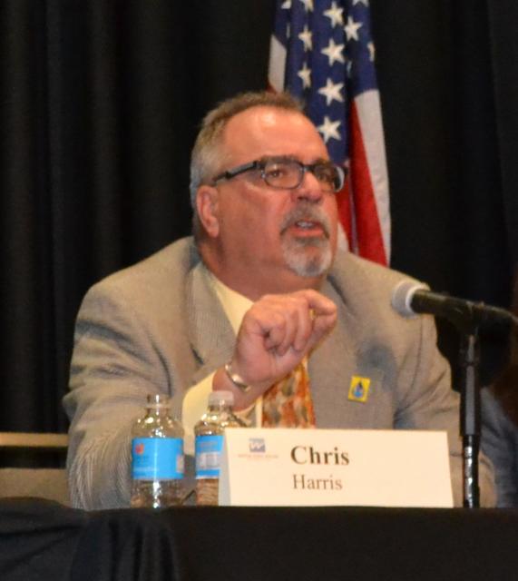
Chris Harris, executive director of the Colorado River Board of California, said the “take-home message” of the National Climate Assessment and other reports is that past droughts may not be the template of what to expect in the future.
“There is something going on in the world and we have to keep relying on scientists to continue to do the good work they are doing and bring us the information that all water managers need, whether you are in the Colorado River Basin, the Sierras or other portions of the western United States,” he said.
“If we don’t do anything, we know that for a fact it’s going to be a much harder row to hoe if we keep getting the hydrology that the climate models suggest we might get.”
~James Eklund, Colorado’s representative to the Upper Colorado River Commission
Stakeholders in the Colorado River Basin have to be all-in on addressing the situation because of the consequences of inaction, Eklund said.
“If we don’t do anything, we know that for a fact it’s going to be a much harder row to hoe if we keep getting the hydrology that the climate models suggest we might get,” he said.
Sizing up a ‘new normal’
The National Climate Assessment is the latest entry in a growing body of research about the present and projected effects of climate change, including what’s expected to happen in the Colorado River Basin – the source of water for 40 million people. Udall co-authored a 2017 study with Jonathan Overpeck that for the first time linked the Colorado River’s declining flows since 2000 to climate change.
A 2018 article by Udall and University of California, Los Angeles co-authors Mu Xiao and Dennis Lettenmaier said streamflow in the Upper Colorado River Basin (which produces about 90 percent of the river’s entire runoff) declined by 16 percent between 1916 and 2014, despite a slight increase in annual precipitation during that time. The 1922 Colorado River Compact allocated 15 million acre-feet of water from the mainstem river, plus an additional 1.5 million acre-feet in Arizona.
Published in the September edition of Water Resources Research, the article said that “pervasive warming” has reduced snowpack and enhanced evapotranspiration during the last 100 years and that more than one-half of the long‐term decline in runoff is associated with the general warming.
Udall said the rate of warming “was quite large, over 3 degrees Fahrenheit” between 1916 and 2014, and that “when you put those three factors together – declining flow, no change in precipitation and increasing temperature — they strongly suggest that temperature has caused at least some of the flow decline and that’s exactly what we found.”
“What we have right now is not a drought, it’s aridification,” he said. “Drought implies a return to a previous world that we will not see. What we are seeing is the long-term drying of the Basin.”
‘We learn stuff every day’
 Eklund, an attorney with Squire
Patton Boggs in Denver and former director of the Colorado Water
Conservation Board, said reports such as the National Climate
Assessment and Udall’s studies “are helpful in that they
underscore some of the things we have long talked about and
assumed to be true, such as we are likely in a new normal now.”
“The new droughts that we are experiencing now are the products of warmer temperatures and it’s important to understand that dynamic because that means the infrastructure we created to deal with this entire system … all of it was predicated on the river behaving a certain way and what the models tell us is that’s not something you can take for granted and in fact it’s unlikely to happen,” Eklund added. “History can’t be used to predict the future.”
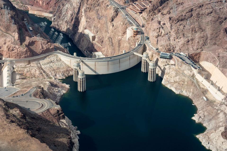
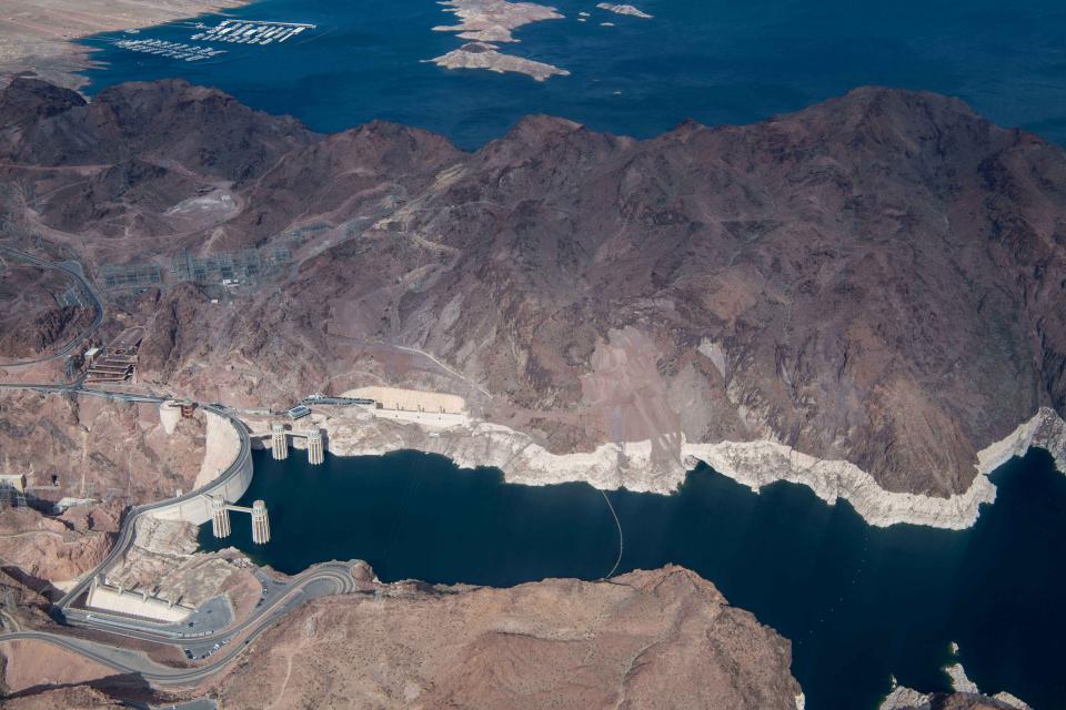
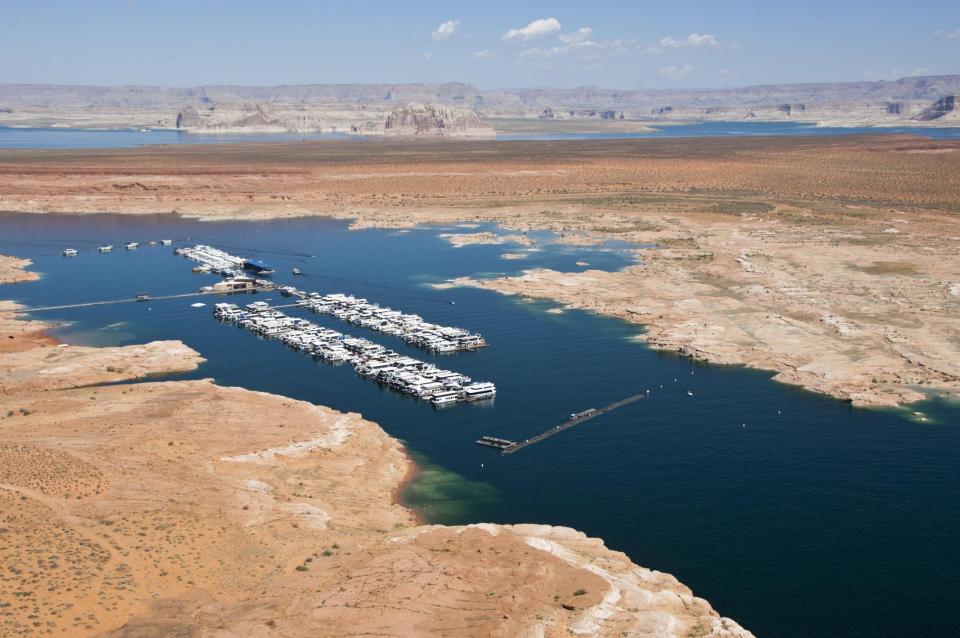
Drought regularly happens in the Colorado River Basin, but the effects in the last 20 years or so have been particularly pronounced, leading its major water users to regularly caucus in search of immediate and long-term management solutions to preserve the two anchors of the storage and delivery system — Lake Powell and Lake Mead.
In its 2012 Colorado River Basin Water Supply and Demand Study, the Bureau of Reclamation projected a wide range of potential long-term imbalances between supply and demand by 2060, with a median figure of 3.2 million acre-feet. The study noted that the amount of water available and the changes in demand during the next 50 years are “highly uncertain” and that the potential impacts of future climate change and variability “further contribute to these uncertainties.”
“We need to assume the worst is going to happen just because we have already seen some very substantial impacts.”
~Brad Udall, senior water and climate research scientist at Colorado State University
Udall believes it is time to recalculate the 3.2-million-acre-foot imbalance estimate.
“There were lots of assumptions that went into that and I think we are going to be recalculating it effectively every few years because we are seeing unprecedented changes. Our ability to project out to 2060 with certainty is just too difficult,” he said. “We learn stuff every day, every few months and of course we should look at this imbalance on a regular basis.”
University of Arizona Professor Gregg Garfin, one of the authors of the National Climate Assessment, said despite the size and scale of the Basin study, many of its aspects need to be revisited as new information comes to light.
“Updated climate change projections are one change, but there have been other changes since the 2012 release of the study,” he wrote in an email. “If one views this as a sort of adaptive management process, then it is critical to reassess assumptions, infuse new scientific findings, and evaluate various indicators of change (or progress) through monitoring. If I were the director of the Bureau of Reclamation, I would see Basin studies as an ongoing investment in ensuring that society can effectively balance water demand and supply.”
 Accounting for and incorporating the
latest scientific information is part of Reclamation’s strategy
for helping to manage resources in the Colorado River Basin, said
David Raff, Reclamation’s science adviser and scientific
integrity officer.
“As new information has been brought to the table … the Bureau of Reclamation’s approach has always been to try to include as much information as possible in a risk context and work with the stakeholders in the Basin to try to analyze the risk and address it the best way possible,” he said.
Raff said the emphasis should be on the immediate actions designed to manage the river and avoid critically low reservoir levels.
“I think the focus has been on what types of options exist in the Colorado system to address future constraints relative to supply and demand,” he said. “Things like [U.S.-Mexico shortage sharing] and the efforts associated with drought contingency planning … are probably the best investment of time and resources, as opposed to updating any specific quantitative analysis as was done in 2012.”
“It’s a very large, complex system that has all sorts of drivers to it and demands on it and therefore it’s far more complex than any one shift being a story into and of itself.”
~David Raff, Reclamation’s science adviser and scientific integrity officer
Because the breadth of scientific work on the Colorado River Basin covers so many different aspects — things such as dust on the snowpack, runoff and climate change — scientists note that no one element tells the entire story.
“It’s a very large, complex system that has all sorts of drivers to it and demands on it and therefore it’s far more complex than any one shift being a story into and of itself,” Raff said. “Certainly aridification, or a lack of water, is a big driver but certainly not one even by itself to be taken independently from the rest of the system.”
Considering the Basin’s Future
Much of what is expected to happen in the Colorado River Basin is couched by several variables, including changes in water demand and the rate of greenhouse gas emissions. According to the National Climate Assessment, under certain scenarios, higher temperatures would cause more frequent and severe droughts in the Southwest, including megadroughts — dry periods lasting 20 years or more.
“Snowpack supplies a major portion of water in the Southwest, but with continued emissions, models project substantial reductions in snowpack, less snow and more rain, shorter snowfall seasons, earlier runoff, and warmer late-season stream temperatures,” the climate assessment said. “The combination of reduced river flows in California and the Colorado River Basin and increasing population in Southern California, which imports most of its water, would increase the probability of future water shortages.”
Eklund said the climate assessment’s release “was incredibly well-timed” considering the present focus on drought contingency discussions. He extolled the candor of the report’s authors.
“It said, this is not political. We are just telling you the facts and the facts are we have missed the window to do some things, but we still have an opportunity,” he said. “Yes, it’s bad and we have known it’s bad and that crises are looming, but there are things we can do to mitigate the impacts.”
 Harris with the Colorado River Board
said it behooves stakeholders to take a more far-sighted and
proactive approach to what the science is saying instead of a
“knee-jerk reaction to a problem because that tends to result in
duct tape and baling wire patches than more adaptive and
long-term solutions.”
Many people view the drought contingency planning effort as “maybe one of our first steps in the renegotiation of what the next set of operational guidelines might be for the Colorado River system,” Harris said.
In the meantime, those dependent on the Colorado River will keep looking at ways to tighten their belt and become more creative.
“When it comes to projected reduced Colorado River flows, we will continue to be doing more projects and activities in the areas of water conservation, water augmentation and use of banked groundwater,” said Mohammed Mahmoud, senior policy analyst with the Central Arizona Project.
Raff with Reclamation said the issue goes beyond the climate assessment and the controversy associated with its political ramifications. “Future climate consideration is a major aspect of how we consider the Colorado River Basin,” he said.
Despite the new information, Raff said he believes the findings of the 2012 Basin Study showing an imbalance between supply and demand remain valid.
“An imbalance, even with the newest available information, is likely to exist where it was identified in 2012.”
 Improvements are needed in
precipitation modeling for the Basin as well as the ability of
scientists to give decision-makers the best possible information
upon which to proceed. Projecting temperature and precipitation
into the future is uncertain and the science community and
policymakers need to continue to work together to find the best
ways to achieve that, Raff said.
Udall echoed the need for better, more informative data, saying that scaling global climate models down to the regional level remains problematic and that science needs to come up with “realistic, believable” future flow scenarios to aid officials in their decision-making.
“We have really struggled to come up with projections of hydrology that are believable, that track with what we are actually seeing as the years go by and represent the system in a realistic and credible way,” he said.
Then there is the need to better understand and anticipate how much precipitation can be expected in such key places as the headwaters of the Colorado River as autumn segues into winter.
“There is something going on in the world and we have to keep relying on scientists to continue to do the good work they are doing and bring us the information that all water managers need.”
~Chris Harris, executive director of the Colorado River Board of California
“Subseasonal to seasonal is a huge area of research, and something that can be highly informative, given that we are probably in a place where projections out 30 years to 100 years will be incrementally improved in the next generations of modeling efforts,” Raff said. “If we focus on doing the best we can with near-term forecasts, that would put us in a much better position.”
While the science improves, stakeholders getting ahead of the curve is a good development, Udall said.
“A drought contingency plan that’s approved is really a climate change plan, so I would argue that is a good first step,” he said. Stakeholders “are really going to have to look at even lower flows and even higher shortage amounts and we need to be ready for some quite extreme changes.”
However, merely approving a drought contingency plan isn’t a guarantee of success, Eklund said.
“Predictions are tough in this business,” he said. “I wouldn’t say that if we get this all passed and if our contingency plans are put in place that we are out of the woods by any stretch. We can have those things adopted and have those tools at the ready, but if we don’t use them effectively, if it’s operator error on the utilization of the tools, then we can still find ourselves in a crisis or predicament that we don’t want to be in.”
Further Reading
- Western Water: As Shortages Loom in the Colorado River Basin, Indian Tribes Seek to Secure Their Water Rights, Nov. 2, 2018
- Western Water: Despite Risk of Unprecedented Shortage on the Colorado River, Reclamation Commissioner Sees Room for Optimism, Sept. 21, 2018
- Western Water: New Leader Takes Over as the Upper Colorado River Commission Grapples With Less Water and a Drier Climate, Aug. 10, 2018
- Western Water: As Colorado River Levels Drop, Pressure Grows On Arizona To Complete A Plan For Water Shortages, June 15, 2018
- Western Water: The Colorado River: Living with Risk, Avoiding Curtailment, Fall 2017
- Western Water: Historic Drought and the Colorado River: Today and Tomorrow, November/December 2015
- Western Water: A Call to Action? The Colorado River Basin Supply and Demand Study, November/December 2012
- Aquapedia: Colorado River
Know someone else who wants to stay connected with water in the West? Encourage them to sign up for Western Water, and follow us on Facebook and Twitter.


