In general, regulations are rules or laws designed to control or
govern conduct. Specifically, water quality regulations under the
federal and state Clean Water Act “protect the public health or
welfare, enhance the quality of water and serve the purposes of
the Act.”
The Trump administration on Monday proposed rolling back limits
on “forever chemicals” that contaminate millions of Americans’
drinking water and have been linked to a range of health
problems. The proposal would partially rescind the first
national drinking water limits for the chemicals — also known
as per- and polyfluoroalkyl substances, or PFAS — set by the
Biden administration. Under the changes, EPA would eliminate
strict limits for four PFAS and allow utilities to request a
two-year extension to remove two other PFAS from tap water.
PFAS are a class of thousands of synthetic substances nicknamed
“forever chemicals” because they do not naturally break
down.
The Trump administration will soon propose softening Biden-era
limits on “forever chemicals” in drinking
water, delaying but keeping tough standards for two common
types and rescinding limits on some rarer forms of the
substance, according to an EPA official. The proposal will
start the formal process of rolling back parts of the
first-ever limits on PFAS in drinking water finalized during
former President Joe Biden’s administration. … Jessica
Kramer, head of the Environmental Protection Agency’s Office of
Water, said at a conference in Washington, D.C., on Thursday
the agency intended to rescind and revisit certain limits she
said were improperly issued by the Biden administration.
The owners of a planned data center in Box Elder County will be
subject to a new Utah law about water reporting requirements
that coincidentally just went into effect on Wednesday. “When
it comes to this proposed project in Box Elder County, they
will have to report 90 days prior to construction what their
estimated water use would look like and then there’s annual
reporting required,” said Representative Jill Koford, the
sponsor of the bill. Koford clarified that this
legislation did not come about because of a specific data
center plan, like the one in Box Elder County that has been
drawing a lot of criticism. She said she is heavily involved in
water policy and this law was conceptualized before the last
legislative session when she and other leaders were talking
about ways to help the Great Salt Lake.
… The California Chamber of Commerce has collected more than
945,000 signatures — nearly twice the 546,651 required — to
qualify a measure on the November statewide ballot to overhaul
the California Environmental Quality Act, commonly known as
CEQA. On Monday it will begin turning them in to elections
officials. The changes, if approved by a majority of
voters, will help lower housing, energy and water costs,
supporters say, by cutting burdensome regulations and making it
easier to build everything from homes to reservoirs to solar
farms. Environmental groups call the measure a giveaway to
developers and are lining up to fight it.
The 24-page Layperson’s Guide to the Delta explores the competing
uses and demands on California’s Sacramento-San Joaquin
Delta. The 11th edition examines this critical
water hub and its myriad challenges. The 2025 version
includes the latest information on the tunnel project, habitat
restoration efforts, climate change impacts and an updated
section on the legal and political facets of the Delta.
Cities across California and the Southwest are significantly
increasing and diversifying their use of recycled wastewater as
traditional water supplies grow tighter.
The 5th edition of our Layperson’s Guide to Water Recycling
covers the latest trends and statistics on water reuse as a
strategic defense against prolonged drought and climate change.
Below-average precipitation and snowpack during 2020-22 and
depleted surface and groundwater supplies pushed California
into a drought emergency that brought curtailment orders and
calls for modernizing water rights. At the Water Education
Foundation annual water summit last week in Sacramento,
Eric Oppenheimer, chief deputy director of the California State
Water Resources Control Board, discussed what he described as
the state’s “antiquated” water rights system. He spoke before
some 150 water managers, government officials, farmers,
environmentalists and others as part of the event where
interests come together to collaborate on some of the state’s
most challenging water issues.
It was exactly the sort of deluge
California groundwater agencies have been counting on to
replenish their overworked aquifers.
The start of 2023 brought a parade of torrential Pacific storms
to bone dry California. Snow piled up across the Sierra Nevada at
a near-record pace while runoff from the foothills gushed into
the Central Valley, swelling rivers over their banks and filling
seasonal creeks for the first time in half a decade.
Suddenly, water managers and farmers toiling in one of the
state’s most groundwater-depleted regions had an opportunity to
capture stormwater and bank it underground. Enterprising agencies
diverted water from rushing rivers and creeks into manmade
recharge basins or intentionally flooded orchards and farmland.
Others snagged temporary permits from the state to pull from
streams they ordinarily couldn’t touch.
Managers of California’s most
overdrawn aquifers were given a monumental task under the state’s
landmark Sustainable Groundwater Management Act: Craft viable,
detailed plans on a 20-year timeline to bring their beleaguered
basins into balance. It was a task that required more than 250
newly formed local groundwater agencies – many of them in the
drought-stressed San Joaquin Valley – to set up shop, gather
data, hear from the public and collaborate with neighbors on
multiple complex plans, often covering just portions of a
groundwater basin.
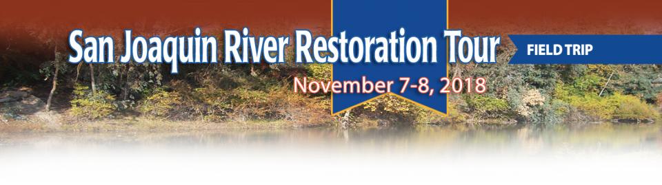
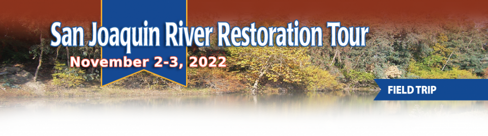
This tour traveled along the San Joaquin River to learn firsthand
about one of the nation’s largest and most expensive river
restoration projects.
The San Joaquin River was the focus of one of the most
contentious legal battles in California water history,
ending in a 2006 settlement between the federal government,
Friant Water Users Authority and a coalition of environmental
groups.
Hampton Inn & Suites Fresno
327 E Fir Ave
Fresno, CA 93720
Martha Guzman recalls those awful
days working on water and other issues as a deputy legislative
secretary for then-Gov. Jerry Brown. California was mired in a
recession and the state’s finances were deep in the red. Parks
were cut, schools were cut, programs were cut to try to balance a
troubled state budget in what she remembers as “that terrible
time.”
She now finds herself in a strikingly different position: As
administrator of the U.S. Environmental Protection Agency’s
Region 9, she has a mandate to address water challenges across
California, Nevada, Arizona and Hawaii and $1 billion to help pay
for it. It is the kind of funding, she said, that is usually
spread out over a decade. Guzman called it the “absolutely
greatest opportunity.”
For more than 20 years, Tanya
Trujillo has been immersed in the many challenges of the Colorado
River, the drought-stressed lifeline for 40 million people from
Denver to Los Angeles and the source of irrigation water for more
than 5 million acres of winter lettuce, supermarket melons and
other crops.
Trujillo has experience working in both the Upper and Lower
Basins of the Colorado River, basins that split the river’s water
evenly but are sometimes at odds with each other. She was a
lawyer for the state of New Mexico, one of four states in the
Upper Colorado River Basin, when key operating guidelines for
sharing shortages on the river were negotiated in 2007. She later
worked as executive director for the Colorado River Board of
California, exposing her to the different perspectives and
challenges facing California and the other states in the river’s
Lower Basin.
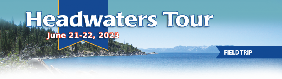
On average, more than 60 percent of
California’s developed water supply originates in the Sierra
Nevada and the southern spur of the Cascade Range. Our water
supply is largely dependent on the health of our Sierra forests,
which are suffering from ecosystem degradation, drought,
wildfires and widespread tree mortality.
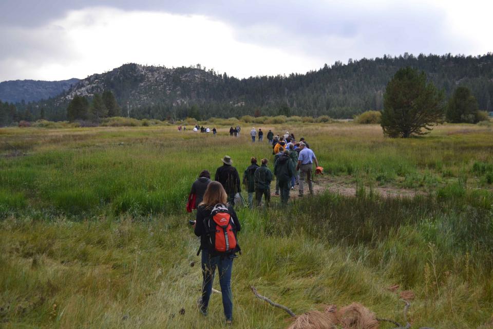
This tour ventured into the Sierra to examine water issues
that happen upstream but have dramatic impacts downstream and
throughout the state.
As California slowly emerges from
the depths of the COVID-19 pandemic, one remnant left behind by
the statewide lockdown offers a sobering reminder of the economic
challenges still ahead for millions of the state’s residents and
the water agencies that serve them – a mountain of water debt.
Water affordability concerns, long an issue in a state where
millions of people struggle to make ends meet, jumped into
overdrive last year as the pandemic wrenched the economy. Jobs
were lost and household finances were upended. Even with federal
stimulus aid and unemployment checks, bills fell by the wayside.
As California’s seasons become
warmer and drier, state officials are pondering whether the water
rights permitting system needs revising to better reflect the
reality of climate change’s effect on the timing and volume of
the state’s water supply.
A report by the State Water Resources Control Board recommends
that new water rights permits be tailored to California’s
increasingly volatile hydrology and be adaptable enough to ensure
water exists to meet an applicant’s demand. And it warns
that the increasingly whiplash nature of California’s changing
climate could require existing rights holders to curtail
diversions more often and in more watersheds — or open
opportunities to grab more water in climate-induced floods.
Groundwater provides about 40
percent of the water in California for urban, rural and
agricultural needs in typical years, and as much as 60 percent in
dry years when surface water supplies are low. But in many areas
of the state, groundwater is being extracted faster than it can
be replenished through natural or artificial means.
Voluntary agreements in California
have been touted as an innovative and flexible way to improve
environmental conditions in the Sacramento-San Joaquin Delta
and the rivers that feed it. The goal is to provide river flows
and habitat for fish while still allowing enough water to be
diverted for farms and cities in a way that satisfies state
regulators.
Shortly after taking office in 2019,
Gov. Gavin Newsom called on state agencies to deliver a Water
Resilience Portfolio to meet California’s urgent challenges —
unsafe drinking water, flood and drought risks from a changing
climate, severely depleted groundwater aquifers and native fish
populations threatened with extinction.
Within days, he appointed Nancy Vogel, a former journalist and
veteran water communicator, as director of the Governor’s Water
Portfolio Program to help shepherd the monumental task of
compiling all the information necessary for the portfolio. The
three state agencies tasked with preparing the document delivered
the draft Water Resilience Portfolio Jan. 3. The document, which
Vogel said will help guide policy and investment decisions
related to water resilience, is nearing the end of its comment
period, which goes through Friday, Feb. 7.
It’s been a year since two devastating wildfires on opposite ends
of California underscored the harsh new realities facing water
districts and cities serving communities in or adjacent to the
state’s fire-prone wildlands. Fire doesn’t just level homes, it
can contaminate water, scorch watersheds, damage delivery systems
and upend an agency’s finances.
To survive the next drought and meet
the looming demands of the state’s groundwater sustainability
law, California is going to have to put more water back in the
ground. But as other Western states have found, recharging
overpumped aquifers is no easy task.
Successfully recharging aquifers could bring multiple benefits
for farms and wildlife and help restore the vital interconnection
between groundwater and rivers or streams. As local areas around
California draft their groundwater sustainability plans, though,
landowners in the hardest hit regions of the state know they will
have to reduce pumping to address the chronic overdraft in which
millions of acre-feet more are withdrawn than are naturally
recharged.
Dates are now set for two key
Foundation events to kick off 2020 — our popular Water 101
Workshop, scheduled for Feb. 20 at McGeorge School of Law in
Sacramento, and our Lower Colorado River Tour, which will run
from March 11-13.
In addition, applications will be available by the first week of
October for our 2020 class of Water Leaders, our competitive
yearlong program for early to mid-career up-and-coming water
professionals. To learn more about the program, check out our
Water Leaders program
page.
Californians have been doing an
exceptional job
reducing their indoor water use, helping the state survive
the most recent drought when water districts were required to
meet conservation targets. With more droughts inevitable,
Californians are likely to face even greater calls to save water
in the future.
Bruce Babbitt, the former Arizona
governor and secretary of the Interior, has been a thoughtful,
provocative and sometimes forceful voice in some of the most
high-profile water conflicts over the last 40 years, including
groundwater management in Arizona and the reduction of
California’s take of the Colorado River. In 2016, former
California Gov. Jerry Brown named Babbitt as a special adviser to
work on matters relating to the Sacramento-San Joaquin Delta and
the Delta tunnels plan.
Groundwater helped make Kern County
the king of California agricultural production, with a $7 billion
annual array of crops that help feed the nation. That success has
come at a price, however. Decades of unchecked groundwater
pumping in the county and elsewhere across the state have left
some aquifers severely depleted. Now, the county’s water managers
have less than a year left to devise a plan that manages and
protects groundwater for the long term, yet ensures that Kern
County’s economy can continue to thrive, even with less water.
The growing leadership of women in water. The Colorado River’s persistent drought and efforts to sign off on a plan to avert worse shortfalls of water from the river. And in California’s Central Valley, promising solutions to vexing water resource challenges.
These were among the topics that Western Water news explored in 2018.
We’re already planning a full slate of stories for 2019. You can sign up here to be alerted when new stories are published. In the meantime, take a look at what we dove into in 2018:
In 1983, a landmark California Supreme Court ruling extended the public trust doctrine to tributary creeks that feed Mono Lake, which is a navigable water body even though the creeks themselves were not. The ruling marked a dramatic shift in water law and forced Los Angeles to cut back its take of water from those creeks in the Eastern Sierra to preserve the lake.
Now, a state appellate court has for the first time extended that same public trust doctrine to groundwater that feeds a navigable river, in this case the Scott River flowing through a picturesque valley of farms and alfalfa in Siskiyou County in the northern reaches of California.
There’s going to be a new governor
in California next year – and a host of challenges both old and
new involving the state’s most vital natural resource, water.
So what should be the next governor’s water priorities?
That was one of the questions put to more than 150 participants
during a wrap-up session at the end of the Water Education
Foundation’s Sept. 20 Water Summit in Sacramento.
Sixty percent of California’s developed water supply
originates high in the Sierra Nevada mountains. Our water
supply is largely dependent on the health of our Sierra forests,
which are suffering from ecosystem degradation, drought,
wildfires and widespread tree mortality.
We headed into the foothills and the mountains to examine
water issues that happen upstream but have dramatic impacts
downstream and throughout the state.
GEI (Tour Starting Point)
2868 Prospect Park Dr.
Rancho Cordova, CA 95670.
Spurred by drought and a major
policy shift, groundwater management has assumed an unprecedented
mantle of importance in California. Local agencies in the
hardest-hit areas of groundwater depletion are drawing plans to
halt overdraft and bring stressed aquifers to the road of
recovery.
Along the way, an army of experts has been enlisted to help
characterize the extent of the problem and how the Sustainable
Groundwater Management Act of 2014 is implemented in a manner
that reflects its original intent.
For decades, cannabis has been grown
in California – hidden away in forested groves or surreptitiously
harvested under the glare of high-intensity indoor lamps in
suburban tract homes.
In the past 20 years, however, cannabis — known more widely as
marijuana – has been moving from being a criminal activity to
gaining legitimacy as one of the hundreds of cash crops in the
state’s $46 billion-dollar agriculture industry, first legalized
for medicinal purposes and this year for recreational use.
As we continue forging ahead in 2018
with our online version of Western Water after 40 years
as a print magazine, we turned our attention to a topic that also
got its start this year: recreational marijuana as a legal use.
State regulators, in the last few years, already had been beefing
up their workforce to tackle the glut in marijuana crops and
combat their impacts to water quality and supply for people, fish
and farming downstream. Thus, even if these impacts were perhaps
unbeknownst to the majority of Californians who approved
Proposition 64 in 2016, we thought it important to see if
anything new had evolved from a water perspective now that
marijuana was legal.
Joaquin Esquivel learned that life is
what happens when you make plans. Esquivel, who holds the public
member slot at the State Water Resources Control Board in
Sacramento, had just closed purchase on a house in Washington
D.C. with his partner when he was tapped by Gov. Jerry Brown a
year ago to fill the Board vacancy.
Esquivel, 35, had spent a decade in Washington, first in several
capacities with then Sen. Barbara Boxer, D-Calif., and then as
assistant secretary for federal water policy at the California
Natural Resources Agency. As a member of the State Water Board,
he shares with four other members the difficult task of
ensuring balance to all the uses of California’s water.
Sixty percent of California’s developed water supply
originates high in the Sierra Nevada mountains. Our water
supply is largely dependent on the health of our Sierra forests,
which are suffering from ecosystem degradation, drought,
wildfires and widespread tree mortality.
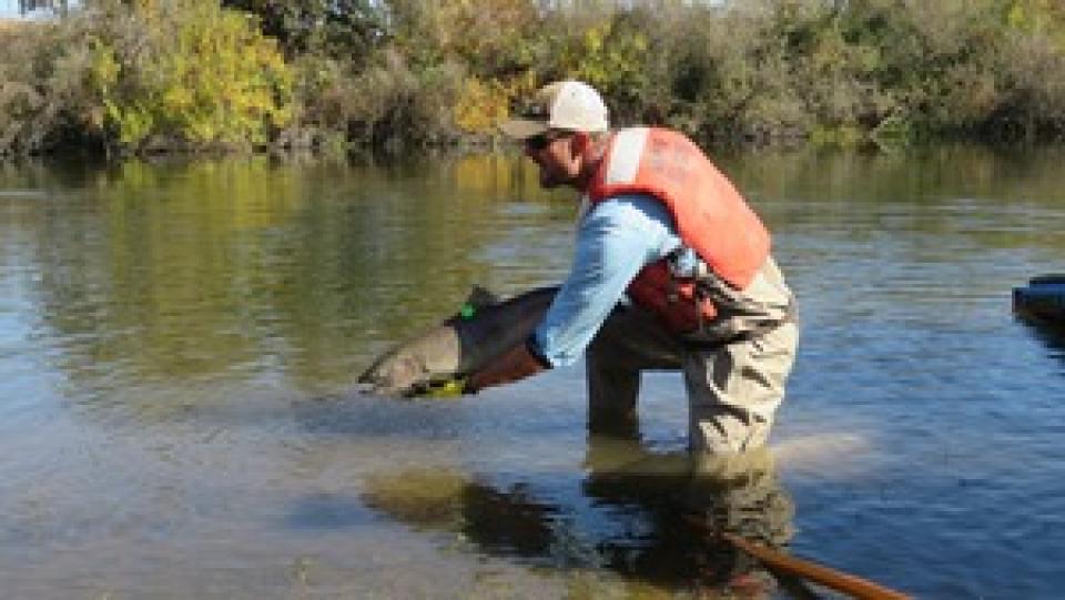
Participants of this tour snaked along the San Joaquin River to
learn firsthand about one of the nation’s largest and most
expensive river restoration projects.
The San Joaquin River was the focus of one of the most
contentious legal battles in California water history,
ending in a 2006 settlement between the federal government,
Friant Water Users Authority and a coalition of environmental
groups.
Water conservation has become a way of life throughout the West
with a growing recognition that water supply is not unlimited.
Drought is the most common motivator of increased water
conservation. However, the gradual drying of the West due to
climate change means the amount of fresh water available for
drinking, irrigation, industry and other uses must be used as
efficiently as possible.
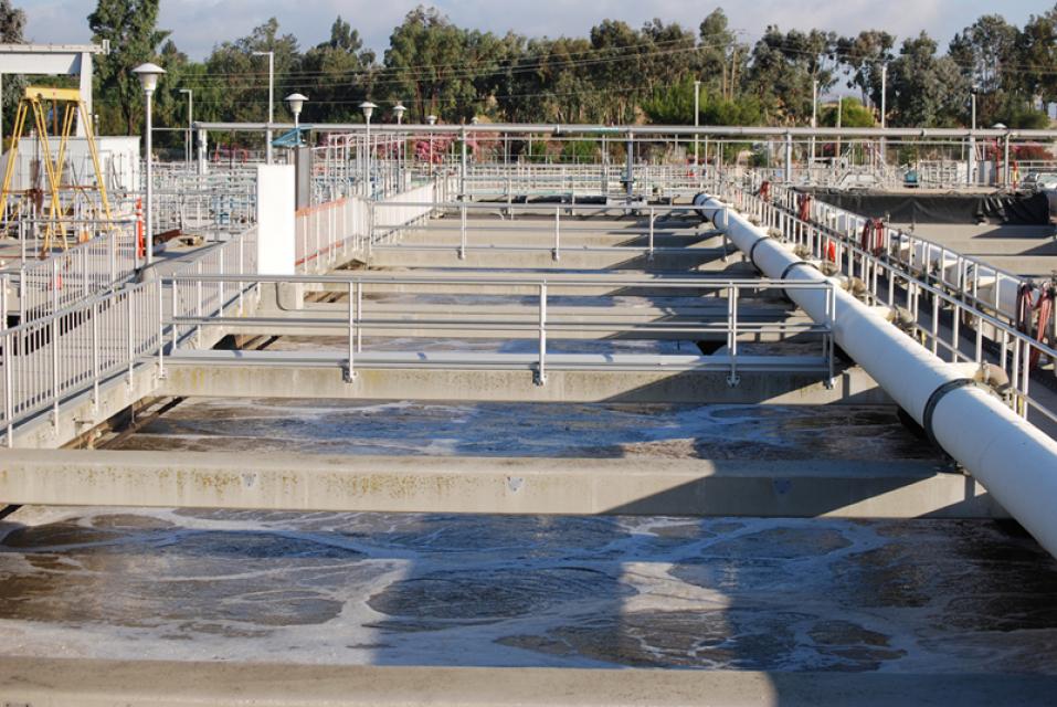
Wastewater management in California centers on the collection,
conveyance,
treatment, reuse and disposal of wastewater. This process is
conducted largely by public agencies, though there are also
private systems in places where a publicly owned treatment plant
is not feasible.
In California, wastewater treatment takes place through 100,000
miles of sanitary sewer lines and at more than 900 wastewater
treatment plants that manage the roughly 4 billion gallons of
wastewater generated in the state each day.
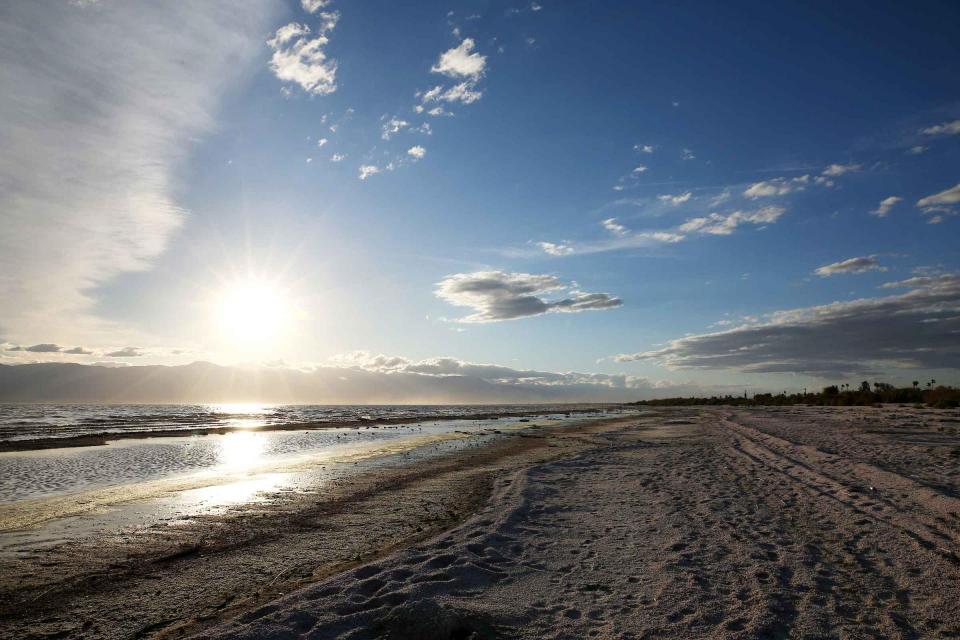
As part of the historic Colorado
River Delta, the Salton Sea regularly filled and dried for
thousands of years due to its elevation of 237 feet below
sea level.
The most recent version of the Salton Sea was formed in 1905 when
the Colorado River broke
through a series of dikes and flooded the seabed for two years,
creating California’s largest inland body of water. The
Salton Sea, which is saltier than the Pacific Ocean, includes 130
miles of shoreline and is larger than Lake Tahoe.
The federal Safe Drinking Water Act sets standards for drinking
water quality in the United States.
Launched in 1974 and administered by the U.S. Environmental
Protection Agency, the Safe Drinking Water Act oversees states,
communities, and water suppliers who implement the drinking water
standards at the local level.
The act’s regulations apply to every public water system in the
United States but do not include private wells serving less than
25 people.
According to the EPA, there are more than 160,000 public water
systems in the United States.
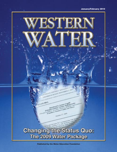
This printed issue of Western Water looks at some of
the pieces of the 2009 water legislation, including the Delta
Stewardship Council, the new requirements for groundwater
monitoring and the proposed water bond.
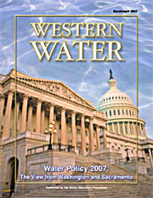
This issue of Western Water looks at the political
landscape in Washington, D.C., and Sacramento as it relates to
water issues in 2007. Several issues are under consideration,
including the means to deal with impending climate change, the
fate of the San Joaquin River, the prospects for new surface
storage in California and the Delta.
2002 marks the 30th anniversary of one of the most significant
environmental laws in American history, the Clean Water Act
(CWA). The CWA has had remarkable success, reversing years of
neglect and outright abuse of the nation’s waters. But challenges
remain as attention turns to the thorny issue of cleaning up
nonpoint sources of pollution.
This printed issue of Western Water, based on presentations
at the November 3-4, 2010 Water Quality Conference in Ontario,
Calif., looks at constituents of emerging concerns (CECs) – what
is known, what is yet to be determined and the potential
regulatory impacts on drinking water quality.
This printed issue of Western Water discusses low
impact development and stormwater capture – two areas of emerging
interest that are viewed as important components of California’s
future water supply and management scenario.
This printed issue of Western Water examines the issues
associated with the State Water Board’s proposed revision of the
water quality Bay-Delta Plan, most notably the question of
whether additional flows are needed for the system, and how they
might be provided.
This printed issue of Western Water looks at hydraulic
fracturing, or “fracking,” in California. Much of the information
in the article was presented at a conference hosted by the
Groundwater Resources Association of California.
This printed issue of Western Water examines the
Colorado River Basin Water Supply and Demand Study and what its
finding might mean for the future of the lifeblood of the
Southwest.
This printed issue of Western Water features a
roundtable discussion with Anthony Saracino, a water resources
consultant; Martha Davis, executive manager of policy development
with the Inland Empire Utilities Agency and senior policy advisor
to the Delta Stewardship Council; Stuart Leavenworth, editorial
page editor of The Sacramento Bee and Ellen Hanak, co-director of
research and senior fellow at the Public Policy Institute of
California.
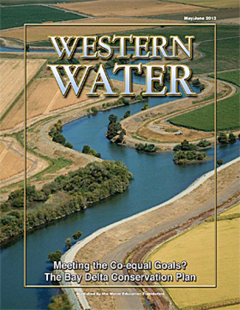
This issue of Western Water looks at the BDCP and the
Coalition to Support Delta Projects, issues that are aimed at
improving the health and safety of the Delta while solidifying
California’s long-term water supply reliability.
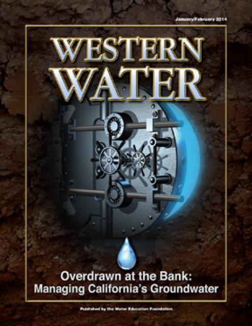
This printed issue of Western Water looks at California
groundwater and whether its sustainability can be assured by
local, regional and state management. For more background
information on groundwater please refer to the Foundation’s
Layperson’s Guide to Groundwater.
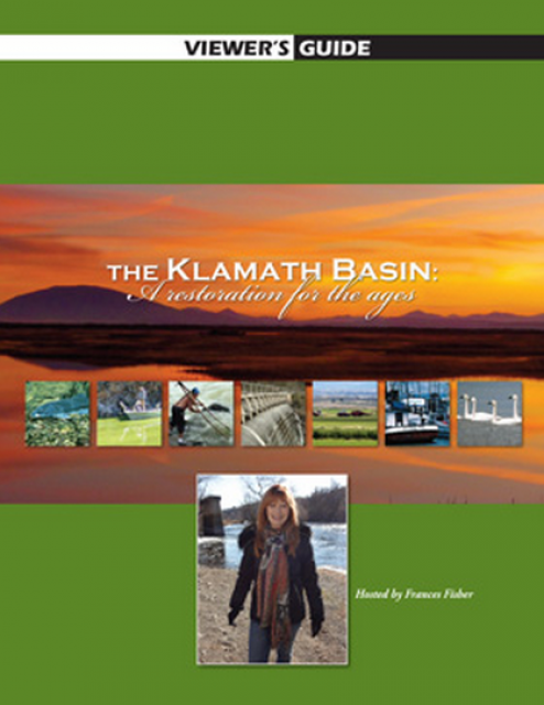
20-minute version of the 2012 documentary The Klamath Basin: A
Restoration for the Ages. This DVD is ideal for showing at
community forums and speaking engagements to help the public
understand the complex issues related to complex water management
disputes in the Klamath River Basin. Narrated by actress Frances
Fisher.
For over a century, the Klamath River Basin along the Oregon and
California border has faced complex water management disputes. As
relayed in this 2012, 60-minute public television documentary
narrated by actress Frances Fisher, the water interests range
from the Tribes near the river, to energy producer PacifiCorp,
farmers, municipalities, commercial fishermen, environmentalists
– all bearing legitimate arguments for how to manage the water.
After years of fighting, a groundbreaking compromise may soon
settle the battles with two epic agreements that hold the promise
of peace and fish for the watershed. View an excerpt from the
documentary here.
The Water Education Foundation’s second edition of
the Layperson’s Guide to The Klamath River Basin is
hot off the press and available for purchase.
Updated and redesigned, the easy-to-read overview covers the
history of the region’s tribal, agricultural and environmental
relationships with one of the West’s largest rivers — and a
vast watershed that hosts one of the nation’s oldest and
largest reclamation projects.
The 24-page Layperson’s Guide to the Central Valley Project
explores the history and development of the federal Central
Valley Project (CVP), California’s largest surface water delivery
system. In addition to the project’s history, the guide describes
the various facilities, operations and benefits the water
project brings to the state along with the CVP
Improvement Act (CVPIA).
The 28-page Layperson’s Guide to Water Rights Law, recognized as
the most thorough explanation of California water rights law
available to non-lawyers, traces the authority for water flowing
in a stream or reservoir, from a faucet or into an irrigation
ditch through the complex web of California water rights.
30-minute DVD that traces the history of the U.S. Bureau of
Reclamation and its role in the development of the West. Includes
extensive historic footage of farming and the construction of
dams and other water projects, and discusses historic and modern
day issues.
Water truly has shaped California into the great state it is
today. And if it is water that made California great, it’s the
fight over – and with – water that also makes it so critically
important. In efforts to remap California’s circulatory system,
there have been some critical events that had a profound impact
on California’s water history. These turning points not only
forced a re-evaluation of water, but continue to impact the lives
of every Californian. This 2005 PBS documentary offers a
historical and current look at the major water issues that shaped
the state we know today. Includes a 12-page viewer’s guide with
background information, historic timeline and a teacher’s lesson.
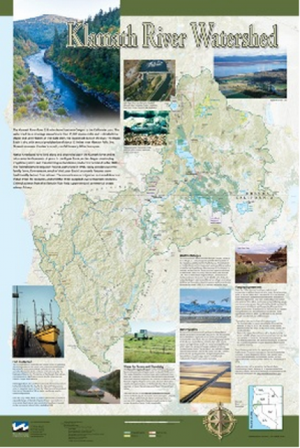
This beautiful 24×36-inch poster, suitable for framing, displays
the rivers, lakes and reservoirs, irrigated farmland, urban areas
and Indian reservations within the Klamath River Watershed. The
map text explains the many issues facing this vast,
15,000-square-mile watershed, including fish restoration;
agricultural water use; and wetlands. Also included are
descriptions of the separate, but linked, Klamath Basin
Restoration Agreement and the Klamath Hydroelectric Agreement,
and the next steps associated with those agreements. Development
of the map was funded by a grant from the U.S. Fish and Wildlife
Service.
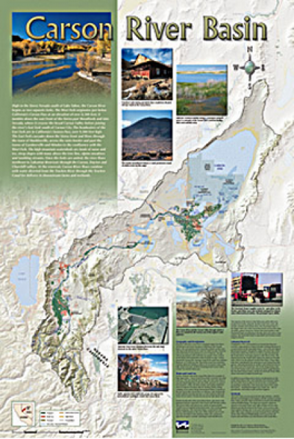
A companion to the Truckee River Basin Map poster, this
24×36-inch poster, suitable for framing, explores the Carson
River, and its link to the Truckee River. The map includes the
Lahontan Dam and reservoir, the Carson Sink, and the farming
areas in the basin. Map text discusses the region’s hydrology and
geography, the Newlands Project, land and water use within the
basin and wetlands. Development of the map was funded by a grant
from the U.S. Bureau of Reclamation Mid-Pacific Region, Lahontan
Basin Area Office.
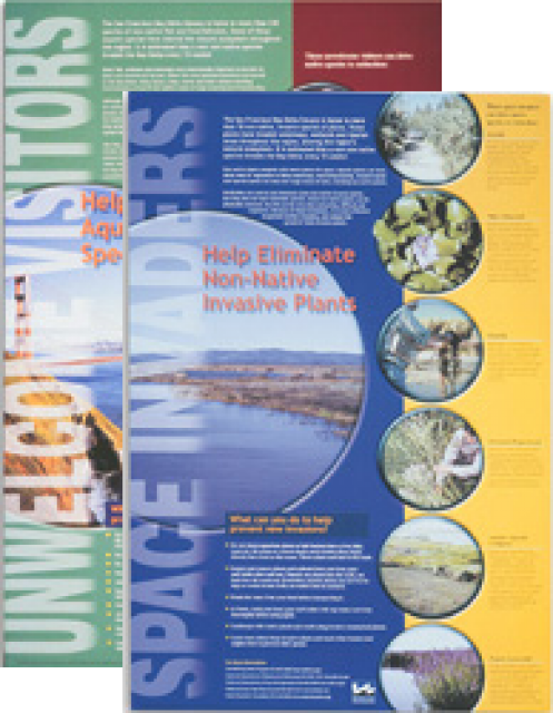
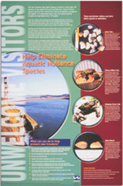
This 24×36 inch poster, suitable for framing, explains how
non-native invasive animals can alter the natural ecosystem,
leading to the demise of native animals. “Unwelcome Visitors”
features photos and information on four such species – including
the zerbra mussel – and explains the environmental and economic
threats posed by these species.
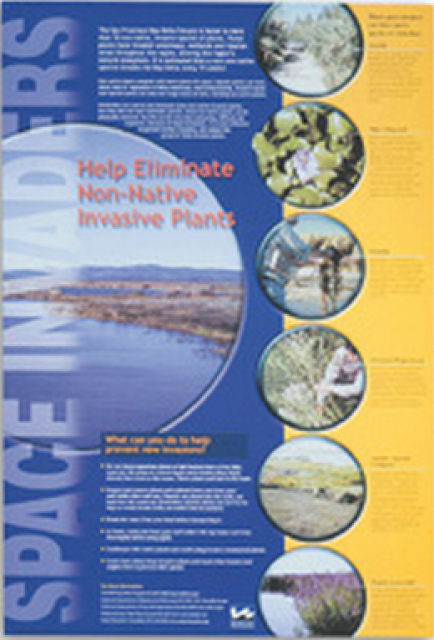
This 24×36 inch poster, suitable for framing, explains how
non-native invasive plants can alter the natural ecosystem,
leading to the demise of native plants and animals. “Space
Invaders” features photos and information on six non-native
plants that have caused widespread problems in the Bay-Delta
Estuary and elsewhere.


")
")
")
")
")
")
")
")
")
")
")
")
")
: Karla Nemeth, director, California Department of Water Resources; Gloria Gray, chair, Metropolitan Water District of Southern California; Brenda Burman, Bureau of Reclamation Commissioner; Jayne Harkins, commissioner, International Boundary and Water Commission, U.S. and Mexico; Amy Haas, executive director, Upper Colorado River Commission.")
")
")
")
")