In rural areas with widely dispersed houses, reliance upon a
centralized
sewer system is not practical compared to individual
wastewater treatment methods. These on-site management facilities
– or septic systems – are more commonplace given their simpler
structure, efficiency and easy maintenance.
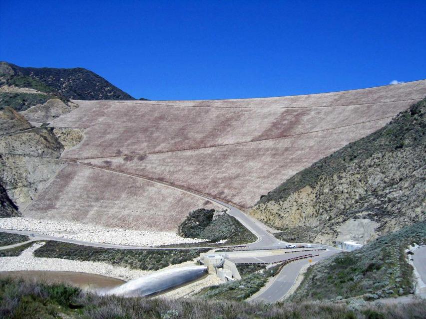
Completed in 1999, the Seven Oaks
Dam is a 550-feet-high earthen dam
on the Santa Ana River.
Its construction at the base of the San Bernardino Mountains was
a major component of the Santa Ana River
Mainstem Project, costing $534 million and meant to protect
the more than 2 million citizens of Orange, Riverside and San
Bernardino counties from flooding. To accomplish this, the dam
releases only 7,000 cubic feet per second (cfs) of the 85,000 cfs
flowing into it, giving it 350-year flood
protection. The rest of this flood control project
consisted of raising the already existing Prado Dam downstream and
building additional channels.
Shasta Dam forms California’s
largest storage reservoir, Shasta Lake, which can hold about 4.5
million acre-feet.
As the keystone of the federal Central Valley Project,
Shasta stands among the world’s largest dams. Construction on the dam began in 1938
and was completed in 1945, with flood control as the
highest priority.
Stretching 450 miles long and up to
50 miles wide, the Sierra Nevada makes up more than a quarter of
California’s land area and forms its largest watersheds,
providing more than half of the state’s developed water supply to
residents, agriculture and other businesses.*
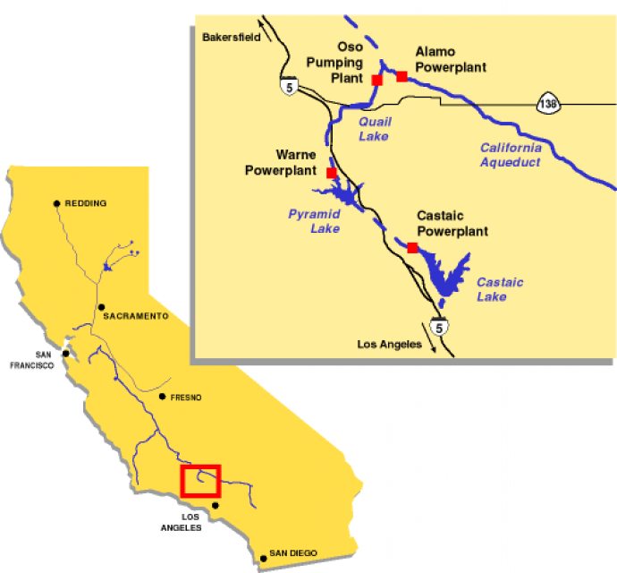
Silverwood Lake in the San Bernardino Mountains in Southern
California is part of the State Water
Project (SWP), storing water for Inland Empire cities
such as San Bernardino and Riverside. The water is conveyed to
Silverwood Lake via the SWP’s East Branch Aqueduct.
Formed by the 249-foot-high Cedar Springs Dam, Silverwood Lake
was constructed between 1968 and 1971 to provide water storage
and recreation and assure flows through the Devil Canyon
Powerplant near San Bernardino.
Sinkholes are caused by erosion of rocks beneath soil’s surface.
Groundwater dissolves soft rocks such as gypsum, salt and
limestone, leaving gaps in the originally solid structure. This
is exacerbated when water is acidic from contact with carbon
dioxide or acid rain. Even humidity can play a major role in
destabilizing water underground.
The land remains intact until the spaces become too big to
support the surface above – called “overburden” – causing it to
collapse and create a “sinkhole.” They can be undetectably
small or hundreds of miles in diameter.
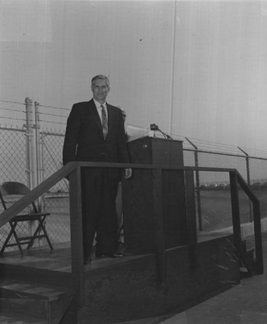
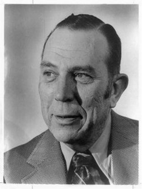
Bernice Frederic “B.F.” “Bernie” Sisk (1910-1995) represented the
San Joaquin Valley in the U.S. Congress for nearly a quarter of a
century from 1955-1978.
The proposed Sites Reservoir would
be a 1.5 million-acre-foot off-river storage basin on the west
side of the Sacramento Valley, about 78 miles northwest of
Sacramento. It would capture stormwater flows from the Sacramento River for release in
dry years for fish and wildlife, farms, communities and
businesses.
Robert A. Skinner (1895-1986) was the Metropolitan Water District
of Southern California general manager from 1962-1967. An
engineer, he was instrumental in negotiating the district’s
contract with the California Department of Water Resources for
delivery of water from Northern California. Both Lake Skinner and
a treatment plant in southwestern Riverside County were named in
his honor.
Sloughs (pronounced “slews”) are shallow lakes or swamps. Generally
they serve as backwaters –
or a stagnant part of a river – and are consequently located at
edges of rivers where a stream or other canal once flowed.
Lester A. Snow, the mastermind behind
countless water resources management projects, has been involved
in water issues in two states, both the public and private
sectors and on regional, state and federal levels of government.
In a timeline of his career, Snow served from 1988-1995 as the
general manager of the San Diego County Water Authority after
leaving the Arizona Department of Water Resources. From
1995-1999, he was the executive director of the CALFED Bay-Delta
Program, which included a team of both federal and state
agencies.
Springs are where groundwater becomes surface water, acting as openings
where subsurface water can discharge onto the ground or directly
into other water bodies. They can also be considered the
consequence of an overflowing
aquifer. As a result, springs often serve as headwaters to streams.
The Stanislaus River empties into the San Joaquin River from the
east along with the Merced
and Tuolumne rivers.
Although some agricultural drainage
flows into these rivers in their lower reaches, the water quality
is relatively good in each of the three tributaries.
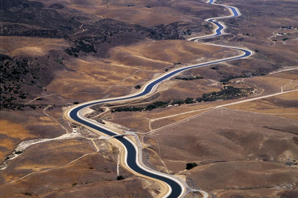
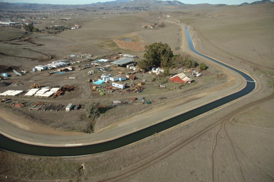
The State Water Project is a lifeline for California because of its vital role in bringing water to cities and farms. Without it, California would never have developed into the economic powerhouse it is.
One of two State Water
Project aqueducts serving Southern California, the East
Branch Aqueduct stores water in Silverwood Lake and Lake Perris.
After being pumped over the Tehachapi Mountains from the Edmonston Pumping
Plant, water for the East Branch Aqueduct passes through
Palmdale and Lancaster [see also West Branch Aqueduct]. The
water is then stored for distribution to Inland Empire cities
such as San Bernardino and Riverside.
The West Branch Aqueduct supplies water for Los Angeles and other
Southern California cities.
The West Branch is one of two State Water Project
aqueducts serving Southern California.
After being pumped over the Tehachapi Mountains from the Edmonston Pumping
Plant, water for the West Branch Aqueduct is then stored in
Pyramid Lake and Castaic Lake [See also East Branch Aqueduct, which
serves the Inland Empire near Riverside.]
Ron Stork, the award-winning policy director of the Friends of
the River, joined the statewide California river conservation
group in 1987 as its associate conservation director. Previously
he was executive director of the Merced Canyon Committee, where
he directed the successful effort to obtain the National Wild and
Scenic River designation for the Merced River.


")