Header link June 22, 2020

LinkedIn

  • Read more
Header link September 15, 2014

Cart

  • Read more
Header link November 3, 2015

Donate Now

  • Read more
Header link May 15, 2014

Twitter

  • Read more
Header link May 15, 2014

Facebook

  • Read more
Instagram
Header link May 15, 2014

Instagram

  • Read more
Header link May 15, 2014

Contact Us

  • Read more
More options
Water Education Foundation
Home

Water Education Foundation

Everything about California water that matters
  • Water Academy
    • Agriculture
      • Agricultural Conservation
      • Agricultural Drainage
    • Background Information
      • Legislation — California and Federal
      • Regulations — California and Federal
      • Water History
      • Water Rights
    • Bay-Delta
      • Bay Delta
      • Bay Delta Conservation Plan
      • Delta Issues
      • Delta Smelt
      • Sacramento San Joaquin Delta
      • San Francisco Bay
      • Suisun Marsh
    • Dams, Reservoirs and Water Projects
      • California Aqueduct
      • Central Valley Project
      • Folsom Dam
      • Friant Dam
      • Hetch Hetchy
      • Hoover Dam
      • Infrastructure
      • Lake Mead
      • Lake Powell
      • Oroville Dam
      • San Luis Dam
      • Shasta Dam
      • State Water Project
    • Environmental Issues
      • Anadromous Fish Restoration
      • Ecosystem
      • Endangered Species Act
      • Invasive species
      • Lake Tahoe
      • Mono Lake
      • Public Trust Doctrine
      • Salmon
      • San Joaquin River Restoration
      • Watershed
      • Wetlands
    • Leaders and Experts
    • Regions
      • Central Coast
      • Central Valley
      • Mexico
      • Nevada
      • North Coast
      • Pyramid Lake
      • Sacramento Valley
      • Salton Sea
      • San Joaquin Valley
      • Sierra Nevada
      • Southern California
      • Tulare Lake Basin
    • Rivers
      • Carson River
      • Colorado River
      • Klamath River
      • New River
      • North Coast Rivers
      • Russian River
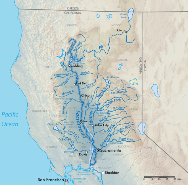
      • Sacramento River
      • Truckee River
      • San Joaquin River
    • Water Issues
      • Climate Change
      • Coronavirus
      • Drought
      • Earthquakes
      • Energy and Water
      • Floods
      • Fracking
      • Growth
      • Hydropower
      • Levees
      • Tribal Water Issues
      • Water Conservation
    • Water Quality
      • Drinking Water
      • Nitrate contamination
      • Pollution
      • Stormwater
      • Wastewater
      • Water Quality
    • Water Supply and Management
      • Acre Foot
      • Aquifers
      • California Water Plan
      • Conjunctive Use
      • Desalination
      • Grey water
      • Groundwater
      • Integrated Regional Water Management
      • Recreation
      • Surface Water
      • Water Marketing and Banking
      • Water Rates
      • Water Recycling
      • Water Supply
      • Water Transfers
  • Tours & Events
    • Water Tours
      • 2024 Tour Sponsors
    • Events
    • Event Calendar
    • Past Tours & Events
      • Anne J. Schneider Fund Lecture Series
  • Specialized Programs
    • Water Leaders
      • Cohort Rosters
      • Yearly Class Reports
      • Your Alumni Network
      • Alumni Profiles
    • Project WET
      • Workshops
      • Special Workshops & Events
      • Supplementary Materials
      • California Content Standard Correlations
      • Facilitator's Trainings
      • Foundation School Programs
        • Elementary Programs
        • Secondary Programs
      • Water Kids
      • California Project WET Gazette
      • Gazette Archives
    • Colorado River Project
    • GRA Scholastic Fund Program
  • Maps & Guides
    • Maps & Posters
    • Layperson's Guides
    • Map & Guide Bundles
    • Books
    • Colorado River Materials
    • California Runoff Rundown
    • Other Publications
    • Water Awareness Materials
    • Downloadable Publications
    • Videos and DVDs
      • Video Clips
    • School Age Publications
    • Stickers
    • Free Programs and Publications
  • Newsroom
    • Western Water News
    • Aquafornia
      • About Aquafornia
    • Information Desk
    • Western Water Magazine Archive
      • Full Print Edition
      • Print Edition Excerpts
    • River Report Archive
  • Aquapedia
    • Alphabetical List of Subjects
      • A
      • B
      • C
      • D
      • E
      • F
      • G
      • H
      • I
      • J
      • K
      • L
      • M
      • N
      • O
      • P
      • Q
      • R
      • S
      • T
      • U
      • V
      • W
      • X
      • Y
      • Z
    • Historical Water People
    • Where Does My Water Come From?
      • Northern California
      • Sacramento
      • North Bay
      • South Bay
      • Central Valley
      • Los Angeles
      • Inland Empire
      • San Diego
      • All California Water Sources
    • Timelines
    • Videos
    • Image Gallery
    • Water Directory
      • Federal Agencies
      • State Agencies in California
      • Environmental Organizations
      • Other California Organizations
      • State and Federal Legislative Committees
      • Water Associations and Groups
      • Western States Water Agencies and Districts
    • Online Resources
    • Useful Acronyms
    • About Aquapedia
  • About
    • About Us
      • Board of Directors
      • Staff Biographies
      • Job Openings
    • Announcements
    • Support Our Mission
      • Become a Member
      • Donate in Honor/Memory
      • Planned Giving
    • Contact Us
Maps & Posters April 17, 2014 California Water Bundle

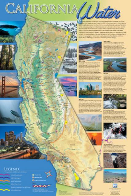
California Water Map
Updated December 2016

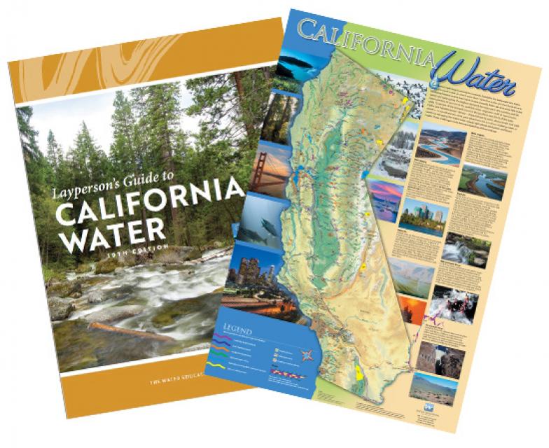
A new look for our most popular product! And it’s the perfect gift for the water wonk in your life.

Our 24×36-inch California Water Map is widely known for being the definitive poster that shows the integral role water plays in the state. On this updated version, it is easier to see California’s natural waterways and man-made reservoirs and aqueducts – including federally, state and locally funded projects – the wild and scenic rivers system, and natural lakes. The map features beautiful photos of California’s natural environment, rivers, water projects, wildlife, and urban and agricultural uses and the text focuses on key issues: water supply, water use, water projects, the Delta, wild and scenic rivers and the Colorado River.

Map is UV coated to resist fading. Suitable for framing, copies of the map are available for $20 each, plus applicable tax and shipping charges.

To order 10 copies or more at a discounted price, contact the Foundation at 916-444-6240.

  • Print-friendly

Referring Pages

Aquapedia background February 11, 2014 California Water Map Layperson's Guide to the State Water Project

State Water Project

California Aqueduct

The State Water Project is an aquatic lifeline for California because of its vital role in bringing water to cities and farms. Without it, California would never have developed into the economic powerhouse it is.

The Project diverts water from the Feather River to the Central Valley, South Bay Area and Southern California. Its key feature is the 444-mile-long California Aqueduct seen along Interstate 5.

  • Read more
Aquapedia background February 11, 2014 California Water Map Layperson's Guide to California Water

Sierra Nevada

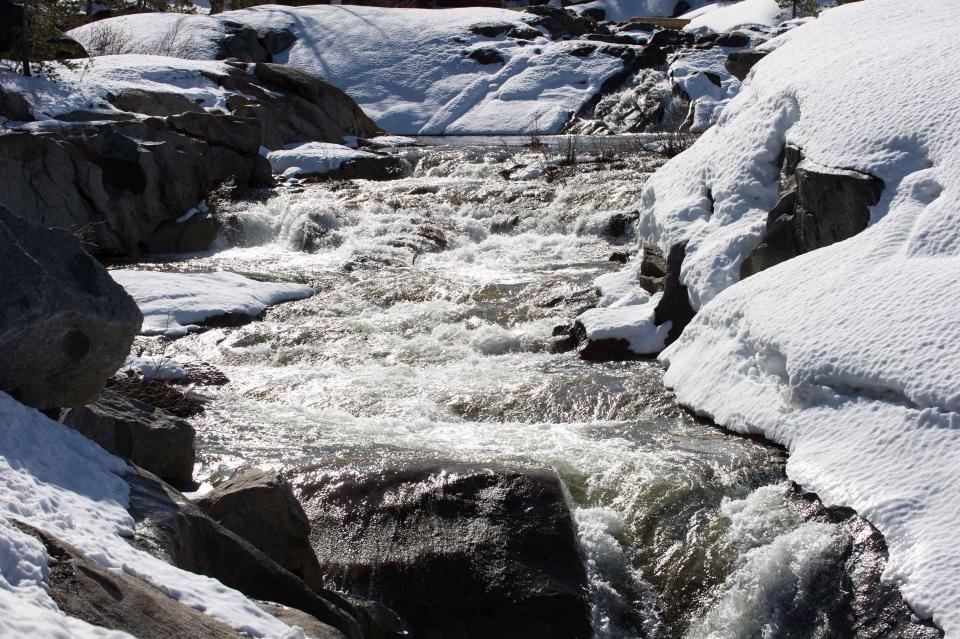
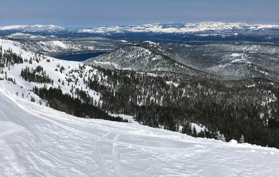
The Sierra NevadaStretching 450 miles long and up to 50 miles wide, the Sierra Nevada makes up more than a quarter of California’s land area and forms its largest watersheds, providing more than half of the state’s developed water supply to residents, agriculture and other businesses.*

  • Read more
Aquapedia background February 11, 2014 Dams Layperson's Guide to the Central Valley Project California Water Map

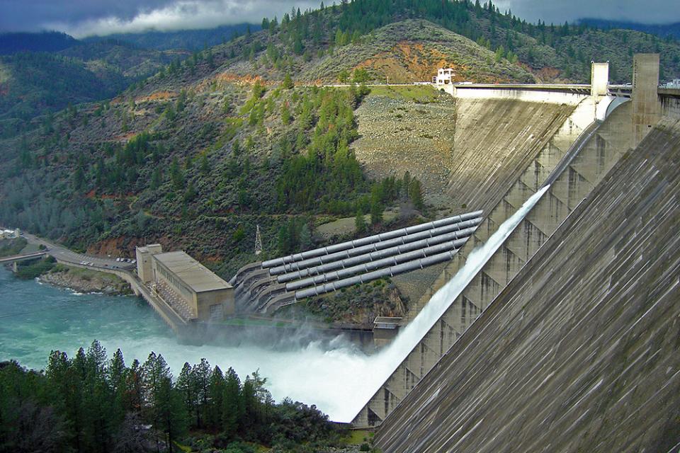
Shasta Dam

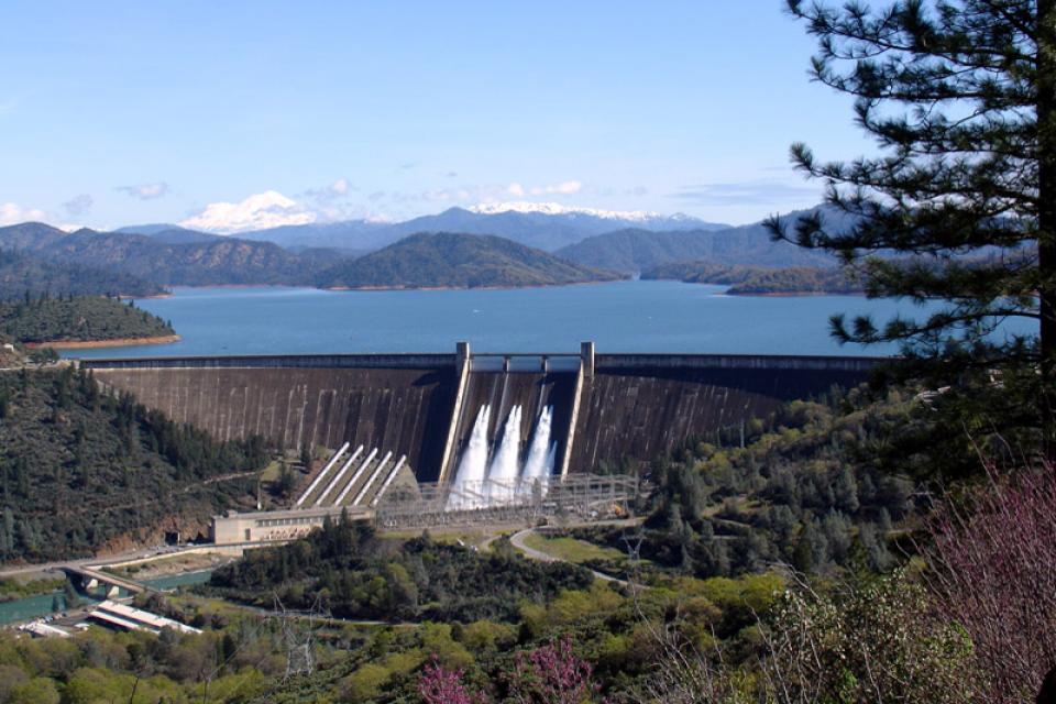
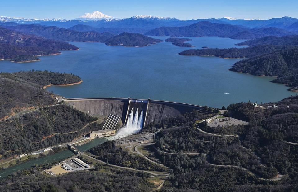
Image shows Shasta Dam from a distance, with the reservoir largely filled.Shasta Dam forms California’s largest storage reservoir, Shasta Lake, which can hold about 4.5 million acre-feet.

As the keystone of the federal Central Valley Project, Shasta stands among the world’s largest dams. Construction on the dam began in 1938 and was completed in 1945, with flood control as the highest priority.

  • Read more
Aquapedia background February 11, 2014 California Water Map Layperson's Guide to California Water

Safe Drinking Water Act

The federal Safe Drinking Water Act sets standards for drinking water quality in the United States.

Launched in 1974 and administered by the U.S. Environmental Protection Agency, the Safe Drinking Water Act oversees states, communities, and water suppliers who implement the drinking water standards at the local level.

The act’s regulations apply to every public water system in the United States but do not include private wells serving less than 25 people.

According to the EPA, there are more than 160,000 public water systems in the United States.

  • Read more
Aquapedia background February 11, 2014 California Water Map Layperson's Guide to California Water

Pacific Flyway

Sacramento National Wildlife RefugeThe Pacific Flyway is one of four major North American migration routes for birds, especially waterbirds, and stretches from Alaska in the north to Patagonia in South America.

Each year, birds follow ancestral patterns as they travel the flyway on their annual north-south migration. Along the way, they need stopover sites such as wetlands with suitable habitat and food supplies. In California, 95 percent of historic wetlands have been lost, yet the Central Valley hosts some of the world’s largest populations of wintering birds. 

  • Read more
Aquapedia background February 11, 2014 California Water Map Layperson's Guide to California Water

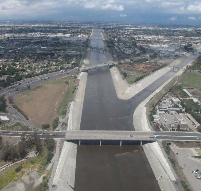
Los Angeles River

The Los Angeles River

The Los Angeles River is gradually being transformed from a giant, trash-strewn stormwater channel to a recreational and open space corridor that continues to provide flood control.

Deadly floods in the 1930s led the U.S. Army Corps of Engineers to straighten and pave nearly all 52 miles of the river channel in concrete. The trough was designed to keep flood water from destroying property, to manage the discharges from sewage treatment plants and to flush stormwater to the Pacific Ocean.

Since the 1990s, a grassroots campaign to restore some of the natural character of the river has gained political traction.

Los Angeles has the lowest ratio of open space per capita of any major American city, due to rapid growth and poor urban planning.

A bill passed by the state Legislature in 1992 established a Los Angeles River Conservancy to develop comprehensive planning strategies along the concrete corridor.

Additionally, a citizens’ group, Friends of the Los Angeles River, has helped coordinate the cleanup and rejuvenation of the river.

In the past, river advocates considered painting the river channel blue to give it a more natural look.

In 2010, the U.S. EPA deemed the river navigable and subject to the protections of the Clean Water Act. A year later, the Army Corps permitted kayaking along soft-bottom stretches north of downtown.

In 2014, the Army Corps recommended approval of Los Angeles County’s plan to restore habitat, widen the river, create wetlands, and invite new commercial and residential development. The county Board of Supervisors approved the Los Angeles River Master Plan in 2022.

In the winter of 2024, the river captured near-record precipitation from a series of intense atmospheric rivers, thanks to drain clearing and dredging of debris, Army Corps officials said.​

Los Angeles River supporters are looking beyond the river’s banks toward improved management of the Los Angeles River watershed as a whole. Advocates seek a strategy that integrates and coordinates the management of water quality, flood control and habitat restoration across jurisdictional boundaries.

  • Read more
Aquapedia background February 11, 2014 California Water Map California Water Map, Spanish

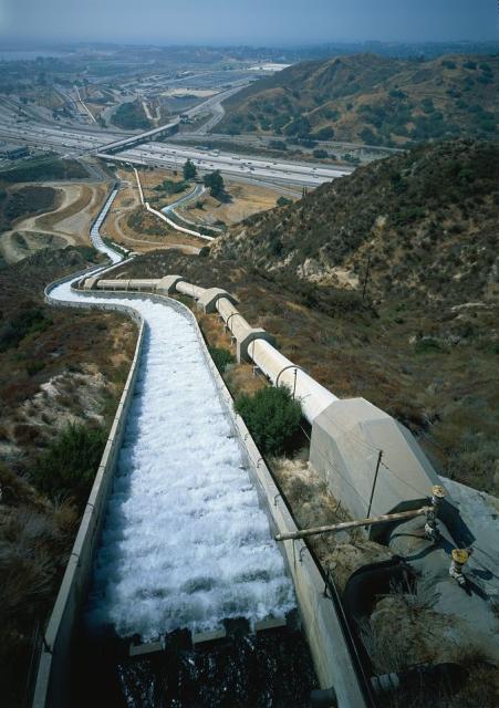
Los Angeles Aqueduct and Owens Valley

Los Angeles Aqueduct Cascades The Owens Valley in eastern California helped transform distant Los Angeles into today’s sprawling megalopolis.

More than 100 years ago, Los Angeles recognized the need to augment local water supplies and decided to tap faraway sources.

  • Read more
Aquapedia background February 4, 2014 California Water Map

Hydroelectric Power

Power plant at Shasta DamHydroelectric power is a relatively pollution-free source of electricity generated at a comparatively low cost. Its ability to generate electricity, however, can drop significantly during a drought.

In 2022, hydropower accounted for more than 28% of all renewable electricity generation in the nation, according to the U.S. Department of Energy.

  • Read more
Aquapedia background February 4, 2014 Layperson's Guide to California Water California Water Map

Hetch Hetchy Reservoir and Water System

Hetch Hetchy – a Sierra Miwok word for a type of wild grass – is a valley in Yosemite National Park whose river was dammed to create a water supply for the San Francisco Bay Area. The O’Shaughnessy Dam on the Tuolumne River forms Hetch Hetchy Reservoir.

Owned by the city of San Francisco, Hetch Hetchy Reservoir provides water to 2.7 million residents and businesses in the San Francisco Bay Area.

  • Read more
Aquapedia background February 3, 2014 California Water Map Layperson's Guide to California Water

Federal Endangered Species Act

The federal government passed the Endangered Species Act in 1973, following earlier legislation. The first, the  Endangered Species Preservation Act of 1966, authorized land acquisition to conserve select species. The Endangered Species Conservation Act of 1969 then expanded on the 1966 act, and authorized “the compilation of a list of animals “threatened with worldwide extinction” and prohibits their importation without a permit.”

  • Read more
Aquapedia background February 3, 2014 All Things Drought California Water Map Layperson's Guide to Water Conservation Water Conservation Tips Up Close and Personal: Water Use at Home Drought FAQs

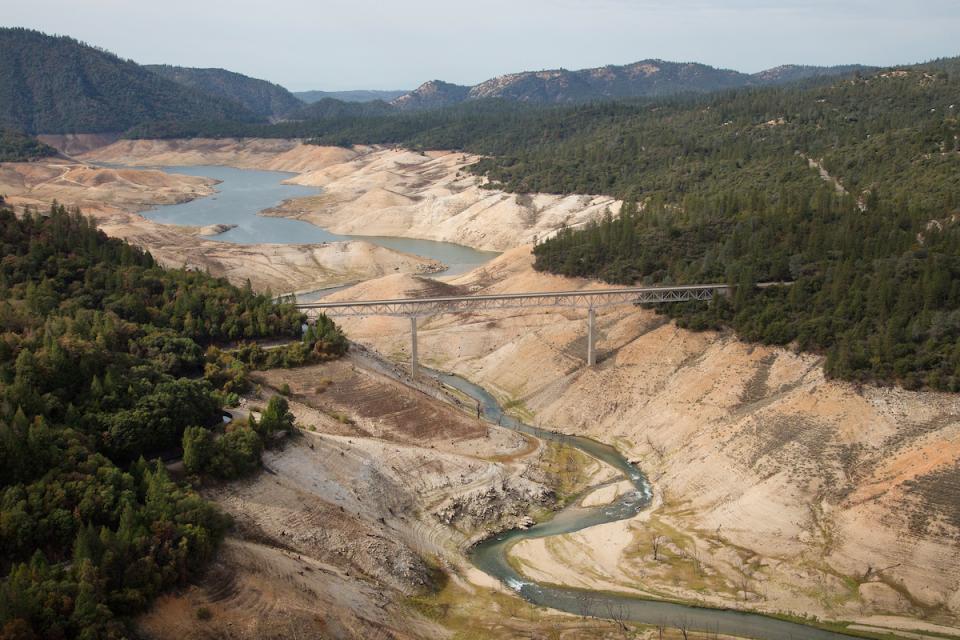
Drought

Lake Oroville shows the effects of drought in 2014.

Drought—an extended period of limited or no precipitation—is a fact of life in California and the West, with water resources following boom-and-bust patterns. During California’s 2012–2016 drought, much of the state experienced severe drought conditions: significantly less precipitation and snowpack, reduced streamflow and higher temperatures. Those same conditions reappeared early in 2021 prompting Gov. Gavin Newsom in May to declare drought emergencies in watersheds across 41 counties in California.

  • Read more
Aquapedia background January 30, 2014 Layperson's Guide to Climate Change and Water Resources California Water Map Colorado River Basin Map

Climate Change

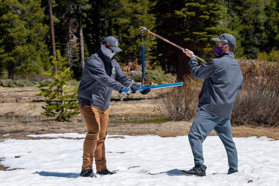
California Department of Water Resources snow survey in the Sierra Nevada.

Climate change involves natural and man-made changes to weather patterns that occur over millions of years or over multiple decades.

In the past 150 years, human industrial activity has accelerated the rate of change in the climate due to the increase in greenhouse gases (carbon dioxide, methane and nitrous oxide, among others). Scientific studies describing this climate change continue to be produced and its expected impacts continue to be assessed.

  • Read more
Aquapedia background January 30, 2014 California Water Map Layperson's Guide to California Water

California Water Plan

Every five years the California Department of Water Resources updates its strategic plan for managing the state’s water resources, as required by state law.

The California Water Plan, or Bulletin 160, projects the status and trends of the state’s water supplies and demands under a range of future scenarios.

  • Read more
Aquapedia background January 30, 2014 Layperson's Guide to California Water California Water Map Water & the Shaping of California

California Water Overview

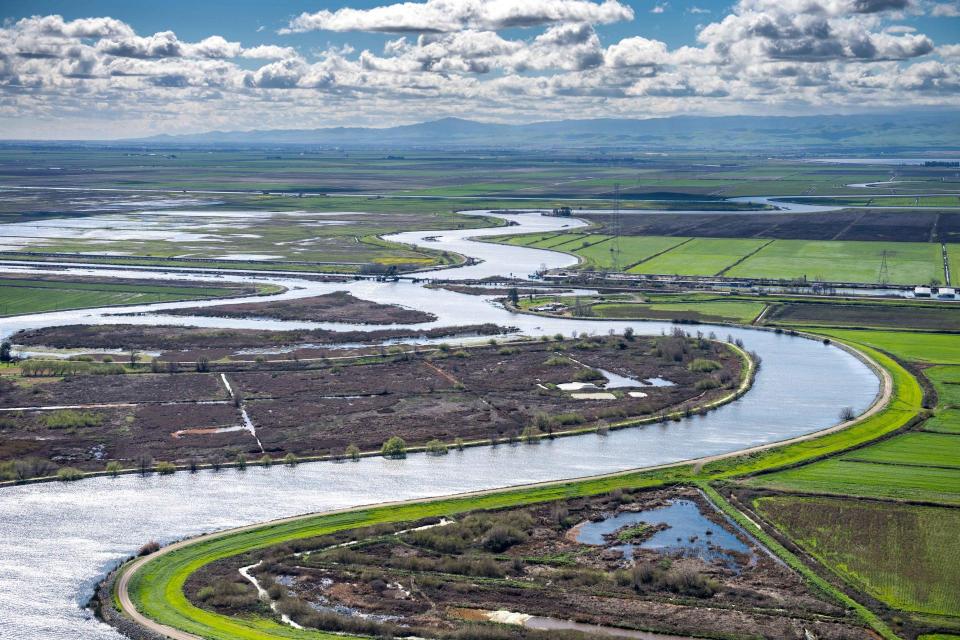
Aerial view of the Sacramento-San Joaquin DeltaCalifornia will always be inextricably linked to its water resources. Water continues to shape the state’s development and no resource is as vital to California’s urban centers, farms, industry, recreation, scenic beauty and environmental preservation.

But California’s relationship to water is also one that continues to generate controversy.

  • Read more
Aquapedia background January 30, 2014 California Water Map Layperson's Guide to California Water

California Environmental Quality Act

The California Environmental Quality Act, commonly known as CEQA, is foundational to the state’s environmental protection efforts. The law requires proposed developments with the potential for “significant” impacts on the physical environment to undergo an environmental review. 

Since its passage in 1970, CEQA (based on the National Environmental Policy Act) has served as a model for similar legislation in other states.

  • Read more
Aquapedia background January 30, 2014 California Water Map Layperson's Guide to the State Water Project

California Aqueduct

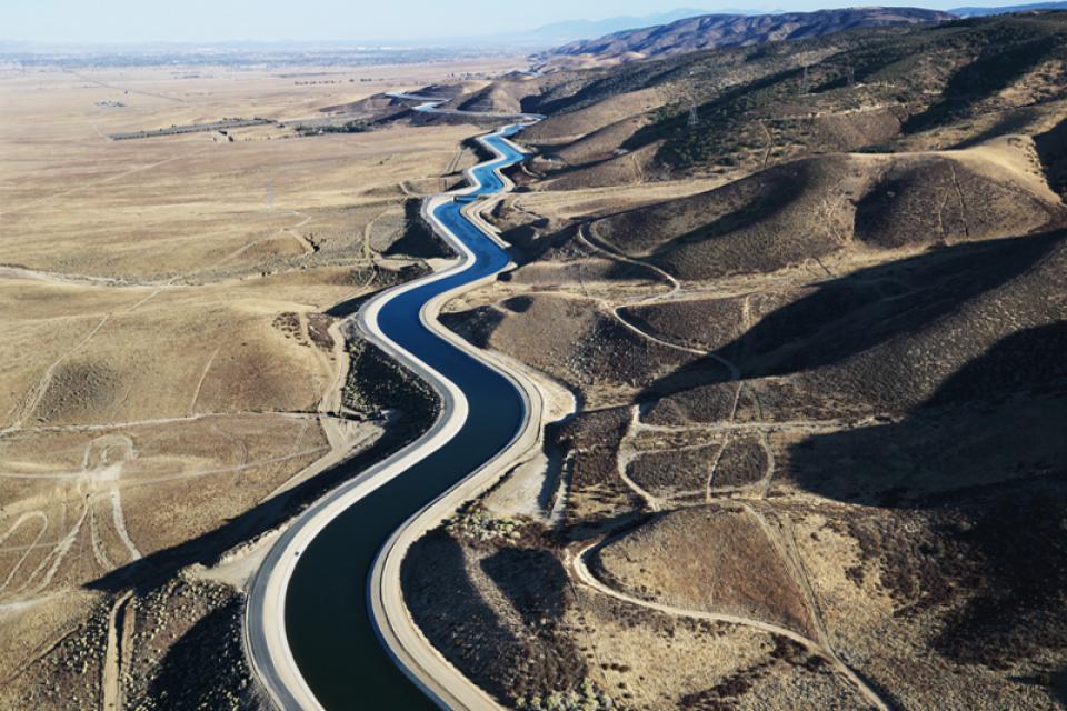
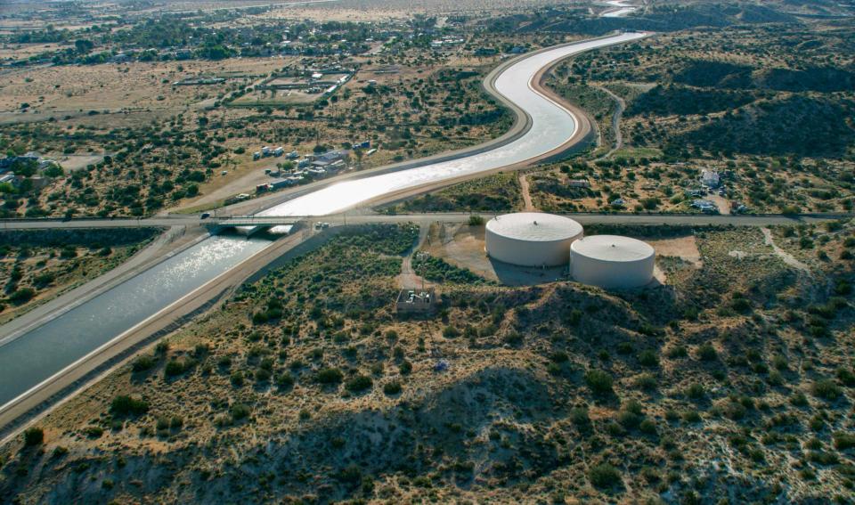
California Aqueduct

The California Aqueduct, a critical part of the State Water Project, carries water from the Sacramento-San Joaquin Delta to the San Joaquin Valley and Southern California.

Established as part of a $1.75 billion bond passed by voters in 1960, the 444-mile-long California Aqueduct (formally known as the Edmund G. Brown California Aqueduct) begins at the Harvey O. Banks Pumping Plant in the Delta. It parallels Interstate 5 south to the Tehachapi Mountains.

  • Read more
Aquapedia background January 30, 2014 California Water Map Layperson's Guide to Water Rights Law

Appropriative Rights

Consumnes River water diversion

California law allows rivers, streams, lakes and other surface water to be diverted at one point and appropriated (used) beneficially at a separate point.

This “appropriative right” contrasts with a “riparian right,” which is based on ownership of property adjacent to surface water.

  • Read more
Aquapedia background January 30, 2014 California Water Map Layperson's Guide to California Water

Acre-Foot

Shasta Lake

An acre-foot is a common way in the U.S. to measure water volume and use. It is the amount of water it takes to cover an acre of land one foot deep. An acre is about the size of a football field.

An acre-foot of water equals 325,851 gallons, and historically that was enough to serve the needs of two families for a year in California.

  • Read more
  • ‹‹
  • 2 of 2
  •  
Print-friendly

Related Links

Maps & Posters April 17, 2014 California Water Bundle
California Water bundle
Maps & Posters November 27, 2017 California Water Map Layperson's Guide to California Water

California Water Bundle
Special discount with combined Layperson's Guide & Map

The California water bundle features our California Water Map and our updated and redesigned Layperson’s Guide to California Water, giving you the resources you need to understand water in the Golden State.

Regularly priced at $22 for the map and $18 for the guide, this bundle allows you to purchase both of these high-quality products for $35. Please note they ship separately.

  • Read more
Back
This item appears in:
  • Topic: Acre Foot
  • Topic List: Agriculture
  • Topic: Bay Delta
  • Topic: California Aqueduct
  • Maps & Posters
  • Topic: Bay Delta Conservation Plan
  • Topic: Central Valley
  • Topic: Central Valley Project
  • Topic: Colorado River
  • Topic List: Background Information
  • Topic: California Water Plan
  • Topic: Delta Issues
  • Topic: Drought
  • Topic: Folsom Dam
  • Topic: Klamath River
  • Topic: Friant Dam
  • Topic: Hetch Hetchy
  • Topic: Lake Tahoe
  • Topic: North Coast Rivers
  • Topic: Pyramid Lake
  • Topic: Sacramento San Joaquin Delta
  • Topic: Floods
  • Topic: Hoover Dam
  • Topic: Mono Lake
  • Topic: Russian River
  • Topic: Sacramento Valley
  • Topic: San Francisco Bay
  • Topic: Sacramento River
  • Topic: Salton Sea
  • Topic: Lake Mead
  • Topic: San Joaquin Valley
  • Topic: Lake Powell
  • Topic: Recreation
  • Topic: San Joaquin River Restoration
  • Topic: Sierra Nevada
  • Topic: Levees
  • Topic: Oroville Dam
  • Topic: Surface Water
  • Topic: San Luis Dam
  • Tulare Lake Basin
  • Topic: Shasta Dam
  • Topic: State Water Project
  • Topic: Water Supply
Footer pod May 20, 2014

Water Education Foundation

Copyright © 2025 Water Education Foundation. All rights reserved.

The Water Education Foundation is a nonprofit, tax-exempt, 501(c)3 organization, federal tax ID #942419885.

Privacy Policy

Donor Privacy Policy

  • Read more
Footer pod May 20, 2014

Contact Information

2151 River Plaza Drive, Suite 205
Sacramento CA 95833

Telephone (916) 444-6240

Contact Us via email

  • Read more

Quicklinks

Footer quicklink May 20, 2014

Contact Us

  • Read more
Footer quicklink May 20, 2014

Donate Today

  • Read more
Footer quicklink May 20, 2014

Tours

  • Read more
Footer quicklink May 20, 2014

Newsletter Signup

  • Read more
Footer quicklink May 20, 2014

Foundation News

  • Read more
Footer quicklink May 20, 2014

Calendar

  • Read more

Log in

  • Create new account
  • Request new password

Commands

  • Support portal
  • Log in