Wetlands are among the most important ecosystems in the world.
They produce high levels of oxygen, filter toxic chemicals out of
water, reduce flooding and erosion and recharge groundwater. They
also serve as critical habitat for wildlife, including a large
percentage of plants and animals on California’s endangered
species list.
As the state has grown into one of the world’s leading economies,
Californians have developed and transformed the state’s marshes,
swamps and tidal flats, losing as much as 90 percent of the
original wetlands acreage—a greater percentage of loss than any
other state in the nation.
While the conversion of wetlands has slowed, the loss in
California is significant and it affects a range of factors from
water quality to quality of life.
Wetlands still remain in every part of the state, with the
greatest concentration in the Sacramento-San Joaquin Delta and
its watershed, which includes the Central Valley. The Delta
wetlands are especially important because they are part of the
vast complex of waterways that provide two-thirds of California’s
drinking water.
Quitobaquito Springs in south-west Arizona has been called a
biological wonderland with few equals. The springs are an oasis
in the vast Sonoran desert along the US-Mexico border, held
sacred by the O’odham people, who call it A’al Vaipia. … The
spring, located within Organ Pipe Cactus national monument,
provides one of the only reliable bodies of water for
about 100 miles in any direction, making it vital for
wildlife in the area and for humans who have lived here for
millennia. But the spring is in trouble. In 2020, the
Trump administration completed a 30ft-tall (9 meters) border
wall in this remote area, during which time the spring flow
dipped to an all-time low, and the pond partially dried up
after its lining cracked. Now, plans are under way to build a
second massive section of the wall, just 90-150 feet north of
the existing one.
… In 2023 the U.S. Supreme Court dramatically narrowed the
1972 Clean Water Act in Sackett v. EPA. … The Sackett ruling
effectively shifted more clean water oversight to states. About
half already had their own wetland protections on the books,
according to the Environmental Law Institute. Arizona and
Wyoming state laws provided some clean water protections. But
in the rest of the Mountain West, states relied on federal law
to limit pollution. … So, Colorado
stepped in. It became the first state after the Supreme
Court decision to create a new permitting program for waters
that lost federal protection. … Colorado
lawmakers eventually reached a bipartisan compromise in 2024.
It includes expanded protections for isolated wetlands and
requirements to offset harmful impacts but also includes
exemptions for agriculture.
Scientists said wetlands can slow down storm surges, absorb
pollutants and even offer protection for infrastructure as a
buffer between the ocean and roads. That’s why for the past
decade, some scientists have been working on a solution for a
wetlands area in Seal Beach that had often been underwater.
… As part of a pilot project that began a decade ago,
scientists started applying a thin layer of sediment (mud or
sand to match the existing sediment) to the surface area of the
marsh in an attempt to raise its elevation. The method is
called “sediment (or soil) augmentation.” … After a
decade, [Cal State Long Beach biology professor Christine]
Whitcraft said the team is thrilled with the results of the
pilot project. “There are plants, there’s birds. It’s out of
the water at the highest tides.” she said.
The Carpinteria Salt Marsh — a portion of the remaining coastal
wetlands in Santa Barbara County — has become a legal
battleground over a proposed house at 501 Sand Point Road. The
house, elevated above an environmentally sensitive habitat area
(ESHA) has been contested over environmental concerns. Friends
of the Carpinteria Salt Marsh say construction will threaten
hundreds of species that call the marsh their habitat, as well
as the vital flooding control function of the marsh.
… On Wednesday, Judge Thomas P. Anderle of the Superior
Court of Santa Barbara postponed a court hearing between the
Friends of the Carpinteria Salt Marsh (an organization that
aimed to challenge the environmental legality of the project)
and the California Coastal Commission. … When
extreme weather leads to flooding, Carpinteria’s wetlands serve
as a vital stormwater distribution outlet — preventing
disastrous debris-flows that have decimated Santa Barbara in
the past.
While many visitors admire the scenic beauty of the Carpinteria
Salt Marsh, few realize that some of its most popular
educational and stewardship programs are powered almost
entirely by the volunteers of the Carpinteria Salt Marsh Docent
Program. Every Saturday morning, volunteer docents welcome
residents and visitors alike for free guided tours of the
Carpinteria Salt Marsh, sharing the area’s remarkable geology,
wildlife and history. On the first Saturday of most months,
another dedicated group — the Carpinteria Weed Warriors — heads
into the marsh to remove invasive plants and help restore
habitat for native species. According to longtime
volunteer and program coordinator Andrea Adams-Morden, both
programs have one simple goal: helping people understand why
the marsh matters.
Lookout Slough, a 3,400-acre wetland on the edge of the
Sacramento-San Joaquin Delta in central California, is ringed
with aquatic plants, pulsing with tides from San Francisco Bay,
and home to dozens of species of fish, amphibians, reptiles and
birds. Until two years ago, it was parched former farmland, cut
off from the Sacramento River’s floodplain by a 26-foot-tall
levee. This transformation, the delta’s largest tidal
restoration project, was prompted by the decline of the Delta
smelt, a fish barely as long as an index finger. Adapted to the
delta’s brackish tides over thousands of years, the smelt is
considered a strong indicator of ecological
health. … The question now is whether
restoring wetlands like Lookout Slough can revive the Delta
smelt.
… A few years ago there was clamor from environmental
advocates urging California officials to save it [the Salton
Sea]. Like the Great Salt Lake and its Great Basin sister
lakes, it had become an important ecosystem supporting birds
traveling across the Pacific Flyway. Its drying playa had also
created a major public health hazard, with studies showing dust
was taking a toll on the lungs of children and low-income
communities living nearby. … [F]or the first time
in a long time, there are reasons to feel hopeful about the
Salton Sea. State officials began work last year on a
2,000-acre wetland pond that will both provide bird habitat and
keep the dust down. A year and a half ago, the California
Legislature created the Salton Sea Conservancy to find and fund
projects preserving the lake. The board held its first meeting
last month.
Boaters may notice lower water levels at the Thermalito
Afterbay through the end of June as the California Department
of Water Resources (DWR) works to support an endangered bird
species. The Western Snowy Plover is a threatened shorebird
that is native to Northern California. The species has been
endangered since 1993, according to the U.S. Fish and Wildlife
Service. Shallow water can be a hazard to boaters and jet
skiers. DWR said the shallow-water hazard is located in a
corner of the Thermalito Afterbay near the intersection of East
Hamilton Road and Highway 99. A hazard buoy will be placed
in the area to alert boaters to shallow water.
A major restoration project in the lower Eel River estuary is
moving closer to construction after California Trout received a
$4 million grant to advance work on the Cannibal Island Unit.
The funding will support restoration of the 850-acre Cannibal
Island Unit in the lower Eel River estuary, an area that once
contained some of the most productive wetland habitat on
California’s North Coast. The award advances the California
Salmon Strategy for a Hotter, Drier Future and Gov. Gavin
Newsom’s goal of conserving 30 percent of California’s lands
and coastal waters by 2030 to protect biodiversity and help
California adapt to the impacts of a changing climate.
A few miles down the Sacramento River from the small town of
Rio Vista lies a 6.5-mile stretch of undeveloped riverbank that
California Forever calls “the perfect location” for the
nation’s largest shipyard. … Yet even while California
Forever has pushed to skip new environmental reviews, it has
offered few or shifting details on what the infrastructure will
be and how it might impact the Delta’s delicate biodiversity,
Bay Nature has found. … While ecologists and advocates say
the shipyard site itself has minimal ecological value, it lies
less than two miles from the restored Montezuma Wetlands, as
well as Suisun Marsh, one of the largest remaining intact
marshes on the West Coast. “Placing industry next to one of the
last wildest areas in the San Francisco area, hands down, it’s
just a bad idea,” says John Durand, an ecologist at UC Davis
who has surveyed the river’s biodiversity for years. But what
kind of bad idea, Durand notes, “all depends on the
details.”
It’s hard to envision the vibrant landscape that the Mormon
Slough could become if Restore the Delta’s community-focused
efforts finally bear fruit. The 6.5 mile slough is mostly dry
on its westerly trek from about two miles east of Highway 99
through central Stockton to the San Joaquin River. It
used to be a natural drainage channel for excess water from the
Calaveras River but was intentionally cut off in 1910 …. With
$1.2 million in funding from California Jobs First through
North Valley Thrive, Restore the Delta has held 70 community
meetings, knocked on 3,000 doors and done an analysis of
possibilities. … [Artie] Valencia (Flood and Land Restoration
Manager for Restore the Delta) said the Mormon Slough
project is a prime example of how a locally driven project can
advance both community needs and broader Delta conservation
goals, which is why Restore the Delta focused on building its
extensive partnerships.
The 24-page Layperson’s Guide to the Delta explores the competing
uses and demands on California’s Sacramento-San Joaquin
Delta. The 11th edition examines this critical
water hub and its myriad challenges. The 2025 version
includes the latest information on the tunnel project, habitat
restoration efforts, climate change impacts and an updated
section on the legal and political facets of the Delta.
The return of fully planted rice crops to the Sacramento Valley
following years of drought has restored another essential
feature of the region. After harvest, reservoirs replenished by
last year’s historic storms enabled farmers to flood more of
their fields this winter, creating wetland habitat for
migrating waterfowl. … Today, around 300,000 acres of the
valley’s rice paddies are flooded each winter to provide food
and shelter for 7 million ducks and geese, according to the
California Rice Commission. More than 200 species of wildlife,
including threatened species such as Sandhill Cranes, rely on
the fields. Especially over the past decade, state and federal
programs have been developed to incentivize winter flooding,
defraying some of the cost, and rice farmers have embraced
their role in wildlife conservation.
A new but little-known change in
California law designating aquifers as “natural infrastructure”
promises to unleash a flood of public funding for projects that
increase the state’s supply of groundwater.
The change is buried in a sweeping state budget-related law,
enacted in July, that also makes it easier for property owners
and water managers to divert floodwater for storage underground.
It was exactly the sort of deluge
California groundwater agencies have been counting on to
replenish their overworked aquifers.
The start of 2023 brought a parade of torrential Pacific storms
to bone dry California. Snow piled up across the Sierra Nevada at
a near-record pace while runoff from the foothills gushed into
the Central Valley, swelling rivers over their banks and filling
seasonal creeks for the first time in half a decade.
Suddenly, water managers and farmers toiling in one of the
state’s most groundwater-depleted regions had an opportunity to
capture stormwater and bank it underground. Enterprising agencies
diverted water from rushing rivers and creeks into manmade
recharge basins or intentionally flooded orchards and farmland.
Others snagged temporary permits from the state to pull from
streams they ordinarily couldn’t touch.
Land and waterway managers labored
hard over the course of a century to control California’s unruly
rivers by building dams and levees to slow and contain their
water. Now, farmers, environmentalists and agencies are undoing
some of that work as part of an accelerating campaign to restore
the state’s major floodplains.
Biologists have designed a variety
of unique experiments in the past decade to demonstrate the
benefits that floodplains provide for small fish. Tracking
studies have used acoustic tags to show that chinook salmon
smolts with access to inundated fields are more likely than their
river-bound cohorts to reach the Pacific Ocean. This is because
the richness of floodplains offers a vital buffet of nourishment
on which young salmon can capitalize, supercharging their growth
and leading to bigger, stronger smolts.
Water is flowing once again
to the Colorado River’s delta in Mexico, a vast region that
was once a natural splendor before the iconic Western river was
dammed and diverted at the turn of the last century, essentially
turning the delta into a desert.
In 2012, the idea emerged that water could be intentionally sent
down the river to inundate the delta floodplain and regenerate
native cottonwood and willow trees, even in an overallocated
river system. Ultimately, dedicated flows of river water were
brokered under cooperative
efforts by the U.S. and Mexican governments.
State work to improve wildlife habitat and tamp down dust at California’s ailing Salton Sea is finally moving forward. Now the sea may be on the verge of getting the vital ingredient needed to supercharge those restoration efforts – money.
The shrinking desert lake has long been a trouble spot beset by rising salinity and unhealthy, lung-irritating dust blowing from its increasingly exposed bed. It shadows discussions of how to address the Colorado River’s two-decade-long drought because of its connection to the system. The lake is a festering health hazard to nearby residents, many of them impoverished, who struggle with elevated asthma risk as dust rises from the sea’s receding shoreline.
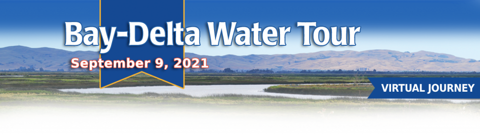
This tour guided participants on a virtual journey deep into California’s most crucial water and ecological resource – the Sacramento-San Joaquin Delta. The 720,000-acre network of islands and canals support the state’s two major water systems – the State Water Project and the Central Valley Project. The Delta and the connecting San Francisco Bay form the largest freshwater tidal estuary of its kind on the West coast.
Out of sight and out of mind to most
people, the Salton Sea in California’s far southeast corner has
challenged policymakers and local agencies alike to save the
desert lake from becoming a fetid, hyper-saline water body
inhospitable to wildlife and surrounded by clouds of choking
dust.
The sea’s problems stretch beyond its boundaries in Imperial and
Riverside counties and threaten to undermine multistate
management of the Colorado River. A 2019 Drought Contingency Plan for the
Lower Colorado River Basin was briefly stalled when the Imperial
Irrigation District, holding the river’s largest water
allocation, balked at participating in the plan because, the
district said, it ignored the problems of the Salton Sea.
Deep, throaty cadenced calls —
sounding like an off-key bassoon — echo over the grasslands,
farmers’ fields and wetlands starting in late September of each
year. They mark the annual return of sandhill cranes to the
Cosumnes River Preserve,
46,000 acres located 20 miles south of Sacramento on the edge of
the Sacramento-San Joaquin Delta.
For the bulk of her career, Jayne
Harkins has devoted her energy to issues associated with the
management of the Colorado River, both with the U.S. Bureau of
Reclamation and with the Colorado River Commission of Nevada.
Now her career is taking a different direction. Harkins, 58, was
appointed by President Trump last August to take the helm of the
United States section of the U.S.-Mexico agency that oversees
myriad water matters between the two countries as they seek to
sustainably manage the supply and water quality of the Colorado
River, including its once-thriving Delta in Mexico, and other
rivers the two countries share. She is the first woman to be
named the U.S. Commissioner of the International Boundary and
Water Commission for either the United States or Mexico in the
commission’s 129-year history.
There’s going to be a new governor
in California next year – and a host of challenges both old and
new involving the state’s most vital natural resource, water.
So what should be the next governor’s water priorities?
That was one of the questions put to more than 150 participants
during a wrap-up session at the end of the Water Education
Foundation’s Sept. 20 Water Summit in Sacramento.
Farmers in the Central Valley are broiling about California’s plan to increase flows in the Sacramento and San Joaquin river systems to help struggling salmon runs avoid extinction. But in one corner of the fertile breadbasket, River Garden Farms is taking part in some extraordinary efforts to provide the embattled fish with refuge from predators and enough food to eat.
And while there is no direct benefit to one farm’s voluntary actions, the belief is what’s good for the fish is good for the farmers.
Deep, throaty cadenced calls —
sounding like an off-key bassoon — echo over the grasslands,
farmers’ fields and wetlands starting in late September of each
year. They mark the annual return of sandhill cranes to the
Cosumnes River Preserve,
46,000 acres located 20 miles south of Sacramento on the edge of
the Sacramento-San Joaquin Delta.
California voters may experience a sense of déjà vu this year when they are asked twice in the same year to consider water bonds — one in June, the other headed to the November ballot.
Both tackle a variety of water issues, from helping disadvantaged communities get clean drinking water to making flood management improvements. But they avoid more controversial proposals, such as new surface storage, and they propose to do some very different things to appeal to different constituencies.
Along the banks of the
Sacramento-San Joaquin Delta in Oakley, about 50 miles southwest
of Sacramento, is a park that harkens back to the days when the
Delta lured Native Americans, Spanish explorers, French fur
trappers, and later farmers to its abundant wildlife and rich
soil.
That historical Delta was an enormous marsh linked to the two
freshwater rivers entering from the north and south, and tidal
flows coming from the San Francisco Bay. After the Gold Rush,
settlers began building levees and farms, changing the landscape
and altering the habitat.
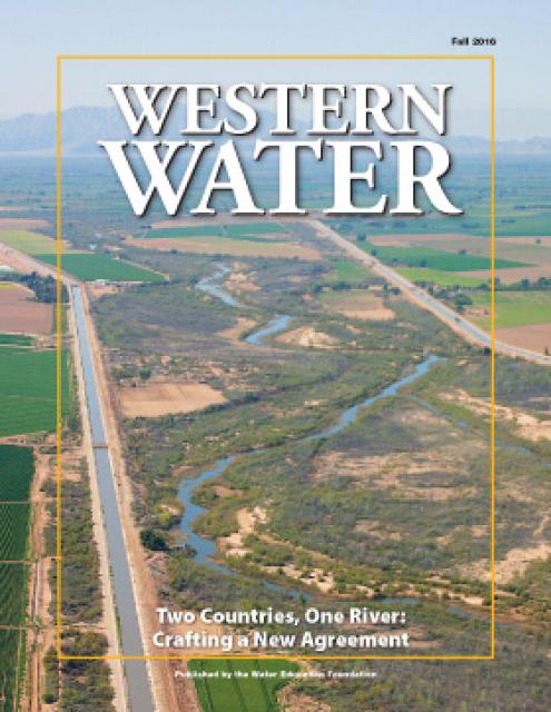
As vital as the Colorado River is to the United States and
Mexico, so is the ongoing process by which the two countries
develop unique agreements to better manage the river and balance
future competing needs.
The prospect is challenging. The river is over allocated as urban
areas and farmers seek to stretch every drop of their respective
supplies. Since a historic treaty between the two countries was
signed in 1944, the United States and Mexico have periodically
added a series of arrangements to the treaty called minutes that
aim to strengthen the binational ties while addressing important
water supply, water quality and environmental concerns.
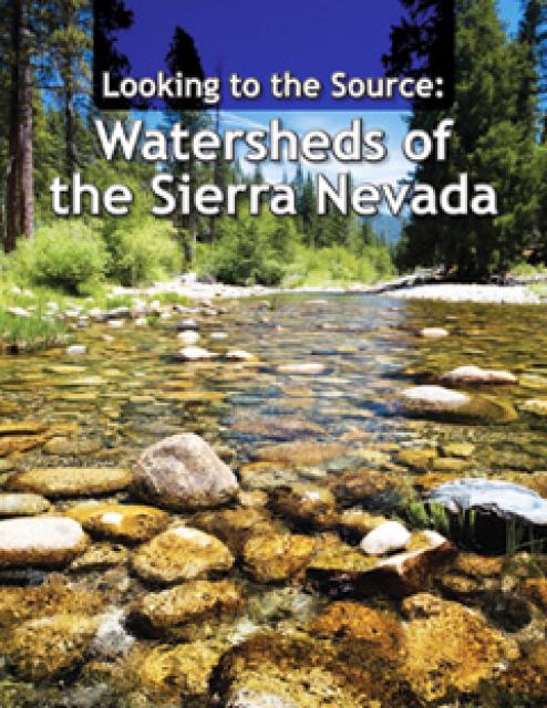
This 28-page report describes the watersheds of the Sierra Nevada
region and details their importance to California’s overall water
picture. It describes the region’s issues and challenges,
including healthy forests, catastrophic fire, recreational
impacts, climate change, development and land use.
The report also discusses the importance of protecting and
restoring watersheds in order to retain water quality and enhance
quantity. Examples and case studies are included.
This 30-minute documentary, produced in 2011, explores the past,
present and future of flood management in California’s Central
Valley. It features stories from residents who have experienced
the devastating effects of a California flood firsthand.
Interviews with long-time Central Valley water experts from
California Department of Water Resources (FloodSAFE), U.S. Army
Corps of Engineers, Bureau of Reclamation, Central Valley Flood
Management Program and environmental groups are featured as they
discuss current efforts to improve the state’s 150-year old flood
protection system and develop a sustainable, integrated, holistic
flood management plan for the Central Valley.
This 25-minute documentary-style DVD, developed in partnership
with the California Department of Water Resources, provides an
excellent overview of climate change and how it is already
affecting California. The DVD also explains what scientists
anticipate in the future related to sea level rise and
precipitation/runoff changes and explores the efforts that are
underway to plan and adapt to climate.
15-minute DVD that graphically portrays the potential disaster
should a major earthquake hit the Sacramento-San Joaquin Delta.
“Delta Warning” depicts what would happen in the event of an
earthquake registering 6.5 on the Richter scale: 30 levee breaks,
16 flooded islands and a 300 billion gallon intrusion of salt
water from the Bay – the “big gulp” – which would shut down the
State Water Project and Central Valley Project pumping plants.
Water truly has shaped California into the great state it is
today. And if it is water that made California great, it’s the
fight over – and with – water that also makes it so critically
important. In efforts to remap California’s circulatory system,
there have been some critical events that had a profound impact
on California’s water history. These turning points not only
forced a re-evaluation of water, but continue to impact the lives
of every Californian. This 2005 PBS documentary offers a
historical and current look at the major water issues that shaped
the state we know today. Includes a 12-page viewer’s guide with
background information, historic timeline and a teacher’s lesson.
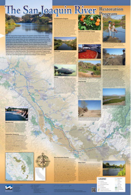
This beautiful 24×36 inch poster, suitable for framing, features
a map of the San Joaquin River. The map text focuses on the San
Joaquin River Restoration Program, which aims to restore flows
and populations of Chinook salmon to the river below Friant Dam
to its confluence with the Merced River. The text discusses the
history of the program, its goals and ongoing challenges with
implementation.
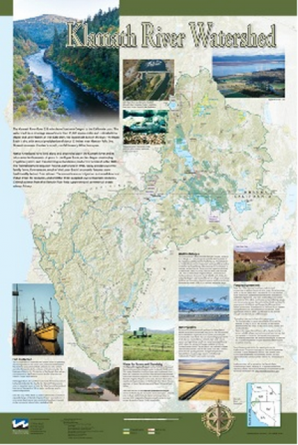
This beautiful 24×36-inch poster, suitable for framing, displays
the rivers, lakes and reservoirs, irrigated farmland, urban areas
and Indian reservations within the Klamath River Watershed. The
map text explains the many issues facing this vast,
15,000-square-mile watershed, including fish restoration;
agricultural water use; and wetlands. Also included are
descriptions of the separate, but linked, Klamath Basin
Restoration Agreement and the Klamath Hydroelectric Agreement,
and the next steps associated with those agreements. Development
of the map was funded by a grant from the U.S. Fish and Wildlife
Service.
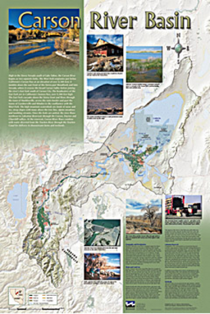
A companion to the Truckee River Basin Map poster, this
24×36-inch poster, suitable for framing, explores the Carson
River, and its link to the Truckee River. The map includes the
Lahontan Dam and reservoir, the Carson Sink, and the farming
areas in the basin. Map text discusses the region’s hydrology and
geography, the Newlands Project, land and water use within the
basin and wetlands. Development of the map was funded by a grant
from the U.S. Bureau of Reclamation Mid-Pacific Region, Lahontan
Basin Area Office.
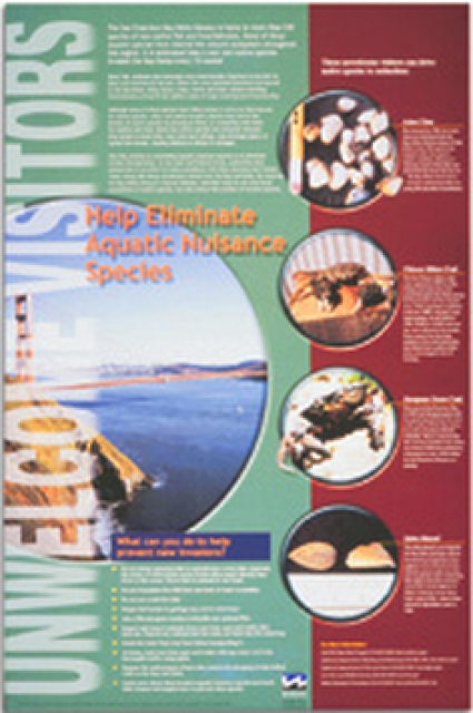
This 24×36 inch poster, suitable for framing, explains how
non-native invasive animals can alter the natural ecosystem,
leading to the demise of native animals. “Unwelcome Visitors”
features photos and information on four such species – including
the zerbra mussel – and explains the environmental and economic
threats posed by these species.
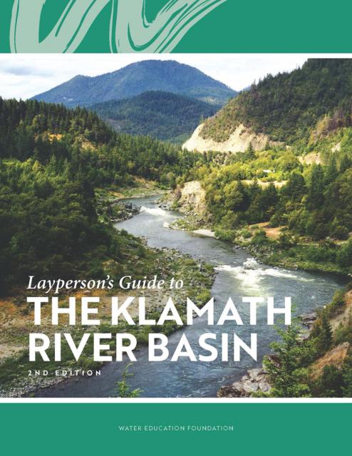
The Water Education Foundation’s second edition of
the Layperson’s Guide to The Klamath River Basin is
hot off the press and available for purchase.
Updated and redesigned, the easy-to-read overview covers the
history of the region’s tribal, agricultural and environmental
relationships with one of the West’s largest rivers — and a
vast watershed that hosts one of the nation’s oldest and
largest reclamation projects.
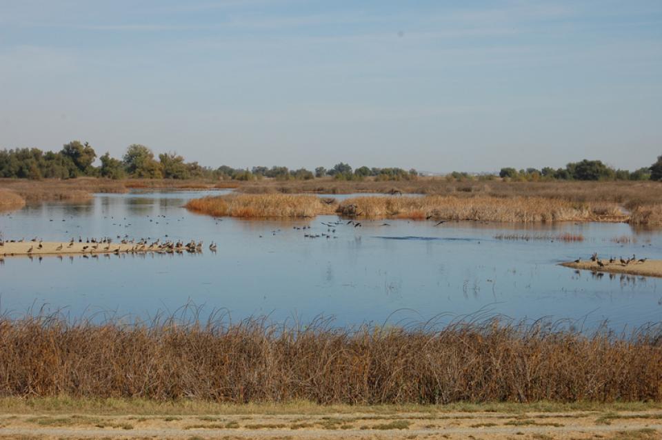
The Pacific Flyway is one of four
major North American migration routes for birds, especially
waterbirds, and stretches from Alaska in the north
to Patagonia in South America.
Each year, birds follow ancestral patterns as they travel the
flyway on their annual north-south migration. Along the way, they
need stopover sites such as wetlands with suitable habitat and
food supplies. In California, 95 percent of historic
wetlands have been lost, yet the Central Valley hosts some of the
world’s largest populations of wintering birds.
In the Central Valley, wetlands—partly or seasonally saturated
land that supports aquatic life and distinct ecosystems— provide
critical habitat for a variety of wildlife.
This printed issue of Western Water examines how the various
stakeholders have begun working together to meet the planning
challenges for the Colorado River Basin, including agreements
with Mexico, increased use of conservation and water marketing,
and the goal of accomplishing binational environmental
restoration and water-sharing programs.
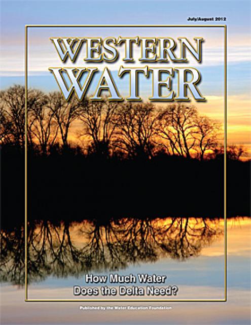
This printed issue of Western Water examines the issues
associated with the State Water Board’s proposed revision of the
water quality Bay-Delta Plan, most notably the question of
whether additional flows are needed for the system, and how they
might be provided.
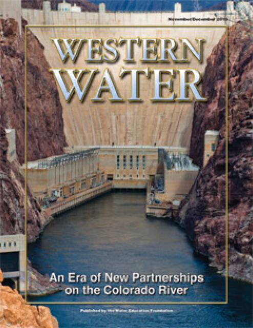
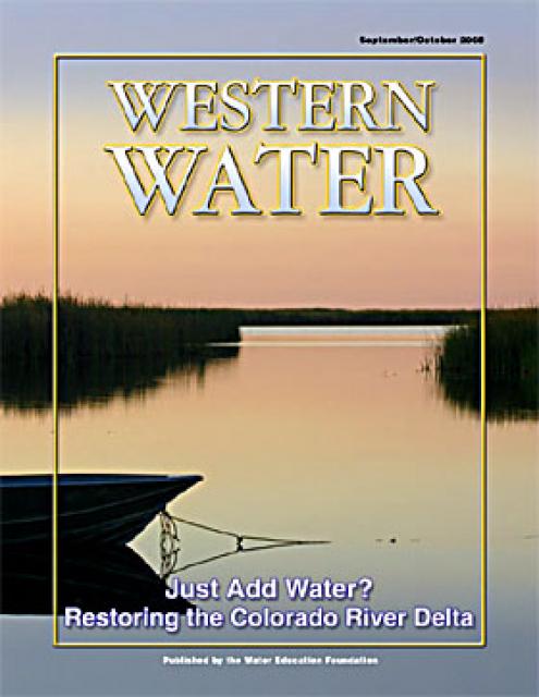
This printed copy of Western Water examines the Colorado River
Delta, its ecological significance and the lengths to which
international, state and local efforts are targeted and achieving
environmental restoration while recognizing the needs of the
entire river’s many users.


")
")

")
")
")
")
")
")
")