Water and energy are interconnected. A frequent term to describe
this relationship is the “water-energy nexus.”
Energy for Water: Energy is needed to store water, get it where
it is needed and also treat it to be used:
* Extracting water from rivers and streams or pumping it
from aquifers, and then conveying it over hills and into storage
facilities is a highly energy intensive process. The State Water
Project (SWP) pumps water 700 miles, including up nearly 2,000
feet over the Tehachapi Mountains. The SWP is the largest single
user of energy in California. It consumes an average of 5 billion
kWh per year. That’s about 2 to 3 percent of all electricity
consumed in California
* Water treatment facilities use energy to pump and process
water for use in homes, businesses and industry
* Consumers use energy to treat water with softeners or
filters, to circulate and pressurize water and to heat and cool
water
* Wastewater plants use energy to pump wastewater to
treatment plants, and also to aerate and filter it at the plant.
Different end uses require more electricity for delivery than
others. Water for residential, commercial and industrial end-use
needs the most energy (11 percent), followed by agricultural
end-use (3 percent), residential, commercial and industrial
supply and treatment (3 percent), agricultural water supply and
treatment (1 percent) and wastewater treatment (1 percent),
according to the California Energy Commission.
Water for Energy: Water is used to generate electricity
* Water is needed either to process raw materials used in a
facility or maintaining a plant,or to just generate electricity
itself.
Overall, the electricity industry is second only to agriculture
as the largest user of water in the United States. Electricity
production from fossil fuels and nuclear energy requires 190,000
million gallons of water per day, accounting for 39 percent of
all freshwater withdrawals in the nation. Coal, the most abundant
fossil fuel, currently accounts for 52 percent of U.S.
electricity generation, and each kWh generated from coal requires
withdrawal of 25 gallons of water.
A Kern County conservation district has announced it is
opposing the potential data center slated to be built in the
Ridgecrest and Inyokern area, citing low water levels. The
Eastern Kern County Resource Conservation District submitted a
letter of opposition to the California Energy Commission saying
the project would create “significant environmental impacts”
and would “undermine decades of local and state efforts to
achieve groundwater sustainability” in the area if built.
… If approved, the project — formally named the Inyokern
RB Data Center — would pull water from the Indian Wells
Valley Groundwater Basin to support its cooling
towers.
Every morning Marisol Winfrey Herrera’s
three-and-a-half-year-old daughter Jo reminds her to turn off
the tap while washing her hands and brushing her teeth.
… It is what prompted Herrera to join No Desert Data
Center, a residents’ group that opposes two large data centres
coming up on either side of Tucson – the $3.6bn project on the
city’s southeast edge and a $5bn project on its northwest side
in the town of Marana, together known as Project Blue. The
group believes these would consume more water and power
than the city set in the Sonoran Desert can afford.
… “Water was a unifying theme in our campaign. The
Colorado River cuts are looming, and this project would take
water away,” Herrera told Al Jazeera.
The House Science, Space and Technology Committee approved
legislation Thursday that would standardize how the federal
government studies data centers and their energy and
water use. The committee passed H.R. 9372, the
Data Infrastructure Energy Measurement and Standards Act, 34-1.
Rep. Daniel Webster (R-Fla.) was the lone no vote. The bill,
led by Rep. Suhas Subramanyam (D-Va.), would direct the
Department of Energy and the National Institute of Standards
and Technology to draw up standards and best practices
for reporting the energy and water use of artificial
intelligence data centers.
The president of the Utah State Senate, who championed a huge
data center beside the Great Salt Lake, was defeated in his
Republican primary on Tuesday night, one of the most
high-profile signs of the voter backlash to data center
projects. … Mr. Adams did not directly represent the
40,000-acre proposed site of the data center in Box Elder
County, a fast-growing farming and industrial area about 60
miles north of Salt Lake City. But he became the focus of
an anti-data-center groundswell because he served as chairman
of a Utah agency that approved initial plans this spring to
build the data center, known as Stratos. … They [voters]
worried about how much energy it would consume and how its
water usage would affect the drought-stricken Great
Salt Lake.
… As the state grapples with artificial intelligence and how
to regulate the industry, attempts to add data centers to
support this wave of technology are being met with strong
resistance. Earlier this month in Monterey Park, east of Los
Angeles, residents overwhelmingly voted to permanently
ban data centers in the city. HMC Statcap is an
Australian Company, and it had planned to build an AI data
center in Monterey Park. … Residents packed a city council
meeting in January to protest the plans. [Resident Yun] Wang
said the city council didn’t really address residents’
concerns about water and electricity use. And
so residents started organizing. Three months later, the city
council voted to place a measure banning data centers on the
June ballot.
The Sacramento Municipal Utility District appointed Lora
Anguay, who has spent the past five years guiding the utility’s
ambitious zero-carbon effort, to become the agency’s next chief
executive officer. Anguay will take over leadership of the
utility — which employs about 2,400 people and serves an area
with a population of about 1.5 million — as the utility
navigates a shifting energy market and pursues an aggressive
zero-carbon goal. Anguay serves as the chief zero carbon
officer, a role she has held since 2021. She has overseen the
retooling of SMUD’s largest natural gas plant, the Cosumnes
Power Plant, which reduced emissions by 27%, according to the
utility.
In April, developers of the massive Imperial Data Center
cleared a major hurdle after Imperial County Supervisors
approved a plan to combine several tracts of land for the
nearly one-million-square-foot facility in rural Southern
California. It would be the largest data center in the
state. … Last week, that progress came to a
halt when the county board walked back its decision, declaring
a 45-day moratorium on data centers and forming a public
commission to advise the county on zoning policy for the
facilities. … The company originally pledged to
use recycled water from neighboring cities, but when
that didn’t pan out, it sued Imperial Irrigation District in
Imperial County Superior Court this month, seeking 260
million gallons of river water each year.
In California, a sprawling 4,000-mile network of canals winds
through citrus orchards and fields of tree nuts, delivering
irrigation and drinking water to homes and farms across the
state. The canals are critical in an increasingly arid part of
the country. But what if they could help fulfill another urgent
need: renewable energy? To test that idea, researchers, private
enterprise and a public utility in the Central Valley are
installing solar panels atop the man-made waterways. The pilot
program, called Project Nexus, is testing solar
canopies that researchers say could generate gigawatts of power
and save billions of gallons of water by providing shade that
slows evaporation. It could be transformational if
scaled up, researchers say, in helping the state to meet its
ambitious climate and biodiversity goals.
… [D]ata centers’ everyday utility has been lost in a haze of
anxiety about new proposals. … In 2024, The
Washington Post released a report claiming that a 100-word
email written by ChatGPT consumes an entire bottle of water or
519 milliliters. … When Andy Masley, a former physics
teacher turned writer, saw this report, it didn’t sit well with
him. So he started looking into the article’s methodology, then
reached out to the researcher tapped for the calculation,
Shaolei Ren, an associate professor of electrical and computer
engineering at the University of California, Riverside.
… In a conversation with the Deseret News, Ren said
the Washington Post’s report should not be considered an
accurate measure of today’s artificial intelligence water
demands. … “[I]t’s just never correct to say, ‘AI uses this
much water,’” Ren said.
… Local fights are flaring over proposed data centers in Kern
and Imperial Counties, some of California’s most
water-parched regions. The ratcheting up of tension
comes as two bills from Assemblymember Diane Papan that would
force earlier disclosure of data centers’ projected and
actual water use are winding their way through
the Legislature, with a first hearing in the Senate
scheduled next Tuesday. AB 2469 would require data
centers to provide more information on water supply, use and
planning before cities or counties can approve new or expanded
data centers. AB 2619 would require data centers to report
projected and actual water use as a requirement for renewing a
local business license.
The Utah State Legislature took some initial steps to begin
regulating large-scale data centers in the state. On Wednesday,
the legislature’s Economic Development & Workforce Services
Interim Committee voted unanimously to open a bill file
to define in Utah State Code exactly what a large-scale data
center is. … Celebrity investor Kevin O’Leary’s
plans for a massive data center in Box Elder County has sparked
significant public uproar. … “We want to make sure
there are clear guidelines to protect the environment,” Rep.
[Paul] Cutler told FOX 13 News. “To make sure that data
centers, especially in the Great Salt Lake Basin, the
Colorado River Basin, there are strict
guidelines on water use.”
The developer of a proposed 330-megawatt data center near the
City of Imperial has filed a sweeping lawsuit against the
Imperial Irrigation District (IID), alleging the district
unlawfully denied its request for water service and
discriminates against industrial water users. Imperial Valley
Computer Manufacturing, LLC … is developing a data center
project on a 75-acre site at Aten and Clark roads in
unincorporated Imperial County.The lawsuit challengesIID’s May
1 denial of the company’s request for approximately 880
acre-feet of water annually for industrial cooling
purposes. The developer contends the water demand is
comparable to that of a typical 160-acre farm and represents a
small fraction of IID’s annual Colorado River
allocation. IID denied the application on grounds that the
project site lies within the City of Imperial’s sphere of
influence and is near municipal water infrastructure
Under no projections for global temperature rise can the United
States supply the amount of water demanded by lithium mines
proposed across the nation, a new study has found. … The
researchers, who analyzed public mine proposals and available
data, say declining water availability is a problem in rapidly
warming and water-starved states like Nevada, the driest in the
nation with the country’s two fastest-warming cities. …
The study, published at the end of last month in the
peer-reviewed journal Communications Earth & Environment,
contends that water is the ultimate limiting factor to
lithium mining, said Dunn, director of the
university’s Center for Engineering Sustainability and
Resilience. … Nevada has been at the heart of the boom for
the better part of a decade. … Dunn said the study
should be a warning to mining companies that still have the
chance to explore how to reduce their water use.
Construction crews have begun clearing a patch of desert
southeast of Tucson for a new data center development, but
roughly 40 protesters gathered Wednesday evening at the site of
the proposed Project Blue facility to make clear their fight is
not over. Protesters stood along a chain-link fence separating
the desert landscape from the construction site at South
Houghton Road, holding hand-painted signs and banners to voice
opposition to the facility’s projected environmental and
infrastructure footprint. As heavy machinery continued to work
in the background, demonstrators made clear they had no
intention of going quietly. … The environmental concerns
resonate deeply with local history, according to protest
attendee Nicole Borchaloey, who pointed to past issues
involving groundwater depletion.
Data centers are allegedly an unmitigated disaster: They guzzle
water, strain electric grids, and raise prices, all while
offering almost nothing in return. Little wonder that according
to a recent Gallup poll, 71 percent of Americans oppose
the construction of new AI data centers in their area.
Politicians of both parties are proposing moratoriums on new
builds, and local officials who have approved construction in
the past are losing reelection because of it. … Critics
argue that AI wastes billions of liters of water every year and
that this is an “environmental justice crisis.” … Data
centers certainly do use water. They are basically warehouses
of tightly packed, high-powered computers, and when computers
run, they get hot. Most data centers—though not all—use water
for cooling. But many of them use a “closed loop,” which
doesn’t actually waste much, because the water is recycled
repeatedly for the same purpose. –Written by Atlantic columnist Elias Wachtel.
The Trump administration is not going to set nationwide
environmental requirements or recommendations for the rapidly
growing data center industry, EPA Administrator Lee Zeldin said
Wednesday. While there are technologies and practices that
reduce air pollution and water usage, states
and communities know what works best for them, Zeldin said at
the POLITICO Energy Summit in Washington. … Just 37
percent of Americans would support a data center being built in
their area, according to a POLITICO poll earlier this year.
There are myriad reasons cited by opponents, but water usage
and air pollution are common complaints. Zeldin on Wednesday
cited closed-loop data center designs that don’t have to
regularly tap into local water supplies.
The Socorro County Board of Commissioners unanimously adopted a
yearlong moratorium on data centers and related infrastructure
projects Tuesday evening after residents for months opposed a
Canadian tech CEO’s proposal to build a data center and solar
array on 10,000 acres of nearby land. … [Green Data CEO
Jason] Bak proposed a massive solar array to power the
data center and said it would rely on technology called
atmospheric water generation to pull moisture out of the air
and convert it into usable water, rather than draining local
aquifers. … In the months since Bak first
unveiled his proposal, residents have packed the room at City
Council and New Mexico Tech town hall meetings to oppose the
project, often contending that the solar array could harm the
surrounding desert environment and that the water technology
was not a proven solution.
The Trump administration is “keenly aware” of Americans’
concerns about water and artificial intelligence data centers
and wants the industry to embrace technologies like
reusing treated wastewater, according to a senior EPA
official. But Jess Kramer, who leads EPA’s water office, also
defended the administration’s pledge to help make the U.S. “the
AI capital of the world,” arguing that the technology is
already driving conversations at the agency. “Being the AI
capital of the world, utilizing that as a tool, and utilizing
[it] to the best of its ability, I think that’s a great goal,”
Kramer said in an interview last week. “I don’t think there’s
anything short-sighted about that. I think it has driven a lot
of conversations.”
A record-shattering drought has racked much of the US. But the
artificial intelligence industry is pushing ahead regardless,
with the majority of planned datacenters set to be built in
drought-ridden locations, a Guardian analysis has found. About
two-thirds of upcoming datacenters, which typically require a
large amount of water to operate, are set to be built in places
that have been among the driest in the country over the past
year. … Datacenter developers say the industry’s current
water use is still just a fraction of what much larger
consumers, primarily agriculture, already take, causing growing
strain on key sources such as the Colorado
River. … Yet the public backlash has been so
strong – polling shows 70% of Americans don’t want to live next
to a datacenter – that some states are considering new
restrictions.
Voters in a Southern California city moved to cement what is
believed to be the nation’s first ban on data
centers, appearing to resoundingly approve a ballot
measure that prohibits the facilities citywide. The
Monterey Park City Council unanimously voted in March to submit
the ballot measure — known as Measure NDC — to the June 2
special municipal election, seeking to permanently prohibit
data centers within city limits. The measure amends the city’s
general plan and land use framework to add a citywide ban on
data centers, according to city officials. … City
officials described the ban as a way to protect air
quality, drinking water resources, and public health,
and to avoid potential impacts to electricity and water rates
from the large-scale computing facilities.
Other data center moratorium news around the West:
Water contractors can expect to pay between 1% to 3% more for
the energy it takes to bring supplies down the state through
California’s largest project thanks to just one renewable
energy project that came online recently in Kern County – the
Pastoria Solar Project. And that’s just the beginning. When the
Department of Water Resources (DWR) brings on enough renewable
energy projects to fully power the State Water
Project (SWP), contractors can expect their costs to
increase another 10% to 20%, according to a presentation at the
May 20 California Water Commission meeting by DWR Manager of
Power Operations Jorge Quintero. … The SWP is the
state’s largest single electricity consumer, using between 2.5
million and 9.5 million megawatt hours a year, depending on how
much water it’s moving.
U.S. Representative Dr. Raúl Ruiz (D-CA) called for an
immediate halt to proposed data center projects in his
district, voicing sharp concerns over their potential impact on
local utility costs, power grid stability, and public health.
In a video statement released last week, Ruiz—a physician who
represents California’s 25th congressional district,
encompassing parts of the Imperial Valley and Eastern Riverside
County—argued that the massive energy and water demands of
these facilities pose an undue burden on an already vulnerable
region. … The environmental footprint of these
facilities extends to water consumption. Many data centers
utilize evaporative cooling systems that consume
millions of gallons of water daily—a logistics
challenge that Ruiz argues is unsustainable given the state’s
hydrology.
The US Bureau of Reclamation has added two new categorical
exclusions for hydropower-related activities under the National
Environmental Policy Act, in a move the agency says will speed
up environmental reviews for selected projects and maintenance
work across its hydropower portfolio. The changes were
announced on Friday as part of Reclamation’s ongoing Hydropower
Action Plan, which the agency says is intended to support
capital investment, regulatory efficiency and technological
innovation in the US hydropower sector. … The agency
said the exclusions were developed after identifying categories
of hydropower activity that have “consistently demonstrated no
significant environmental impacts.”
Governor Cox (R-UT) signed an executive order establishing a
statewide framework to guide the evaluation and development of
large data center projects across the state. On Friday morning,
Governor Cox signed Executive Order 2026-03 with the goal
to direct state agencies toprioritize
protecting water resources, including the Great Salt
Lake. The order also is set to safeguard utility ratepayers,
protect air quality, mitigate wildlife impacts, support
transparent public engagement, and ensure future development
aligns with the long-term interests of Utah. … The
guiding principles of the framework include: Protecting the
Great Salt Lake and other water resources by ensuring
water consumption is not increased and water quality is
protected.
A proposed 12-month moratorium on data centers in Cheyenne was
rejected on a 9-1 City Council vote after nearly four hours of
emotional, and at times angry, testimony Tuesday night.
… Cheyenne’s debate over whether to halt data centers
mirrors a broader national conversation unfolding as
communities grapple with the explosive growth of artificial
intelligence infrastructure and the enormous power and
water demands tied to hyperscale data centers.
… Lawmakers in at least 14 states have recently
introduced or considered legislation aimed at slowing or
temporarily pausing new data center construction while
governments study long-term impacts on energy grids, water
supplies and community growth.
The Nye County Water District Governing Board unanimously
approved an emergency order Tuesday requesting that the Nye
County Commission place a moratorium on data centers in the
Pahrump Valley. The emergency order is non-binding and
includes draft language for an ordinance that would
make data center projects a non-permissive use of
water within the Pahrump Regional Planning District
and Nevada Hydrographic Basin 162, a critically
over-appropriated aquifer. Board members emphasized that
they do not have the authority to approve or deny data centers,
and that any recommendation they make will have to be approved
by the Nye County Commission. … The vote comes after the
Reno City Council placed a temporary pause on new data center
applications earlier this month.
… Residents around industrial-scale data centers proposed
near Casper and Evanston are raising a number of questions
about whether data centers are right for Wyoming, ranging from
water and electricity use to fears of a growing artificial
intelligence-powered surveillance society. … The concerns now
surfacing in Natrona County along Big Muddy Creek and in Uinta
County near the Utah border echo a debate that’s already been
stewing in Cheyenne for the better part of a year. That
culminated Monday in debate of a proposed 12-month moratorium
on new data centers in Cheyenne, which drew hours of emotional
testimony. … Ultimately, the committee failed to make any
recommendation for or against the moratorium, which will go
back to the full City Council for a final decision.
The U.S. Bureau of Reclamation has freed up $52 million that
water managers will use to replace three old turbines at Hoover
Dam as forecasters expect Lake Mead levels to plunge to
historic lows over the next two years. Previously, the federal
agency had said extremely low reservoir levels could
cause a 40 percent reduction in hydropower — a
concerning sign for utilities that rely on it throughout
Nevada, California and Arizona. Older turbines
cannot generate power below 1,035 feet in elevation at the
reservoir, and hydropower levels would have dropped from 1,302
megawatts to 382 megawatts, the agency said. … Record-low
Lake Mead levels are coming largely due to the Bureau of
Reclamation’s move to reduce flows out of Lake Powell — a
decision made to ensure water can keep flowing in the face of
the worst runoff season on record.
Just hours after a second water rights change application for
the proposed Stratos data center was published for public
notice, hundreds of formal protests started to pour in. The
application was filed with the Utah Division of Water Rights on
April 28, though the formal period for public response opened
up Wednesday morning. “I’m encouraged. I think it’s important
for the public to weigh in,” General Counsel for Friends of
Great Salt Lake, Rob Debuc, said. The organization had
previously called for protests against an earlier water rights
change application that called for 1,900 square acre-feet of
water. This second application only asks for 11 square
acre-feet, but Dubuc pointed out there’s likely more to come,
as he said the process for the massive project will likely be
unusual.
The 24-page Layperson’s Guide to California Water provides an
excellent overview of the history of water development and use in
California. It includes the latest information on the state’s
changing hydrology, recent water conservation legislation and the
state’s efforts to stretch the available water supplies.
This tour explored the lower Colorado River firsthand where virtually every drop of the river is allocated, yet demand is growing from myriad sources — increasing population, declining habitat, drought and climate change.
The 1,450-mile river is a lifeline to some 40 million people in the Southwest across seven states, 30 tribal nations and Mexico. How the Lower Basin states – Arizona, California and Nevada – use and manage this water to meet agricultural, urban, environmental and industrial needs was the focus of this tour.
Hilton Garden Inn Las Vegas Strip South
7830 S Las Vegas Blvd
Las Vegas, NV 89123
On this first-ever Foundation water tourwe examined water issues along the 263-mile Klamath River, from its spring-fed headwaters in south-central Oregon to its redwood-lined estuary on the Pacific Ocean in California.
Running Y Resort
5500 Running Y Rd
Klamath Falls, OR 97601
This tour explored the lower Colorado River firsthand where virtually every drop of the river is allocated, yet demand is growing from myriad sources — increasing population, declining habitat, drought and climate change.
The 1,450-mile river is a lifeline to some 40 million people in the Southwest across seven states, 30 tribal nations and Mexico. How the Lower Basin states – Arizona, California and Nevada – use and manage this water to meet agricultural, urban, environmental and industrial needs was the focus of this tour.
Hilton Garden Inn Las Vegas Strip South
7830 S Las Vegas Blvd
Las Vegas, NV 89123
Learn the history and challenges facing the West’s most dramatic
and developed river.
The Layperson’s Guide to the Colorado River Basin introduces the
1,450-mile river that sustains 40 million people and millions of
acres of farmland spanning seven states and parts of northern
Mexico.
The 28-page primer explains how the river’s water is shared and
managed as the Southwest transitions to a hotter and drier
climate.
This tour explored the lower Colorado River firsthand where virtually every drop of the river is allocated, yet demand is growing from myriad sources — increasing population, declining habitat, drought and climate change.
The 1,450-mile river is a lifeline to some 40 million people in the Southwest across seven states, 30 tribal nations and Mexico. How the Lower Basin states – Arizona, California and Nevada – use and manage this water to meet agricultural, urban, environmental and industrial needs was the focus of this tour.
Hilton Garden Inn Las Vegas Strip South
7830 S Las Vegas Blvd
Las Vegas, NV 89123
This special Foundation water tour journeyed along the Eastern Sierra from the Truckee River to Mono Lake, through the Owens Valley and into the Mojave Desert to explore a major source of water for Southern California, this year’s snowpack and challenges for towns, farms and the environment.
This tour explored the lower Colorado River firsthand where virtually every drop of the river is allocated, yet demand is growing from myriad sources — increasing population, declining habitat, drought and climate change.
The 1,450-mile river is a lifeline to some 40 million people in the Southwest across seven states, 30 tribal nations and Mexico. How the Lower Basin states – Arizona, California and Nevada – use and manage this water to meet agricultural, urban, environmental and industrial needs was the focus of this tour.
Hyatt Place Las Vegas At Silverton Village
8380 Dean Martin Drive
Las Vegas, NV 89139
The majestic beauty of the Sierra
Nevada forest is awe-inspiring, but beneath the dazzling blue
sky, there is a problem: A century of fire suppression and
logging practices have left trees too close together. Millions of
trees have died, stricken by drought and beetle infestation.
Combined with a forest floor cluttered with dry brush and debris,
it’s a wildfire waiting to happen.
Fires devastate the Sierra watersheds upon which millions of
Californians depend — scorching the ground, unleashing a
battering ram of debris and turning hillsides into gelatinous,
stream-choking mudflows.
We explored the lower Colorado River where virtually every drop
of the river is allocated, yet demand is growing from myriad
sources — increasing population, declining habitat, drought and
climate change.
The 1,450-mile river is a lifeline to 40 million people in
the Southwest across seven states and Mexico. How the Lower Basin
states – Arizona, California and Nevada – use and manage this
water to meet agricultural, urban, environmental and industrial
needs was the focus of this tour.
Hampton Inn Tropicana
4975 Dean Martin Drive, Las Vegas, NV 89118
This 30-minute documentary-style DVD on the history and current
state of the San Joaquin River Restoration Program includes an
overview of the geography and history of the river, historical
and current water delivery and uses, the genesis and timeline of
the 1988 lawsuit, how the settlement was reached and what was
agreed to.
This 25-minute documentary-style DVD, developed in partnership
with the California Department of Water Resources, provides an
excellent overview of climate change and how it is already
affecting California. The DVD also explains what scientists
anticipate in the future related to sea level rise and
precipitation/runoff changes and explores the efforts that are
underway to plan and adapt to climate.
20-minute DVD that explains the problem with polluted stormwater,
and steps that can be taken to help prevent such pollution and
turn what is often viewed as a “nuisance” into a water resource
through various activities.
Many Californians don’t realize that when they turn on the
faucet, the water that flows out could come from a source close
to home or one hundreds of miles away. Most people take their
water for granted; not thinking about the elaborate systems and
testing that go into delivering clean, plentiful water to
households throughout the state. Where drinking water comes from,
how it’s treated, and what people can do to protect its quality
are highlighted in this 2007 PBS documentary narrated by actress
Wendie Malick.
A 30-minute version of the 2007 PBS documentary Drinking Water:
Quenching the Public Thirst. This DVD is ideal for showing at
community forums and speaking engagements to help the public
understand the complex issues surrounding the elaborate systems
and testing that go into delivering clean, plentiful water to
households throughout the state.
Water truly has shaped California into the great state it is
today. And if it is water that made California great, it’s the
fight over – and with – water that also makes it so critically
important. In efforts to remap California’s circulatory system,
there have been some critical events that had a profound impact
on California’s water history. These turning points not only
forced a re-evaluation of water, but continue to impact the lives
of every Californian. This 2005 PBS documentary offers a
historical and current look at the major water issues that shaped
the state we know today. Includes a 12-page viewer’s guide with
background information, historic timeline and a teacher’s lesson.
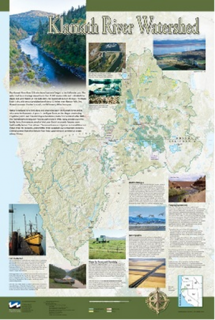
This beautiful 24×36-inch poster, suitable for framing, displays
the rivers, lakes and reservoirs, irrigated farmland, urban areas
and Indian reservations within the Klamath River Watershed. The
map text explains the many issues facing this vast,
15,000-square-mile watershed, including fish restoration;
agricultural water use; and wetlands. Also included are
descriptions of the separate, but linked, Klamath Basin
Restoration Agreement and the Klamath Hydroelectric Agreement,
and the next steps associated with those agreements. Development
of the map was funded by a grant from the U.S. Fish and Wildlife
Service.
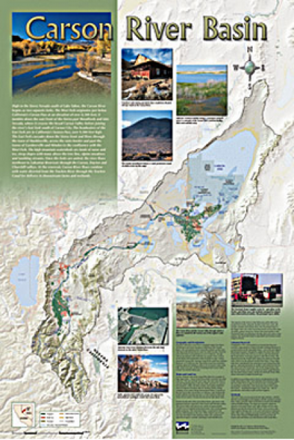
A companion to the Truckee River Basin Map poster, this
24×36-inch poster, suitable for framing, explores the Carson
River, and its link to the Truckee River. The map includes the
Lahontan Dam and reservoir, the Carson Sink, and the farming
areas in the basin. Map text discusses the region’s hydrology and
geography, the Newlands Project, land and water use within the
basin and wetlands. Development of the map was funded by a grant
from the U.S. Bureau of Reclamation Mid-Pacific Region, Lahontan
Basin Area Office.
Redesigned in 2017, this beautiful map depicts the seven
Western states that share the Colorado River with Mexico. The
Colorado River supplies water to nearly 40 million people in
Arizona, California, Colorado, Nevada, New Mexico, Utah, Wyoming
and Mexico. Text on this beautiful, 24×36-inch map, which is
suitable for framing, explains the river’s apportionment, history
and the need to adapt its management for urban growth and
expected climate change impacts.
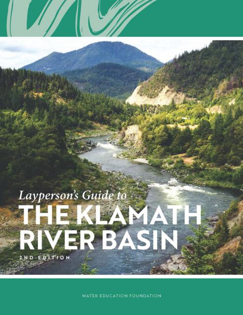
The Water Education Foundation’s second edition of
the Layperson’s Guide to The Klamath River Basin is
hot off the press and available for purchase.
Updated and redesigned, the easy-to-read overview covers the
history of the region’s tribal, agricultural and environmental
relationships with one of the West’s largest rivers — and a
vast watershed that hosts one of the nation’s oldest and
largest reclamation projects.
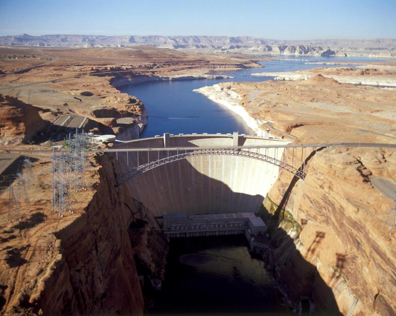
The construction of Glen Canyon Dam
in 1964 created Lake Powell. Both are located in north-central
Arizona near the Utah border. Lake Powell acts as a holding tank
for outflow from the Colorado River Upper Basin States: Colorado,
New Mexico, Utah and Wyoming.
The water stored in Lake Powell is used for recreation, power
generation and delivering water to the Lower Basin states of
California, Arizona, and Nevada.
Every five years the California Department of Water Resources
updates its strategic plan for managing the state’s water
resources, as required by state law.
The California Water Plan, or Bulletin 160, projects the
status and trends of the state’s water supplies and demands
under a range of future scenarios.
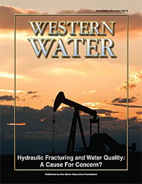
This printed issue of Western Water looks at hydraulic
fracturing, or “fracking,” in California. Much of the information
in the article was presented at a conference hosted by the
Groundwater Resources Association of California.
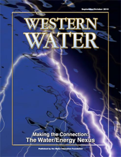
The connection between water and energy is more relevant than
ever. After existing in separate realms for years, the maxim that
it takes water to produce energy and energy to produce water has
prompted a re-thinking of management strategies, including an
emphasis on renewable energy use by water agencies.
This printed issue of Western Water looks at the energy
requirements associated with water use and the means by which
state and local agencies are working to increase their knowledge
and improve the management of both resources.
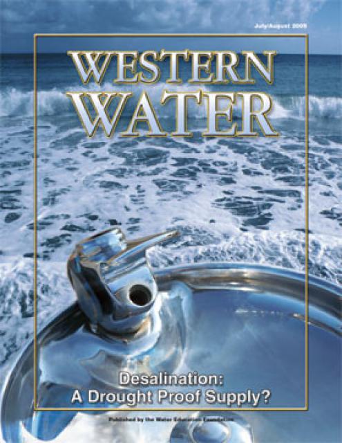
This printed issue of Western Water examines
desalination – an issue that is marked by great optimism and
controversy – and the expected role it might play as an
alternative water supply strategy.
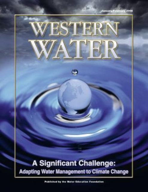
This printed copy of Western Water examines climate change –
what’s known about it, the remaining uncertainty and what steps
water agencies are talking to prepare for its impact. Much of the
information comes from the October 2007 California Climate Change
and Water Adaptation Summit sponsored by the Water Education
Foundation and DWR and the November 2007 California Water Policy
Conference sponsored by Public Officials for Water and
Environmental Reform.
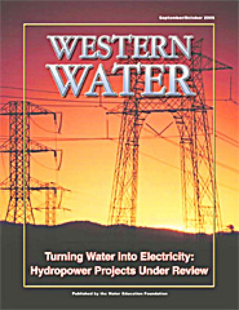
Hydropower generation is prevalent in the West, where rapidly
flowing river systems have been tapped for generations to produce
electricity. Hydropower is a clean, steady and reliable energy
source, but the damming of rivers has exacted a toll on the
environment, affecting, among other things, the migration of fish
to vestigial spawning grounds. Many of those projects are due to
be relicensed by the Federal Energy Regulatory Commission.
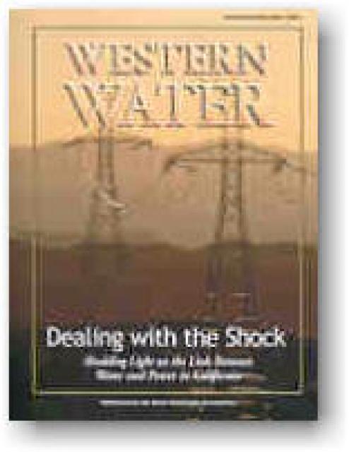
The California power crisis has made international headlines. But
what is the link between water and power in California? How is
the state’s dry spell affecting its hydropower generation? How
has the electric crisis affected water users in the state? These
questions and others are addressed in this issue of Western
Water.


")