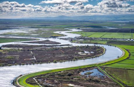
Watch our series of short videos on the importance of the
Sacramento-San Joaquin Delta, how it works as a water hub for
California and the challenges it is facing.
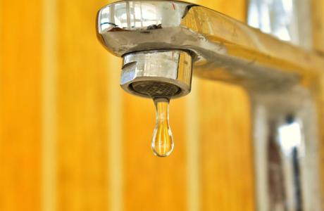
When a person opens a spigot to draw a glass of water, he or she
may be tapping a source close to home or hundreds of miles away.
Water gets to taps via a complex web of aqueducts, canals and
groundwater.
Learn more about our team in the office and on the Board of
Directors and how you can support our nonprofit mission by
donating in someone’s honor or memory, or becoming a regular
contributor or supporting specific projects.
Unlike California’s majestic rivers and massive dams and
conveyance systems, groundwater is out of sight and underground,
though no less plentiful. The state’s enormous cache of
underground water is a great natural resource and has contributed
to the state becoming the nation’s top agricultural producer and
leader in high-tech industries.
A new era of groundwater management began in 2014 in California
with the Sustainable Groundwater Management Act. The landmark law
turned 10 in 2024, with many challenges still ahead.
Tom Gibson, new director of
California’s Department of Water Resources, will serve as the
keynote speaker for our 42ⁿᵈ annual Water
Summit on Oct. 29.
Guided by this year’s theme, Stewarding a New Era in
Western Water,Gibson and
other leading policymakers and experts will address emerging
topics related to the challenges and opportunities facing water
resource management in California and the West.
Gibson,
an attorney who has held several roles in the state’s Natural
Resources Agency and its various departments, was appointed by
Gov. Newsom on June 29 and sworn in on July 6 to lead DWR and its
nearly 4,000 employees.
Mark your calendars! Registration will be opening soon for two
exciting Water Education Foundation events this fall.
Water Summit | Oct. 29
Join us for our premier event of
the year, bringing together leading policymakers and experts from
all sectors to discuss the most pressing water issues facing
California and the West.
Arizona, California and Nevada would take less water
from the Colorado River under a proposal announced
Friday by the federal government to stave off crisis in
the beleaguered waterway. The proposal from the U.S.
Bureau of Reclamation spares Colorado, Utah, New Mexico
and Wyoming from facing mandatory cuts for now. But
it’s a temporary fix as the states that rely on the river still
fight over a long-term management plan for the
dwindling resource that powers huge swaths of the Western
U.S. Under the plan, the Lower Basin states could face
collective cuts up to 3 million acre-feet (130 billion cubic
feet) through 2036, “subject to hydrology,”
according to a press release by the Department of the Interior.
That’s about enough water to serve more than 25 million people
a year.
… According to a new report, rigid fee structures and
complex regulations threaten to harm California’s smallest
growers, driving land consolidation in favor of deep-pocketed
corporate orchards. The report by the University of California
Small Farms Network and the nonprofit group Community Alliance
with Family Farmers warns that without immediate action
by state and local agencies, many family farms could be forced
out of business. … The researchers suggested
each local groundwater agency identify the smaller farmers,
consider exempting those that use minimal water and set
fees in a tiered system that allows growers who pump less to
pay less.
Since President Donald Trump took office for a second term, his
administration has rolled back numerous environmental
protections. The latest target is the Endangered Species Act,
one of the nation’s bedrock conservation laws. Earlier this
month, the U.S. Department of the Interior issued a new
interpretation of what would constitute harming an endangered
species that sharply loosens the act’s protections related to
the degradation of protected wildlife’s habitat.
… Endangered and threatened fish species have carried
particular weight in dictating how state and federal agencies
regulate the flow of water into and out of the
Delta. Agencies today balance irrigation and
development needs with the water quality and
temperature needed by endangered and threatened fish,
ranging from winter run Chinook salmon and Central
Valley steelhead trout to diminutive delta and longfin
smelt.
A class-action lawsuit filed last week seeks to challenge a
controversial water-use fee that the Las Vegas Valley Water
District has said is an attempt to rein in the valley’s
top water-wasters. Attorneys argue that the district’s
excessive use fees generated at least $96 million in agency
revenue that should be returned to ratepayers. Tens of
thousands of Las Vegas residents could join the lawsuit and
potentially recover the penalty they paid for using too much
water per the policy, according to a legal complaint.
… Officials have said the goal of the program is
to help identify leaks and reduce community water usage as
drought in the Colorado River Basin and the outlook of Lake
Mead worsen every year.
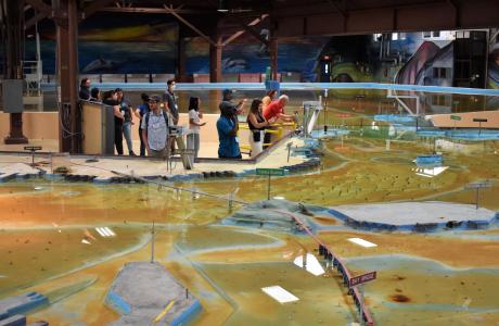
Operated by the U.S. Army Corps of Engineers, the
Bay Model is a giant hydraulic replica of San Francisco
Bay and the Sacramento-San Joaquin
Delta. It is housed in a converted World II-era
warehouse in Sausalito near San Francisco.
Hundreds of gallons of water are pumped through the
three-dimensional, 1.5-acre model to simulate a tidal ebb
and flow lasting 14 minutes.
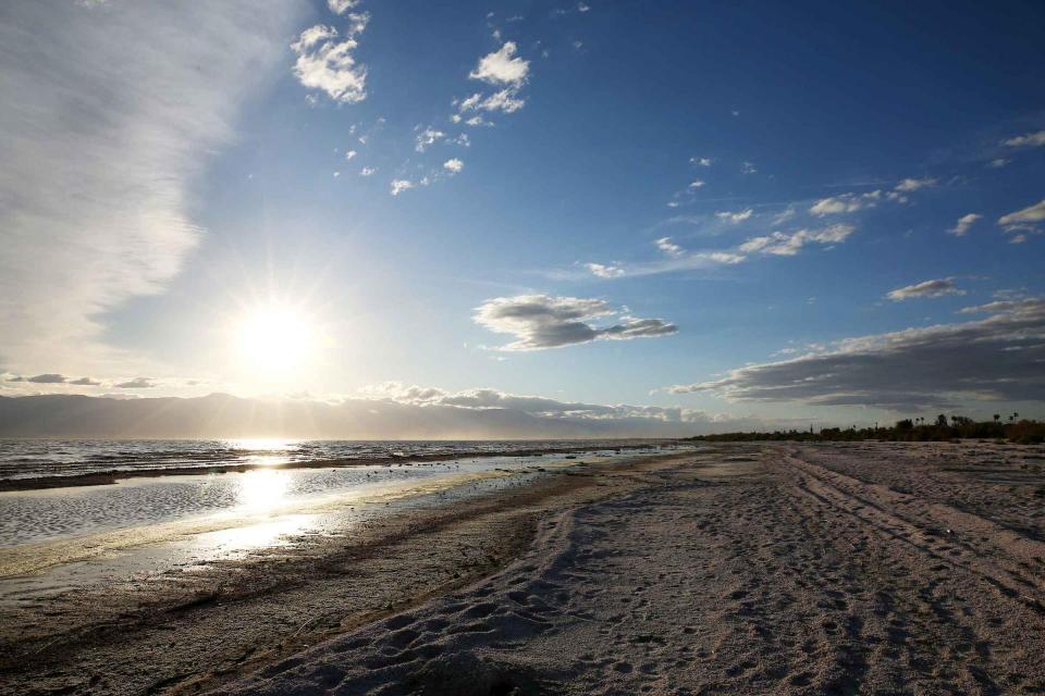
As part of the historic Colorado
River Delta, the Salton Sea regularly filled and dried for
thousands of years due to its elevation of 237 feet below
sea level.
The most recent version of the Salton Sea was formed in 1905 when
the Colorado River broke
through a series of dikes and flooded the seabed for two years,
creating California’s largest inland body of water. The
Salton Sea, which is saltier than the Pacific Ocean, includes 130
miles of shoreline and is larger than Lake Tahoe.
Drought — an extended period of
limited or no precipitation — is a fact of life in California and
the West, with water resources following boom-and-bust patterns.
No portion of the West has been immune to drought during the last
century and it occurs with much greater frequency in the West
than in any other region of the country.