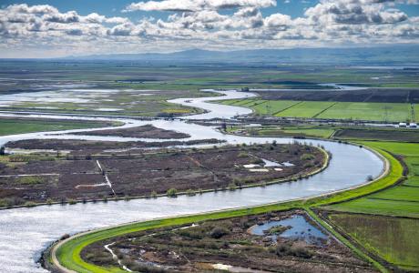
Watch our series of short videos on the importance of the
Sacramento-San Joaquin Delta, how it works as a water hub for
California and the challenges it is facing.
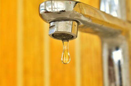
When a person opens a spigot to draw a glass of water, he or she
may be tapping a source close to home or hundreds of miles away.
Water gets to taps via a complex web of aqueducts, canals and
groundwater.
Learn more about our team in the office and on the Board of
Directors and how you can support our nonprofit mission by
donating in someone’s honor or memory, or becoming a regular
contributor or supporting specific projects.
Unlike California’s majestic rivers and massive dams and
conveyance systems, groundwater is out of sight and underground,
though no less plentiful. The state’s enormous cache of
underground water is a great natural resource and has contributed
to the state becoming the nation’s top agricultural producer and
leader in high-tech industries.
A new era of groundwater management began in 2014 in California
with the Sustainable Groundwater Management Act. The landmark law
turned 10 in 2024, with many challenges still ahead.
As we head into summer, be sure to
mark your calendars for our popular fall programs which will all
be opening for registration soon!
Importantly, we will launch our first-ever Klamath River Tour to
visit the watershed and, among other things, see how the
river has responded to the dismantling of four obsolete dams. It
will not be an annual tour, so don’t miss this opportunity!
Check out the event dates and registration
details:
Big Day of
Giving is ending soon but you still have until
midnight to support the Water Education Foundation’s tours,
workshops, publications and other programs with a donation to help us reach our
$10,000 fundraising goal - we are only $2,502
away!
At the Foundation, we believe that education is as precious
as water. Your donations help us every day to teach K-12
educators how to bring water science into the classroom and to
empower future decision-makers through our professional
development programs.
As the Colorado River’s giant reservoirs have declined during
the last two decades, even larger amounts of water have been
pumped and drained from underground, according to new research
based on data from NASA satellites. Scientists at Arizona State
University examined more than two decades of satellite
measurements and found that since 2003 the quantity of
groundwater depleted in the Colorado River Basin is comparable
to the total capacity of Lake Mead, the nation’s largest
reservoir. The researchers estimated that pumping from wells
has drained about 34 cubic kilometers, or 28 million acre-feet,
of groundwater in the watershed since 2003 — more than twice
the amount of water that has been depleted from the river’s
reservoirs during that time.
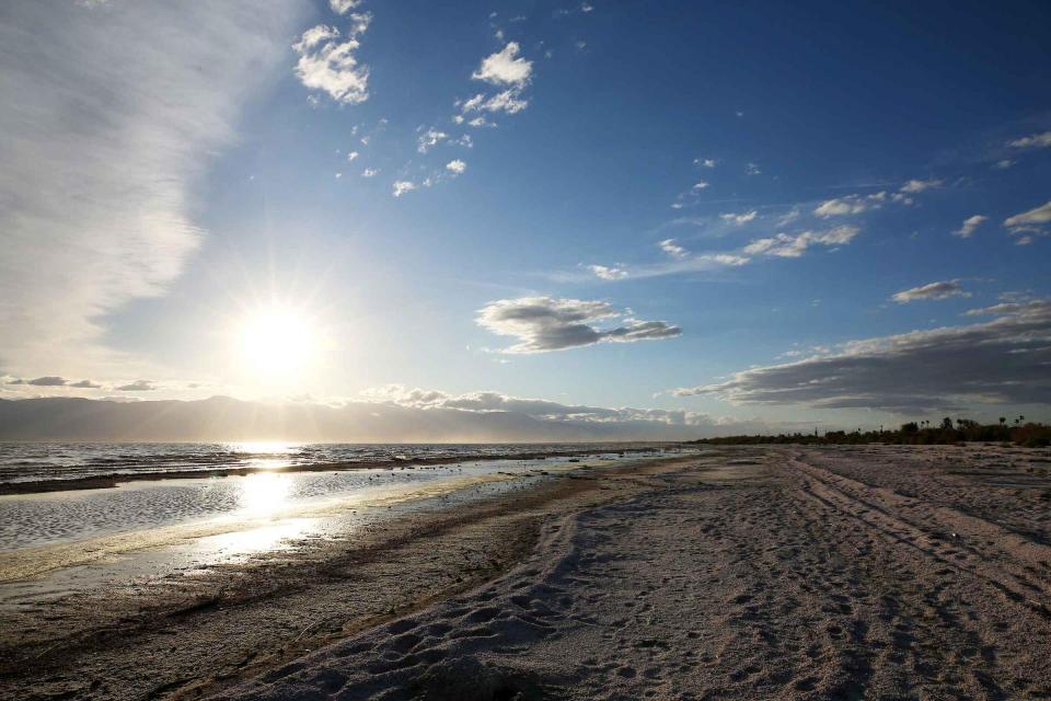
Water began flowing from a pipe onto hundreds of acres of dry,
sunbaked lake bed as California officials filled a complex of
shallow ponds near the south shore of the Salton Sea in an
effort to create wetlands that will provide habitat for fish
and birds, and help control lung-damaging dust around the
shrinking lake. The project represents the state’s largest
effort to date to address the environmental problems plaguing
the Salton Sea, which has been steadily retreating and leaving
growing stretches of dusty lake bottom exposed to the desert
winds. … The habitat area in Imperial County is being
filled with water after an adjacent area called East Pond
received its first water in April. In the coming weeks, state
officials said the flooding of these sections will bring to
fruition the first 2,000 acres of the Species Conservation
Habitat Project, a central effort in California’s plan for
improving conditions at the state’s largest lake.
California’s second-largest reservoir, Lake
Oroville, reached capacity Friday, hitting the high
water mark for the third straight year — a first for the
57-year-old reservoir. The milestone comes after a moderately
wet winter in California, with enough snow in the mountains,
particularly in the north, to melt and flush substantial water
into state reservoirs. This week, water storage in California’s
major reservoirs stood at a comfortable 116% of average for the
time of year, ensuring decent supplies for the rest of
2025. At Lake Oroville, about 70 miles north of Sacramento
in Butte County, water levels rose Friday morning to within
inches of the 900-foot elevation mark that state water managers
deem full pool, prompting notice that the reservoir had hit
capacity. At capacity, the lake holds 3.4 million acre-feet of
water, enough to supply more than 7 million households for a
year.
Recent cuts to the National Oceanic and Atmospheric
Administration (NOAA) have conservationists and scientists
worried about anadromous fish populations in the Pacific
Northwest. Like other federal agencies, NOAA is undergoing
major downsizing. The shrinkage is already disrupting habitat
restoration work for salmon and steelhead in California. And if
additional budget cuts that are currently in the works come to
fruition, the agency’s fisheries division could be eliminated
entirely, a recently retired NOAA scientist tells Field &
Stream. … When it comes to salmon and steelhead,
(fluvial geomorphologist Brian) Cluer worries most about
the potential loss of dam-removal projects in the Pacific
Northwest. NOAA played a pivotal role in the removal of four
dams on California’s Klamath River in 2023 and 2024, Cluer
says.
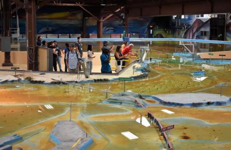
Operated by the U.S. Army Corps of Engineers, the
Bay Model is a giant hydraulic replica of San Francisco
Bay and the Sacramento-San Joaquin
Delta. It is housed in a converted World II-era
warehouse in Sausalito near San Francisco.
Hundreds of gallons of water are pumped through the
three-dimensional, 1.5-acre model to simulate a tidal ebb
and flow lasting 14 minutes.
As part of the historic Colorado
River Delta, the Salton Sea regularly filled and dried for
thousands of years due to its elevation of 237 feet below
sea level.
The most recent version of the Salton Sea was formed in 1905 when
the Colorado River broke
through a series of dikes and flooded the seabed for two years,
creating California’s largest inland body of water. The
Salton Sea, which is saltier than the Pacific Ocean, includes 130
miles of shoreline and is larger than Lake Tahoe.
Drought—an extended period of
limited or no precipitation—is a fact of life in California and
the West, with water resources following boom-and-bust patterns.
During California’s 2012–2016 drought, much of the state
experienced severe drought conditions: significantly less
precipitation and snowpack, reduced streamflow and higher
temperatures. Those same conditions reappeared early in 2021
prompting Gov. Gavin Newsom in May to declare drought emergencies
in watersheds across 41 counties in California.