Since World War II and a booming state population that
increasingly sought out the great outdoors to relax, the state’s
water-based recreational activities have continued to grow more
popular and diverse, occurring in a multitude of sources –
from swimming pools and spas to beaches, reservoirs, natural
lakes and rivers.
Public water supply projects, such as the State Water Project,
have helped to provide additional recreational opportunities for
Californians. In some cases, reservoir releases can contribute to
downstream recreation benefits by improving fisheries or by
creating whitewater rafting opportunities that would not be
possible in the absence of reservoir regulation. However, there
are conflicting values and needs for the same river system.
Before the Pacific Coast Highway,
before Malibu and before
multimillion-dollar beachfront homes, Topanga Creek flowed
freely down through the Santa Monica Mountains. The water,
swelling and subsiding with the seasons, eventually dumped out
into a large lagoon, which in turn drained out to the Pacific
Ocean. Historically, the lagoon covered 30 acres of
coastal wetlands. But over time, the brackish water slowly gave
way to homes, beach parking lots and the Pacific Coast Highway.
Today, less than 1 acre of the lagoon remains.
… In Malibu, a last-ditch effort is underway to
save and expand the Topanga Lagoon, which contains
some of the last remaining coastal wetlands in the state.
Despite demands from San Diegan officials that Gov. Gavin
Newsom declare a state of emergency for the
Tijuana Rivercrisis, the governor’s position stands —
the crisis remains a federal issue. … On April 9,
Aguirre took to Instagram to plead with the governor to declare
a state of emergency over the worsening sewage crisis in the
Tijuana River. The long-brewing problem is part of a broader
crossborder watershed in which untreated wastewater, sediment
and trash regularly flow into California from Mexico, impacting
public health and the environment, the California State Lands
Commission has said. But Newsom’s office has long argued
that the federal government is responsible.
California’s state parks system is getting larger, following a
trio of new additions announced on Earth Day. State
officials said the three parks will be located in an area where
these public spaces have long been few and
far-between. They are the Feather River
Park near Olivehurst in Yuba County — the county’s
first state park — the San Joaquin River
Parkway in Fresno and Madera counties, and the Dust
Bowl Camp near Bakersfield in Kern County. … State Parks
Director Armando Quintero spoke with Insight Host Vicki
Gonzalez about these latest efforts to expand recreational and
conservation efforts in the Central Valley.
Sycamore Island, a 600-acre property on the banks of
the San Joaquin River in the Central Valley,
is a little pocket of nature in the middle of a metropolis.
… Last week, Sycamore Island became part of California’s
largest expansion to its state park system in decades. On Earth
Day, Gov. Gavin Newsom unveiled plans for three new California
state parks and announced the expansion of several more. The
state parks expansion touches the redwoods, the Sierra Nevada,
the Pacific Coast and the Central Valley. … The San
Joaquin River Parkway, including Sycamore Island, is a proposed
state park that would consist of 874 acres of riverfront
property and will provide river access and recreation
opportunities for communities in Fresno and Madera.
Mandy Yeahpau has done a lot of whitewater rafting in Oregon,
but she never thought she’d get the chance to run the Klamath
River. That changed in 2024, when the river’s dams were removed
and the waterway ran free for the first time in generations,
allowing not only the salmon to return but also boaters, many
of whom jumped at the opportunity to explore the reawakened
river. On this week’s episode of the Peak Northwest
podcast, Yeahpau recounts her rafting trip on the Klamath
River, which she said was both a great adventure and a deeply
moving experience.
The Central Valley could soon be home to three new state parks
in what officials say is the largest expansion of California’s
state park system in decades. The proposed parks —
Feather River Park in Yuba County, San
Joaquin River Parkway near Fresno, and Dust Bowl Camp
in Bakersfield — would serve historically park-poor
communities. … The largest of the proposed parks,
Feather River in Olivehurst, Yuba County, sits on nearly 2,000
acres along the Feather River. It would be the first state park
in Yuba County, complete with a boat launch and riverside
beach, as well as a floodplain designed to take on
water in high-flow years. The San Joaquin River
Parkway in Fresno and Madera counties would join various
properties into an 874-acre state park directly upriver from
the city of Fresno.
Along Northern California’s Sonoma Coast, finding stretches of
shoreline that still feel truly wild and undeveloped is
becoming increasingly rare. That’s what makes the Estero
Americano Coast Preserve, just south of Bodega Bay, such a
remarkable discovery. … For generations, this land was
part of a working coastal ranch. The rolling grasslands and
estuary edges were privately owned and used primarily for
agriculture and grazing, keeping the coastline off-limits to
the public for nearly 100 years. … Birdwatchers may spot
great blue herons stalking the shallows, snowy egrets moving
through the marsh, and hawks riding the coastal updrafts above
the bluffs.
*IMPORTANT* In anticipation of high demand, the Foundation will be allocating tickets via a lottery method with a maximum of 3 entrants per organization. Tickets will be released in batches over time. Details coming soon.
This special, first-ever Foundation water tour will only be offered once! Join us on this special journey as we examine water issues along the Kern River, from its mountain-fed headwaters in the southern Sierra Nevada to its terminus in the Central Valley west of Bakersfield. Among the planned stops are both upper forks of the Kern River, Lake Isabella, lower Kern River canyon, the Friant-Kern Canal, irrigated agriculture in the valley, the Kern Water Bank and more.
Hyatt Place Bakersfield
310 Coffee Rd.
Bakersfield, CA 93309
A river access advocacy group is splintered. Landowners are
organized to protect a decades-old “float but don’t touch”
decree. And lawmakers, halfway through the legislative session,
have yet to take up any bill that would change that
state’s murky rules around recreational access to the state’s
waterways. As a short and dry river season takes shape
after a snow-starved winter, it appears the status quo will
hold. But passions are roiling at Colorado’s uniquely volatile
confluence of property rights, recreational pressures and river
safety. … The blend of three divergent arguments — the
right-to float, the right-to-wade and do nothing — seems to
have stymied any new laws.
Colorado’s long-standing balance between public recreation and
private property along rivers is now under renewed pressure.
But changing stream access law would impose significant fiscal
and legal costs for relatively limited new recreational
benefit. The state of Colorado itself may not be able to afford
a redrafting of river access laws, and the state’s property
owners certainly will not be able to afford it.
… Changing these laws would not only be a legal
headache. It would be an enormously expensive proposition for
landowners, county governments, and the state of Colorado, and
one with limited demonstrable value. –Written by Greg Walcher and Mike King, former executive
directors of the Colorado Department of Natural Resources.
The public interest group, Bring Back the Kern, is launching a
competition for residents to use artificial intelligence to
generate images of a flowing Kern River through Bakersfield,
where it is mostly dry, according to a press release from the
group. The contest has been dubbed “A.I.pril Fools for the Kern
River” and runs Wednesday, April 1 through April 15. The idea
is to draw attention to the fact that the river runs dry
through Bakersfield in most years as agricultural diversions
take most of the water. … Bring Back the Kern, along
with Water Audit California, is suing the City of Bakersfield
over how it operates the river.
Colorado’s dry winter is now raising concerns about what summer
recreation could look like, but rafting outfitters said the
outlook isn’t as bleak as it might seem. At Dillon
Reservoir, low snowpack paints a concerning picture, with
statewide levels dipping to record lows. But according to AVA
Rafting and Ziplining owner Duke Bradford, snowpack is only
part of the equation. Bradford said rafting conditions
depend heavily on spring and summer rain, especially on
free-flowing rivers like Clear Creek near Idaho Springs. He
explained that water levels, measured in cubic feet per second
(cfs), could rise dramatically overnight with the right storm.
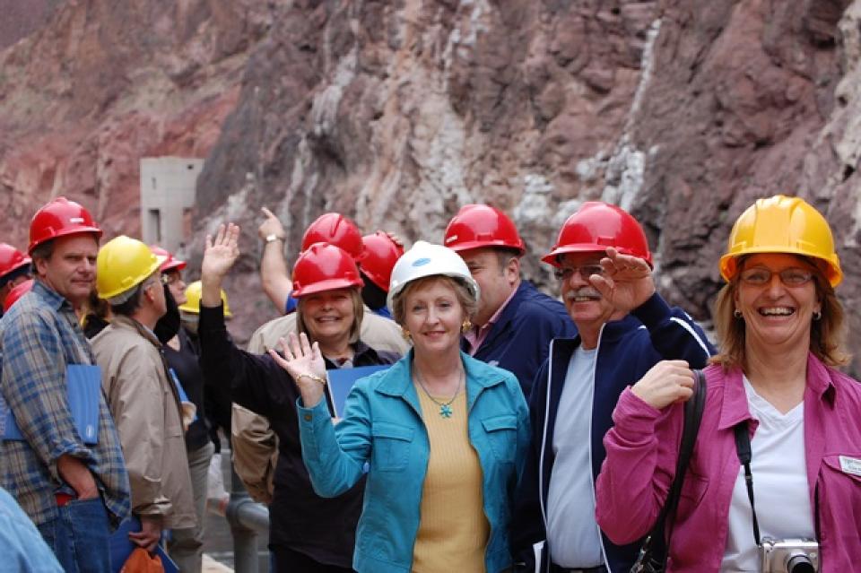
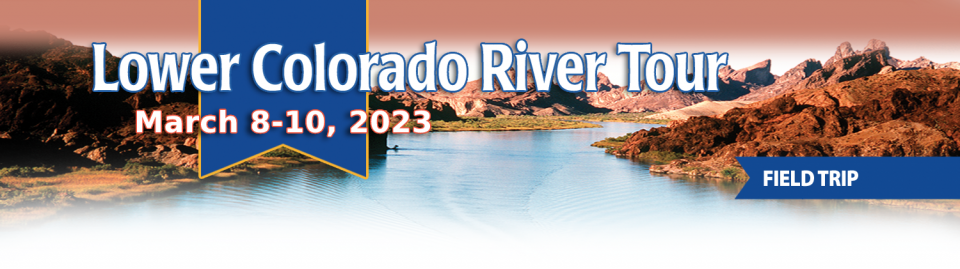
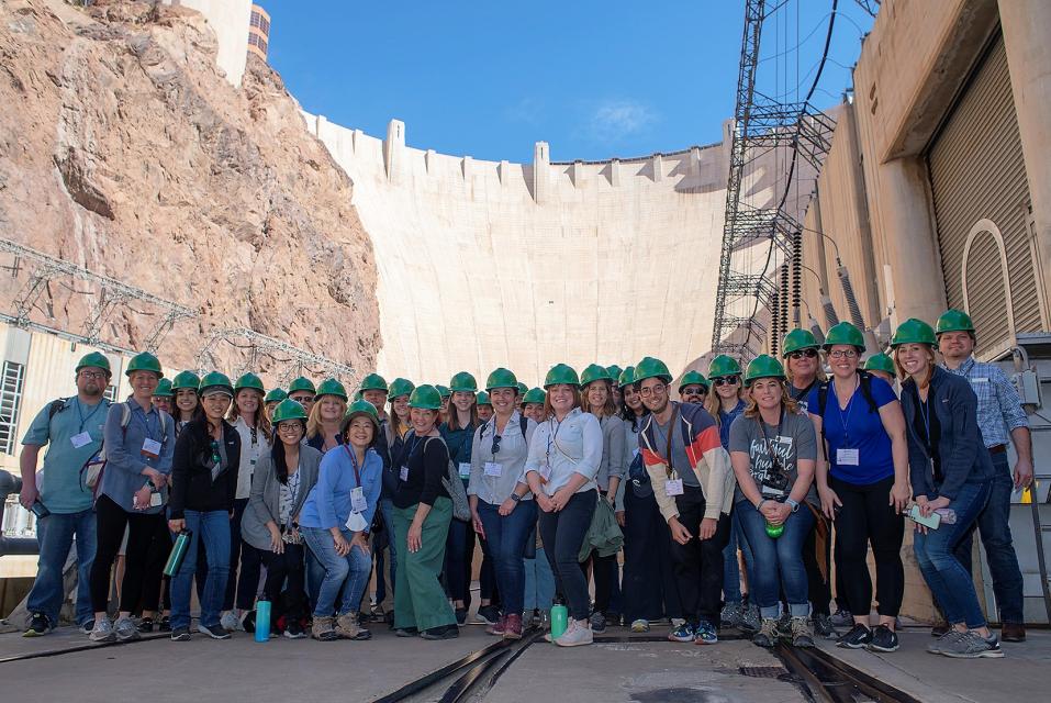
This tour explored the lower Colorado River firsthand where virtually every drop of the river is allocated, yet demand is growing from myriad sources — increasing population, declining habitat, drought and climate change.
The 1,450-mile river is a lifeline to some 40 million people in the Southwest across seven states, 30 tribal nations and Mexico. How the Lower Basin states – Arizona, California and Nevada – use and manage this water to meet agricultural, urban, environmental and industrial needs was the focus of this tour.
Hilton Garden Inn Las Vegas Strip South
7830 S Las Vegas Blvd
Las Vegas, NV 89123
On this first-ever Foundation water tourwe examined water issues along the 263-mile Klamath River, from its spring-fed headwaters in south-central Oregon to its redwood-lined estuary on the Pacific Ocean in California.
Running Y Resort
5500 Running Y Rd
Klamath Falls, OR 97601
This tour explored the lower Colorado River firsthand where virtually every drop of the river is allocated, yet demand is growing from myriad sources — increasing population, declining habitat, drought and climate change.
The 1,450-mile river is a lifeline to some 40 million people in the Southwest across seven states, 30 tribal nations and Mexico. How the Lower Basin states – Arizona, California and Nevada – use and manage this water to meet agricultural, urban, environmental and industrial needs was the focus of this tour.
Hilton Garden Inn Las Vegas Strip South
7830 S Las Vegas Blvd
Las Vegas, NV 89123
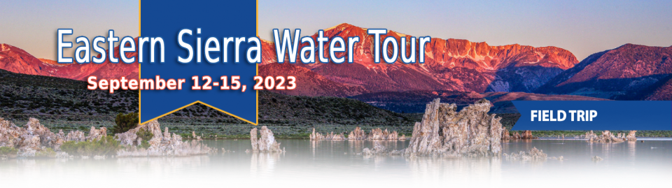
This special Foundation water tour journeyed along the Eastern Sierra from the Truckee River to Mono Lake, through the Owens Valley and into the Mojave Desert to explore a major source of water for Southern California, this year’s snowpack and challenges for towns, farms and the environment.
This tour explored the lower Colorado River firsthand where virtually every drop of the river is allocated, yet demand is growing from myriad sources — increasing population, declining habitat, drought and climate change.
The 1,450-mile river is a lifeline to some 40 million people in the Southwest across seven states, 30 tribal nations and Mexico. How the Lower Basin states – Arizona, California and Nevada – use and manage this water to meet agricultural, urban, environmental and industrial needs was the focus of this tour.
Hyatt Place Las Vegas At Silverton Village
8380 Dean Martin Drive
Las Vegas, NV 89139
Deep, throaty cadenced calls —
sounding like an off-key bassoon — echo over the grasslands,
farmers’ fields and wetlands starting in late September of each
year. They mark the annual return of sandhill cranes to the
Cosumnes River Preserve,
46,000 acres located 20 miles south of Sacramento on the edge of
the Sacramento-San Joaquin Delta.
We explored the lower Colorado River where virtually every drop
of the river is allocated, yet demand is growing from myriad
sources — increasing population, declining habitat, drought and
climate change.
The 1,450-mile river is a lifeline to 40 million people in
the Southwest across seven states and Mexico. How the Lower Basin
states – Arizona, California and Nevada – use and manage this
water to meet agricultural, urban, environmental and industrial
needs was the focus of this tour.
Hampton Inn Tropicana
4975 Dean Martin Drive, Las Vegas, NV 89118
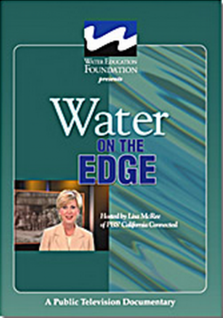
Water truly has shaped California into the great state it is
today. And if it is water that made California great, it’s the
fight over – and with – water that also makes it so critically
important. In efforts to remap California’s circulatory system,
there have been some critical events that had a profound impact
on California’s water history. These turning points not only
forced a re-evaluation of water, but continue to impact the lives
of every Californian. This 2005 PBS documentary offers a
historical and current look at the major water issues that shaped
the state we know today. Includes a 12-page viewer’s guide with
background information, historic timeline and a teacher’s lesson.
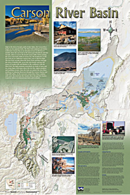
A companion to the Truckee River Basin Map poster, this
24×36-inch poster, suitable for framing, explores the Carson
River, and its link to the Truckee River. The map includes the
Lahontan Dam and reservoir, the Carson Sink, and the farming
areas in the basin. Map text discusses the region’s hydrology and
geography, the Newlands Project, land and water use within the
basin and wetlands. Development of the map was funded by a grant
from the U.S. Bureau of Reclamation Mid-Pacific Region, Lahontan
Basin Area Office.
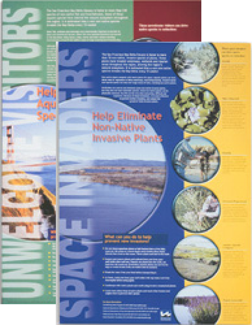
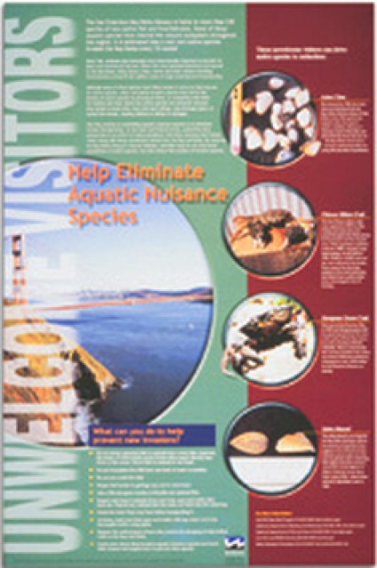
This 24×36 inch poster, suitable for framing, explains how
non-native invasive animals can alter the natural ecosystem,
leading to the demise of native animals. “Unwelcome Visitors”
features photos and information on four such species – including
the zerbra mussel – and explains the environmental and economic
threats posed by these species.
The 24-page Layperson’s Guide to the State Water Project provides
an overview of the California-funded and constructed State Water
Project.
The State Water Project is best known for the 444-mile-long
aqueduct that provides water from the Delta to San Joaquin Valley
agriculture and southern California cities. The guide contains
information about the project’s history and facilities.
A new look for our most popular product! And it’s the perfect
gift for the water wonk in your life.
Our 24×36-inch California Water Map is widely known for being the
definitive poster that shows the integral role water plays in the
state. On this updated version, it is easier to see California’s
natural waterways and man-made reservoirs and aqueducts
– including federally, state and locally funded
projects – the wild and scenic rivers system, and
natural lakes. The map features beautiful photos of
California’s natural environment, rivers, water projects,
wildlife, and urban and agricultural uses and the
text focuses on key issues: water supply, water use, water
projects, the Delta, wild and scenic rivers and the Colorado
River.


")