Header link June 22, 2020

LinkedIn

  • Read more
Header link September 15, 2014

Cart

  • Read more
Header link November 3, 2015

Donate Now

  • Read more
Header link May 15, 2014

Twitter

  • Read more
Header link May 15, 2014

Facebook

  • Read more
Instagram
Header link May 15, 2014

Instagram

  • Read more
Header link May 15, 2014

Contact Us

  • Read more
More options
Water Education Foundation
Home
Water Education Foundation
Everything about California water that matters
  • Water Academy
    • Agriculture
      • Agricultural Conservation
      • Agricultural Drainage
    • Background Information
      • Legislation — California and Federal
      • Regulations — California and Federal
      • Water History
      • Water Rights
    • Bay-Delta
      • Bay Delta
      • Bay Delta Conservation Plan
      • Delta Issues
      • Delta Smelt
      • Sacramento San Joaquin Delta
      • San Francisco Bay
      • Suisun Marsh
    • Dams, Reservoirs and Water Projects
      • California Aqueduct
      • Central Valley Project
      • Folsom Dam
      • Friant Dam
      • Hetch Hetchy
      • Hoover Dam
      • Infrastructure
      • Lake Mead
      • Lake Powell
      • Oroville Dam
      • San Luis Dam
      • Shasta Dam
      • State Water Project
    • Environmental Issues
      • Anadromous Fish Restoration
      • Ecosystem
      • Endangered Species Act
      • Invasive species
      • Lake Tahoe
      • Mono Lake
      • Public Trust Doctrine
      • Salmon
      • San Joaquin River Restoration
      • Watershed
      • Wetlands
    • Leaders and Experts
    • Regions
      • Central Coast
      • Central Valley
      • Mexico
      • Nevada
      • North Coast
      • Pyramid Lake
      • Sacramento Valley
      • Salton Sea
      • San Joaquin Valley
      • Sierra Nevada
      • Southern California
      • Tulare Lake Basin
    • Rivers
      • Carson River
      • Colorado River
      • Klamath River
      • New River
      • North Coast Rivers
      • Russian River
      • Sacramento River
      • Truckee River
      • San Joaquin River
    • Water Issues
      • Climate Change
      • Coronavirus
      • Drought
      • Earthquakes
      • Energy and Water
      • Floods
      • Fracking
      • Growth
      • Hydropower
      • Levees
      • Tribal Water Issues
      • Water Conservation
    • Water Quality
      • Drinking Water
      • Nitrate contamination
      • Pollution
      • Stormwater
      • Wastewater
      • Water Quality
    • Water Supply and Management
      • Acre Foot
      • Aquifers
      • California Water Plan
      • Conjunctive Use
      • Desalination
      • Grey water
      • Groundwater
      • Integrated Regional Water Management
      • Recreation
      • Surface Water
      • Water Marketing and Banking
      • Water Rates
      • Water Recycling
      • Water Supply
      • Water Transfers
  • Tours & Events
    • Water Tours
      • 2024 Tour Sponsors
    • Events
    • Event Calendar
    • Past Tours & Events
      • Anne J. Schneider Fund Lecture Series
  • Specialized Programs
    • Water Leaders
      • Cohort Rosters
      • Yearly Class Reports
      • Your Alumni Network
      • Alumni Profiles
    • Project WET
      • Workshops
      • Special Workshops & Events
      • Supplementary Materials
      • California Content Standard Correlations
      • Facilitator's Trainings
      • Foundation School Programs
        • Elementary Programs
        • Secondary Programs
      • Water Kids
      • California Project WET Gazette
      • Gazette Archives
    • Colorado River Project
    • GRA Scholastic Fund Program
  • Maps & Guides
    • Maps & Posters
    • Layperson's Guides
    • Map & Guide Bundles
    • Books
    • Colorado River Materials
    • California Runoff Rundown
    • Other Publications
    • Water Awareness Materials
    • Downloadable Publications
    • Videos and DVDs
      • Video Clips
    • School Age Publications
    • Stickers
    • Free Programs and Publications
  • Newsroom
    • Western Water News
    • Aquafornia
      • About Aquafornia
    • Information Desk
    • Western Water Magazine Archive
      • Full Print Edition
      • Print Edition Excerpts
    • River Report Archive
  • Aquapedia
    • Alphabetical List of Subjects
      • A
      • B
      • C
      • D
      • E
      • F
      • G
      • H
      • I
      • J
      • K
      • L
      • M
      • N
      • O
      • P
      • Q
      • R
      • S
      • T
      • U
      • V
      • W
      • X
      • Y
      • Z
    • Historical Water People
    • Where Does My Water Come From?
      • Northern California
      • Sacramento
      • North Bay
      • South Bay
      • Central Valley
      • Los Angeles
      • Inland Empire
      • San Diego
      • All California Water Sources
    • Timelines
    • Videos
    • Image Gallery
    • Water Directory
      • Federal Agencies
      • State Agencies in California
      • Environmental Organizations
      • Other California Organizations
      • State and Federal Legislative Committees
      • Water Associations and Groups
      • Western States Water Agencies and Districts
    • Online Resources
    • Useful Acronyms
    • About Aquapedia
  • About
    • About Us
      • Board of Directors
      • Staff Biographies
      • Job Openings
    • Announcements
    • Support Our Mission
      • Become a Member
      • Donate in Honor/Memory
      • Planned Giving
    • Contact Us

Topic: San Joaquin River

Overview July 1, 2014

San Joaquin River

San Joaquin RiverThe San Joaquin River, which helps drain California’s Central Valley, has been negatively impacted by construction of dams, inadequate streamflows and poor water quality. Efforts are now underway to restore the river and continue providing agricultural lands with vital irrigation, among other water demands.

After an 18-year lawsuit to restore water flows to a 60-mile dry stretch of river and to boost the dwindling salmon populations, the San Joaquin River Restoration Settlement is underway. Water releases are now used to restore the San Joaquin River and to provide habitat for naturally-reproducing populations of self-sustaining Chinook salmon and other fish in the San Joaquin River. Long-term efforts also include measures to reduce or avoid adverse water supply impacts from the restoration flows.

  • Read more
Aquafornia news May 1, 2025 GV Wire (Fresno, Calif.)

State says Arambula CEMEX bill subverts CEQA. What’s next for San Joaquin River?

State legislators denied a local lawmaker’s bill to stop a mining project that proposes to drill and blast a 600-foot pit along the San Joaquin River and is undergoing its environmental review. On Monday, the California Assembly Committee on Natural Resources voted down AB 1425 from Assemblymember Joaquin Arambula, D-Fresno, though it may come back up in January 2026 for absent committee members to consider, said committee chair Isaac Bryan, D-Baldwin Hills. The “narrowly tailored” bill, according to Arambula, would have stopped Mexico-based CEMEX from emptying water from mining pits, which he said risks contaminating the river and overdrafting water along the river. By banning “dewatering,” the company’s plan to dig the 600-foot pit would not only be stopped, but it would force the company to cease its current operations as well, CEMEX representative Scott Govenar said at the hearing. 

Related article:

  • Fresnoland (Calif.): Arambula’s bill protect San Joaquin River dies in committee
  • Read more
  • View Original Article
Aquafornia news April 30, 2025 The Fresno Bee

Opinion: Bill to stop CEMEX blast mine on San Joaquin River fails

If the San Joaquin River is to be protected from further harm at the hands of a multinational mining company with a history of environmental violations, help won’t be arriving from the state capitol. A bill authored by Assemblymember Joaquin Arambula (D-Fresno) aimed at squelching CEMEX’s controversial blast mine failed to advance from its first committee hearing Monday afternoon in Sacramento. Only one member of the Assembly Natural Resources Committee voted “aye” on AB 1425 compared to 13 “noes” and no votes, killing the bill for this legislative session. That does not mean CEMEX gets the green light to start drilling and blasting 200 feet away from the river 3 miles outside the Fresno city limits. Goodness no. It simply means the process for potential approval will continue as prescribed by the California Environmental Quality Act.
–Written by Fresno Bee opinion columnist Marek Warszawski.

Related articles:

  • The San Joaquin Valley Sun (Fresno, Calif.): Assembly Committee rejects Arambula’s bill to block Cemex expansion
  • Read more
  • View Original Article
Aquafornia news April 29, 2025 ABC30 (Fresno, Calif.)

Bill that would stop 100-year mining permit near San Joaquin River fails

A bill introduced by Assemblyman Joaquin Arambula aimed at stopping a century-long mining project in Fresno County did not make it out of committee Monday afternoon. That mining project would drill a 600-foot deep pit near the San Joaquin River in Fresno County. Arambula introduced a bill, AB1425, which went before the Natural Resources Committee in Sacramento this afternoon. It would have disqualified building materials company CEMEX’s proposed 100-year mining expansion project utilizing hard rock mining, blasting and drilling that deep pit. … The San Joaquin River Parkway and Conservation Trust has been strongly opposed to the project because of its potential impact on the environment.

Related article:

  • Fresnoland (Calif.): San Joaquin River rally draws hundreds against CEMEX blast mine as state bill hangs in balance
  • Read more
  • View Original Article
Aquafornia news April 23, 2025 Fresnoland (Calif.)

CEMEX’s proposed blast mine faces potential new law

Fresno Assemblyman Joaquin Arambula will host a town hall Thursday evening to rally opposition against CEMEX’s proposed blast mine along the San Joaquin River, a project critics warn could contaminate groundwater and damage critical habitat. The April 24 event at the River Center will feature presentations on the environmental impacts of the mining giant’s expansion plans and highlight Arambula’s legislation aimed at blocking the project. … “The CEMEX Rockfield Expansion poses a serious threat to wildlife, water quality, air quality, and the long-term vision for the San Joaquin River Parkway. This is a critical moment for our community to get informed, get involved, and make your voices heard,” the flyer for the event reads.

Related articles:

  • KVPR (Fresno, Calif.): Arambula to host river rally on Thursday against CEMEX blast mine
  • GV Wire (Fresno, Calif.): Arambula town hall will examine CEMEX mining plan for San Joaquin River
  • Read more
  • View Original Article
Aquafornia news April 21, 2025 Stocktonia (Calif.)

Monday Top of the Scroll: $2 billion levee project breaks ground in Stockton

Construction on a $2 billion levee project that will effectively protect more than a third of Stocktonians’ homes from flooding kicked off this week. Local government officials took part in a groundbreaking ceremony Friday off March Lane at the Tenmile Slough in Brookside to launch the Lower San Joaquin River Improvement Project. … The first phase of the project, slated for completion in late 2026, will see improvements made to just over a mile of the Tenmile Slough levee, which sits directly in the backyard of many homes in the Brookside area of west Stockton, according to a presentation on the project’s overview. About one mile of the levee will be upgraded to have a seepage cutoff wall, which is an added layer of material preventing water seeping through or under the levee.

Related articles:

  • Office of Gov. Gavin Newsom: News release: California breaks ground on critical flood protection project in the Central Valley​
  • KCRA (Sacramento, Calif.): Groundbreaking ceremony kicks off first phase of flood risk reduction project in San Joaquin County
  • FOX40 (Sacramento, Calif.): A $1.95 billion flood risk reduction project breaks ground in Stockton​
  • Read more
  • View Original Article
Aquafornia news April 2, 2025 GV Wire (Fresno, Calif.)

Can CEMEX dig a 600-foot hole and not harm the river? Arambula says no and writes a bill

A mining company wants to dig hundreds of feet down on a site along the San Joaquin River. With an environmental review of the project released, the decision now lands on Fresno County supervisors to approve or deny — and, if the project gets a green light,  decide how deep to allow the company to dig. Mexico-based mining company CEMEX wants to dig a 600-foot hole and blast hard rock from its quarry site about 200 feet from the banks of the San Joaquin River, according to Fresno County’s environmental impact report. The company already mines aggregate at its quarry. A permit to operate expires in July 2026. However, a new California legislative bill may decide the future of mining on the prime river land, bypassing the supervisors.  Assembly Bill 1425 from Joaquin Arambula (D-Fresno) would ban dewatering from many sites along the San Joaquin River — effectively killing the CEMEX proposal.

  • Read more
  • View Original Article
Western Water January 13, 2023 Layperson's Guide to Water Conservation WESTERN WATER-In One of the Snowiest Places in the West, A Scientist Hunts for Clues to the Sierra Snowpack’s Future By Nick Cahill

In One of the Snowiest Places in the West, A Scientist Hunts for Clues to the Sierra Snowpack’s Future
WESTERN WATER Q&A: Central Sierra Snow Lab Manager Andrew Schwartz Aims to Help Water Managers Improve Tracking of Snowpack Crucial to California's Drought-Stressed Water Supply

Photo of Andrew Schwartz, manager and lead scientist at the Central Sierra Snow Laboratory.Growing up in the shadow of the Rocky Mountains, Andrew Schwartz never missed an opportunity to play in – or study – a Colorado snowstorm. During major blizzards, he would traipse out into the icy wind and heavy drifts of snow pretending to be a scientist researching in Antarctica.  

Decades later, still armed with an obsession for extreme weather, Schwartz has landed in one of the snowiest places in the West, leading a research lab whose mission is to give California water managers instant information on the depth and quality of snow draping the slopes of the Sierra Nevada.

  • Read more
Tour November 2, 2022 - 7:30am - November 3, 2022 - 6:30pm Nick Gray

San Joaquin River Restoration Tour 2022
Field Trip - November 2-3

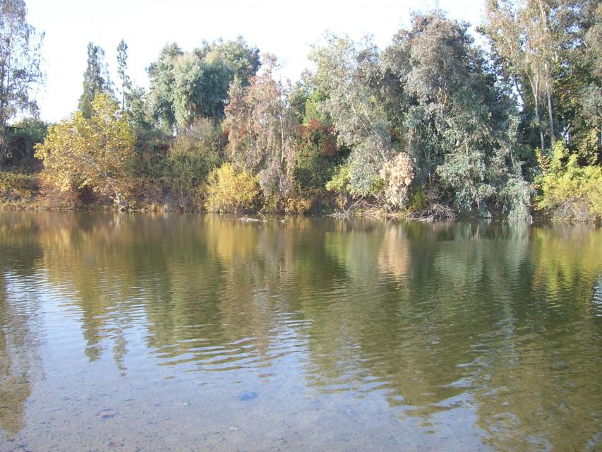
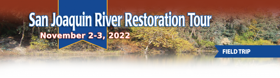
This tour traveled along the San Joaquin River to learn firsthand about one of the nation’s largest and most expensive river restoration projects.

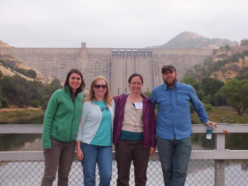
The San Joaquin River was the focus of one of the most contentious legal battles in California water history, ending in a 2006 settlement between the federal government, Friant Water Users Authority and a coalition of environmental groups.

Hampton Inn & Suites Fresno
327 E Fir Ave
Fresno, CA 93720
View map
  • Read more
Tour April 20, 2022 - 7:30am - April 22, 2022 - 6:30pm Explore Epicenter of Drought and Groundwater Sustainability on the Central Valley Tour Nick Gray

Central Valley Tour 2022
Field Trip - April 20-22

Central Valley Tour participants at a dam.
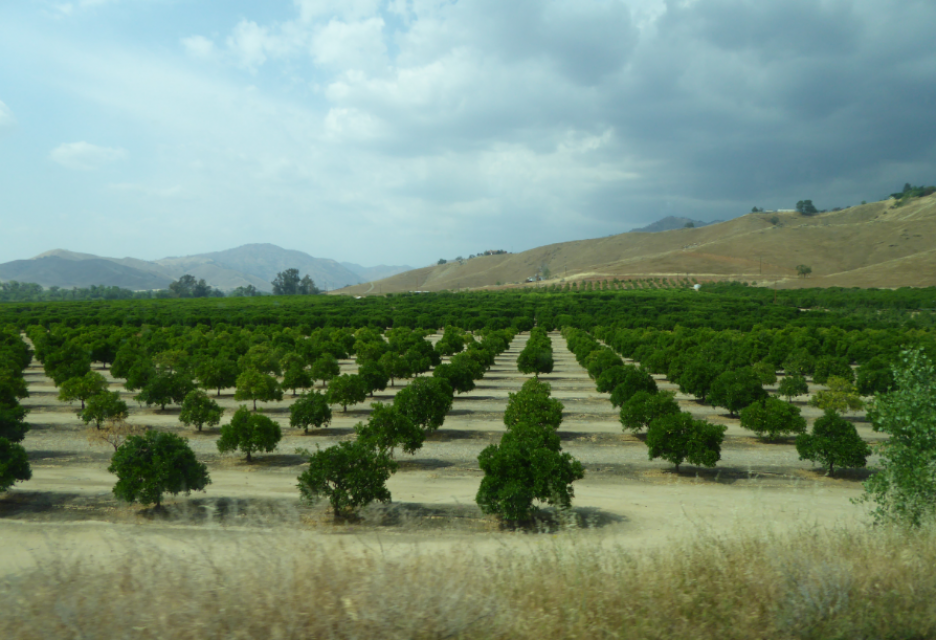
This tour ventured through California’s Central Valley, known as the nation’s breadbasket thanks to an imported supply of surface water and local groundwater. Covering about 20,000 square miles through the heart of the state, the valley provides 25 percent of the nation’s food, including 40 percent of all fruits, nuts and vegetables consumed throughout the country.

  • Read more
Western Water November 19, 2021 California Water Map WESTERN WATER-California Spent Decades Trying to Keep Central Valley Floods at Bay. Now It Looks to Welcome Them Back By Alastair Bland

California Spent Decades Trying to Keep Central Valley Floods at Bay. Now It Looks to Welcome Them Back
WESTERN WATER IN-DEPTH: Floodplain restoration gets a policy and funding boost as interest grows in projects that bring multiple benefits to respond to climate change impacts

Land and waterway managers labored hard over the course of a century to control California’s unruly rivers by building dams and levees to slow and contain their water. Now, farmers, environmentalists and agencies are undoing some of that work as part of an accelerating campaign to restore the state’s major floodplains.

  • Read more
Western Water April 17, 2020 Gary Pitzer

Framework for Agreements to Aid Health of Sacramento-San Joaquin Delta is a Starting Point With An Uncertain End
WESTERN WATER IN-DEPTH: Voluntary agreement discussions continue despite court fights, state-federal conflicts and skepticism among some water users and environmental groups

Aerial image of the Sacramento-San Joaquin DeltaVoluntary agreements in California have been touted as an innovative and flexible way to improve environmental conditions in the Sacramento-San Joaquin Delta and the rivers that feed it. The goal is to provide river flows and habitat for fish while still allowing enough water to be diverted for farms and cities in a way that satisfies state regulators.

  • Read more
Western Water October 24, 2019 California Water Map Gary Pitzer

Understanding Streamflow Is Vital to Water Management in California, But Gaps In Data Exist
WESTERN WATER NOTEBOOK: A new law aims to reactivate dormant stream gauges to aid in flood protection, water forecasting

Stream gauges gather important metrics such as  depth, flow (described as cubic feet per second) and temperature.  This gauge near downtown Sacramento measures water depth.California is chock full of rivers and creeks, yet the state’s network of stream gauges has significant gaps that limit real-time tracking of how much water is flowing downstream, information that is vital for flood protection, forecasting water supplies and knowing what the future might bring.

That network of stream gauges got a big boost Sept. 30 with the signing of SB 19. Authored by Sen. Bill Dodd (D-Napa), the law requires the state to develop a stream gauge deployment plan, focusing on reactivating existing gauges that have been offline for lack of funding and other reasons. Nearly half of California’s stream gauges are dormant.

  • Read more
Western Water April 25, 2019 California Water Map Gary Pitzer

California’s New Natural Resources Secretary Takes on Challenge of Implementing Gov. Newsom’s Ambitious Water Agenda
WESTERN WATER Q&A: Wade Crowfoot addresses Delta tunnel shift, Salton Sea plan and managing water amid a legacy of conflict

Wade Crowfoot, California Natural Resources Secretary.One of California Gov. Gavin Newsom’s first actions after taking office was to appoint Wade Crowfoot as Natural Resources Agency secretary. Then, within weeks, the governor laid out an ambitious water agenda that Crowfoot, 45, is now charged with executing.

That agenda includes the governor’s desire for a “fresh approach” on water, scaling back the conveyance plan in the Sacramento-San Joaquin Delta and calling for more water recycling, expanded floodplains in the Central Valley and more groundwater recharge.

  • Read more
Western Water April 11, 2019 Sacramento-San Joaquin Delta Map Gary Pitzer

Bruce Babbitt Urges Creation of Bay-Delta Compact as Way to End ‘Culture of Conflict’ in California’s Key Water Hub
WESTERN WATER NOTEBOOK: Former Interior secretary says Colorado River Compact is a model for achieving peace and addressing environmental and water needs in the Delta

Former Interior Secretary Bruce Babbitt gives the Anne J. Schneider Lecture April 3 at Sacramento's Crocker Art Museum.  Bruce Babbitt, the former Arizona governor and secretary of the Interior, has been a thoughtful, provocative and sometimes forceful voice in some of the most high-profile water conflicts over the last 40 years, including groundwater management in Arizona and the reduction of California’s take of the Colorado River. In 2016, former California Gov. Jerry Brown named Babbitt as a special adviser to work on matters relating to the Sacramento-San Joaquin Delta and the Delta tunnels plan.

  • Read more
Announcement March 6, 2019

A Bounty of San Joaquin Valley Crops on Display During Central Valley Tour
Act now, our April 3-5 tour is almost sold out!

The San Joaquin Valley, known as the nation’s breadbasket, grows a cornucopia of fruits, nuts and other agricultural products.

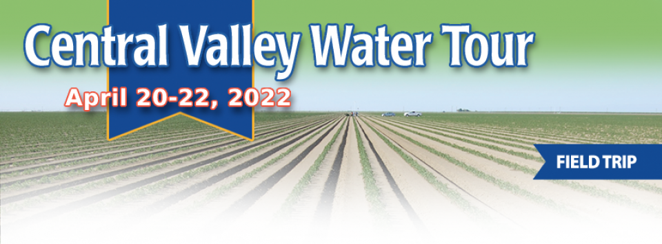
During our three-day Central Valley Tour April 3-5, you will meet farmers who will explain how they prepare the fields, irrigate their crops and harvest the produce that helps feed the nation and beyond. We also will drive through hundreds of miles of farmland and visit the rivers, dams, reservoirs and groundwater wells that provide the water.

  • Read more
Western Water January 17, 2019 Layperson's Guide to the Central Valley Project San Joaquin River Restoration Map Gary Pitzer

Key California Ag Region Ponders What’s Next After Voters Spurn Bond to Fix Sinking Friant-Kern Canal
WESTERN WATER NOTEBOOK: Subsidence chokes off up to 60% of canal’s capacity to move water to aid San Joaquin Valley farms and depleted groundwater basins

Water is up to the bottom of a bridge crossing the Friant-Kern Canal due to subsidence caused by overpumping of groundwater. The whims of political fate decided in 2018 that state bond money would not be forthcoming to help repair the subsidence-damaged parts of Friant-Kern Canal, the 152-mile conduit that conveys water from the San Joaquin River to farms that fuel a multibillion-dollar agricultural economy along the east side of the fertile San Joaquin Valley.

  • Read more
Announcement August 8, 2018

Examine Key California Rivers on the Last Two Water Tours of 2018
Join us as we explore the Sacramento and San Joaquin rivers; hear from farmers, water managers, environmentalists

Northern California Tour participants pose in front of Shasta Dam.The Sacramento and San Joaquin rivers are the two major Central Valley waterways that feed the Delta, the hub of California’s water supply network. Our last water tours of 2018 will look in-depth at how these rivers are managed and used for agriculture, cities and the environment. You’ll see infrastructure, learn about efforts to restore salmon runs and talk to people with expertise on these rivers.

Early bird prices are still available!

  • Read more
Western Water June 29, 2018 California Water Map Gary Pitzer

As Decision Nears On California Water Storage Funding, a Chairman Reflects on Lessons Learned and What’s Next
WESTERN WATER Q&A: California Water Commission Chairman Armando Quintero

Armando Quintero, chair of the California Water CommissionNew water storage is the holy grail primarily for agricultural interests in California, and in 2014 the door to achieving long-held ambitions opened with the passage of Proposition 1, which included $2.7 billion for the public benefits portion of new reservoirs and groundwater storage projects. The statute stipulated that the money is specifically for the benefits that a new storage project would offer to the ecosystem, water quality, flood control, emergency response and recreation.

  • Read more
Western Water June 1, 2018 Space Invaders Gary Pitzer

It’s Not Just Nutria — Sacramento-San Joaquin Delta has 185 Invasive Species, But Tracking Them is Uneven
WESTERN WATER NOTEBOOK: Delta science panel urges greater coordination, funding of invasive species monitoring

Water hyacinth choke a channel in the Sacramento-San Joaquin Delta.For more than 100 years, invasive species have made the Sacramento-San Joaquin Delta their home, disrupting the ecosystem and costing millions of dollars annually in remediation.

The latest invader is the nutria, a large rodent native to South America that causes concern because of its propensity to devour every bit of vegetation in sight and destabilize levees by burrowing into them. Wildlife officials are trapping the animal and trying to learn the extent of its infestation.

  • Read more
Western Water March 23, 2018 Layperson's Guide to the Delta

ON THE ROAD: Park Near Historic Levee Rupture Offers Glimpse of Old Sacramento-San Joaquin Delta
Big Break Regional Shoreline will be a stop on Bay-Delta Tour May 16-18

Visitors explore a large, three-dimensional map of the Sacramento-San Joaquin Delta at Big Break Regional Shoreline in Oakley. Along the banks of the Sacramento-San Joaquin Delta in Oakley, about 50 miles southwest of Sacramento, is a park that harkens back to the days when the Delta lured Native Americans, Spanish explorers, French fur trappers, and later farmers to its abundant wildlife and rich soil.

That historical Delta was an enormous marsh linked to the two freshwater rivers entering from the north and south, and tidal flows coming from the San Francisco Bay. After the Gold Rush, settlers began building levees and farms, changing the landscape and altering the habitat.

  • Read more
  • 1
  • 2
  • next ›
  • last »

Water Academy

  • Agriculture
  • Background Information
  • Bay-Delta
  • Dams, Reservoirs and Water Projects
  • Environmental Issues
  • Leaders and Experts
  • Regions
  • Rivers
    • Carson River
    • Colorado River
    • Klamath River
    • New River
    • North Coast Rivers
    • Russian River
    • Sacramento River
    • Truckee River
    • San Joaquin River
  • Water Issues
  • Water Quality
  • Water Supply and Management
Footer pod May 20, 2014

Water Education Foundation

Copyright © 2025 Water Education Foundation. All rights reserved.

The Water Education Foundation is a nonprofit, tax-exempt, 501(c)3 organization, federal tax ID #942419885.

Privacy Policy

Donor Privacy Policy

  • Read more
Footer pod May 20, 2014

Contact Information

2151 River Plaza Drive, Suite 205
Sacramento CA 95833

Telephone (916) 444-6240

Contact Us via email

  • Read more

Quicklinks

Footer quicklink May 20, 2014

Contact Us

  • Read more
Footer quicklink May 20, 2014

Donate Today

  • Read more
Footer quicklink May 20, 2014

Tours

  • Read more
Footer quicklink May 20, 2014

Newsletter Signup

  • Read more
Footer quicklink May 20, 2014

Foundation News

  • Read more
Footer quicklink May 20, 2014

Calendar

  • Read more

Log in

  • Create new account
  • Request new password

Commands

  • Support portal
  • Log in