Header link June 22, 2020

LinkedIn

  • Read more
Header link September 15, 2014

Cart

  • Read more
Header link November 3, 2015

Donate Now

  • Read more
Header link May 15, 2014

Twitter

  • Read more
Header link May 15, 2014

Facebook

  • Read more
Instagram
Header link May 15, 2014

Instagram

  • Read more
Header link May 15, 2014

Contact Us

  • Read more
More options
Water Education Foundation
Home

Water Education Foundation

Everything about California water that matters
  • Water Academy
    • Agriculture
      • Agricultural Conservation
      • Agricultural Drainage
    • Background Information
      • Legislation — California and Federal
      • Regulations — California and Federal
      • Water History
      • Water Rights
    • Bay-Delta
      • Bay Delta
      • Bay Delta Conservation Plan
      • Delta Issues
      • Delta Smelt
      • Sacramento San Joaquin Delta
      • San Francisco Bay
      • Suisun Marsh
    • Dams, Reservoirs and Water Projects
      • California Aqueduct
      • Central Valley Project
      • Folsom Dam
      • Friant Dam
      • Hetch Hetchy
      • Hoover Dam
      • Infrastructure
      • Lake Mead
      • Lake Powell
      • Oroville Dam
      • San Luis Dam
      • Shasta Dam
      • State Water Project
    • Environmental Issues
      • Anadromous Fish Restoration
      • Ecosystem
      • Endangered Species Act
      • Invasive species
      • Lake Tahoe
      • Mono Lake
      • Public Trust Doctrine
      • Salmon
      • San Joaquin River Restoration
      • Watershed
      • Wetlands
    • Leaders and Experts
    • Regions
      • Central Coast
      • Central Valley
      • Mexico
      • Nevada
      • North Coast
      • Pyramid Lake
      • Sacramento Valley
      • Salton Sea
      • San Joaquin Valley
      • Sierra Nevada
      • Southern California
      • Tulare Lake Basin
    • Rivers
      • Carson River
      • Colorado River
      • Klamath River
      • New River
      • North Coast Rivers
      • Russian River
      • Sacramento River
      • Truckee River
      • San Joaquin River
    • Water Issues
      • Climate Change
      • Coronavirus
      • Drought
      • Earthquakes
      • Energy and Water
      • Flood Management
      • Fracking
      • Growth
      • Hydropower
      • Levees
      • Tribal Water Issues
      • Water Conservation
      • Water Equity
    • Water Quality
      • Drinking Water
      • Nitrate contamination
      • Pollution
      • Stormwater
      • Wastewater
      • Water Quality
    • Water Supply and Management
      • Acre Foot
      • Aquifers
      • California Water Plan
      • Conjunctive Use
      • Desalination
      • Grey water
      • Groundwater
      • Integrated Regional Water Management
      • Recreation
      • Surface Water
      • Water Marketing and Banking
      • Water Rates
      • Water Recycling
      • Water Supply
      • Water Transfers
  • Tours & Events
    • Water Tours
      • 2023 Tour Sponsors
    • Events
    • Event Calendar
    • Past Tours & Events
      • Anne J. Schneider Fund Lecture Series
  • Specialized Programs
    • Water Leaders
      • Class Rosters
      • Yearly Class Reports
      • Your Alumni Network
      • Alumni Profiles
    • Project WET
      • Workshops
      • Special Workshops & Events
      • Supplementary Materials
      • California Content Standard Correlations
      • Facilitator's Trainings
      • Foundation School Programs
        • Elementary Programs
        • Secondary Programs
      • Water Kids
      • California Project WET Gazette
      • Gazette Archives
    • Colorado River Project
    • GRA Scholastic Fund Program
  • Maps & Guides
    • Maps & Posters
    • Layperson's Guides
    • Map & Guide Bundles
    • Books
    • Colorado River Materials
    • California Runoff Rundown
    • Other Publications
    • Water Awareness Materials
    • Downloadable Publications
    • Videos and DVDs
      • Video Clips
    • School Age Publications
    • Stickers
    • Free Programs and Publications
  • Newsroom
    • Western Water News
    • Aquafornia
      • About Aquafornia
    • Information Desk
    • Western Water Magazine Archive
      • Full Print Edition
      • Print Edition Excerpts
    • River Report Archive
  • Aquapedia
    • Alphabetical List of Subjects
      • A
      • B
      • C
      • D
      • E
      • F
      • G
      • H
      • I
      • J
      • K
      • L
      • M
      • N
      • O
      • P
      • Q
      • R
      • S
      • T
      • U
      • V
      • W
      • X
      • Y
      • Z
    • Historical Water People
    • Where Does My Water Come From?
      • Northern California
      • Sacramento
      • North Bay
      • South Bay
      • Central Valley
      • Los Angeles
      • Inland Empire
      • San Diego
      • All California Water Sources
    • Timelines
    • Videos
    • Image Gallery
    • Water Directory
      • Federal Agencies
      • State Agencies in California
      • Environmental Organizations
      • Other California Organizations
      • State and Federal Legislative Committees
      • Water Associations and Groups
      • Western States Water Agencies and Districts
    • Online Resources
    • Useful Acronyms
    • About Aquapedia
  • About
    • About Us
      • Board of Directors
      • Staff Biographies
      • Job Openings
    • Announcements
    • Support Our Mission
      • Become a Member
      • Donate in Honor/Memory
      • Donate to Aquapedia or Aquafornia
      • Shop Amazon
      • Planned Giving
    • Contact Us
Aquapedia background February 11, 2014 All Things Drought Dams Layperson's Guide to the State Water Project

Oroville Dam

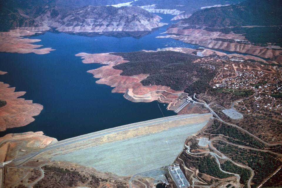
Oroville Dam, a key part of California's State Water Project.Oroville Dam is the centerpiece of the State Water Project (SWP) and its largest water storage facility.

Located about 70 miles north of Sacramento at the confluence of the three forks of the Feather River, Oroville Dam is an earthfill dam (consisting of an impervious core surrounded by sands, gravels and rockfill materials) that creates a reservoir that can hold 3.5 million acre-feet of water.

Features such as a fish barrier dam and pool at Oroville Dam made the State Water Project one of the first major water projects built with environmental protections as a significant consideration. The reservoir created by the dam provides major water recreation facilities for boating, fishing and camping.

Besides storing water, the dam also protects downstream residents from the flood-prone Feather River – the main feeder of the State Water Project, which sends water all the way to Southern California and serves 27 million people and 4 million to 5 million acres of farmland along the way. 

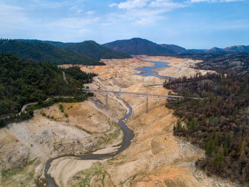
Water stored behind Oroville Dam helps California withstand periodic droughts that grip the state. But a severe two-year drought by early October 2021 had cut water storage behind Oroville Dam to just 22 percent of capacity.

Oroville Dam Background

Oroville Dam’s Edward Hyatt Powerplant is also the largest SWP hydroelectric facility, and has the capacity to generate 819 megawatts of electricity. A megawatt produces electricity roughly equal to the same amount of electricity consumed by 400 to 900 homes in a year.

Construction began on facilities related to Oroville Dam in 1957 and on the dam site itself in 1961. Within a few years, the partially completed dam checked flooding on the Feather River in December 1964, saving the Sacramento Valley. 

Oroville Dam is the tallest dam in the U.S. at 770 feet (slightly shorter than the Transamerica Pyramid in San Francisco, which is 853 feet tall).

Oroville Dam Operations

Lake Oroville shows the effects of drought in 2021.Stored water released from Oroville Dam flows down the Feather River and enters the Sacramento River system near Verona.

About one-third of the water released from the reservoir goes to uses between Oroville and the Sacramento-San Joaquin Delta. When it reaches the Delta, Feather River water blends with snowmelt and runoff from other watersheds of the Sacramento and San Joaquin valleys. At Barker Slough, in the North Delta, up to 76,781 acre-feet of water can be diverted into the North Bay Aqueduct, a 27.6-mile underground pipeline that provides water to augment local supplies in Napa and Solano counties.

More problematic, Oroville Dam blocked salmon and steelhead trout access to upstream spawning areas, though many of the fish have adapted to spawning in gravel beds below the dam. To further mitigate fisheries impacts, a barrier and ladder system was built that allows adult salmon and steelhead to be captured at the Feather River Fish Hatchery, then artificially spawned and later released in the Delta or Sacramento River.

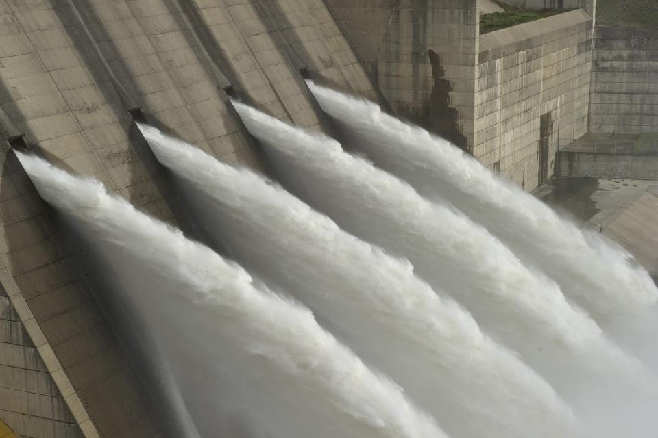
When high inflows occur between October and May, water is held in Lake Oroville temporarily until downstream channels are capable of handling them without flooding. Oroville Dam alone provides 750,000 acre-feet of flood control storage. The dam has been credited with minimizing damage during floods that have hit the Feather River watershed in virtually every decade since the dam’s construction in the 1960s.

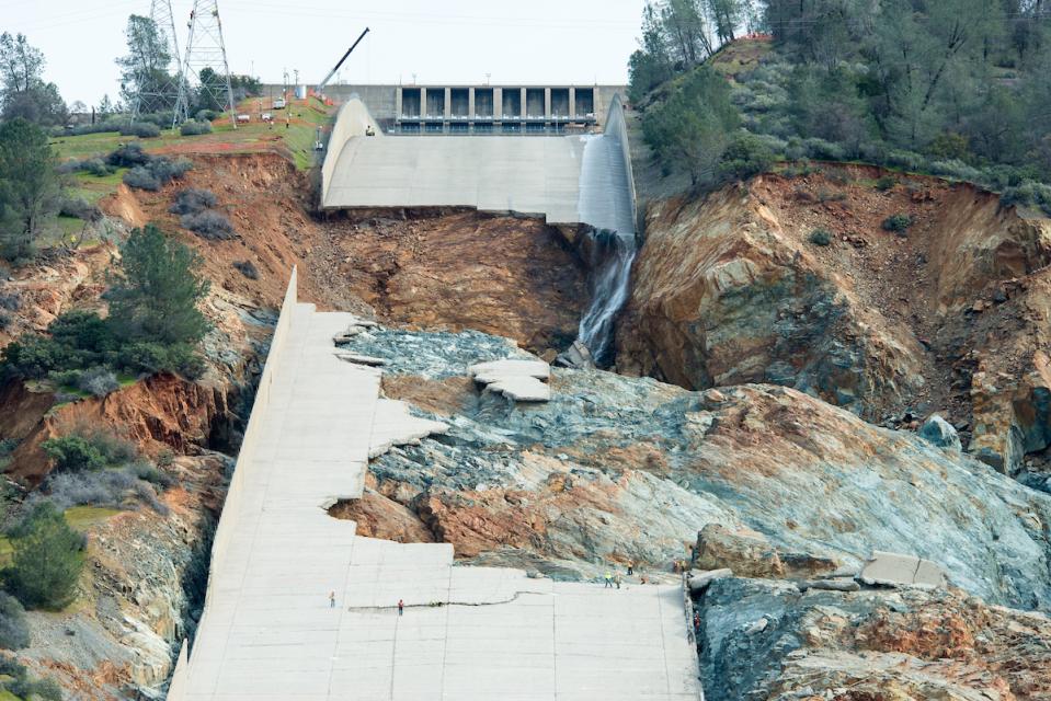
In early 2017, substantial runoff from the Sierra Nevada filled up Lake Oroville, forcing the release of a large volume of water down the dam’s concrete spillway. The force of the release gouged a large crater in the concrete spillway and required the California Department of Water Resources (DWR) to halt water releases via that conduit.

The main spillway failed in February 2017 and high lake levels strained the emergency spillway, prompting an evacuation of nearly 200,000 people downstream from the dam.  The spillway has since been repaired.The high lake level strained the earthen emergency spillway and eventually there was fear that erosion would compromise the integrity of the auxiliary spillway and flood the city of Oroville and surrounding communities. An evacuation order forced thousands of people to seek higher ground.

Ultimately, an independent analysis concluded that poor design and construction and inadequate state oversight contributed to the collapse of the concrete spillway. After an accelerated repair, the 3,000-foot main spillway was completed in time for the winter 2017 runoff, with additional phases of work focused on concrete seams, drainpipes, drain seams, cleanup and the emergency spillway and cutoff wall below. On April 2, 2019, water flowed for the first time down the rebuilt spillway. Reconstruction of the main and emergency spillways cost $1.1 billion.

In 2020, an independent review board convened by DWR determined that the dam and its associated facilities are safe to operate and that no urgent repairs are needed. The assessment, initiated in 2018 to identify dam safety and operational needs, identified several risk-reduction projects that DWR is working on, including installation of new water pressure measurement devices to improve seepage monitoring and completion of a state-of-the-art seismic stability analysis.

Feather River Fish Hatchery

The hatchery was built by DWR and paid for by the agencies that buy water from the SWP to mitigate for upper Feather River spawning areas lost to the creation of Lake Oroville. Fish raised at the hatchery or spawned in the Feather River account for an estimated 20 percent of the ocean sport and commercial catch of salmon and steelhead in the Pacific Ocean. The hatchery is run by the state’s Department of Fish and Wildlife.

FERC Relicensing

The Federal Energy Regulatory Commission, commonly known as FERC, licenses hydroelectric facilities such as the Edward Hyatt Power Plant at Oroville Dam.

DWR and stakeholders participated in a six-year renewal process for a 50-year hydroelectric license for the Oroville facilities. If adopted by FERC, the resulting agreement commits the state to:

  • Restored salmon and steelhead habitat
  • Improved river recreation and community benefits
  • A fish passage study to determine and launch a project to enhance fish passage in the Feather and surrounding river basins
  • Print-friendly

Referring Pages

Aquapedia background May 4, 2021 Lake Tahoe State Water Project Oroville Dam Lake Perris

Pauline Davis

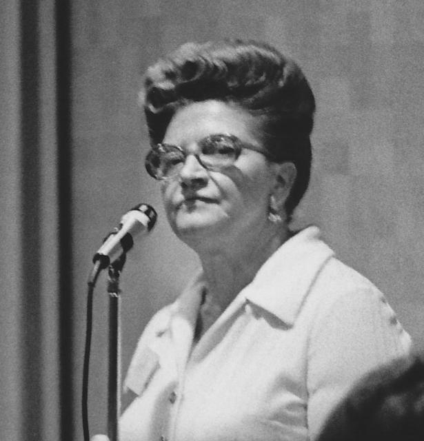
Pauline DavisPauline Davis (1917-1995), who represented all or portions of 12 rural Northern California counties in the California Assembly, guided some of the state’s most significant water development proposals through the Legislature.

During her legislative career from 1952 to 1976, Davis concentrated on water issues important to her constituents by championing area-of-origin protections for water targeted for export as part of the fledgling State Water Project.

  • Read more
Aquapedia background February 3, 2014 Oroville Dam Shasta Dam Hoover Dam Layperson's Guide to the Central Valley Project Layperson's Guide to the State Water Project

Dams

Folsom Dam on the American River east of Sacramento

Dams have allowed Californians and others across the West to harness and control water dating back to pre-European settlement days when Native Americans had erected simple dams for catching salmon.

  • Read more

Share this page

  • Share on Facebook
  • Share on Twitter
  • Share on LinkedIn
  • Sent to a friend.
Print-friendly

Related Links

Aquapedia background February 11, 2014 All Things Drought Dams Layperson's Guide to the State Water Project
Aerial view of Lake Oroville showing the effects of drought in May 2022.
Post May 28, 2021 Drought FAQs Water Conservation Tips Drought

All Things Drought
Resources, tips and the latest information on the drought gripping the West

This page is a resource for all things drought – where you can find real-time reservoir levels, drought severity maps, special reports, a newsfeed of current developments on the drought that began in 2020 and general background on droughts in California and the West, as well as answers to common drought questions and tips for how you can save water at home.

What is Drought?

Drought – an extended period of limited or no precipitation – is a fact of life in California and the West, with water resources following boom-and-bust patterns. During California’s 2012-2016 drought, much of the state experienced severe drought conditions: significantly less precipitation and snowpack, reduced streamflow and higher temperatures. Those same conditions reappeared early in 2021, prompting Gov. Gavin Newsom in May of that year to declare drought emergencies in watersheds across 41 counties in California.

  • Read more
Folsom Dam on the American River east of Sacramento
Aquapedia background February 3, 2014 Oroville Dam Shasta Dam Hoover Dam Layperson's Guide to the Central Valley Project Layperson's Guide to the State Water Project

Dams

Dams have allowed Californians and others across the West to harness and control water dating back to pre-European settlement days when Native Americans had erected simple dams for catching salmon.

  • Read more
Publication May 20, 2014

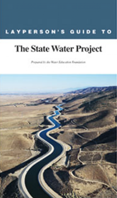
Layperson’s Guide to the State Water Project
Updated 2013

The 24-page Layperson’s Guide to the State Water Project provides an overview of the California-funded and constructed State Water Project.

  • Read more
Back
This item appears in:
  • Topic: Oroville Dam
  • Topic: State Water Project
  • O
Footer pod May 20, 2014

Water Education Foundation

Copyright © 2023 Water Education Foundation. All rights reserved.

The Water Education Foundation is a nonprofit, tax-exempt, 501(c)3 organization, federal tax ID #942419885.

Privacy Policy

Donor Privacy Policy

  • Read more
Footer pod May 20, 2014

Contact Information

2151 River Plaza Drive, Suite 205
Sacramento CA 95833

Telephone (916) 444-6240

Contact Us via email

  • Read more

Quicklinks

Footer quicklink May 20, 2014

Contact Us

  • Read more
Footer quicklink May 20, 2014

Donate Today

  • Read more
Footer quicklink May 20, 2014

Tours

  • Read more
Footer quicklink May 20, 2014

Newsletter Signup

  • Read more
Footer quicklink May 20, 2014

Foundation News

  • Read more
Footer quicklink May 20, 2014

Calendar

  • Read more

Log in

  • Create new account
  • Request new password

Commands

  • Support portal
  • Log in