Header link June 22, 2020

LinkedIn

  • Read more
Header link September 15, 2014

Cart

  • Read more
Header link November 3, 2015

Donate Now

  • Read more
Header link May 15, 2014

Twitter

  • Read more
Header link May 15, 2014

Facebook

  • Read more
Instagram
Header link May 15, 2014

Instagram

  • Read more
Header link May 15, 2014

Contact Us

  • Read more
More options
Water Education Foundation
Home

Water Education Foundation

Everything about California water that matters
  • Water Academy
    • Agriculture
      • Agricultural Conservation
      • Agricultural Drainage
    • Background Information
      • Legislation — California and Federal
      • Regulations — California and Federal
      • Water History
      • Water Rights
    • Bay-Delta
      • Bay Delta
      • Bay Delta Conservation Plan
      • Delta Issues
      • Delta Smelt
      • Sacramento San Joaquin Delta
      • San Francisco Bay
      • Suisun Marsh
    • Dams, Reservoirs and Water Projects
      • California Aqueduct
      • Central Valley Project
      • Folsom Dam
      • Friant Dam
      • Hetch Hetchy
      • Hoover Dam
      • Infrastructure
      • Lake Mead
      • Lake Powell
      • Oroville Dam
      • San Luis Dam
      • Shasta Dam
      • State Water Project
    • Environmental Issues
      • Anadromous Fish Restoration
      • Ecosystem
      • Endangered Species Act
      • Invasive species
      • Lake Tahoe
      • Mono Lake
      • Public Trust Doctrine
      • Salmon
      • San Joaquin River Restoration
      • Watershed
      • Wetlands
    • Leaders and Experts
    • Regions
      • Central Coast
      • Central Valley
      • Mexico
      • Nevada
      • North Coast
      • Pyramid Lake
      • Sacramento Valley
      • Salton Sea
      • San Joaquin Valley
      • Sierra Nevada
      • Southern California
      • Tulare Lake Basin
    • Rivers
      • Carson River
      • Colorado River
      • Klamath River
      • New River
      • North Coast Rivers
      • Russian River
      • Sacramento River
      • Truckee River
      • San Joaquin River
    • Water Issues
      • Climate Change
      • Coronavirus
      • Drought
      • Earthquakes
      • Energy and Water
      • Floods
      • Fracking
      • Growth
      • Hydropower
      • Levees
      • Tribal Water Issues
      • Water Conservation
      • Water Equity
    • Water Quality
      • Drinking Water
      • Nitrate contamination
      • Pollution
      • Stormwater
      • Wastewater
      • Water Quality
    • Water Supply and Management
      • Acre Foot
      • Aquifers
      • California Water Plan
      • Conjunctive Use
      • Desalination
      • Grey water
      • Groundwater
      • Integrated Regional Water Management
      • Recreation
      • Surface Water
      • Water Marketing and Banking
      • Water Rates
      • Water Recycling
      • Water Supply
      • Water Transfers
  • Tours & Events
    • Water Tours
      • 2023 Tour Sponsors
    • Events
    • Event Calendar
    • Past Tours & Events
      • Anne J. Schneider Fund Lecture Series
  • Specialized Programs
    • Water Leaders
      • Class Rosters
      • Yearly Class Reports
      • Your Alumni Network
      • Alumni Profiles
    • Project WET
      • Workshops
      • Special Workshops & Events
      • Supplementary Materials
      • California Content Standard Correlations
      • Facilitator's Trainings
      • Foundation School Programs
        • Elementary Programs
        • Secondary Programs
      • Water Kids
      • California Project WET Gazette
      • Gazette Archives
    • Colorado River Project
    • GRA Scholastic Fund Program
  • Maps & Guides
    • Maps & Posters
    • Layperson's Guides
    • Map & Guide Bundles
    • Books
    • Colorado River Materials
    • California Runoff Rundown
    • Other Publications
    • Water Awareness Materials
    • Downloadable Publications
    • Videos and DVDs
      • Video Clips
    • School Age Publications
    • Stickers
    • Free Programs and Publications
  • Newsroom
    • Western Water News
    • Aquafornia
      • About Aquafornia
    • Information Desk
    • Western Water Magazine Archive
      • Full Print Edition
      • Print Edition Excerpts
    • River Report Archive
  • Aquapedia
    • Alphabetical List of Subjects
      • A
      • B
      • C
      • D
      • E
      • F
      • G
      • H
      • I
      • J
      • K
      • L
      • M
      • N
      • O
      • P
      • Q
      • R
      • S
      • T
      • U
      • V
      • W
      • X
      • Y
      • Z
    • Historical Water People
    • Where Does My Water Come From?
      • Northern California
      • Sacramento
      • North Bay
      • South Bay
      • Central Valley
      • Los Angeles
      • Inland Empire
      • San Diego
      • All California Water Sources
    • Timelines
    • Videos
    • Image Gallery
    • Water Directory
      • Federal Agencies
      • State Agencies in California
      • Environmental Organizations
      • Other California Organizations
      • State and Federal Legislative Committees
      • Water Associations and Groups
      • Western States Water Agencies and Districts
    • Online Resources
    • Useful Acronyms
    • About Aquapedia
  • About
    • About Us
      • Board of Directors
      • Staff Biographies
      • Job Openings
    • Announcements
    • Support Our Mission
      • Become a Member
      • Donate in Honor/Memory
      • Donate to Aquapedia or Aquafornia
      • Shop Amazon
      • Planned Giving
    • Contact Us
Aquapedia background November 15, 2016

Cosumnes River

Northern California’s Cosumnes River is the only river on the western side of the Sierra Nevada without major dams. The river flows about 52.5 miles from its headwaters at the 7,350-foot  into the Central Valley, merging with Mokelumne River in the Sacramento-San Joaquin Delta at Mokelumne City, originally formed in 1850 that now is a California Historical Landmark 26 miles south of Sacramento.

The river endures seasonal overbank flooding that was once a typical occurrence along rivers in California’s Central Valley. The flooding fosters vegetation growth in riparian and floodplain habitats, which in turn supports a wide range of wildlife.

The Cosumnes River is believed to be named combining the Miwok word “kosum” meaning “salmon” and the “-umne” suffix meaning “people of”.

The Different Forks

The Cosumnes River features three forks – north, middle and south – that cut through canyons in El Dorado and Amador counties and converge east of Highway 49.

  • The 40-mile long North Fork begins at the Singleton Springs in El Dorado County (about 10 miles southwest of Kirkwood ski resort) and flows west, receiving its largest tributary, Camp Creek, at Somerset. Below Camp Creek the river flows through the granite narrows of the Cosumnes River Gorge and joins the Middle Fork near Enterprise.
  • The 44.5-mile long Middle Fork also starts in El Dorado County and basically parallels the North Fork. From the headwaters, the river flows through a canyon, collecting Dogtown Creek at Omo Ranch. From there, the water flows through a valley past Outingdale.
  • The 20-mile long South Fork flows northwest along the El Dorado/Amador County line before connecting with the Middle Fork. Not far from there, all forks combine, and the river continues to flow west through the Sierra foothills, the historic mining site Michigan Bar and then into southern Sacramento County.

The river then flows west through the Sacramento suburb Rancho Murrieta, through agricultural land and past Sloughhouse. It goes under Highway 99 near Elk Grove and into the Cosumnes River Preserve, which include some of the largest wetlands and riparian areas in the Central Valley.

It then enters the Sacramento–San Joaquin River Delta near Mokelumne City, turning west once more to join the Mokelumne on the border of Sacramento County and San Joaquin County.

Diversions

Some water is diverted from the North Fork at Camp Creek and from Sly Park Creek to be used for irrigation in the Camino area.

Sly Park creek, a tributary of the Middle Fork, provides water for Sly Park Dam, near Pollock Pines. The creek creates 41,000-acre-foot Jenkinson Lake. The dam and reservoir are part of the federal Central Valley Project.

Restoration
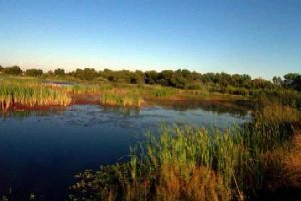
Federal and state agencies, university and nonprofit organizations have teamed up to restore portions of the river. Together they have improved habitat on 500 acres of floodplain and 600 acres of riparian areas, as well as removed or improved two fish passage barriers, replaced five stream crossings and made 7.2 miles of stream made accessible to fish.

In 2011, the removal of the last river barrier opened up 7.2 more miles of spawning habitat for adult steelhead and fall-run Chinook salmon.  

Fish

Like other waters in California, the salmon population has dwindled through the years on the Cosumnes due to, in part, invasive fish species, irrigation diversion structures and pollution from illegal mining activity.

The number of annual fall-run Chinook salmon, which return from June through November and spawn from early October through late December, have dwindled to about half over the past 60 years, according to the California Department of Fish and Wildlife monitoring statistics.

For example, from 1953-1958, an average of 1,800 salmon were counted during the fall run. From 1960-1969, there were an average of 1,500; 1970-1979, an average of 600; 1980-1988, an average of 300; from 2000-2004, an average of 800 salmon. In 2012, the population spiked to 1,071. Yet in 2014, only 373 fish were counted during fall run. See the statistics here.

Cosumnes River Preserve

The Cosumnes River Preserve consists of more than 50,000 acres along the Cosumnes River and is buffered by agricultural lands to provide both floodplains and riparian habitat. Activities include hiking along 11 miles of trails, paddling and nature watching.

The preserve supports more than 250 bird species, more than 40 fish species and about 230 plant species. These include sandhill cranes, egrets and herons, stilts and avocets and many more, including birds that migrate throughout the Pacific Flyway.

Property in the preserved is owned by seven partners — The Nature Conservancy, Bureau of Land Management, California Department of Fish & Wildlife, Sacramento County Regional Parks, Department of Water Resources, Ducks Unlimited, and the California State Lands Commission.

Click here to find out more.


  • Print-friendly

Referring Pages

Share this page

  • Share on Facebook
  • Share on Twitter
  • Share on LinkedIn
  • Sent to a friend.
Print-friendly

Related Links

Aquapedia background November 15, 2016
Back
Footer pod May 20, 2014

Water Education Foundation

Copyright © 2023 Water Education Foundation. All rights reserved.

The Water Education Foundation is a nonprofit, tax-exempt, 501(c)3 organization, federal tax ID #942419885.

Privacy Policy

Donor Privacy Policy

  • Read more
Footer pod May 20, 2014

Contact Information

2151 River Plaza Drive, Suite 205
Sacramento CA 95833

Telephone (916) 444-6240

Contact Us via email

  • Read more

Quicklinks

Footer quicklink May 20, 2014

Contact Us

  • Read more
Footer quicklink May 20, 2014

Donate Today

  • Read more
Footer quicklink May 20, 2014

Tours

  • Read more
Footer quicklink May 20, 2014

Newsletter Signup

  • Read more
Footer quicklink May 20, 2014

Foundation News

  • Read more
Footer quicklink May 20, 2014

Calendar

  • Read more

Log in

  • Create new account
  • Request new password

Commands

  • Support portal
  • Log in