California’s climate, characterized by warm, dry summers and mild
winters, makes the state’s water supply unpredictable. For
instance, runoff and precipitation in California can be quite
variable. The northwestern part of the state can receive more
than 140 inches per year while the inland deserts bordering
Mexico can receive less than 4 inches.
By the Numbers:
Precipitation averages about 193 million acre-feet per year.
In a normal precipitation year, about half of the state’s
available surface water – 35 million acre-feet – is collected in
local, state and federal reservoirs.
California is home to more than 1,300 reservoirs.
About two-thirds of annual runoff evaporates, percolates into
the ground or is absorbed by plants, leaving about 71 million
acre-feet in average annual runoff.
New water storage is the holy grail
primarily for agricultural interests in California, and in 2014
the door to achieving long-held ambitions opened with the passage
of Proposition
1, which included $2.7 billion for the public benefits
portion of new reservoirs and groundwater storage projects. The
statute stipulated that the money is specifically for the
benefits that a new storage project would offer to the ecosystem,
water quality, flood control, emergency response and recreation.
Nowhere is the domino effect in
Western water policy played out more than on the Colorado River,
and specifically when it involves the Lower Basin states of
California, Nevada and Arizona. We are seeing that play out now
as the three states strive to forge a Drought Contingency Plan.
Yet that plan can’t be finalized until Arizona finds a unifying
voice between its major water players, an effort you can read
more about in the latest in-depth article of Western Water.
Even then, there are some issues to resolve just within
California.
It’s high-stakes time in Arizona. The state that depends on the
Colorado River to help supply its cities and farms — and is
first in line to absorb a shortage — is seeking a unified plan
for water supply management to join its Lower Basin neighbors,
California and Nevada, in a coordinated plan to preserve water
levels in Lake Mead before
they run too low.
If the lake’s elevation falls below 1,075 feet above sea level,
the secretary of the Interior would declare a shortage and
Arizona’s deliveries of Colorado River water would be reduced by
320,000 acre-feet. Arizona says that’s enough to serve about 1
million households in one year.
As California embarks on its unprecedented mission to harness groundwater pumping, the Arizona desert may provide one guide that local managers can look to as they seek to arrest years of overdraft.
Groundwater is stressed by a demand that often outpaces natural and artificial recharge. In California, awareness of groundwater’s importance resulted in the landmark Sustainable Groundwater Management Act in 2014 that aims to have the most severely depleted basins in a state of balance in about 20 years.
Spurred by drought and a major
policy shift, groundwater management has assumed an unprecedented
mantle of importance in California. Local agencies in the
hardest-hit areas of groundwater depletion are drawing plans to
halt overdraft and bring stressed aquifers to the road of
recovery.
Along the way, an army of experts has been enlisted to help
characterize the extent of the problem and how the Sustainable
Groundwater Management Act of 2014 is implemented in a manner
that reflects its original intent.
For decades, cannabis has been grown
in California – hidden away in forested groves or surreptitiously
harvested under the glare of high-intensity indoor lamps in
suburban tract homes.
In the past 20 years, however, cannabis — known more widely as
marijuana – has been moving from being a criminal activity to
gaining legitimacy as one of the hundreds of cash crops in the
state’s $46 billion-dollar agriculture industry, first legalized
for medicinal purposes and this year for recreational use.
As we continue forging ahead in 2018
with our online version of Western Water after 40 years
as a print magazine, we turned our attention to a topic that also
got its start this year: recreational marijuana as a legal use.
State regulators, in the last few years, already had been beefing
up their workforce to tackle the glut in marijuana crops and
combat their impacts to water quality and supply for people, fish
and farming downstream. Thus, even if these impacts were perhaps
unbeknownst to the majority of Californians who approved
Proposition 64 in 2016, we thought it important to see if
anything new had evolved from a water perspective now that
marijuana was legal.
We explored the lower Colorado River where virtually every drop
of the river is allocated, yet demand is growing from myriad
sources — increasing population, declining habitat, drought and
climate change.
The 1,450-mile river is a lifeline to 40 million people in
the Southwest across seven states and Mexico. How the Lower Basin
states – Arizona, California and Nevada – use and manage this
water to meet agricultural, urban, environmental and industrial
needs was the focus of this tour.
Hampton Inn Tropicana
4975 Dean Martin Drive, Las Vegas, NV 89118
Learn what new tree-ring studies in
Southern California watersheds reveal about drought, hear about
efforts to improve subseasonal to seasonal weather forecasting
and get the latest on climate change impacts that will alter
drought vulnerability in the future.
At our Paleo
Drought Workshop on April 19th in San Pedro, you will hear
from experts at NASA Jet Propulsion Laboratory, University of
Arizona and California Department of Water Resources.
Joaquin Esquivel learned that life is
what happens when you make plans. Esquivel, who holds the public
member slot at the State Water Resources Control Board in
Sacramento, had just closed purchase on a house in Washington
D.C. with his partner when he was tapped by Gov. Jerry Brown a
year ago to fill the Board vacancy.
Esquivel, 35, had spent a decade in Washington, first in several
capacities with then Sen. Barbara Boxer, D-Calif., and then as
assistant secretary for federal water policy at the California
Natural Resources Agency. As a member of the State Water Board,
he shares with four other members the difficult task of
ensuring balance to all the uses of California’s water.
Does California need to revamp the way in which water is dedicated to the environment to better protect fish and the ecosystem at large? In the hypersensitive world of California water, where differences over who gets what can result in epic legislative and legal battles, the idea sparks a combination of fear, uncertainty and promise.
Saying that the way California manages water for the environment “isn’t working for anyone,” the Public Policy Institute of California (PPIC) shook things up late last year by proposing a redesigned regulatory system featuring what they described as water ecosystem plans and water budgets with allocations set aside for the environment.
Every day, people flock to Daniel
Swain’s social media platforms to find out the latest news and
insight about California’s notoriously unpredictable weather.
Swain, a climate scientist at the Institute of the
Environment and Sustainability at UCLA, famously coined the
term “Ridiculously Resilient Ridge” in December 2013 to describe
the large, formidable high-pressure mass that was parked over the
West Coast during winter and diverted storms away from
California, intensifying the drought.
Swain’s research focuses on atmospheric processes that cause
droughts and floods, along with the changing character of extreme
weather events in a warming world. A lifelong Californian and
alumnus of University of California, Davis, and Stanford
University, Swain is best known for the widely read Weather West blog, which provides
unique perspectives on weather and climate in California and the
western United States. In a recent interview with Western
Water, he talked about the Ridiculously Resilient Ridge, its
potential long-term impact on California weather, and what may
lie ahead for the state’s water supply.
The 2017 Water Leaders class
organized by the Water Education Foundation completed its year
with a report outlining policy recommendations for the
future of water storage in California.
The class of 20 from
various stakeholder groups and backgrounds that hailed from
cities and towns across the state had full editorial control to
chose recommendations. While they did not endorse a specific
storage proposal, they recommended that California:
Deepen your knowledge of California water issues at our popular
Water
101 Workshop and jump aboard the bus the next day to
visit the Sacramento-San Joaquin Delta, a 720,000-acre
network of islands and canals that supports the state’s water
system and is California’s most crucial water and ecological
resource.
Atmospheric rivers are relatively
narrow bands of moisture that ferry precipitation across the
Pacific Ocean to the West Coast and are key to California’s
water
supply.
For decades, no matter the weather, the message has been preached
to Californians: use water wisely, especially outdoors, which
accounts for most urban water use.
Enforcement of that message filters to the local level, where
water agencies routinely target the notorious “gutter flooder”
with gentle reminders and, if necessary, financial penalties.
Sixty percent of California’s developed water supply
originates high in the Sierra Nevada mountains. Our water
supply is largely dependent on the health of our Sierra forests,
which are suffering from ecosystem degradation, drought,
wildfires and widespread tree mortality.
This three-day, two-night tour explored the lower Colorado River
where virtually every drop of the river is allocated, yet demand
is growing from myriad sources — increasing population,
declining habitat, drought and climate change.
The 1,450-mile river is a lifeline to 40 million people in
the Southwest across seven states and Mexico. How the Lower Basin
states – Arizona, California and Nevada – use and manage this
water to meet agricultural, urban, environmental and industrial
needs is the focus of this tour.
Best Western McCarran Inn
4970 Paradise Road
Las Vegas, NV 89119
This tour explored the Sacramento River and its tributaries
through a scenic landscape as participants learned about the
issues associated with a key source for the state’s water supply.
All together, the river and its tributaries supply 35 percent of
California’s water and feed into two major projects: the State
Water Project and the federal Central Valley Project. Tour
participants got an on-site update of repair efforts on the
Oroville Dam spillway.
Participants of this tour snaked along the San Joaquin River to
learn firsthand about one of the nation’s largest and most
expensive river restoration projects.
The San Joaquin River was the focus of one of the most
contentious legal battles in California water history,
ending in a 2006 settlement between the federal government,
Friant Water Users Authority and a coalition of environmental
groups.
For as long as agriculture has existed in the Central Valley,
farmers have pumped water from the ground to sustain their
livelihood and grow food consumed by much of the nation. This has
caused the ground in certain places to sink, sometimes
dramatically, eliminating valuable aquifer storage space that can
never be restored.
One of the wettest years in California history that ended a
record five-year drought has rejuvenated the call for new storage
to be built above and below ground.
In a state that depends on large surface water reservoirs to help
store water before moving it hundreds of miles to where it is
used, a wet year after a long drought has some people yearning
for a place to sock away some of those flood flows for when they
are needed.
A critical aspect of California’s drive to create new water
storage is in place after the California Water Commission
approved regulations governing how those potential storage
projects could receive public funding under Prop. 1.
The Dec. 14 decision potentially paves the way for new surface
water projects, such as Sites Reservoir, and expansion of Los
Vaqueros reservoir in Contra Costa County.
This 24-page booklet details the conflict between
environmentalists, fish organizations and the Yuba County Water
Agency and how it was resolved through the Lower Yuba River
Accord – a unique agreement supported by 18 agencies and
non-governmental organizations. The publication details
the history and hydrology of the Yuba River, past and present
environmental concerns, and conflicts over dam operations and
protecting endangered fish is included.
This 30-minute documentary, produced in 2011, explores the past,
present and future of flood management in California’s Central
Valley. It features stories from residents who have experienced
the devastating effects of a California flood firsthand.
Interviews with long-time Central Valley water experts from
California Department of Water Resources (FloodSAFE), U.S. Army
Corps of Engineers, Bureau of Reclamation, Central Valley Flood
Management Program and environmental groups are featured as they
discuss current efforts to improve the state’s 150-year old flood
protection system and develop a sustainable, integrated, holistic
flood management plan for the Central Valley.
20-minute version of the 2012 documentary The Klamath Basin: A
Restoration for the Ages. This DVD is ideal for showing at
community forums and speaking engagements to help the public
understand the complex issues related to complex water management
disputes in the Klamath River Basin. Narrated by actress Frances
Fisher.
For over a century, the Klamath River Basin along the Oregon and
California border has faced complex water management disputes. As
relayed in this 2012, 60-minute public television documentary
narrated by actress Frances Fisher, the water interests range
from the Tribes near the river, to energy producer PacifiCorp,
farmers, municipalities, commercial fishermen, environmentalists
– all bearing legitimate arguments for how to manage the water.
After years of fighting, a groundbreaking compromise may soon
settle the battles with two epic agreements that hold the promise
of peace and fish for the watershed. View an excerpt from the
documentary here.
This 30-minute documentary-style DVD on the history and current
state of the San Joaquin River Restoration Program includes an
overview of the geography and history of the river, historical
and current water delivery and uses, the genesis and timeline of
the 1988 lawsuit, how the settlement was reached and what was
agreed to.
This 25-minute documentary-style DVD, developed in partnership
with the California Department of Water Resources, provides an
excellent overview of climate change and how it is already
affecting California. The DVD also explains what scientists
anticipate in the future related to sea level rise and
precipitation/runoff changes and explores the efforts that are
underway to plan and adapt to climate.
Salt. In a small amount, it’s a gift from nature. But any doctor
will tell you, if you take in too much salt, you’ll start to have
health problems. The same negative effect is happening to land in
the Central Valley. The problem scientists call “salinity” poses
a growing threat to our food supply, our drinking water quality
and our way of life. The problem of salt buildup and potential –
but costly – solutions are highlighted in this 2008 public
television documentary narrated by comedian Paul Rodriguez.
A 20-minute version of the 2008 public television documentary
Salt of the Earth: Salinity in California’s Central Valley. This
DVD is ideal for showing at community forums and speaking
engagements to help the public understand the complex issues
surrounding the problem of salt build up in the Central Valley
potential – but costly – solutions. Narrated by comedian Paul
Rodriquez.
20-minute DVD that explains the problem with polluted stormwater,
and steps that can be taken to help prevent such pollution and
turn what is often viewed as a “nuisance” into a water resource
through various activities.
Many Californians don’t realize that when they turn on the
faucet, the water that flows out could come from a source close
to home or one hundreds of miles away. Most people take their
water for granted; not thinking about the elaborate systems and
testing that go into delivering clean, plentiful water to
households throughout the state. Where drinking water comes from,
how it’s treated, and what people can do to protect its quality
are highlighted in this 2007 PBS documentary narrated by actress
Wendie Malick.
A 30-minute version of the 2007 PBS documentary Drinking Water:
Quenching the Public Thirst. This DVD is ideal for showing at
community forums and speaking engagements to help the public
understand the complex issues surrounding the elaborate systems
and testing that go into delivering clean, plentiful water to
households throughout the state.
15-minute DVD that graphically portrays the potential disaster
should a major earthquake hit the Sacramento-San Joaquin Delta.
“Delta Warning” depicts what would happen in the event of an
earthquake registering 6.5 on the Richter scale: 30 levee breaks,
16 flooded islands and a 300 billion gallon intrusion of salt
water from the Bay – the “big gulp” – which would shut down the
State Water Project and Central Valley Project pumping plants.
30-minute DVD that traces the history of the U.S. Bureau of
Reclamation and its role in the development of the West. Includes
extensive historic footage of farming and the construction of
dams and other water projects, and discusses historic and modern
day issues.
Water truly has shaped California into the great state it is
today. And if it is water that made California great, it’s the
fight over – and with – water that also makes it so critically
important. In efforts to remap California’s circulatory system,
there have been some critical events that had a profound impact
on California’s water history. These turning points not only
forced a re-evaluation of water, but continue to impact the lives
of every Californian. This 2005 PBS documentary offers a
historical and current look at the major water issues that shaped
the state we know today. Includes a 12-page viewer’s guide with
background information, historic timeline and a teacher’s lesson.
California’s little-known New River has been called one of North
America’s most polluted. A closer look reveals the New River is
full of ironic twists: its pollution has long defied cleanup, yet
even in its degraded condition, the river is important to the
border economies of Mexicali and the Imperial Valley and a
lifeline that helps sustain the fragile Salton Sea ecosystem.
Now, after decades of inertia on its pollution problems, the New
River has emerged as an important test of binational cooperation
on border water issues. These issues were profiled in the 2004
PBS documentary Two Sides of a River.
This 7-minute DVD is designed to teach children in grades 5-12
about where storm water goes – and why it is so important to
clean up trash, use pesticides and fertilizers wisely, and
prevent other chemicals from going down the storm drain. The
video’s teenage actors explain the water cycle and the difference
between sewer drains and storm drains, how storm drain water is
not treated prior to running into a river or other waterway. The
teens also offer a list of BMPs – best management practices that
homeowners can do to prevent storm water pollution.
This beautiful 24×36 inch poster, suitable for framing, features
a map of the San Joaquin River. The map text focuses on the San
Joaquin River Restoration Program, which aims to restore flows
and populations of Chinook salmon to the river below Friant Dam
to its confluence with the Merced River. The text discusses the
history of the program, its goals and ongoing challenges with
implementation.
This beautiful 24×36 inch poster, suitable for framing, displays
the rivers, lakes and reservoirs, irrigated farmland, urban areas
and Indian reservations within the Klamath River Watershed. The
map text explains the many issues facing this vast,
15,000-square-mile watershed, including fish restoration;
agricultural water use; and wetlands. Also included are
descriptions of the separate, but linked, Klamath Basin
Restoration Agreement and the Klamath Hydroelectric Agreement,
and the next steps associated with those agreements. Development
of the map was funded by a grant from the U.S. Fish and Wildlife
Service.
A companion to the Truckee River Basin Map poster, this 24×36
inch poster, suitable for framing, explores the Carson River, and
its link to the Truckee River. The map includes Lahontan Dam and
Reservoir, the Carson Sink, and the farming areas in the basin.
Map text discusses the region’s hydrology and geography, the
Newlands Project, land and water use within the basin and
wetlands. Development of the map was funded by a grant from the
U.S. Bureau of Reclamation Mid-Pacific Region, Lahontan Basin
Area Office.
This beautiful 24×36 inch poster, suitable for framing, displays
the rivers, lakes and reservoirs, irrigated farmland, urban areas
and Indian reservations within the Truckee River Basin, including
the Newlands Project, Pyramid Lake and Lake Tahoe. Map text
explains the issues surrounding the use of the Truckee-Carson
rivers, Lake Tahoe water quality improvement efforts, fishery
restoration and the effort to reach compromise solutions to many
of these issues.
This 24×36 inch poster, suitable for framing, illustrates the
water resources available for Nevada cities, agriculture and the
environment. It features natural and manmade water resources
throughout the state, including the Truckee and Carson rivers,
Lake Tahoe, Pyramid Lake and the course of the Colorado River
that forms the state’s eastern boundary.
Water as a renewable resource is depicted in this 18×24 inch
poster. Water is renewed again and again by the natural
hydrologic cycle where water evaporates, transpires from plants,
rises to form clouds, and returns to the earth as precipitation.
Excellent for elementary school classroom use.
Fashioned after the popular California Water Map, this 24×36 inch
poster was extensively re-designed in 2017 to better illustrate
the value and use of groundwater in California, the main types of
aquifers, and the connection between groundwater and surface
water.
The 28-page Layperson’s Guide to Water Rights Law, recognized as
the most thorough explanation of California water rights law
available to non-lawyers, traces the authority for water flowing
in a stream or reservoir, from a faucet or into an irrigation
ditch through the complex web of California water rights.
The 24-page Layperson’s Guide to the State Water Project provides
an overview of the California-funded and constructed State Water
Project.
The State Water Project is best known for the 444-mile-long
aqueduct that provides water from the Delta to San Joaquin Valley
agriculture and southern California cities. The guide contains
information about the project’s history and facilities.
The 28-page Layperson’s Guide to Nevada Water provides an
overview of the history of water development and use in Nevada.
It includes sections on Nevada’s water rights laws, the history
of the Truckee and Carson rivers, water supplies for the Las
Vegas area, groundwater, water quality, environmental issues and
today’s water supply challenges.
The Water Education Foundation’s second edition of
the Layperson’s Guide to The Klamath River Basin is
hot off the press and available for purchase.
Updated and redesigned, the easy-to-read overview covers the
history of the region’s tribal, agricultural and environmental
relationships with one of the West’s largest rivers — and a
vast watershed that hosts one of the nation’s oldest and
largest reclamation projects.
The 24-page Layperson’s Guide to Integrated Regional Water
Management (IRWM) is an in-depth, easy-to-understand publication
that provides background information on the principles of IRWM,
its funding history and how it differs from the traditional water
management approach.
The 28-page Layperson’s Guide to Groundwater is an in-depth,
easy-to-understand publication that provides background and
perspective on groundwater. The guide explains what groundwater
is – not an underground network of rivers and lakes! – and the
history of its use in California.
The Colorado River provides water to 40 million people and 4
million acres of farmland in a region encompassing some 246,000
square miles in the southwestern United States. The 32-page
Layperson’s Guide to the Colorado River covers the history of the
river’s development; negotiations over division of its water; the
items that comprise the Law of the River; and a chronology of
significant Colorado River events.
The 24-page Layperson’s Guide to California Water provides an
excellent overview of the history of water development and use in
California. It includes sections on flood management; the state,
federal and Colorado River delivery systems; Delta issues; water
rights; environmental issues; water quality; and options for
stretching the water supply such as water marketing and
conjunctive use. New in this 10th edition of the guide is a
section on the human need for water.
The 24-page Layperson’s Guide to the Central Valley Project
explores the history and development of the federal Central
Valley Project (CVP), California’s largest surface water delivery
system. In addition to the project’s history, the guide describes
the various CVP facilities, CVP operations, the benefits the CVP
brought to the state and the CVP Improvement Act (CVPIA).
The 24-page Layperson’s Guide to the Delta explores the competing
uses and demands on California’s Sacramento-San Joaquin Delta.
Included in the guide are sections on the history of the Delta,
its role in the state’s water system, and its many complex issues
with sections on water quality, levees, salinity and agricultural
drainage, fish and wildlife, and water distribution.
A new look for our most popular product! And it’s the perfect
gift for the water wonk in your life.
Our 24×36 inch California Water Map is widely known for being the
definitive poster that shows the integral role water plays in the
state. On this updated version, it is easier to see California’s
natural waterways and man-made reservoirs and aqueducts
– including federally, state and locally funded
projects – the wild and scenic rivers system, and
natural lakes. The map features beautiful photos of
California’s natural environment, rivers, water projects,
wildlife, and urban and agricultural uses and the
text focuses on key issues: water supply, water use, water
projects, the Delta, wild and scenic rivers and the Colorado
River.
A watershed is the land area that drains snowmelt and rain into a
network of lakes, streams, rivers and other waterways. It
typically is identified by the largest draining watercourse
within the system. In California, for example, the Sacramento River Basin is the
state’s largest watershed.
California’s “Mediterranean”
climate, characterized by
warm, dry summers and mild winters, is considered one of its
great attractions, but it also can be unpredictable with flooding followed by drought and few years of “normal”
precipitation. [See also Hydrologic Cycle].
Stretching 450 miles long and up to
50 miles wide, the Sierra Nevada makes up more than a quarter of
California’s land area and forms its largest watersheds,
providing more than half of the state’s developed water supply to
residents, agriculture and other businesses.*
The San Luis Reservoir is the largest off-stream reservoir in the
nation, serving as a key water facility for both the
State Water
Project (SWP) and the federal Central Valley Project
(CVP).
The construction of Glen Canyon Dam
in 1964 created Lake Powell. Both are located in north-central
Arizona near the Utah border. Lake Powell acts as a holding tank
for outflow from the Colorado River Upper Basin States: Colorado,
New Mexico, Utah and Wyoming.
The water stored in Lake Powell is used for recreation, power
generation and delivering water to the Lower Basin states of
California, Arizona, and Nevada.
Dams have allowed Californians and others across the West to
harness and control water dating back to pre-European settlement
days when Native Americans had erected simple dams for catching
salmon.
In 2005, after six years of severe
drought in the Colorado River Basin, federal officials and
representatives of the seven basin states — California, Arizona,
Nevada, New Mexico, Colorado, Utah and Wyoming — began building a
framework to better respond to drought conditions and coordinate
the operations of the basin’s two key reservoirs, Lake Powell and
Lake Mead.
The resulting Interim Guidelines for Lower Basin Shortages and
the Coordinated Operations for Lake Powell and Lake Mead (Interim
Guidelines) identified the conditions for shortage determinations
and details of coordinated reservoir operations. The 2007 Interim
Guidelines remain in effect through Dec. 31, 2025.
California will always be
inextricably linked to its water resources. Water continues
to shape the state’s development and no resource is as vital to
California’s urban centers, farms, industry, recreation, scenic
beauty and environmental preservation.
But California’s relationship to water is also one that continues
to generate controversy.
Applied water refers to water delivered by an application to a
user, either indoors or outdoors. Applied water use typically
occurs in an agricultural or urban setting.
In agriculture, applied water is typically supplied through
irrigation, which uses such devices as pipes and sprinklers.
There are also different types of systems including gravity flow
and pressurized systems.
With soil absorbing applied water and being porous (some water
can move down below a plant’s root zone), it is necessary to
apply more water than a crop might need.
This printed issue of Western Water looks at California
groundwater and whether its sustainability can be assured by
local, regional and state management. For more background
information on groundwater please refer to the Foundation’s
Layperson’s Guide to Groundwater.
This printed issue of Western Water examines how the various
stakeholders have begun working together to meet the planning
challenges for the Colorado River Basin, including agreements
with Mexico, increased use of conservation and water marketing,
and the goal of accomplishing binational environmental
restoration and water-sharing programs.
This printed issue of Western Water This issue of Western Water
looks at climate change through the lens of some of the latest
scientific research and responses from experts regarding
mitigation and adaptation.
This issue of Western Water looks at the BDCP and the
Coalition to Support Delta Projects, issues that are aimed at
improving the health and safety of the Delta while solidifying
California’s long-term water supply reliability.
This printed issue of Western Water features a
roundtable discussion with Anthony Saracino, a water resources
consultant; Martha Davis, executive manager of policy development
with the Inland Empire Utilities Agency and senior policy advisor
to the Delta Stewardship Council; Stuart Leavenworth, editorial
page editor of The Sacramento Bee and Ellen Hanak, co-director of
research and senior fellow at the Public Policy Institute of
California.
This printed issue of Western Water examines the issues
associated with the State Water Board’s proposed revision of the
water quality Bay-Delta Plan, most notably the question of
whether additional flows are needed for the system, and how they
might be provided.
This printed issue of Western Water discusses several
flood-related issues, including the proposed Central Valley Flood
Protection Plan, the FEMA remapping process and the dispute
between the state and the Corps regarding the levee vegetation
policy.
This printed issue of Western Water examines the
Colorado River drought, and the ongoing institutional and
operational changes underway to maintain the system and meet the
future challenges in the Colorado River Basin.
This printed issue of Western Water examines the
changed nature of the California Water Plan, some aspects of the
2009 update (including the recommendation for a water finance
plan) and the reaction by certain stakeholders.
This printed issue of Western Water looks at some of
the pieces of the 2009 water legislation, including the Delta
Stewardship Council, the new requirements for groundwater
monitoring and the proposed water bond.
It seems not a matter of if but when seawater desalination will
fulfill the promise of providing parts of California with a
reliable, drought-proof source of water. With a continuing
drought and uncertain water deliveries, the state is in the grip
of a full-on water crisis, and there are many people who see
desalination as a way to provide some relief to areas struggling
to maintain an adequate water supply.
This printed issue of Western Water examines
desalination – an issue that is marked by great optimism and
controversy – and the expected role it might play as an
alternative water supply strategy.
This printed copy of Western Water examines California’s drought
– its impact on water users in the urban and agricultural sector
and the steps being taken to prepare for another dry year should
it arrive.
This printed copy of Western Water examines the challenges facing
small water systems, including drought preparedness, limited
operating expenses and the hurdles of complying with costlier
regulations. Much of the article is based on presentations at the
November 2007 Small Systems Conference sponsored by the Water
Education Foundation and the California Department of Water
Resources.
This printed copy of Western Water examines climate change –
what’s known about it, the remaining uncertainty and what steps
water agencies are talking to prepare for its impact. Much of the
information comes from the October 2007 California Climate Change
and Water Adaptation Summit sponsored by the Water Education
Foundation and DWR and the November 2007 California Water Policy
Conference sponsored by Public Officials for Water and
Environmental Reform.
This issue of Western Water asks whether a groundwater
compact is needed to manage this shared resource today. In the
water-stressed West, there will need to be a recognition of
sharing water resources or a line will need to be drawn in the
sand against future growth.
Despite a winter during which much of California was drenched
with plentiful rain and snow, there is no escaping the need for
the continued wise use of water, no matter what the change of
seasons brings.
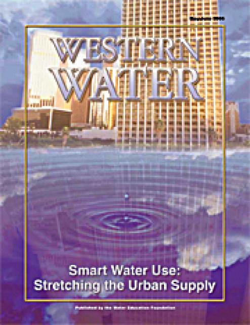
This issue of Western Water examines the continuing practice of
smart water use in the urban sector and its many facets, from
improved consumer appliances to improved agency planning to the
improvements in water recycling and desalination. Many in the
water community say conserving water is not merely a response to
drought conditions, but a permanent ethic in an era in which
every drop of water is a valuable commodity not to be wasted.
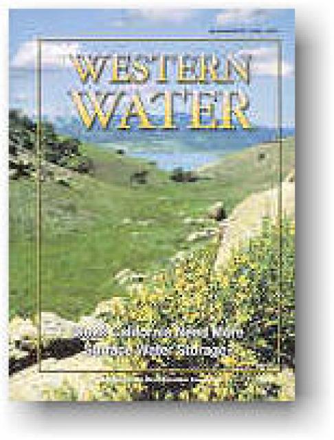
According to political debate and the popular press, the purpose
of adding surface water storage reservoirs to California’s
existing system is to provide water for urban growth and
agricultural crops. But that viewpoint touches only the surface
of a more complex policy and operations issue spelled out in the
CALFED Record of Decision (ROD): the need to expand storage
capacity to increase the existing system’s flexibility, improve
water quality and provide water for fish, as well as meet the
needs of a growing population.
This issue of Western Water explores the question of whether the
state needs more surface storage, with a particular focus on the
five proposed projects identified in the CALFED 2000 ROD and the
politics and funding issues of these projects.
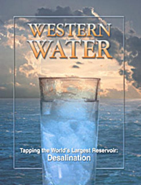
“Water, water, everywhere, nor any drop to drink.” – Samuel
Taylor Coleridge
For time immemorial, the seas of the Earth have been seen as an
enticing but unreachable source of fresh water. Separating the
salt from ocean water was always a cost prohibitive process,
primarily reserved to wealthy Middle Eastern nations and
small-scale operations such as ocean-bound vessels and small
islands. Otherwise, through the evolution of modern civilization,
man has depended upon lakes, rivers and groundwater – a supply
that comprises less than 3 percent of the planet’s total water.
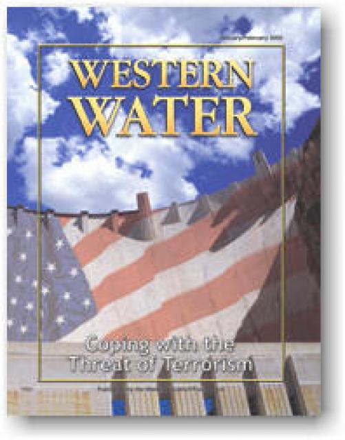
The events of September 11 brought a new reality to the water
world. Since California was the destination of the four hijacked
planes, security was immediately tightened at dams, aqueducts and
water treatment plants. This issue of Western Water examines the
issue of water security and the preparedness of federal, state
and local agencies to the threat of terrorism. In addition to
physical security and bioterrorism, it focuses on the type of
long-term security measures being implemented to ensure a safe
water supply.
Drinking water is the ultimate recycled resource. It is recycled
over years, centuries and millenniums. The water we use today is
the same supply with which civilization began. The water that
once coursed down the Ganges River or splashed into Julius
Caesar’s bathing pool may end up running from the tap in your
home.
Balance between ecosystem restoration and water supply
reliability is key to a Bay-Delta solution. Everyone agrees on
this concept. But the demands of the competing interests can tilt
the scales. So, too, can the member agencies’ conflicting
missions. For more than three years, the joint state-federal
CALFED Bay-Delta Program has been searching for equilibrium among
the Delta’s complex problems and its contentious stakeholders. In
December, it released its latest blueprint for resolving the
Delta dilemma — the Revised Phase II Report.
This issue updates progress on crafting and implementing
California’s 4.4 plan to reduce its use of Colorado River water
by 800,000 acre-feet. The state has used as much as 5.2 million
acre-feet of Colorado River water annually, but under pressure
from Interior Secretary Bruce Babbitt and the other six states
that share this resource, California’s Colorado River parties
have been trying to close the gap between demand and supply.