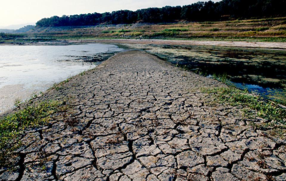
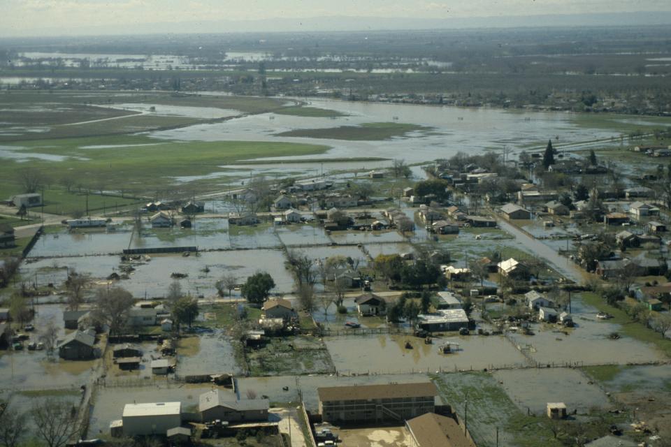
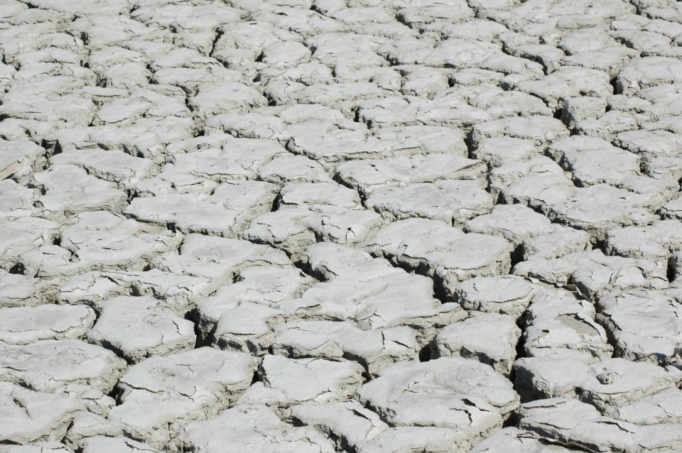
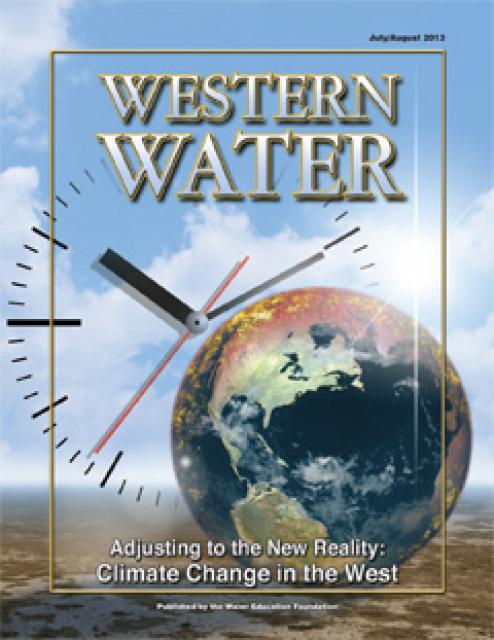
Drought— an extended period of
limited or no precipitation— is a fact of life in California and
the West, with water resources following boom-and-bust patterns.
No portion of the West has been immune to drought during the last
century and drought occurs with much greater frequency in the
West than in other regions of the country.
Most of the West experiences what is classified as severe to
extreme drought more than 10 percent of the time, and a
significant portion of the region experiences severe to extreme
drought more than 15 percent of the time, according to the
National Drought Mitigation Center.
Experts who have studied recent droughts say a drought occurs
about once every 10 years somewhere in the United States.
Droughts are believed to be the most costly of all natural
disasters because of their widespread effects on agriculture and
related industries, as well as on urbanized areas. One of those
decennial droughts could cost as much as $38 billion, according
to one estimate.
Because droughts cannot be prevented, experts are looking for
better ways to forecast them and new approaches to managing
droughts when they occur.
Coastal wetlands—including salt marshes, tidal forested
wetlands, and seagrasses—can sequester more carbon per acre
than inland forests, making them some of the world’s most
effective natural carbon sinks. So, states [including
California] are increasingly incorporating the protection and
restoration of these “blue carbon” habitats into their broader
initiatives to reduce greenhouse gas emissions and meet their
climate change goals. Although states use different approaches
to incorporating coastal wetlands into their climate planning,
some common elements are high-level leadership and policy
goals, quality data and established methodologies for
understanding blue carbon trends, and partnerships for
effective implementation.
Last fall, UC Riverside’s Dr. Hoori Ajami co-authored a study
looking at how long-term droughts are impacting river flows
across the US. We asked Dr. Ajami and The Nature Conservancy’s
lead river scientist, Dr. Bronwen Stanford, to tell us about
the study and its implications. First, what is a “baseflow
drought” and how is it distinct from a precipitation drought?
Hoori Ajami: Water in a stream has two sources: precipitation
and groundwater. “Baseflow” is groundwater’s contribution to a
stream’s flow. We were specifically interested to see how a
river’s baseflow changes after a precipitation drought. …”
Since the first Earth Day in 1970, the world has experienced
profound ecological changes. Wildlife populations have
decreased by 69 percent, the result of habitat loss caused by
rapid industrialization and changing temperatures. 2023 was the
hottest year on record. Certain ancient practices could
mitigate the deleterious effects of global warming. From
building seaside gardens to water management in desert terrain,
these time-honored practices work with the natural world’s
rhythms.
The recently announced closure of the salmon fishing season
delivered yet another devastating blow to the thousands of
families that depend on commercial and recreational fishing for
their livelihoods. For the second year in a row, fishing boats
at Fisherman’s Wharf will remain mothballed. The recent drought
contributed to the salmon decline, but the larger problem is
archaic water policies that allow too much water to be diverted
from our rivers and the Delta. As a result, salmon experience
manmade droughts almost every year, and the droughts we notice
become mega-droughts for fish. … California desperately needs
water reform, but strong opposition has come from what might
seem like an unlikely suspect. The San Francisco Public
Utilities Commission, which manages our Hetch Hetchy Water
System, is one of the worst culprits when it comes to poor
stewardship of our aquatic ecosystems. -Written by Peter Drekmeier, Policy Director for
the Tuolumne River Trust; and Scott Artis; Executive
Director of the Golden State Salmon Association.
Record-breaking heat waves, severe floods and acute wildfires,
exacerbated by climate change, carry a colossal price tag: an
approximately 19% reduction in global income over just the next
26 years, a new study published Wednesday found. That financial
gut punch won’t just affect big governments and corporations.
According to the United Nations, the world is heading toward a
gain of nearly 3 degrees of global warming in the next century,
even with current climate policies and goals – and researchers
say individuals could bear the economic burden. The researchers
in Wednesday’s study, published in Nature, said financial pain
in the short-term is inevitable, even if governments ramp up
their efforts to tackle the crisis now.
The Metropolitan Water District plans to spend up to $250
million on four non-traditional water projects that, combined,
could supply up to 100,000 Southern California households over
the next few years. Wastewater recycling, rainwater reclamation
and transforming ocean water into drinking water are some of
the technologies that could get money in the coming wave of
funding from MWD. The Los Angeles-based wholesaler, which helps
transfer water from Northern California and the Colorado River
to 26 retail water districts in the Los Angeles region, has
spent about $700 million on smaller, non-traditional water
projects since launching its Local Resources Program in 1990.
The amounts announced Monday, April 15, represent some of MWD’s
biggest investments in water innovation to date.
Insurers in California have sounded the alarm: A warming
climate has dramatically raised the risk of devastating
wildfires, and with it the cost of providing coverage. But now
a Peninsula lawmaker says those insurance companies should
credit the state and homeowners for the work done to reduce our
vulnerability to wildfires. State Sen. Josh Becker, a Menlo
Park Democrat, has introduced a bill that would require
insurers to consider the state’s efforts to thin flammable
brush and trees as well as property owners’ steps to make their
homes more fire resistant, such as covering vents and clearing
vegetation. Those efforts would need to be incorporated into
their risk modeling to determine coverage decisions and costs.
Ecuador on Tuesday began to ration electricity in the country’s
main cities as a drought linked to the El Niño weather pattern
depletes reservoirs and limits output at hydroelectric plants
that produce about 75% of the nation’s power. The power cuts
were announced on Monday night by the ministry of energy, which
said in a statement that it would review its decision on
Wednesday night. … The power cuts in Ecuador come days after
dry weather forced Colombia’s capital city of Bogotá to ration
water as its reservoirs reached record lows, threatening local
supplies of tap water. In the town of La Calera, on the
outskirts of Bogotá, water trucks visited neighborhoods where
water has been scarce recently because a local stream that
supplies the town with water is drying up.
California’s second wet winter in a row has left L.A’s water
supplies in good shape for at least another year, but the
inevitable return to dry conditions could once again put the
city’s residents in a precarious position. After the state’s
final snow survey of the season, officials with the Los Angeles
Department of Water and Power announced that Eastern Sierra
snowpack is measuring 103% of normal, “providing ample supplies
through the city’s most cost-efficient water supply from the
Los Angeles Aqueduct.”
Missouri lawmakers say water has almost always been plentiful
in their state, giving no reason to think twice about a concept
known as riparian rights — the idea that, if you own the land,
you have broad freedoms to use its water. But that could change
under a bill advancing quickly in a state legislature that is
normally sharply divided. The measure would largely forbid the
export of water across state lines without a permit, even
though there is no evidence that is happening on any large
scale. … lawmakers are wary of the West, and the chance that
thirsty communities facing dwindling water supplies will look
east for lakes and rivers to tap.
Erica Gies has always cared deeply about water. … Today, Gies
is an award-winning independent journalist and author who has
covered sustainability and water in outlets like The New York
Times, Scientific American, Nature, The Economist, and National
Geographic … River Partners sat down with Gies recently to
talk about bringing back floodplains, the importance of native
seeds and plants in restoration, what California is doing—and
what it could be doing—in managing water, and how optimistic
she is that we can thrive in an era of weather whiplash.
Earth’s worrisome warming trajectory continued unabated last
month, with March marking the 10th month in a row that the
planet has broken global heat records, international climate
officials announced this week. With an average surface
temperature of 57.45 degrees Fahrenheit, last month was warmer
globally than any previous March on record, according to the
European Union’s Copernicus Climate Change Service.
… There is a 62% chance that its cooler, drier
counterpart, La Niña, will develop between June and August.
That could be good news for temperatures but bad news for water
supplies — at least in Southern California.
An interdisciplinary team of scientists and researchers from
University of California, Davis, are studying agave plants in
the Golden State as farmers are turning to the crop as a
potential drought-tolerant option of the future. The research
is centered on studying agave genetics, virus susceptibility,
pest control, soil management and crop productivity, said Ron
Runnebaum, a viticulture and enology professor who is leading
the team of researchers at the newly formed UC Davis Agave
Center. … Agave plants don’t require much water and
their hardy leaves are fire resistant. The crop can be used as
a fiber, distilled into spirits or converted into a sweetener.
That combination of traits could offer an alternative to
fallowing fields by switching from thirsty crops to one
requiring less water.
… U.S. Geological Service data shows Teton Valley’s aquifer
steadily declined in recent decades as development increased
and crop watering systems became more efficient, reducing
infiltration by replacing flood irrigation with pivots and
sprinklers. In addition, the area’s transition from
agricultural valley to recreation hub has meant less acreage
being watered: farms replaced by subdivisions full of houses
with domestic wells, each one a straw guzzling from the
valley’s all-important aquifer. … Recharge has benefited
farmers and fish in western communities like Idaho’s Eastern
Snake River Plain and California’s Central Valley, and the
group believes the data shows it can work in the Teton Basin.
They hope it can. In addition to providing a bulwark against
future water shortages or legislative changes to water rights
laws, they want to do something groundbreaking: create a
market-based system to pay farmers for incidental recharge.
The Commerce Department announced Monday it pledged up to
$6.6 billion to Taiwanese semiconductor manufacturer TSMC,
which will add a third chip manufacturing facility in Arizona
to the two in the works. The grant will go down in Washington
as one of the crown jewels of the Biden administration’s
initiative to bring the supply chain for ubiquitous—and
strategically vital—computer chips back to the United
States. But in Phoenix, where the factories are going to
be built, TSMC faces a lingering question: where’s the water
going to come from in one of the driest cities in the
country?
… So what kind of fire season are we in for this year? Like
2023, this year has been a wet one. … After the wet
winter, vegetation in the state isn’t as parched as it would be
during a drought, so wildfire activity is likely to be pretty
low in the spring and early summer, Daniel Swain, a climate
scientist at the University of California, Los Angeles, said in
an online briefing this week. … But the year probably
won’t stay as quiet as 2023 was. This year’s wet weather hasn’t
been as extreme as last year’s — some inland cities, like
Fresno and South Lake Tahoe, actually received less rain
than usual this year — so plants and soil are more likely
to dry out over the rest of this year than they were last year.
“I would be somewhat surprised if this year was not
significantly more active,” Swain said.
Last month, the seven U.S. states that use Colorado River water
released two divergent plans for how that water should be
managed after 2026 when the current agreement expires. Their
proposals centered on operations at Lake Powell and Lake Mead,
the country’s two largest reservoirs, the levels of which are
instrumental in determining how much water each state gets. But
a coalition of environmental organizations felt that those
plans — and the discourse surrounding which states should have
to cut their water use — drowned out a crucial consideration:
the environment. So, last week, they submitted a plan of their
own. “Our plan explicitly integrates environmental values and
resources into the planning, while also trying to meet the
needs of people,” Taylor Hawes, the Colorado River Program
director for The Nature Conservancy, said.
… I asked my boss about his restaurant choice. He said he’d
gone vegan after learning how much Colorado River water
irrigates cattle feed — almost a third of all river
consumption, according to a recent study. His comment made
me reconsider my own beef consumption. … And most
Angelenos would find eating one less burger a week much easier
than tearing out their lawns (which I also advocate!). -Written by Aaron Mead, a writer based in the Los Angeles
area.
Zimbabwe declared a state of disaster Wednesday over a
devastating drought that’s sweeping across much of southern
Africa, with the country’s president saying it needs $2 billion
for humanitarian assistance. The declaration was widely
expected following similar actions by neighboring Zambia and
Malawi, where drought linked to the El Nino weather phenomenon
has scorched crops, leaving millions of people in need of food
assistance. … [President Emmerson Mnangagwa] appealed to
United Nations agencies, local businesses and faith
organizations to contribute towards humanitarian
assistance. El Nino, a naturally occurring climatic
phenomenon that warms parts of the Pacific Ocean every two to
seven years, has varied effects on the world’s weather. In
southern Africa, it typically causes below-average rainfall,
but this year has seen the worst drought in decades.
At the Indian Wells Valley Groundwater Authority board meeting
on March 29, the IWVGA board approved motions to reimburse two
domestic well owners who had to replace their wells due to
declining groundwater levels. IWVGA reimbursed $37,996 for the
Halpin Well and $31,082 for the Byerly Well. Reimbursement
covers the estimated current value of the exhausted well and
the incremental costs of drilling a deeper well. California’s
Sustainable Groundwater Management Act requires groundwater
basins like the IWV groundwater basin to reach sustainability
by 2040. This is why the IWVGA initially formed to draft and
implement a Groundwater Sustainability Plan.
On April 2, 2024, the California Department of Water Resources
(DWR) released the California Water Plan Update 2023 (CWP 2023
Update). DWR’s press release dubs the plan “A Roadmap to Water
Management and Infrastructure for a Water Resilient Future.”
Resiliency is one of the key focuses for the CWP 2023 Update,
as its chapter on objectives is entitled the “Roadmap to
Resilience.” The plan is focused on the vision that “All
Californians benefit from water resources that are sustainable,
resilient to climate change, and managed to achieve shared
values and connections to our communities and the environment.”
Almost half of all homes in the U.S. are at severe or extreme
risk of flood, hurricane winds, wildfires, heat and/or
hazardous air quality. In the 2024 Housing and Climate Risk
Report, Realtor.com looked at homes across the nation to
analyze which cities had homes at the highest risk of those
disasters, which the site calls climate
risk. … About 9% of homes across the U.S. are at
severe to extreme air quality risk. The San Francisco
Bay Area tops the list. California’s
frequent droughts, wildfires and heat waves are largely at
fault. ”Shifts in environmental conditions, including
extreme heat, drought, and wildfires, are amplifying the
likelihood of heightened air pollution risk,” wrote
analysts.
California has more than 1,000 thousand miles of coastline and
the water in the Pacific Ocean presents an opportunity for more
fresh water in the state. Unlocking the opportunity takes time,
money and resources, and some experts say it’s not for
everyone. … The massive system California has in place
now is one of the most complicated, robust and successful
systems ever created. That system has more recently
incorporated the ocean. Desalination is being put to the test
in coastal areas up and down the state. The process takes salt
out of ocean water and turns it into fresh water for people.
State officials, as well as private partners, focus on these
areas as the best fit for this water supply.
It was an average year for Colorado’s snowpack — and that’s
great news. The statewide snowpack sat at 109% of the
30-year median on Wednesday, just a few days shy of the normal
peak of snowpack for the state. Every major river basin in the
state also recorded above-median snowpack, reducing the risk of
large, uncontrollable wildfires and boosting the state’s water
supplies. Despite a slow start to the snow season, large
storms in February and March boosted the amount of water that
will become available as mountain snow melts. The statewide
snowpack had lagged behind the median until early March.
With California snowpack and reservoirs at above-average levels
following two wet winters, Gov. Gavin Newsom stood on a snowy
field near Lake Tahoe on Tuesday and urged the state to do much
more to make its water supplies resilient to the extreme
droughts and flooding that come with climate change. … The
governor presented a new water plan that lays out priorities
for changing how the state captures, stores and moves water,
including efforts to replenish groundwater, recycle wastewater
and restore the natural ecosystems of watersheds. Newsom said
his administration is focusing on infrastructure projects such
as building the Sites Reservoir — the first new major reservoir
in decades — and he vowed to move ahead with the proposed Delta
Conveyance Project.
As winter conditions wind down, the beginning of April is
always the most important time for California’s water managers
to take stock of how much snow has fallen in the Sierra
Nevada. This year, something unusual happened. After years
of extreme drought and several very wet flood years, the Sierra
snowpack, the source of one-third of the state’s water supply,
is shockingly average this year: 104% of normal on
Friday. And more is on the way.
With chronic water shortages afflicting the Colorado River,
discussions about how to cut usage have increasingly focused on
a thirsty crop that consumes an especially large share of the
river’s water: hay that is grown to feed cattle and produce
beef and dairy products. In a new study, researchers found that
alfalfa and other cattle-feed crops consume 46% of the water
that is diverted from the river, accounting for nearly
two-thirds of agricultural water use. The research also shows
that agriculture is the dominant user of Colorado River water,
accounting for 74% of the water that is diverted — about three
times the combined usage of all the cities that depend on the
river. The study presents the most detailed analysis of its
kind to date, including extensive data on where the river’s
water goes across seven Western states and northern Mexico.
Deadly heat in the Southwest. Hot-tub temperatures in the
Atlantic Ocean. Sweltering conditions in Europe, Asia and South
America. That 2023 was Earth’s hottest year on record was in
some ways no surprise. For decades, scientists have been
sounding the alarm about rapidly rising temperatures driven by
humanity’s relentless burning of fossil fuels. But last year’s
sudden spike in global temperatures blew far beyond what
statistical climate models had predicted, leading one noted
climate scientist to warn that the world may be entering
“uncharted territory.” … [R]esearchers are scrambling to
explain why 2023 was so anomalously hot. Many theories have
been proposed, but “as yet, no combination of them has been
able to reconcile our theories with what has happened,” Schmidt
wrote.
The Mid-Kings River Groundwater Sustainability Agency is
looking to impose a pumping fee of nearly $100 per
acre-foot. Mid-Kings River GSA is comprised of the Kings
County Water District, the City of Hanford and Kings
County. The big picture: The GSA is proposing a
pumping fee maximum of $95 per acre-foot. This comes after
the State views that the region has not made enough progress
through the Sustainable Groundwater Management Act
(SGMA). The state wants agriculture and industrial water
pumpers to cut back or pay to mitigate the impacts on
other users. The state could move to put the subbasin in
probation if it does not feel confident in local groundwater
management, and could completely take over operations in 2025.
Does the public sector need the private sector’s help to
address the freshwater crisis? That’s the controversial thesis
of Stanford law and environmental social sciences professor
Barton “Buzz” Thompson’s provocatively titled new book: Liquid
Asset: How Business and Government Can Partner to Solve the
Freshwater Crisis. (Buzz is also a member of the PPIC Water
Policy Center’s research network.) We sat down with him to hear
more. … The private sector is already involved in water in
many ways, some more controversial than others. … We
think of the Sustainable Groundwater Management Act (SGMA) as a
public program, and it is. The legislature passed the law, and
public agencies are implementing it. But if you look carefully,
you’ll see private handprints all over SGMA’s success.
California farmers could save massive amounts of water if they
planted less thirsty — but also less lucrative — crops such as
grains and hay instead of almonds and alfalfa, according to new
research by scientists who used remote sensing and artificial
intelligence. Such a seismic shift in the nation’s most
productive agricultural state could cut consumption by roughly
93%, researchers with UC Santa Barbara and the NASA Jet
Propulsion Laboratory reported Monday. But Anna Boser, the
study’s lead author, acknowledged that replacing all of
California’s water-intensive crops with the least-intensive
ones is an unrealistic economic scenario. … In a
less-extreme scenario, Boser and her colleagues reported that
fallowing 5% of fields with the most water-intensive crops
could cut water consumption by more than 9%, according to
the study, published in the journal Nature Communications.
It’s the second straight year of above-average rain and snow in
California, amid the state’s driest period in 1,200 years. The
respite from drought is certainly welcome, despite flooding,
mudslides and associated miseries. Now meteorologists and
oceanographers are watching possible La Niña conditions develop
in the Pacific, perhaps signaling a return to drier times. It’s
an appropriate time to take stock — of how we weathered the
last two winters, what we’ve learned and what’s ahead.
… It’s also important to note that California got a
scary dose of climate change reality early in the winter when
all that precipitation failed to turn into Sierra snowpack. It
does us little good to get lots of rain or even snow if the
weather is too warm to permit snow accumulation on the slopes.
The annual snowpack‘s slow spring-and-summer melt has
historically been the primary source of water for California
cities and farm fields.
Water shortages are becoming a way of life in cities across the
globe — Los Angeles; Cape Town, South Africa; Jakarta,
Indonesia; and many more — as climate change worsens and
authorities often pipe in water from ever-more-distant sources.
“Water sources are depleted around the world,” said Victoria
Beard, a professor of city and regional planning at Cornell
University. “Every year, more cities will face ‘Day Zero,’ with
no water in their piped systems.” Mexico City — founded by the
Aztecs on an island amid lakes, with a rainy season that
brought torrents and flooding — might have been an exception.
For decades, the focus has been getting rid of water, not
capturing it. But a grim convergence of factors — including
runaway growth, official indifference, faulty infrastructure,
rising temperatures and reduced rainfall — have left this
mega-city at a tipping point after years of mostly unheeded
warnings.
NASA and the German Space Agency at DLR (German Aerospace
Center) have agreed to jointly build, launch, and operate a
pair of spacecraft that will yield insights into how Earth’s
water, ice, and land masses are shifting by measuring monthly
changes in the planet’s gravity field. Tracking large-scale
mass changes – showing when and where water moves within and
between the atmosphere, oceans, underground aquifers, and ice
sheets – provides a view into Earth’s water cycle, including
changes in response to drivers like climate change.
A network of artificial streams is teaching scientists how
California’s mountain waterways — and the ecosystems that
depend on them — may be impacted by a warmer, drier climate.
Over the next century, climate change is projected to bring
less snowfall to the Sierra Nevada. … In a new study,
University of California, Berkeley, researchers used a series
of nine artificial stream channels off Convict Creek in Mammoth
Lakes, California, to mimic the behavior of headwater streams
under present-day conditions and future climate change
scenarios.
Can Texas, New Mexico, and Colorado agree to a new
apportionment of the Rio Grande’s waters without the U.S.
government’s approval? The Supreme Court of the United States
is set to hear a case next week that may affect access to water
for millions of Americans — and set a precedent that could
impact millions more, as increased usage and climate change
further strain supply of the precious resource. … If
[the court sides with the states], the government might be
understood to have less weight to throw around in other
negotiations, such as the one that is also happening about the
Colorado River.
In early February 2024 the Mountain Counties Water Resources
Association adopted new forest management principles with the
goal of solving the ongoing problem and severe effects of
California’s mega wildfires. “Over 100 years of
suppressing wildfires and changing climate have produced
overgrown forests and catastrophic mega wildfires that are
impacting communities, degrading California’s headwaters’ water
quality, water infrastructure and forest resources in Sierra
Nevada watersheds, (ultimately) creating a toxic smoke health
hazard throughout the state,” MCWRA’s website
reads. “These severe mega wildfires release tons of
greenhouse gases and eliminate the ability of forests to absorb
and store atmospheric carbon,” the website continues.
The United States suffers the world’s second-highest toll from
major weather disasters, according to a new analysis — even
when numbers are adjusted for the country’s wealth. The report
released late last month by Zurich-based reinsurance giant
Swiss Re, which analyzed the vulnerability and damages of 36
different countries, suggests that weather disasters may become
a heavy drag on the U.S. economy — especially as insurers
increasingly pull out of hazardous areas. Those disasters are
driving up insurance rates, compounding inflation and adding to
Americans’ high cost of living. … Some insurers have
stopped offering home insurance policies in California, which
has seen numerous large wildfires in the past few years.
Learn the history and challenges facing the West’s most dramatic
and developed river.
The Layperson’s Guide to the Colorado River Basin introduces the
1,450-mile river that sustains 40 million people and millions of
acres of farmland spanning seven states and parts of northern
Mexico.
The 28-page primer explains how the river’s water is shared and
managed as the Southwest transitions to a hotter and drier
climate.
State health officials know that extreme heat can cost lives
and send people to the hospital, just like wildfire smoke. Now,
new research finds that when people are exposed to both hazards
simultaneously — as is increasingly the case in California —
heart and respiratory crises outpace the expected sum of
hospitalizations compared to when the conditions occur
separately. … The study joins a growing body of research
about the intersection of different climate risks. Last month,
California-based think-tank the Pacific
Institute published a report about how converging
hazards — including wildfires, drought, flooding, sea level
rise and intensifying storms — are harming access to drinking
water and sanitation in California and other parts of the
world. The deadly 2018 Camp fire in Butte
County impacted an estimated 2,438 private wells, the
report said.
After more than two decades of
drought, water utilities serving the largest urban regions in the
arid Southwest are embracing a drought-proof source of drinking
water long considered a supply of last resort: purified sewage.
Water supplies have tightened to the point that Phoenix and the
water supplier for 19 million Southern California residents are
racing to adopt an expensive technology called “direct potable
reuse” or “advanced purification” to reduce their reliance on
imported water from the dwindling Colorado River.
The climate-driven shrinking of the
Colorado River is expanding the influence of Native American
tribes over how the river’s flows are divided among cities, farms
and reservations across the Southwest.
The tribes are seeing the value of their largely unused river
water entitlements rise as the Colorado dwindles, and they are
gaining seats they’ve never had at the water bargaining table as
government agencies try to redress a legacy of exclusion.
Water conservation has become a way of life throughout the West
with a growing recognition that water supply is not unlimited.
Drought is the most common motivator of increased water
conservation. However, the gradual drying of the West due to
climate change means the amount of fresh water available for
drinking, irrigation, industry and other uses must be used as
efficiently as possible.
Every five years the California Department of Water Resources
updates its strategic plan for managing the state’s water
resources, as required by state law.
The California Water Plan, or Bulletin 160, projects the
status and trends of the state’s water supplies and demands
under a range of future scenarios.
A new but little-known change in
California law designating aquifers as “natural infrastructure”
promises to unleash a flood of public funding for projects that
increase the state’s supply of groundwater.
The change is buried in a sweeping state budget-related law,
enacted in July, that also makes it easier for property owners
and water managers to divert floodwater for storage underground.
A new underground mapping technology
that reveals the best spots for storing surplus water in
California’s Central Valley is providing a big boost to the
state’s most groundwater-dependent communities.
The maps provided by the California Department of Water Resources
for the first time pinpoint paleo valleys and similar prime
underground storage zones traditionally found with some guesswork
by drilling exploratory wells and other more time-consuming
manual methods. The new maps are drawn from data on the
composition of underlying rock and soil gathered by low-flying
helicopters towing giant magnets.
The unique peeks below ground are saving water agencies’
resources and allowing them to accurately devise ways to capture
water from extreme storms and soak or inject the surplus
underground for use during the next drought.
“Understanding where you’re putting and taking water from really
helps, versus trying to make multimillion-dollar decisions based
on a thumb and which way the wind is blowing,” said Aaron Fukuda,
general manager of the Tulare Irrigation District, an early
adopter of the airborne electromagnetic or
AEM technology in California.
The states of the Lower Colorado
River Basin have traditionally played an oversized role in
tapping the lifeline that supplies 40 million people in the West.
California, Nevada and Arizona were quicker to build major canals
and dams and negotiated a landmark deal that requires the Upper
Basin to send predictable flows through the Grand Canyon, even
during dry years.
But with the federal government threatening unprecedented water
cuts amid decades of drought and declining reservoirs, the Upper
Basin states of Wyoming, Utah, Colorado and New Mexico are
muscling up to protect their shares of an overallocated river
whose average flows in the Upper Basin have already dropped
20 percent over the last century.
They have formed new agencies to better monitor their interests,
moved influential Colorado River veterans into top negotiating
posts and improved their relationships with Native American
tribes that also hold substantial claims to the river.
This tour explored the lower Colorado River firsthand where virtually every drop of the river is allocated, yet demand is growing from myriad sources — increasing population, declining habitat, drought and climate change.
The 1,450-mile river is a lifeline to some 40 million people in the Southwest across seven states, 30 tribal nations and Mexico. How the Lower Basin states – Arizona, California and Nevada – use and manage this water to meet agricultural, urban, environmental and industrial needs was the focus of this tour.
Hilton Garden Inn Las Vegas Strip South
7830 S Las Vegas Blvd
Las Vegas, NV 89123
It was exactly the sort of deluge
California groundwater agencies have been counting on to
replenish their overworked aquifers.
The start of 2023 brought a parade of torrential Pacific storms
to bone dry California. Snow piled up across the Sierra Nevada at
a near-record pace while runoff from the foothills gushed into
the Central Valley, swelling rivers over their banks and filling
seasonal creeks for the first time in half a decade.
Suddenly, water managers and farmers toiling in one of the
state’s most groundwater-depleted regions had an opportunity to
capture stormwater and bank it underground. Enterprising agencies
diverted water from rushing rivers and creeks into manmade
recharge basins or intentionally flooded orchards and farmland.
Others snagged temporary permits from the state to pull from
streams they ordinarily couldn’t touch.
This special Foundation water tour journeyed along the Eastern Sierra from the Truckee River to Mono Lake, through the Owens Valley and into the Mojave Desert to explore a major source of water for Southern California, this year’s snowpack and challenges for towns, farms and the environment.
Growing up in the shadow of the
Rocky Mountains, Andrew Schwartz never missed an opportunity to
play in – or study – a Colorado snowstorm. During major
blizzards, he would traipse out into the icy wind and heavy
drifts of snow pretending to be a scientist researching in
Antarctica.
Decades later, still armed with an obsession for extreme weather,
Schwartz has landed in one of the snowiest places in the West,
leading a research lab whose mission is to give California water
managers instant information on the depth and quality of snow
draping the slopes of the Sierra Nevada.
When the Colorado River Compact was
signed 100 years ago, the negotiators for seven Western states
bet that the river they were dividing would have ample water to
meet everyone’s needs – even those not seated around the table.
A century later, it’s clear the water they bet on is not there.
More than two decades of drought, lake evaporation and overuse of
water have nearly drained the river’s two anchor reservoirs, Lake
Powell on the Arizona-Utah border and Lake Mead near Las Vegas.
Climate change is rendering the basin drier, shrinking spring
runoff that’s vital for river flows, farms, tribes and cities
across the basin – and essential for refilling reservoirs.
The states that endorsed the Colorado River Compact in 1922 – and
the tribes and nation of Mexico that were excluded from the table
– are now straining to find, and perhaps more importantly accept,
solutions on a river that may offer just half of the water that
the Compact assumed would be available. And not only are
solutions not coming easily, the relationships essential for
compromise are getting more frayed.
The three-year span, 2019 to 2022, was officially the driest ever
statewide going back to 1895 when modern records began in
California. But that most recent period of overall drought
also saw big swings from very wet to very dry stretches such
as the 2021-2022 water year that went from a relatively
wet Oct.-Dec. beginning to the driest Jan.-March period in the
state’s history.
With La Niña conditions predicted to persist into the
winter, what can reliably be said about the prospects for
Water Year 2023? Does La Niña really mean anything for California
or is it all washed up as a predictor in this new reality of
climate whiplash, and has any of this affected our reliance on
historical patterns to forecast California’s water supply?
Participants found out what efforts are being made to
improve sub-seasonal to seasonal (S2S) precipitation
forecasting for California and the Colorado River Basin at our
one-day Winter Outlook Workshop December
8 in Irvine, CA.
Beckman Center
Huntington Room
100 Academy Way
Irvine, California 92617
With 25 years of experience working
on the Colorado River, Chuck Cullom is used to responding to
myriad challenges that arise on the vital lifeline that seven
states, more than two dozen tribes and the country of Mexico
depend on for water. But this summer problems on the
drought-stressed river are piling up at a dizzying pace:
Reservoirs plummeting to record low levels, whether Hoover Dam
and Glen Canyon Dam can continue to release water and produce
hydropower, unprecedented water cuts and predatory smallmouth
bass threatening native fish species in the Grand Canyon.
“Holy buckets, Batman!,” said Cullom, executive director of the
Upper Colorado River Commission. “I mean, it’s just on and on and
on.”
This printed issue of Western Water explores some of the major
challenges facing Colorado River stakeholders: preparing for
climate change, forging U.S.-Mexico water supply solutions and
dealing with continued growth in the basins states. Much of the
content for this issue of Western Water came from the in-depth
panel discussions at the September 2009 Colorado River Symposium.
As water interests in the Colorado
River Basin prepare to negotiate a new set of operating
guidelines for the drought-stressed river, Amelia Flores wants
her Colorado River Indian Tribes (CRIT) to be involved in the
discussion. And she wants CRIT seated at the negotiating table
with something invaluable to offer on a river facing steep cuts
in use: its surplus water.
CRIT, whose reservation lands in California and Arizona are
bisected by the Colorado River, has some of the most senior water
rights on the river. But a federal law enacted in the late 1700s,
decades before any southwestern state was established, prevents
most tribes from sending any of its water off its reservation.
The restrictions mean CRIT, which holds the rights to nearly a
quarter of the entire state of Arizona’s yearly allotment of
river water, is missing out on financial gain and the chance to
help its river partners.
Managers of California’s most
overdrawn aquifers were given a monumental task under the state’s
landmark Sustainable Groundwater Management Act: Craft viable,
detailed plans on a 20-year timeline to bring their beleaguered
basins into balance. It was a task that required more than 250
newly formed local groundwater agencies – many of them in the
drought-stressed San Joaquin Valley – to set up shop, gather
data, hear from the public and collaborate with neighbors on
multiple complex plans, often covering just portions of a
groundwater basin.
Momentum is building for a unique
interstate deal that aims to transform wastewater from Southern
California homes and business into relief for the stressed
Colorado River. The collaborative effort to add resiliency to a
river suffering from overuse, drought and climate change is being
shaped across state lines by some of the West’s largest water
agencies.
This tour explored the lower Colorado River firsthand where virtually every drop of the river is allocated, yet demand is growing from myriad sources — increasing population, declining habitat, drought and climate change.
The 1,450-mile river is a lifeline to some 40 million people in the Southwest across seven states, 30 tribal nations and Mexico. How the Lower Basin states – Arizona, California and Nevada – use and manage this water to meet agricultural, urban, environmental and industrial needs was the focus of this tour.
Hyatt Place Las Vegas At Silverton Village
8380 Dean Martin Drive
Las Vegas, NV 89139
This tour ventured through California’s Central Valley, known as the nation’s breadbasket thanks to an imported supply of surface water and local groundwater. Covering about 20,000 square miles through the heart of the state, the valley provides 25 percent of the nation’s food, including 40 percent of all fruits, nuts and vegetables consumed throughout the country.
Climate scientist Brad Udall calls
himself the skunk in the room when it comes to the Colorado
River. Armed with a deck of PowerPoint slides and charts that
highlight the Colorado River’s worsening math, the Colorado State
University scientist offers a grim assessment of the river’s
future: Runoff from the river’s headwaters is declining, less
water is flowing into Lake Powell – the key reservoir near the
Arizona-Utah border – and at the same time, more water is being
released from the reservoir than it can sustainably provide.
The lower Colorado River has virtually every drop allocated, yet demand is growing from myriad sources — increasing population, declining habitat, drought and climate change.
The 1,450-mile river is a lifeline to 40 million people in the Southwest across seven states, 30 tribal nations and Mexico. How the Lower Basin states – Arizona, California and Nevada – use and manage this water to meet agricultural, urban, environmental and industrial needs was the focus of this tour.
Hyatt Place Las Vegas At Silverton Village
8380 Dean Martin Drive
Las Vegas, NV 89139
For more than 20 years, Tanya
Trujillo has been immersed in the many challenges of the Colorado
River, the drought-stressed lifeline for 40 million people from
Denver to Los Angeles and the source of irrigation water for more
than 5 million acres of winter lettuce, supermarket melons and
other crops.
Trujillo has experience working in both the Upper and Lower
Basins of the Colorado River, basins that split the river’s water
evenly but are sometimes at odds with each other. She was a
lawyer for the state of New Mexico, one of four states in the
Upper Colorado River Basin, when key operating guidelines for
sharing shortages on the river were negotiated in 2007. She later
worked as executive director for the Colorado River Board of
California, exposing her to the different perspectives and
challenges facing California and the other states in the river’s
Lower Basin.
Water as a renewable resource is depicted in this 18×24 inch
poster. Water is renewed again and again by the natural
hydrologic cycle where water evaporates, transpires from plants,
rises to form clouds, and returns to the earth as precipitation.
Excellent for elementary school classroom use.
This page is a resource for all things drought – where you
can find real-time reservoir levels, drought severity
maps, special reports, a newsfeed of current
developments on the drought that began in 2020 and general
background on droughts in California and the West, as well as
answers to common drought questions and tips for how you can save
water at home.
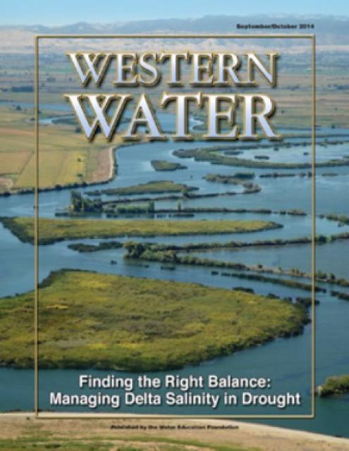
What is Drought?
Drought – an extended period of limited or no
precipitation – is a fact of life in California and the
West, with water resources following boom-and-bust patterns.
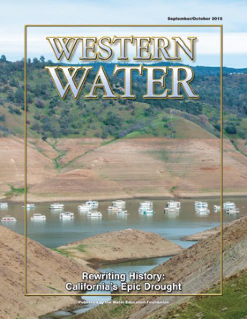
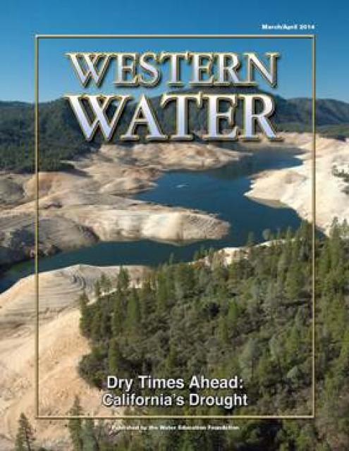
During California’s 2012-2016 drought, much of the state
experienced severe drought conditions: significantly less
precipitation and snowpack, reduced streamflow and higher
temperatures. Those same conditions began reappearing in late
2020, prompting Gov. Gavin Newsom in May of 2021 to declare
drought emergencies in watersheds across 41 counties in
California. Restrictions were later extended to all 58 counties.
Gov. Newsom relaxed those restrictions finally in March 2023,
after an exceptionally wet winter filled reservoirs and packed
the Sierra Nevada with record snowfall.
Las Vegas, known for its searing summertime heat and glitzy casino fountains, is projected to get even hotter in the coming years as climate change intensifies. As temperatures rise, possibly as much as 10 degrees by end of the century, according to some models, water demand for the desert community is expected to spike. That is not good news in a fast-growing region that depends largely on a limited supply of water from an already drought-stressed Colorado River.
When you oversee the largest
supplier of treated water in the United States, you tend to think
big.
Jeff Kightlinger, general manager of the Metropolitan Water
District of Southern California for the last 15 years, has
focused on diversifying his agency’s water supply and building
security through investment. That means looking beyond MWD’s
borders to ensure the reliable delivery of water to two-thirds of
California’s population.
As California’s seasons become
warmer and drier, state officials are pondering whether the water
rights permitting system needs revising to better reflect the
reality of climate change’s effect on the timing and volume of
the state’s water supply.
A report by the State Water Resources Control Board recommends
that new water rights permits be tailored to California’s
increasingly volatile hydrology and be adaptable enough to ensure
water exists to meet an applicant’s demand. And it warns
that the increasingly whiplash nature of California’s changing
climate could require existing rights holders to curtail
diversions more often and in more watersheds — or open
opportunities to grab more water in climate-induced floods.
A government agency that controls much of California’s water
supply released its initial allocation for 2021, and the
numbers reinforced fears that the state is falling into another
drought. The U.S. Bureau of Reclamation said Tuesday that most
of the water agencies that rely on the Central Valley Project
will get just 5% of their contract supply, a dismally low
number. Although the figure could grow if California gets more
rain and snow, the allocation comes amid fresh weather
forecasts suggesting the dry winter is continuing. The National
Weather Service says the Sacramento Valley will be warm and
windy the next few days, with no rain in the forecast.
Across a sprawling corner of southern Tulare County snug against the Sierra Nevada, a bounty of navel oranges, grapes, pistachios, hay and other crops sprout from the loam and clay of the San Joaquin Valley. Groundwater helps keep these orchards, vineyards and fields vibrant and supports a multibillion-dollar agricultural economy across the valley. But that bounty has come at a price. Overpumping of groundwater has depleted aquifers, dried up household wells and degraded ecosystems.
Twenty years ago, the Colorado River
Basin’s hydrology began tumbling into a historically bad stretch.
The weather turned persistently dry. Water levels in the system’s
anchor reservoirs of Lake Powell and Lake Mead plummeted. A river
system relied upon by nearly 40 million people, farms and
ecosystems across the West was in trouble. And there was no guide
on how to respond.
Practically every drop of water that flows through the meadows, canyons and plains of the Colorado River Basin has reams of science attached to it. Snowpack, streamflow and tree ring data all influence the crucial decisions that guide water management of the iconic Western river every day.
Dizzying in its scope, detail and complexity, the scientific information on the Basin’s climate and hydrology has been largely scattered in hundreds of studies and reports. Some studies may conflict with others, or at least appear to. That’s problematic for a river that’s a lifeline for 40 million people and more than 4 million acres of irrigated farmland.
Sprawled across a desert expanse
along the Utah-Arizona border, Lake Powell’s nearly 100-foot high
bathtub ring etched on its sandstone walls belie the challenges
of a major Colorado River reservoir at less than half-full. How
those challenges play out as demand grows for the river’s water
amid a changing climate is fueling simmering questions about
Powell’s future.
This event explored the lower Colorado River where virtually every drop of the river is allocated, yet demand is growing from myriad sources — increasing population, declining habitat, drought and climate change.
The 1,450-mile river is a lifeline to 40 million people in the Southwest across seven states and Mexico. How the Lower Basin states – Arizona, California and Nevada – use and manage this water to meet agricultural, urban, environmental and industrial needs was the focus of this tour.
The Colorado River is arguably one
of the hardest working rivers on the planet, supplying water to
40 million people and a large agricultural economy in the West.
But it’s under duress from two decades of drought and decisions
made about its management will have exceptional ramifications for
the future, especially as impacts from climate change are felt.
Every other year we hold an
invitation-only Colorado River Symposium attended by various
stakeholders from across the seven Western states and Mexico that
rely on the iconic river. We host this three-day event in Santa
Fe, N.M., where the 1922 Colorado River Compact was signed, as
part of our mission to catalyze critical conversations to build
bridges and inform collaborative decision-making.
Many of California’s watersheds are
notoriously flashy – swerving from below-average flows to jarring
flood conditions in quick order. The state needs all the water it
can get from storms, but current flood management guidelines are
strict and unyielding, requiring reservoirs to dump water each
winter to make space for flood flows that may not come.
However, new tools and operating methods are emerging that could
lead the way to a redefined system that improves both water
supply and flood protection capabilities.
California is chock full of rivers and creeks, yet the state’s network of stream gauges has significant gaps that limit real-time tracking of how much water is flowing downstream, information that is vital for flood protection, forecasting water supplies and knowing what the future might bring.
That network of stream gauges got a big boost Sept. 30 with the signing of SB 19. Authored by Sen. Bill Dodd (D-Napa), the law requires the state to develop a stream gauge deployment plan, focusing on reactivating existing gauges that have been offline for lack of funding and other reasons. Nearly half of California’s stream gauges are dormant.
The southern part of California’s Central Coast from San Luis Obispo County to Ventura County, home to about 1.5 million people, is blessed with a pleasing Mediterranean climate and a picturesque terrain. Yet while its unique geography abounds in beauty, the area perpetually struggles with drought.
Indeed, while the rest of California breathed a sigh of relief with the return of wet weather after the severe drought of 2012–2016, places such as Santa Barbara still grappled with dry conditions.
The Colorado River Basin’s 20 years
of drought and the dramatic decline in water levels at the
river’s key reservoirs have pressed water managers to adapt to
challenging conditions. But even more extreme — albeit rare —
droughts or floods that could overwhelm water managers may lie
ahead in the Basin as the effects of climate change take hold,
say a group of scientists. They argue that stakeholders who are
preparing to rewrite the operating rules of the river should plan
now for how to handle these so-called “black swan” events so
they’re not blindsided.
Summer is a good time to take a
break, relax and enjoy some of the great beaches, waterways and
watersheds around California and the West. We hope you’re getting
a chance to do plenty of that this July.
But in the weekly sprint through work, it’s easy to miss
some interesting nuggets you might want to read. So while we’re
taking a publishing break to work on other water articles planned
for later this year, we want to help you catch up on
Western Water stories from the first half of this year
that you might have missed.
New to this year’s slate of water
tours, our Edge of
Drought Tour Aug. 27-29 will venture into the Santa
Barbara area to learn about the challenges of limited local
surface and groundwater supplies and the solutions being
implemented to address them.
Despite Santa Barbara County’s decision to lift a drought
emergency declaration after this winter’s storms replenished
local reservoirs, the region’s hydrologic recovery often has
lagged behind much of the rest of the state.
On average, more than 60 percent of
California’s developed water supply originates in the Sierra
Nevada and the southern spur of the Cascade Range. Our water
supply is largely dependent on the health of our Sierra forests,
which are suffering from ecosystem degradation, drought,
wildfires and widespread tree mortality.
This tour ventured into the Sierra to examine water issues
that happen upstream but have dramatic impacts downstream and
throughout the state.
Even as stakeholders in the Colorado River Basin celebrate the recent completion of an unprecedented drought plan intended to stave off a crashing Lake Mead, there is little time to rest. An even larger hurdle lies ahead as they prepare to hammer out the next set of rules that could vastly reshape the river’s future.
Set to expire in 2026, the current guidelines for water deliveries and shortage sharing, launched in 2007 amid a multiyear drought, were designed to prevent disputes that could provoke conflict.
One of California Gov. Gavin
Newsom’s first actions after taking office was to appoint Wade
Crowfoot as Natural Resources Agency secretary. Then, within
weeks, the governor laid out an ambitious water agenda that
Crowfoot, 45, is now charged with executing.
That agenda includes the governor’s desire for a “fresh approach”
on water, scaling back the conveyance plan in the Sacramento-San
Joaquin Delta and calling for more water recycling, expanded
floodplains in the Central Valley and more groundwater recharge.
This tour journeyed through a scenic landscape and
explored an area of California dealing with
persistent threats to its water supply and quality. Along
the way, we learned about solutions that were being
implemented.
Although Santa Barbara County had lifted its drought
emergency declaration after the 2019 storms replenished
local reservoirs, the region’s hydrologic recovery has often
lagged behind much of the rest of the state. It is a region
particularly prone to drought, wildfires and mudslides.
Groundwater helped make Kern County
the king of California agricultural production, with a $7 billion
annual array of crops that help feed the nation. That success has
come at a price, however. Decades of unchecked groundwater
pumping in the county and elsewhere across the state have left
some aquifers severely depleted. Now, the county’s water managers
have less than a year left to devise a plan that manages and
protects groundwater for the long term, yet ensures that Kern
County’s economy can continue to thrive, even with less water.
For the bulk of her career, Jayne
Harkins has devoted her energy to issues associated with the
management of the Colorado River, both with the U.S. Bureau of
Reclamation and with the Colorado River Commission of Nevada.
Now her career is taking a different direction. Harkins, 58, was
appointed by President Trump last August to take the helm of the
United States section of the U.S.-Mexico agency that oversees
myriad water matters between the two countries as they seek to
sustainably manage the supply and water quality of the Colorado
River, including its once-thriving Delta in Mexico, and other
rivers the two countries share. She is the first woman to be
named the U.S. Commissioner of the International Boundary and
Water Commission for either the United States or Mexico in the
commission’s 129-year history.
This tour explored the lower Colorado River where virtually every drop of the river is allocated, yet demand is growing from myriad sources — increasing population, declining habitat, drought and climate change.
The 1,450-mile river is a lifeline to 40 million people in the Southwest across seven states and Mexico. How the Lower Basin states – Arizona, California and Nevada – use and manage this water to meet agricultural, urban, environmental and industrial needs is the focus of this tour.
Silverton Hotel
3333 Blue Diamond Road
Las Vegas, NV 89139
Although Santa Monica may be the most aggressive Southern California water provider to wean itself from imported supplies, it is hardly the only one looking to remake its water portfolio.
In Los Angeles, a city of about 4 million people, efforts are underway to dramatically slash purchases of imported water while boosting the amount from recycling, stormwater capture, groundwater cleanup and conservation. Mayor Eric Garcetti in 2014 announced a plan to reduce the city’s purchase of imported water from Metropolitan Water District by one-half by 2025 and to provide one-half of the city’s supply from local sources by 2035. (The city considers its Eastern Sierra supplies as imported water.)
Imported water from the Sierra
Nevada and the Colorado River built Southern California. Yet as
drought, climate change and environmental concerns render those
supplies increasingly at risk, the Southland’s cities have ramped
up their efforts to rely more on local sources and less on
imported water.
Far and away the most ambitious goal has been set by the city of
Santa Monica, which in 2014 embarked on a course to be virtually
water independent through local sources by 2023. In the 1990s,
Santa Monica was completely dependent on imported water. Now, it
derives more than 70 percent of its water locally.
The growing leadership of women in water. The Colorado River’s persistent drought and efforts to sign off on a plan to avert worse shortfalls of water from the river. And in California’s Central Valley, promising solutions to vexing water resource challenges.
These were among the topics that Western Water news explored in 2018.
We’re already planning a full slate of stories for 2019. You can sign up here to be alerted when new stories are published. In the meantime, take a look at what we dove into in 2018:
As stakeholders labor to nail down
effective and durable drought contingency plans for the Colorado
River Basin, they face a stark reality: Scientific research is
increasingly pointing to even drier, more challenging times
ahead.
The latest sobering assessment landed the day after Thanksgiving,
when U.S. Global Change Research Program’s Fourth National Climate
Assessment concluded that Earth’s climate is changing rapidly
compared to the pace of natural variations that have occurred
throughout its history, with greenhouse gas emissions largely the
cause.
In the universe of California water, Tim Quinn is a professor emeritus. Quinn has seen — and been a key player in — a lot of major California water issues since he began his water career 40 years ago as a young economist with the Rand Corporation, then later as deputy general manager with the Metropolitan Water District of Southern California, and finally as executive director of the Association of California Water Agencies. In December, the 66-year-old will retire from ACWA.
Just because El Niño may be lurking
off in the tropical Pacific, does that really offer much of a
clue about what kind of rainy season California can expect in
Water Year 2019?
Will a river of storms pound the state, swelling streams and
packing the mountains with deep layers of heavy snow much like
the exceptionally wet 2017 Water Year (Oct. 1, 2016 to Sept. 30,
2017)? Or will this winter sputter along like last winter,
leaving California with a second dry year and the possibility of
another potential drought? What can reliably be said about the
prospects for Water Year 2019?
At Water Year
2019: Feast or Famine?, a one-day event on Dec. 5 in Irvine,
water managers and anyone else interested in this topic will
learn about what is and isn’t known about forecasting
California’s winter precipitation weeks to months ahead, the
skill of present forecasts and ongoing research to develop
predictive ability.
“Dry, hot and on fire” is how the
California Department of Water Resources described Water Year
2018 in a recent report.
Water Year 2018 – from Oct. 1, 2017 to Sept. 30, 2018 -
marked a return to dry conditions statewide following an
exceptionally wet 2017, according to DWR’s Water
Year 2018 report. But 2017 was exceptional as all but two of
the water years in the past decade experienced drought.
Was Water Year 2018 simply a single dry year or does it
signal the beginning of another drought? And what can
reliably be said about the prospects for Water Year 2019? Does El
Niño really mean anything for California or is it all washed up
as a predictor?
Attendees found out at this one-day event Dec. 5 in
Irvine, Water Year 2019: Feast or
Famine?
Beckman Center
Auditorium - Huntington Room
100 Academy Way
Irvine, California 92617
There’s going to be a new governor
in California next year – and a host of challenges both old and
new involving the state’s most vital natural resource, water.
So what should be the next governor’s water priorities?
That was one of the questions put to more than 150 participants
during a wrap-up session at the end of the Water Education
Foundation’s Sept. 20 Water Summit in Sacramento.
People in California and the
Southwest are getting stingier with water, a story that’s told by
the acre-foot.
For years, water use has generally been described in terms of
acre-foot per a certain number of households, keying off the
image of an acre-foot as a football field a foot deep in water.
The long-time rule of thumb: One acre-foot of water would supply
the indoor and outdoor needs of two typical urban households for
a year.
The Colorado River Basin is more
than likely headed to unprecedented shortage in 2020 that could
force supply cuts to some states, but work is “furiously”
underway to reduce the risk and avert a crisis, Bureau of
Reclamation Commissioner Brenda Burman told an audience of
California water industry people.
During a keynote address at the Water Education Foundation’s
Sept. 20 Water Summit in Sacramento, Burman said there is
opportunity for Colorado River Basin states to control their
destiny, but acknowledged that in water, there are no guarantees
that agreement can be reached.
Amy Haas recently became the first non-engineer and the first woman to serve as executive director of the Upper Colorado River Commission in its 70-year history, putting her smack in the center of a host of daunting challenges facing the Upper Colorado River Basin.
Yet those challenges will be quite familiar to Haas, an attorney who for the past year has served as deputy director and general counsel of the commission. (She replaced longtime Executive Director Don Ostler). She has a long history of working within interstate Colorado River governance, including representing New Mexico as its Upper Colorado River commissioner and playing a central role in the negotiation of the recently signed U.S.-Mexico agreement known as Minute 323.
Nowhere is the domino effect in
Western water policy played out more than on the Colorado River,
and specifically when it involves the Lower Basin states of
California, Nevada and Arizona. We are seeing that play out now
as the three states strive to forge a Drought Contingency Plan.
Yet that plan can’t be finalized until Arizona finds a unifying
voice between its major water players, an effort you can read
more about in the latest in-depth article of Western Water.
Even then, there are some issues to resolve just within
California.
It’s high-stakes time in Arizona. The state that depends on the
Colorado River to help supply its cities and farms — and is
first in line to absorb a shortage — is seeking a unified plan
for water supply management to join its Lower Basin neighbors,
California and Nevada, in a coordinated plan to preserve water
levels in Lake Mead before
they run too low.
If the lake’s elevation falls below 1,075 feet above sea level,
the secretary of the Interior would declare a shortage and
Arizona’s deliveries of Colorado River water would be reduced by
320,000 acre-feet. Arizona says that’s enough to serve about 1
million households in one year.
We explored the lower Colorado River where virtually every drop
of the river is allocated, yet demand is growing from myriad
sources — increasing population, declining habitat, drought and
climate change.
The 1,450-mile river is a lifeline to 40 million people in
the Southwest across seven states and Mexico. How the Lower Basin
states – Arizona, California and Nevada – use and manage this
water to meet agricultural, urban, environmental and industrial
needs was the focus of this tour.
Hampton Inn Tropicana
4975 Dean Martin Drive, Las Vegas, NV 89118
This winter’s wild swings in weather
– an early lack of rain, then late-season Sierra snowstorms,
followed by a torrent of subtropical moisture – shows the need in
California for long-range tools to better manage water supply.
At a Paleo
Drought Workshop in San Pedro on April 19, six experts will
discuss research on centuries-long precipitation and streamflow
records, new forecasting tools and planning strategies to help
reduce Southern California’s vulnerability to drought.
Learn what new tree-ring studies in
Southern California watersheds reveal about drought, hear about
efforts to improve subseasonal to seasonal weather forecasting
and get the latest on climate change impacts that will alter
drought vulnerability in the future.
At our Paleo
Drought Workshop on April 19th in San Pedro, you will hear
from experts at NASA Jet Propulsion Laboratory, University of
Arizona and California Department of Water Resources.
Dramatic swings in weather patterns
over the past few years in California are stark reminders of
climate variability and regional vulnerability. Alternating years
of drought and intense rain events make long-term planning for
storing and distributing water a challenging task.
Current weather forecasting capabilities provide details for
short time horizons. Attend the Paleo Drought
Workshop in San Pedro on April 19 to learn more about
research efforts to improve sub-seasonal to seasonal
precipitation forecasting, known as S2S, and how those models
could provide more useful weather scenarios for resource
managers.
California’s 2012-2016 drought
revealed vulnerabilities for water users throughout the state,
and the long-term record suggests more challenges may lie ahead.
An April 19
workshop in San Pedro will highlight new information about
drought durations in Southern California watersheds dating
back centuries.
Every day, people flock to Daniel
Swain’s social media platforms to find out the latest news and
insight about California’s notoriously unpredictable weather.
Swain, a climate scientist at the Institute of the
Environment and Sustainability at UCLA, famously coined the
term “Ridiculously Resilient Ridge” in December 2013 to describe
the large, formidable high-pressure mass that was parked over the
West Coast during winter and diverted storms away from
California, intensifying the drought.
Swain’s research focuses on atmospheric processes that cause
droughts and floods, along with the changing character of extreme
weather events in a warming world. A lifelong Californian and
alumnus of University of California, Davis, and Stanford
University, Swain is best known for the widely read Weather West blog, which provides
unique perspectives on weather and climate in California and the
western United States. In a recent interview with Western
Water, he talked about the Ridiculously Resilient Ridge, its
potential long-term impact on California weather, and what may
lie ahead for the state’s water supply.
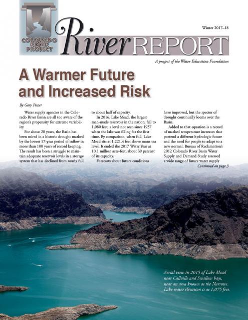
Rising temperatures from climate change are having a noticeable
effect on how much water is flowing down the Colorado River. Read
the latest River Report to learn more about what’s
happening, and how water managers are responding.
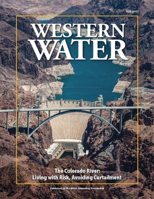
This issue of Western Water discusses the challenges
facing the Colorado River Basin resulting from persistent
drought, climate change and an overallocated river, and how water
managers and others are trying to face the future.
For decades, no matter the weather, the message has been preached
to Californians: use water wisely, especially outdoors, which
accounts for most urban water use.
Enforcement of that message filters to the local level, where
water agencies routinely target the notorious “gutter flooder”
with gentle reminders and, if necessary, financial penalties.
Sixty percent of California’s developed water supply
originates high in the Sierra Nevada mountains. Our water
supply is largely dependent on the health of our Sierra forests,
which are suffering from ecosystem degradation, drought,
wildfires and widespread tree mortality.
This three-day, two-night tour explored the lower Colorado River
where virtually every drop of the river is allocated, yet demand
is growing from myriad sources — increasing population,
declining habitat, drought and climate change.
The 1,450-mile river is a lifeline to 40 million people in
the Southwest across seven states and Mexico. How the Lower Basin
states – Arizona, California and Nevada – use and manage this
water to meet agricultural, urban, environmental and industrial
needs is the focus of this tour.
Best Western McCarran Inn
4970 Paradise Road
Las Vegas, NV 89119
In a state with such topsy-turvy weather as California, the
ability of forecasters to peer into the vast expanse of the
Pacific Ocean and accurately predict the arrival of storms is a
must to improve water supply reliability and flood management
planning.
The problem, according to Jeanine Jones, interstate resources
manager with the state Department of Water Resources, is
that “we have been managing with 20th century
technology with respect to our ability to do weather
forecasting.”
During drought, people conserve water. That’s a good thing for
public water agencies and the state as a whole but the reduction
in use ultimately means less money flowing into the budgets of
those very agencies that need funds to treat water to drinkable
standards, maintain a distribution system, and build a more
drought-proof supply.
“There are two things that can’t happen to a water utility – you
can’t run out of money and you can’t run out of water,” said Tom
Esqueda, public utilities director for the city of Fresno. He was
a panelist at a June 16 discussion in Sacramento about drought
resiliency sponsored by the Public Policy Institute of California
(PPIC).
Years of drought have sapped California’s water supply, creating
an accumulated deficit exacerbated by increasingly warmer
temperatures, a top researcher said at a recent briefing.
Michael Dettinger, research hydrologist with the U.S. Geological
Survey, said parts of California have fallen more than two years
behind where they should be in terms of receiving “normal”
precipitation. The situation augurs what would be expected under
projected climate change conditions as average annual
temperatures warm and the snow level declines.
A hydrograph illustrates a type of activity of water during a
specific time frame. Salinity and acidity are sometimes measured,
but the most common types
are stage and discharge hydrographs. These graphs show how
surface water flow responds to fluxes in precipitation.
California is no stranger to drought. When conditions become dry,
water storage declines and water conservation mandates make news
headlines; questions from the public often surface about what
appear to be easy solutions to augment the state’s water supply.
But the answers can be complicated and, in the end, there is no
silver bullet to ensure a resilient water supply, especially
during drought.
We explore “frequently asked questions” often posed by the public
and provide answers below. Simply click on the question for the
answer to appear.
The dramatic decline in water levels in Lake Mead and Lake Powell
is perhaps the most visible sign of the historic drought that has
gripped the Colorado River Basin for the past 16 years. In 2000,
the reservoirs stood at nearly 100 percent capacity; today, Lake
Powell is at 49 percent capacity while Lake Mead has dropped to
38 percent. Before the late season runoff of Miracle May, it
looked as if Mead might drop low enough to trigger the first-ever
Lower Basin shortage determination in 2016.
Read the excerpt below from the Sept./Oct. 2015 issue along
with the editor’s note. Click here to subscribe to Western
Water and get full access.
This free briefing sponsored by the Department of Water Resources
and the Water Education Foundation will discuss forecasts of
water project operations in the coming year.
Water year 2016 has officially begun, and all eyes are on the
weather and the potential runoff. But even if the projected heavy
El Niño becomes reality, the state’s drought-impacted reservoirs
are still a major concern.
This issue examines the impacts of California’s epic
drought, especially related to water supplies for San Joaquin
Valley rural communities and farmland.
Drought doesn’t instantly ravage
the way flooding does. It advances at a steady, determined pace,
building and spreading during several years. Fields wither,
reservoirs drop to dangerously low levels and the memory of what
constitutes a normal water supply becomes more distant.
Read the excerpt below from the Sept./Oct. 2015 issue along
with the editor’s note. Click here to subscribe to Western Water and
get full access.
California’s severe drought has put its water rights system under
scrutiny, raising the question whether a complete overhaul is
necessary to better allocate water use.
(Read the excerpt below from the July/August 2015 issue along
with the editor’s note. Click here
to subscribe to Western Water and get full access.)
Introduction
California’s severe drought has put its water rights system under
scrutiny, raising the question whether a complete overhaul is
necessary to better allocate water use.
This 2-day, 1-night tour traveled through the San Joaquin Valley
to explore the impacts of California’s unprecedented four-year
drought on the nation’s breadbasket and what steps are being
taken to avert disaster.
This 3-day, 2-night tour followed the course of the
lower Colorado River through Nevada, Arizona and California, and
included a private tour of Hoover Dam.
In wet years, dry years and every type of water year in between,
the daily intrusion and retreat of salinity in the Sacramento-San
Joaquin Delta is a constant pattern.
The cycle of ebb and flood is the defining nature of an estuary
and prior to its transformation into an agricultural tract in
the mid-19th century, the Delta was a freshwater marsh with
plants, birds, fish and wildlife that thrived on the edge of the
saltwater/freshwater interface.
Living in the semi-arid, Mediterranean climate of California,
drought always lingers on the horizon. People believe they are
ready to face the next dry period, then conditions arrive testing
whether that is the case.
This printed copy of Western Water examines climate change –
what’s known about it, the remaining uncertainty and what steps
water agencies are talking to prepare for its impact. Much of the
information comes from the October 2007 California Climate Change
and Water Adaptation Summit sponsored by the Water Education
Foundation and DWR and the November 2007 California Water Policy
Conference sponsored by Public Officials for Water and
Environmental Reform.
This printed copy of Western Water examines California’s drought
– its impact on water users in the urban and agricultural sector
and the steps being taken to prepare for another dry year should
it arrive.
This printed issue of Western Water examines the
Colorado River drought, and the ongoing institutional and
operational changes underway to maintain the system and meet the
future challenges in the Colorado River Basin.
This printed issue of Western Water explores the
historic nature of some of the key agreements in recent years,
future challenges, and what leading state representatives
identify as potential “worst-case scenarios.” Much of the content
for this issue of Western Water came from the in-depth
panel discussions at the Colorado River Symposium. The Foundation
will publish the full proceedings of the Symposium in 2012.
This printed issue of Western Water examines the issues
associated with the State Water Board’s proposed revision of the
water quality Bay-Delta Plan, most notably the question of
whether additional flows are needed for the system, and how they
might be provided.
This printed issue of Western Water examines the
Colorado River Basin Water Supply and Demand Study and what its
finding might mean for the future of the lifeblood of the
Southwest.
This printed issue of Western Water features a
roundtable discussion with Anthony Saracino, a water resources
consultant; Martha Davis, executive manager of policy development
with the Inland Empire Utilities Agency and senior policy advisor
to the Delta Stewardship Council; Stuart Leavenworth, editorial
page editor of The Sacramento Bee and Ellen Hanak, co-director of
research and senior fellow at the Public Policy Institute of
California.
This printed issue of Western Water This issue of Western Water
looks at climate change through the lens of some of the latest
scientific research and responses from experts regarding
mitigation and adaptation.
This printed issue of Western Water examines how the various
stakeholders have begun working together to meet the planning
challenges for the Colorado River Basin, including agreements
with Mexico, increased use of conservation and water marketing,
and the goal of accomplishing binational environmental
restoration and water-sharing programs.
This printed issue of Western Water looks at California
groundwater and whether its sustainability can be assured by
local, regional and state management. For more background
information on groundwater please refer to the Foundation’s
Layperson’s Guide to Groundwater.
This 25-minute documentary-style DVD, developed in partnership
with the California Department of Water Resources, provides an
excellent overview of climate change and how it is already
affecting California. The DVD also explains what scientists
anticipate in the future related to sea level rise and
precipitation/runoff changes and explores the efforts that are
underway to plan and adapt to climate.
Many Californians don’t realize that when they turn on the
faucet, the water that flows out could come from a source close
to home or one hundreds of miles away. Most people take their
water for granted; not thinking about the elaborate systems and
testing that go into delivering clean, plentiful water to
households throughout the state. Where drinking water comes from,
how it’s treated, and what people can do to protect its quality
are highlighted in this 2007 PBS documentary narrated by actress
Wendie Malick.
A 30-minute version of the 2007 PBS documentary Drinking Water:
Quenching the Public Thirst. This DVD is ideal for showing at
community forums and speaking engagements to help the public
understand the complex issues surrounding the elaborate systems
and testing that go into delivering clean, plentiful water to
households throughout the state.
This 3-day, 2-night tour travels the length of the San Joaquin
Valley, giving participants a clear understanding of the State
Water Project and Central Valley Project.
This beautiful 24×36 inch poster, suitable for framing, displays
the rivers, lakes and reservoirs, irrigated farmland, urban areas
and Indian reservations within the Truckee River Basin, including
the Newlands Project, Pyramid Lake and Lake Tahoe. Map text
explains the issues surrounding the use of the Truckee-Carson
rivers, Lake Tahoe water quality improvement efforts, fishery
restoration and the effort to reach compromise solutions to many
of these issues.
This 24×36 inch poster, suitable for framing, illustrates the
water resources available for Nevada cities, agriculture and the
environment. It features natural and manmade water resources
throughout the state, including the Truckee and Carson rivers,
Lake Tahoe, Pyramid Lake and the course of the Colorado River
that forms the state’s eastern boundary.
The 24-page Layperson’s Guide to the State Water Project provides
an overview of the California-funded and constructed State Water
Project.
The State Water Project is best known for the 444-mile-long
aqueduct that provides water from the Delta to San Joaquin Valley
agriculture and southern California cities. The guide contains
information about the project’s history and facilities.
The 28-page Layperson’s Guide to Nevada Water provides an
overview of the history of water development and use in Nevada.
It includes sections on Nevada’s water rights laws, the history
of the Truckee and Carson rivers, water supplies for the Las
Vegas area, groundwater, water quality, environmental issues and
today’s water supply challenges.
The Water Education Foundation’s second edition of
the Layperson’s Guide to The Klamath River Basin is
hot off the press and available for purchase.
Updated and redesigned, the easy-to-read overview covers the
history of the region’s tribal, agricultural and environmental
relationships with one of the West’s largest rivers — and a
vast watershed that hosts one of the nation’s oldest and
largest reclamation projects.
The 24-page Layperson’s Guide to Integrated Regional Water
Management (IRWM) is an in-depth, easy-to-understand publication
that provides background information on the principles of IRWM,
its funding history and how it differs from the traditional water
management approach.
The 28-page Layperson’s Guide to Groundwater is an in-depth,
easy-to-understand publication that provides background and
perspective on groundwater. The guide explains what groundwater
is – not an underground network of rivers and lakes! – and the
history of its use in California.
The 24-page Layperson’s Guide to California Water provides an
excellent overview of the history of water development and use in
California. It includes sections on flood management; the state,
federal and Colorado River delivery systems; Delta issues; water
rights; environmental issues; water quality; and options for
stretching the water supply such as water marketing and
conjunctive use. New in this 10th edition of the guide is a
section on the human need for water.
The 24-page Layperson’s Guide to the Central Valley Project
explores the history and development of the federal Central
Valley Project (CVP), California’s largest surface water delivery
system. In addition to the project’s history, the guide describes
the various CVP facilities, CVP operations, the benefits the CVP
brought to the state and the CVP Improvement Act (CVPIA).
The 24-page Layperson’s Guide to the Delta explores the competing
uses and demands on California’s Sacramento-San Joaquin Delta.
Included in the guide are sections on the history of the Delta,
its role in the state’s water system, and its many complex issues
with sections on water quality, levees, salinity and agricultural
drainage, fish and wildlife, and water distribution.
Redesigned in 2017, this beautiful map depicts the seven
Western states that share the Colorado River with Mexico. The
Colorado River supplies water to nearly 40 million people in
Arizona, California, Colorado, Nevada, New Mexico, Utah, Wyoming
and Mexico. Text on this beautiful, 24×36-inch map, which is
suitable for framing, explains the river’s apportionment, history
and the need to adapt its management for urban growth and
expected climate change impacts.
It seems not a matter of if but when seawater desalination will
fulfill the promise of providing parts of California with a
reliable, drought-proof source of water. With a continuing
drought and uncertain water deliveries, the state is in the grip
of a full-on water crisis, and there are many people who see
desalination as a way to provide some relief to areas struggling
to maintain an adequate water supply.
Drought—an extended period of
limited or no precipitation—is a fact of life in California and
the West, with water resources following boom-and-bust patterns.
During California’s 2012–2016 drought, much of the state
experienced severe drought conditions: significantly less
precipitation and snowpack, reduced streamflow and higher
temperatures. Those same conditions reappeared early in 2021
prompting Gov. Gavin Newsom in May to declare drought emergencies
in watersheds across 41 counties in California.
California’s seasonal weather is
influenced by El Niño and La Niña – temporary climatic conditions
that, depending on their severity, make the weather wetter or
drier than normal.
El Niño and La Niña episodes typically last 9 to 12 months,
but some may last for years. While their frequency can be quite
irregular, El Niño and La Niña events occur on average every two
to seven years. Typically, El Niño occurs more frequently than La
Niña, according to the National Oceanic and Atmospheric
Administration (NOAA).
A new look for our most popular product! And it’s the perfect
gift for the water wonk in your life.
Our 24×36 inch California Water Map is widely known for being the
definitive poster that shows the integral role water plays in the
state. On this updated version, it is easier to see California’s
natural waterways and man-made reservoirs and aqueducts
– including federally, state and locally funded
projects – the wild and scenic rivers system, and
natural lakes. The map features beautiful photos of
California’s natural environment, rivers, water projects,
wildlife, and urban and agricultural uses and the
text focuses on key issues: water supply, water use, water
projects, the Delta, wild and scenic rivers and the Colorado
River.
30-minute DVD that traces the history of the U.S. Bureau of
Reclamation and its role in the development of the West. Includes
extensive historic footage of farming and the construction of
dams and other water projects, and discusses historic and modern
day issues.
Just before summer officially began in June, Gov. Arnold
Schwarzenegger publicly proclaimed what many people already knew:
California is in a drought. Consecutive years of sub par rainfall
coupled with a 2008 snowpack that literally dried up and blew
away before it could turn into runoff forced the issuance of the
state’s first drought declaration since 1991.
When a drought occurs as it has this year, the response is
couched in the three Rs of the waste hierarchy: reduce, reuse and
recycle.
The reduction part is well-known. State and local officials are
urging people to use less water in everything they do, from
landscape irrigation to shorter showers. Spurred by California’s
difficulties, Gov. Arnold Schwarzenegger on June 4 declared a
statewide drought. On July 10, the governor and Sen. Dianne
Feinstein announced their support of the Safe, Clean, Reliable
Drinking Water Supply Act of 2008 – a $9.3 billion bond proposal
that would allocate $250 million for water recycling projects.
Water truly has shaped California into the great state it is
today. And if it is water that made California great, it’s the
fight over – and with – water that also makes it so critically
important. In efforts to remap California’s circulatory system,
there have been some critical events that had a profound impact
on California’s water history. These turning points not only
forced a re-evaluation of water, but continue to impact the lives
of every Californian. This 2005 PBS documentary offers a
historical and current look at the major water issues that shaped
the state we know today. Includes a 12-page viewer’s guide with
background information, historic timeline and a teacher’s lesson.


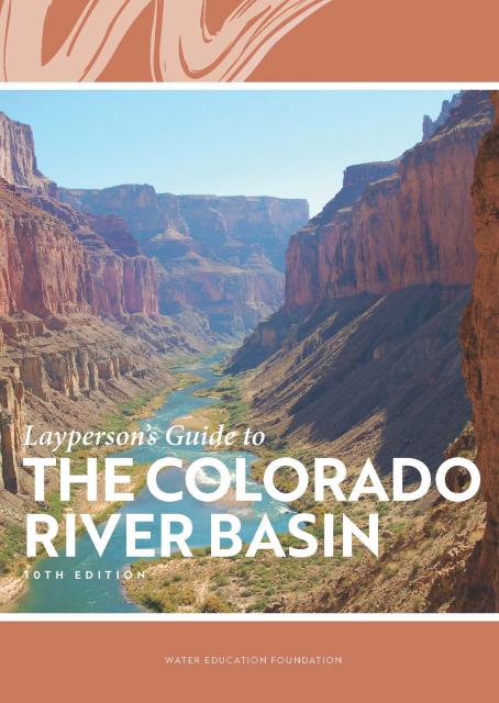


")
 and other tributaries of the upper Colorado River have declined dramatically and contributed to the precipitous declines of Lake Powell and Lake Mead. (Source: The Water Desk)")


")
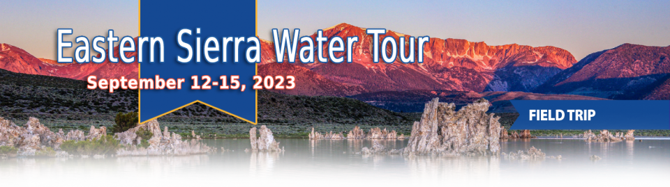
")
")
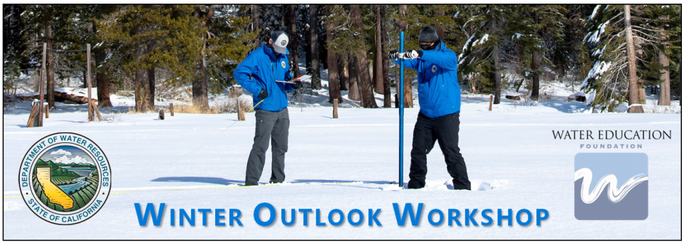
")
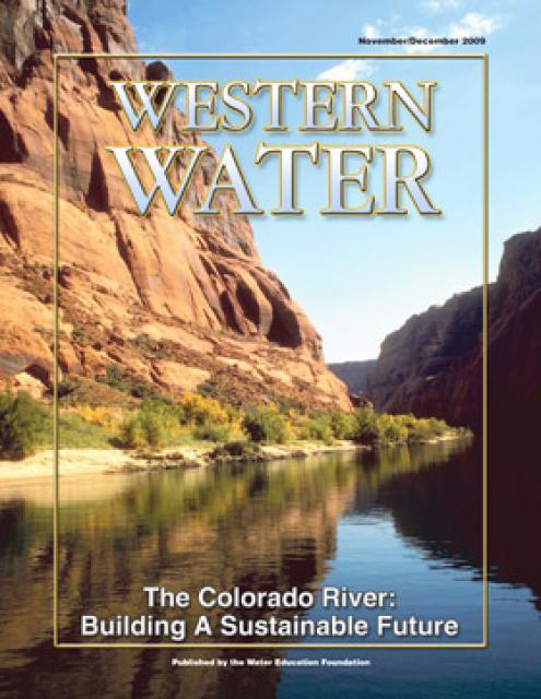
")
")
")
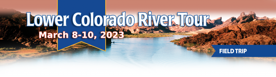
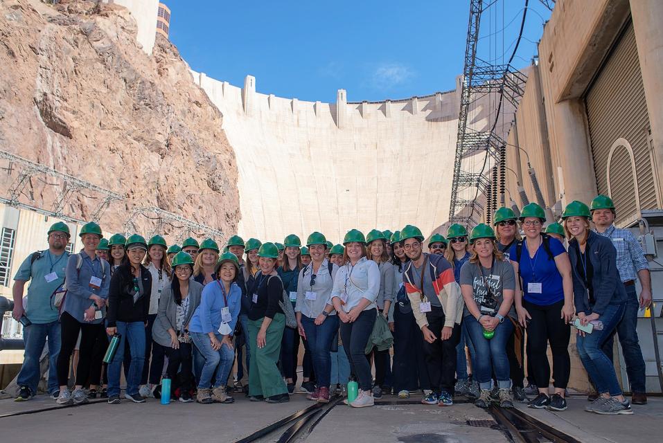
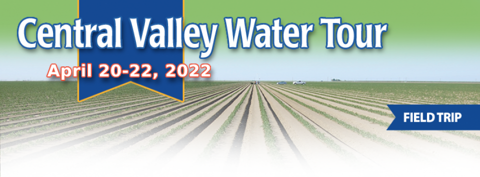
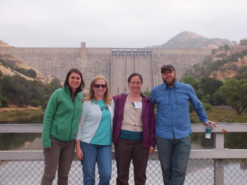
")

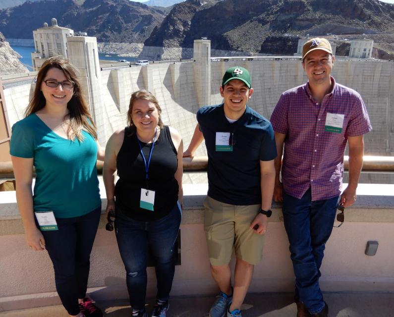
")
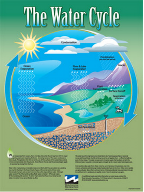

")
")
")
")
")
")
")
")
")
 and temperature. This gauge near downtown Sacramento measures water depth. (Source: California Department of Water Resources)")
")
")


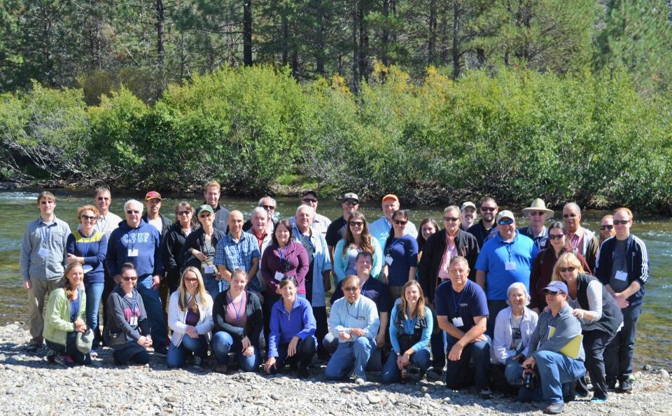
")
")
")
")
 treats dry weather urban runoff to remove pollutants such as sediment, oil, grease, and pathogens for nonpotable use. (Image: City of Santa Monica)")
: Karla Nemeth, director, California Department of Water Resources; Gloria Gray, chair, Metropolitan Water District of Southern California; Brenda Burman, Bureau of Reclamation Commissioner; Jayne Harkins, commissioner, International Boundary and Water Commission, U.S. and Mexico; Amy Haas, executive director, Upper Colorado River Commission.")
")
")
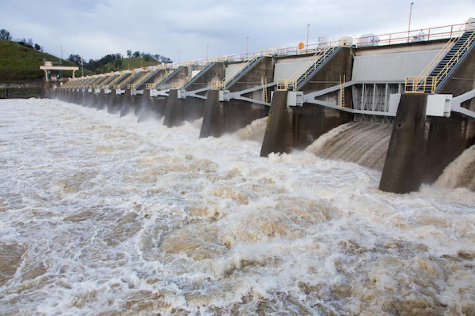

")
")
")
")
")