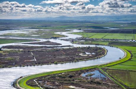
Watch our series of short videos on the importance of the
Sacramento-San Joaquin Delta, how it works as a water hub for
California and the challenges it is facing.
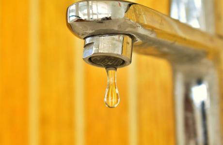
When a person opens a spigot to draw a glass of water, he or she
may be tapping a source close to home or hundreds of miles away.
Water gets to taps via a complex web of aqueducts, canals and
groundwater.
Learn more about our team in the office and on the Board of
Directors and how you can support our nonprofit mission by
donating in someone’s honor or memory, or becoming a regular
contributor or supporting specific projects.
Unlike California’s majestic rivers and massive dams and
conveyance systems, groundwater is out of sight and underground,
though no less plentiful. The state’s enormous cache of
underground water is a great natural resource and has contributed
to the state becoming the nation’s top agricultural producer and
leader in high-tech industries.
A new era of groundwater management began in 2014 in California
with the Sustainable Groundwater Management Act. The landmark law
turned 10 in 2024, with many challenges still ahead.
Our Layperson’s
Guide to California Water has been completely
updated for 2026, providing a comprehensive overview of the
ways water is used, as well as its critical ecological role,
throughout the state. The 24-page publication traces the history
of the vital resource at the core of California’s identity,
politics and culture since its founding in 1850.
Time is running out to register for next Thursday’s Water
101 Workshop and go beyond the headlines to gain a
deeper understanding of how water is managed and moved across
California. Plus, only a handful of seats remain for the
opportunity to extend your ‘beyond the headlines’ water education
experience on the optional watershed tour the next day!
California is resuming commercial salmon fishing after three
consecutive years of closure due to concerns over declining
populations. Gavin Newsom and state officials celebrated the
move, citing the state’s conservation efforts as a key factor
that has contributed to the progress. … The state has
restricted commercial fishing for three consecutive years since
2023 and has leaned on a number of efforts to support the
salmon population, including increasing the number of
hatchery-reared salmon, while conservationists continue to call
for stronger measures and increased water
allocations. “The return of salmon seasons in 2026 is a
testament to the heavy rains of 2023, not a shift in
management,” Vance Staplin, executive director of the Golden
State Salmon Association said in an email.
Despite pressure from Colorado’s congressional delegation,
around $140 million in federal funding previously granted to
Western Slope water projects has lingered in limbo for nearly
16 months. The funds, awarded to 17 Western Slope projects in
the final days of President Joe Biden’s administration, were
part of the Inflation Reduction Act’s drought mitigation grant
opportunity for the Upper Colorado River Basin. This included
$40 million granted to the Colorado River District to aid in
its purchase of the Shoshone water rights, the oldest and
largest non-consumptive right on the Colorado River tied to the
hydropower plant in Glenwood Canyon. … In June, the U.S.
Bureau of Reclamation released funds for two of the projects in
the Orchard Mesa Irrigation District in Palisade, but the rest
remain frozen.
Gov. Katie Hobbs vetoed a bill aimed at funding the recovery of
brackish groundwater— one of the ways some leaders want to
address the water shortage in Arizona. Brackish
groundwater requires some extra treatment than non-brackish
groundwater due to its higher salinity levels. Experts say this
veto doesn’t close the doors on options helping provide
Arizonans with sustainable water
sources. ”Groundwater in the state of Arizona
needs to be managed as a non-renewing water supply,” said Sarah
Porter, the director of ASU’s Kyl Center for Water Policy.
… In her veto letter for the bill, Gov. Hobbs said the
legislation “diverted important funding” to “speculative
groundwater extraction proposals” that she says are already
eligible for funds.
… Now, an even more costly water project is about to break
ground in the Carpinteria Valley—a $90 million system for
converting wastewater to drinking water. It’s a joint project
of the valley’s water and sanitary districts, and it’s the
first of its kind in the county. The purified
wastewater, 1.3 million gallons per day, will be enough to
supply a quarter of the valley’s yearly water demand.
… This kind of water recycling, called “indirect potable
reuse,” or, more indelicately, “toilet-to-tap,” has been
rejected by water agencies elsewhere on the South Coast as too
expensive. But, armed with $34 million in state and federal
grants and a 30-year, $50 million low-interest loan from the
state, the Carpinteria Valley agencies are moving full steam
ahead.
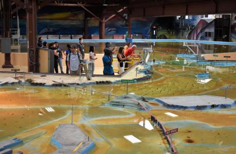
Operated by the U.S. Army Corps of Engineers, the
Bay Model is a giant hydraulic replica of San Francisco
Bay and the Sacramento-San Joaquin
Delta. It is housed in a converted World II-era
warehouse in Sausalito near San Francisco.
Hundreds of gallons of water are pumped through the
three-dimensional, 1.5-acre model to simulate a tidal ebb
and flow lasting 14 minutes.
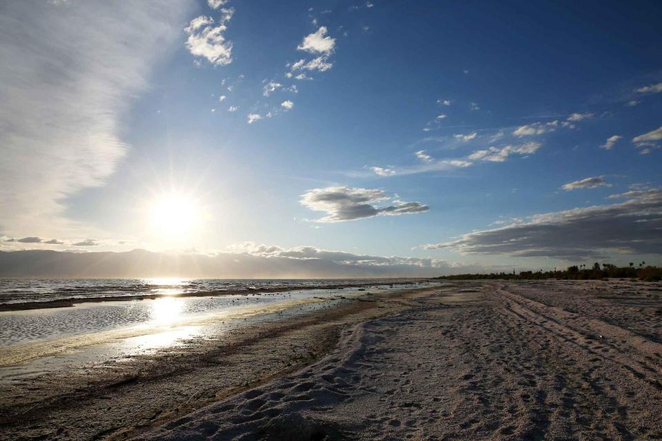
As part of the historic Colorado
River Delta, the Salton Sea regularly filled and dried for
thousands of years due to its elevation of 237 feet below
sea level.
The most recent version of the Salton Sea was formed in 1905 when
the Colorado River broke
through a series of dikes and flooded the seabed for two years,
creating California’s largest inland body of water. The
Salton Sea, which is saltier than the Pacific Ocean, includes 130
miles of shoreline and is larger than Lake Tahoe.
Drought—an extended period of
limited or no precipitation—is a fact of life in California and
the West, with water resources following boom-and-bust patterns.
During California’s 2012–2016 drought, much of the state
experienced severe drought conditions: significantly less
precipitation and snowpack, reduced streamflow and higher
temperatures. Those same conditions reappeared early in 2021
prompting Gov. Gavin Newsom in May to declare drought emergencies
in watersheds across 41 counties in California.