Wetlands are among the most important ecosystems in the world.
They produce high levels of oxygen, filter toxic chemicals out of
water, reduce flooding and erosion and recharge groundwater. They
also serve as critical habitat for wildlife, including a large
percentage of plants and animals on California’s endangered
species list.
As the state has grown into one of the world’s leading economies,
Californians have developed and transformed the state’s marshes,
swamps and tidal flats, losing as much as 90 percent of the
original wetlands acreage—a greater percentage of loss than any
other state in the nation.
While the conversion of wetlands has slowed, the loss in
California is significant and it affects a range of factors from
water quality to quality of life.
Wetlands still remain in every part of the state, with the
greatest concentration in the Sacramento-San Joaquin Delta and
its watershed, which includes the Central Valley. The Delta
wetlands are especially important because they are part of the
vast complex of waterways that provide two-thirds of California’s
drinking water.
Coastal wetlands—including salt marshes, tidal forested
wetlands, and seagrasses—can sequester more carbon per acre
than inland forests, making them some of the world’s most
effective natural carbon sinks. So, states [including
California] are increasingly incorporating the protection and
restoration of these “blue carbon” habitats into their broader
initiatives to reduce greenhouse gas emissions and meet their
climate change goals. Although states use different approaches
to incorporating coastal wetlands into their climate planning,
some common elements are high-level leadership and policy
goals, quality data and established methodologies for
understanding blue carbon trends, and partnerships for
effective implementation.
The Sacramento-San Joaquin River Delta faces significant
challenges affecting the health of its waterways and ecosystem,
and stewards say state agencies must accelerate efforts to
prepare for the impacts of climate change and a growing urban
landscape. Delta Stewardship Council staff presented the
Delta Plan Five Year Review on Thursday, recommending numerous
measures to preserve precious water and environmental habitats
against future crises such as extreme drought, sea level rise
and earthquakes. The council recommended that stewards work
with state regulators to improve the delta’s ecosystems and
reduce reliance on delta water, and with landowners to identify
affordable uses of sinking land for sustainable farming.
The Biden administration announced a goal Tuesday to protect
and restore 8 million acres of wetlands over the next six years
in an effort to counter development pressures and recently
weakened federal regulations. The bold new target seeks to
reverse the ongoing loss of U.S. wetlands, which help keep
pollutants out of rivers and streams and act as a natural
buffer against flooding. Over 60 percent of wetlands now lack
protections under the Clean Water Act for the first time in
decades after the Supreme Court curtailed the law’s scope last
year. In addition to wetlands, the administration
committed to “reconnect, restore and protect” 100,000 miles of
rivers and streams nationwide by 2030, including by removing
impediments such as dams and by restoring stream banks
experiencing erosion.
As it does every year, the U.S. Fish & Wildlife Service (FWS)
will be evaluating plant and animal species to determine which
ones deserve federal protection under the Endangered Species
Act. About half of the species chosen for analysis so far in
2024 have something in common: Their futures depend on the
conservation of wetlands. A mere coincidence? Probably
not. While wetlands cover just 6 percent of the earth’s
land surface area, they provide habitat for a whopping 40
percent of plants and animals. In all likelihood, we can
expect this trend of wetland-dependent species coming under the
protection of the Endangered Species Act to continue, predicts
Amy McNamara, a freshwater ecosystems strategist for NRDC. But
this, she says, “is something that we should work to avoid at
all costs.”
In one of the biggest rollbacks of the Clean Water Act since
its inception five decades ago, the U.S. Supreme Court last
year abolished protections for tens of thousands of acres of
wetlands in Colorado. And unless the state legislature passes a
measure to create a permitting plan and restore the protections
that existed before the Supreme Court’s decision, Grand
County’s waterways are at risk. In every area of the state,
Colorado’s wetlands lacking a permanent surface flow – along
with intermittent streams that run seasonally and ephemeral
streams that only flow in response to rain or snow – are in
jeopardy. In essence, the ruling means wetlands that were
previously protected can now be filled, paved over and
destroyed with impunity. -Written by Kirk Klanke, Colorado Headwaters
Chapter of Trout Unlimited.
After a decade in the works, California is getting a new state
park this summer. Dos Rios Ranch, a 1,600-acre plot west of
Modesto where the San Joaquin and Tuolumne rivers converge, has
long been slated to become the next state park. On Monday, the
Department of Parks and Recreation announced it would open June
12. … Department of Parks and Recreation Director
Armando Quintero has characterized Dos Rios as a needed
public investment in a “a park-poor region.” The site for
Dos Rios was donated by the Chico conservation group River
Partners, which spent $40 million restoring the
area from its previous incarnation as a dairy farm to its
more natural state as a floodplain, a transition that state
leaders have touted as climate-resilient. In Monday’s
announcement, Gov. Gavin Newsom called the Dos Rios restoration
“a key asset to fighting the climate crisis.”
The San Francisco Bay could experience a foot of water in sea
level rise by 2050 if high emissions continue, according to the
State of California’s Sea-Level Rise Guidance Report. There is
a push for major spending to control flooding in the Bay Area
before that scenario plays out – and one of the proposed
solutions is tidal marsh. Like many Pacific Islanders living
around East Palo Alto, the shoreline is a spiritual place to
Anthony Tongia and Violet Saena. … According to the
USDA Forest Service, more than 80 percent of the San Francisco
Bay’s original tidal wetlands have been altered or displaced.
This has impacted habitats and species that live along the
shoreline. It also partially led to recurring flooding in
several areas along the Bay.
Palo Alto’s bioreactor towers are aging out, like a lot of the
clean water infrastructure constructed around the Bay Area in
the 1950s-1970s. Recent wind gusts, swirling around the edges
of February’s atmospheric river storms, have not been friendly
to the towers either. On a March visit to the Palo Alto
Regional Water Quality Control Plant, which treats 18 million
gallons of wastewater every day, I could see a big chunk
missing from the wall of one rusty cauldron and tumbleweeds
caught in the metalwork. Elsewhere on the 25-acre site,
the plant’s facilities are visibly undergoing a $193 million
overhaul. The overhaul will help the plant meet increasing
regulatory limits on the amount of nitrogen that dischargers
can pipe into the shallows of San Francisco Bay.
A federal judge denied summary judgment to a California
nonprofit that accuses a solid waste facility in Butte County
of allowing contaminants to seep out of its facility and into a
wetland preserve that leads to a Sacramento River tributary
during a major rainstorm. Nonprofit California Open Lands
maintains a wetland preserve in Butte County that sits near the
Neal Road Recycling and Waste Facility, operated by the Butte
County Department of Public Works.
California’s changing climate brings new challenges each year
for water managers as they navigate extreme shifts from drought
to flood while working to ensure safe, reliable water supplies
for California’s 39 million residents. Water managers address
these challenges in their local watersheds, which are often at
the forefront of the impacts of climate change.
How Colorado protects wetlands depends on two perspectives: Is
it a water quality issue or a land management issue? Even
assuming it’s a little of both, either answer leads to
different approaches, each to be overseen by a different
agency. And either path offers implications for construction,
permitting and management of habitats. This month,
lawmakers looked at the dueling approaches contained in two
measures seeking to implement a way for the state to manage
“dredge and fill discharge” permits tied to a recent U.S.
Supreme Court decision that redefined how a body of water can
be protected under the Environmental Protection Agency’s
“Waters of the United States” rule.
If you’re like us, you’re inspired by the natural world and
eager to see California’s beautiful mountains, forests, and
lakes protected for future generations. You also might be
surprised to hear that the health and survival of these places
depends on one species more than most: beavers. Put simply,
beavers are our partners in protecting and restoring
California. Beavers are known as a “keystone species,” meaning
they create, modify, and maintain critical ecosystems for
insects, birds, mammals, fish, plants, and trees. -Written by Kate Lundquist and Brock Dolman,
Co-Directors of the Watershed Advocacy, Training, Education, &
Research (WATER) Institute and the Bring Back the Beaver
Campaign at the Occidental Arts & Ecology Center.
California’s Death Valley, the driest place in North America,
has hosted an ephemeral lake since late 2023. A NASA-led
analysis recently calculated water depths in the temporary lake
over several weeks in February and March 2024, demonstrating
the capabilities of the U.S.-French Surface Water and Ocean
Topography (SWOT) satellite, which launched in December 2022.
The analysis found that water depths in the lake ranged from
about 3 feet (1 meter) to less than 1.5 feet (0.5 meters) over
the course of about 6 weeks. This period included a series of
storms that swept across California, bringing record amounts of
rainfall.
A Supreme Court decision that stripped protections from
America’s wetlands will have reverberating impacts on rivers
that supply drinking water all over the U.S., according to a
new report. The rivers of New Mexico are among the waterways
that will be affected most by the May 2023 Supreme Court
decision in Sackett v. EPA, which rolled back decades of
federal safeguards under the Clean Water Act for about half of
the nation’s wetlands and up to four million miles of streams
that supply drinking water for up to four million people,
according to the report, titled “America’s Most Endangered
Rivers of 2024.” … [The report, issued by the advocacy group
American Rivers, also cited the Trinity River in
California and the Tijuana River in California and Mexico as
among the ten most endangered rivers.]
Each morning is similar, but different. As we approach the pond
on the wooden catwalk, you can hear the birds calling,
eventually you start to smell the freshness of the ecosystem,
the glitters and splashing ahead gives some indication of bird
activity on the water. Sometimes an alligator lizard scoots
past along the floorwork – occasionally even two. Steam rises
from my coffee cup, to varying degrees, depending on how
quickly we got out the door. And then there are my three kids,
also ever changing. Each day, one to three are in-tow, usually
chatting it up about geology, Egypt, space, or the day’s most
pressing sports news. And so it goes on most mornings, ideally
when the mist is still fresh or the winter fog lingering, the
Rypel family ventures to the “the duck pond” aka Julie
Partansky Pond in north Davis.
The Upper Truckee River Watershed is the largest contributor of
freshwater to Lake Tahoe. … With fewer floodplains, more fine
sediment and nutrients began flowing in, and the lake’s clarity
declined from more than 130 feet in the 1960s to a low point of
60 feet in 2017. … Once a healthy wetland, the property
is paved with asphalt, housing a defunct Motel 6 and a
long-shuttered restaurant. During the next several years,
the buildings will be razed, the asphalt removed and the
wetland restored, connecting 560 acres of the Upper Truckee
Marsh on the shores of Lake Tahoe to 206-acre Johnson Meadow
across Highway 50 to the south. It’s all part of a bigger
effort to restore the lake’s clarity by reclaiming habitat
around the 9 miles of the river closest to Lake Tahoe, an area
that has seen heavy development.
The water in California’s San Francisco Bay could rise more
than two meters by the year 2100. For the region’s tidal
marshes and their inhabitants, such as the endangered Ridgway’s
rail and the salt marsh harvest mouse, it’s a potential death
sentence. Given enough time, space, and sediment, tidal marshes
can build layers of mud and decaying vegetation to keep up with
rising seas. Unfortunately, upstream dams and a long history of
dredging bays and dumping the sediment offshore are starving
many tidal marshes around the world of the sediment they need
to grow. To keep its marshes above water, San Francisco Bay
needs more than 545 million tonnes of dirt by 2100.
After being sanctioned by federal regulators for plowing up
protected wetlands on his California farm, a U.S. lawmaker is
now spearheading an effort to roll back federal water
protections — including the very same provisions that he once
paid penalties for violating. If the scheme is successful,
environmental groups say industrial polluters could more freely
contaminate wetlands, rivers, and other waters, harming both
the nation’s water resources and the communities depending on
them. It could also benefit the lawmaker spearheading the
attack, since he still owns the farm where he was found to be
destroying wetlands.
Wetlands have flourished along the world’s coastlines for
thousands of years, playing valuable roles in the lives of
people and wildlife. They protect the land from storm surge,
stop seawater from contaminating drinking water supplies, and
create habitat for birds, fish and threatened species. Much of
that may be gone in a matter of decades. As the planet warms,
sea level rises at an ever-faster rate. Wetlands have generally
kept pace by building upward and creeping inland a few meters
per year. But raised roadbeds, cities, farms and increasing
land elevation can leave wetlands with nowhere to go. Sea-level
rise projections for midcentury suggest the waterline will be
shifting 15 to 100 times faster than wetland migration has been
clocked. -Written by Randall W. Parkinson, Research Associate
Professor in Coastal Geology, Florida International
University.
The Nesting Bird Habitat Incentive Program is still accepting
applications for the Delayed Cereal Grain Harvest and Fallow
Agriculture programs until end of day Wednesday, April 10. If
you have winter planted cereal grains, winter planted cover
crops or farm fields that will be left fallow this growing
season, these programs could be a great fit for your
operations. You must be willing to leave them undisturbed and
or delay harvest until at least July 15th. Below are key
details for each of the program.
The USDA Forest Service Lake Tahoe Basin Management Unit
(LTBMU) released the final environmental review documents and
draft decision for the Meeks Bay Restoration Project. The
LTBMU, in conjunction with Tahoe Regional Planning Agency, and
Lahontan Regional Water Quality Control Board, is developing a
plan to restore Meeks Creek to a more natural condition, while
continuing to support sustainable recreation
opportunities. In 1960, a marina with approximately
120 boat slips and a boat launch facility was dredged at the
mouth of Meeks Creek, on the West Shore of Lake Tahoe. The
marina eliminated a unique wetland habitat for numerous bird,
mammal, and amphibian species.
The Department of the Interior announced the Yuma East Wetlands
will receive $5 million to upgrade infrastructure to ensure the
continued existence of the marshes for future
generations. There will be improvements that include
designing and replacing the system used to move water around
the wetlands. Pumps currently fueled by diesel with
electrical pumps will be replaced, concrete canals will be
extended and electrical power will be brought to the
conservation area to allow for technology updates. The
Yuma East Wetlands is used by the community for public
recreation and it also provides habitat for wildlife including
endangered species.
In late February, the nonprofit Central Valley Joint
Venture took a group of environmental scientists, advocates and
nature enthusiasts on a tour of successful wetland restoration
projects in the south San Joaquin Valley. The tour focused on
the efforts to reclaim agricultural land for habitat and the
possibility of returning more of the valley to its original
state.
Colorado lawmakers are considering legislation to restore
protections to key waters and wetlands struck down by the U.S.
Supreme Court last year in a decision leaving more than half of
the nation’s water supply at risk of industrial pollution.
Margaret Kran-Annexstein, director of the Colorado chapter of
the Sierra Club, said House Bill 1379 is in sync with Colorado
voters, pointing to a recent survey which found nearly nine in
10 voters want to limit damage and pollution from development,
industry and mining on wetlands and streams.
For the first time in four years, water is being pumped from
Tulelake to the Lower Klamath National Wildlife Refuge. The
historic Pumping Plant D in Tulelake Irrigation District (TID)
was constructed at the base of Sheepy Ridge in 1942. TID
Manager Brad Kirby said the five massive pumps ran year-round
for nearly 70 years. … In 2020, drought conditions and
federal regulations rendered the plant inoperative. As of
Monday morning, the D-Plant is up and running again, pumping
water from the Tulelake National Wildlife Refuge through Sheepy
Ridge to the Lower Klamath refuge thanks to the efforts of TID,
Ducks Unlimited and U.S. Fish and Wildlife.
A vast burn scar unfolds in drone footage of a landscape seared
by massive wildfires north of Lake Tahoe. But amid the expanses
of torched trees and gray soil, an unburnt island of lush green
emerges. The patch of greenery was painstakingly engineered. A
creek had been dammed, creating ponds that slowed the flow of
water so the surrounding earth had more time to sop it up. A
weblike system of canals helped spread that moisture through
the floodplain. Trees that had been encroaching on the wetlands
were felled. But it wasn’t a team of firefighters or
conservationists who performed this work. It was a crew of
semiaquatic rodents whose wetland-building skills have seen
them gain popularity as a natural way to mitigate
wildfires. A movement is afoot to restore beavers to the
state’s waterways, many of which have suffered from their
absence.
Birds and people need clean and abundant water in rivers,
lakes, streams, wetlands, and marshes in landscapes throughout
the country. Today, the White House is announcing several
new initiatives to celebrate World Water Day and protect
waterways, and access to clean water, across the country.
… The announcements are paired with updates from
previous water-related commitments from the Administration,
including historic levels of Bipartisan Infrastructure Law
funding for conservation in places like the Everglades, the
Great Lakes, and the Delaware River basin, safeguarding
wilderness and cultural areas to protect them from pollution
and development, and building resilience to climate change in
places threatened by flooding, drought, and wildfires like the
Colorado River Basin.
… Riparian forest is a rare sight in the Central Valley.
About one million acres of trees, shrubs, and grasses once
flourished, drowned, and flourished again along the valley’s
rivers, creeks, and floodplains; now, perhaps 130,000 acres
remain. In recent years, though, that number has begun to inch
up again. Caswell has about 260 acres. Seven miles south of
there is Dos Rios Ranch—2,100 acres, much of it former dairy
farm and almond orchard, at the extremely floodable confluence
of the Tuolumne and San Joaquin rivers—which is steadily being
restored to riparian forest. Later this year it will open as
California’s first new state park in 15 years.
Outrage over the Trump-packed U.S. Supreme Court rolling back
federal reproductive rights has in some ways overshadowed the
now 6-3 conservative majority’s relentless assault on
environmental regulations that for decades protected Colorado’s
clean air and water. … Now Colorado lawmakers are trying
to step into that regulatory void with Wednesday’s filing of
the Regulate Dredge and Fill Activities in State Waters bill
(HB24-1379). If passed, it would require a rulemaking process
by the Colorado Department of Health and Environment’s Water
Quality and Control Division to permit dredge and fill
activities on both public and private land. -Written by contributor David O. Williams.
The Cocopah Tribe and two other Arizona tribal communities are
working with new money and tools to address climate change
after receiving grants from the U.S. Department of the Interior
and several private funders. In 2023, the 1,000-member Cocopah
Tribe, whose lands lie along the Colorado River southwest of
Yuma, received $5 million from the National Fish and Wildlife
Foundation’s America the Beautiful Challenge to support two
riparian restoration initiatives. During the four-year project,
the tribe will remove invasive species and replant 45,000
native trees, like cottonwood, willow and mesquite to restore
390 acres of the river’s historic floodplain close to the
U.S.-Mexico border. The Cocopah Tribe also received $515,000
from the U.S. Fish and Wildlife Service and the Bonneville
Environmental Foundation for the restoration effort.
Nature is not what comes to mind when an outsider drives
into Bel Marin Keys, a tiny community that begins 1½ miles
east of Highway 101 in Marin County, reached by a single road
that passes a shopping center and small industrial buildings
along the way. The wide streets are monotonous, often lined
with homes that resemble those of countless 1960s subdivisions.
On some blocks, the only hint that creeks and wetlands might be
nearby are the red-winged blackbirds that touch down on utility
poles. … It’s a bucolic scene — and an engineering
landscape that wouldn’t exist if not for the intrusions into
former bay wetlands that now are at risk due to sea level
rise. That’s why residents of Bel Marin Keys voted to
approve a $30 million parcel tax this month aimed at building
stronger and taller levees, plus an improved set of locks to
keep adjacent waters from spilling into one of the lagoons that
give this precarious collection of 700 homes its character.
California officials are trying to boost state wetlands
protections in order to guard against a 2023 Supreme Court
decision that slashed federal oversight of wetlands.
Assemblymember Laura Friedman’s A.B. 2875 would declare it the
state’s policy to ensure long-term gain and no net loss of
California’s wetlands. And Democratic Gov. Gavin Newsom’s
administration is proposing to add 38 new positions to enforce
the state’s existing wetlands protection laws and scrutinize
development permits.
This half-hour special dives into the troubles and triumphs at
the Salton Sea. The sea is the largest body of water in
California. It formed after a levee at the Colorado River burst
in the early 1900s, and after the levee was fixed, it cut off
the flow of fresh water. Since then, the sea has become
polluted with chemical runoff from nearby farms. It’s also
slowly evaporating. The chemical-filled water releases gases
that trigger asthma in nearby communities, and toxic dust from
around the shoreline acts as an irritant as well. Despite
all of the negatives, there are a few positives. New wetlands
are forming as the sea slowly pulls away from the shoreline,
playing host to thousands of migrating birds. Developing
wetlands make the sea an important stop along the Pacific
Flyway.
A restoration project at Talbert Marsh got the go-ahead
Thursday after the state Coastal Commission approved a coastal
permit application submitted by the Huntington Beach Wetlands
Conservancy as part of its consent calendar. The roughly 25
acres of Talbert Marsh stretch between Brookhurst Street to the
Santa Ana River Trail and make up one of four wetlands the
nonprofit owns and maintains. More than 90 bird species have
been observed at the marsh in addition to the adjoining
wetlands, according to the organization. The project along the
southeastern and western shorelines of South Island will
address erosion, which Coastal Commission staff said causes the
disappearance of coastal salt marsh vegetation and depletes
refuge spaces for sensitive bird species that live there.
The return of fully planted rice crops to the Sacramento Valley
following years of drought has restored another essential
feature of the region. After harvest, reservoirs replenished by
last year’s historic storms enabled farmers to flood more of
their fields this winter, creating wetland habitat for
migrating waterfowl. … Today, around 300,000 acres of the
valley’s rice paddies are flooded each winter to provide food
and shelter for 7 million ducks and geese, according to the
California Rice Commission. More than 200 species of wildlife,
including threatened species such as Sandhill Cranes, rely on
the fields. Especially over the past decade, state and federal
programs have been developed to incentivize winter flooding,
defraying some of the cost, and rice farmers have embraced
their role in wildlife conservation.
A new but little-known change in
California law designating aquifers as “natural infrastructure”
promises to unleash a flood of public funding for projects that
increase the state’s supply of groundwater.
The change is buried in a sweeping state budget-related law,
enacted in July, that also makes it easier for property owners
and water managers to divert floodwater for storage underground.
It was exactly the sort of deluge
California groundwater agencies have been counting on to
replenish their overworked aquifers.
The start of 2023 brought a parade of torrential Pacific storms
to bone dry California. Snow piled up across the Sierra Nevada at
a near-record pace while runoff from the foothills gushed into
the Central Valley, swelling rivers over their banks and filling
seasonal creeks for the first time in half a decade.
Suddenly, water managers and farmers toiling in one of the
state’s most groundwater-depleted regions had an opportunity to
capture stormwater and bank it underground. Enterprising agencies
diverted water from rushing rivers and creeks into manmade
recharge basins or intentionally flooded orchards and farmland.
Others snagged temporary permits from the state to pull from
streams they ordinarily couldn’t touch.
Land and waterway managers labored
hard over the course of a century to control California’s unruly
rivers by building dams and levees to slow and contain their
water. Now, farmers, environmentalists and agencies are undoing
some of that work as part of an accelerating campaign to restore
the state’s major floodplains.
Biologists have designed a variety
of unique experiments in the past decade to demonstrate the
benefits that floodplains provide for small fish. Tracking
studies have used acoustic tags to show that chinook salmon
smolts with access to inundated fields are more likely than their
river-bound cohorts to reach the Pacific Ocean. This is because
the richness of floodplains offers a vital buffet of nourishment
on which young salmon can capitalize, supercharging their growth
and leading to bigger, stronger smolts.
Water is flowing once again
to the Colorado River’s delta in Mexico, a vast region that
was once a natural splendor before the iconic Western river was
dammed and diverted at the turn of the last century, essentially
turning the delta into a desert.
In 2012, the idea emerged that water could be intentionally sent
down the river to inundate the delta floodplain and regenerate
native cottonwood and willow trees, even in an overallocated
river system. Ultimately, dedicated flows of river water were
brokered under cooperative
efforts by the U.S. and Mexican governments.
State work to improve wildlife habitat and tamp down dust at California’s ailing Salton Sea is finally moving forward. Now the sea may be on the verge of getting the vital ingredient needed to supercharge those restoration efforts – money.
The shrinking desert lake has long been a trouble spot beset by rising salinity and unhealthy, lung-irritating dust blowing from its increasingly exposed bed. It shadows discussions of how to address the Colorado River’s two-decade-long drought because of its connection to the system. The lake is a festering health hazard to nearby residents, many of them impoverished, who struggle with elevated asthma risk as dust rises from the sea’s receding shoreline.
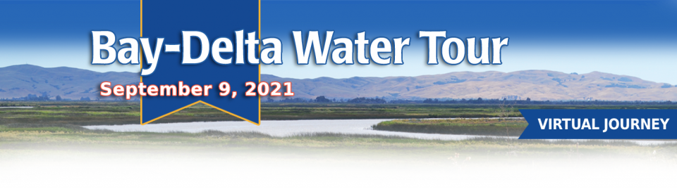
This tour guided participants on a virtual journey deep into California’s most crucial water and ecological resource – the Sacramento-San Joaquin Delta. The 720,000-acre network of islands and canals support the state’s two major water systems – the State Water Project and the Central Valley Project. The Delta and the connecting San Francisco Bay form the largest freshwater tidal estuary of its kind on the West coast.
Out of sight and out of mind to most
people, the Salton Sea in California’s far southeast corner has
challenged policymakers and local agencies alike to save the
desert lake from becoming a fetid, hyper-saline water body
inhospitable to wildlife and surrounded by clouds of choking
dust.
The sea’s problems stretch beyond its boundaries in Imperial and
Riverside counties and threaten to undermine multistate
management of the Colorado River. A 2019 Drought Contingency Plan for the
Lower Colorado River Basin was briefly stalled when the Imperial
Irrigation District, holding the river’s largest water
allocation, balked at participating in the plan because, the
district said, it ignored the problems of the Salton Sea.
Deep, throaty cadenced calls —
sounding like an off-key bassoon — echo over the grasslands,
farmers’ fields and wetlands starting in late September of each
year. They mark the annual return of sandhill cranes to the
Cosumnes River Preserve,
46,000 acres located 20 miles south of Sacramento on the edge of
the Sacramento-San Joaquin Delta.
For the bulk of her career, Jayne
Harkins has devoted her energy to issues associated with the
management of the Colorado River, both with the U.S. Bureau of
Reclamation and with the Colorado River Commission of Nevada.
Now her career is taking a different direction. Harkins, 58, was
appointed by President Trump last August to take the helm of the
United States section of the U.S.-Mexico agency that oversees
myriad water matters between the two countries as they seek to
sustainably manage the supply and water quality of the Colorado
River, including its once-thriving Delta in Mexico, and other
rivers the two countries share. She is the first woman to be
named the U.S. Commissioner of the International Boundary and
Water Commission for either the United States or Mexico in the
commission’s 129-year history.
There’s going to be a new governor
in California next year – and a host of challenges both old and
new involving the state’s most vital natural resource, water.
So what should be the next governor’s water priorities?
That was one of the questions put to more than 150 participants
during a wrap-up session at the end of the Water Education
Foundation’s Sept. 20 Water Summit in Sacramento.
Farmers in the Central Valley are broiling about California’s plan to increase flows in the Sacramento and San Joaquin river systems to help struggling salmon runs avoid extinction. But in one corner of the fertile breadbasket, River Garden Farms is taking part in some extraordinary efforts to provide the embattled fish with refuge from predators and enough food to eat.
And while there is no direct benefit to one farm’s voluntary actions, the belief is what’s good for the fish is good for the farmers.
Deep, throaty cadenced calls —
sounding like an off-key bassoon — echo over the grasslands,
farmers’ fields and wetlands starting in late September of each
year. They mark the annual return of sandhill cranes to the
Cosumnes River Preserve,
46,000 acres located 20 miles south of Sacramento on the edge of
the Sacramento-San Joaquin Delta.
California voters may experience a sense of déjà vu this year when they are asked twice in the same year to consider water bonds — one in June, the other headed to the November ballot.
Both tackle a variety of water issues, from helping disadvantaged communities get clean drinking water to making flood management improvements. But they avoid more controversial proposals, such as new surface storage, and they propose to do some very different things to appeal to different constituencies.
Along the banks of the
Sacramento-San Joaquin Delta in Oakley, about 50 miles southwest
of Sacramento, is a park that harkens back to the days when the
Delta lured Native Americans, Spanish explorers, French fur
trappers, and later farmers to its abundant wildlife and rich
soil.
That historical Delta was an enormous marsh linked to the two
freshwater rivers entering from the north and south, and tidal
flows coming from the San Francisco Bay. After the Gold Rush,
settlers began building levees and farms, changing the landscape
and altering the habitat.
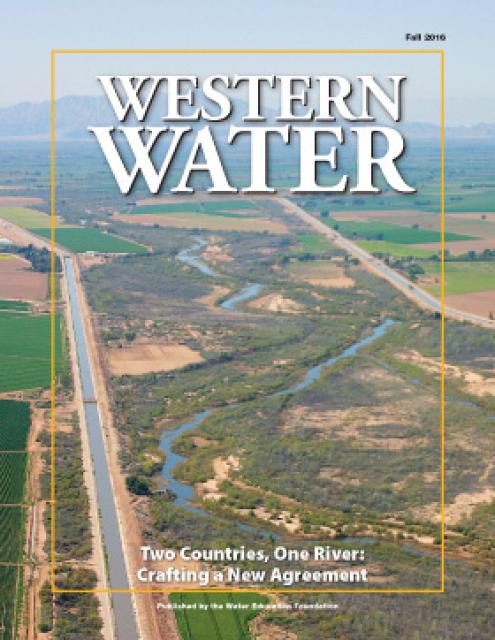
As vital as the Colorado River is to the United States and
Mexico, so is the ongoing process by which the two countries
develop unique agreements to better manage the river and balance
future competing needs.
The prospect is challenging. The river is over allocated as urban
areas and farmers seek to stretch every drop of their respective
supplies. Since a historic treaty between the two countries was
signed in 1944, the United States and Mexico have periodically
added a series of arrangements to the treaty called minutes that
aim to strengthen the binational ties while addressing important
water supply, water quality and environmental concerns.
This 28-page report describes the watersheds of the Sierra Nevada
region and details their importance to California’s overall water
picture. It describes the region’s issues and challenges,
including healthy forests, catastrophic fire, recreational
impacts, climate change, development and land use.
The report also discusses the importance of protecting and
restoring watersheds in order to retain water quality and enhance
quantity. Examples and case studies are included.
This 30-minute documentary, produced in 2011, explores the past,
present and future of flood management in California’s Central
Valley. It features stories from residents who have experienced
the devastating effects of a California flood firsthand.
Interviews with long-time Central Valley water experts from
California Department of Water Resources (FloodSAFE), U.S. Army
Corps of Engineers, Bureau of Reclamation, Central Valley Flood
Management Program and environmental groups are featured as they
discuss current efforts to improve the state’s 150-year old flood
protection system and develop a sustainable, integrated, holistic
flood management plan for the Central Valley.
This 25-minute documentary-style DVD, developed in partnership
with the California Department of Water Resources, provides an
excellent overview of climate change and how it is already
affecting California. The DVD also explains what scientists
anticipate in the future related to sea level rise and
precipitation/runoff changes and explores the efforts that are
underway to plan and adapt to climate.
15-minute DVD that graphically portrays the potential disaster
should a major earthquake hit the Sacramento-San Joaquin Delta.
“Delta Warning” depicts what would happen in the event of an
earthquake registering 6.5 on the Richter scale: 30 levee breaks,
16 flooded islands and a 300 billion gallon intrusion of salt
water from the Bay – the “big gulp” – which would shut down the
State Water Project and Central Valley Project pumping plants.
Water truly has shaped California into the great state it is
today. And if it is water that made California great, it’s the
fight over – and with – water that also makes it so critically
important. In efforts to remap California’s circulatory system,
there have been some critical events that had a profound impact
on California’s water history. These turning points not only
forced a re-evaluation of water, but continue to impact the lives
of every Californian. This 2005 PBS documentary offers a
historical and current look at the major water issues that shaped
the state we know today. Includes a 12-page viewer’s guide with
background information, historic timeline and a teacher’s lesson.
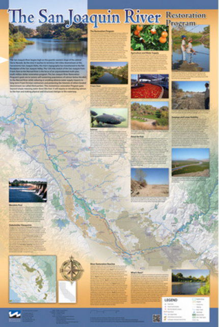
This beautiful 24×36 inch poster, suitable for framing, features
a map of the San Joaquin River. The map text focuses on the San
Joaquin River Restoration Program, which aims to restore flows
and populations of Chinook salmon to the river below Friant Dam
to its confluence with the Merced River. The text discusses the
history of the program, its goals and ongoing challenges with
implementation.
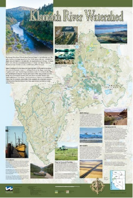
This beautiful 24×36 inch poster, suitable for framing, displays
the rivers, lakes and reservoirs, irrigated farmland, urban areas
and Indian reservations within the Klamath River Watershed. The
map text explains the many issues facing this vast,
15,000-square-mile watershed, including fish restoration;
agricultural water use; and wetlands. Also included are
descriptions of the separate, but linked, Klamath Basin
Restoration Agreement and the Klamath Hydroelectric Agreement,
and the next steps associated with those agreements. Development
of the map was funded by a grant from the U.S. Fish and Wildlife
Service.
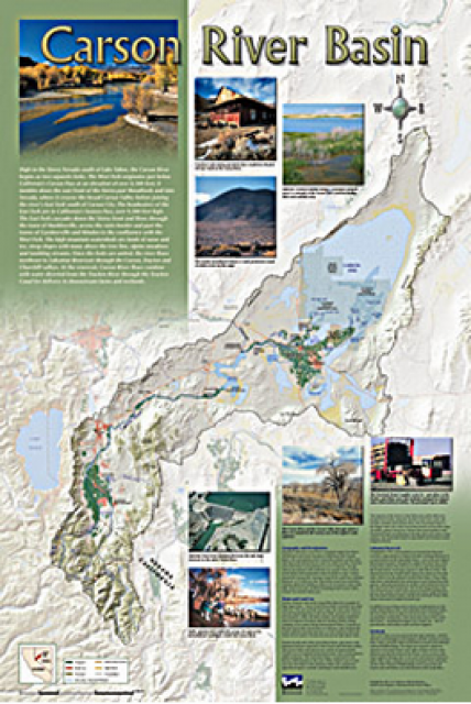
A companion to the Truckee River Basin Map poster, this 24×36
inch poster, suitable for framing, explores the Carson River, and
its link to the Truckee River. The map includes Lahontan Dam and
Reservoir, the Carson Sink, and the farming areas in the basin.
Map text discusses the region’s hydrology and geography, the
Newlands Project, land and water use within the basin and
wetlands. Development of the map was funded by a grant from the
U.S. Bureau of Reclamation Mid-Pacific Region, Lahontan Basin
Area Office.
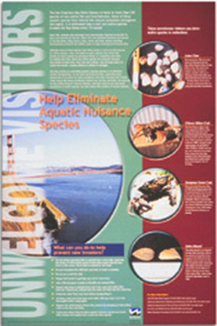
This 24×36 inch poster, suitable for framing, explains how
non-native invasive animals can alter the natural ecosystem,
leading to the demise of native animals. “Unwelcome Visitors”
features photos and information on four such species – including
the zerbra mussel – and explains the environmental and economic
threats posed by these species.
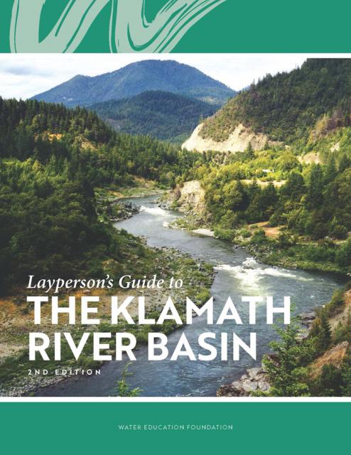
The Water Education Foundation’s second edition of
the Layperson’s Guide to The Klamath River Basin is
hot off the press and available for purchase.
Updated and redesigned, the easy-to-read overview covers the
history of the region’s tribal, agricultural and environmental
relationships with one of the West’s largest rivers — and a
vast watershed that hosts one of the nation’s oldest and
largest reclamation projects.
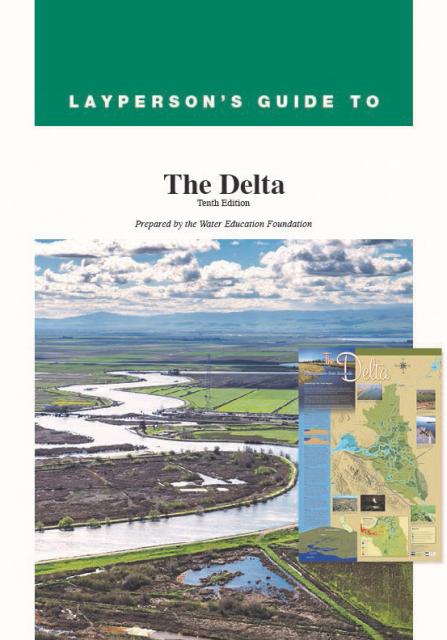
The 24-page Layperson’s Guide to the Delta explores the competing
uses and demands on California’s Sacramento-San Joaquin Delta.
Included in the guide are sections on the history of the Delta,
its role in the state’s water system, and its many complex issues
with sections on water quality, levees, salinity and agricultural
drainage, fish and wildlife, and water distribution.
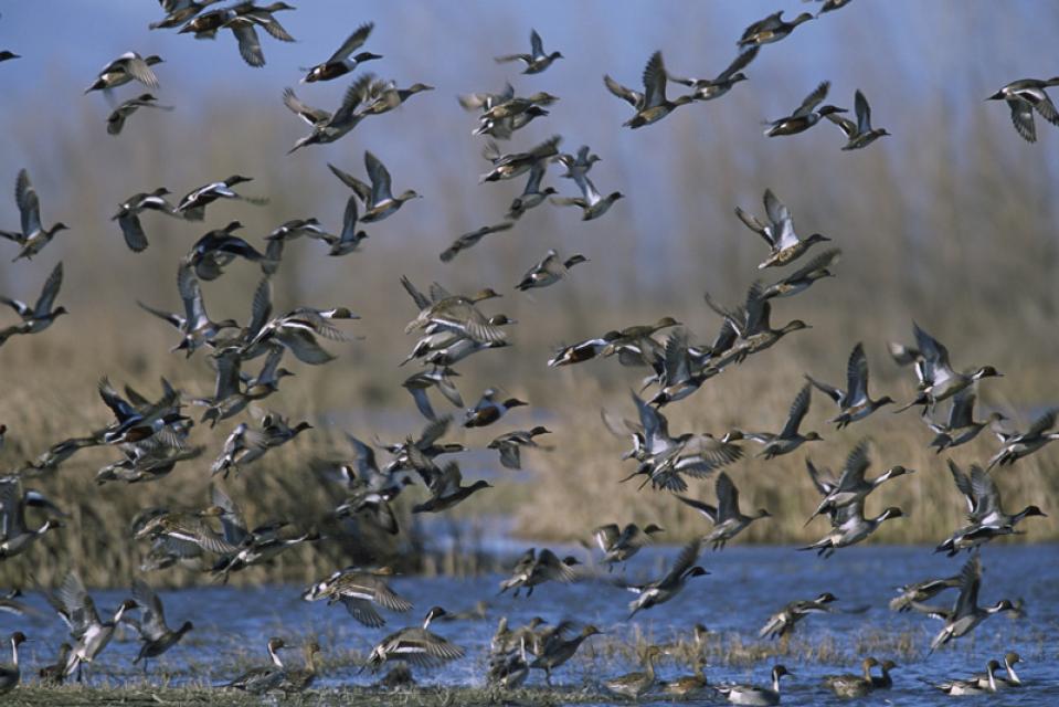
The Pacific Flyway is one of four
major North American migration routes for birds, especially
waterfowl, and extends from Alaska and Canada, through
California, to Mexico and South America. Each year, birds follow
ancestral patterns as they travel the flyway on their annual
north-south migration. Along the way, they need stopover sites
such as wetlands with suitable habitat and food supplies. In
California, 90 percent of historic wetlands have been lost.
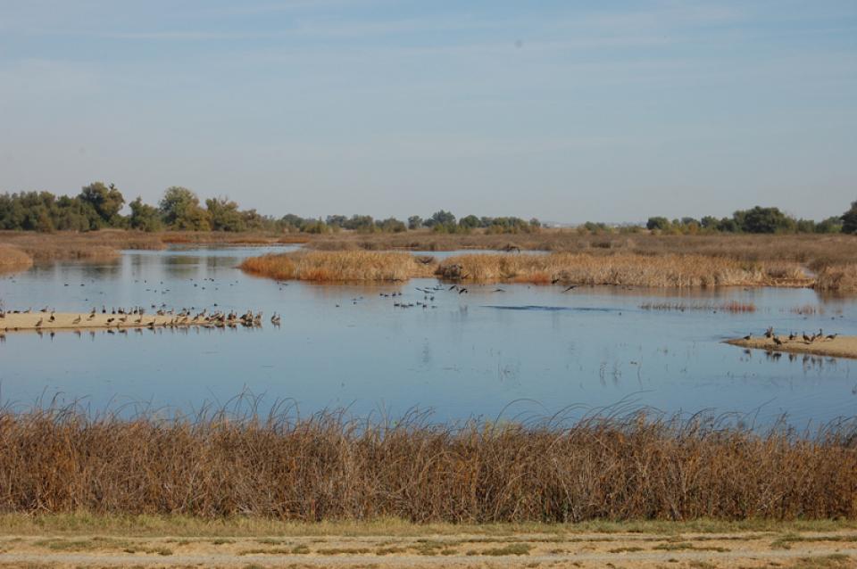
In the Central Valley, wetlands—partly or seasonally saturated
land that supports aquatic life and distinct ecosystems— provide
critical habitat for a variety of wildlife.
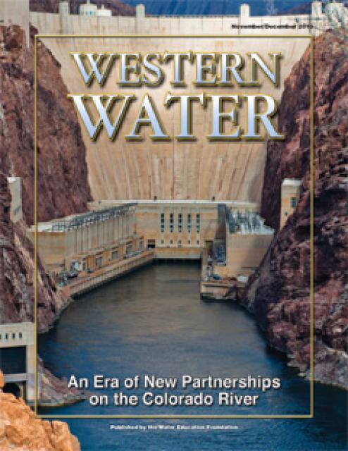
This printed issue of Western Water examines how the various
stakeholders have begun working together to meet the planning
challenges for the Colorado River Basin, including agreements
with Mexico, increased use of conservation and water marketing,
and the goal of accomplishing binational environmental
restoration and water-sharing programs.
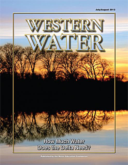
This printed issue of Western Water examines the issues
associated with the State Water Board’s proposed revision of the
water quality Bay-Delta Plan, most notably the question of
whether additional flows are needed for the system, and how they
might be provided.
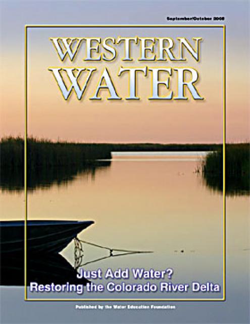
This printed copy of Western Water examines the Colorado River
Delta, its ecological significance and the lengths to which
international, state and local efforts are targeted and achieving
environmental restoration while recognizing the needs of the
entire river’s many users.


")
")

")
")
")
")
")
")
")