A new look for our most popular product! And it’s the perfect
gift for the water wonk in your life.
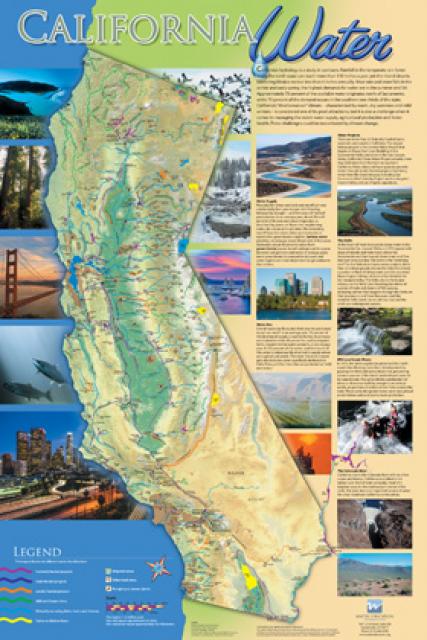
Our 24×36 inch California Water Map is widely known for being the
definitive poster that shows the integral role water plays in the
state. On this updated version, it is easier to see California’s
natural waterways and man-made reservoirs and aqueducts
– including federally, state and locally funded
projects – the wild and scenic rivers system, and
natural lakes. The map features beautiful photos of
California’s natural environment, rivers, water projects,
wildlife, and urban and agricultural uses and the
text focuses on key issues: water supply, water use, water
projects, the Delta, wild and scenic rivers and the Colorado
River.
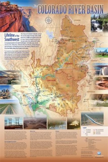
Redesigned in 2017, this beautiful map depicts the seven
Western states that share the Colorado River with Mexico. The
Colorado River supplies water to nearly 40 million people in
Arizona, California, Colorado, Nevada, New Mexico, Utah, Wyoming
and Mexico. Text on this beautiful, 24×36-inch map, which is
suitable for framing, explains the river’s apportionment, history
and the need to adapt its management for urban growth and
expected climate change impacts.
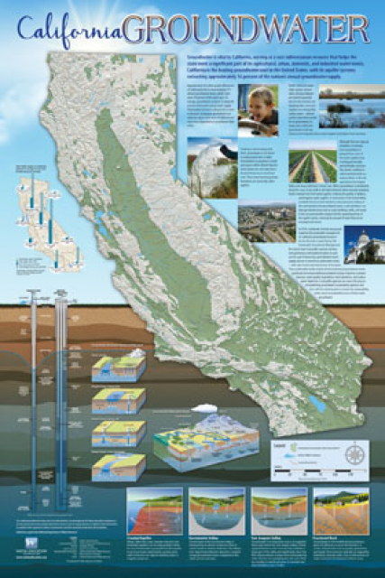
Fashioned after the popular California Water Map, this 24×36 inch
poster was extensively re-designed in 2017 to better illustrate
the value and use of groundwater in California, the main types of
aquifers, and the connection between groundwater and surface
water.
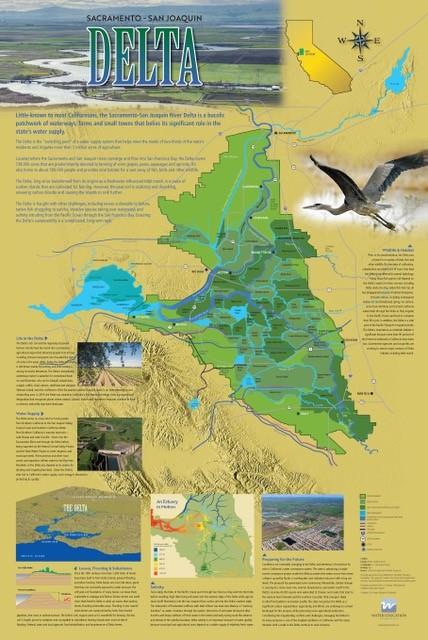
This beautifully illustrated 24×36-inch poster, suitable for
framing and display in any office or classroom, highlights the
Sacramento-San Joaquin River Delta, its place as a center of
farming, its importance as an ecological resource and its
vital role in California’s water supply system.
The text, photos and graphics explain issues related to land
subsidence, levees and flooding, urbanization, farming, fish and
wildlife protection. An inset map illustrates the tidal action
that increases the salinity of the Delta’s waterways.
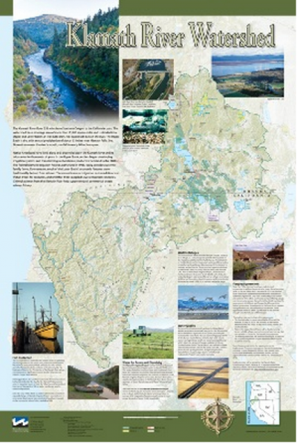
This beautiful 24×36 inch poster, suitable for framing, displays
the rivers, lakes and reservoirs, irrigated farmland, urban areas
and Indian reservations within the Klamath River Watershed. The
map text explains the many issues facing this vast,
15,000-square-mile watershed, including fish restoration;
agricultural water use; and wetlands. Also included are
descriptions of the separate, but linked, Klamath Basin
Restoration Agreement and the Klamath Hydroelectric Agreement,
and the next steps associated with those agreements. Development
of the map was funded by a grant from the U.S. Fish and Wildlife
Service.
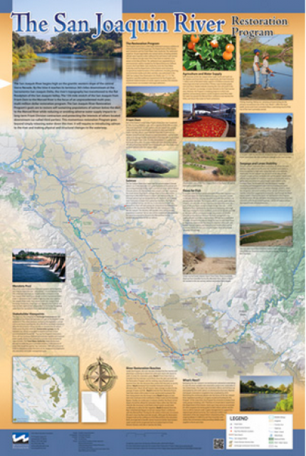
This beautiful 24×36 inch poster, suitable for framing, features
a map of the San Joaquin River. The map text focuses on the San
Joaquin River Restoration Program, which aims to restore flows
and populations of Chinook salmon to the river below Friant Dam
to its confluence with the Merced River. The text discusses the
history of the program, its goals and ongoing challenges with
implementation.
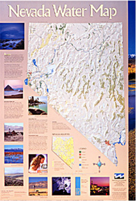
This 24×36 inch poster, suitable for framing, illustrates the
water resources available for Nevada cities, agriculture and the
environment. It features natural and manmade water resources
throughout the state, including the Truckee and Carson rivers,
Lake Tahoe, Pyramid Lake and the course of the Colorado River
that forms the state’s eastern boundary.
This beautiful 24×36 inch poster, suitable for framing, displays
the rivers, lakes and reservoirs, irrigated farmland, urban areas
and Indian reservations within the Truckee River Basin, including
the Newlands Project, Pyramid Lake and Lake Tahoe. Map text
explains the issues surrounding the use of the Truckee-Carson
rivers, Lake Tahoe water quality improvement efforts, fishery
restoration and the effort to reach compromise solutions to many
of these issues.
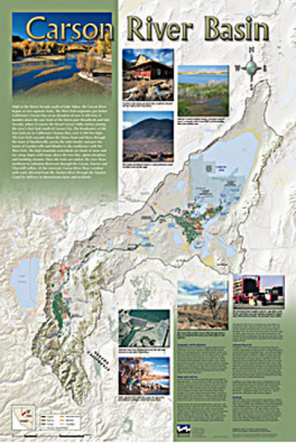
A companion to the Truckee River Basin Map poster, this 24×36
inch poster, suitable for framing, explores the Carson River, and
its link to the Truckee River. The map includes Lahontan Dam and
Reservoir, the Carson Sink, and the farming areas in the basin.
Map text discusses the region’s hydrology and geography, the
Newlands Project, land and water use within the basin and
wetlands. Development of the map was funded by a grant from the
U.S. Bureau of Reclamation Mid-Pacific Region, Lahontan Basin
Area Office.
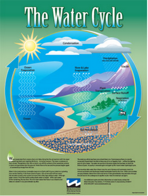
Water as a renewable resource is depicted in this 18×24 inch
poster. Water is renewed again and again by the natural
hydrologic cycle where water evaporates, transpires from plants,
rises to form clouds, and returns to the earth as precipitation.
Excellent for elementary school classroom use.
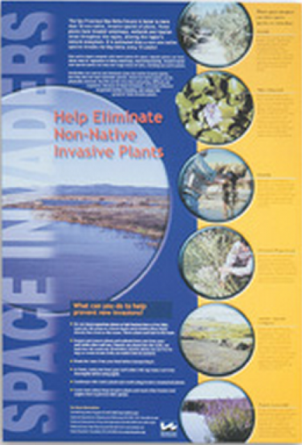
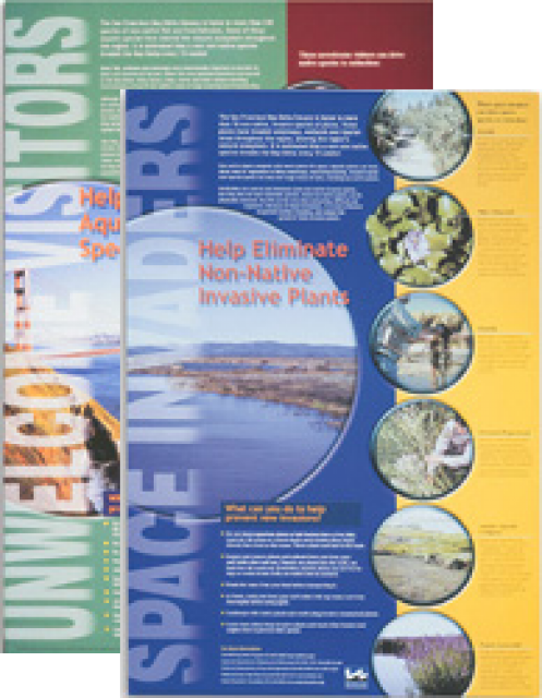
This 24×36 inch poster, suitable for framing, explains how
non-native invasive plants can alter the natural ecosystem,
leading to the demise of native plants and animals. “Space
Invaders” features photos and information on six non-native
plants that have caused widespread problems in the Bay-Delta
Estuary and elsewhere.
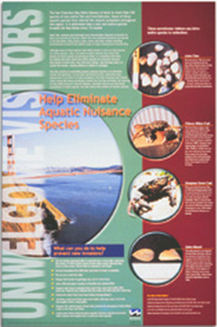
This 24×36 inch poster, suitable for framing, explains how
non-native invasive animals can alter the natural ecosystem,
leading to the demise of native animals. “Unwelcome Visitors”
features photos and information on four such species – including
the zerbra mussel – and explains the environmental and economic
threats posed by these species.