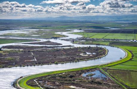
Watch our series of short videos on the importance of the
Sacramento-San Joaquin Delta, how it works as a water hub for
California and the challenges it is facing.
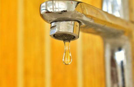
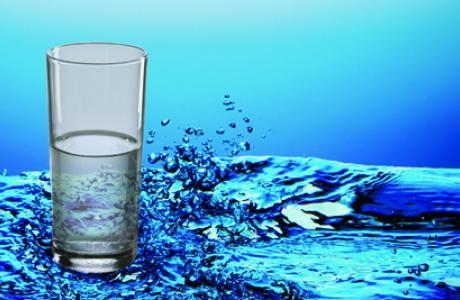
When a person opens a spigot to draw a glass of water, he or she
may be tapping a source close to home or hundreds of miles away.
Water gets to taps via a complex web of aqueducts, canals and
groundwater.
Learn more about our team in the office and on the Board of
Directors and how you can support our nonprofit mission by
donating in someone’s honor or memory, or becoming a regular
contributor or supporting specific projects.
Unlike California’s majestic rivers and massive dams and
conveyance systems, groundwater is out of sight and underground,
though no less plentiful. The state’s enormous cache of
underground water is a great natural resource and has contributed
to the state becoming the nation’s top agricultural producer and
leader in high-tech industries.
A new era of groundwater management began in 2014 in California
with the Sustainable Groundwater Management Act. The landmark law
turned 10 in 2024, with many challenges still ahead.
Tom Gibson, new director of
California’s Department of Water Resources, will serve as the
keynote speaker for our 42ⁿᵈ annual Water
Summit on Oct. 29.
Guided by this year’s theme, Stewarding a New Era in
Western Water,Gibson and
other leading policymakers and experts will address emerging
topics related to the challenges and opportunities facing water
resource management in California and the West.
Gibson,
an attorney who has held several roles in the state’s Natural
Resources Agency and its various departments, was appointed by
Gov. Newsom on June 29 and sworn in on July 6 to lead DWR and its
nearly 4,000 employees.
Mark your calendars! Registration will be opening soon for two
exciting Water Education Foundation events this fall.
Water Summit | Oct. 29
Join us for our premier event of
the year, bringing together leading policymakers and experts from
all sectors to discuss the most pressing water issues facing
California and the West.
The Trump administration has released its long-awaited 10-year
plan for dealing with worsening water shortages along the
Colorado River. Instead of ordering the most drastic water
cutbacks it could have imposed, the administration chose to
take more of a wait-and-see approach. The plan allows for steep
water cuts if they’re deemed necessary, requiring California,
Arizona and Nevada to cut up to 3 million acre-feet per year —
as much as 40% of the combined allotments. But as The
Times reported last week, state and local officials
say for the first two years, the Trump administration is
accepting an offer the three states made to reduce what they
take from the river by about half that amount.
… While the three lower basin states shoulder
the burden for now, “the only sustainable path is with
the seven states and Mexico all participating,” said Bill
Hasencamp, MWD’s manager of Colorado River resources.
“We can’t do it alone.”
After the U.S. Bureau of Reclamation released its Final
Environmental Impact Statement for Post-2026 Colorado River
Operations, Governor Katie Hobbs issued the following
statement: “Today, the federal government released a broad
range of alternatives for how the Colorado River will be
managed over the next ten years. Within that range is the
opportunity for the federal government to adopt the
commonsense, compromise proposal put forward by Lower Basin
States for 2027 and 2028. Our proposal is one of the largest
conservation programs in Colorado River history and builds on
Arizona’s decades-long commitment to responsible water
stewardship. While this FEIS still contains unacceptable
options that include the federal government forcing Arizona to
take the majority of draconian water cutbacks, implementing the
Lower Basin agreement would protect Arizona from massive water
cuts.”
Other Colorado River statements and news releases:
The scope of cyberattacks on U.S. water systems has grown to
include at least seven states and may be far wider, officials
and experts warned, as the authorities raced to
safeguard the nation’s water supply against an assault that
increasingly appeared to be the work of Iran. While
there were no indications that any water supply had been
altered or made unsafe to drink, state and local officials
throughout the country were on high alert for potential
problems in vulnerable computers that are commonly used to
monitor and adjust water quality, including chemical-treatment
levels and water pressure. Minnesota first publicly reported
the attacks, and now Michigan says its systems have also been
targeted.
Mexican officials announced on Thursday that the contamination
of the Tijuana River could be fully resolved by 2027, pending
the completion of infrastructure projects outlined in
binational agreements with the United States. During the
president’s morning press conference, Environment Secretary
Alicia Bárcena provided an update on the country’s progress
under Minute 333 of the International Boundary and Water
Commission (IBWC), an agreement signed last year to tackle
cross-border pollution affecting both San Diego and
Tijuana. According to Bárcena, Mexico has already
fulfilled its commitments under the agreement, with 17
of the approximately 38 planned projects either finalized or
significantly advanced, as part of the federal
government’s strategy to improve water quality and reduce
pollution.
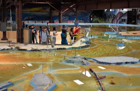
Operated by the U.S. Army Corps of Engineers, the
Bay Model is a giant hydraulic replica of San Francisco
Bay and the Sacramento-San Joaquin
Delta. It is housed in a converted World II-era
warehouse in Sausalito near San Francisco.
Hundreds of gallons of water are pumped through the
three-dimensional, 1.5-acre model to simulate a tidal ebb
and flow lasting 14 minutes.
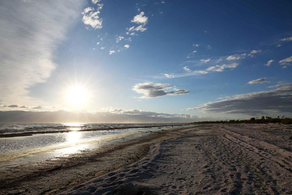
As part of the historic Colorado
River Delta, the Salton Sea regularly filled and dried for
thousands of years due to its elevation of 237 feet below
sea level.
The most recent version of the Salton Sea was formed in 1905 when
the Colorado River broke
through a series of dikes and flooded the seabed for two years,
creating California’s largest inland body of water. The
Salton Sea, which is saltier than the Pacific Ocean, includes 130
miles of shoreline and is larger than Lake Tahoe.
Drought — an extended period of
limited or no precipitation — is a fact of life in California and
the West, with water resources following boom-and-bust patterns.
No portion of the West has been immune to drought during the last
century and it occurs with much greater frequency in the West
than in any other region of the country.