



Header link June 22, 2020

LinkedIn

  • Read more
Header link September 15, 2014

Cart

  • Read more
Header link November 3, 2015

Donate Now

  • Read more
Header link May 15, 2014

Twitter

  • Read more
Header link May 15, 2014

Facebook

  • Read more
Instagram
Header link May 15, 2014

Instagram

  • Read more
Header link May 15, 2014

Contact Us

  • Read more
More options
Water Education Foundation
Home

Water Education Foundation

Everything about California water that matters
  • Water Academy
    • Agriculture
      • Agricultural Conservation
      • Agricultural Drainage
    • Background Information
      • Legislation — California and Federal
      • Regulations — California and Federal
      • Water History
      • Water Rights
    • Bay-Delta
      • Bay Delta
      • Bay Delta Conservation Plan
      • Delta Issues
      • Delta Smelt
      • Sacramento San Joaquin Delta
      • San Francisco Bay
      • Suisun Marsh
    • Dams, Reservoirs and Water Projects
      • California Aqueduct
      • Central Valley Project
      • Folsom Dam
      • Friant Dam
      • Hetch Hetchy
      • Hoover Dam
      • Infrastructure
      • Lake Mead
      • Lake Powell
      • Oroville Dam
      • San Luis Dam
      • Shasta Dam
      • State Water Project
    • Environmental Issues
      • Anadromous Fish Restoration
      • Ecosystem
      • Endangered Species Act
      • Invasive species
      • Lake Tahoe
      • Mono Lake
      • Public Trust Doctrine
      • Salmon
      • San Joaquin River Restoration
      • Watershed
      • Wetlands
    • Leaders and Experts
    • Regions
      • Central Coast
      • Central Valley
      • Mexico
      • Nevada
      • North Coast
      • Pyramid Lake
      • Sacramento Valley
      • Salton Sea
      • San Joaquin Valley
      • Sierra Nevada
      • Southern California
      • Tulare Lake Basin
    • Rivers
      • Carson River
      • Colorado River
      • Klamath River
      • New River
      • North Coast Rivers
      • Russian River
      • Sacramento River
      • Truckee River
      • San Joaquin River
    • Water Issues
      • Climate Change
      • Coronavirus
      • Drought
      • Earthquakes
      • Energy and Water
      • Floods
      • Fracking
      • Growth
      • Hydropower
      • Levees
      • Tribal Water Issues
      • Water Conservation
    • Water Quality
      • Drinking Water
      • Nitrate contamination
      • Pollution
      • Stormwater
      • Wastewater
      • Water Quality
    • Water Supply and Management
      • Acre Foot
      • Aquifers
      • California Water Plan
      • Conjunctive Use
      • Desalination
      • Grey water
      • Groundwater
      • Integrated Regional Water Management
      • Recreation
      • Surface Water
      • Water Marketing and Banking
      • Water Rates
      • Water Recycling
      • Water Supply
      • Water Transfers
  • Tours & Events
    • Water Tours
      • 2026 Tour Sponsors
    • Events
    • Event Calendar
    • Past Tours & Events
      • Anne J. Schneider Fund Lecture Series
  • Specialized Programs
    • Water Leaders
      • Cohort Rosters
      • Yearly Class Reports
      • Your Alumni Network
      • Alumni Profiles
    • Project WET
      • Workshops
      • Supplementary Materials
      • California Content Standard Correlations
      • Foundation School Programs
        • Elementary Programs
        • Secondary Programs
      • Water Kids
      • California Project WET Gazette
      • Gazette Archives
    • Colorado River Project
    • GRA Scholastic Fund Program
  • Maps & Guides
    • Maps & Posters
    • Layperson's Guides
    • Map & Guide Bundles
    • Books
    • Colorado River Materials
    • California Runoff Rundown
    • Other Publications
    • Water Awareness Materials
    • Downloadable Publications
    • Videos and DVDs
      • Video Clips
    • School Age Publications
    • Stickers
    • Free Programs and Publications
  • Newsroom
    • Western Water News
    • Aquafornia
      • About Aquafornia
    • Information Desk
    • Western Water Magazine Archive
      • Full Print Edition
      • Print Edition Excerpts
    • River Report Archive
  • Aquapedia
    • Alphabetical List of Subjects
      • A
      • B
      • C
      • D
      • E
      • F
      • G
      • H
      • I
      • J
      • K
      • L
      • M
      • N
      • O
      • P
      • Q
      • R
      • S
      • T
      • U
      • V
      • W
      • X
      • Y
      • Z
    • Historical Water People
    • Where Does My Water Come From?
      • Northern California
      • Sacramento
      • North Bay
      • South Bay
      • Central Valley
      • Los Angeles
      • Inland Empire
      • San Diego
      • All California Water Sources
    • Timelines
    • Videos
    • Image Gallery
    • Water Directory
      • Federal Agencies
      • State Agencies in California
      • Environmental Organizations
      • Other California Organizations
      • State and Federal Legislative Committees
      • Water Associations and Groups
      • Western States Water Agencies and Districts
    • Online Resources
    • Useful Acronyms
    • About Aquapedia
  • About
    • About Us
      • Board of Directors
      • Staff Biographies
      • Job Openings
    • Announcements
    • Support Our Mission
      • Become a Member
      • Donate in Honor/Memory
      • Planned Giving
    • Contact Us
Aquapedia background February 11, 2014 Dams Shasta Dam

Trinity River and Trinity Dam
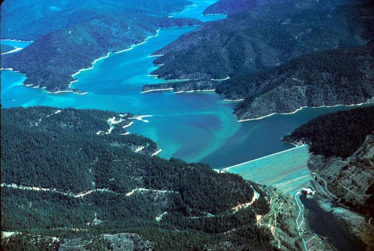
Image shows Trinity Lake, a part of the federal Central Valley ProjectThe Trinity River flows for 700 twisting, winding miles from the rugged Trinity Alps in northwestern California to the Pacific Ocean. In the upper reach of the Trinity River are two dams – Trinity Dam and Lewiston Dam – that store and divert water to the Sacramento Valley as part of the Central Valley Project (CVP).

The Trinity River is the largest tributary of the Klamath River in the Klamath watershed that straddles Northern California and southern Oregon. The Trinity River once supported steelhead and several different runs of salmon that were important to the lives and subsistence of the Yurok and Hupa Native American tribes. But the Trinity and Lewiston dams have blocked spawning grounds for steelhead and salmon, causing fish populations to decline.

BACKGROUND

Though seemingly a long way from California’s Central Valley, the Trinity Dam, a 538-foot-tall earthfill structure, helps supply irrigation water for Valley farmers and produces hydropower.

Constructed in the 1950s, Trinity Dam and the 91-foot-tall Lewiston Dam, just downstream, increased the storage capacity of the federal CVP by more than 2.5 million acre-feet.

To get the water to the Central Valley, the 11-mile Clear Creek Tunnel transports water from Lewiston Reservoir through the Trinity Mountains to Whiskeytown Reservoir, 10 miles southwest of Shasta Dam. From Whiskeytown, Trinity River water is transported through a 3-mile tunnel to Clear Creek, which flows into the Keswick Reservoir, passing through five power plants before reaching the Sacramento River.

The Trinity River was first considered by the federal government as a possible location for a hydroelectric power plant in the 1920s. But it wasn’t until the 1950s that Congress authorized the Trinity River Division as a part of the CVP.

CHALLENGES AND CONTROVERSIES

The 1955 Trinity River Division Authorization Act required minimum water releases of 120,000 acre-feet to maintain Trinity River salmon and steelhead populations, and a fish hatchery was built downstream from Lewiston Dam. With up to 90 percent of the river’s average annual flow diverted to the Sacramento River, however, the diversion contributed to the declines in Trinity River chinook and coho salmon populations. (In 2003, the Trinity River was also diverted to boost flows in the lower Klamath River after a large number died in the Klamath the previous year.)

Consequently, the Bureau of Reclamation established the Trinity River Fish Hatchery to boost declining fish populations. As part of the establishment of the Central Valley Project Improvement Act in 1992, minimal annual releases from Lewiston Dam into the Trinity River are set at 340,000 acre-feet.

In 2000, the Trinity River Restoration Program was established to restore more naturally spawning salmon and steelhead populations in the river to pre-dam levels. The recovery plan for the Trinity River and its fish and wildlife populations increased flows based on water-year type and a combination of river channel rehabilitation, watershed restoration and sediment management. The plan guides restoration projects that recreate at a smaller scale the environment that existed prior to construction of the Trinity and Lewiston dams.

Flow releases in some years have been supplemented to protect the health of fish in the river, actions that have been controversial among some water users.

LOOKING AHEAD

Climate change is expected to bring more extreme weather, which could result in wetter winters with precipitation falling more as rain than snow or more extended dry spells. The dry spells could reduce water available to the CVP for Central Valley farms and cities as well as the Trinity River fishery. Meanwhile, the Trinity River Restoration Program continues to improve river habitat to increase survival of salmon and steelhead and their return for spawning. 

Updated May 2026

  • Print-friendly

Referring Pages

Share this page

  • Share on Facebook
  • Share on Twitter
  • Share on LinkedIn
  • Sent to a friend.
Print-friendly

Related Links

Aquapedia background February 11, 2014 Dams Shasta Dam
Folsom Dam on the American River east of Sacramento
Aquapedia background February 3, 2014 Layperson's Guide to the Central Valley Project Layperson's Guide to the State Water Project Oroville Dam Shasta Dam Hoover Dam

Dams

Dams have allowed Californians and others across the West to harness and control water dating back to the late 1800s.

  • Read more
Aquapedia background February 11, 2014 Dams Layperson's Guide to the Central Valley Project California Water Map

Shasta Dam

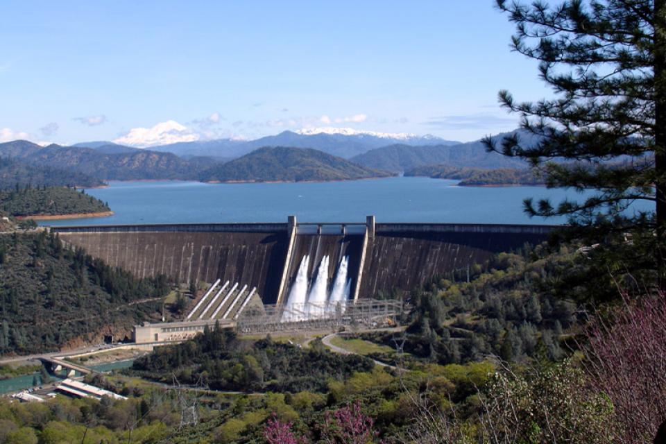
Image shows Shasta Dam from a distance, with the reservoir largely filled.Shasta Dam forms California’s largest storage reservoir, Shasta Lake, which can hold about 4.5 million acre-feet.

As the keystone of the federal Central Valley Project, Shasta stands among the world’s largest dams. Construction on the dam began in 1938 and was completed in 1945, with flood control as the highest priority.

  • Read more
Back
This item appears in:
  • Topic: Hydropower
  • T
Footer pod May 20, 2014

Water Education Foundation

Copyright © 2026 Water Education Foundation. All rights reserved.

The Water Education Foundation is a nonprofit, tax-exempt, 501(c)3 organization, federal tax ID #942419885.

Privacy Policy

Donor Privacy Policy

  • Read more
Footer pod May 20, 2014

Contact Information

2151 River Plaza Drive, Suite 205
Sacramento CA 95833

Telephone (916) 444-6240

Contact Us via email

  • Read more

Quicklinks

Footer quicklink May 20, 2014

Contact Us

  • Read more
Footer quicklink May 20, 2014

Donate Today

  • Read more
Footer quicklink May 20, 2014

Tours

  • Read more
Footer quicklink May 20, 2014

Newsletter Signup

  • Read more
Footer quicklink May 20, 2014

Foundation News

  • Read more
Footer quicklink May 20, 2014

Calendar

  • Read more

Log in

  • Create new account
  • Request new password

Commands

  • Support portal
  • Log in